15 Geography Facts We Just Learned
The world keeps surprising us, even when we think we’ve got it figured out. Maps lie to us in subtle ways, borders shift when nobody’s paying attention, and entire countries exist in places most people can’t find on a globe.
Geography textbooks capture snapshots, but the planet doesn’t sit still long enough for the picture to stay accurate.
These aren’t the facts you memorized in middle school. They’re the kind that make you question what else you’ve been getting wrong about the world around you.
Vatican City has its own railway system
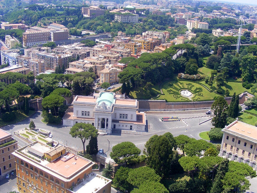
Vatican City operates the shortest national railway system in the world. The entire track stretches 984 feet.
That’s it.
The railway connects to Italy’s rail network, though it’s mostly used for freight deliveries rather than papal commutes. Most visitors never see it because it sits behind the Vatican walls, quietly moving supplies for the world’s smallest sovereign state.
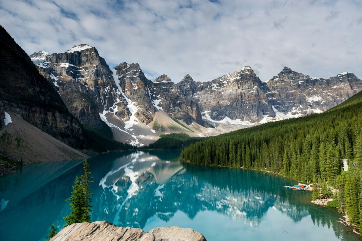
Lake Baikal contains more water than all the Great Lakes combined
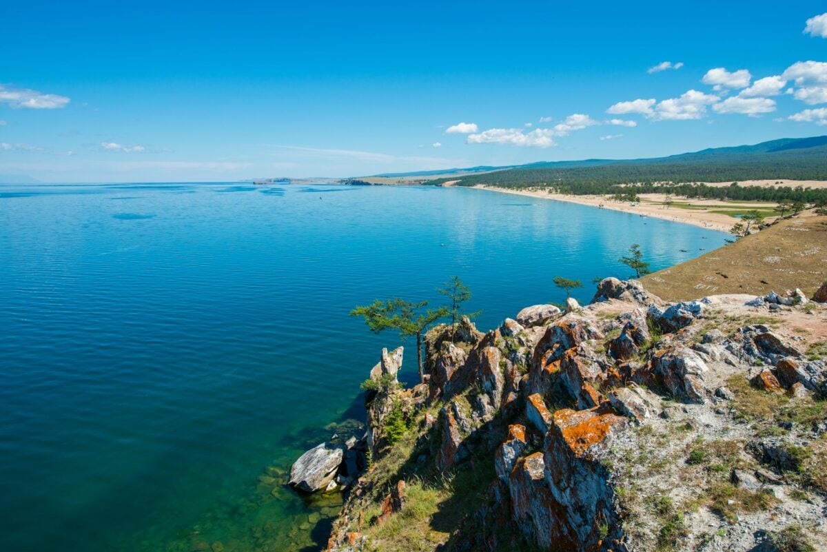
Lake Baikal is the world’s largest freshwater lake by volume. It holds roughly 20-23% of the world’s unfrozen freshwater.
The Great Lakes collectively hold about 21% of the world’s freshwater. While Baikal contains more water than any single Great Lake individually, the combined freshwater volume of the Great Lakes exceeds that of Lake Baikal.
So one lake in Siberia nearly matches five massive lakes in North America. And it’s deeper than any other lake on Earth — over a mile down at its deepest point, which means you could stack four Empire State Buildings in there and still have room left over.
The lake is also ancient beyond comprehension, roughly 25 million years old, making it not just the deepest and largest by volume, but also the oldest freshwater lake on the planet.
Australia is wider than the moon
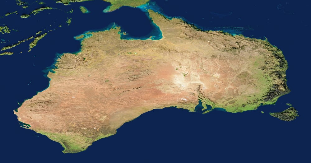
Australia stretches roughly 2,500 miles from east to west. The moon’s diameter measures about 2,159 miles.
This means if you placed Australia over the moon, it would hang over the edges like an oversized tablecloth.
Most people think of Australia as large, but not larger than celestial bodies large. The moon looms so prominently in our night sky that it feels massive by comparison.
Geography has a way of humbling our sense of scale — what feels impossibly vast from ground level shrinks when measured against other impossibly vast things.
Russia spans 11 time zones
Russia doesn’t just cross time zones — it devours them. When it’s midnight in Moscow, it’s already 8 AM the next day in Vladivostok.
This creates practical problems that most countries never face. Television broadcasts, business meetings, federal holidays — everything has to account for the fact that the country exists in nearly half the world’s time zones simultaneously.
Russia has more time zones than any other country, and it’s not particularly close.
The Sahara Desert grows three tons of dust to the Amazon rainforest every year

Think of it as the world’s most improbable delivery system: wind currents scoop up nutrient-rich dust from the Sahara and carry it 5,000 miles across the Atlantic Ocean to fertilize the Amazon rainforest. The dust contains phosphorus, which rainforest soil typically lacks, so this transcontinental dust storm essentially feeds one of the world’s most important ecosystems.
Without this annual shipment from Africa, the Amazon would struggle to maintain its current biodiversity. Two seemingly unrelated landscapes — one barren, one lush — depend on each other in ways that satellite imagery makes visible but ground-level observation never could.
The desert nurtures the rainforest from thousands of miles away, and neither could exist in its current form without the other.
Canada has more lakes than the rest of the world combined
Canada contains roughly 2 million lakes that are larger than 12 acres each. The rest of the world combined has fewer lakes of that size.
This isn’t a close competition — Canada wins by a landslide.
Most of these lakes formed when glaciers retreated after the last ice age, leaving behind depressions that filled with water. The Canadian Shield, which covers about half the country, is particularly lake-dense.
Some regions have more water surface than land surface, which creates navigation challenges that most countries never encounter.
Chile is longer than the distance from New York to Rome

Chile stretches 2,670 miles from north to south, while the distance from New York to Rome measures about 4,280 miles.
Wait — that doesn’t sound right, does it? Actually, let’s recalculate that: New York to Rome is roughly 4,280 miles as the crow flies, but if you follow Chile’s coastline and account for its serpentine shape, the country feels much longer than it actually measures (which is where the confusion usually starts, since Chile’s unusual proportions — averaging only 112 miles wide while stretching those 2,670 miles north to south — create an optical illusion of even greater length).
But here’s the better comparison: Chile is longer than the distance from New York to Denver, and then from Denver to Los Angeles.
So you could drive across the entire United States and still not cover the same distance as Chile’s north-to-south span. The country is so long that its northern desert regions and southern glacial regions exist in completely different climate zones, with some areas experiencing year-round summer while others endure perpetual winter conditions.
Antarctica is a desert
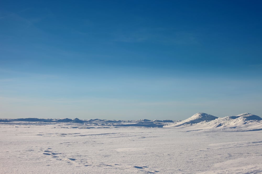
Antarctica receives less annual precipitation than the Sahara. Deserts are defined by lack of precipitation, not temperature, so the coldest continent also ranks as the world’s largest desert.
The entire continent averages about 6.5 inches of precipitation per year. Most of that falls as snow, but it’s still less moisture than what falls in Nevada or Arizona.
The ice accumulates because it never melts, not because Antarctica gets heavy snowfall. This distinction matters more than it might seem — understanding Antarctica as a desert helps explain why its interior is so hostile to life, even compared to other frozen environments.
The Dead Sea is getting deader
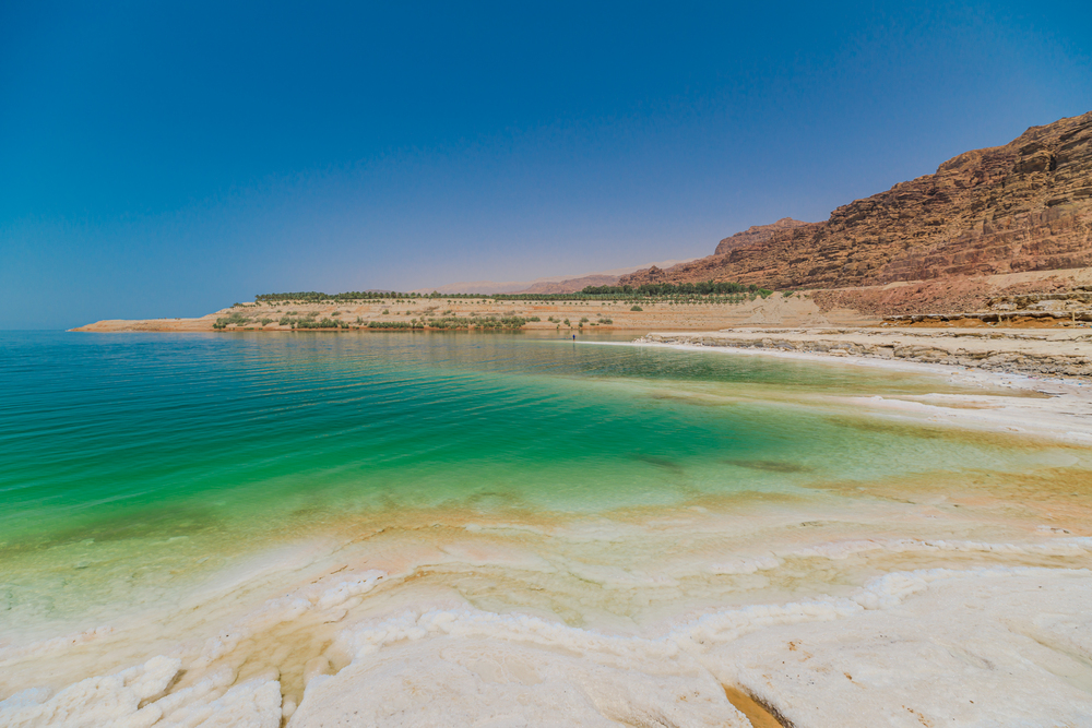
Each year, the Dead Sea drops about three feet. At this rate, it could disappear entirely within 50 years, though geological processes are rarely that predictable over such timeframes.
The Dead Sea loses water faster than it gains water because the Jordan River, its primary source, gets diverted for agricultural and municipal use before reaching the sea. What’s left is essentially a shrinking salt lake that gets saltier as it shrinks.
The surrounding landscape is literally sinking as the water table drops, creating sinkholes that swallow roads and buildings without warning. The Dead Sea isn’t just dying — it’s taking the surrounding geography down with it.
Madagascar split from India, not Africa
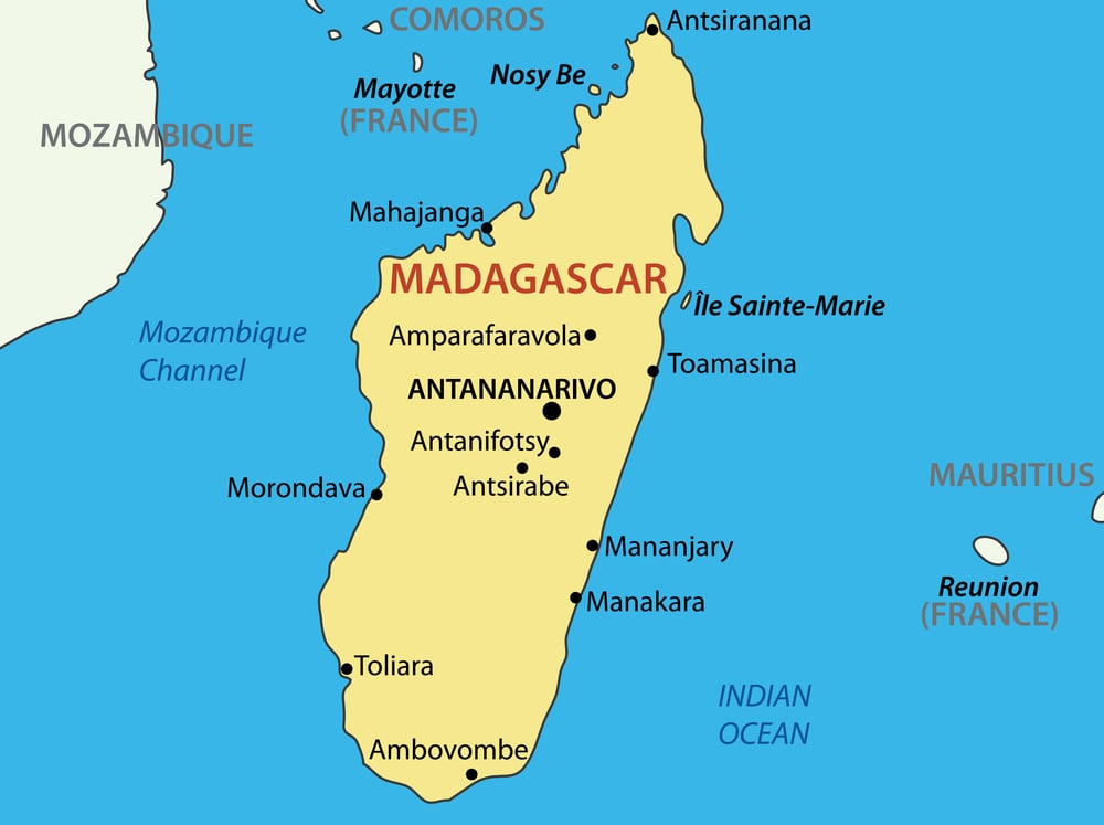
Madagascar sits 250 miles off the eastern coast of Africa, so most people assume it broke away from the African continent. The island actually split from India about 165 million years ago, which explains why its wildlife resembles nothing found in Africa.
Madagascar’s lemurs, fossas, and baobab trees evolved in isolation after the split, creating an ecosystem that functions like a separate biological experiment. The island’s geology also matches formations found in India and Sri Lanka rather than continental Africa.
Continental drift moved Madagascar to its current position, but its biological and geological roots trace back to the Indian subcontinent.
Norway has more coastline than Australia

Norway’s coastline measures roughly 15,600 miles when you include all the fjords and islands. Australia’s coastline measures about 16,000 miles, making this closer than it should be given the size difference between the two countries.
Norway achieves this through sheer geographic complexity — fjords that cut deep inland, archipelagos that scatter across the North Sea, and a jagged coastline that zigs and zags rather than running in clean curves. Australia is roughly 21 times larger than Norway by land area, but Norway nearly matches it for coastal perimeter. Fjords are efficient coastline generators.
The Pacific Ocean is larger than all land on Earth combined
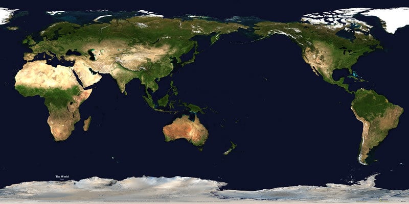
The Pacific covers about 63 million square miles. All the continents combined cover roughly 57 million square miles.
This means the Pacific Ocean is larger than every piece of dry land on the planet put together.
Looking at most world maps, the Pacific appears large but not larger than all the continents large. Map projections compress the ocean’s true scale because they have to fit a sphere onto a flat surface.
The Pacific is so vast that you could fit all the continents inside it and still have millions of square miles of open water left over.
Singapore is growing
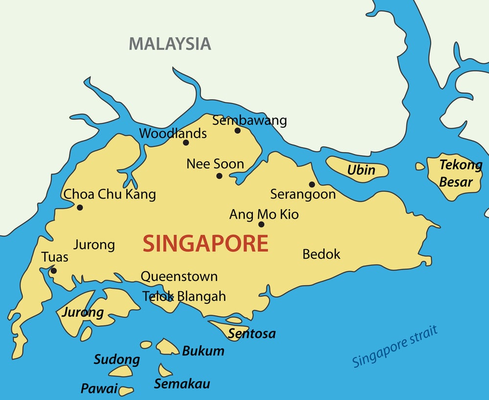
Singapore adds land area every year through land reclamation projects. The country has increased its total area by about 25% since independence in 1965, essentially creating new geography from scratch.
Land reclamation works by dumping sand and soil into shallow coastal waters until new land emerges above sea level. Singapore imports sand from neighboring countries to fuel these projects, though this has created diplomatic tensions with Malaysia and Indonesia, who are essentially selling their territory to help Singapore expand.
The country is literally growing larger while its neighbors grow smaller, one dump truck of sand at a time.
Africa is being split in two

The East African Rift System is actively pulling the African continent apart. In about 10 million years, the eastern portion of Africa will likely break off to form a separate continent.
The rift runs roughly 3,000 miles from the Gulf of Aden down to Zimbabwe, creating a geological fault line that’s slowly widening each year. This isn’t theoretical future geology — it’s happening now, measurably, though at speeds that make continental drift seem rapid by comparison.
The Red Sea and the Gulf of Aden formed through this same process, so there’s precedent for what happens when the Earth’s crust decides to go its separate ways.
Mount Everest grows taller every year

Mount Everest gains roughly 4 millimeters of height annually due to ongoing tectonic activity. The Indian subcontinent continues pushing northward into the Eurasian plate, which keeps pushing the Himalayas higher.
This means Everest’s official height needs periodic updating. The most recent official measurement, conducted jointly by China and Nepal in 2020, put the summit at 29,031.7 feet — about 2.8 feet taller than the previous official measurement.
Everest isn’t just the world’s tallest mountain; it’s actively working to stay that way.
The world keeps teaching us things we thought we knew
Geography feels fixed until it doesn’t. Continents drift, lakes disappear, countries gain land while others lose it, and mountains grow taller while we’re not paying attention.
The planet operates on timescales that make human history look like a brief interruption, but some changes happen fast enough that we can watch them unfold.
These facts matter because they remind us that the world is more dynamic, more connected, and more surprising than any static map can capture. Every measurement is temporary, every border is negotiable, and every certainty about the physical world comes with an expiration date.
The Earth doesn’t care what we think we know about it — it just keeps changing, one millimeter and one year at a time.
More from Go2Tutors!

- The Romanov Crown Jewels and Their Tragic Fate
- 13 Historical Mysteries That Science Still Can’t Solve
- Famous Hoaxes That Fooled the World for Years
- 15 Child Stars with Tragic Adult Lives
- 16 Famous Jewelry Pieces in History
Like Go2Tutors’s content? Follow us on MSN.