31 Maps That Show Borders Nobody Recognizes Today
The world’s political boundaries are younger than assumed. The following thirty-one maps show territorial claims, empires, and political divisions that have vanished, been redrawn, or been so thoroughly forgotten that contemporary mapmakers and politicians no longer recognize them as legitimate historical claims.
The Spanish Viceroyalties
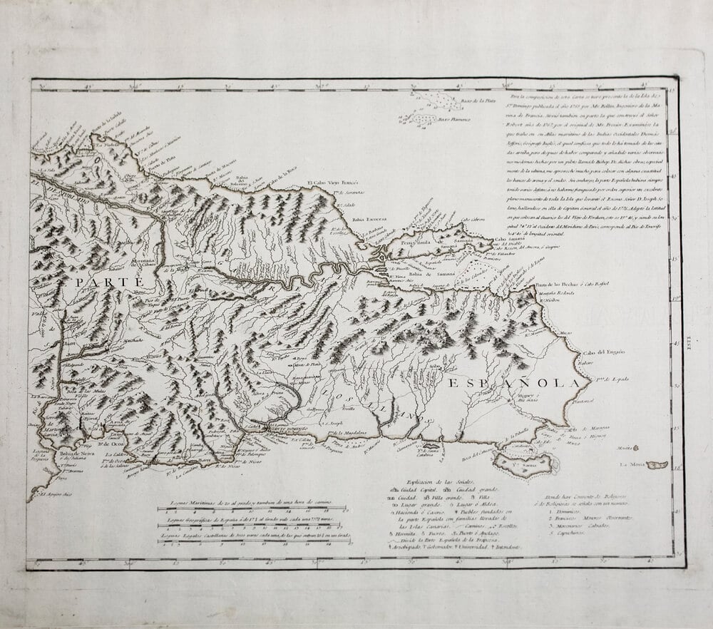
Spanish colonial maps from the sixteenth through eighteenth centuries show vast territories in the Americas divided into viceroyalties (New Spain, New Granada, Peru, Rio de la Plata). Contemporary Latin American borders follow some colonial divisions but ignore others entirely.
The original Spanish territorial claims are now entirely replaced by modern nation-states.
The Duchy of Burgundy
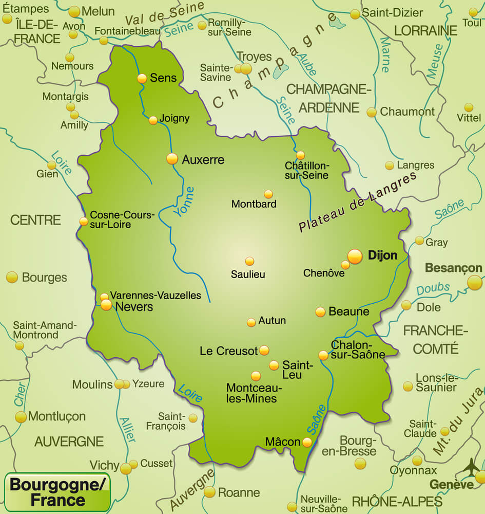
Medieval maps show Burgundy as a powerful independent state controlling territory that is now divided between France, Belgium, the Netherlands, and Germany. Burgundy competed with France and the Holy Roman Empire for dominance.
Contemporary political maps show Burgundy only as a French region, erasing centuries of independence.
The Ottoman Empire’s Peak Extent
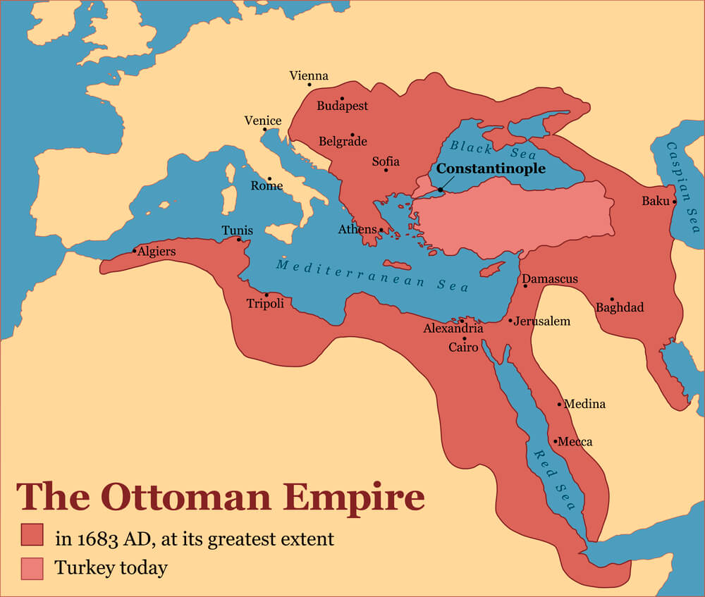
Maps from the sixteenth and seventeenth centuries show Ottoman territorial reach extending across three continents. The empire’s boundaries are now entirely replaced by modern nation-states.
Contemporary maps show Turkey as a much smaller entity, and Ottoman claims are not recognized as legitimate.
The Mughal Empire
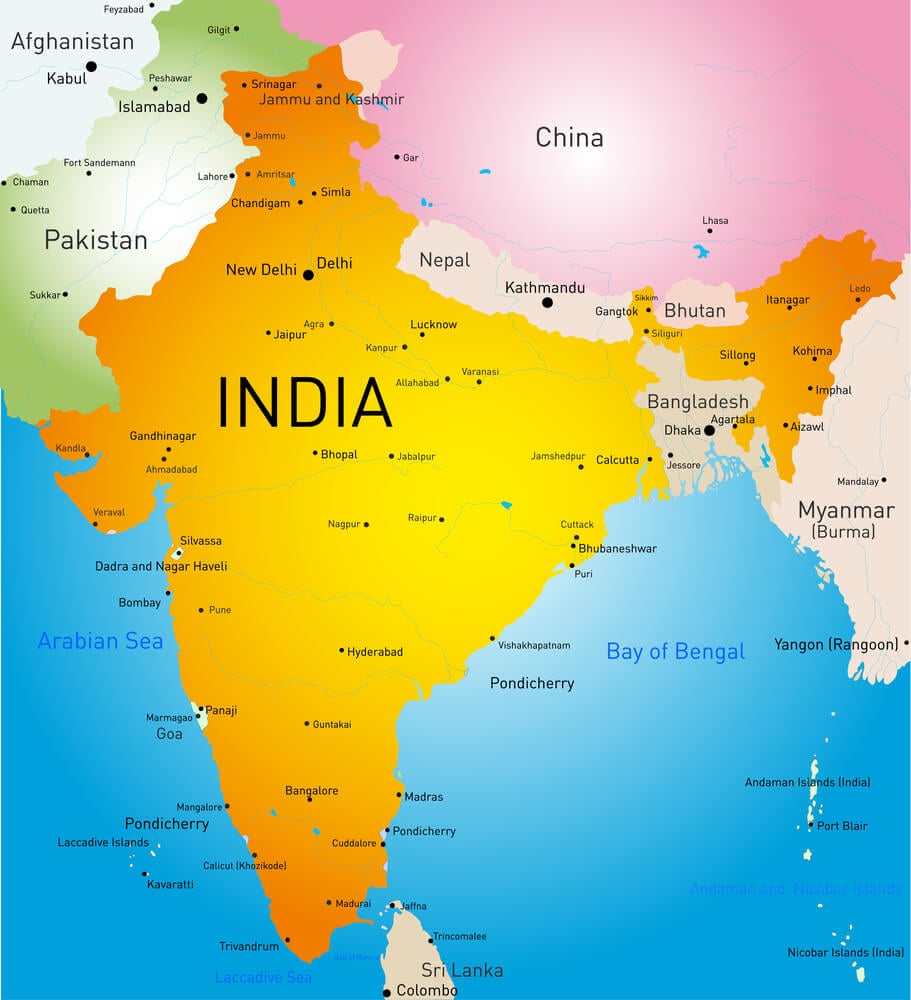
Maps of the sixteenth through eighteenth centuries show the Mughal Empire controlling most of the Indian subcontinent. Contemporary maps show India, Pakistan, and Bangladesh as separate nations.
Mughal territorial claims are now entirely erased from political maps.
The Austro-Hungarian Empire
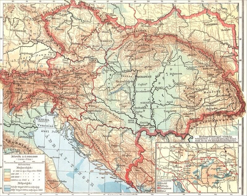
Maps from the nineteenth and early twentieth centuries show Austria-Hungary as a vast multiethnic empire. Contemporary maps show the territory divided among Austria, Hungary, Czech Republic, Slovakia, Slovenia, Croatia, Bosnia, Poland, Ukraine, and Romania.
Austro-Hungarian borders are now entirely unrecognized.
The German Confederation
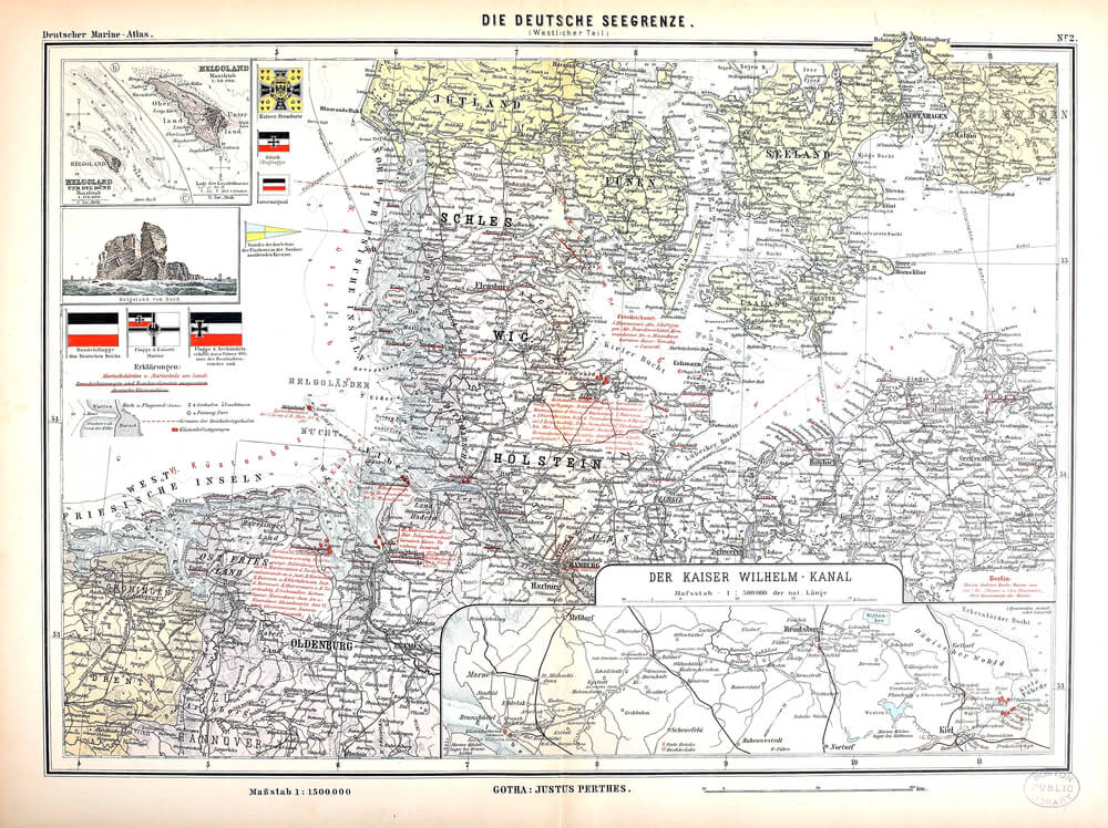
Maps from 1815 to 1866 show the German Confederation, a loose alliance of German-speaking states. Contemporary maps show a unified Germany.
The confederation’s boundaries are now entirely historical and unrecognized.
The Greater German Empire (Grossdeutsch Concept)
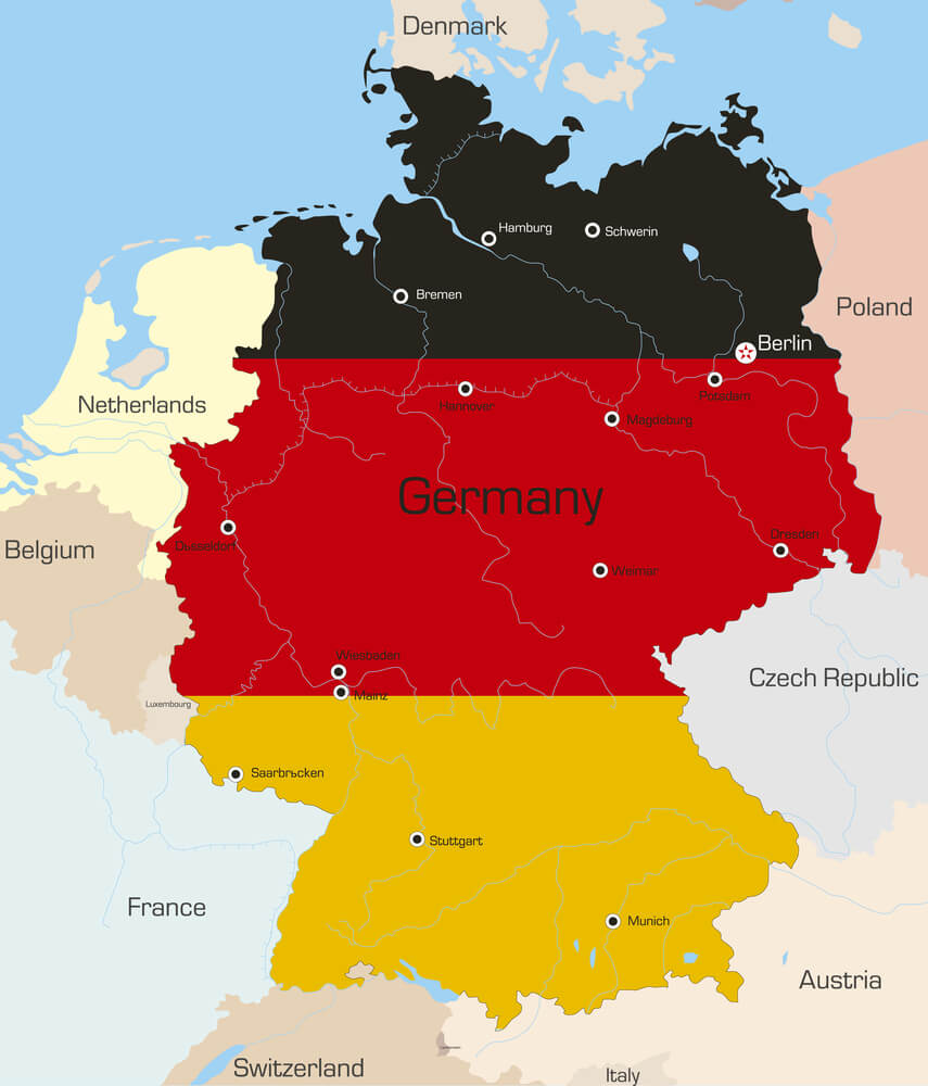
Nineteenth-century maps show what German nationalists imagined as the proper boundaries of a unified German state, including Austrian territory. Twentieth-century maps show Germany and Austria as separate states.
The historical claim to Austrian territory is now entirely unrecognized.
The British Raj in India
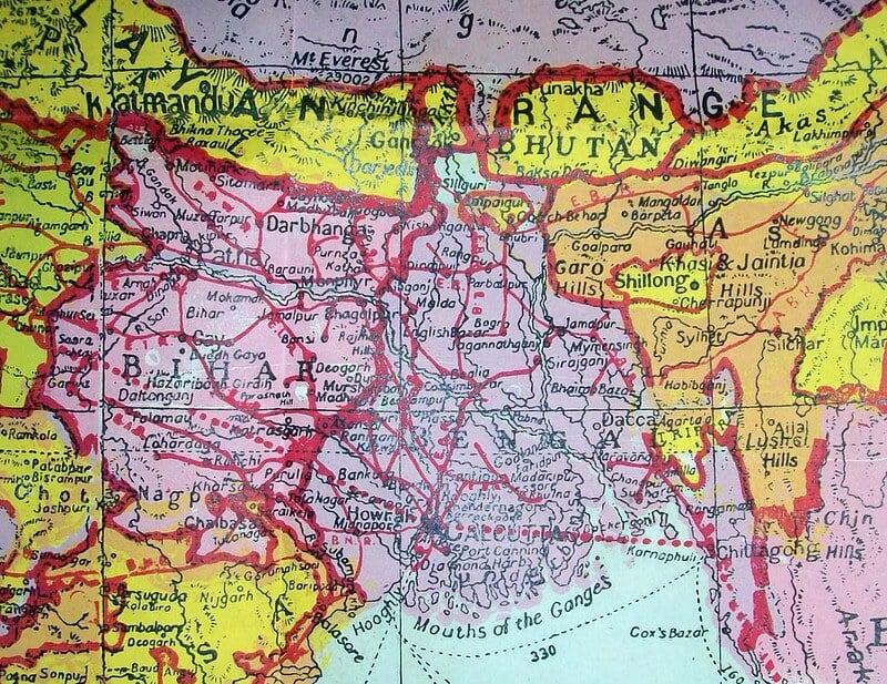
Maps from the nineteenth and early twentieth centuries show British India as a single political entity. Contemporary maps show India, Pakistan, Bangladesh, and other nations as independent states.
The Raj’s territorial claims are now entirely replaced.
The Qing Dynasty’s Expanded Territory
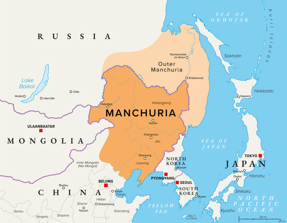
Eighteenth-century maps show the Qing Dynasty controlling vast territories in Central Asia (Xinjiang), Mongolia, Tibet, and Manchuria. Contemporary maps show China with these territories but contested in some regions.
The original Qing territorial claims extended further than even contemporary China’s claims.
The Russian Empire’s American Territory
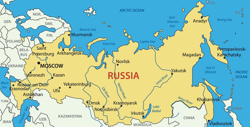
Eighteenth and nineteenth-century maps show Russian claims extending into North America through Alaska. Contemporary maps show Alaska as part of the United States.
Russian territorial claims in North America are now entirely historical.
The Greek Megali Idea
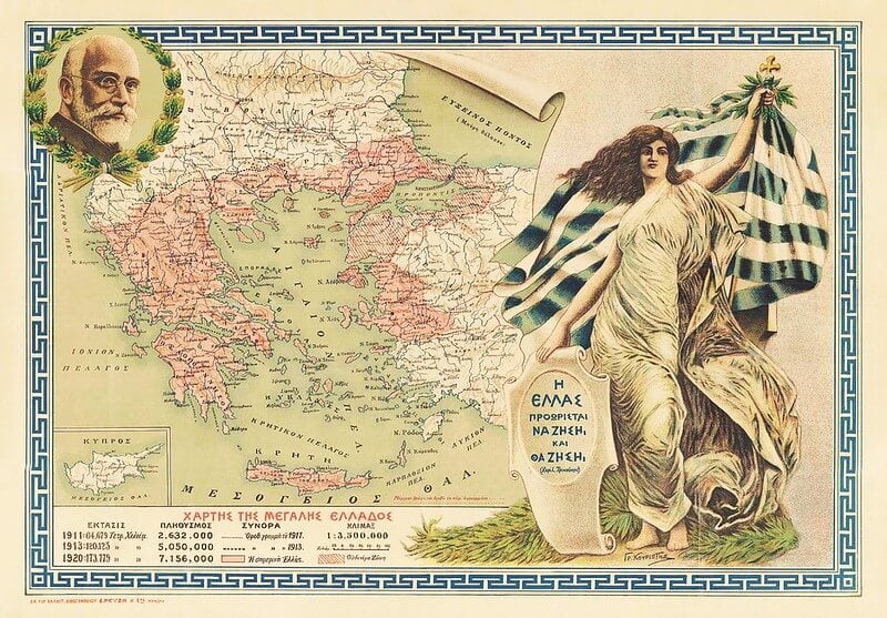
Nineteenth-century maps show what Greek nationalists imagined as the proper boundaries of a Greek nation-state, including Ottoman territory in Asia Minor and the Balkans. Contemporary maps show a much smaller Greece.
The territorial claims implied by the Megali Idea are now entirely unrecognized.
The Medieval Polish-Lithuanian Commonwealth
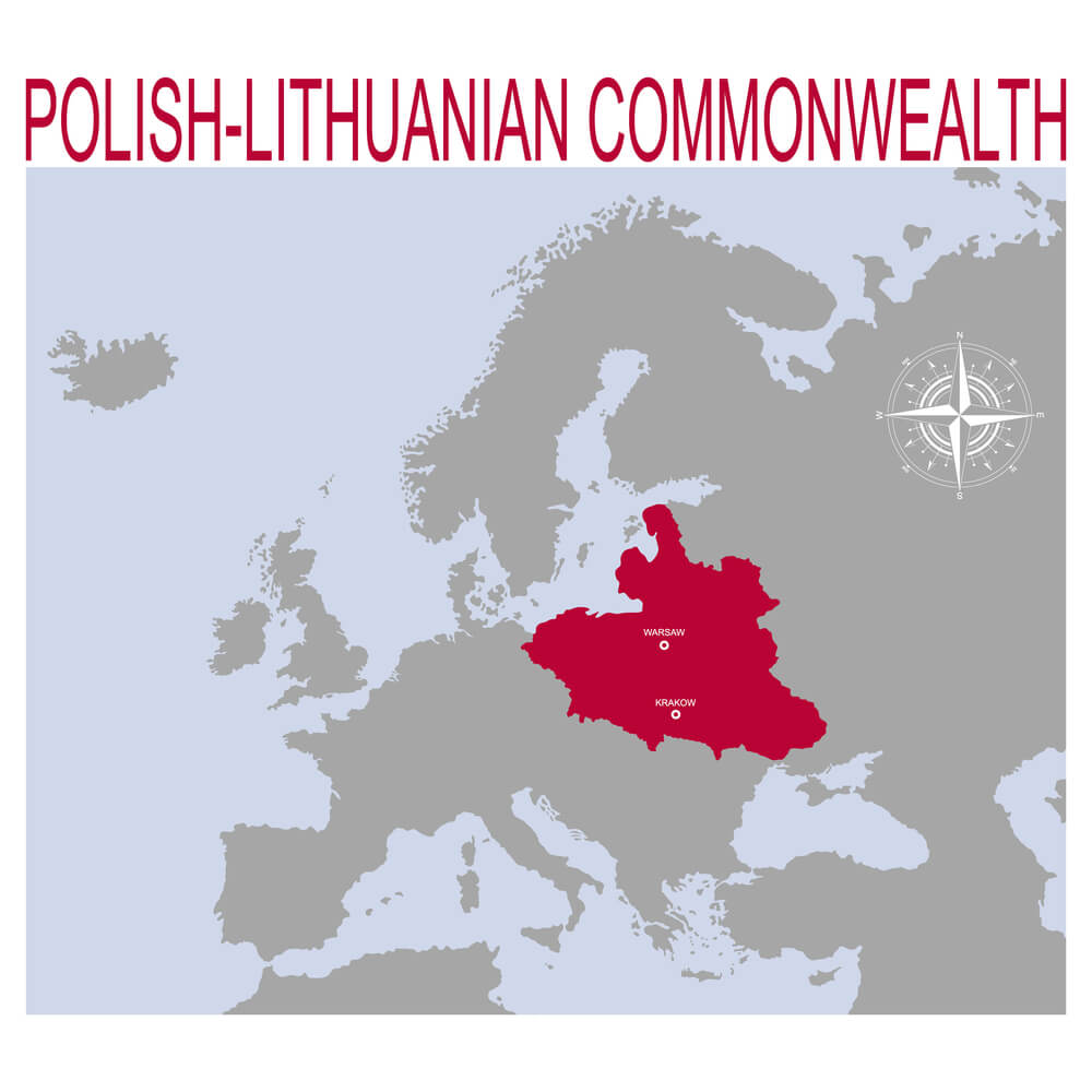
Maps from the sixteenth through eighteenth centuries show Poland-Lithuania as a vast federation controlling territory from the Baltic to the Black Sea. Contemporary maps show Poland and Lithuania as separate, much smaller nations.
The commonwealth’s territorial claims are now entirely historical.
The Khmer Empire
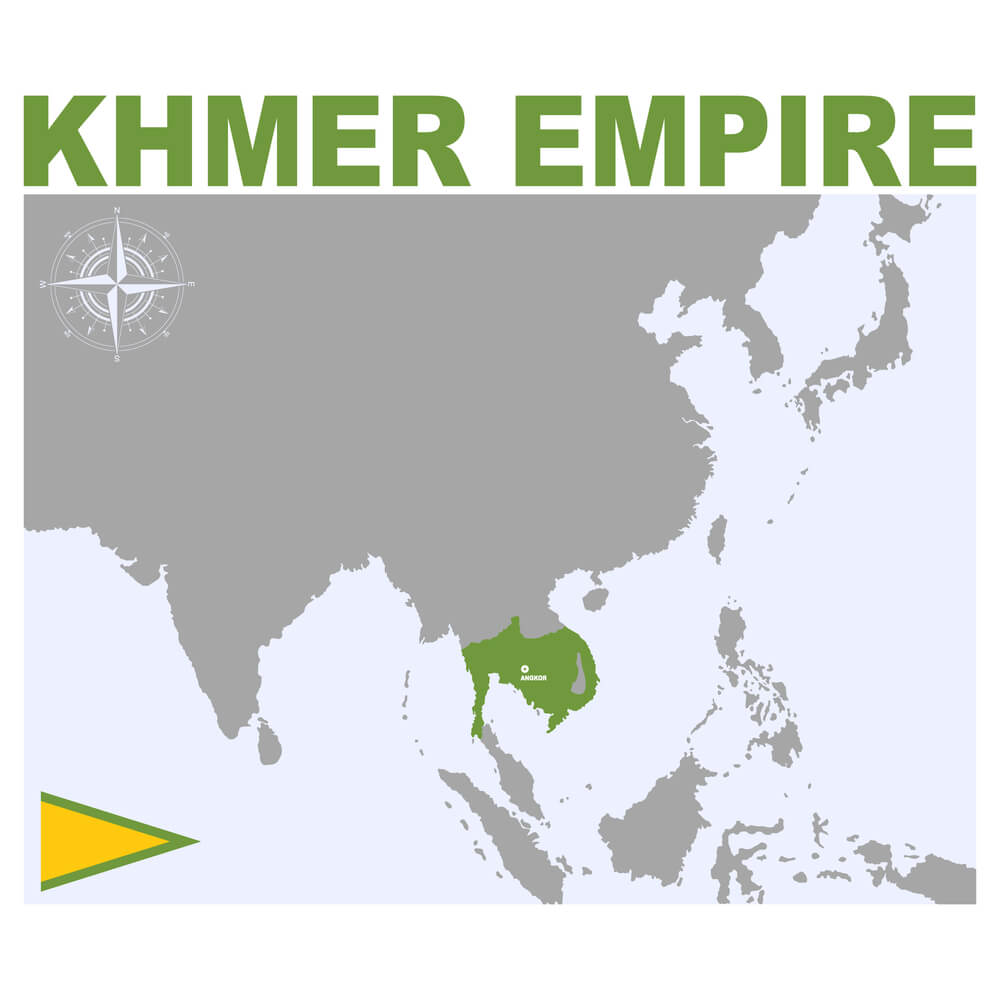
Medieval maps show the Khmer Empire controlling vast territory across Southeast Asia. Contemporary maps show Cambodia as a much smaller nation.
Khmer territorial claims are now entirely historical.
The Carolingian Empire
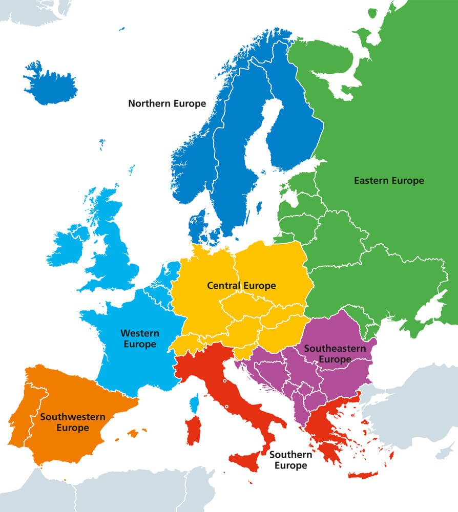
Ninth-century maps show Charlemagne’s empire controlling territory across Western and Central Europe. Contemporary maps show this territory divided among numerous nations.
Carolingian claims are now entirely historical and not recognized as legitimate.
The Roman Empire at Its Peak
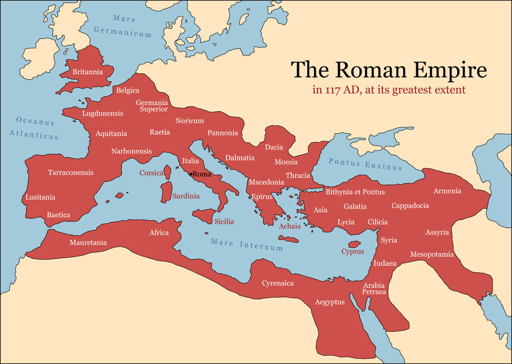
Second-century maps show Rome controlling territory from Britain to Iraq. Contemporary maps show this territory divided among dozens of nations.
Roman territorial claims are now entirely historical and recognized only by historians.
The Islamic Caliphate Under the Umayyads
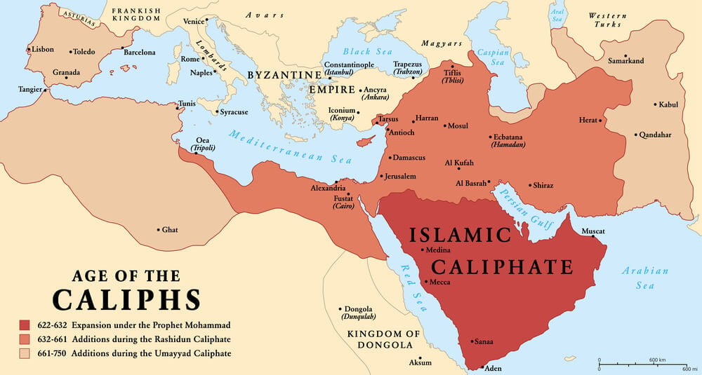
Eighth-century maps show the Umayyad Caliphate controlling territory across North Africa, the Middle East, and Spain. Contemporary maps show this territory divided among numerous nations and religions.
Umayyad territorial claims are now entirely historical.
The Mongol Empire at Its Peak
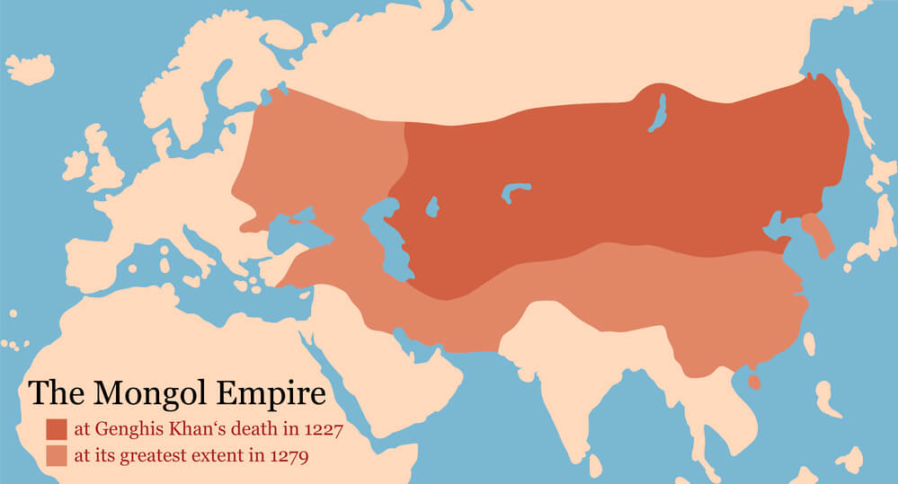
Thirteenth-century maps show Mongol control extending from the Pacific to Eastern Europe. Contemporary maps show this territory divided among dozens of nations.
Mongol territorial claims are now entirely historical.
The Partition Maps of India and Pakistan

Maps from 1947 show the original partition boundaries between India and Pakistan. Contemporary maps show modified boundaries following wars and negotiations.
The original partition maps are now primarily historical, with contemporary boundaries altered from the originals.
The Soviet Union
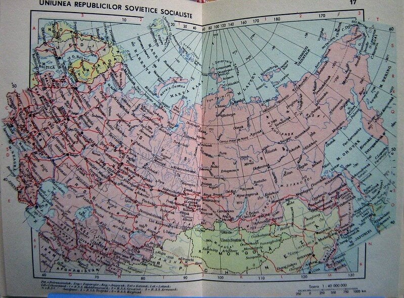
Maps from the twentieth century show the Soviet Union controlling vast territory across Eastern Europe and Asia. Contemporary maps show this territory divided among numerous independent nations.
Soviet territorial claims are now entirely historical.
The Prussian State Before Unification
Eighteenth-century maps show Prussia as a distinct state controlling territory primarily in northern Germany. Contemporary maps show Prussia dissolved into Germany.
Prussian territorial distinctiveness is now entirely historical.
The Free City of Danzig
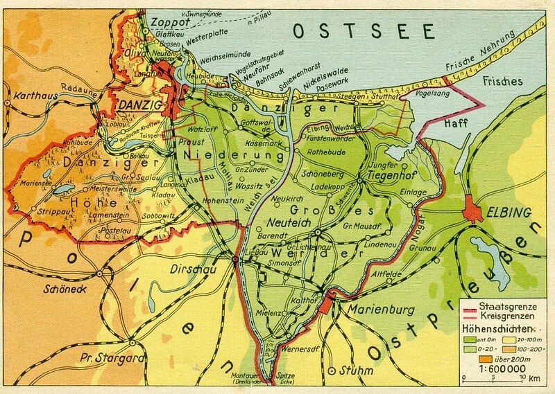
Interwar maps show Danzig as an independent city-state under League of Nations protection. Contemporary maps show Danzig (Gdańsk) as part of Poland.
The city’s political independence is now entirely historical.
The Yugoslav Federation
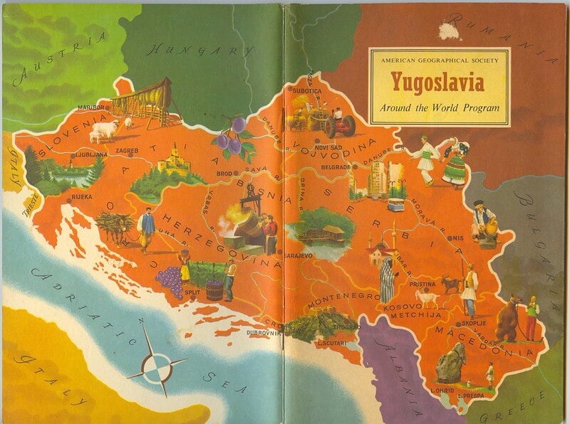
Late twentieth-century maps show Yugoslavia as a unified state. Contemporary maps show the territory divided into Serbia, Croatia, Bosnia, Montenegro, Macedonia, and Slovenia, with further contested divisions.
Yugoslav territorial unity is now entirely historical.
The Transvaal and the Orange Free State
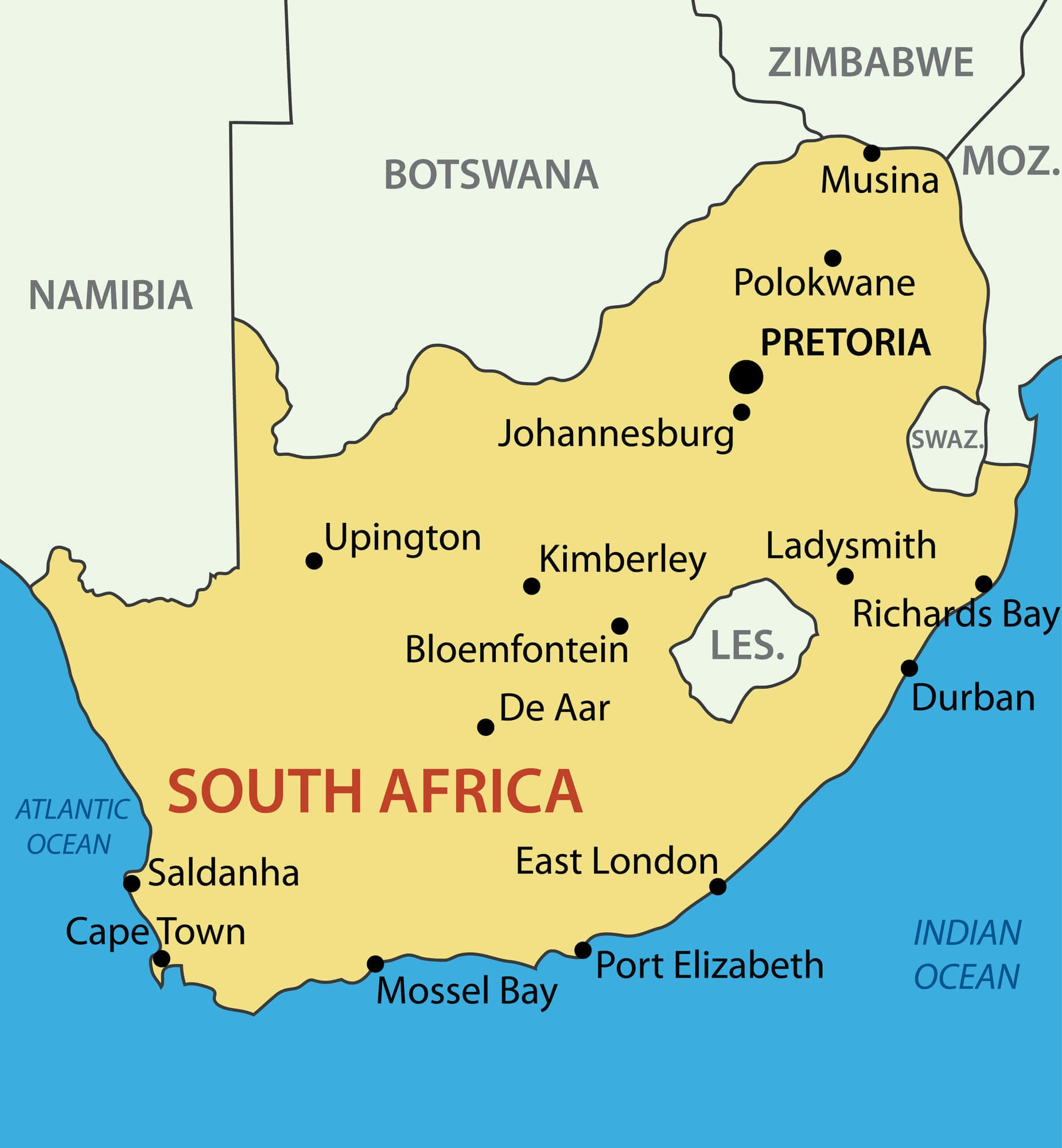
Nineteenth-century maps show independent Boer republics in South Africa. Contemporary maps show South Africa as a unified nation.
The republics’ territorial independence is now entirely historical.
Greater Serbia Concept
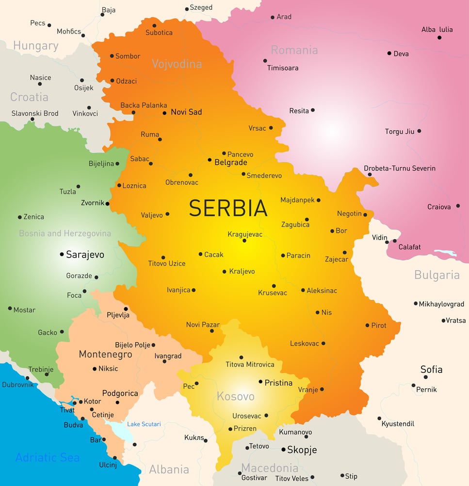
Maps show what Serbian nationalists have imagined as proper Serbian territorial boundaries, including parts of Bosnia, Croatia, and other regions. Contemporary maps show these territories as independent nations or parts of other nations.
Serbian territorial claims are now largely unrecognized in international law.
The Pale of Settlement
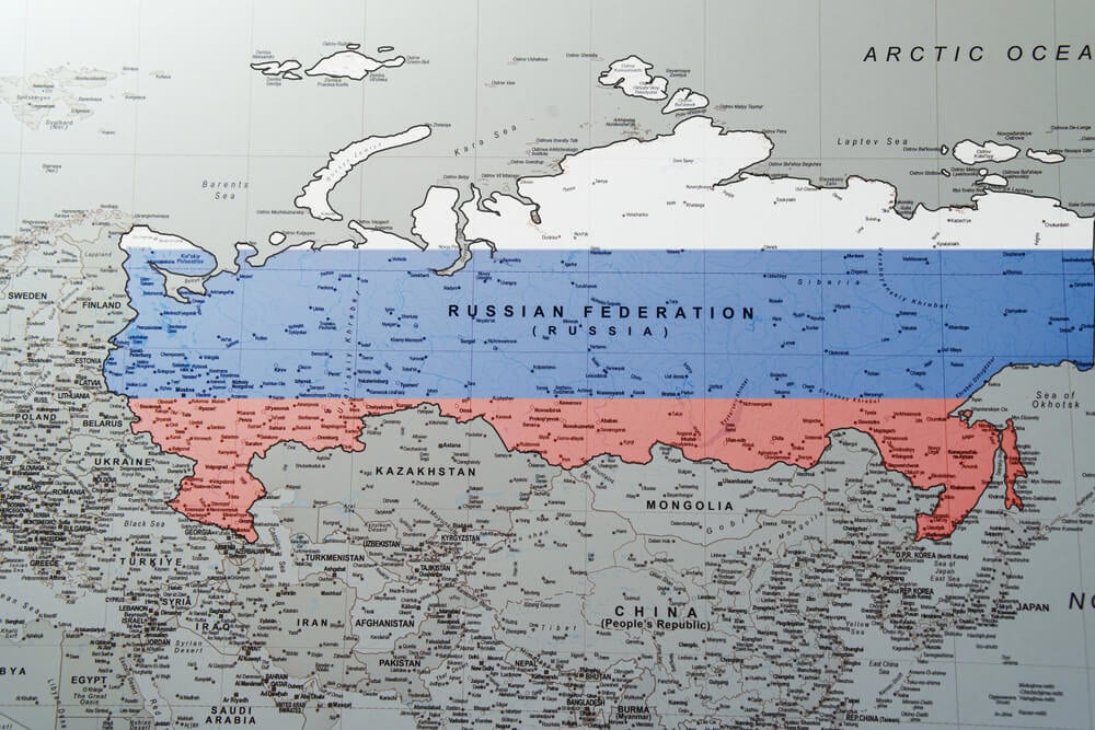
Eighteenth and nineteenth-century maps show the Pale of Settlement—Russian-controlled territory where Jewish settlement was restricted. Contemporary maps show this territory as parts of modern nations.
The Pale’s territorial designation is now entirely historical.
The Hanseatic League Territory
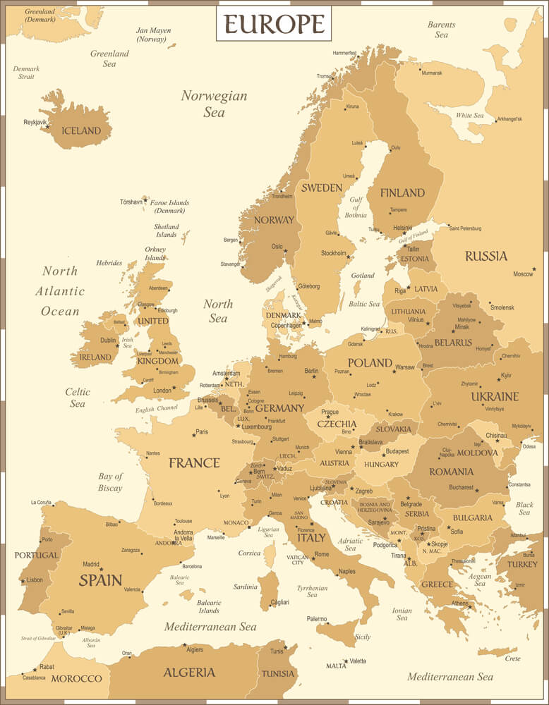
Medieval maps show the Hanseatic League as a confederation of merchant cities controlling trade territory across Northern Europe and the Baltic. Contemporary maps show these cities as parts of modern nation-states.
The league’s territorial coherence is now entirely historical.
The French Indochina
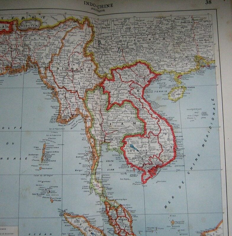
Colonial maps show French Indochina as a single political entity controlling Vietnam, Cambodia, and Laos. Contemporary maps show these as independent nations.
French colonial territorial unity is now entirely historical.
The Scramble for Africa Maps
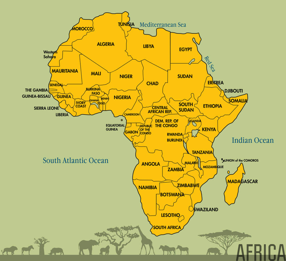
Late nineteenth-century maps show European colonial claims across Africa. Contemporary maps show independent African nations with boundaries only loosely derived from colonial divisions.
The colonial territorial claims are now entirely replaced by post-colonial nation-states.
The Palestine Mandate Territory
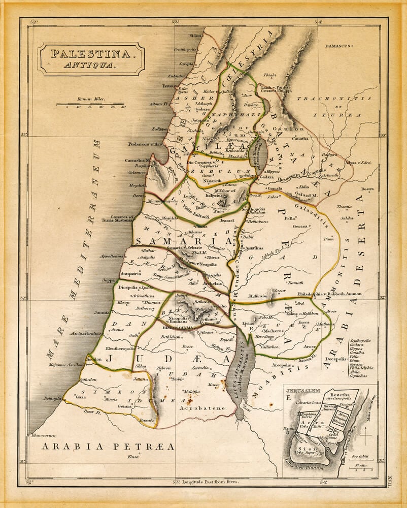
Post-World War I maps show Palestine as a British mandate territory. Contemporary maps show Israel, the Palestinian territories, and neighboring states.
The mandate’s territorial unity is now entirely historical, with the territory divided and disputed.
The Iceland-Denmark Union
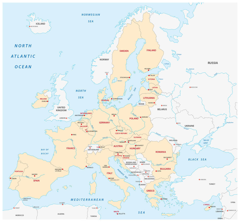
Medieval and early modern maps show Iceland as part of a union with Denmark. Contemporary maps show Iceland as an independent nation.
The union’s territorial arrangement is now entirely historical.
The Swabian Circle
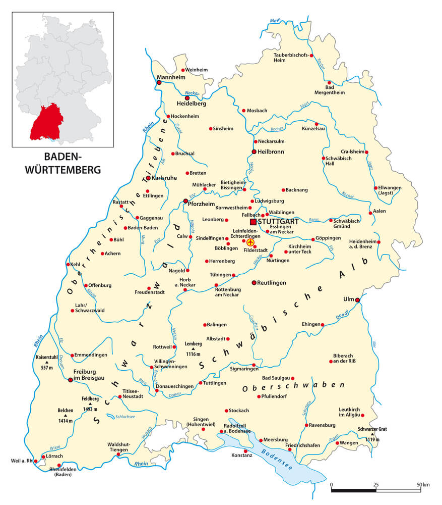
Medieval maps show the Swabian Circle as a distinct political and economic region within the Holy Roman Empire. Contemporary maps show this territory as parts of modern Germany, Switzerland, and Austria.
The circle’s territorial distinctiveness is now entirely historical.
How Borders Become Ghosts
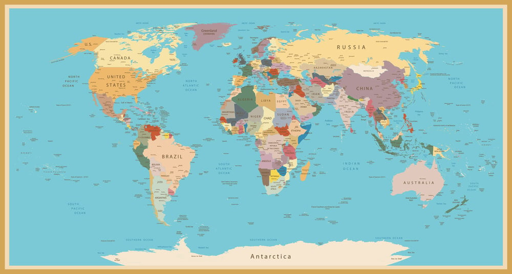
The maps that follow show how thoroughly the world’s political geography has been redrawn. Empires that seemed eternal have dissolved; territorial claims that seemed permanent have been erased; political units that structured centuries of history are now known only to historians.
The permanence of borders is an illusion; maps are arguments, not facts.
More from Go2Tutors!

- The Romanov Crown Jewels and Their Tragic Fate
- 13 Historical Mysteries That Science Still Can’t Solve
- Famous Hoaxes That Fooled the World for Years
- 15 Child Stars with Tragic Adult Lives
- 16 Famous Jewelry Pieces in History
Like Go2Tutors’s content? Follow us on MSN.