15 Volcanoes Hiding Underneath Busy Cities
Living in a major metropolis comes with many considerations—traffic, noise, cost of living, and perhaps surprisingly, volcanic activity. Many of the world’s bustling cities were built atop or near dormant or active volcanoes, creating a fascinating juxtaposition of natural power and human development.
Let’s explore 15 remarkable volcanoes that quietly exist beneath or alongside some of the world’s most populated urban centers.
Naples and Mount Vesuvius
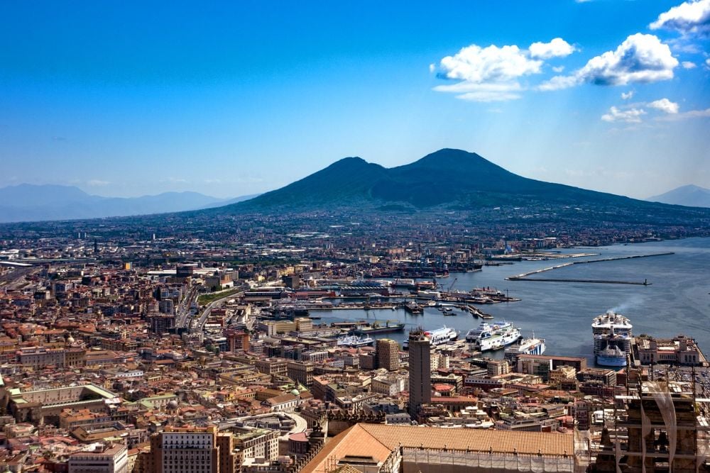
The ancient city of Naples sits in the dangerous shadow of Mount Vesuvius, one of history’s most infamous volcanoes. This sleeping giant famously buried Pompeii and Herculaneum in 79 CE and continues to pose a significant threat to the roughly 3 million people living in its vicinity.
Despite its deadly potential, Neapolitans have developed a complex relationship with their volcanic neighbor, often referring to it as ‘Grandfather Vesuvius’ with a mixture of respect and familiarity.
Auckland’s Volcanic Field
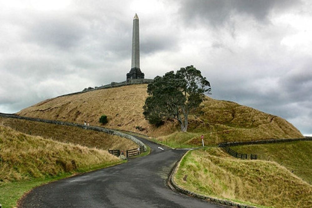
New Zealand’s largest city rests upon a field of approximately 53 volcanic vents, creating a unique urban landscape dotted with volcanic cones. The Auckland Volcanic Field has been active for about 250,000 years, with the most recent eruption occurring just 600 years ago at Rangitoto Island.
These volcanoes typically erupt once and then go extinct, but the field itself remains active, meaning a new volcano could potentially form anywhere within the city limits.
Mexico City and Popocatépetl
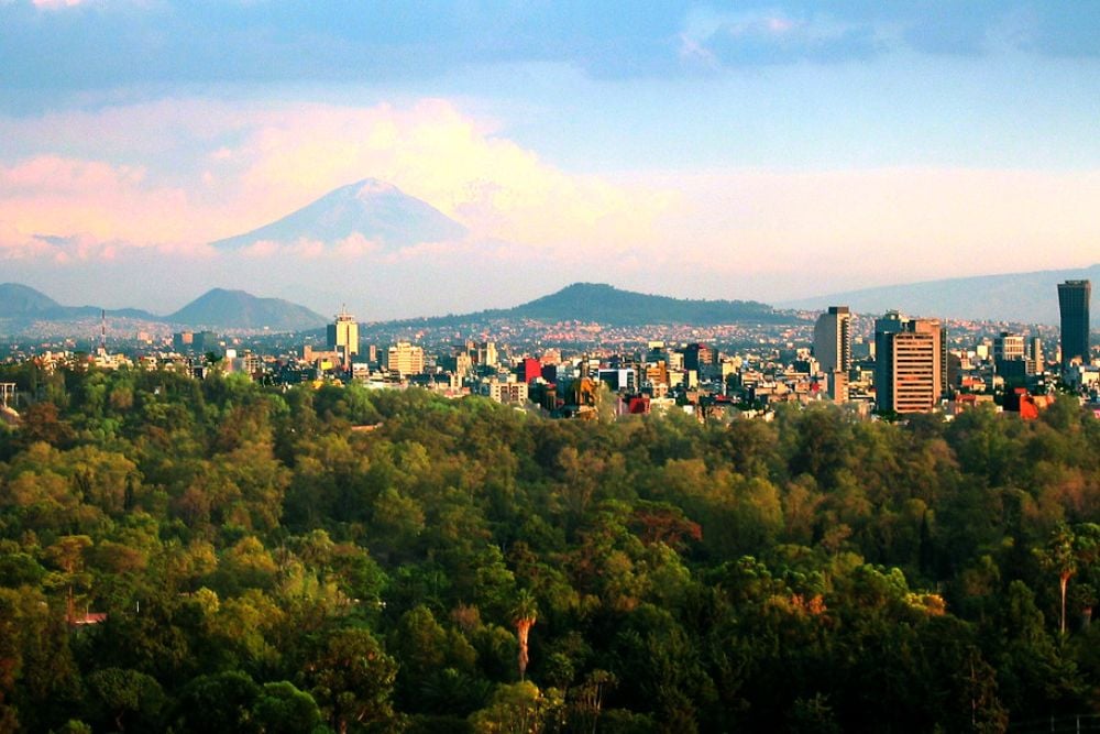
Mexico City, with its population of over 21 million, lies just 45 miles from the active Popocatépetl volcano. Known affectionately as ‘Popo’ by locals, this massive stratovolcano stands at 17,802 feet and regularly releases plumes of ash and smoke.
The Aztecs who first settled the area considered the volcano sacred, viewing its eruptions as messages from the gods—a far cry from today’s emergency evacuation plans and air quality warnings.
Quito and Pichincha
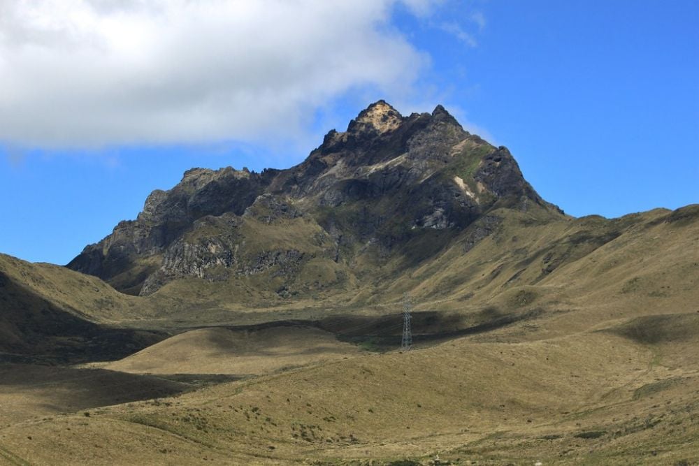
Ecuador’s capital city of Quito stretches along the eastern slopes of the active Pichincha volcano. The city’s 2.7 million residents live with the unique distinction of occupying the world’s highest capital city near an active volcano.
Pichincha reminds citizens of its presence occasionally, with its last significant eruption in 1999 covering the city in a light layer of ash. Many locals consider living in Pichincha’s shadow simply part of Ecuadorian identity, much like dealing with the country’s frequent earthquakes.
Seattle and Mount Rainier
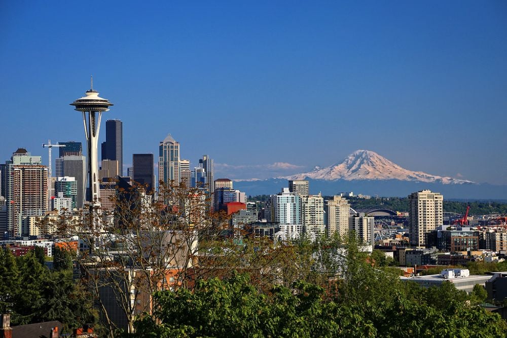
Seattle’s iconic skyline often features the majestic Mount Rainier in the background, but this picturesque scene masks potential danger. Though located about 60 miles southeast of downtown, an eruption of this massive stratovolcano could send lahars—destructive volcanic mudflows—surging through nearby valleys and potentially reaching the city’s southern suburbs.
The mountain’s snow-capped beauty belies the fact that it’s considered one of the most dangerous volcanoes in the United States due to its proximity to populated areas.
Tokyo and Mount Fuji
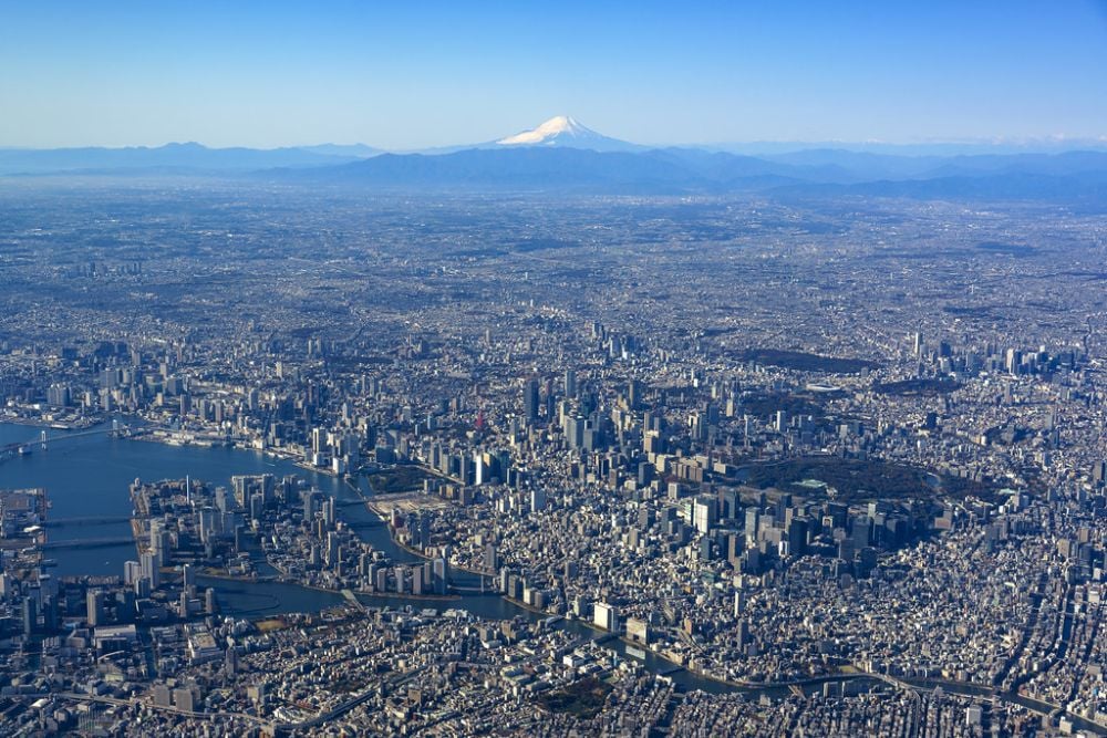
While not directly underneath the city, Mount Fuji looms just 60 miles southwest of Tokyo, placing Japan’s capital within range of ashfall from a major eruption. This perfectly symmetrical volcano last erupted in 1707, sending ash all the way to what is now central Tokyo.
Today, scientists closely monitor this UNESCO World Heritage site for signs of activity, knowing that an eruption could affect not just the 37 million residents of greater Tokyo, but potentially disrupt the global economy.
Naples and Campi Flegrei
Beyond Vesuvius, Naples faces another volcanic threat—the massive Campi Flegrei caldera that underlies the western part of the city. This supervolcano hasn’t erupted catastrophically in thousands of years, but the ground in the region regularly rises and falls as magma shifts beneath the surface.
Unlike a typical cone-shaped volcano, Campi Flegrei resembles a large depression filled with numerous volcanic vents, making it less recognizable but potentially more dangerous than its famous neighbor, Vesuvius.
Portland and the Boring Volcanic Field
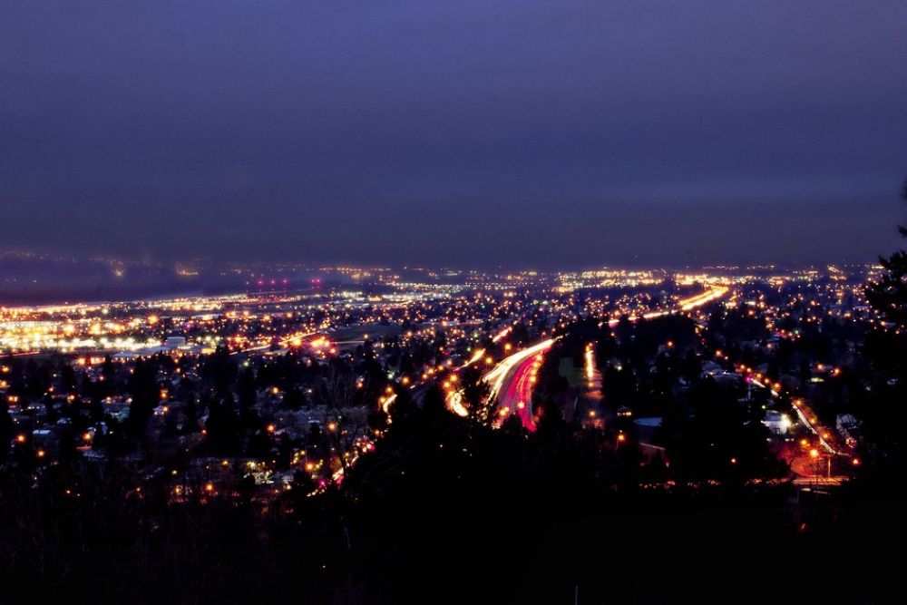
The hip city of Portland, Oregon, rests atop the Boring Volcanic Field, a collection of cinder cones and small shield volcanoes. Despite its rather uninspiring name (derived from the nearby town of Boring), this volcanic field created the distinct hills that give the city its characteristic topography.
The most recent eruption occurred about 350,000 years ago, and while considered extinct by many geologists, the field serves as a reminder that the Pacific Northwest’s volcanic landscape helped shape many of its urban environments.
Guatemala City and Pacaya

Less than 20 miles from Guatemala City stands Pacaya, one of Central America’s most active volcanoes. The capital’s 2.5 million residents have grown accustomed to occasional ash falls and the distant glow of lava flows.
Pacaya erupts so frequently that it’s become a popular tourist destination, with visitors hiking up to roast marshmallows over hot vents—a somewhat casual approach to a force that regularly disrupts flights and occasionally requires evacuations of nearby communities.
Yogyakarta and Mount Merapi
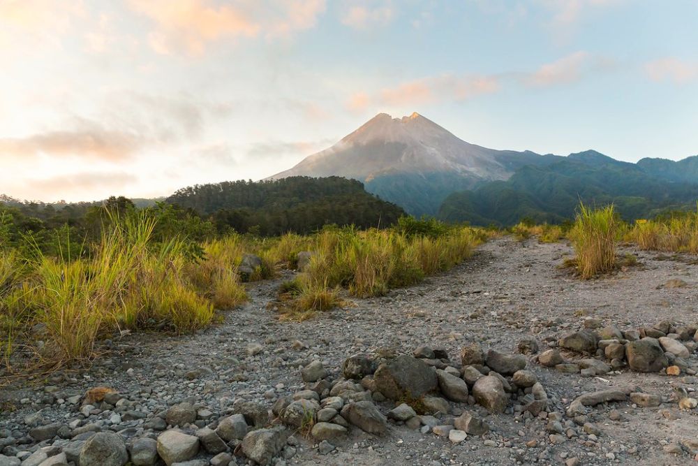
Indonesia’s cultural capital, Yogyakarta, sits just 17 miles from Mount Merapi, one of the world’s most active stratovolcanoes. Merapi, whose name literally means ‘Mountain of Fire,’ erupts frequently, with major events occurring roughly every five to ten years.
Despite the obvious danger, the fertile volcanic soil supports dense farming communities on the mountain’s slopes, creating a precarious balance between natural hazard and agricultural benefit that has existed for centuries.
San Salvador and San Salvador Volcano
El Salvador’s capital city wraps around the slopes of its namesake volcano, creating one of the most direct relationships between an urban area and a volcanic peak in the world. The volcano’s last major eruption in 1917 caused significant damage to the city, but that hasn’t prevented development from creeping ever higher up its slopes.
The volcano’s crater lake, a popular recreation spot, offers residents a surreal experience—swimming in a volcano that could one day reawaken.
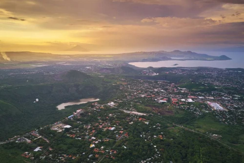
Manila and Taal
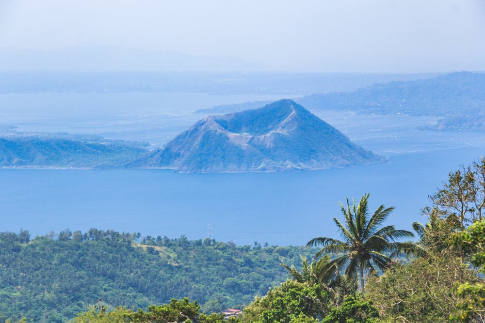
The Philippines’ capital region lies just 30 miles north of Taal, one of the world’s lowest and most deadly volcanoes. What makes Taal particularly unique is its island-within-a-lake-within-an-island configuration, creating a stunning visual that masks its explosive potential.
Despite its relatively small size, Taal has produced some of the Philippines’ most devastating eruptions, with its ash potentially reaching Manila’s 14 million residents within hours of a major event.
Arequipa and Misti
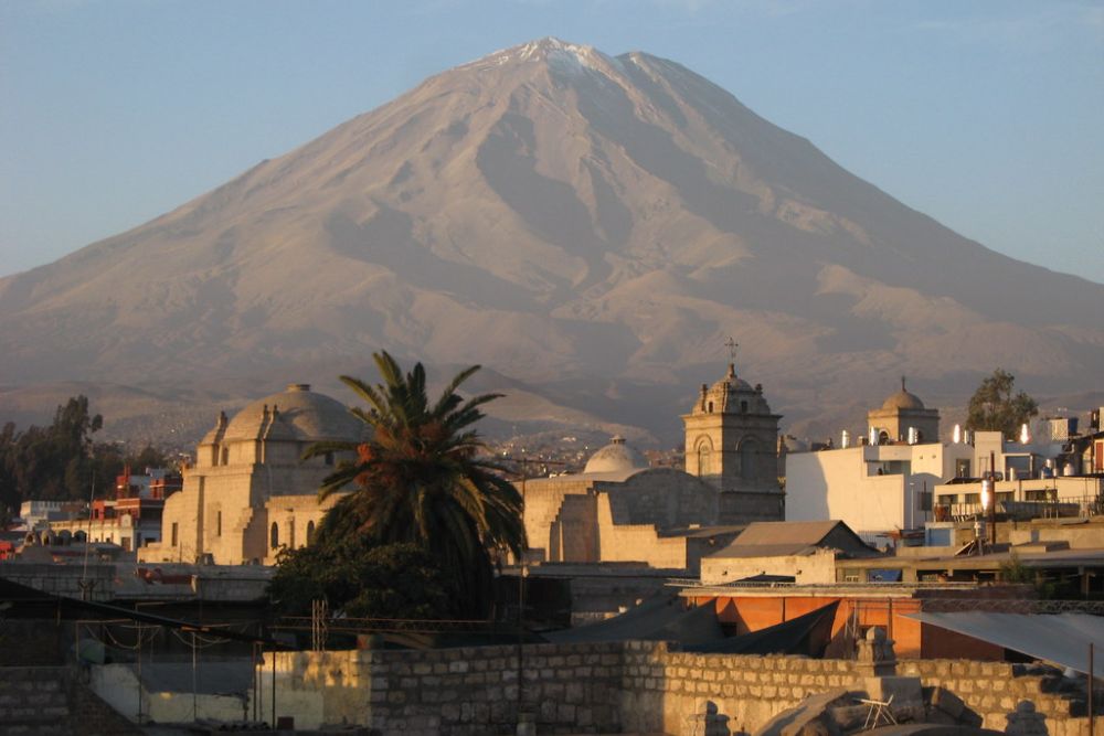
Peru’s second-largest city, Arequipa, developed in the shadow of the perfectly conical Misti volcano, which stands just 11 miles from the city center. The white volcanic stone from Misti was used to construct many of Arequipa’s colonial-era buildings, earning it the nickname ‘The White City.’
This connection between volcano and urban development goes beyond mere proximity—the volcano literally provided the building materials for the city that now watches it warily for signs of awakening.
Managua and Apoyeque
Nicaragua’s capital sits adjacent to Lake Managua, which contains the hidden Apoyeque volcano beneath its waters. This submerged volcanic complex rarely makes it onto tourism brochures, but scientists recognize it as a potentially dangerous system that last erupted about 2,000 years ago.
The lake itself occupies part of a larger volcanic depression, making much of Managua essentially built within an ancient volcanic structure—like constructing a city in the mouth of a sleeping giant.
Kagoshima and Sakurajima

The Japanese city of Kagoshima has perhaps the most intimate relationship with an active volcano of any major urban area in the world. Sakurajima, once an island but now connected to the mainland by lava flows, sits just 4 miles across the bay from downtown.
The volcano erupts almost daily, sending ash clouds over the city so regularly that residents carry umbrellas on clear days and clean ash from their windshields as routinely as they might clear off morning dew.
Living With Geological Time Bombs

These urban volcanoes represent a fascinating intersection of geological power and human adaptation. While modern monitoring systems provide early warning capabilities unimaginable to previous generations, they also reveal just how tenuous our position can be. Cities continue to grow around these sleeping giants, balancing the benefits of fertile soil and geothermal resources against the risk of catastrophic eruption.
For millions of city dwellers worldwide, the distant rumble of an ancient force beneath their streets is simply another aspect of urban life—a reminder that even our most impressive metropolitan achievements exist at the pleasure of the dynamic planet beneath our feet.
More from Go2Tutors!

- The Romanov Crown Jewels and Their Tragic Fate
- 13 Historical Mysteries That Science Still Can’t Solve
- Famous Hoaxes That Fooled the World for Years
- 15 Child Stars with Tragic Adult Lives
- 16 Famous Jewelry Pieces in History
Like Go2Tutors’s content? Follow us on MSN.SN.