Longest Bridges Ever Engineered
Bridges connect more than just land masses. They represent human ambition at its finest—the willingness to solve problems that seem impossible at first glance.
When you look at the world’s longest bridges, you’re seeing decades of planning, billions in funding, and the kind of engineering that pushes the limits of what structures can do. These aren’t just roads or railways stretched across water and valleys.
They’re monuments to what happens when necessity meets determination.
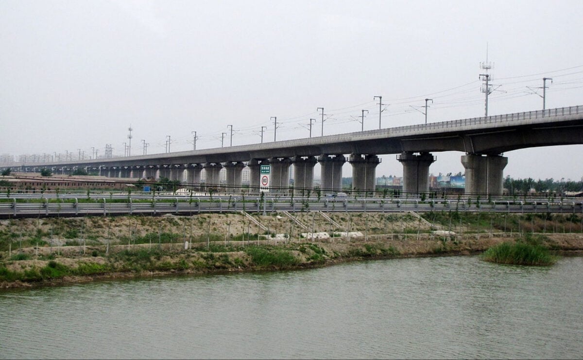
Danyang-Kunshan Grand Bridge

The numbers here are staggering. This bridge in China stretches 102 miles across the Yangtze River Delta.
That’s not a typo. You could drive for over an hour and still be on the same bridge.
Built for the Beijing-Shanghai High-Speed Railway, it carries trains at speeds up to 186 miles per hour. Construction required 10,000 workers and took four years to complete.
The bridge runs mostly parallel to the Yangtze River, crossing rice paddies, rivers, and lakes. Engineers had to account for the area’s tendency to flood and designed the structure to withstand earthquakes and typhoons.
The cost came to about $8.5 billion.
Changhua-Kaohsiung Viaduct

Taiwan’s contribution to the list runs 97 miles through the western part of the island. Like its Chinese counterpart, this bridge serves high-speed rail passengers.
The route connects the capital region to the southern city of Kaohsiung, cutting travel time dramatically. The design had to account for Taiwan’s position along the Pacific Ring of Fire.
Earthquakes pose a constant threat, so engineers built in redundancies and flexibility. The bridge sits on hundreds of piers, each designed to move independently during seismic events without compromising the overall structure.
Cangde Grand Bridge

Another Chinese rail bridge, this one measures 72 miles and forms part of the same Beijing-Shanghai high-speed line as the Danyang-Kunshan. The difference here is the terrain.
Much of this bridge crosses the flat North China Plain, but engineers still faced challenges with soil stability and flooding. The construction timeline overlapped with other mega-projects in the region.
Coordination became critical—not just between engineering teams but with environmental agencies, local governments, and agricultural interests whose land the bridge passed through.
Tianjin Grand Bridge
At 70 miles, this bridge completes a trio of massive structures along the Beijing-Shanghai line. The route takes passengers through Tianjin, one of China’s largest cities, and the bridge has to navigate urban areas, industrial zones, and wetlands.
Building through a major metropolitan area added complexity. Work happened at night in some sections to minimize disruption.
Sound barriers went up along populated stretches. The project demonstrated how mega-infrastructure can integrate with existing urban fabric when planned carefully.
Weinan Weihe Grand Bridge
This 49-mile bridge crosses the Wei River valley in Shaanxi Province. The area’s history adds another layer to the engineering challenge.
Archaeological sites dot the landscape, including parts of ancient Chang’an, one of China’s former capitals. Construction teams worked with archaeologists to preserve historical sites.
When excavation revealed artifacts, work stopped until proper documentation and preservation measures were complete. The bridge ultimately threads through a landscape where history runs thousands of years deep.
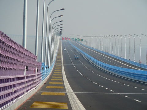
Bang Na Expressway
Thailand’s elevated highway extends 34 miles through the Bangkok metropolitan area. Unlike the rail bridges, this one carries six lanes of road traffic.
The design lifts vehicles above the congested streets below, creating a faster route through one of Asia’s most traffic-clogged cities. The project took six years and used more concrete than any other structure at the time.
Engineers designed it as a series of connected segments, allowing for thermal expansion and contraction in Thailand’s tropical climate. The expressway changed how people move through Bangkok, though it also sparked debate about urban planning and whether elevated highways solve or merely relocate traffic problems.
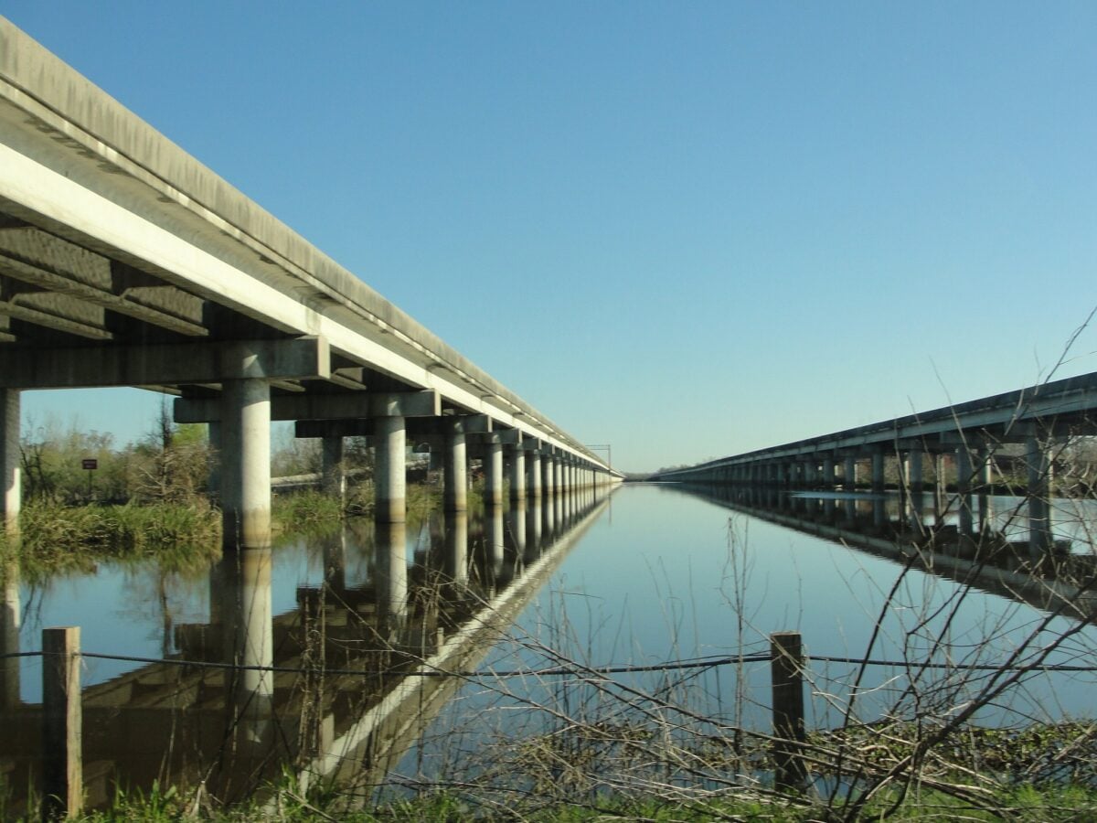
Lake Pontchartrain Causeway
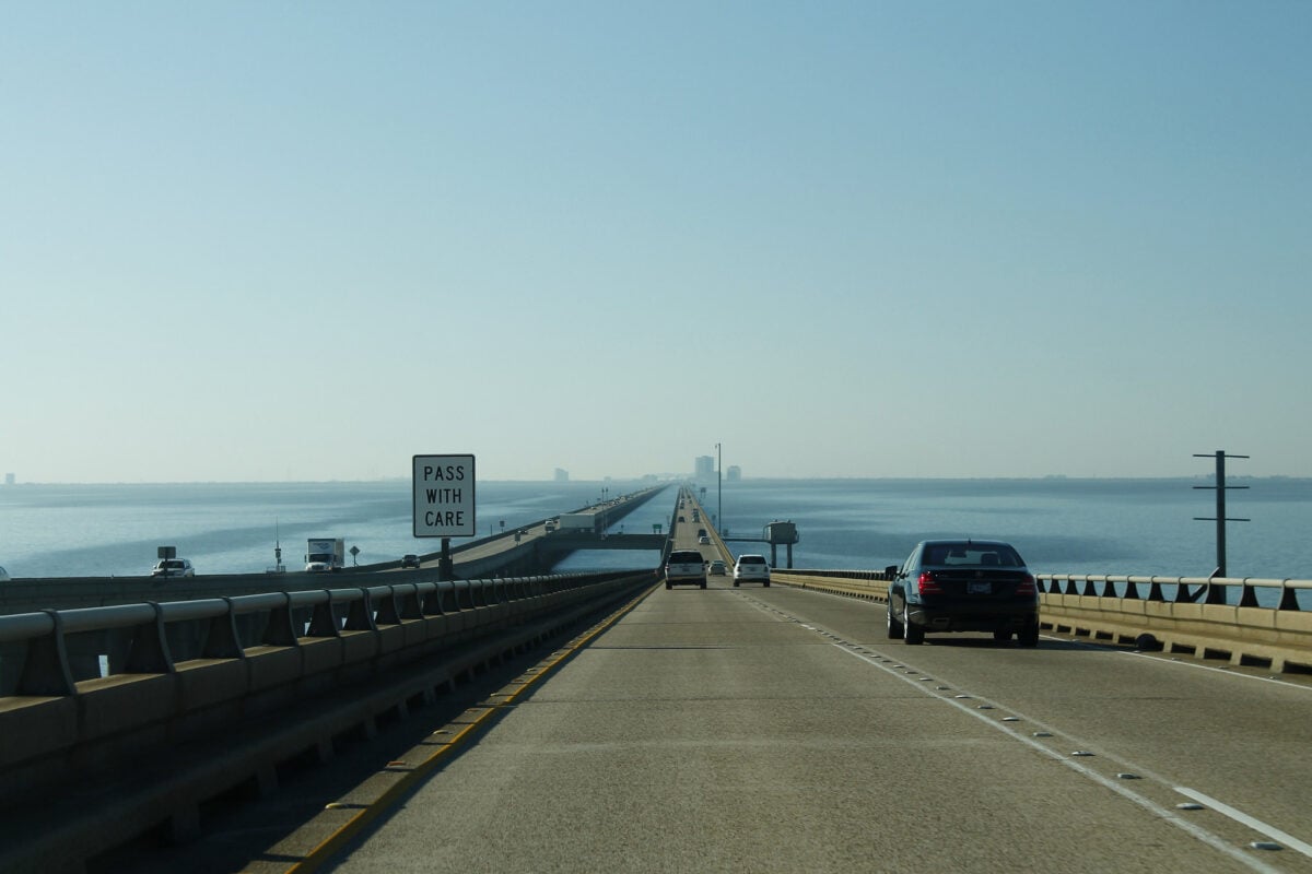
Louisiana’s twin bridges span 24 miles across Lake Pontchartrain, connecting New Orleans to the north shore. For decades, these held the record as the world’s longest continuous bridges over water.
The original bridge opened in 1956, with the parallel span added in 1969. Driving across feels surreal.
For stretches, you can’t see land in any direction—just water and the roadway ahead. The bridges sit just 16 feet above the water, close enough that waves sometimes wash over the surface during storms.
Maintenance crews constantly work to repair damage from salt water, storms, and the sheer volume of traffic.
Manchac Swamp Bridge
Another Louisiana structure, this 23-mile bridge carries Interstate 55 through one of America’s most haunted landscapes—or so local legend claims. The swamp itself is treacherous, with uncertain depths and tangled vegetation that makes traditional construction methods difficult.
Engineers drove thousands of concrete pilings deep into the swamp floor to create stable foundations. The environment constantly tries to reclaim the bridge.
Vegetation grows rapidly, requiring regular clearing. The humid air accelerates rust and decay.
Building here wasn’t just an engineering challenge but an ongoing battle against nature itself.
Yangcun Bridge
This 22-mile viaduct in China carries the Beijing-Tianjin Intercity Railway. The high-speed line needed to be straight and level, which meant building elevated tracks through an area with varying terrain and existing development.
The bridge design allows trains to maintain speeds of 217 miles per hour. At that velocity, even minor imperfections in the track become dangerous.
Engineers used computer modeling to ensure perfect alignment and built in systems to monitor for any shifts or settlements over time.
Jiaozhou Bay Bridge
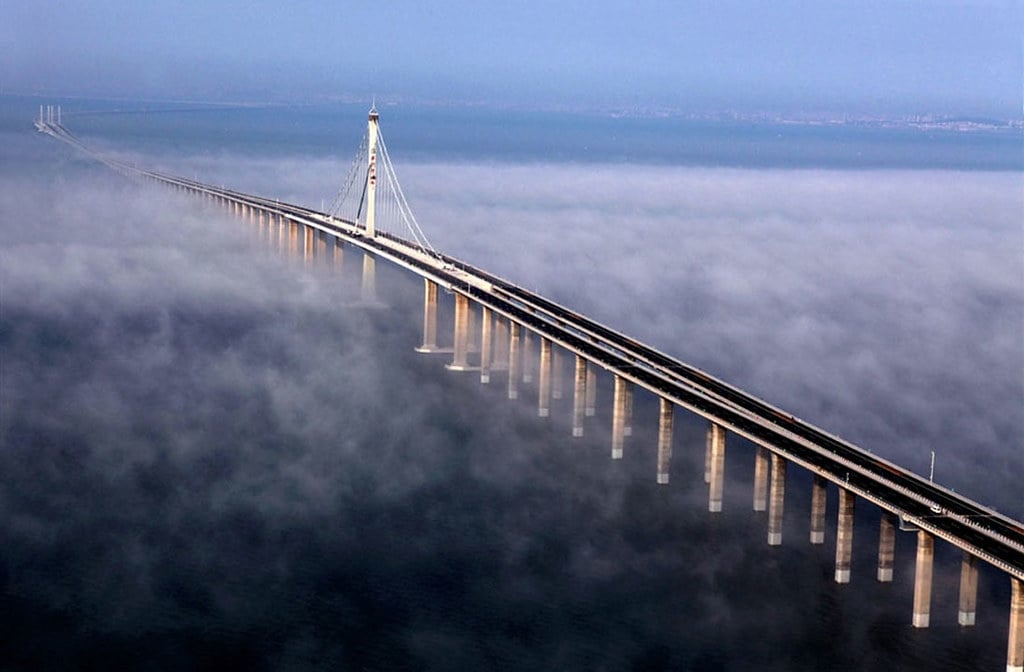
Connecting Qingdao to Huangdao across Jiaozhou Bay, this bridge measures 16 miles over water. The design includes a section that rises to allow ship traffic beneath.
The bay is commercially important, and the bridge had to accommodate large vessels while still providing a direct route for cars and trucks. Construction happened in sections, with different teams working simultaneously on separate parts.
Coordinating the work so everything aligned perfectly when the sections met required precision measuring and constant communication. The bridge opened in 2011 and immediately became one of the region’s most recognizable landmarks.
Hangzhou Bay Bridge
This S-shaped bridge crosses Hangzhou Bay in China, spanning 22 miles. The design isn’t straight because engineers wanted to create the shortest possible route while still avoiding shipping channels.
The result is graceful but complex. The bay experiences some of the world’s highest tidal ranges, with differences of up to 30 feet between high and low tide.
Currents run strong, and typhoons regularly sweep through the area. The bridge’s foundations had to withstand all of this while supporting six lanes of traffic.
A rest area halfway across provides drivers a place to stop, look out at the water, and contemplate the engineering that makes such a structure possible.
Runyang Bridge
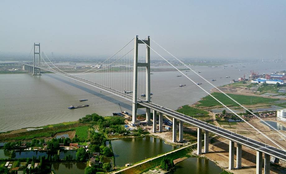
A long stretch of road and wire cuts across the Yangtze – twenty-two miles linking regions once divided by water. Rising high in parts, it stands among the leaders for longest cable-supported spans on Earth.
What required many hours on ferries now takes only a few minutes. Two provinces, previously slowed by crossings, find quicker passage here.
Over the Yangtze, progress moved around constant boat movement. Work continued even as ships passed through daily. Dry zones formed using temporary barriers helped set strong bases below.
Towers rose first, followed by the road surface above – each piece placed only when safe. Timing shaped every step taken during assembly.
Chesapeake Bay Bridge-Tunnel

Floating roads meet hidden passages beneath the waves near Virginia’s coast. This path stretches more than seventeen miles, linking distant shores once divided by water.
Instead of waiting on ferries for hours, travelers now drive straight through. Beneath the surface, twin tunnels – each one mile long – let ships sail above without interruption.
Out in the water, four made-up land spots had to go up where bridge sections shift into underwater passages. Each one works like a breathing spot plus a safe pause zone if something goes wrong.
To build these, workers scooped muck from the bottom of the bay then locked it in place so tides would not wash it away. When it finally launched in 1964, people took notice – now it’s listed among seven standout feats of construction by civil engineers in America.
King Fahd Causeway
Spanning fifteen miles, this link joins Saudi Arabia to Bahrain over the Persian Gulf waters. Made of several bridges along with man-made islands, it carved out a new path for trade and transport.
Getting around used to mean flights or ferries before engineers built the crossing.
Years of effort went into building the link, finished in 1986.
Workers came from many places, skilled in working at sea, erecting bridges, shaping land in arid zones. More than steel and concrete, it showed how two countries could work together.
Trade grew because of it, lives changed on either shore.
Engineering and Ambition Together

What ties these bridges together isn’t just size or span. Moving people and supplies quicker, smoother, steadier – that was the real goal each time. Cash played a role, certainly, yet so did foresight.
A stretch of open water or an empty gorge had to spark an idea in someone’s mind: a crossing right there. From thought to reality meant architects, builders, coordinators shaping metal, pavement, stone into form.
Stretching across vast gaps, these massive bridges show how far engineering has come. Not long ago, such spans would have seemed impossible to build.
Walking or driving over them means moving through a web of choices made years before. Every cable, beam, and anchor reflects careful thought and small corrections along the way.
These are not just paths from one place to another – they’re built to last beyond our lifetimes. Future travelers, unaware of today’s world, will pass where we now do, heading toward lives still unwritten.
What sets these bridges apart isn’t just steel or stone. Built by hands reaching across divides, they show how people push forward, no matter the obstacle.
More from Go2Tutors!

- The Romanov Crown Jewels and Their Tragic Fate
- 13 Historical Mysteries That Science Still Can’t Solve
- Famous Hoaxes That Fooled the World for Years
- 15 Child Stars with Tragic Adult Lives
- 16 Famous Jewelry Pieces in History
Like Go2Tutors’s content? Follow us on MSN.