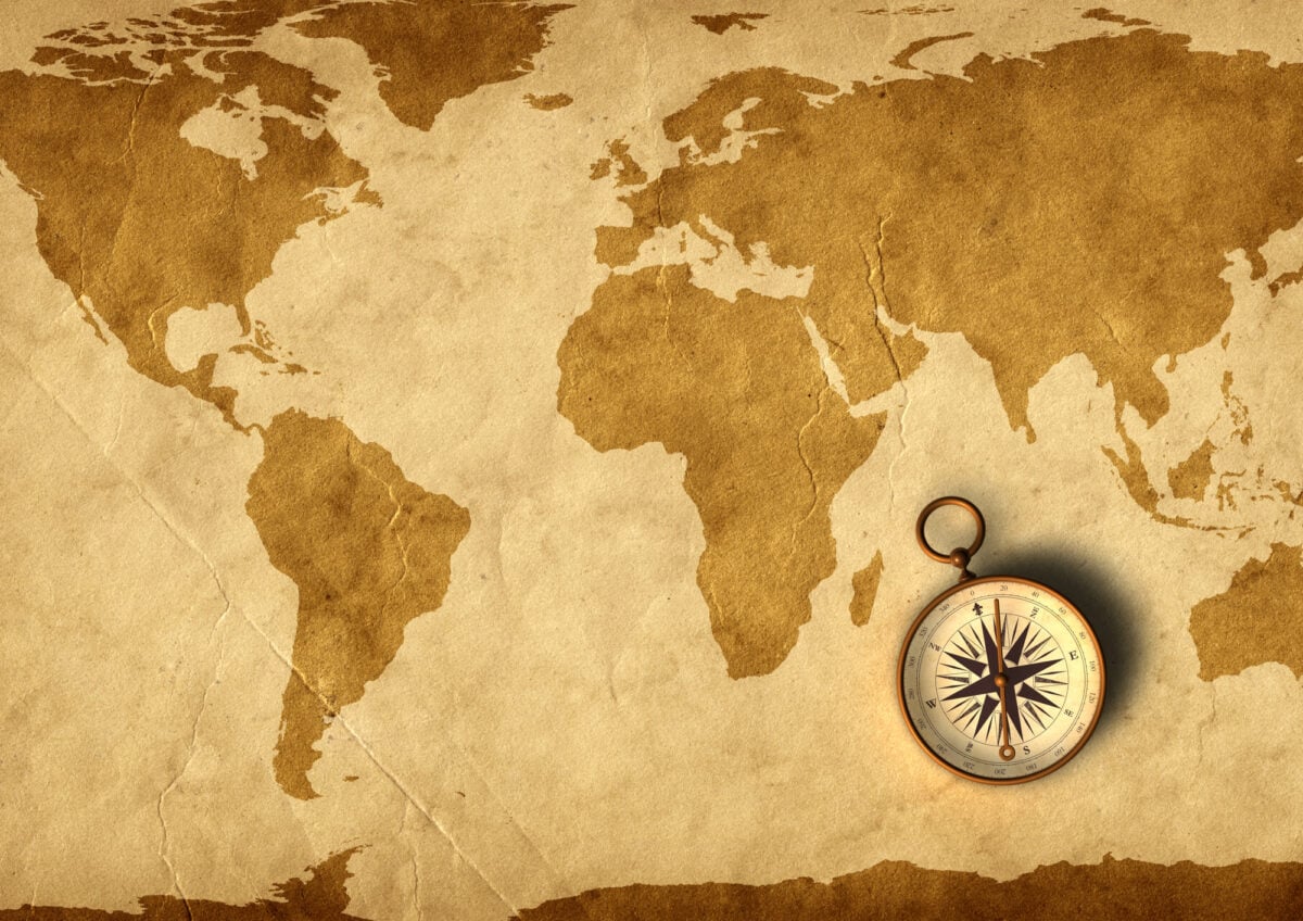
Secret Messages Found in Ancient Maps
Maps have always been more than simple navigation tools. For centuries, cartographers have embedded hidden codes, false locations, and cryptic symbols into their work for reasons ranging from military security to copyright protection.
Some of these secrets were intentional acts of deception, while others remain puzzling mysteries that continue to baffle researchers today. The discovery of these hidden elements has transformed how historians view cartography, revealing that mapmakers were often operating with knowledge or techniques far beyond what was expected for their time.
Here is a list of 14 secret messages found in ancient maps.
Trap Streets

Mapmakers have long protected their work by inserting fake streets into their designs. These deliberate errors, known as trap streets, act like invisible watermarks that catch anyone copying the map without permission.
The fictitious additions are usually subtle enough to avoid confusing travelers but obvious enough to prove theft in court. Thomas Brothers Maps acknowledged in the 1980s that they included trap streets in their Los Angeles county maps, with concentrations in certain areas, though the exact number remains a matter of debate.
The practice worked like a legal tripwire, ready to spring on any competitor foolish enough to copy someone else’s hard work.
The Agloe Paradox

In the 1930s, mapmakers Otto Lindberg and Ernest Alpers created a fictional town called Agloe in upstate New York by mixing their initials together. What started as a simple copyright trap took an unexpected turn when a general store appeared at that location.
Whether the store was named because of the map or the connection emerged later remains unclear, but the result was the same—a fictional place gradually became real. The town gained even more fame decades later when it appeared in John Green’s novel Paper Towns, attracting curious visitors to a place that began as nothing more than ink on parchment.
Portolan Chart Mystery

Medieval portolan charts appeared suddenly in the late 1200s with a level of accuracy that seems remarkable for their time. These nautical maps of the Mediterranean and Black Sea showed coastlines with impressive precision, far exceeding the quality of other medieval maps.
The charts exhibit no clear predecessors or developmental trail, appearing fully formed as if copied from an unknown source. Their accuracy in depicting coastal features has puzzled researchers for generations, though the exact methods used to create them remain debated among historians and cartographers.
Carte de Cassini Discretion

The 18th-century Carte de Cassini, France’s first comprehensive topographic map, represented a massive cartographic achievement. Some historians believe that certain strategic locations may have been softened, omitted, or depicted with less detail than other areas, possibly for security reasons.
Whether this was intentional policy or simply incomplete surveying remains a subject of scholarly discussion. The maps served both civilian and government purposes, walking a careful line between public utility and national interests.
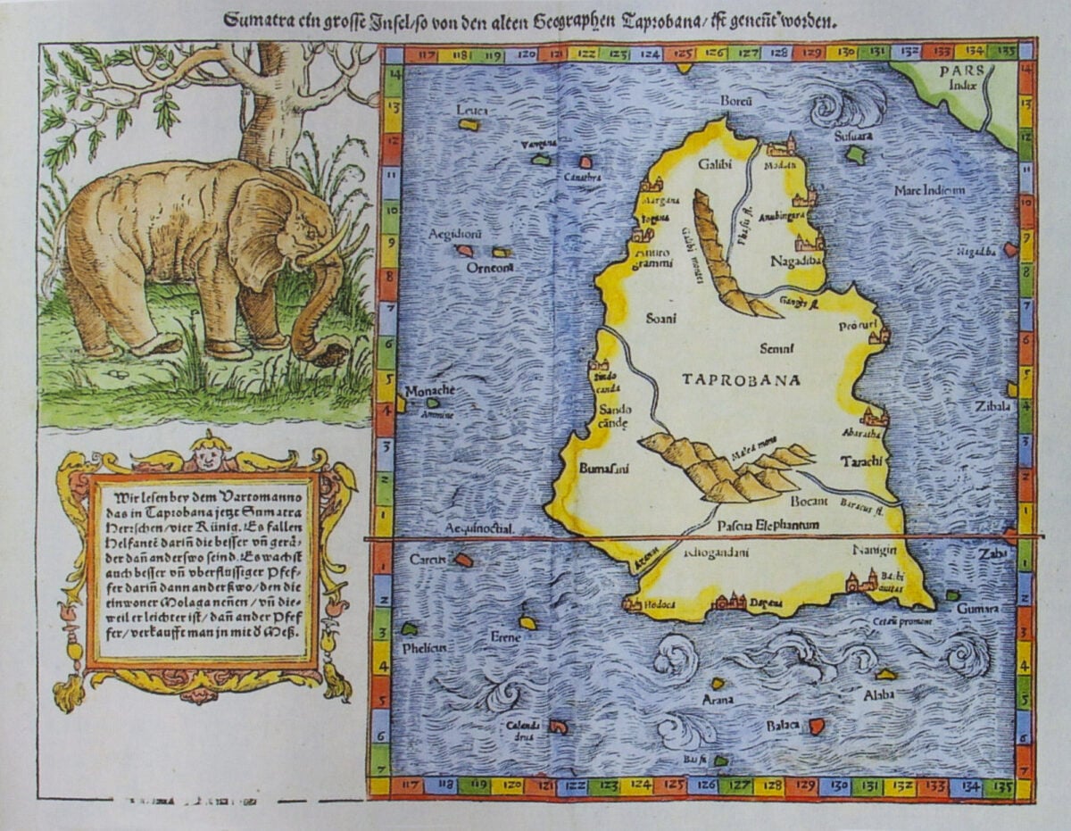
The Piri Reis Map

Ottoman admiral Piri Reis created a map in 1513 that has sparked considerable debate among researchers. The map shows various coastlines with notable detail, and some have suggested it depicts regions that weren’t supposed to be known to European or Ottoman cartographers at that time.
Piri Reis himself stated that he compiled his map from about twenty older charts and maps, including some that may have dated back to the time of Alexander the Great. The exact sources he used and the origins of some of the geographic knowledge shown on the map continue to generate discussion among historians.
Cartographer Markings
Medieval mapmakers sometimes included distinctive stylistic elements in their work that functioned almost like signatures. These personal touches ranged from particular artistic flourishes to specific ways of rendering geographic features.
While the idea of formal secret guild codes lacks strong historical evidence, cartographers did develop recognizable styles that modern researchers can sometimes use to identify the creator of unsigned maps. These subtle markers helped establish a mapmaker’s reputation and allowed their work to be traced across different commissions.
The Phaistos Disc
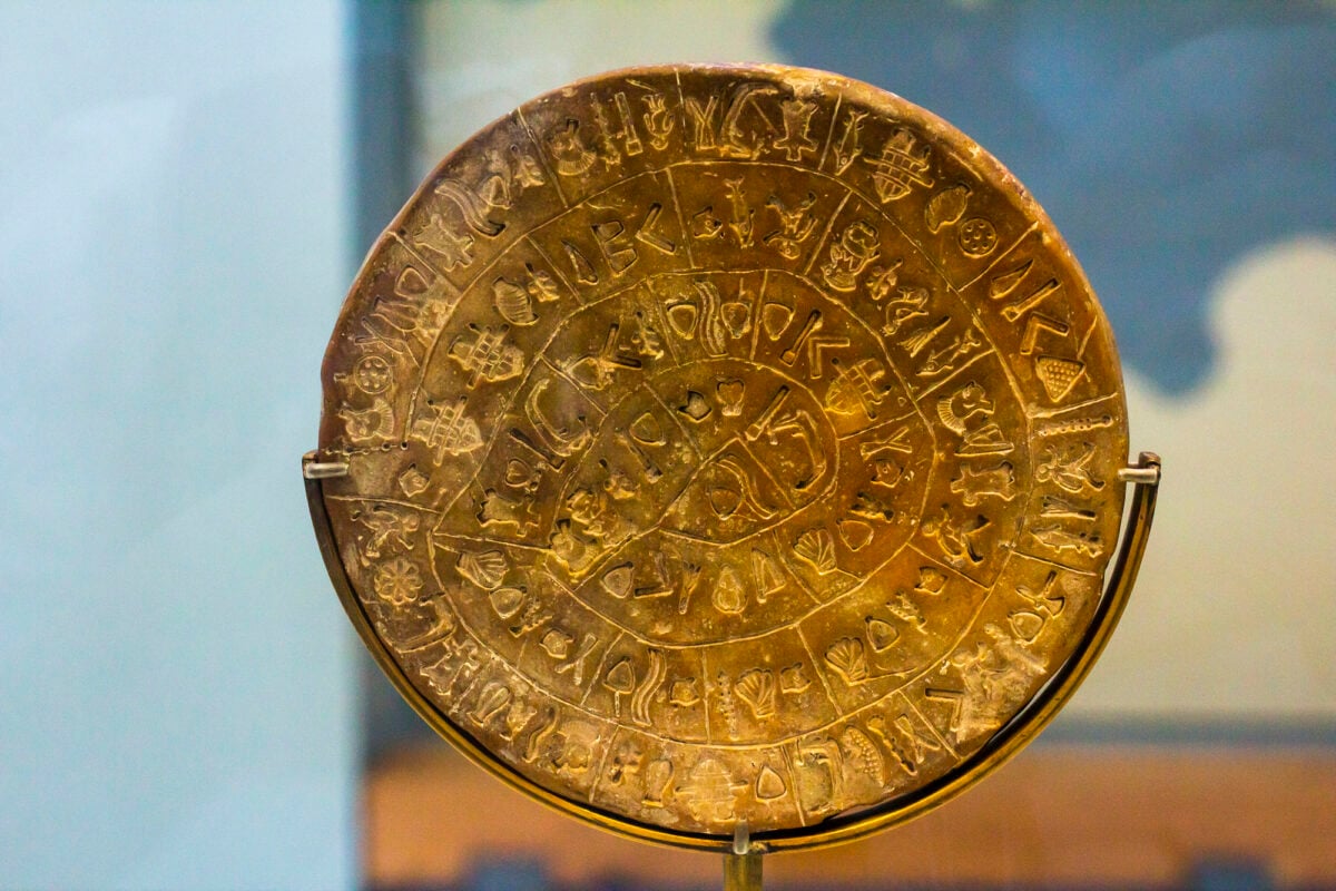
Discovered in Crete in 1908, the Phaistos Disc contains 241 mysterious symbols arranged in a spiral pattern on a clay disc dating to around 1700 to 1600 BCE. While most scholars don’t consider it a map, some researchers have proposed geographic interpretations of its symbols.
The disc remains undeciphered, with theories ranging from religious texts to administrative records. Its purpose and meaning continue to elude researchers, making it one of the most enigmatic archaeological artifacts from the ancient Mediterranean world.
Swiss Alpine Additions

Cartographers occasionally add personality to their technical work through tiny artistic touches. The Swiss Federal Office of Topography has had instances where individual cartographers included small drawings in detailed alpine maps, such as tiny spiders, faces, or other figures hidden in mountain contours.
One notable example is a marmot climbing up a mountainside, drawn by a cartographer just before his retirement in 2011. These aren’t regular features but rather occasional personal touches that add character to otherwise strictly technical documents.
The Ebstorf Map
This massive 13th-century map blended geography with religious imagery, placing Jerusalem near its center and surrounding it with biblical scenes and symbolic creatures. The map functioned as a visual representation of medieval Christian cosmology rather than a practical navigation tool.
Some researchers have explored whether the placement of various elements carried deeper theological meanings, though interpretations remain largely speculative. The original was destroyed during World War II, but reproductions continue to fascinate scholars interested in how medieval Europeans understood their world.
Mesopotamian Clay Tablets
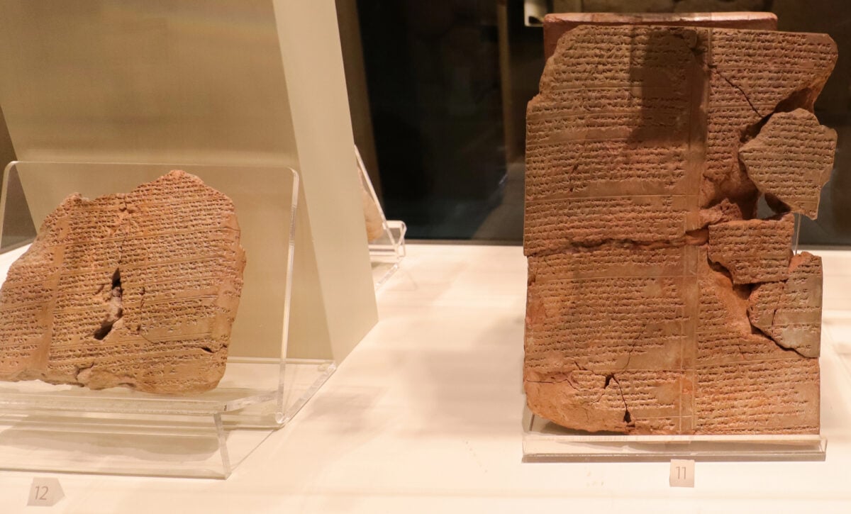
Clay tablets from ancient Mesopotamia dating to around 2300 BCE include some of the earliest known maps. These tablets sometimes combined practical geographic information with cosmological or religious elements, showing how ancient cultures didn’t sharply separate the practical from the sacred.
The maps served multiple purposes, providing useful information for travelers while also reflecting broader beliefs about the structure of the universe. This integration of different types of knowledge was typical of ancient mapmaking traditions.
The Vinland Map Debate

When Yale University acquired the Vinland Map in the 1960s, it appeared to show North America on a pre-Columbian map. The document seemed to depict a landmass labeled Vinlanda Insula southwest of Greenland, apparently drawn in the 1440s.
However, scientific analysis eventually revealed the ink contained modern materials, specifically titanium dioxide compounds not available until the 20th century. The map is now considered a forgery, though questions remain about who created it and why, with various theories proposed but none definitively proven.
The Zeno Map

Published in 1558, the Zeno Map purported to document voyages by Venetian sailors that allegedly occurred in the late 1300s. The map depicted several islands including Frisland, a place that doesn’t correspond to any known landmass.
Most historians now consider the voyages described in connection with the map to be fabrications rather than historical events. Despite being fictional, the map influenced later cartographers who assumed earlier sources must be accurate, demonstrating how cartographic errors could be perpetuated across generations.
Martellus Hidden Texts
The 1491 world map by Henricus Martellus hung in Yale’s library for years before multispectral imaging revealed details in recent decades. Centuries of fading had obscured over 60 place names and Latin descriptions that were invisible to the unaided eye.
The hidden texts showed geographic knowledge about various regions including parts of Asia and Africa. Whether this map influenced Christopher Columbus remains debated among scholars, though some believe it may have informed his understanding of world geography.
The Babylonian World View

The 6th-century BCE Babylonian Map carved into a clay tablet measures just 12 centimeters across and represents an ancient cosmological vision. The map shows Babylon at the center surrounded by a circular ocean, with regions beyond representing distant lands.
Rather than serving as a practical navigation tool, the map functioned primarily as a representation of how Babylonians understood the structure of the universe. It demonstrates how ancient maps often served religious and philosophical purposes alongside any geographic function.
The Layers Beneath
The history of cartographic practices reveals that maps have served many purposes beyond simple wayfinding. From copyright protection to cosmological representation, mapmakers have embedded additional information and meaning into their work across cultures and centuries.
Some elements were deliberately hidden, others were simply artistic expression, and many reflected the worldviews of their creators. Whether intentional secrets or cultural artifacts, these layers remind us that maps are as much about human imagination and intention as they are about geography.
More from Go2Tutors!

- The Romanov Crown Jewels and Their Tragic Fate
- 13 Historical Mysteries That Science Still Can’t Solve
- Famous Hoaxes That Fooled the World for Years
- 15 Child Stars with Tragic Adult Lives
- 16 Famous Jewelry Pieces in History
Like Go2Tutors’s content? Follow us on MSN.