13 Ancient Maps That Suggest Explorers Knew More Than We Thought
The dusty corners of museums and archives hold secrets that continue to baffle modern historians. Ancient cartographers, working with primitive tools and limited travel capabilities, somehow created maps with stunning accuracy and details of lands supposedly “undiscovered” during their era.
These remarkable documents challenge our understanding of exploration history and suggest that ancient navigators may have ventured much further than conventional history records. The following are 13 ancient maps that hint at knowledge that seems impossible for their time, each raising questions about what explorers truly knew and when they knew it.
Piri Reis Map
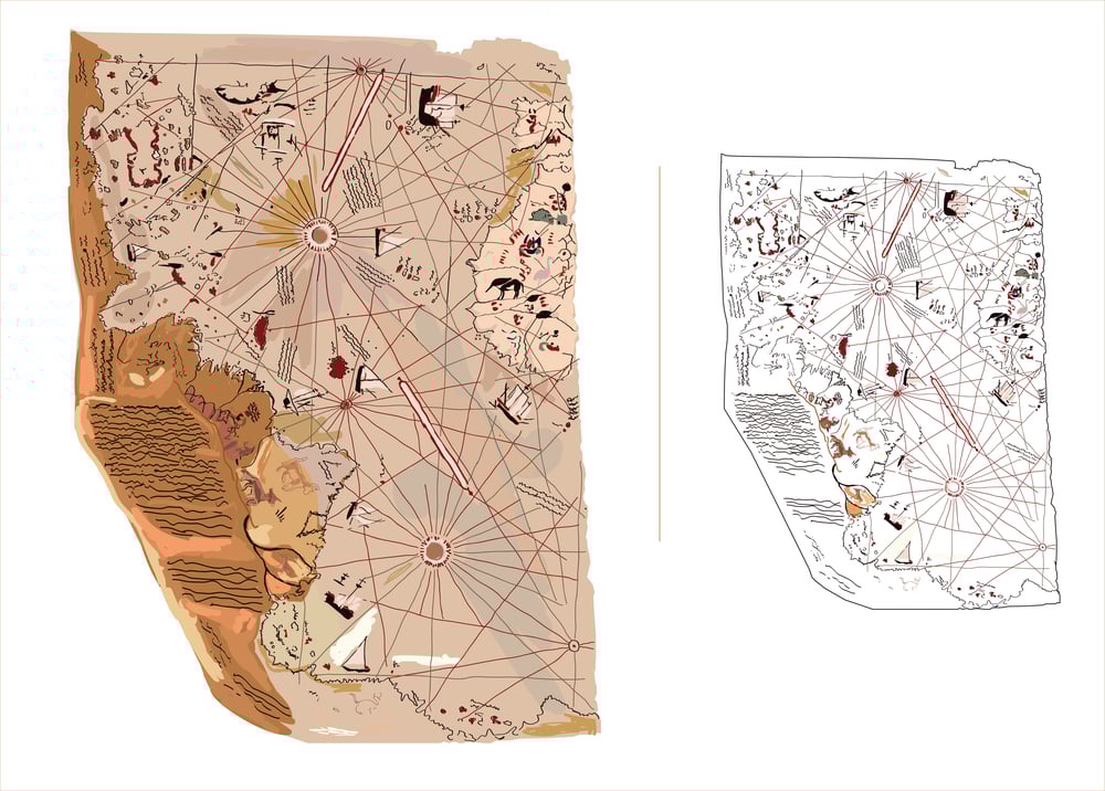
Parts of South America, Africa, and Antarctica are depicted with remarkable precision in this fragment, which was created in 1513 by Ottoman admiral Piri Reis. The most perplexing is Antarctica’s intricate coastline, which would not be formally identified until 1820.
In accordance with current seismic surveys of the continent beneath its ice sheet, the map depicts the shoreline devoid of ice. Regarding how Piri Reis obtained such data, there is still disagreement among scholars. Some contend that he assembled old source maps from Alexandria’s extensive library.
The Waldseemüller’s Map

Although Martin Waldseemüller was the first to refer to the New World as “America,” its secrets are more complex. Even though the map was created only 15 years after Columbus’s first expedition, when most of the region was still uncharted by Europeans, it depicts the whole continent of South America with astounding precision.
The fact that it shows a route between Antarctica and South America centuries before the Strait of Magellan was formally identified makes it much more remarkable.
The Vinland Map

This controversial parchment allegedly dates to 1440, showing Norse exploration of North America nearly 50 years before Columbus sailed. Although debates about its authenticity continue, if genuine, it represents extraordinary knowledge of the North American coastline.
The map displays Newfoundland, Labrador, and possibly parts of Nova Scotia with details that align with actual geography, suggesting Viking explorers mapped these regions during their expeditions around 1000 CE.
The Buache Map

Philippe Buache’s 1739 map portrays Antarctica as two separate land masses divided by a sea, a feature only confirmed by modern seismic surveys that revealed an archipelago beneath the ice. This representation appeared over 80 years before Antarctica was officially discovered.
Adding to this great mystery, Buache claimed he based his work on much older source maps, raising questions about ancient knowledge of the southern continent.
The Oronce Fine World Map
Created in 1531, the Fine’s map shows Antarctica with remarkable detail decades before anyone officially sighted the continent. The map depicts Antarctica as a land mass surrounding the South Pole, free of ice, with mountain ranges and rivers that match features only discovered through modern ice-penetrating radar.
Some researchers strongly suggest that Fine had access to ancient source maps from an unknown maritime civilization.
The Hadji Ahmed Map

This Ottoman map from 1559 accurately depicts the western coast of North America, including a reasonable approximation of Alaska, centuries before thorough European exploration of the region. Even more surprising, it shows a land bridge between Siberia and Alaska, which existed during the last ice age but was submerged around 10,000 years ago.
This raises profound questions about the source and age of the geographical knowledge it contains.
The Zeno Map

This map, which was published in 1558, purports to show the 1380s North Atlantic travels of the Venetian brothers Nicolò and Antonio Zeno. It features islands that match current positions and depicts Greenland with amazing realism.
The map shows exact features of shorelines that Europeans did not formally chart until much later, indicating either access to older, lost navigational sources or earlier discovery.
The Ibn Ben Zara Map
This 14th-century Arabic map shows Antarctica with mountain ranges later confirmed to exist beneath the ice. What makes this map extraordinary is its depiction of rivers and valleys on the continent at a time when Antarctica should have been completely unknown to cartographers.
The accuracy of these inland features, impossible to observe from offshore, suggests access to geographical knowledge that should not have even existed.
The Oronteus Finaeus Map

Created in 1532, this map not only shows Antarctica recognizable by modern standards, complete with mountains, rivers, and estuaries but most remarkably, it depicts the Ross Sea, which would not be discovered for another 300 years. The continent appears with reduced ice cover, potentially representing Antarctica as it looked thousands of years ago, raising profound questions about the age and source of the geographical data.
The De Virga World Map
Dating to 1415, this map contains an accurate depiction of northern Asian coasts and what appears to be part of North America, long before European exploration reached these regions. It portrays Greenland separate from North America correctly, a geographical fact not widely understood in Europe at the time.
These details also suggest the mapmaker had access to navigational knowledge from earlier, undocumented voyages.
The Harris Papyrus Map

This ancient Egyptian map from approximately 1150 BCE shows geological formations in eastern Egypt with remarkable precision. Modern satellite analysis has confirmed the accuracy of mountain ranges and gold deposit locations marked on the map.
The precision of its topographical details seems to suggest sophisticated surveying capabilities far beyond what historians typically attribute to ancient Egyptian civilization.
Zheng He’s Star Charts

Admiral Zheng He led massive Chinese treasure fleets across the Indian Ocean in the early 1400s, but his navigational maps suggest voyages far beyond official records. Some of his star charts contain details of coastlines resembling parts of North America, Australia, and even Antarctica.
However, these controversial maps, if authentic, would rewrite the history of global exploration, placing Chinese navigators in the Americas decades before European arrival.
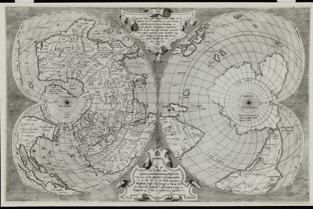
The Mercator 1569 World Map

While Gerardus Mercator is famous for his revolutionary projection, his 1569 map contains additional mysteries. It depicts a remarkably accurate Greenland and a southern continent with details of Antarctica’s coastline centuries before its discovery.
Even more puzzling, it shows mountain ranges in western North America that wouldn’t be charted until the 19th century. Some scholars believe Mercator had access to ancient Viking, Chinese, or even older source maps now lost to history.
A Lost Legacy of Exploration

These enigmatic maps present compelling evidence that ancient explorers ventured far beyond the boundaries recognized by conventional history. Whether through lost civilizations, undocumented voyages, or scientific capabilities we’ve underestimated, these cartographic puzzles suggest our ancestors knew much more about our world than we’ve given them credit for.
So just as technology advances and researchers continue examining these artifacts, we may yet discover that the greatest explorations of humanity weren’t first achievements of the modern era but rediscoveries of places known long ago.
More from Go2Tutors!

- The Romanov Crown Jewels and Their Tragic Fate
- 13 Historical Mysteries That Science Still Can’t Solve
- Famous Hoaxes That Fooled the World for Years
- 15 Child Stars with Tragic Adult Lives
- 16 Famous Jewelry Pieces in History
Like Go2Tutors’s content? Follow us on MSN.