16 Natural Disasters That Created New Land
Natural disasters often bring destruction, but they also serve as Earth’s construction crews. When tectonic plates shift, volcanoes erupt, or massive landslides reshape coastlines, they don’t just destroy—they create. These powerful forces have been building new terrain for millions of years, sometimes forming entire islands overnight or lifting vast stretches of seafloor above the waves.
From volcanic eruptions that birth brand-new islands to earthquakes that thrust mountain ranges skyward, nature’s most violent moments can become geological birth certificates. Here is a list of 16 natural disasters that actually created new land, transforming our planet’s geography in ways both dramatic and lasting.
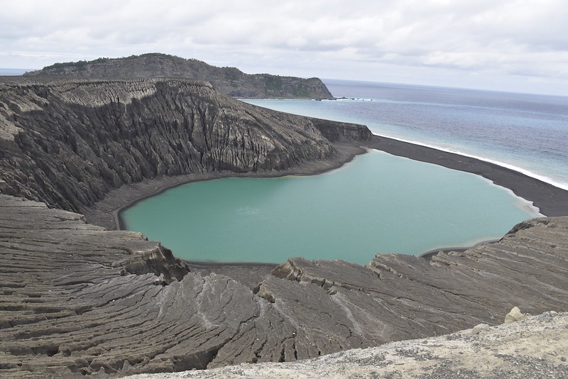
Surtsey Island, Iceland
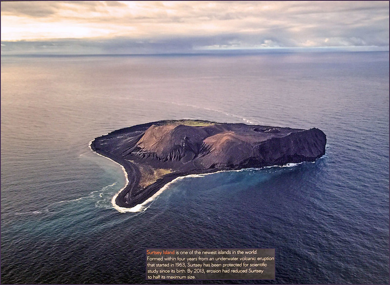
In November 1963, fishermen off Iceland’s coast witnessed something extraordinary: the birth of a new island. Surtsey emerged from 430 feet below the ocean surface when an underwater volcano erupted and continued growing until 1967, reaching a maximum size of 1 square mile and rising 509 feet above sea level. The island became a living laboratory for scientists studying how life colonizes new land. Plants first appeared in 1965, mosses in 1967, and lichens in 1970, with birds beginning to nest by the early 1970s. Iceland declared Surtsey a nature reserve, allowing only scientists to visit and observe natural ecological succession without human interference.
Nishinoshima Expansion, Japan
Nishinoshima, a small volcanic island about 600 miles south of Tokyo, dramatically expanded twice through explosive eruptions. The first major expansion occurred in 1973-74, when eruptions created a new section that eventually merged with the original island. The second major growth phase began in November 2013 when a new island emerged 500 meters south of Nishinoshima and quickly grew through continuous volcanic activity. The 2013 eruption was particularly spectacular, with lava flows and ash deposits expanding the island to more than twelve times its original size. This growth attracted global attention as it reshaped marine maps and increased Japan’s territorial waters.
Iwo Jima’s New Island
In November 2023, a new island formed near Iwo Jima, reaching 100 meters in diameter as a result of underwater volcanic activity. The emergence occurred about 40 miles north of another underwater volcano that had a major eruption in 2021. While the new island’s survival depends on the durability of its volcanic material—pumice and loose rock erode quickly while hardened lava persists—its formation demonstrates how active the Pacific Ring of Fire remains. Similar formations appeared near Japan in 1904, 1914, and 1986, though most vanished after volcanic activity ceased.
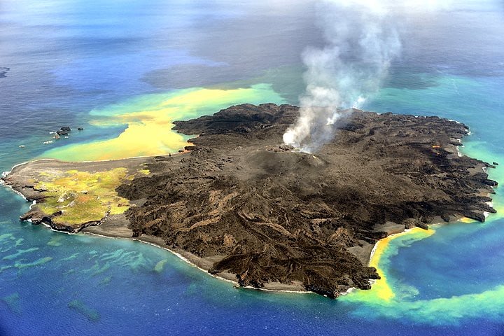
Anak Krakatau, Indonesia
The ‘Child of Krakatoa’ emerged in 1930 from the flooded caldera of the famous Krakatau volcano. Anak Krakatau has grown substantially since its formation, developing lush rainforests that are periodically destroyed by frequent eruptions. The island hosts a surprising variety of wildlife, including insects, birds, and even monitor lizards that somehow made their way to this remote volcanic outcrop. Unlike its parent volcano, which exploded catastrophically in 1883, Anak Krakatau represents a more gradual but persistent form of land creation, continuously adding new material through regular eruptions.
Didicas Volcano, Philippines
Didicas Volcano first created an island during eruptions from 1856 to 1860, but it was initially washed away by ocean waves. The volcano tried again in 1900, leaving three tall rock masses. Finally, during the 1952 eruption, the island became permanent and was further strengthened by subsequent eruptions in 1969 and 1978, eventually reaching 228 meters high. This persistence shows how volcanic islands often require multiple attempts to establish themselves above the relentless erosion of ocean waves.
Alaska’s Earthquake Uplift
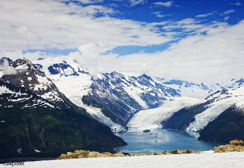
The 1964 Great Alaska Earthquake, measuring 9.2 in magnitude, didn’t just shake the ground—it permanently altered the landscape. Some areas experienced uplift of several feet, creating new coastal terraces and exposing previously underwater areas. The earthquake caused some regions to rise while others subsided, fundamentally changing the coastline around Prince William Sound. This massive tectonic event demonstrates how powerful earthquakes can literally raise new land from the sea in a matter of minutes.
Pakistan’s Earthquake Island
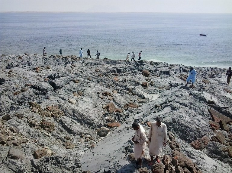
In 2013, a massive 7.7-magnitude earthquake in Pakistan caused a small island to surface from the seabed. The earthquake occurred offshore, and the resulting seafloor displacement pushed sediment and rock above the water’s surface. While not as dramatic as volcanic island formation, this event shows how seismic activity can rapidly create new land through tectonic forces alone. The island’s composition of sediment and loose material makes it vulnerable to erosion, but its formation illustrates the immediate land-creating power of major earthquakes.
Mount Etna’s Lava Extensions
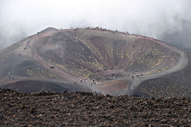
Sicily’s Mount Etna has been building new land for centuries through persistent volcanic activity. Each major eruption adds layers of solidified lava to the mountain’s flanks and creates new coastal areas where lava flows reach the Mediterranean Sea. Submarine volcanic activity can build formations large enough to break the ocean surface as new islands or create floating pumice rafts. Etna’s slow but steady growth demonstrates how volcanic activity creates land not just through explosive eruptions but through gradual accumulation of volcanic material.
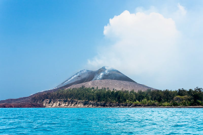
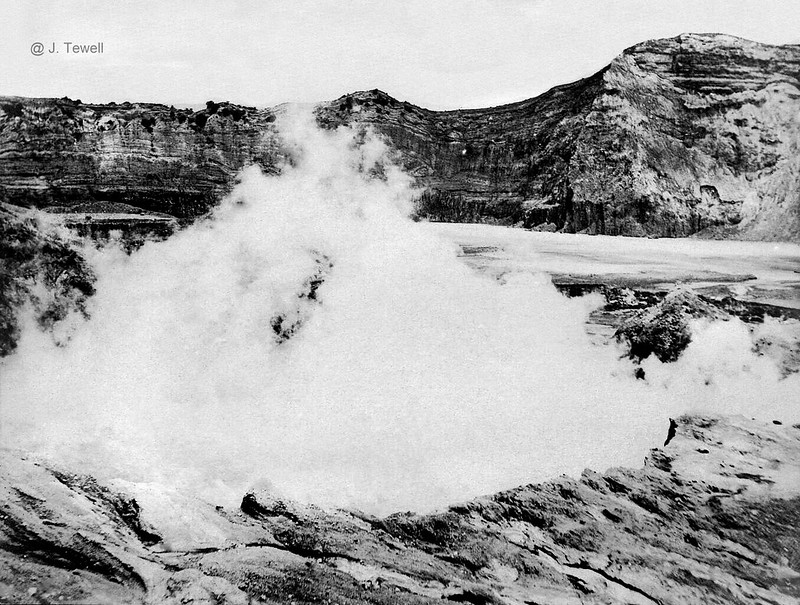
Hunga Tonga-Hunga Ha’apai, Tonga
In February and March 2009, vigorous volcanic eruptions created a new island near Hunga Ha’apai in the Tongan Islands of the southwest Pacific. The new landmass eventually connected to the existing Hunga Ha’apai island, effectively expanding its territory. Tonga’s islands of Hunga Tonga and Hunga Ha’apai are actually the tops of a single large underwater volcano, and the 2009 eruption added hundreds of square meters of new land. This event showcased how underwater volcanoes can rapidly transform from hidden seafloor features into visible land.
Chilean Coastal Uplift
The 1960 Chilean earthquake, the most powerful earthquake ever recorded at magnitude 9.5, created significant new coastal land through tectonic uplift. Chile’s location where converging plates create mountains makes it susceptible to powerful earthquakes that can cause substantial ground elevation changes. The earthquake raised some coastal areas by several feet, exposing new land that had previously been underwater. This massive geological event permanently altered Chile’s coastline and created new habitable areas along the Pacific shore.
Hawaii’s Continuous Creation
The Hawaiian Islands represent ongoing land creation through volcanic activity, with new land constantly being added to the Big Island through eruptions from Kilauea and Mauna Loa volcanoes. The Big Island of Hawaii continues to be fueled by hot spot activity, with the oldest rocks being less than 0.7 million years old, and volcanic activity continues to create new land. Unlike explosive volcanic islands, Hawaii’s shield volcanoes create land through relatively gentle lava flows that build up over time, demonstrating a different but equally effective method of land formation.
Santorini’s Volcanic Rebuilding
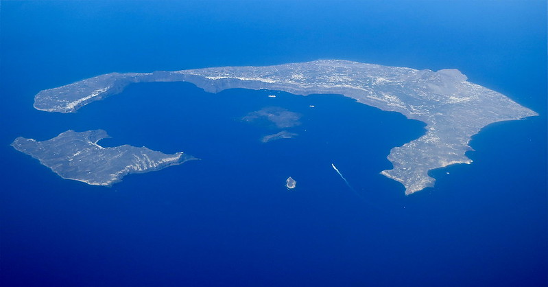
Following its famous explosive eruption around 1600 BCE, Santorini has been slowly rebuilding itself through subsequent volcanic activity. The caldera left by the ancient eruption has been partially filled by new volcanic islands that emerged from underwater eruptions. Detailed observations of submarine eruptions in shallow seas show how volcanic islands can emerge and grow when sufficient magma reaches the surface. These new volcanic islands within Santorini’s caldera represent nature’s effort to rebuild what was once destroyed.
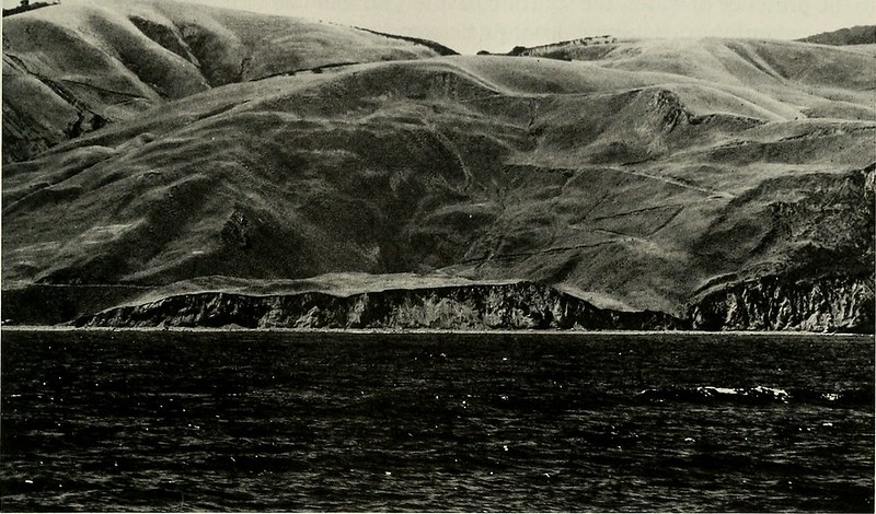
Japan’s Earthquake Fault Scarps
When earthquakes occur, the ground can rupture along fault lines, resulting in the formation of fault scarps—steep slopes or cliffs that form where ground has been uplifted on one side of the fault and dropped on the other. In Japan, numerous earthquakes have created these dramatic landscape features, some several meters high and stretching for kilometers. Mountains grow as a result of many earthquakes that occur over time as one side of a fault moves up relative to the adjacent side. These fault scarps represent instant land creation, forming new topographical features in seconds.
Indonesia’s Tsunami Land Creation
The catastrophic 2004 Indian Ocean tsunami not only caused destruction but also deposited massive amounts of sediment onshore, creating new coastal landforms. While devastating, the tsunami transported offshore sediments—from fine sands to coral boulders—and deposited them on land, effectively building new coastal areas. Most sediments deposited on land came from offshore sources, and the tsunami’s backwash reworked and redistributed large volumes of sediments. This process, while tragic in its human cost, demonstrated how tsunamis can rapidly reshape coastlines and create new land.
Iceland’s Mid-Atlantic Ridge
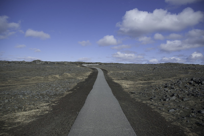
Iceland sits directly on the Mid-Atlantic Ridge, where two tectonic plates are pulling apart and creating new land through volcanic activity. The diverging Eurasian and North American plates caused major eruptions like Eyjafjallajökull in 2010 and Bardarbunga in 2014, with significant rifting and cracking on the ground surface. This ongoing process continuously adds new volcanic material to Iceland’s landscape, making it one of the few places on Earth where you can actually see new land being created through the separation of tectonic plates.
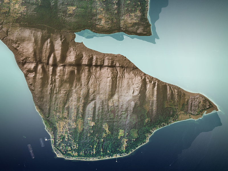
California’s Landslide Terrain
Earthquakes can cause landslides on steep slopes, leading to the formation of new landforms as rocks and soil slide down slopes and create new valleys while changing the shape of hills and mountains. In California, seismic activity regularly triggers massive landslides that block rivers, form new lakes, and create entirely different topographical features. These landslides can block rivers and streams, create new valleys, and change the shape of hills and mountains. While often destructive to human infrastructure, these events represent rapid land formation through the redistribution of existing geological material.
When Destruction Becomes Creation
These examples reveal a fundamental truth about our planet: destruction and creation are often the same process viewed from different perspectives. Volcanic formations created by submarine volcanoes may become so large that they break the ocean surface as new islands, while earthquakes that devastate human communities simultaneously build the mountain ranges that define continents. Mountains are formed by tectonic uplift and shaped by weathering and erosion, with landforms emerging from the interplay between various geomorphic forces over time. Understanding these processes helps us appreciate that today’s solid ground was yesterday’s catastrophic event, and tomorrow’s new land may emerge from disasters we can barely imagine.
More from Go2Tutors!

- 16 Historical Figures Who Were Nothing Like You Think
- 12 Things Sold in the 80s That Are Now Illegal
- 15 VHS Tapes That Could Be Worth Thousands
- 17 Historical “What Ifs” That Would Have Changed Everything
- 18 TV Shows That Vanished Without a Finale
Like Go2Tutors’s content? Follow us on MSN.