30 Places on Earth Only a Handful of People Have Seen
Satellites have photographed almost every square mile of the planet, and it is tempting to assume that means someone has been everywhere. They have not.
Plenty of places are mapped from above yet visited by fewer people than can fit on a school bus.
Some are too deep, too remote, or too dangerous. Others are sealed on purpose, protected by governments, scientists, or the people who already live there.
Together they make a short list of places that ordinary travel still cannot reach.
Challenger Deep in the Mariana Trench
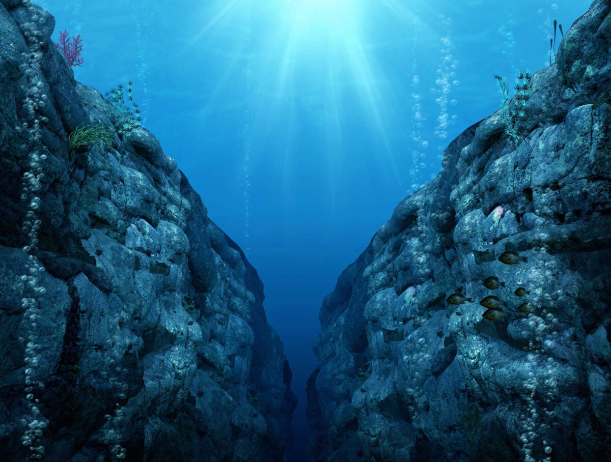
The deepest known point in the ocean sits roughly 35,876 feet below the surface of the western Pacific, at the southern end of the Mariana Trench. Jacques Piccard and Don Walsh reached it first in the bathyscaphe Trieste in January 1960, and nobody returned with a crew for 52 years until James Cameron dove solo in 2012.
By July 2022 the total count of people who had reached the bottom stood at 27. Pressure there exceeds eight tons per square inch.
More people have flown to space than have looked out a window at this seafloor.
Lake Vostok Beneath the Antarctic Ice
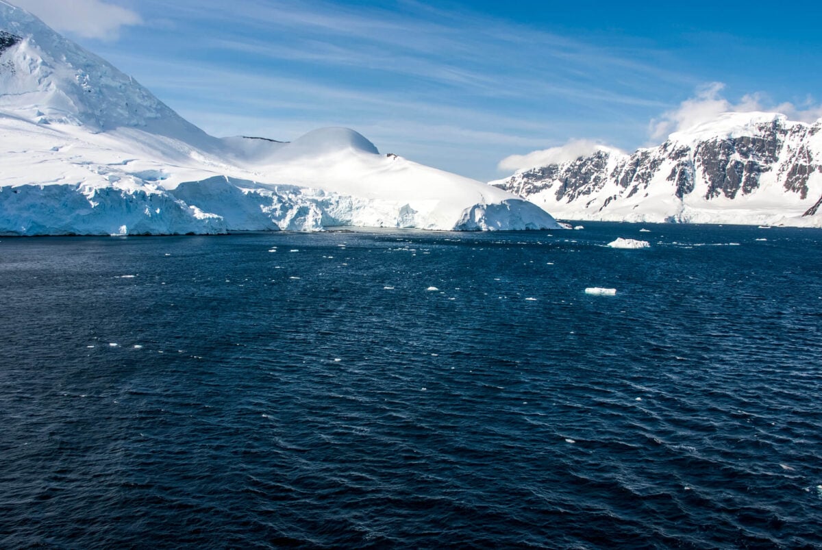
Lake Vostok lies under roughly two and a half miles of ice in East Antarctica, one of the largest of hundreds of lakes sealed beneath the continent. Its water has likely been cut off from the atmosphere for millions of years.
Russian drillers reached the lake’s surface in February 2012 after decades of work, and lake water surged up the drill shaft and froze, giving scientists a sample they recovered later. No person has seen the lake itself, and every drilling effort raises concerns about contaminating a world that may hold microbes found nowhere else.
It remains one of the least accessible bodies of water on the planet.
Floor of Veryovkina Cave
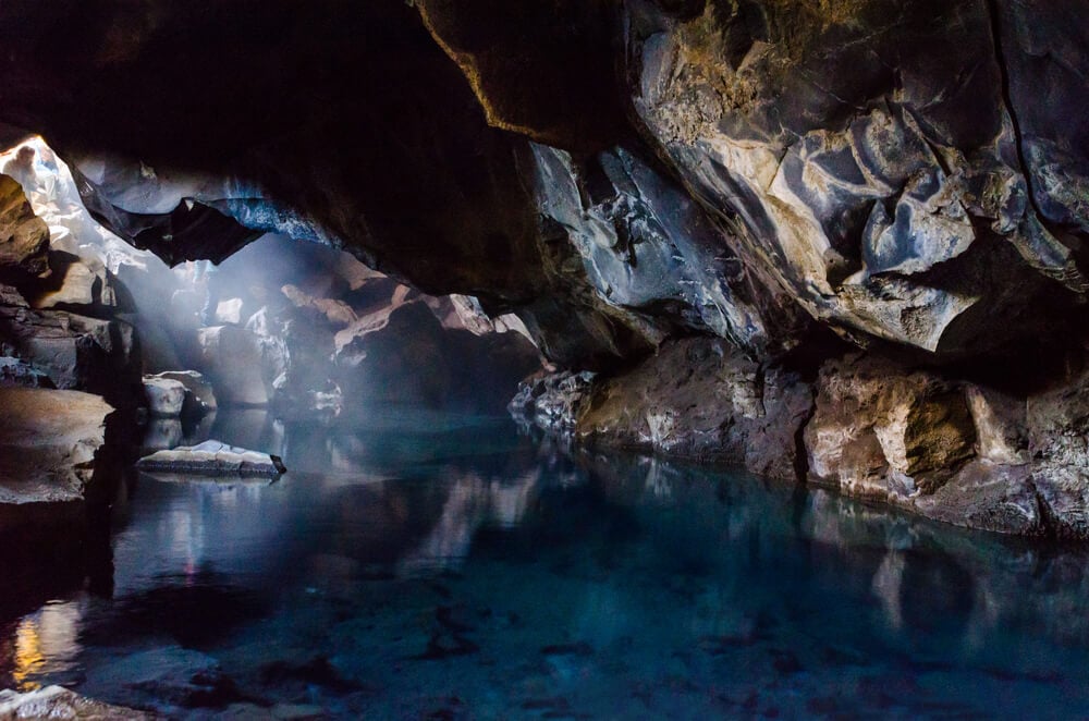
Veryovkina Cave in the Arabika Massif of Abkhazia, in the western Caucasus, is the deepest known cave on Earth, with a measured depth of roughly 2,212 meters. Reaching the bottom takes days of descending shafts on ropes, squeezing through tight passages, and camping underground in cold, wet darkness.
Only a small number of expedition cavers have stood at its deepest point. Floods have trapped teams before, including a 2018 expedition that had to race rising water back up the shafts.
For most people the deepest place they will ever stand is a subway platform.
Movile Cave in Romania
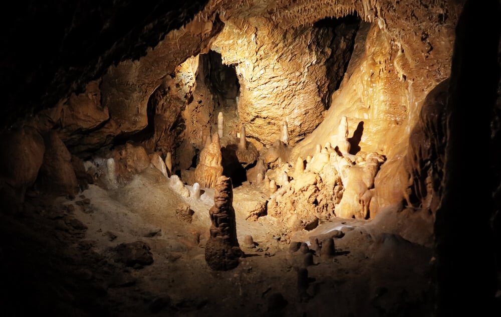
Movile Cave, near the Black Sea coast of Romania, was discovered in 1986 during a survey for a power plant. Scientists believe it had been sealed from the surface for millions of years, and its air is thick with hydrogen sulfide and short on oxygen.
Life inside runs on chemical energy rather than sunlight, supporting spiders, scorpions, and other animals found nowhere else. Access is tightly controlled by researchers to protect this ecosystem.
Reports suggest only a few dozen people have ever been inside, and each visit involves a narrow vertical shaft, careful planning, and very little time underground.
Chauvet Cave in France
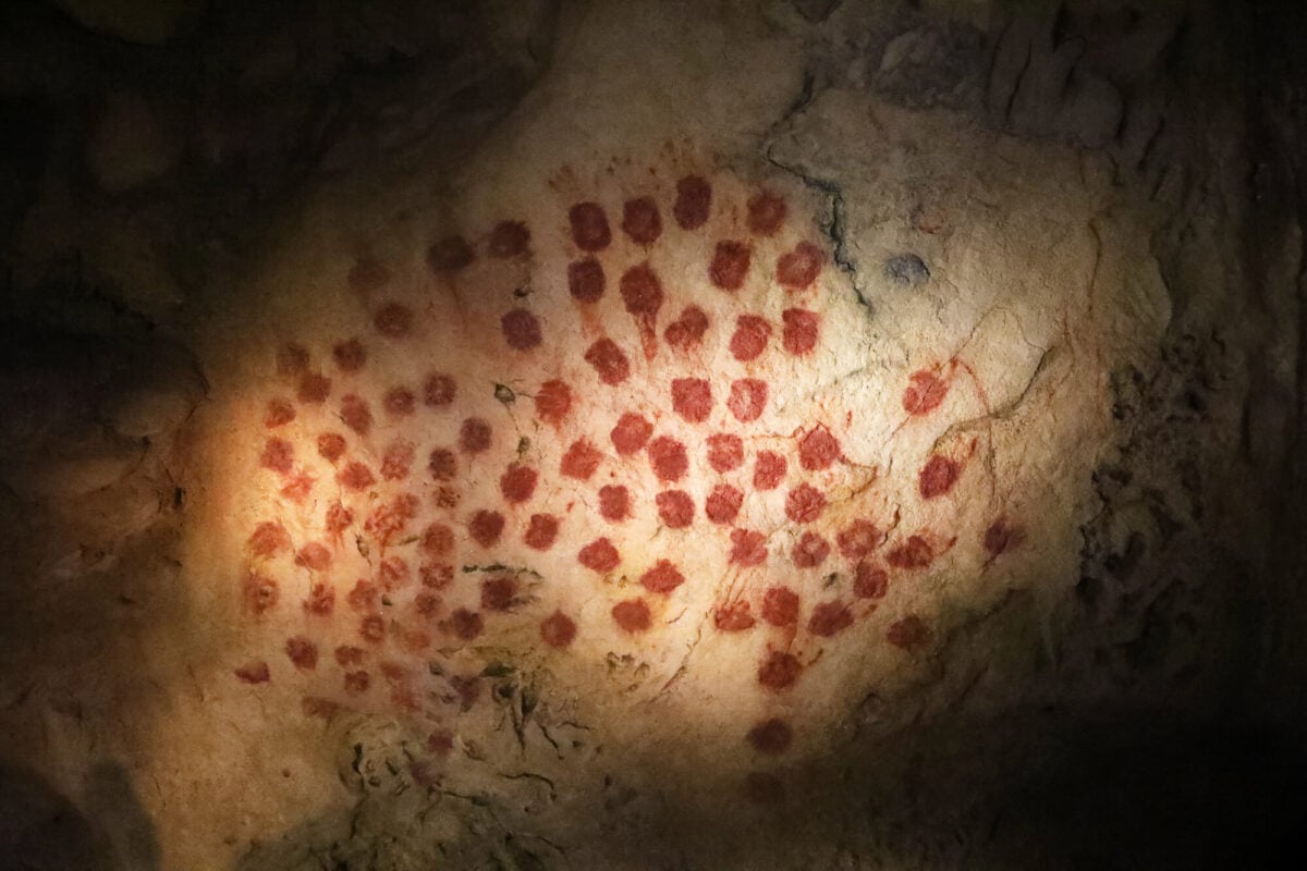
Three cave explorers found the Chauvet Cave in the Ardeche region of southern France in December 1994, and its walls held some of the oldest known figurative paintings in the world. Lions, rhinoceroses, horses, and bears were drawn there more than 30,000 years ago.
French authorities sealed the cave almost immediately to prevent the damage that had struck other painted caves. Only researchers and conservators enter, in small groups and for limited periods.
A full-scale replica opened nearby in 2015, which is the closest nearly anyone will get.
Original Lascaux Cave Chambers
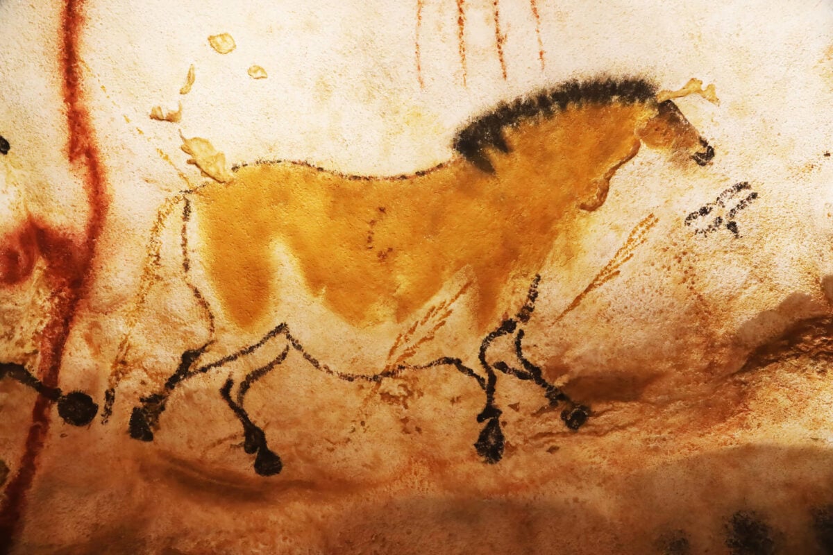
Four teenagers stumbled into Lascaux in southwestern France in 1940, and within a few years its painted chambers drew crowds from across Europe. The breath and body heat of visitors encouraged mold and algae, and the cave closed to the public in 1963.
Since then only a small number of scientists and conservators have entered, and even they limit their time inside. Tourists now visit Lascaux IV, a replica that opened in 2016.
The original paintings, some around 17,000 years old, remain in darkness almost all year.
Lechuguilla Cave in New Mexico
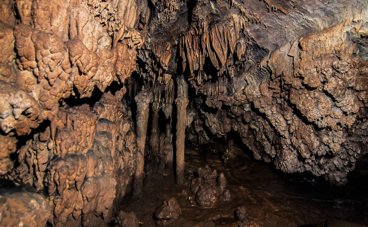
Lechuguilla Cave, within Carlsbad Caverns National Park, was little more than a pit until cavers broke through a rubble floor in 1986. Beyond it lay more than 150 miles of passages decorated with gypsum chandeliers, aragonite bushes, and crystals rarely found anywhere else.
The National Park Service restricts entry to scientific researchers and survey teams to protect its fragile formations and microbial life. Expeditions often last days underground.
Photographs have circulated widely, but the number of people who have actually walked its passages remains small.
Naica Cave of the Crystals in Mexico
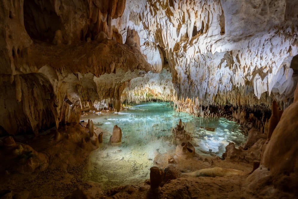
Miners working the Naica silver and lead mine in Chihuahua broke into a chamber in 2000 filled with selenite crystals up to about 12 meters long, among the largest natural crystals ever found. Temperatures inside reached around 58 degrees Celsius with humidity near saturation, so researchers wore cooling suits and could stay only minutes at a time.
After mining pumps were switched off in the mid-2010s, groundwater flooded the chamber again. Only a small group of scientists and filmmakers ever saw it.
Those crystals are now back underwater, growing slowly in the dark.
Hranice Abyss in the Czech Republic
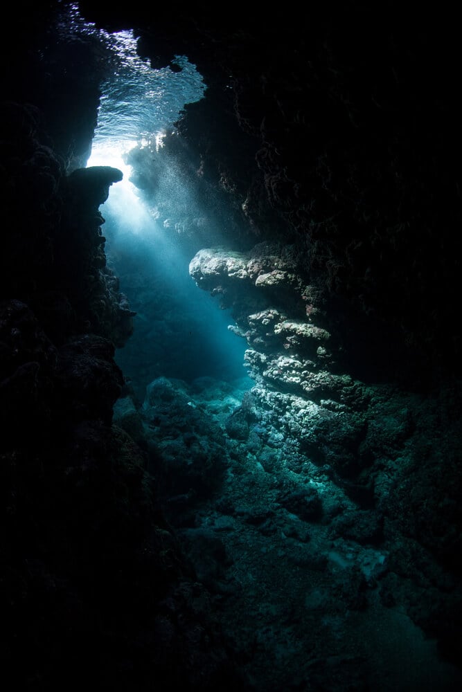
The Hranice Abyss in Moravia is considered the deepest known flooded cave shaft in the world. Polish diver Krzysztof Starnawski reached about 200 meters in 2016, and a remotely operated vehicle has since gone far deeper.
Geophysical surveys suggest the shaft may continue to around 1,000 meters. The water is cold, dark, and loaded with carbon dioxide, which makes diving extremely dangerous.
Only a handful of divers have explored its upper reaches, and nobody has seen the bottom. The rest of the abyss is known only from instruments.
Giant Shafts on Sarisarinama Tepui
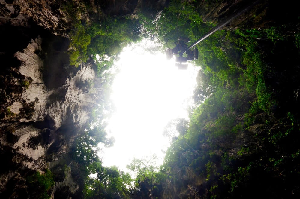
Sarisarinama is a flat-topped mountain rising from the rainforest of southern Venezuela, and its summit holds several enormous shafts, the largest roughly 350 meters wide and deep. Pilots spotted them in the 1960s, and scientists first descended in 1974.
The shafts hold isolated forests with plants and animals that have evolved in near isolation. The area lies within a national park where access is restricted to research expeditions.
Only a small number of scientists have ever reached the floors, and helicopter access remains the practical route.
Summit of Gangkhar Puensum in Bhutan
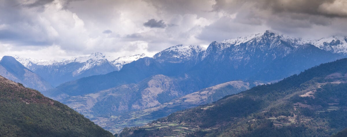
At about 7,570 meters, Gangkhar Puensum on the Bhutan and China border is widely considered the highest unclimbed mountain in the world. Several teams attempted it in the mid-1980s and failed, partly because maps of the region were unreliable.
Bhutan banned climbing peaks above 6,000 meters in 1994 out of respect for local spiritual beliefs, then prohibited mountaineering entirely in 2003. A Japanese team in 1998 settled for a subsidiary summit from the Tibetan side after permission for the main peak was withdrawn.
That leaves the true top without a single human footprint, and it may stay that way indefinitely.
Summit of Mount Kailash in Tibet
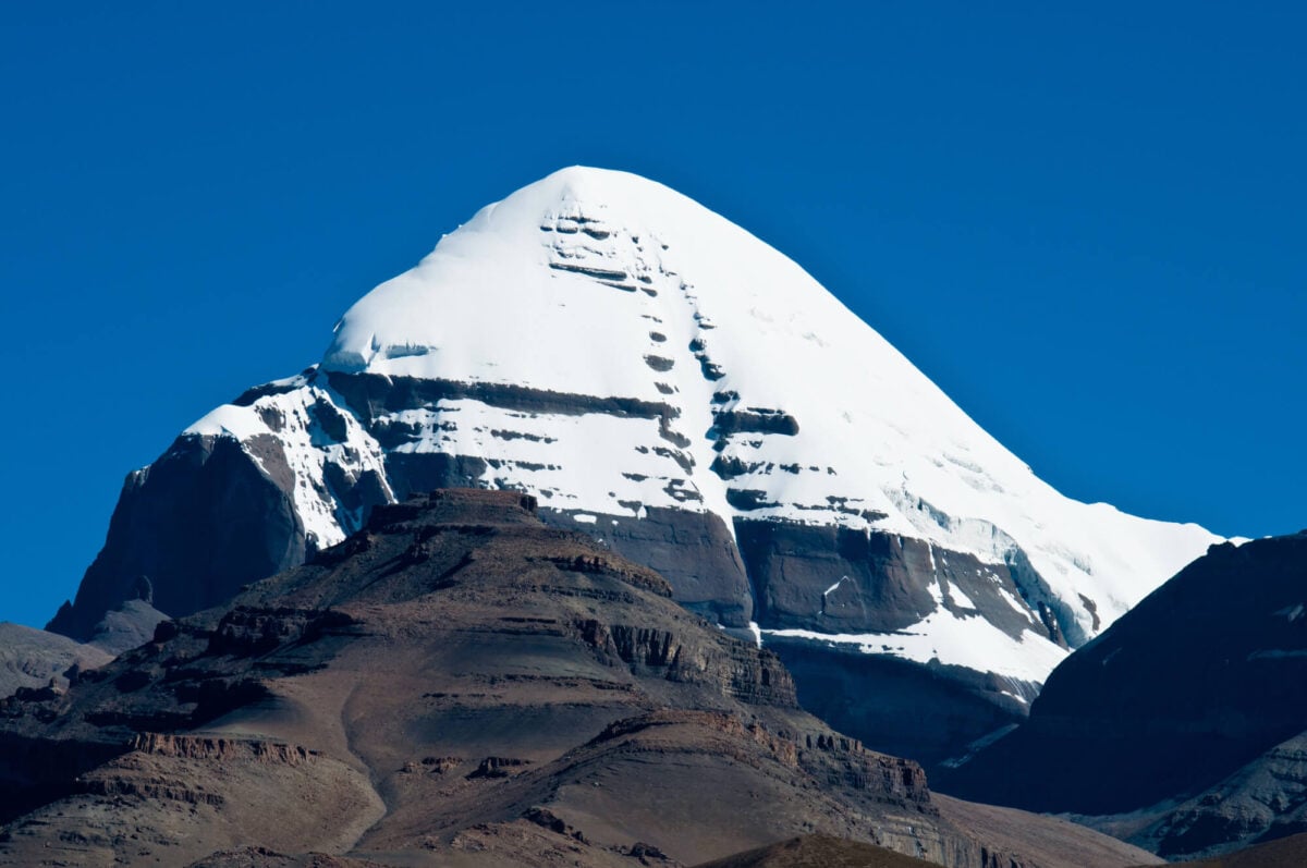
Mount Kailash rises about 6,638 meters in western Tibet and is sacred to Hindus, Buddhists, Jains, and followers of Bon. Pilgrims walk a 52 kilometer circuit around its base, but no climber has ever reached the top.
Chinese authorities have refused climbing permits, and a Spanish team’s plans in 2001 were abandoned after international protest. The mountain’s four faces align closely with the compass points, adding to its reputation.
Many believe that climbing it would be a grave act of disrespect, and the summit is likely to remain untouched.
North Sentinel Island in the Bay of Bengal
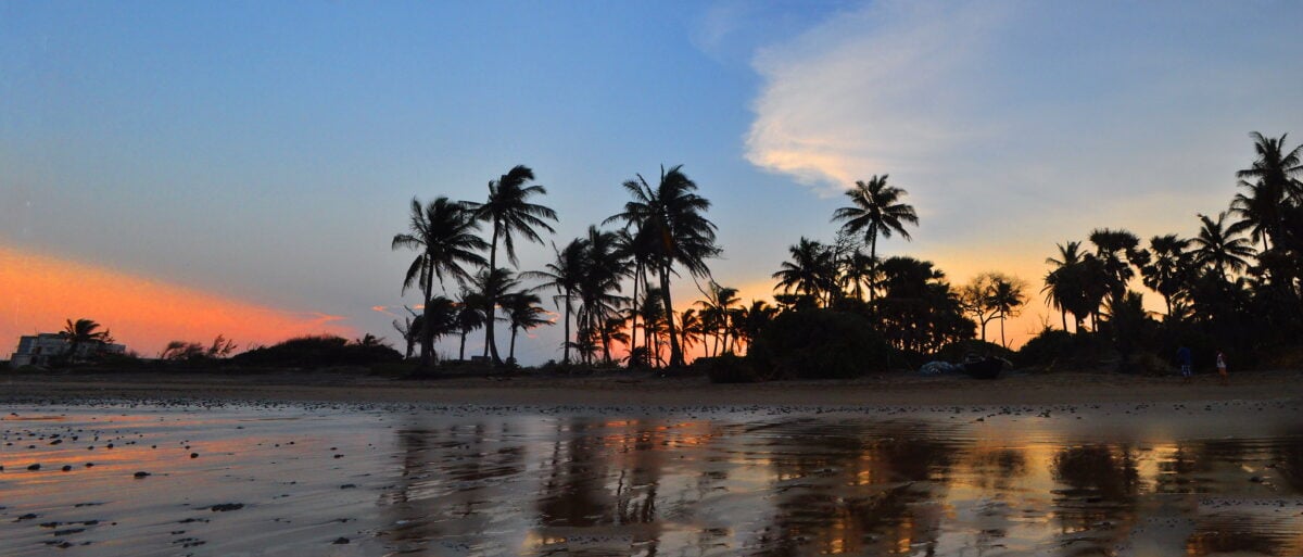
North Sentinel Island in India’s Andaman Islands is home to the Sentinelese, one of the last groups on Earth to remain largely uncontacted. The islanders have repelled outsiders with arrows for decades, and India prohibits approaching within about five nautical miles.
The rule protects both sides, since outside diseases could devastate a population with no immunity. Indian anthropologists made brief gift-giving visits between the 1960s and early 1990s before the program was halted.
In 2018 an American missionary who landed illegally was killed. Satellite images show the forest canopy, but almost no outsider has seen life beneath it.
Vale do Javari in the Brazilian Amazon
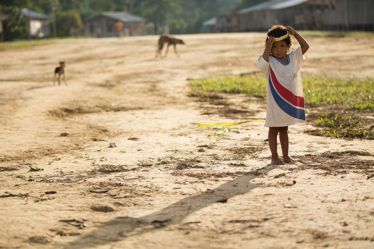
Covering roughly 85,000 square kilometers near the Peruvian border, the Vale do Javari Indigenous Territory in western Brazil is believed to hold the largest concentration of uncontacted peoples on Earth. Brazil’s Indigenous affairs agency restricts entry to protect those communities from disease and conflict.
Several isolated groups are known only from overflights, abandoned camps, and traces left along the rivers. Illegal fishing, logging, and drug trafficking have brought violence to its edges, including the 2022 killing of journalist Dom Phillips and Indigenous expert Bruno Pereira.
Most of its interior has never been visited by outsiders.
Bouvet Island in the South Atlantic
Bouvet Island, a Norwegian territory in the South Atlantic, is often described as the most remote island on Earth. The nearest land is Queen Maud Land in Antarctica, roughly 1,700 kilometers to the south.
Glaciers cover most of the island, and steep cliffs make landing extremely difficult. Only a small number of expeditions have set foot there, and researchers occasionally visit to maintain an automated weather station.
In 1964 a visiting crew found an abandoned lifeboat in a lagoon with supplies but no sign of its occupants, a mystery that has never been solved.
Heard Island in the Southern Ocean
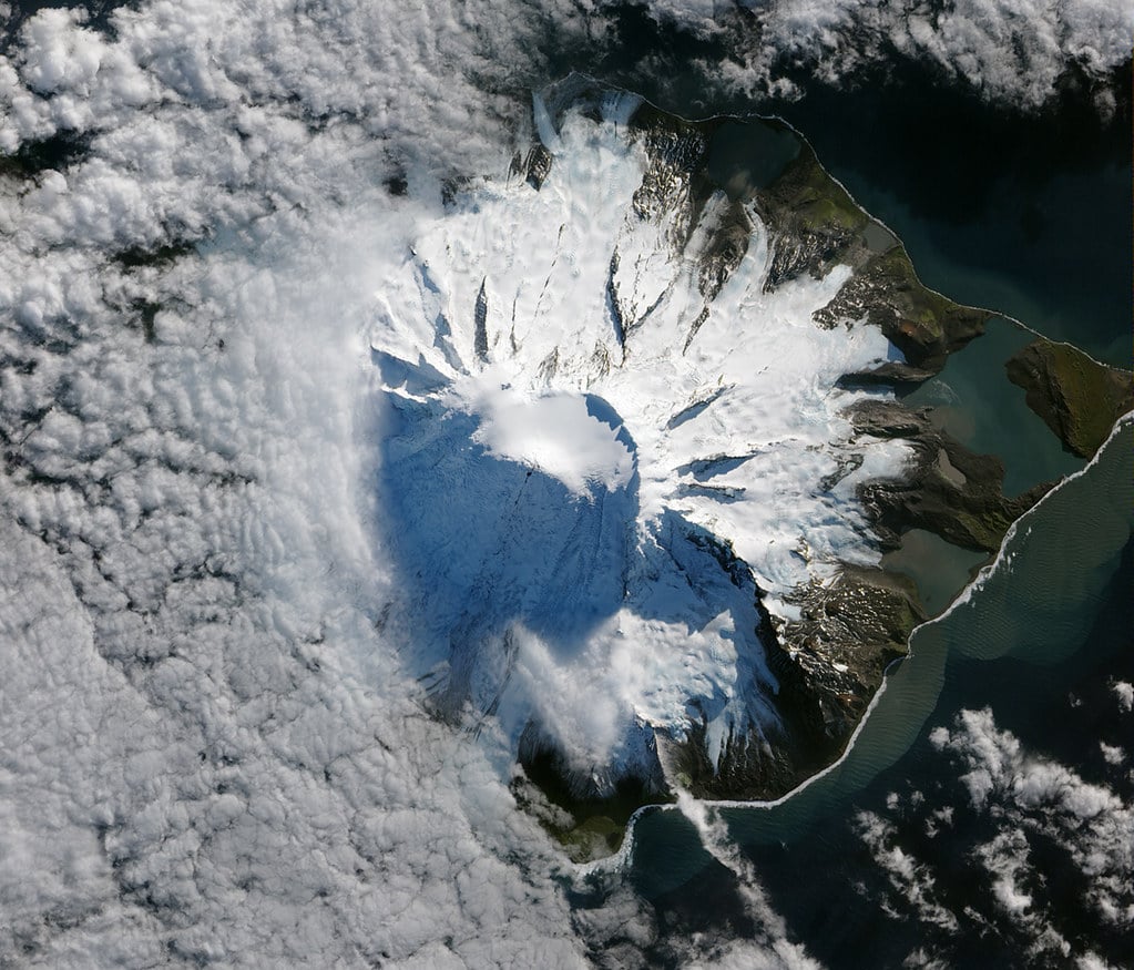
Heard Island, an Australian territory in the Southern Ocean, is dominated by Big Ben, an active volcano whose highest point, Mawson Peak, reaches about 2,745 meters. That makes it taller than any mountain on the Australian mainland, including Mount Kosciuszko.
The island lies roughly 4,000 kilometers southwest of Perth, and visits require permits and long sea voyages through some of the roughest water on Earth. Only a handful of expeditions have landed in recent decades.
Glaciers reach the sea, and large seal and penguin colonies crowd the beaches that remain free of ice.
Clipperton Island in the Eastern Pacific
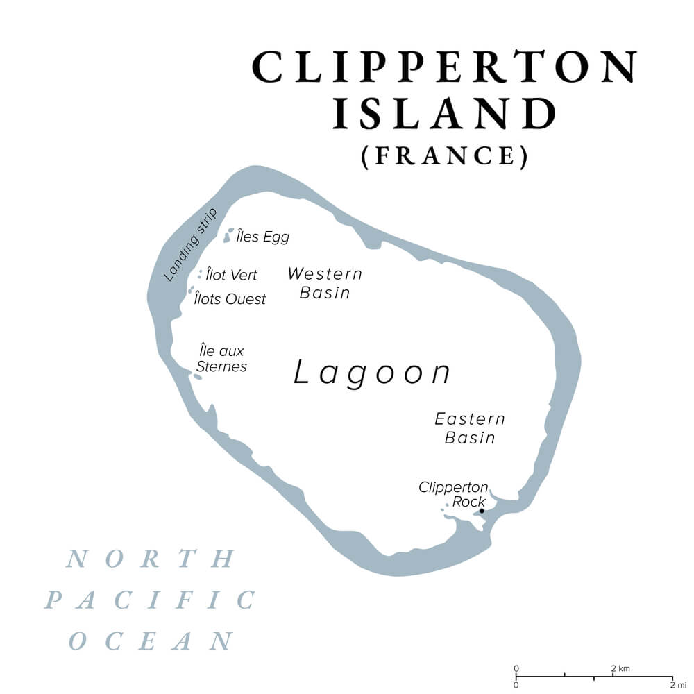
Clipperton Island is a small French atoll about 1,000 kilometers southwest of Mexico, often said to be named after an English pirate. A Mexican garrison lived there in the early twentieth century, but supply ships stopped arriving during the Mexican Revolution, and most residents died of scurvy and violence before rescue in 1917.
The survivors taken off by an American warship were a few women and children. The island has been uninhabited ever since, and visits require permission from French authorities.
Scientific expeditions and occasional radio operators land there, finding a lagoon and coral ring crowded with crabs and seabirds.
Interior of the Kerguelen Islands
Nicknamed the Desolation Islands, the Kerguelen archipelago is a French territory in the southern Indian Ocean. A research station called Port-aux-Francais houses a small rotating staff of scientists and support workers.
There is no airstrip, and the supply ship Marion Dufresne calls only a few times a year. Rabbits, cats, and reindeer brought by earlier visitors have reshaped the vegetation near the coast.
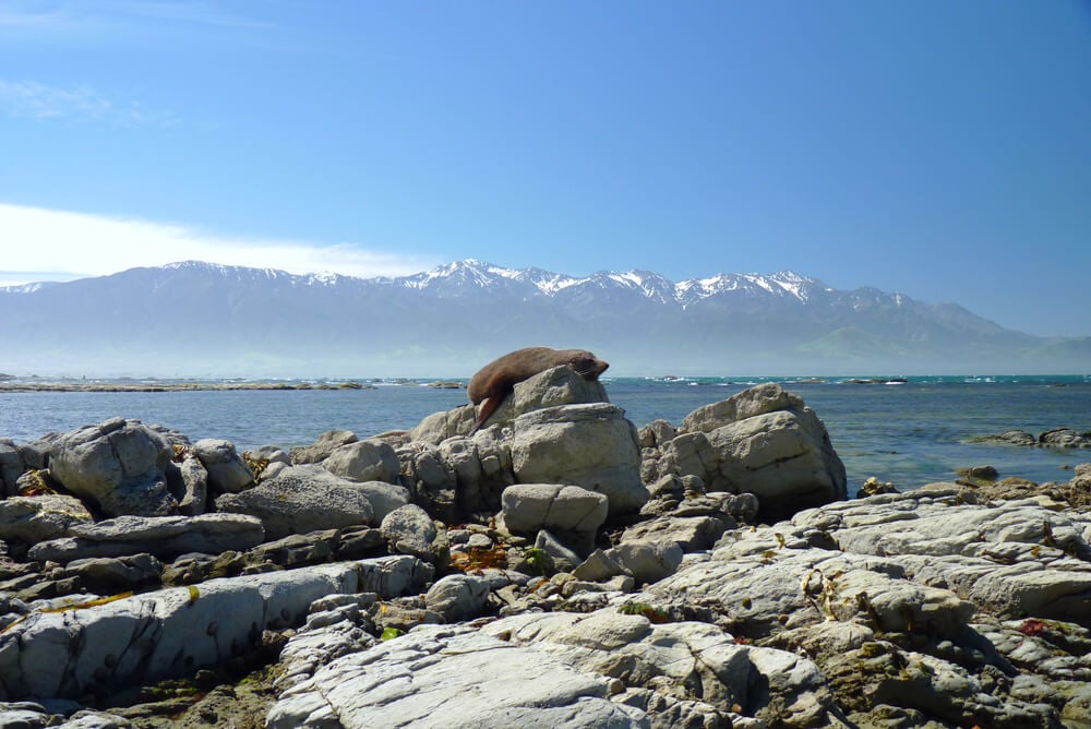
The interior, with glaciers, lakes, and jagged mountains, is visited by very few people. Seals, penguins, and near constant wind own most of the islands.
Point Nemo in the South Pacific
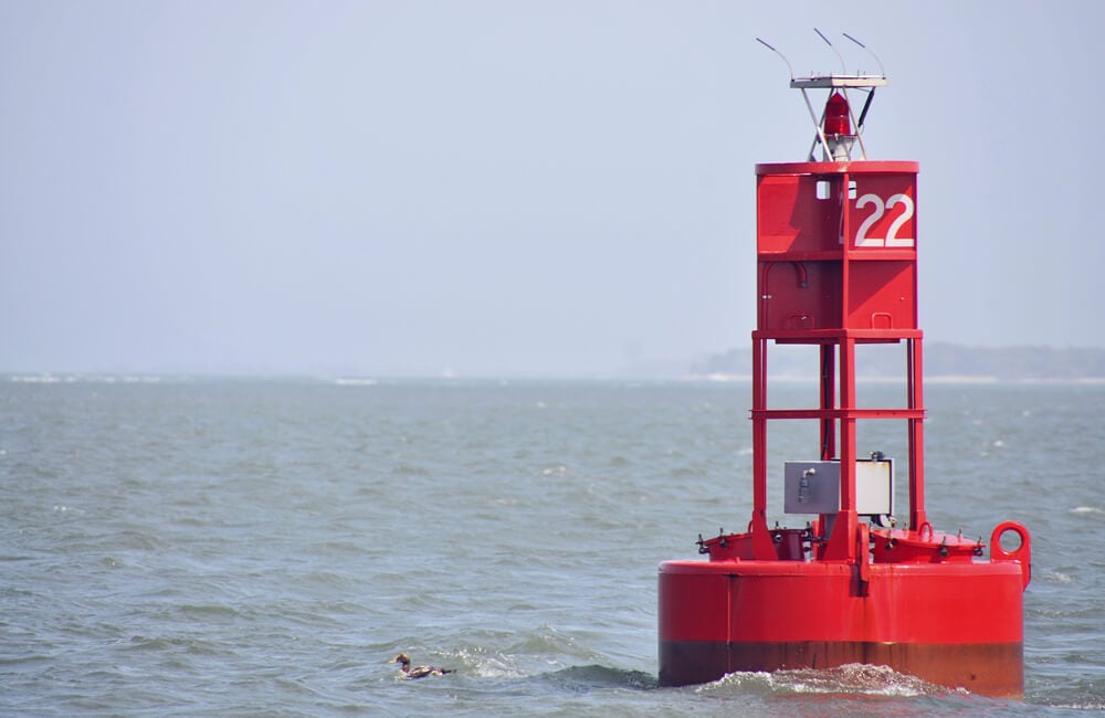
Point Nemo is the oceanic pole of inaccessibility, the spot in the ocean farthest from any land, about 2,688 kilometers from the nearest islands. It was calculated in 1992 by survey engineer Hrvoje Lukatela and named after Jules Verne’s Captain Nemo.
Because the International Space Station orbits roughly 400 kilometers up, astronauts passing overhead are often the nearest humans. Space agencies use the surrounding waters as a graveyard for spacecraft, and the Russian station Mir came down in the region in 2001.
Few ships ever cross this stretch of ocean, and almost no one has reason to stop there.
Surtsey Island Off Iceland
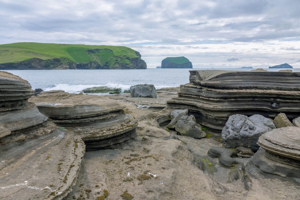
Surtsey rose from the sea in a volcanic eruption that began in November 1963 and lasted until 1967. Scientists quickly recognized it as a natural laboratory for studying how life colonizes new land.
Since then, access has been restricted to a small number of researchers, who must follow strict rules to avoid introducing seeds or insects. Plants, birds, and insects have arrived on their own, carried by wind, waves, and wings.
Erosion has already worn the island down to roughly half its original area. It was named a UNESCO World Heritage Site in 2008, and only a handful of scientists land there each year.
Southern Pole of Inaccessibility in Antarctica
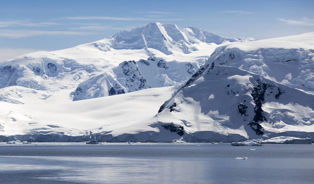
Far from every coastline, the Southern Pole of Inaccessibility marks the point on Antarctica most distant from the ocean. Soviet scientists built a small station there in 1958 and placed a bust of Lenin on its roof.
The station was abandoned, but the bust still pokes above the snow, facing Moscow. A British team reached the site in January 2007 using skis and kites, the first to arrive without mechanical transport.
Only a handful of expeditions have made it since. Temperatures regularly fall below minus 50 degrees Celsius, and the Lenin bust remains one of the strangest landmarks on Earth.
Burial Chamber of Qin Shi Huang
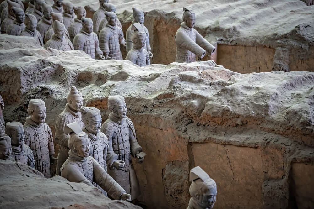
Beneath a large earthen mound near Xi’an lies the tomb of China’s first emperor, Qin Shi Huang, who died in 210 BC. The Terracotta Army, discovered by farmers digging a well in 1974, guards the surrounding area, but the burial chamber itself has never been opened.
The historian Sima Qian wrote that the tomb held rivers of mercury, and soil tests over the mound have found unusually high mercury levels. Chinese authorities have chosen not to excavate until preservation methods improve, since exposure could destroy painted surfaces within minutes.
No living person has seen inside.
Big Void Inside the Great Pyramid
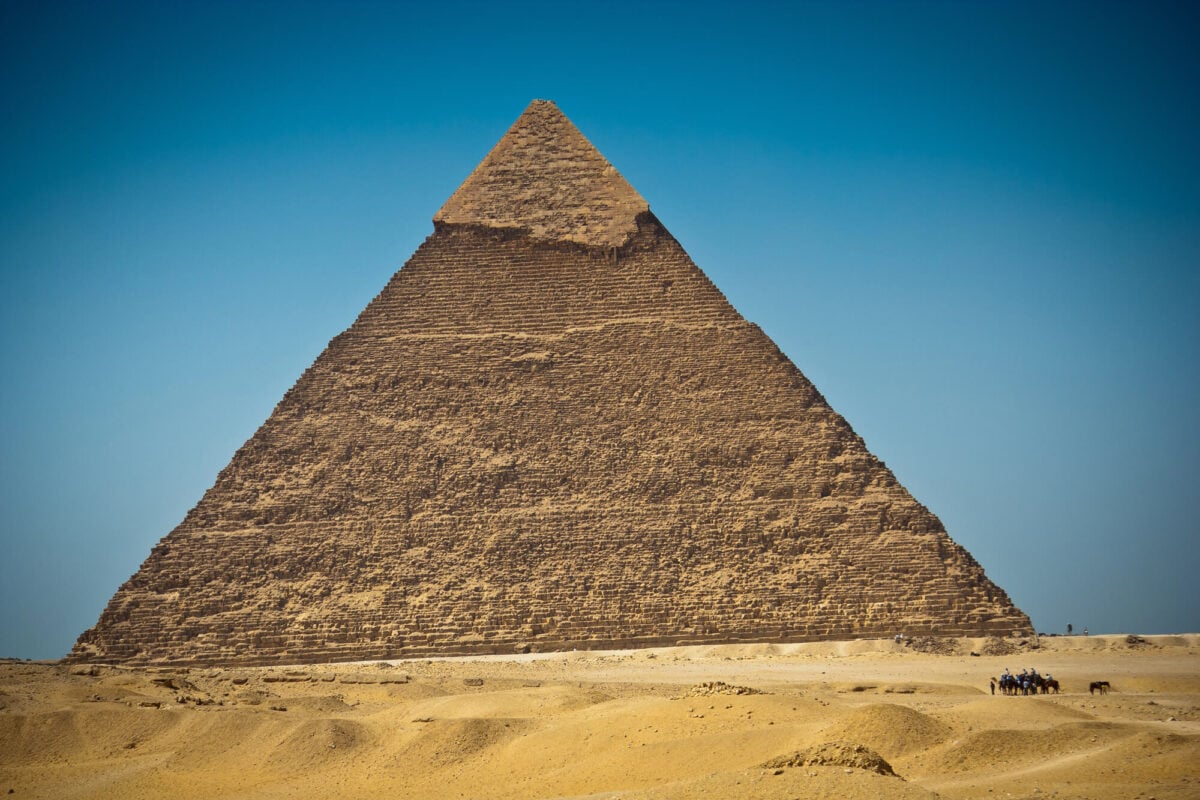
In 2017 researchers using muon imaging announced a large void inside the Great Pyramid of Giza, above the Grand Gallery. The ScanPyramids project, involving Egyptian, French, and Japanese teams, detected the space by tracking cosmic ray particles passing through the stone.
The void is roughly 30 meters long, and nobody has entered it or knows what it was for. Some Egyptologists suspect a construction gap rather than a chamber.
In 2023 researchers pushed an endoscope into a separate hidden corridor above the entrance, offering the first look inside. The larger void remains one of archaeology’s most tantalizing unknowns.
Gold Vault at Fort Knox
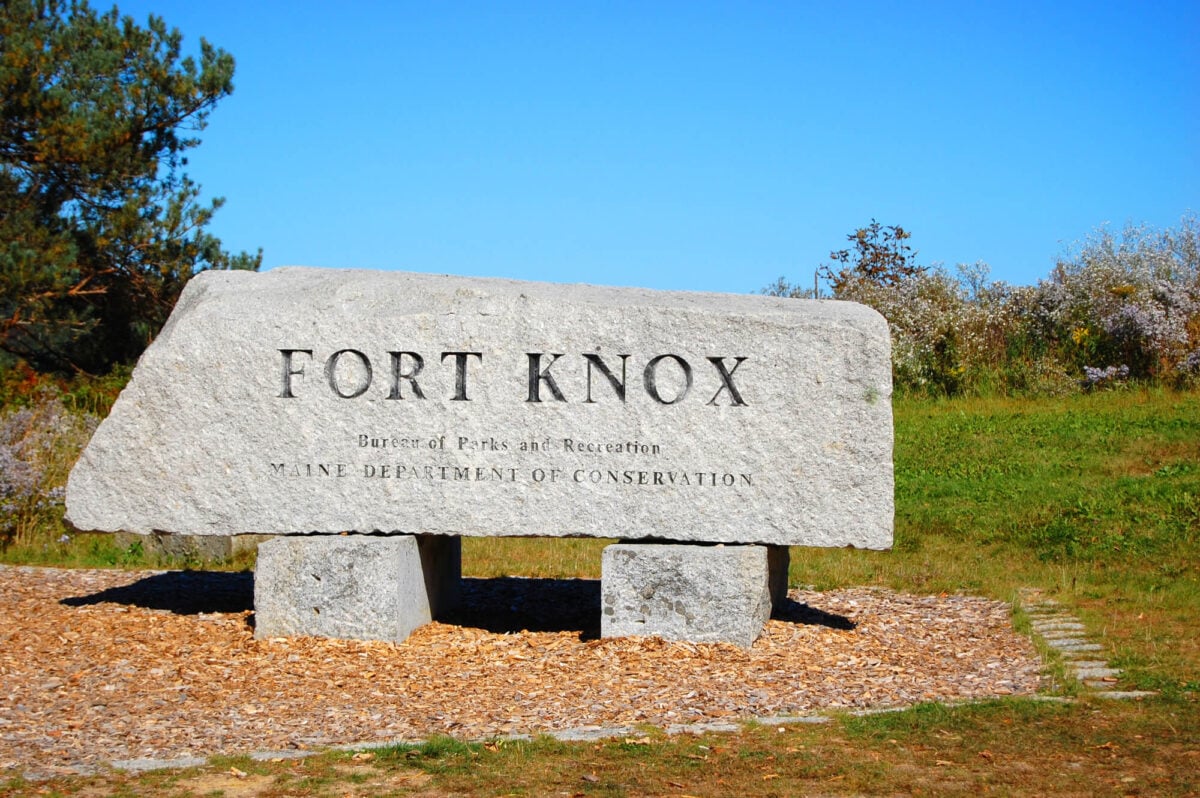
Built in 1936, the United States Bullion Depository at Fort Knox, Kentucky, holds a large share of the nation’s gold reserves. Visitors are not allowed, and the vault has been opened to outsiders only on rare occasions.
In 1974 a group of members of Congress and journalists toured it to answer rumors that the gold was missing, and in 2017 Treasury Secretary Steven Mnuchin visited with several lawmakers. The building is made of granite, concrete, and steel, and its vault door is said to weigh more than 20 tons.
Few people have seen the gold inside.
Interior of the Svalbard Global Seed Vault
Dug into a mountain near Longyearbyen on the Norwegian archipelago of Svalbard, the Global Seed Vault opened in 2008 to store backup copies of seeds from gene banks around the world. It now holds more than one million samples at about minus 18 degrees Celsius.
The vault opens only a few times a year for deposits, and visitors are not allowed inside. In 2017 meltwater from unusually warm weather seeped into the entrance tunnel, prompting upgrades.
The glowing art installation above the door is the only part most people ever see.
Lost City Hydrothermal Field
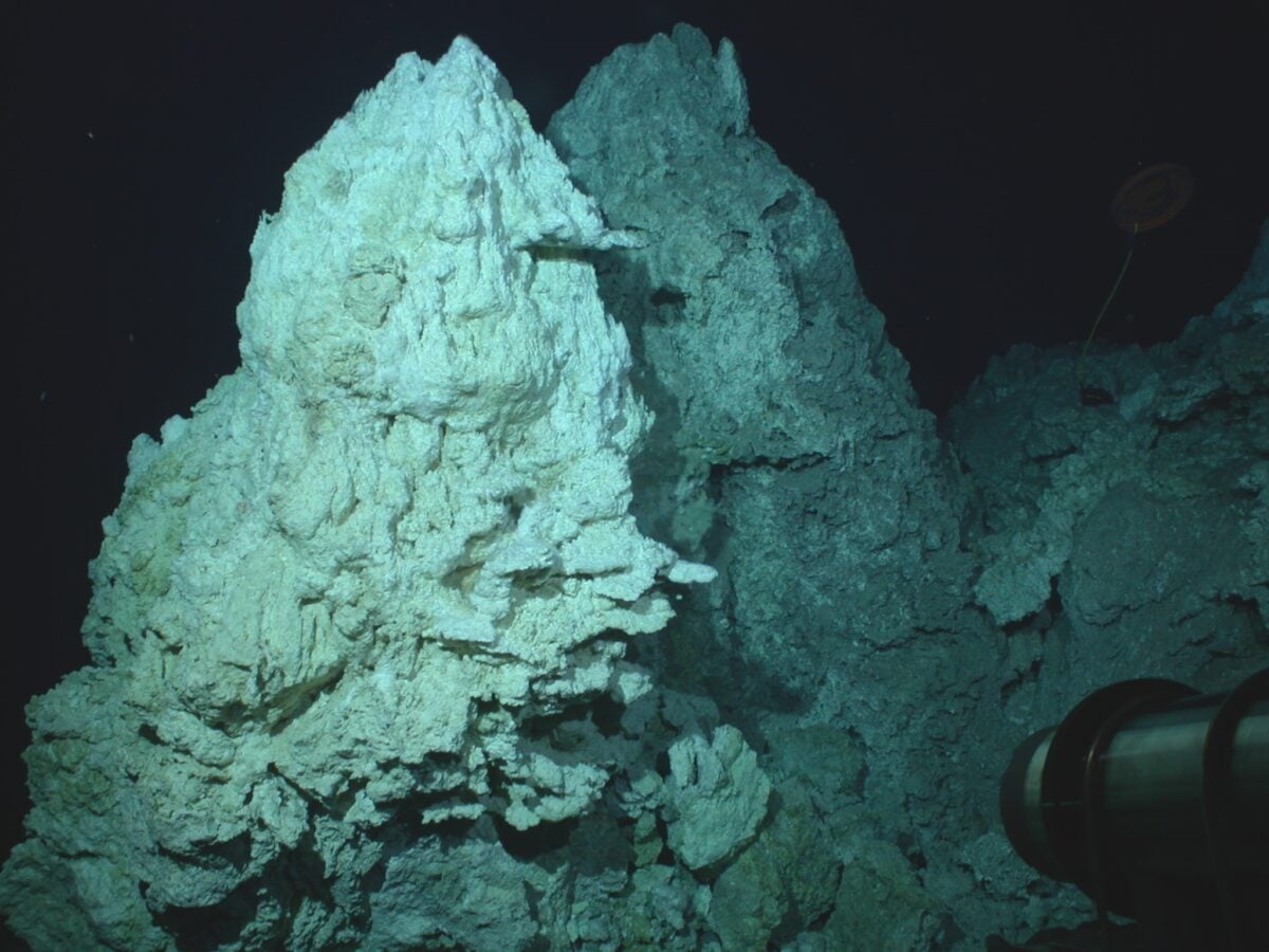
Scientists aboard the submersible Alvin discovered the Lost City hydrothermal field in 2000 on the Atlantis Massif in the mid-Atlantic, at a depth of roughly 750 meters. Its pale carbonate towers rise from the seafloor, and the tallest, nicknamed Poseidon, stands about 60 meters high.
Warm, alkaline fluids vent from the towers, supporting microbial life that may resemble early life on Earth. Research suggests the field has been active for at least 120,000 years.
Only a small number of researchers have seen it in person, and it has been proposed for protection from deep-sea mining.
Inaccessible Island in the South Atlantic
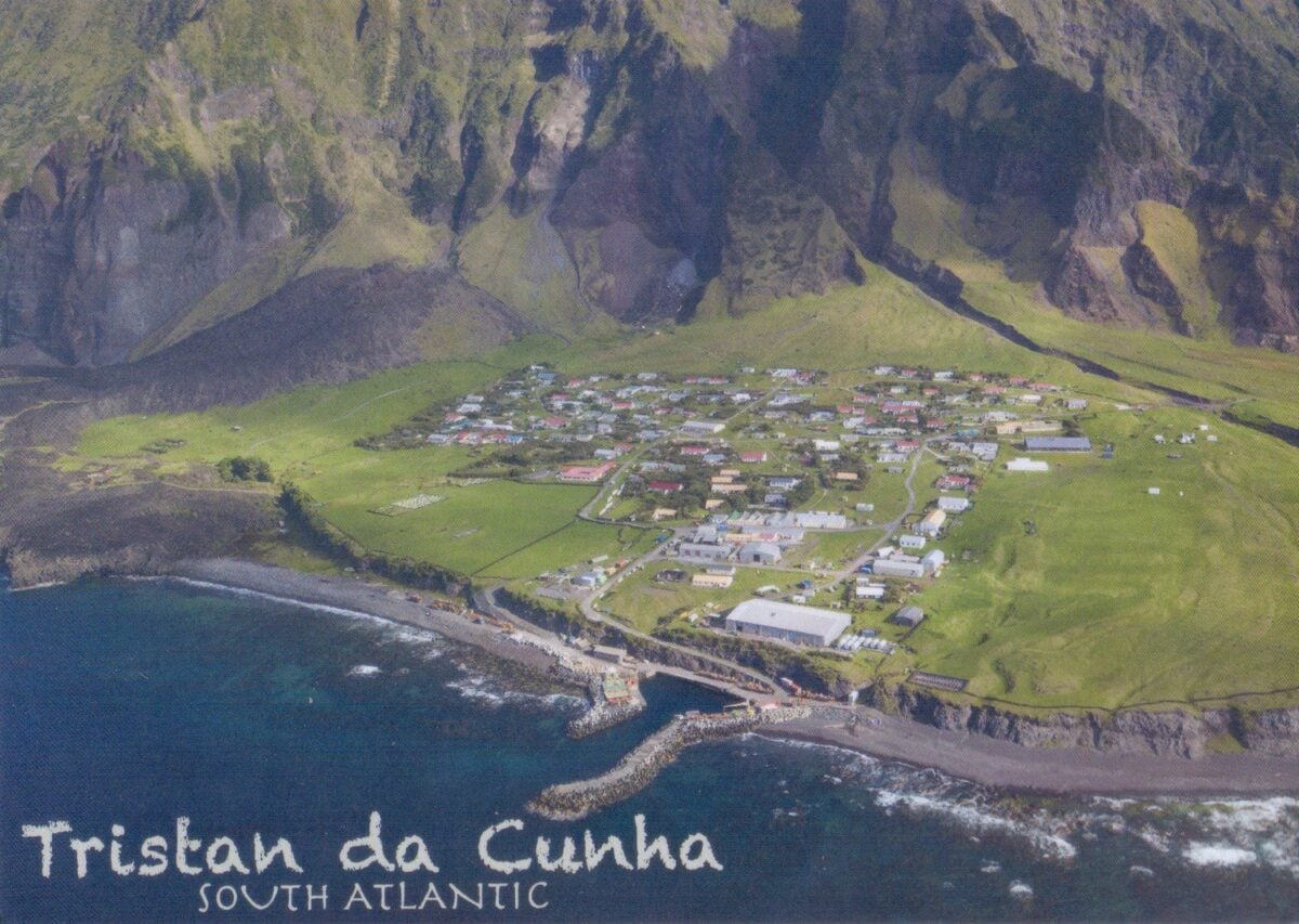
Inaccessible Island belongs to the Tristan da Cunha group in the South Atlantic, about 40 kilometers from Tristan itself. Its steep cliffs and narrow beaches make landing difficult, which is how it earned its name.
The island is home to the Inaccessible Island rail, the smallest living flightless bird, which weighs about as much as a few coins. Together with Gough Island it forms a UNESCO World Heritage Site.
Visits require permission from the Tristan da Cunha government, and calm seas are needed to get ashore. Only a handful of scientists and Tristan residents visit in a typical year.
Nanda Devi Inner Sanctuary in India
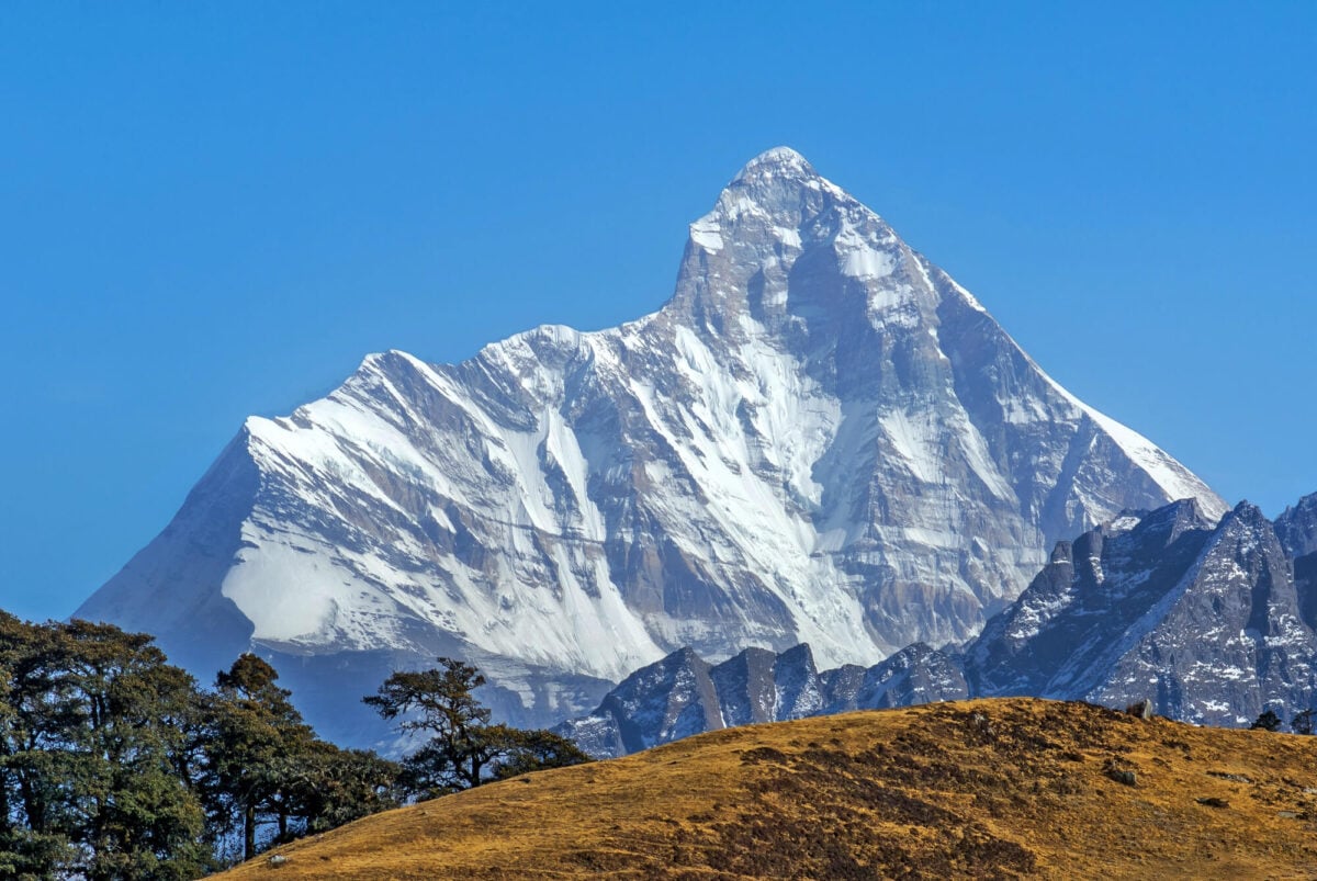
Ringed by high peaks in the Indian Himalaya, the Nanda Devi Sanctuary is a glacial basin that was closed to climbers and trekkers in 1983 to protect its ecology. It was named a UNESCO World Heritage Site in 1988, and very few people have entered since.
In 1965 a joint Indian and American team tried to place a nuclear powered surveillance device on the mountain to monitor Chinese missile tests, but it was lost in an avalanche and never recovered. Snow leopards and Himalayan tahr roam the basin below Nanda Devi, India’s second highest peak.
Quttinirpaaq National Park on Ellesmere Island
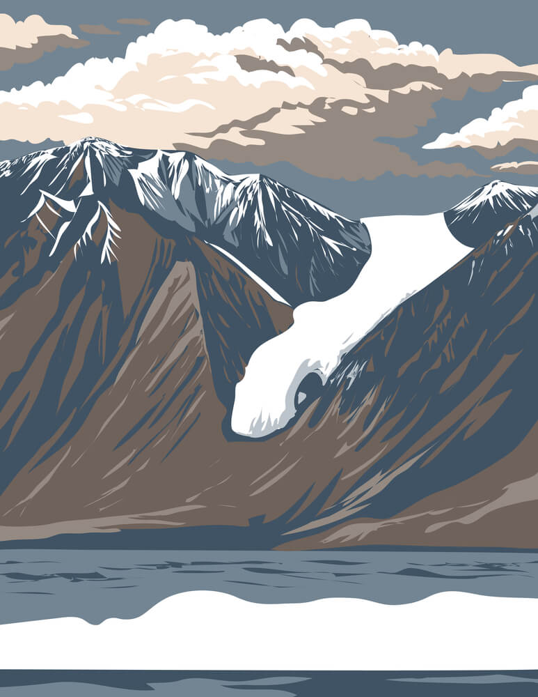
Quttinirpaaq National Park, on Canada’s Ellesmere Island, is one of the most northerly parks in the world and covers about 37,775 square kilometers. It receives only a few dozen visitors in a typical year.
Access requires expensive chartered flights, and the landscape includes glaciers, ice caps, and polar desert. Cape Columbia, the northernmost point of land in Canada, lies within its borders, as does Lake Hazen, among the largest lakes north of the Arctic Circle.
Arctic wolves, muskoxen, and Arctic hares live there, and many of its valleys have never recorded a human visitor.
Tomb of Genghis Khan
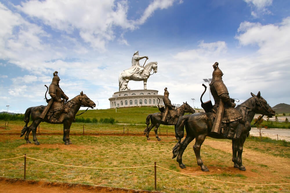
Genghis Khan died in 1227, and his burial place has never been found. Legend holds that those who buried him were killed to keep the location secret, and that horses trampled the ground to erase any trace.
Many believe the tomb lies near the sacred mountain Burkhan Khaldun in Mongolia, an area long restricted as the Great Taboo. Around 2010 the Valley of the Khans project used satellite imagery and thousands of online volunteers to scan the landscape for clues.
Many Mongolians prefer that the grave stay hidden, and no one knows exactly where it lies.
Solitude Is the Rarest Souvenir

Every place on this list resists visitors for a reason. Some are protected by depth, cold, or distance, and others by laws written to guard fragile ecosystems or people who want to be left alone.
Their inaccessibility is often what keeps them intact.
That makes these places valuable precisely because few people see them. Satellite images, photographs, and scientific reports offer a glimpse without the damage that crowds bring.
The world still holds corners that remain wild, and some of them should probably stay that way.
More from Go2Tutors!

- The Romanov Crown Jewels and Their Tragic Fate
- 13 Historical Mysteries That Science Still Can’t Solve
- Famous Hoaxes That Fooled the World for Years
- 15 Child Stars with Tragic Adult Lives
- 16 Famous Jewelry Pieces in History
Like Go2Tutors’s content? Follow us on MSN.