Rock Formations With Backstories That Sound Like Ancient Myths
There’s something deeply unsettling about standing next to a rock formation that has been there for millions of years, indifferent to everything that’s happened around it. Empires rose and collapsed.
Languages died out. Species vanished entirely.
And these stone shapes just kept standing, accumulating stories the way old houses accumulate rumors. Every culture that encountered them reached for the same explanation: something supernatural must have put them there.
What’s strange isn’t that people invented myths to explain these formations — it’s how often the myths feel more satisfying than the geology. Here are some of the most extraordinary rock formations on earth, each with a backstory that makes the science seem almost beside the point.
Devil’s Tower
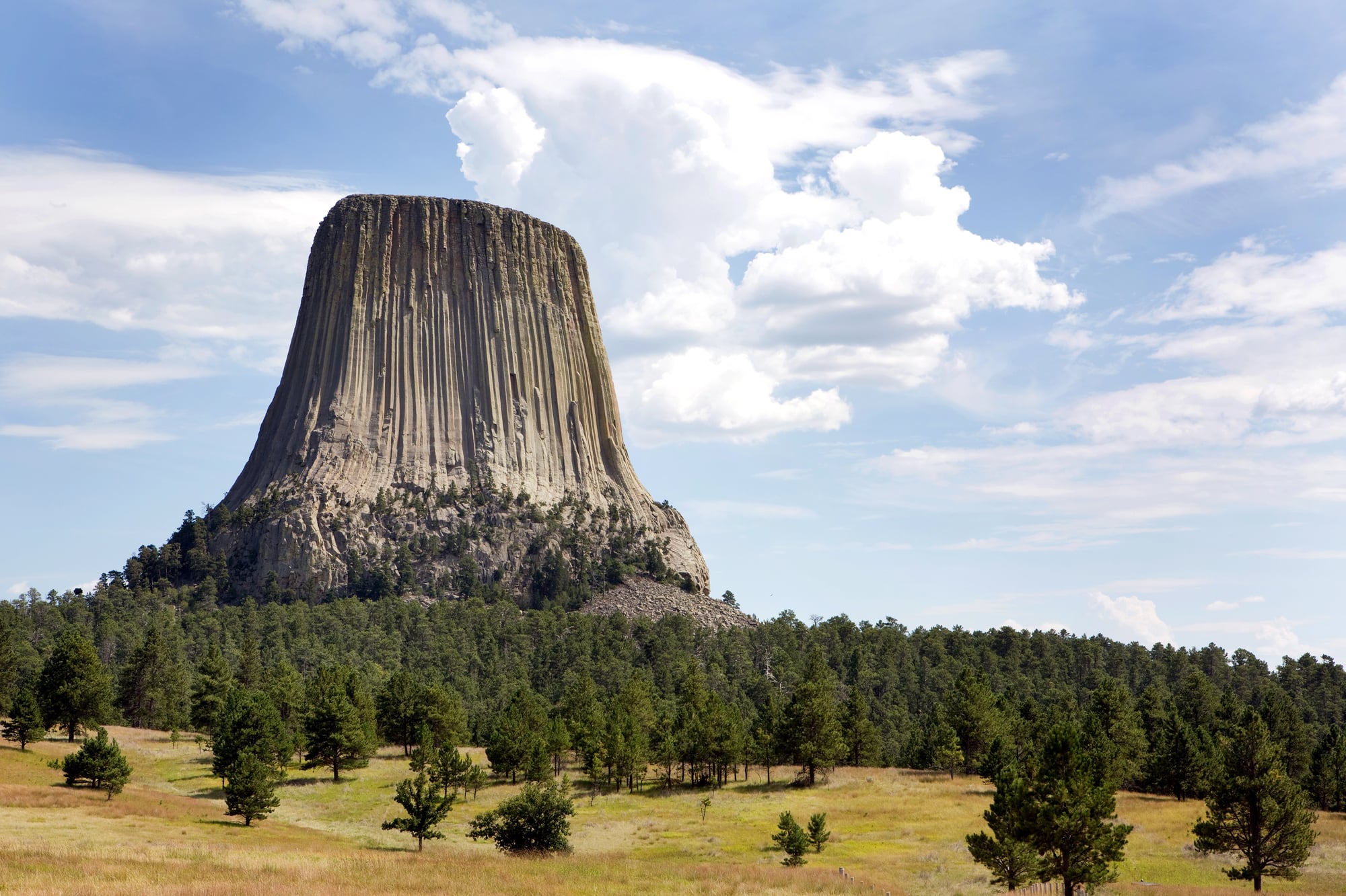
It rises 1,267 feet out of the Wyoming plains like something left behind deliberately, a monument with no clear sender. The Lakota, Kiowa, and Cheyenne all have origin stories involving it — the most common describes children being chased by a bear onto a rock that grew upward to save them, the claw marks still visible as the tower’s famous vertical columns.
The geology (a cooling igneous intrusion, stripped of surrounding softer rock over millennia) is fascinating, but it doesn’t explain why the thing looks so intentional.
The Giant’s Causeway
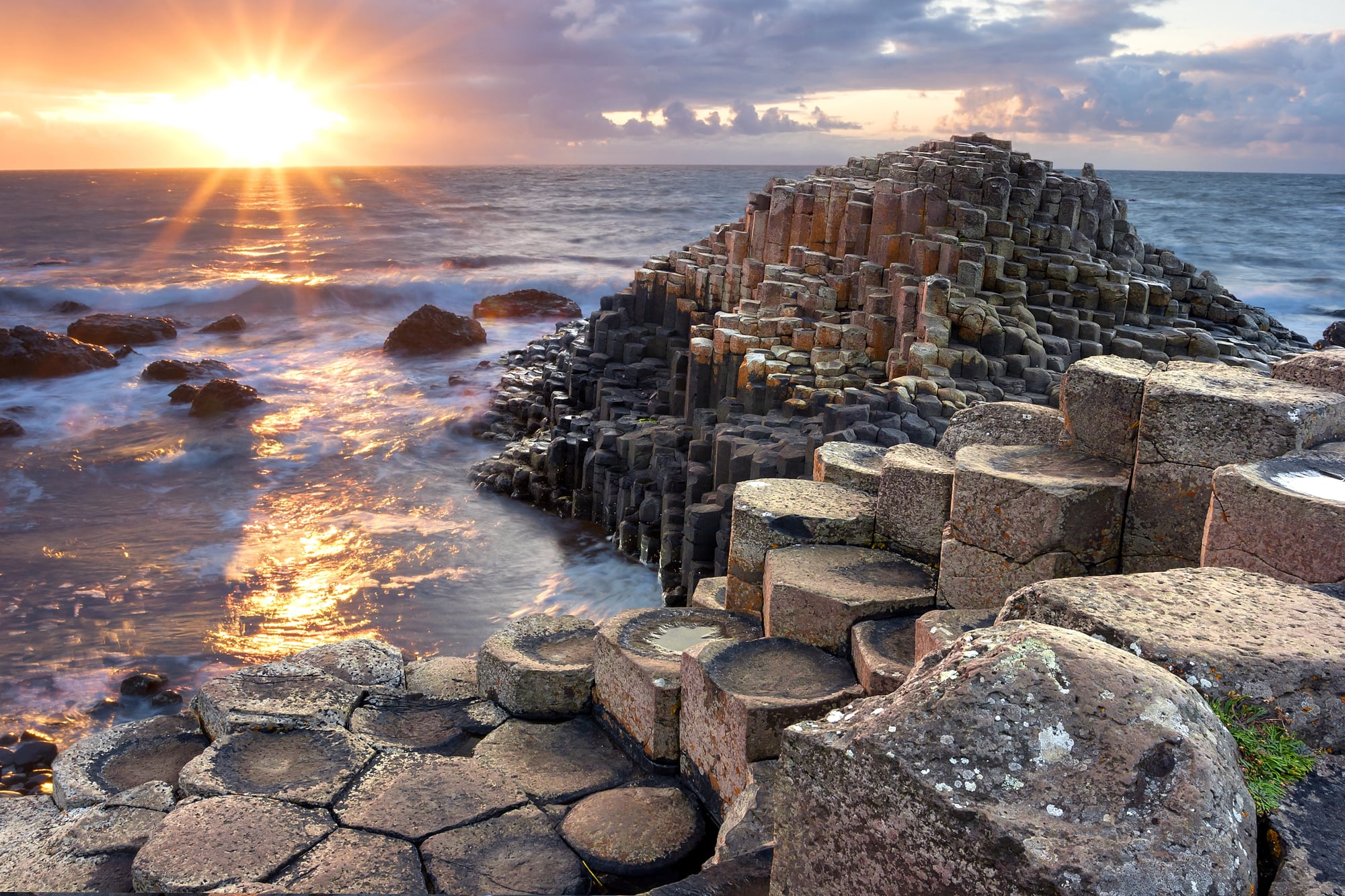
About 40,000 interlocking basalt columns along the coast of Northern Ireland, and the locals didn’t waste a moment reaching for the obvious conclusion: giants built it. The legend names the builder as Fionn mac Cumhaill, who supposedly constructed a walkway across the sea to fight a Scottish rival — and the rival, upon seeing how enormous Fionn was, fled and tore up the causeway behind him.
The columns are the result of ancient volcanic activity and rapid cooling, which produces the hexagonal geometry almost mechanically, and somehow that makes the giant story feel more credible, not less.
Uluru
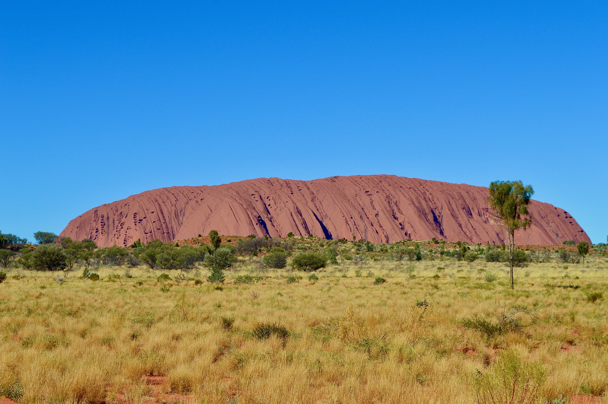
Uluru, in the Northern Territory of Australia, doesn’t just sit in the landscape — it presides over it, the way something ancient and unapologetic presides. The Anangu people, whose ancestral connection to the site stretches back tens of thousands of years, understand Uluru not as a rock formation but as a physical record of the Tjukurpa, the law and creation narratives that structure their entire understanding of the world.
Every crack, overhang, and waterhole has a specific story attached to it — stories that are not metaphor but living instruction.
Moeraki Boulders
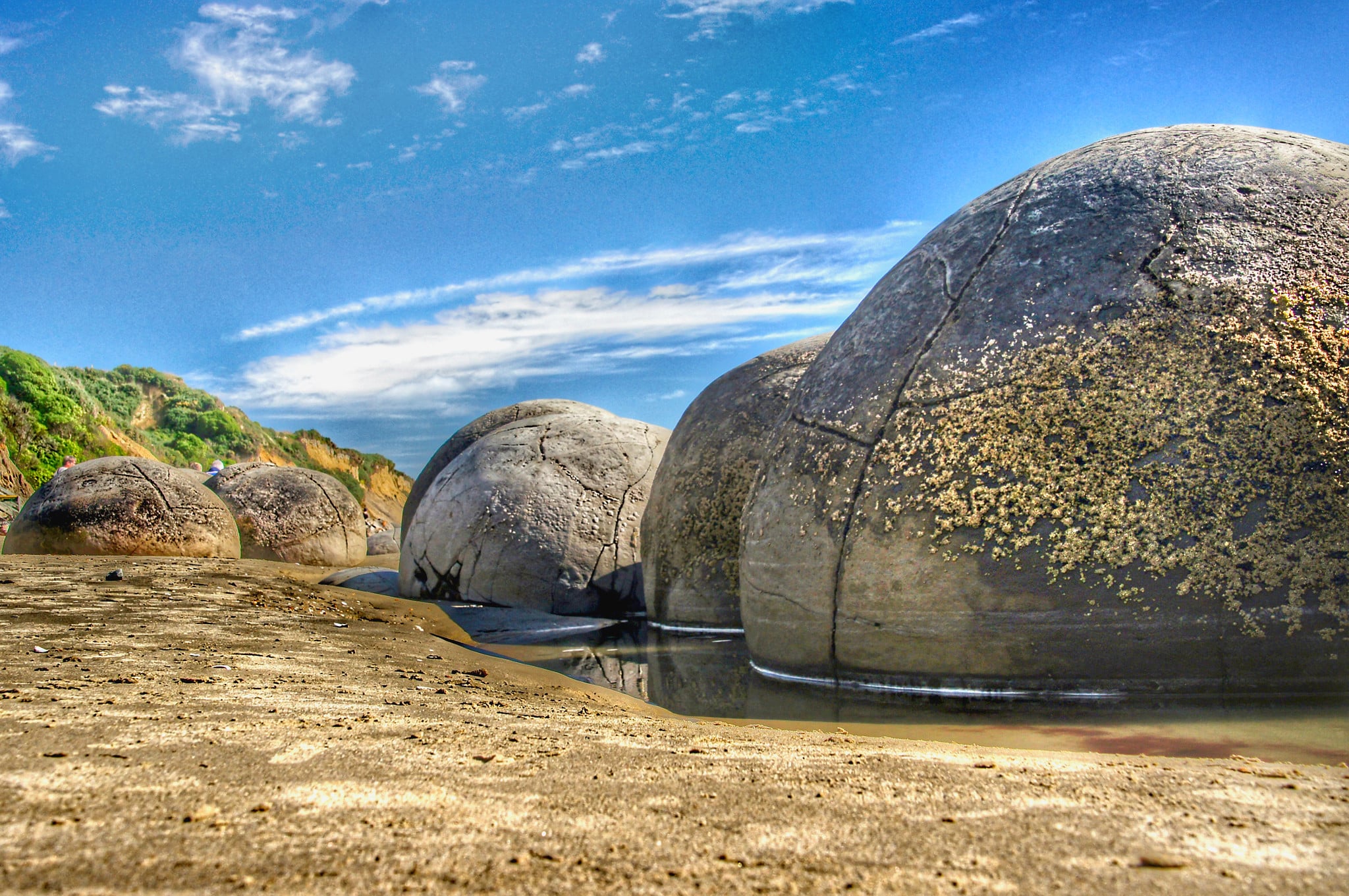
Perfectly spherical boulders scattered along Koekohe Beach in New Zealand, and the Māori explanation is that they are the remains of calabashes, eel baskets, and sweet potatoes washed ashore from the wreck of a great canoe called Arai-te-uru. They look exactly like what the legend describes — cargo tumbled out of a hold and left on the sand — and the scientific explanation (septarian concretions formed around organic material on the seafloor over millions of years) does nothing to diminish how staged the whole scene appears.
Trolltunga
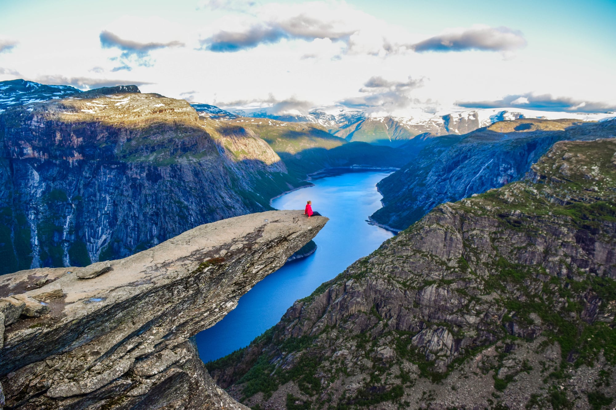
Trolltunga is one of those places where the name does exactly the work it’s supposed to. It means “troll’s tongue” in Norwegian, and the horizontal slab of rock jutting 2,300 feet above Lake Ringedalsvatnet does, in fact, look like a tongue extended from a cliff face — pointed, flat, absurdly precise.
Scandinavian folklore held that trolls caught in sunlight turned to stone, and the landscape of Norway is littered with formations that seem to confirm this theory with unsettling regularity. The rock itself is ancient Precambrian gneiss, shaped by glaciers, which is the kind of explanation that answers the “how” while completely sidestepping the “why it looks like that.”
Thor’s Well
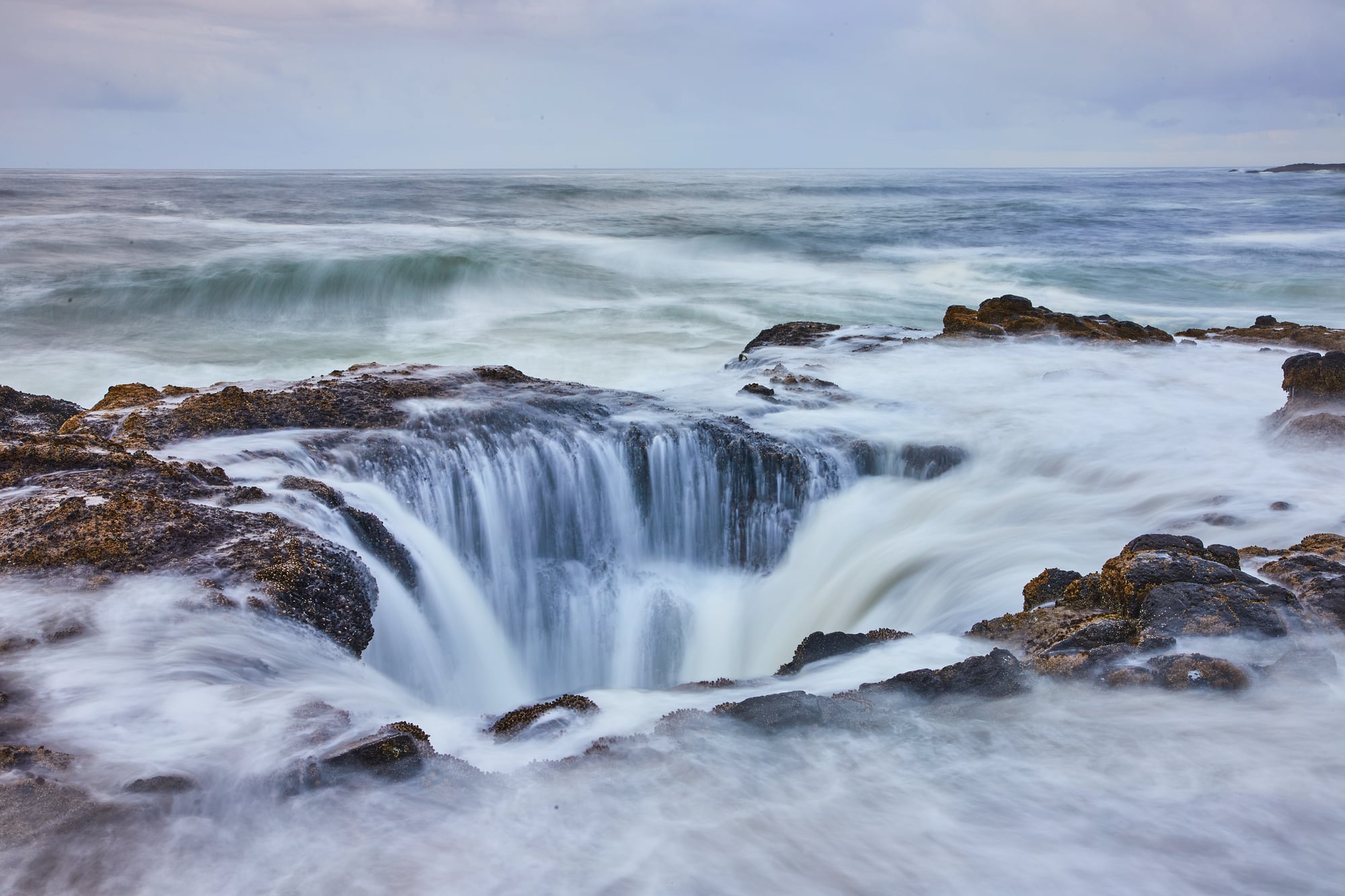
On the Oregon coast, Thor’s Well is a depression in the basalt shoreline that drains and refills with each wave, looking for all the world like a drain for the ocean itself. Local lore frames it as a bottomless pit that the sea pours into endlessly — a gateway, depending on who’s telling the story, to either the underworld or simply nowhere at all.
The geological reality is that it’s a collapsed sea cave, a sinkhole formed by wave erosion, and yet watching it in action at high tide, with seawater surging in and vanishing, the mythology feels like the more honest description.
The Fairy Chimneys of Cappadocia
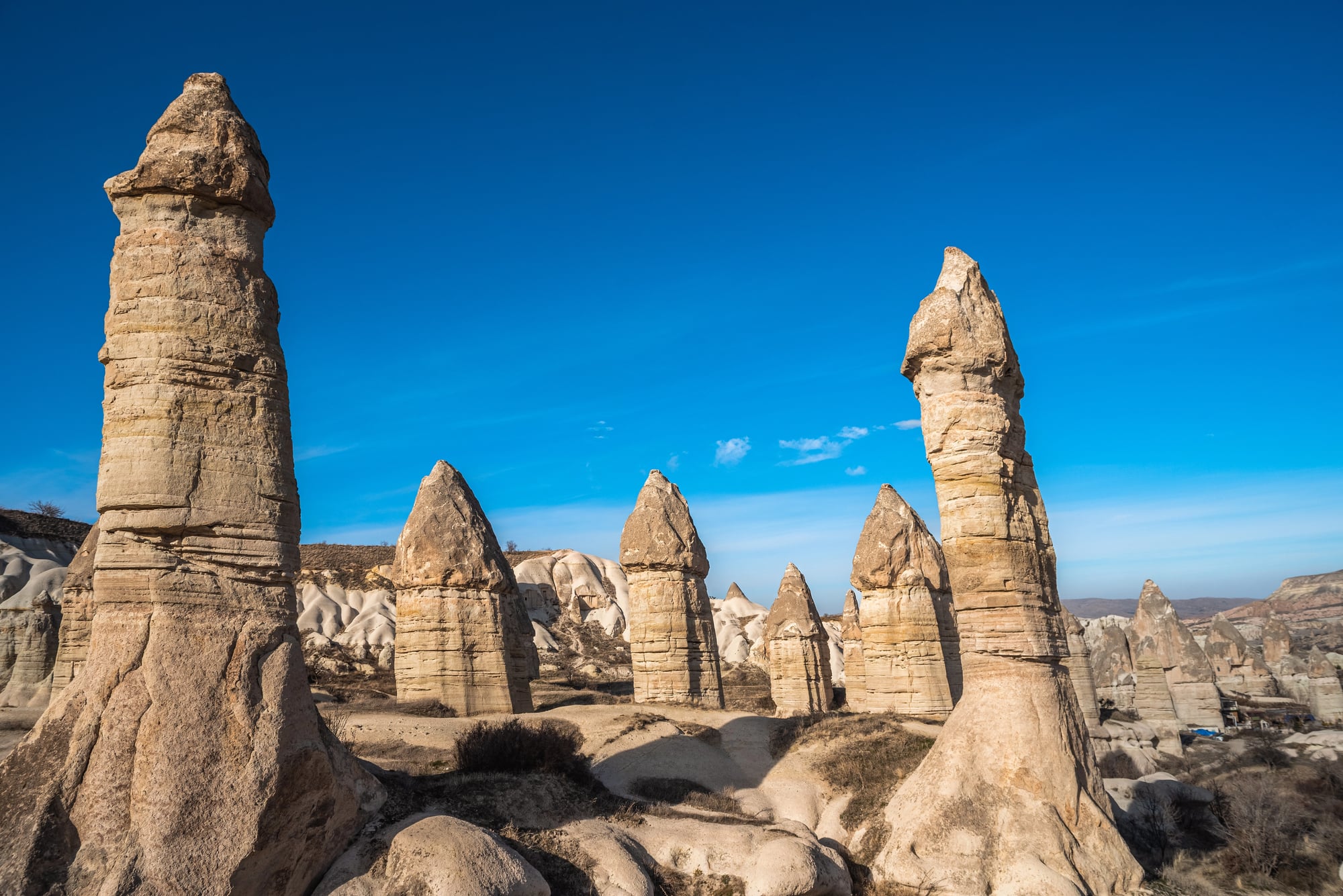
The tuff cones of Cappadocia, in central Turkey, rise from the valley floors in clusters — tapered, capped with darker basalt, averaging 30 to 130 feet tall — and the “fairy chimneys” label isn’t poetic license so much as consensus observation. Early Christian communities carved churches and entire cities into them, treating the formations less as natural curiosities and more as infrastructure.
The region’s mythology layered over centuries: pre-Christian, Byzantine, Ottoman, each generation adding its own explanation for why the landscape looks like something a dreaming god sketched without finishing.
Wave Rock
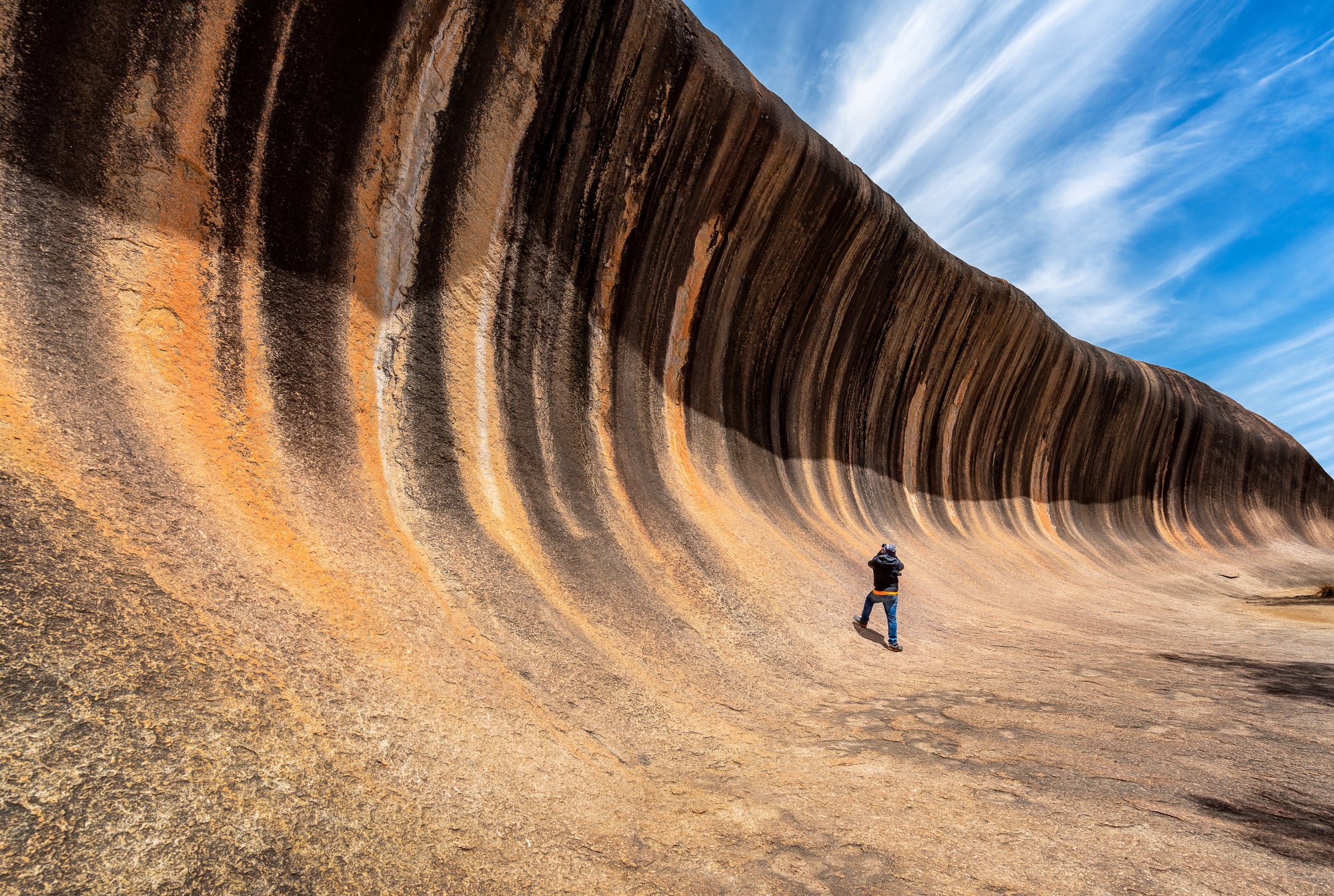
Wave Rock in Western Australia is a granite cliff face that curves and undercuts in such a precise arc that it mimics, with eerie accuracy, a breaking wave frozen at its peak. The Noongar people connect it to a mythological Rainbow Serpent who, in some versions of the story, shaped the land by moving through it — and a 55-foot-tall stone wave frozen mid-break is exactly the kind of geological signature you’d expect a serpent that size to leave behind.
The rock is about 2.7 billion years old, shaped by subsurface weathering and the slow retreat of softer material around the base, which is extraordinary in its own right and does nothing to make the wave metaphor feel less appropriate.
Los Organos
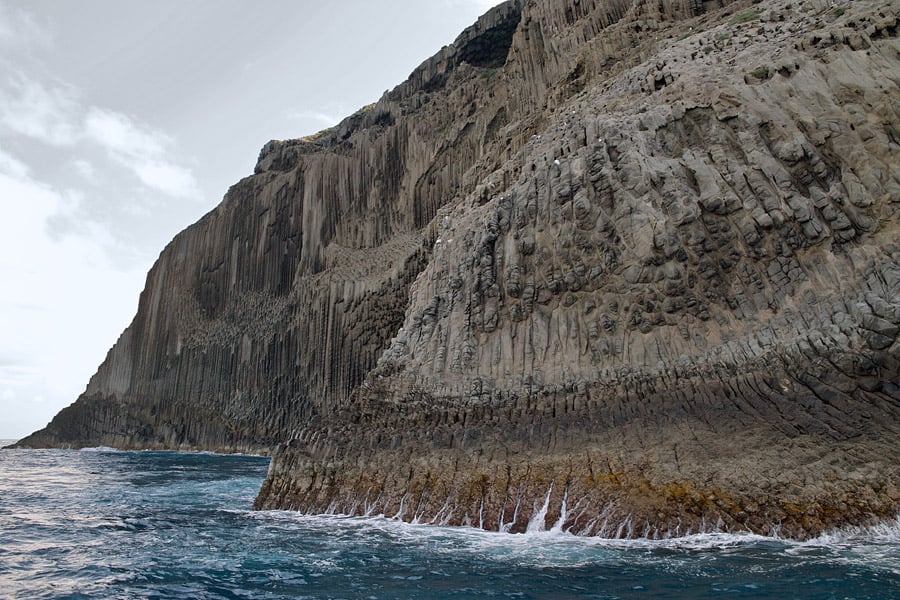
Off the coast of La Gomera in the Canary Islands, a sea cliff rises from the Atlantic displaying a near-perfect arrangement of vertical basalt columns that look indistinguishable from the pipes of a cathedral organ — hence the name Los Organos, “the organs.” The local mythology doesn’t need much embellishment because the visual does all the work: the columns are so evenly spaced and so consistent in their proportions that any reasonable person encountering them from a boat would question whether they’re looking at something natural.
They are — columnar jointing, the same process responsible for the Giant’s Causeway — but the coincidence that this particular formation resembles an instrument built to fill the largest interior spaces humans ever construct is difficult to shake off.
Chimney Rock
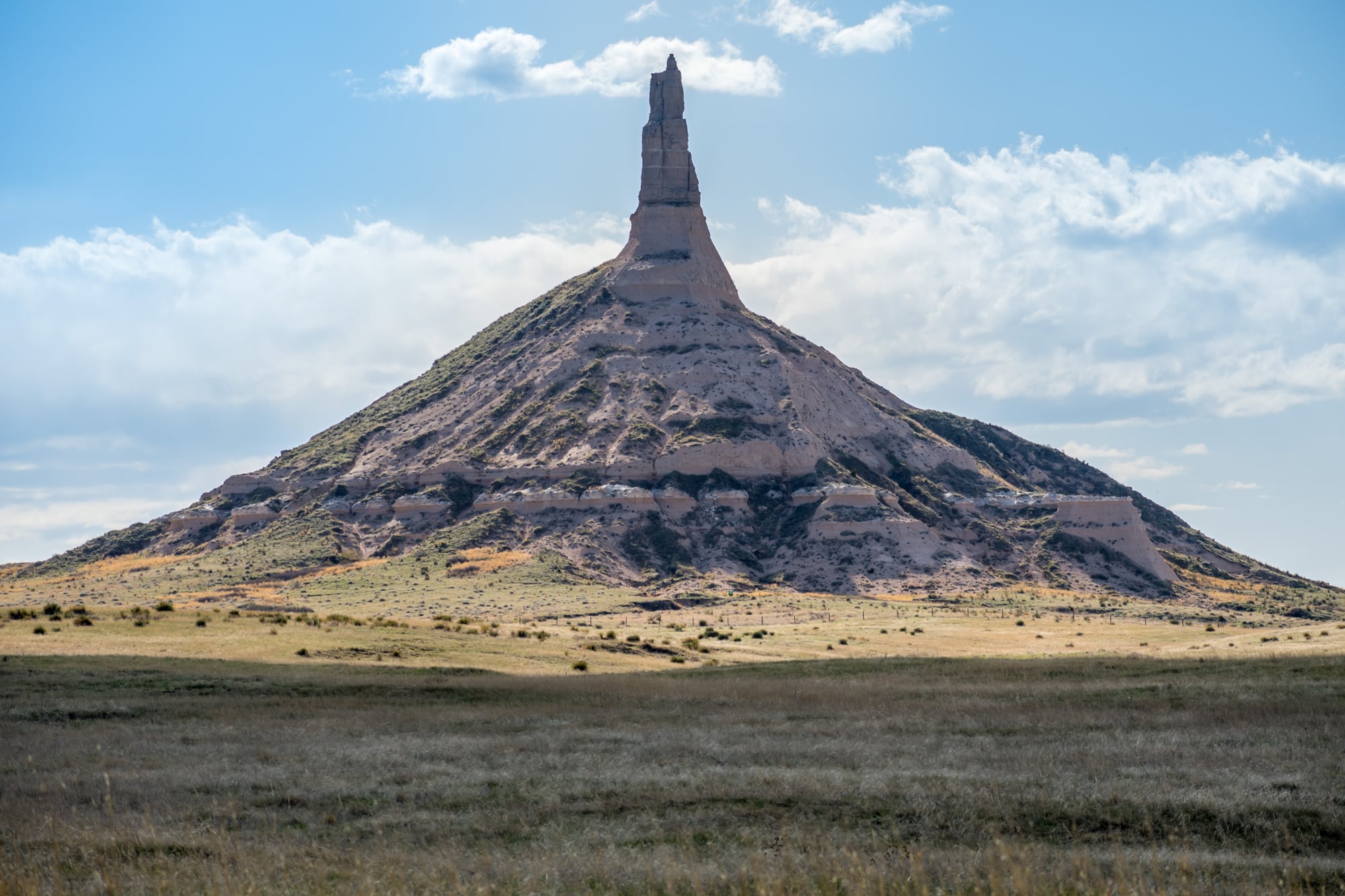
Chimney Rock in western Nebraska rises about 300 feet above the surrounding plain and was such a disorienting landmark for westward-traveling settlers in the 1800s that they recorded it in their journals with an almost desperate frequency. Indigenous peoples of the region held various interpretations of the formation — some regarded it as a gathering point with spiritual significance, others as a marker left by forces older than human memory.
The Lakota name for it translates roughly as “elk penis,” which is — to be fair — also accurate, and suggests that naming landscapes after what they resemble is a remarkably consistent human impulse across cultures.
Balanced Rock
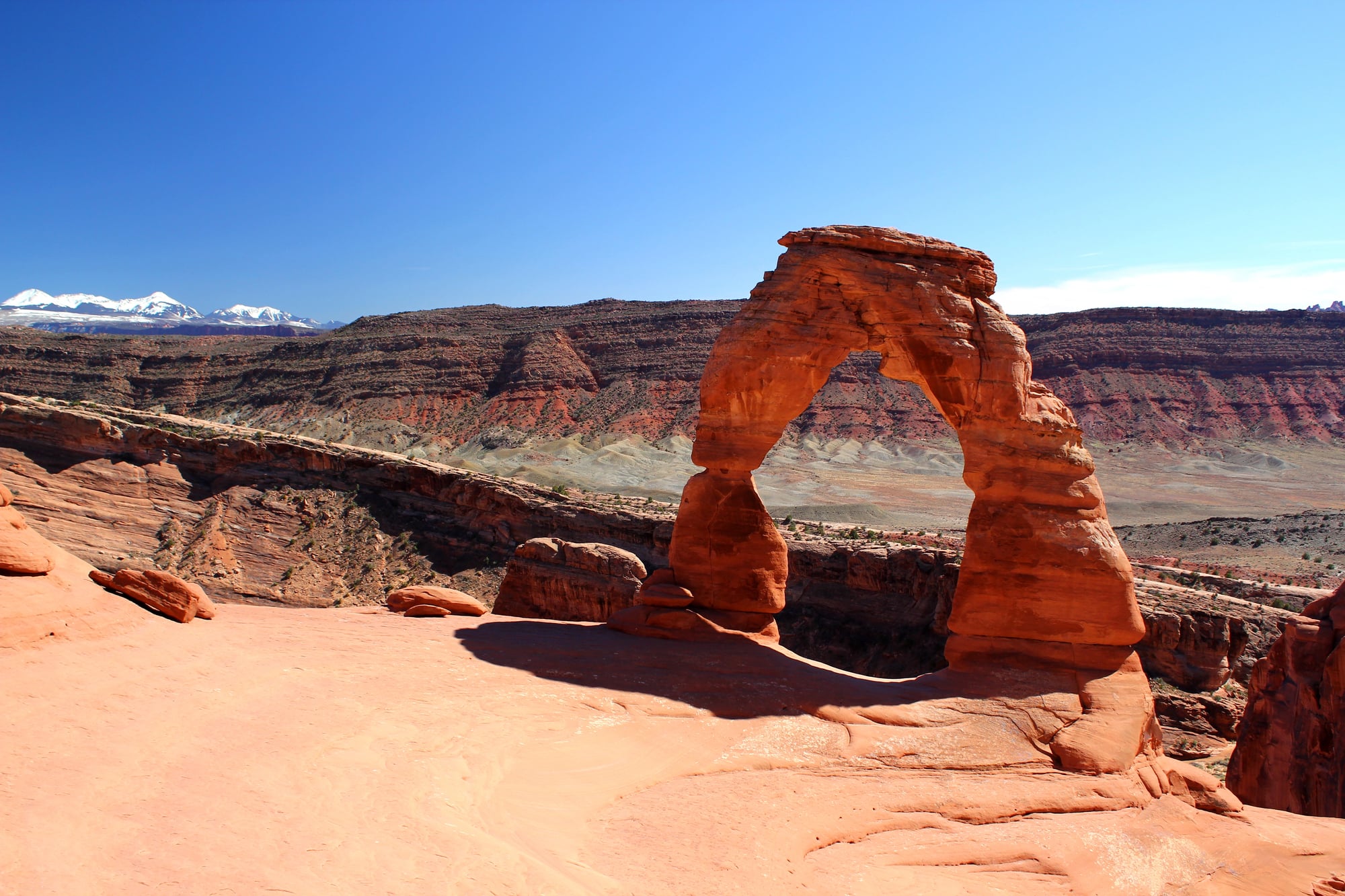
In Arches National Park in Utah, a 3,577-ton boulder sits on a pedestal of softer rock that is visibly, almost comically, too small for the job. It looks like something placed there as a dare, or as a test — the kind of impossible balance that would be explained, in any traditional story, as the work of a trickster figure who arranged it specifically to unsettle observers.
Navajo and Ute oral traditions include figures who reshape the landscape according to their own logic, and Balanced Rock fits that template so precisely it might as well be a signature.
Old Man of Storr
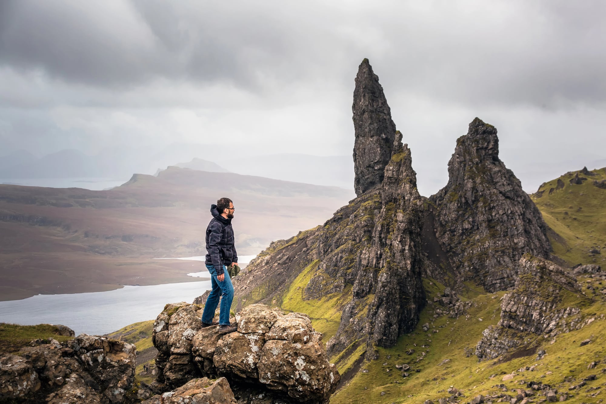
The Old Man of Storr is a 160-foot pinnacle of rock on the Isle of Skye, standing slightly apart from the surrounding crags like something that decided to leave the group. Scottish Gaelic folklore describes it as the petrified thumb of a buried giant — and the shape, isolated and upright, does suggest a last visible part of something much larger just beneath the surface.
The geology involves ancient landslides and differential erosion on a tilted basalt plateau, but the giant-thumb reading requires no mythology degree and arrives instinctively to anyone standing in front of it.
Beehive Domes of Kata Tjuta
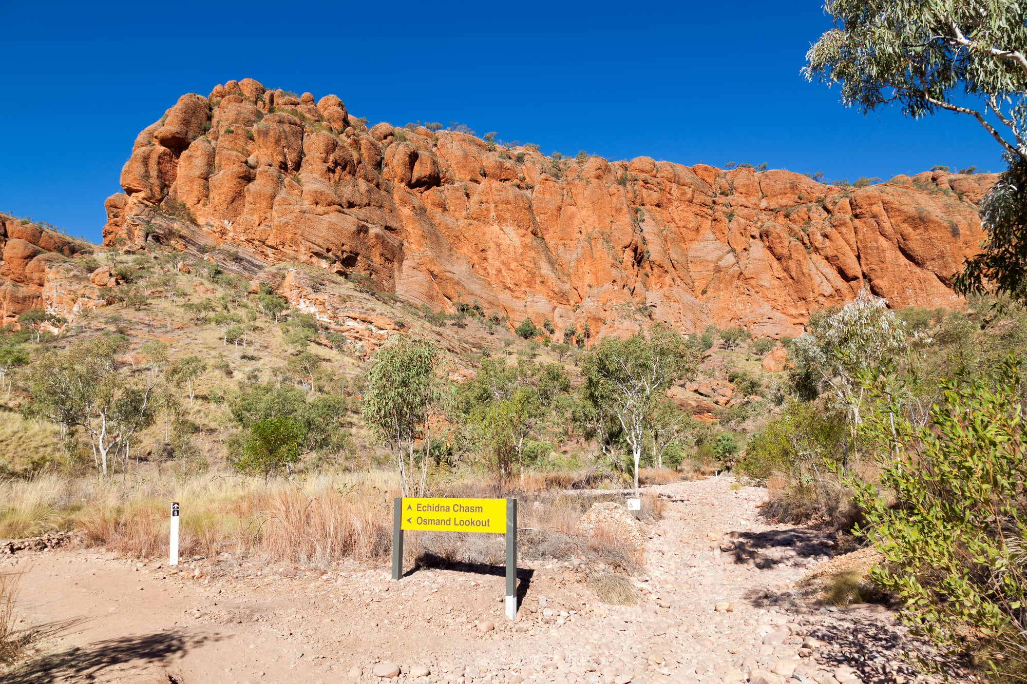
Kata Tjuta, just west of Uluru in Australia’s Northern Territory, is a collection of 36 domed rock formations spread across about 14 square miles — and unlike Uluru, which commands the landscape alone, Kata Tjuta clusters, pressing together in a way that feels conspiratorial. The Anangu consider the site deeply sacred, and the specific knowledge associated with it is restricted — meaning the mythology attached to it is deliberately not for general circulation, which is, honestly, a more interesting relationship with a sacred landscape than most cultures manage.
What’s visible and what’s intentionally withheld are both part of the story.
Elephant Rocks
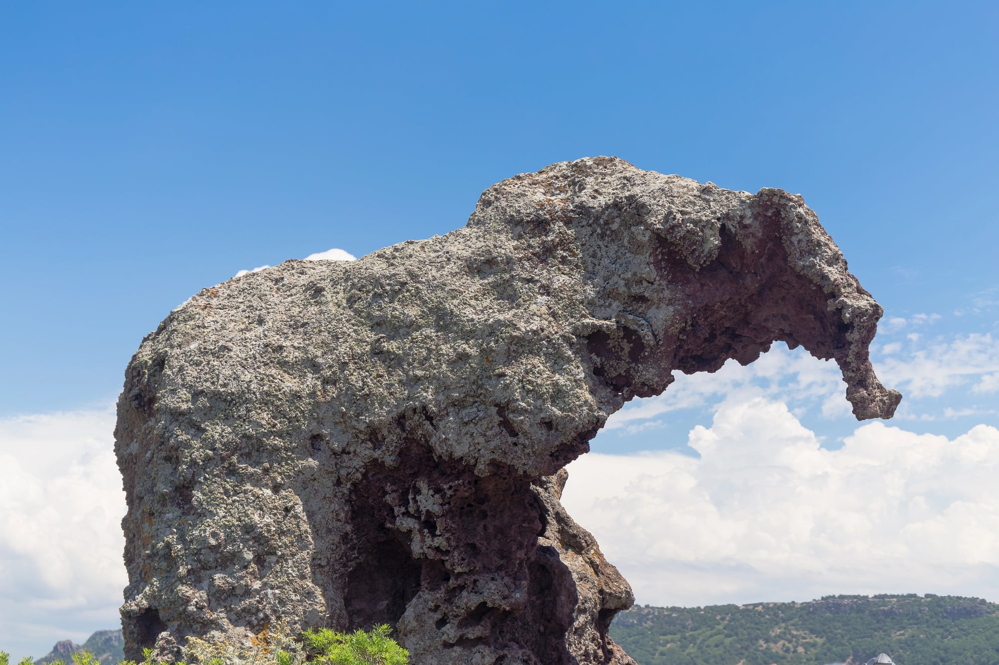
In the Black Hills of South Dakota, a collection of enormous rounded granite boulders sit grouped together in a way that, from the right angle, reads unmistakably as a herd of elephants. The formations are real — exposed granite tors, weathered into smooth, lumbering shapes by millions of years of erosion — and the resemblance is not a stretch people are talked into.
Lakota oral tradition includes stories of great stone animals placed in the landscape by powerful spirits, which, standing in front of these particular rocks, doesn’t feel like a metaphor so much as a straightforward description.
Ha Long Bay’s Karst Towers
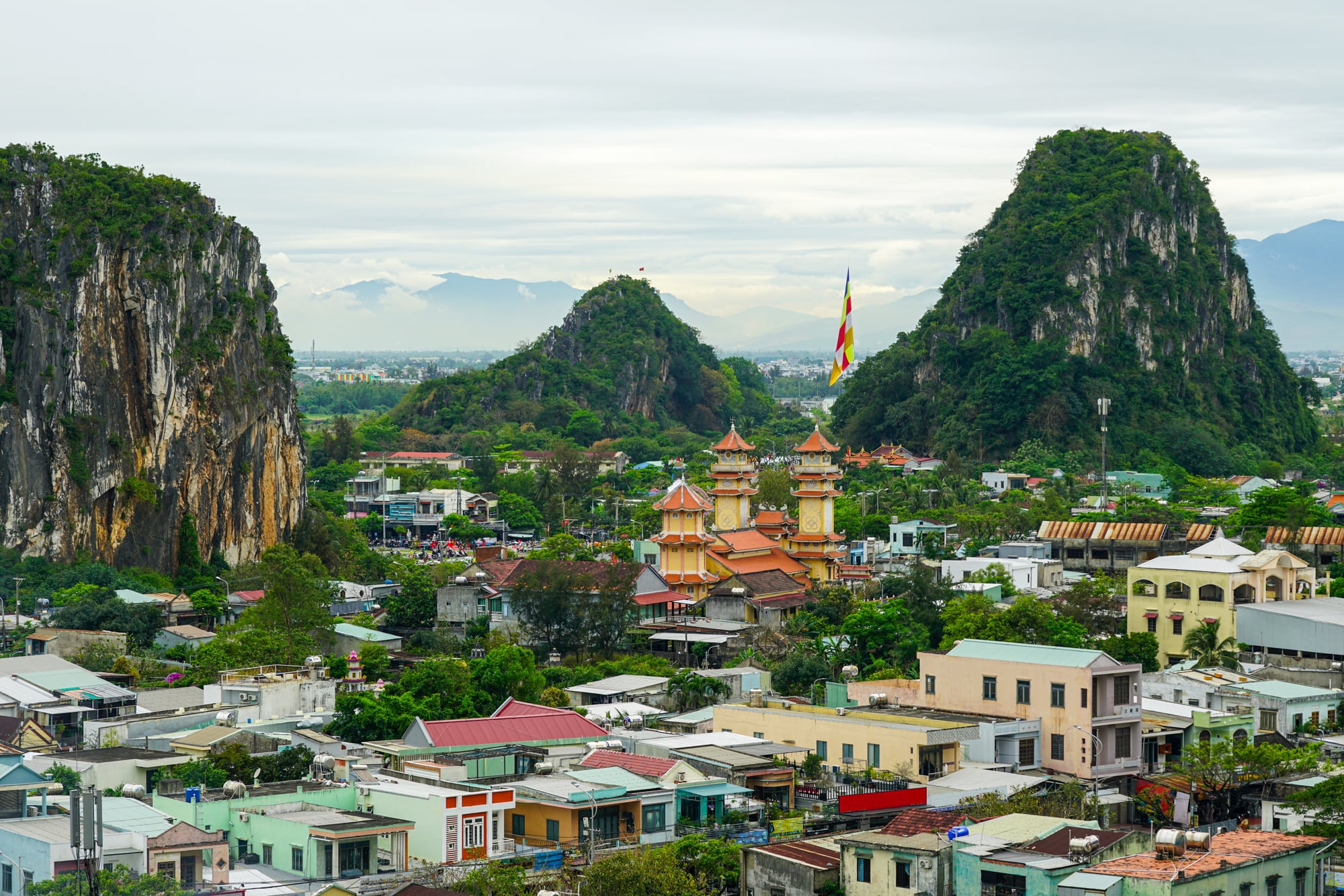
Ha Long Bay in Vietnam contains roughly 1,600 limestone karst islands and pillars rising from the water, forested at the tops and sheer at the waterline, and the Vietnamese creation myth about them is appropriately scaled to the spectacle. The story goes that a great dragon (ha long means “descending dragon”) was sent by the gods to defend Vietnam from invaders and, upon landing, smashed its tail into the land so violently that the shattered earth flooded, creating the bay.
The limestone formations are actually the result of hundreds of millions of years of carbonate deposition followed by tectonic uplift and sea-level rise — but the dragon explanation has the advantage of being completable in one sentence.
Pinnacles Desert
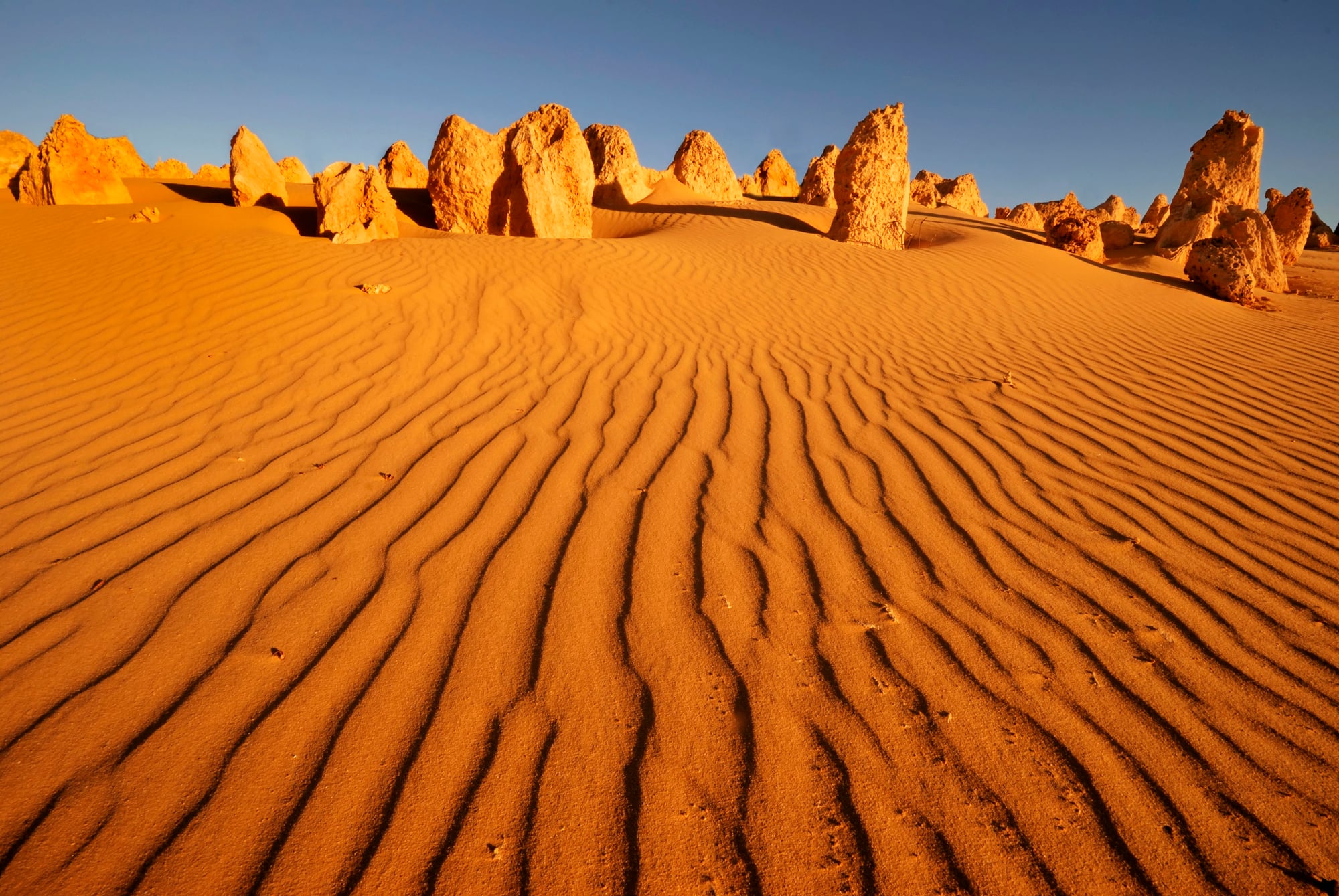
The Pinnacles Desert in Western Australia contains thousands of limestone spires rising from yellow sand — some a few inches, some nearly 12 feet — scattered without obvious pattern across a landscape that looks like the aftermath of something violent. Aboriginal traditions describe the area as a place associated with spiritual danger, which is a reasonable read of an environment that presents, at ground level, like an enormous interrupted ceremony.
The spires formed when seashell material cemented into limestone above the water table, leaving columns after the surrounding sand was stripped away, and the result looks less like geology and more like a question no one has fully answered.
Matterhorn
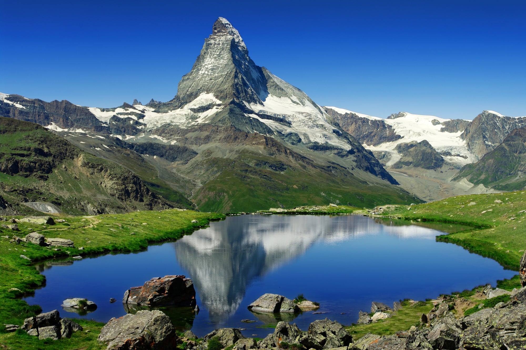
The Matterhorn’s nearly perfect pyramidal shape — all four faces oriented roughly to the cardinal directions — struck early Alpine observers as too deliberate to be accidental. Swiss and Italian mountain folklore filled the gap with stories of giants and protective spirits, and several medieval maps labeled the peak and surrounding area as a place of supernatural guardianship.
The pyramid shape is actually the result of glacial erosion working on all sides simultaneously over millions of years, which is the kind of explanation that makes you appreciate both the glacier and the giant as equally reasonable explanations for the same outcome.
Tsingy de Bemaraha
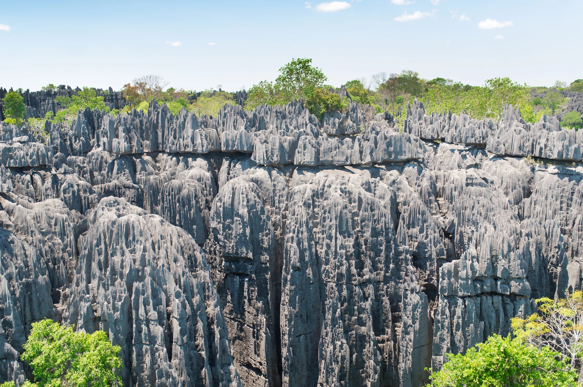
Madagascar’s Tsingy de Bemaraha is a forest of razor-sharp limestone needles — some rising over 300 feet — covering an area so difficult to traverse that large parts of it remained unmapped until relatively recently. The Malagasy name tsingy is generally interpreted as meaning “where one cannot walk barefoot,” which is accurate in the most direct possible sense and also functions as mythology: a landscape defined by what it refuses to permit.
The formations are the result of rainwater dissolving the limestone along fracture lines over millions of years, sharpening the peaks as the valleys between them deepened — a process that seems less like erosion and more like the land deciding to make a point.
Stone Forest of Shilin
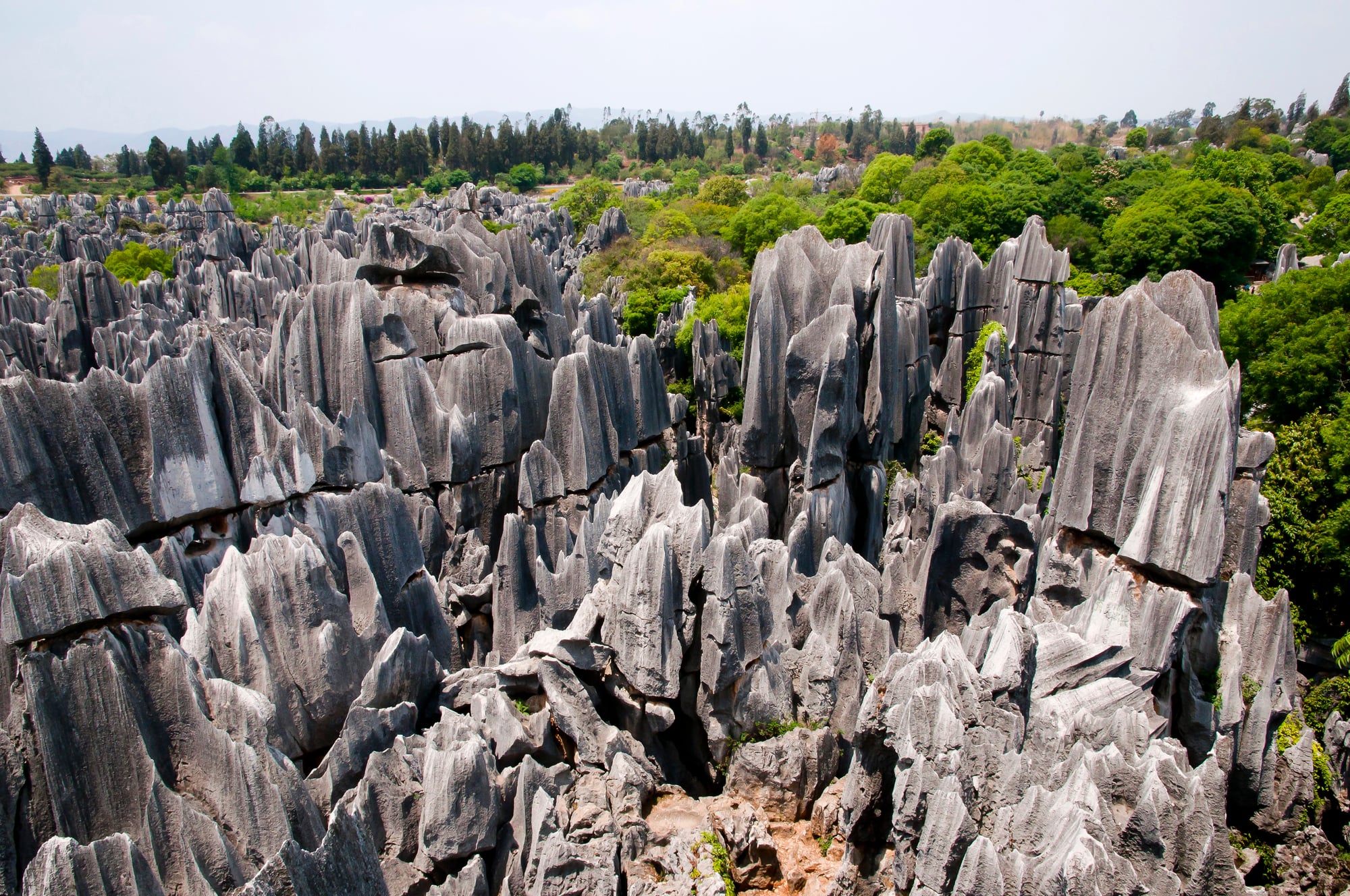
The Stone Forest of Shilin, in China’s Yunnan province, covers about 150 square miles and contains karst limestone pillars standing close together like the trunks of an ancient petrified wood. Yi ethnic tradition tells of a stone forest created by the immortal Ahzhi as a home for the people, and the scale of the place — the way it encloses and surrounds rather than simply impresses — supports that reading more than it challenges it.
One particular formation is called Ashima, named for a Yi girl in a tragic local legend, and visitors come specifically to find the pillar that most resembles a young woman standing and waiting. Turns out, it does.
Where Stone and Story Meet
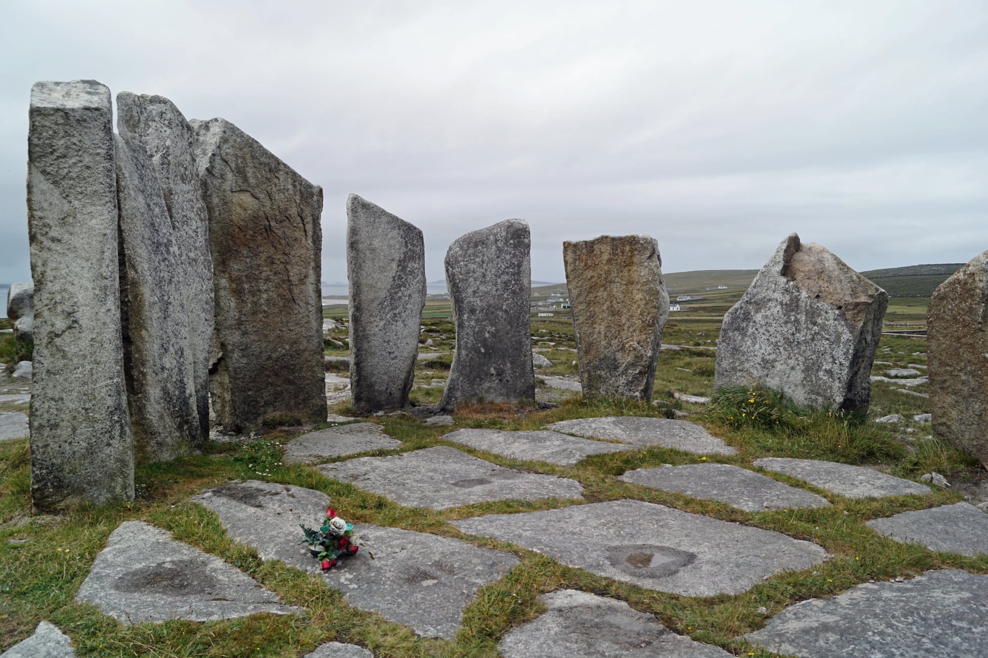
There’s a pattern here that’s hard to ignore: every culture that encountered these formations reached for narrative rather than observation, and in nearly every case, the narrative got there first. The science is real and the science is fascinating — but the myths are something else entirely.
They’re evidence that humans are constitutionally incapable of looking at a 900-foot column of volcanic rock or a perfect circle of boulders on a beach and accepting that it means nothing. So the stories accumulated, generation by generation, attaching meaning to stone the way lichen attaches to cliff faces — slowly, stubbornly, permanently.
What the myths understood, before the geology could articulate it, is that these formations are not incidental. They are landmarks in the truest sense: places where the land marks itself, demanding to be reckoned with.
More from Go2Tutors!

- The Romanov Crown Jewels and Their Tragic Fate
- 13 Historical Mysteries That Science Still Can’t Solve
- Famous Hoaxes That Fooled the World for Years
- 15 Child Stars with Tragic Adult Lives
- 16 Famous Jewelry Pieces in History
Like Go2Tutors’s content? Follow us on MSN.