15 Borders With the Strangest Backstories
Most of us think of borders as simple lines on a map, drawn by diplomats in stuffy rooms with reasonable intentions. Turns out, that’s rarely how it actually worked.
The world’s most peculiar boundaries were carved by everything from drunken surveyors to theological disputes to one very determined Belgian farmer with a tractor. These aren’t the borders you learned about in school.
They’re the ones that got tangled up in human weirdness and stayed that way.
Baarle-Nassau and Baarle-Hertog
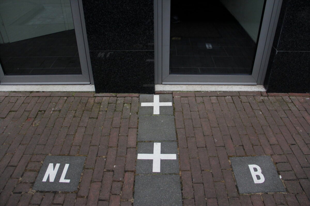
The border between Belgium and the Netherlands doesn’t just run through this area — it has a complete meltdown. There are Belgian enclaves inside Dutch territory, Dutch enclaves inside Belgian enclaves, and (because apparently that wasn’t confusing enough) a few spots where nobody was entirely sure which country they belonged to until fairly recently.
Medieval land swaps between local nobles created this mess, one tiny plot at a time. Back then, it made perfect sense: you trade this field for that forest, this pasture for those fishing rights.
Nobody was thinking about what would happen when modern nations needed clear boundaries. So now there’s a town where the international border runs right through people’s living rooms, and you can eat breakfast in the Netherlands and dinner in Belgium without leaving your kitchen table.
The locals have turned this bureaucratic nightmare into something approaching an art form. Some houses have front doors in one country and back doors in another (which means, depending on how you enter, you’re subject to different tax laws, marriage regulations, and drinking ages).
There’s a restaurant where you can order Belgian waffles while sitting in the Netherlands and Dutch cheese while sitting in Belgium — sometimes at the same table, because the border runs right through the dining room.
Bir Tawil
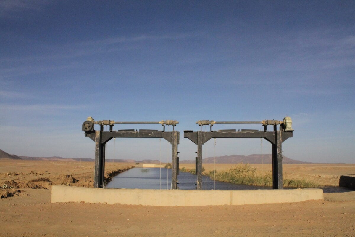
This patch of desert sits between Egypt and Sudan, and neither country wants it. Not because it’s particularly awful — though it is mostly empty sand and rocks — but because claiming it would mean giving up something much more valuable.
The problem starts with two different maps drawn by the British, who controlled both territories in the early 1900s. One map, from 1899, gave Egypt a much larger triangular area along the Red Sea coast called the Halaib Triangle, which has ports and some mineral deposits.
The other map, from 1902, gave Egypt this smaller desert rectangle called Bir Tawil instead. Each country now insists the map that gives them the valuable coastal area is the correct one.
And since you can’t have it both ways, they’re both perfectly happy to let the other country keep the worthless desert. So Bir Tawil has become one of the few places on Earth that no government actually claims.
A few eccentric individuals have tried to plant flags there and declare it their own kingdom, but none of these attempts have been recognized by anyone who matters.
The Korean Demilitarized Zone
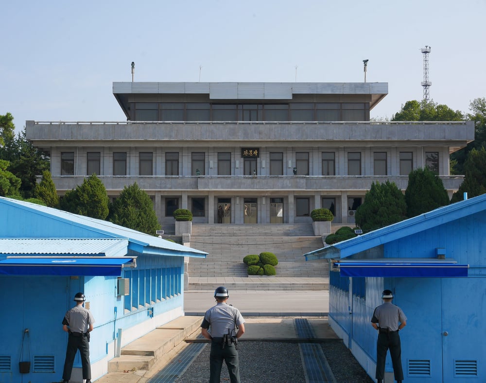
The most heavily militarized border in the world is called a “demilitarized zone,” which tells you everything about how well the Korean War actually ended. The DMZ isn’t just a line — it’s a 2.5-mile-wide strip of land that cuts across the entire Korean peninsula, watched by an estimated two million soldiers on both sides.
But here’s what nobody mentions in the history books: the exact placement of this border was determined by wherever the two armies happened to be standing when the armistice was signed in 1953. Not some carefully planned geographic boundary, not some historic territorial division — just wherever the fighting stopped on that particular day.
If the Chinese offensive had lasted one more week, or if MacArthur had held his ground a little longer, the border could be hundreds of miles north or south of where it ended up. The strangest part is what happened next.
Because nobody was allowed to set foot in the DMZ for decades, it accidentally became one of Asia’s most important wildlife preserves. Endangered cranes nest there now.
Wild boar roam freely between the minefields. There are forests full of trees that haven’t been touched by human hands since 1953.
The most dangerous border in the world has become an unintentional paradise for every species except humans.
Point Roberts, Washington
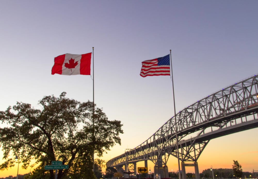
Point Roberts proves that sometimes following the rules creates bigger problems than breaking them would have. When British and American negotiators agreed that the border between Canada and the United States should run along the 49th parallel, they stuck to that decision even when it made absolutely no geographical sense.
The 49th parallel cuts right through a small peninsula that juts down from British Columbia into Puget Sound. The southern tip of this peninsula — about five square miles — ends up being American territory that you can only reach by driving through Canada.
There’s no ferry service, no bridge, no tunnel. If you live in Point Roberts and want to visit the rest of Washington State, you have to cross two international borders and drive through twenty miles of foreign country.
This setup creates problems that nobody anticipated in 1846. Kids who live in Point Roberts and want to attend high school have to cross into Canada every morning and then cross back into the United States to reach a school in Blaine, Washington.
The fire department has mutual aid agreements with Canadian firefighters because American fire trucks can’t get there fast enough in an emergency. During the COVID-19 pandemic, when the Canadian border was closed, Point Roberts was effectively cut off from the world — American delivery trucks couldn’t get through Canada, and Canadian services stopped at the border.
Cooch Behar
Before India’s independence, there were over 200 enclaves scattered around the border between Bengal and Cooch Behar — little islands of territory that belonged to one ruler but were completely surrounded by land controlled by another. These enclaves had enclaves inside them, and some of those had enclaves inside those.
The most complex was an Indian enclave inside a Bangladeshi enclave inside an Indian enclave inside Bangladesh. This absurdity started in the 18th century, when the Maharaja of Cooch Behar and the Nawab of Rangpur engaged in territorial disputes, trading control of villages, river valleys, and land parcels in a series of complex negotiations that created a fragmented border.
The territorial scramble continued for decades until the border looked like someone had thrown confetti at a map. People lived in these enclaves for generations without knowing which country they actually belonged to.
They couldn’t get passports, couldn’t vote, couldn’t receive government services. Children born in the wrong enclave couldn’t attend school. If you got sick and needed to reach a hospital, you might have to cross four different borders to get there.
India and Bangladesh finally cleaned up this mess in 2015, but it took 68 years after independence to sort out what two 18th-century rulers had scrambled in a few decades of competitive land-swapping.
The Medicine Line
The border between the United States and Canada west of the Great Lakes runs in a perfectly straight line for over 1,200 miles — which should tell you immediately that the people who drew it had never actually seen the terrain they were dividing. Native American tribes called it the Medicine Line, because it seemed to possess magical properties: American soldiers could chase you right up to it, but the moment you crossed over, you were untouchable.
This line was drawn by diplomats in London and Washington who were working from maps that were, to put it generously, more aspirational than accurate. They decided the border should follow the 49th parallel from the Rocky Mountains to the Pacific Ocean, which sounds reasonable until you realize that they had no idea what was actually located along the 49th parallel.
There were mountain ranges that weren’t on any map, rivers that were flowing in the wrong directions, and entire forests that cartographers had simply invented. When surveyors finally showed up to mark this border in the real world, they discovered that their perfectly straight line ran directly through lakes, over mountain peaks, and across rivers at the least convenient possible angles.
But they marked it anyway, because the diplomats had already shaken hands on it. So now there’s a 20-foot-wide clear-cut running through some of the most remote wilderness in North America, maintained by crews who have to helicopter in supplies because there are no roads within 50 miles of some sections.
Pheasant Island
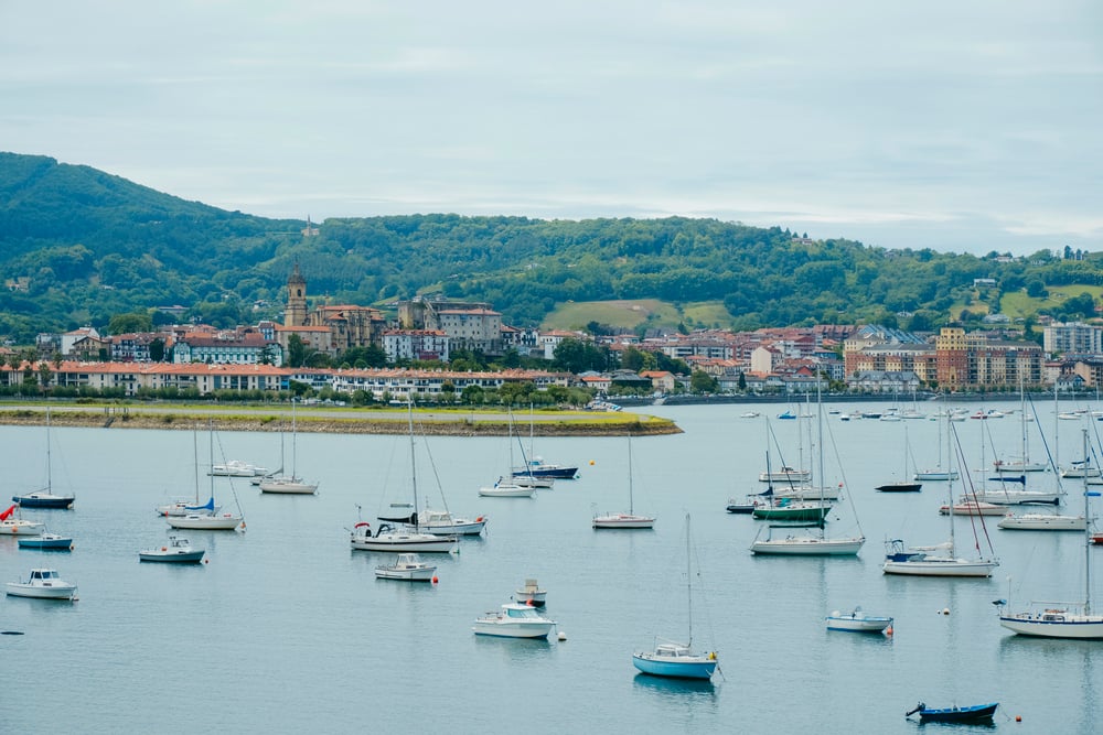
This tiny island in the Bidassoa River changes countries every six months, like clockwork. For half the year, it belongs to Spain.
For the other half, it belongs to France. This arrangement has been running smoothly since 1659, making it probably the most reliable diplomatic agreement in European history.
The island became a neutral meeting place during negotiations to end the Franco-Spanish War. Diplomats from both countries would row out to this little patch of land — it’s only about 200 yards long — to hammer out the details of the Treaty of the Pyrenees.
Since neither side wanted the other to have any advantage, they agreed that the island should belong to both of them, alternating control every six months. What’s remarkable isn’t the arrangement itself, but how seriously both countries have maintained it for over 350 years.
Every February 1st and August 1st, Spanish and French officials hold a brief ceremony to officially hand over the island. There’s no permanent population, no buildings, no economic value whatsoever — just a small piece of land that two countries have been sharing politely for longer than the United States has existed.
The Belgian Farmer
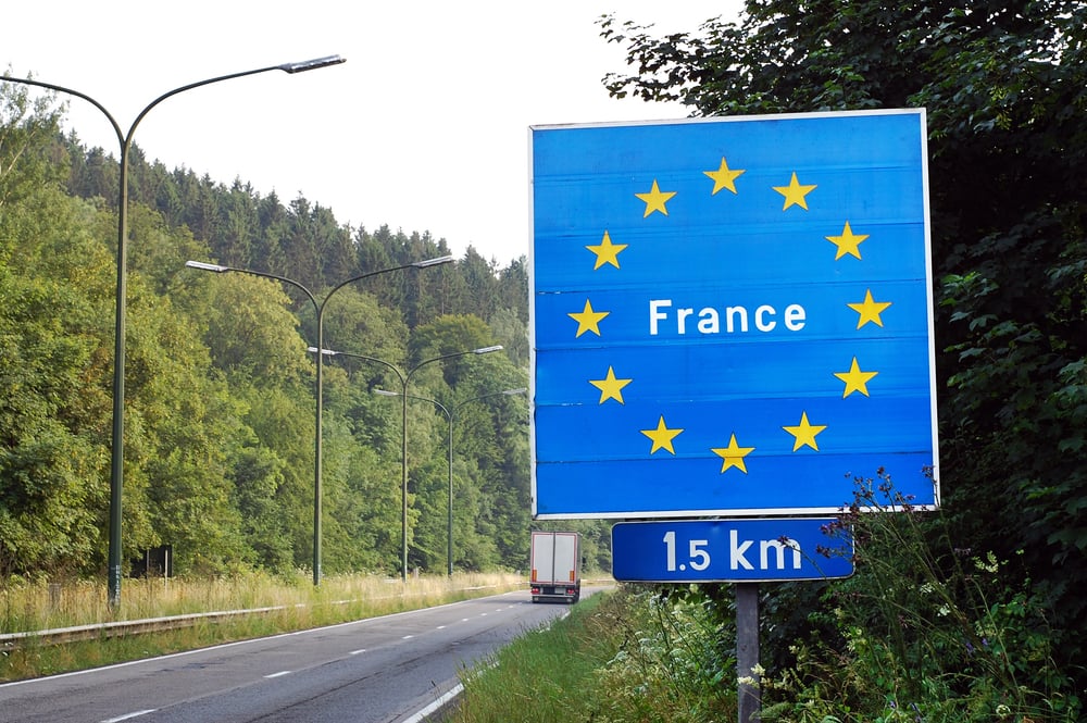
In 2021, a Belgian farmer moved a stone marker because it was getting in the way of his tractor. Reasonable enough — except that the stone marker was part of the official border between Belgium and France, and by moving it, he accidentally expanded Belgian territory by about 10 feet.
The border between these two countries has been precisely surveyed and marked since 1819, following Napoleon’s defeat at Waterloo. French and Belgian officials spent years walking every mile of the boundary, placing stone markers at regular intervals and carefully recording the exact position of each one.
This particular stone had been sitting in the same spot for over 200 years, quietly doing its job of separating two nations. But the farmer didn’t realize what he was moving.
He just saw a rock that was making it difficult to maneuver his equipment, so he pushed it a few feet into France to get it out of his way. Local historians noticed the change and alerted the authorities, who politely asked the farmer to move the stone back where it belonged.
He did, and the international incident was resolved without any diplomatic notes or emergency summit meetings — just a brief conversation between neighbors about property lines.
Haskell Free Library and Opera House
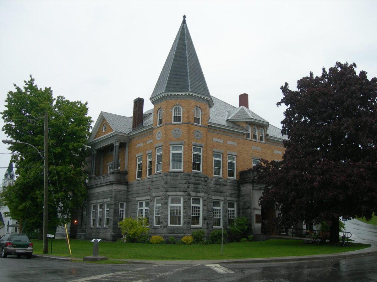
The border between the United States and Canada runs right through the middle of this building, dividing the stage from most of the audience seating. Performers technically stand in Canada while entertaining an audience that’s mostly sitting in the United States.
The building has two front doors — one opening onto a street in Stanstead, Quebec, and another opening onto a street in Derby Line, Vermont. This arrangement worked fine when it was built in 1904, because the border was more of a suggestion than a serious barrier.
People crossed back and forth to visit family, shop for groceries, or attend community events without thinking much about which country they were in at any given moment. The library’s collection was housed on both sides of the border, and patrons would wander from room to room without realizing they were technically entering and leaving two different nations.
Security changes after September 11th made this casual border-crossing much more complicated. Now there are motion sensors and cameras inside the building, and visitors are supposed to report to customs if they cross from one side to the other.
But the library staff has found practical workarounds: they’ve rearranged the book collection so that you can access most materials without actually crossing the border, and they’ve worked out agreements with both countries’ border agencies to allow cultural events to continue without requiring every audience member to show a passport.
Campione d’Italia
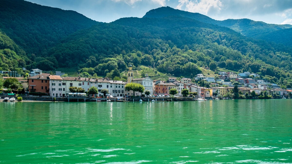
This tiny Italian town sits entirely inside Switzerland, surrounded on all sides by Swiss territory. It’s been Italian for over 500 years, but it uses Swiss currency, Swiss postal codes, and Swiss telephone numbers.
The police are Italian, but the firefighters are Swiss. Students attend Italian schools but often go to Swiss universities. It’s the kind of place that exists because history is messier than geography textbooks suggest.
Campione became Italian back when “Italy” was just a collection of city-states and kingdoms, and “Switzerland” was a loose confederation of mountain cantons. A local archbishop granted the territory to an Italian monastery in 777 AD, and various Italian rulers have held onto it ever since — through wars, political upheavals, and the formation of modern nation-states.
When Italy and Switzerland both became unified countries in the 19th century, Campione was already Italian, and nobody saw any reason to change it. The arrangement creates surreal daily situations.
People work in Swiss offices but live under Italian law. They shop with Swiss francs but vote in Italian elections.
The town’s economy depends heavily on its casino, which attracts Swiss visitors who want to gamble without leaving the country — except technically they are leaving the country, since Campione is Italian soil, but practically they’re not, since it’s surrounded by Switzerland and uses Swiss infrastructure.
The 45×90 Club
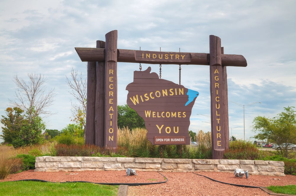
There’s a spot in Wisconsin where you can stand at exactly 45 degrees north latitude and 90 degrees west longitude — halfway between the equator and the North Pole, halfway between the Prime Meridian and the International Date Line. It’s marked with a small monument in the middle of a forest, and people drive for hours to take their picture there and join something called the 45×90 Club.
This perfectly precise geographic location sits right near the border between the United States and… well, nothing, actually. But it’s interesting because it shows how arbitrary our human borders really are when you compare them to the mathematical grid we’ve laid over the Earth.
The 45th parallel runs right through some of the most contentious borders in the world — between North and South Korea, between Russia and Mongolia, between the United States and Canada. But it also runs through places where borders make no difference at all, like this quiet forest in northern Wisconsin.
The monument itself was placed by a local surveyor who thought it would be interesting to mark the exact mathematical center of the northern and western hemispheres. There’s no border here, no international significance, no territorial dispute. Just a spot where the numbers line up neatly and people have decided that’s worth commemorating.
Neutral Moresnet
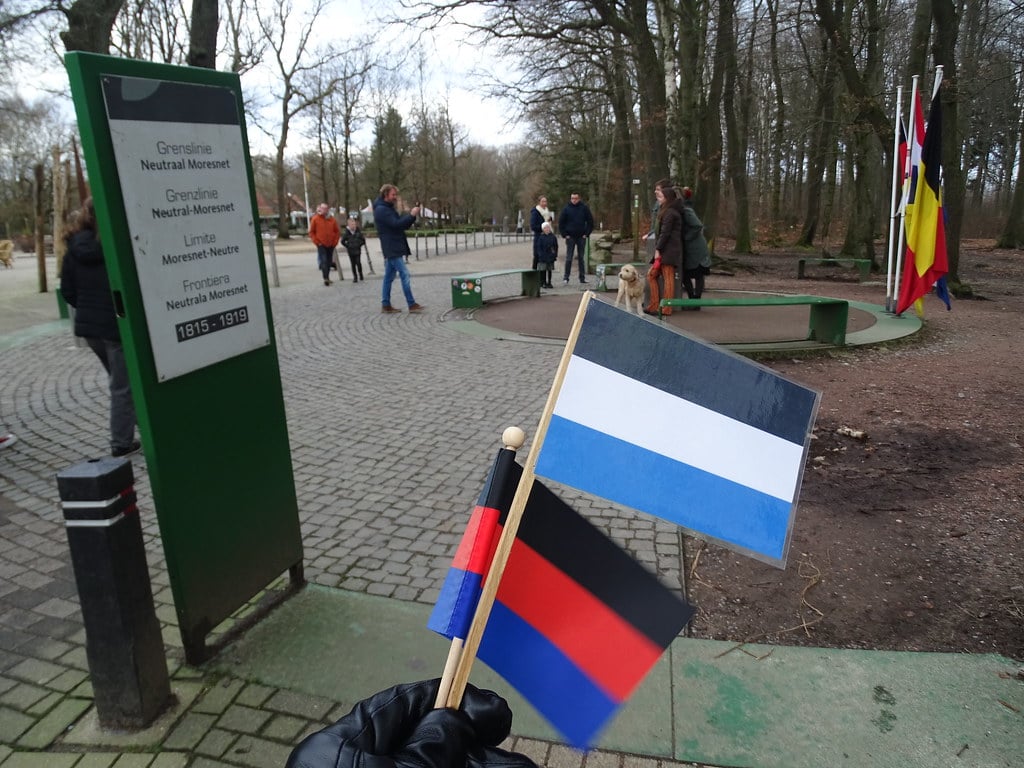
For over a century, there was a tiny country in Europe that existed solely because two larger countries couldn’t agree on how to divide up a zinc mine. When the Congress of Vienna was redrawing European borders after Napoleon’s defeat, Prussia and the Netherlands both wanted control of the lucrative Vieille Montagne mine near Aachen.
Since neither would back down, they created a 1.4-square-mile neutral territory that belonged to both of them and neither of them. This compromise worked better than anyone expected.
Neutral Moresnet developed its own identity, with residents who spoke a mixture of German, Dutch, and French and who became expert smugglers because they could move goods between countries without technically crossing any borders. The territory had no army, no taxes, and no real government beyond a jointly appointed mayor who mostly minded his own business.
The strangest chapter came in the early 1900s, when a local doctor decided that Neutral Moresnet should adopt Esperanto as its official language and become the world’s first Esperanto-speaking nation. He convinced enough residents to support the idea that they actually petitioned the Dutch and Prussian governments for permission to rename their country “Amikejo” (Place of Friendship) and establish it as an international demonstration of how artificial languages could promote world peace.
World War I ended the experiment before it could be officially approved, and the territory was eventually absorbed into Belgium.
Alaska’s Panhandle
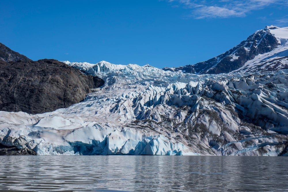
The most awkwardly shaped piece of territory in North America exists because of a 19th-century real estate deal that was negotiated by people who had never seen a detailed map of what they were buying and selling. When Russia sold Alaska to the United States in 1867, the boundary description included language about “following the summits of the mountains parallel to the coast” — which sounds precise until you realize that nobody involved in the negotiation had any idea what those mountains actually looked like or where their summits were located.
The problems became obvious when gold was discovered in the Klondike. Canada suddenly needed access to the sea to supply the gold rush, but the treaty language gave the United States control of a narrow strip of coastline that blocked Canadian access to deepwater ports.
Canadian negotiators argued that the border should follow the actual mountain peaks, which would have left several natural harbors under Canadian control. American negotiators insisted that the border should be drawn 10 marine leagues inland from the coast, regardless of where the mountains actually stood.
President Theodore Roosevelt eventually settled the dispute by appointing three Americans, two Canadians, and one British judge to an arbitration panel — and then privately informing the British judge that the United States would consider any ruling against American interests to be an act of hostility. The British judge voted with the Americans, Canada got shut out of the coastal harbors, and Alaska kept its bizarre panhandle shape that makes it impossible to drive from one part of the state to another without passing through Canada.
The Green Line
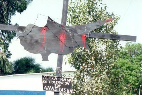
Cyprus has been divided by a “temporary” ceasefire line since 1974, patrolled by United Nations peacekeepers who were supposed to maintain the separation for a few months while diplomats worked out a permanent solution. That was nearly 50 years ago, and the diplomats are still working.
The Green Line — named for the green pencil that a British officer used to draw it on a map of Nicosia — cuts right through the capital city, dividing neighborhoods that had been integrated for centuries. There are streets where Greek Cypriots live on one side and Turkish Cypriots live on the other, separated by barbed wire and UN observation posts.
The old Nicosia airport sits in the buffer zone, abandoned since 1974, with passenger jets still parked on the tarmac where they were left when the fighting started. What makes this border particularly strange is how frozen in time everything has become.
The UN buffer zone preserves not just the 1974 ceasefire line, but also the 1974 world — buildings that were damaged in the fighting have never been repaired, cars that were abandoned during the evacuation are still rusting in
More from Go2Tutors!

- The Romanov Crown Jewels and Their Tragic Fate
- 13 Historical Mysteries That Science Still Can’t Solve
- Famous Hoaxes That Fooled the World for Years
- 15 Child Stars with Tragic Adult Lives
- 16 Famous Jewelry Pieces in History
Like Go2Tutors’s content? Follow us on MSN.