16 Bizarre Country Borders That Make Absolutely No Sense
Maps are supposed to make things clearer, but sometimes they just raise more questions. Look closely at any world atlas and certain borders will make you wonder what the cartographers were thinking — or if they were thinking at all.
Some boundaries slice through the middle of houses, others create tiny isolated pockets of one country trapped inside another, and a few seem to have been drawn by someone with a particularly twisted sense of humor.
These aren’t just quirky lines on paper. Real people live with these geographic puzzles every day, dealing with customs checks in their backyards and needing passports to visit their neighbors.
The stories behind these borders reveal centuries of political wheeling and dealing, wartime chaos, and the occasional bureaucratic decision that nobody bothered to think through.
India And Bangladesh

The border between India and Bangladesh used to be a geographic nightmare that defied all logic. Before a 2015 land swap agreement finally cleaned things up, this boundary contained 162 enclaves — tiny pockets of one country completely surrounded by the other.
Some enclaves were so small you could walk across them in five minutes, yet they required international travel to reach from their own homeland.
The most absurd part was the counter-enclaves: pieces of India inside pieces of Bangladesh that were themselves inside India. One unlucky spot called Dahala Khagrabari was a third-order enclave — Indian territory inside a Bangladeshi enclave inside an Indian enclave inside Bangladesh.
Residents needed to cross four international borders just to reach their own country’s mainland.
Belgium And The Netherlands

Baarle-Hertog and Baarle-Nassau represent what happens when medieval land deals go completely off the rails — and when (because nobody really wants to deal with the paperwork involved) modern governments decide to just live with the mess rather than fix it. The Belgian town of Baarle-Hertog exists as 22 separate pieces scattered throughout the Dutch town of Baarle-Nassau, creating a jigsaw puzzle where some buildings straddle the international border and change countries depending on which room you’re standing in.
So restaurant owners hang two different national flags outside their doors, and customers might eat appetizers in Belgium while having dessert in the Netherlands.
But here’s where it gets properly strange: some Belgian enclaves contain Dutch enclaves, which means you can stand in the Netherlands, inside Belgium, inside the Netherlands.
The postal system gave up trying to make sense of it all and just delivers mail based on house numbers rather than attempting to track which country each address technically belongs to.
Point Roberts, Washington

Point Roberts sits like a geographical afterthought dangling below the 49th parallel, a small American peninsula that can only be reached by land through Canada. This five-square-mile community exists because treaty negotiators in 1846 drew a straight line across the continent without bothering to check what that line would actually cut through.
The result feels like a cartographer’s practical joke.
Residents need to drive through two international border crossings just to buy groceries in the rest of Washington State.
Before 9/11, people treated the borders casually — kids would bike between countries to visit friends, and ambulances could cross freely in emergencies.
Now the community lives with the strange reality of being more connected to Canada than to their own country, yet legally unable to access Canadian services like healthcare.
Italy And Switzerland
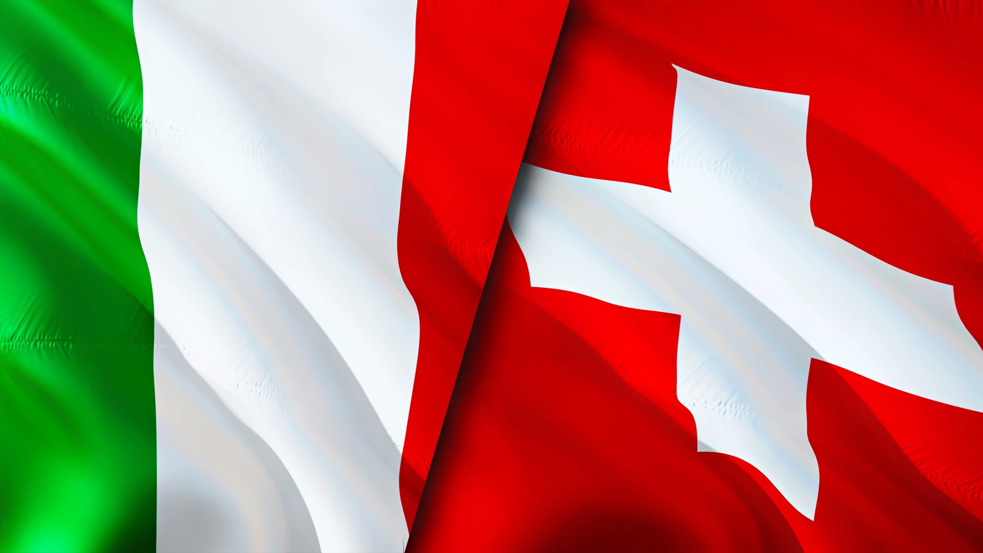
The border between Italy and Switzerland has spent the last century slowly creeping northward, and nobody bothered to tell the ski resorts. Climate change keeps melting the glaciers that mark the official boundary, which means the border literally moves uphill as the ice disappears, and what was Italian territory last year might be Swiss territory today.
This creates the peculiar problem of ski lifts and mountain restaurants that change nationality without changing location.
The Theodul Glacier area has become a bureaucratic puzzle where the same hiking trail can cross between countries multiple times in a single afternoon, and border markers need to be repositioned every few years to keep up with the melting ice.
Spain And Morocco

Ceuta and Melilla are Spanish cities sitting on the North African coast, completely surrounded by Morocco — and they’ve been there for over 500 years. These aren’t recent colonial holdouts or temporary arrangements; they’re fully integrated Spanish municipalities that happen to exist in Africa, complete with Spanish architecture, Spanish street signs, and Spanish post offices.
Walking through Ceuta means stepping from African soil directly into European Union territory without crossing any water.
The cities are protected by some of the world’s most fortified borders, with multiple layers of fencing designed to keep out migrants trying to reach Europe.
The contrast is jarring: medieval Spanish fortresses overlooking Moroccan neighborhoods, with razor wire marking where Europe begins and Africa ends.
United States And Canada

The border between Alaska and Canada cuts through the middle of the Yukon Territory like someone took a ruler to the map without consulting the terrain. This particular line exists because of a boundary dispute that got resolved through international arbitration in 1903, but the arbitrators apparently never visited the region they were dividing.
The result is a border that ignores rivers, mountains, and common sense.
It slices through the middle of watersheds and forces the Yukon River to cross between countries multiple times.
In some places, the boundary runs so close to Canadian communities that residents can see Alaska from their kitchen windows, but reaching it requires a detour of hundreds of miles through wilderness.
Germany, Belgium, And Netherlands

There’s something almost poetic about the spot where Germany, Belgium, and the Netherlands meet — three countries converging at a single point marked by a small monument that tourists pose with, one foot in each nation. But the poetry gets complicated when you realize this tripoint has moved several times throughout history (depending on which war just ended and who won) and the current borders still don’t make geographical sense.
The area around the tripoint resembles a gerrymandered voting district more than a natural boundary.
Dutch territory wraps around German villages in ways that require careful map-reading to navigate, and some roads switch between countries so frequently that border signs would create more confusion than clarity.
Local residents have largely given up trying to keep track of which country they’re technically standing in at any given moment.
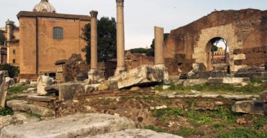
San Marino And Italy

San Marino exists as the world’s fifth-smallest country, completely surrounded by Italy and smaller than most major airports. This ancient republic has maintained its independence for over 1,700 years through a combination of diplomatic skill, geographic isolation, and the fact that conquering it would create more problems than benefits for any potential invader.
The border between San Marino and Italy runs along mountain ridges and through valleys in ways that seem almost deliberately confusing.
Some Italian towns sit higher in elevation than parts of San Marino, which creates the odd situation of looking down from Italy into an independent country.
The postal system operates independently, the currency is different, and customs regulations apply, all within an area you can drive across in twenty minutes.
Vatican City And Italy
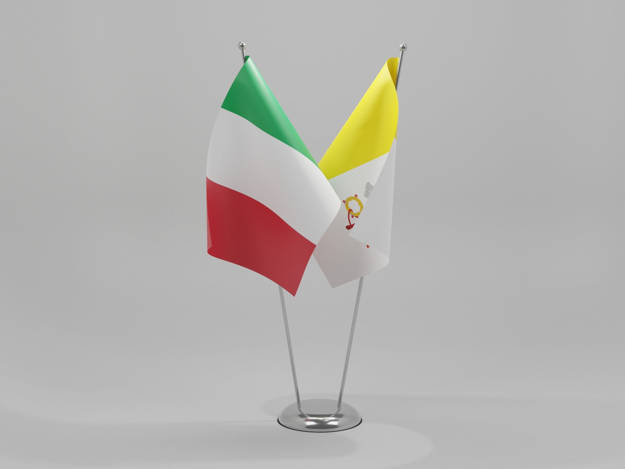
Vatican City represents the ultimate example of a border that exists purely for political reasons rather than geographic ones. At 0.17 square miles, it’s smaller than most shopping malls, yet it maintains complete sovereignty within the city of Rome, complete with its own postal system, railway station, and security force.
The Vatican’s border consists mainly of medieval walls and a white line painted on St. Peter’s Square, marking where Italy ends and the Holy See begins.
Swiss Guards in Renaissance uniforms check passports a few hundred yards from Roman traffic cops directing Italian buses.
The juxtaposition creates one of the world’s shortest international borders and certainly the only one where crossing requires walking past Bernini sculptures.
Cyprus

Cyprus has been divided since 1974, creating a border that exists primarily in the minds of politicians rather than on the ground. The Green Line cuts through the capital city of Nicosia, turning it into the world’s last divided capital, where Greek Cypriots and Turkish Cypriots live within walking distance but in different countries.
The border itself is maintained by United Nations peacekeepers patrolling a buffer zone that includes abandoned buildings, empty lots, and even a former airport frozen in time since the division began.
Some streets end abruptly at concrete barriers, and buildings that once housed single families now sit split between two nations.
The Ledra Street crossing allows people to walk from the Republic of Cyprus to the Turkish Republic of Northern Cyprus in less than five minutes, but they need passports for the journey.
Russia And Norway

The border between Russia and Norway in the Arctic represents one of the world’s most carefully maintained boundaries, despite running through territory where nobody lives and few people ever visit. This remote frontier cuts through reindeer migration routes and requires both countries to maintain border stations in places where the nearest town is hundreds of miles away.
The Norwegians and Russians have turned border maintenance into an art form in this region, with precisely surveyed markers placed across tundra that looks identical on both sides.
Reindeer don’t recognize international boundaries, which creates the ongoing diplomatic challenge of managing herds that wander between countries following migration patterns established long before borders existed.
Argentina And Chile

The Andes Mountains seem like a natural border between Argentina and Chile, but the actual boundary line was drawn by negotiators who apparently never tried to climb the peaks they were dividing. The border zigzags across mountain ranges in ways that place some Chilean territory on the eastern slopes of the Andes and some Argentine territory on the western slopes.
This creates communities that can only reach their own country by crossing international borders and mountain passes that require travel through the neighboring nation.
The town of Los Andes in Chile sits closer to Argentine cities than to Santiago, and some Argentine villages have better road connections to Chilean ports than to Buenos Aires.
Winter weather can cut off these communities entirely, leaving them more isolated from their own countries than from their neighbors.
Denmark And Sweden

The border between Denmark and Sweden runs through the middle of the Øresund strait, creating an international boundary that exists mostly underwater. The Øresund Bridge connects the two countries with a structure that includes both a bridge and a tunnel, which means traffic drives from Denmark to an artificial island, then through a tunnel under Swedish waters, then emerges in Sweden.
But the border gets more complicated in the medieval city centers where Danish and Swedish territories were historically mixed together.
Some buildings that predate the modern border arrangement technically sit in both countries, and old property records reference estates that included land on both sides of what’s now an international boundary.
India And Pakistan
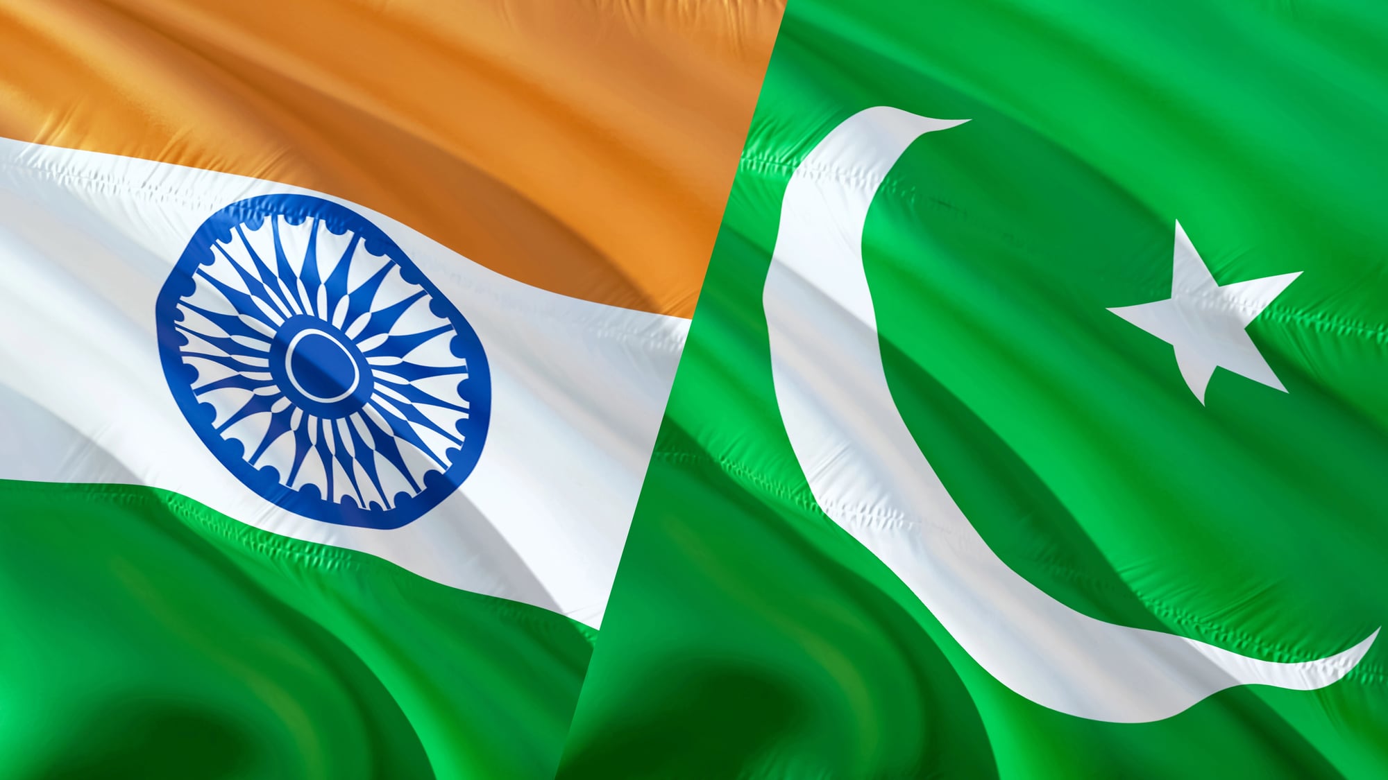
The border between India and Pakistan at Wagah represents one of the world’s most theatrical international boundaries. Every evening, guards from both countries perform an elaborate ceremony of competitive strutting, high kicks, and synchronized gate-closing that draws crowds of tourists who come to watch nationalism turned into performance art.
The ceremony itself is less bizarre than the border’s history.
The line was drawn in 1947 by a British lawyer who had never been to India before and was given just five weeks to divide the subcontinent.
The resulting boundary cuts through the middle of Punjab, separating communities that had been connected for centuries and creating a border that makes cultural sense to nobody who actually lives near it.
Egypt And Sudan
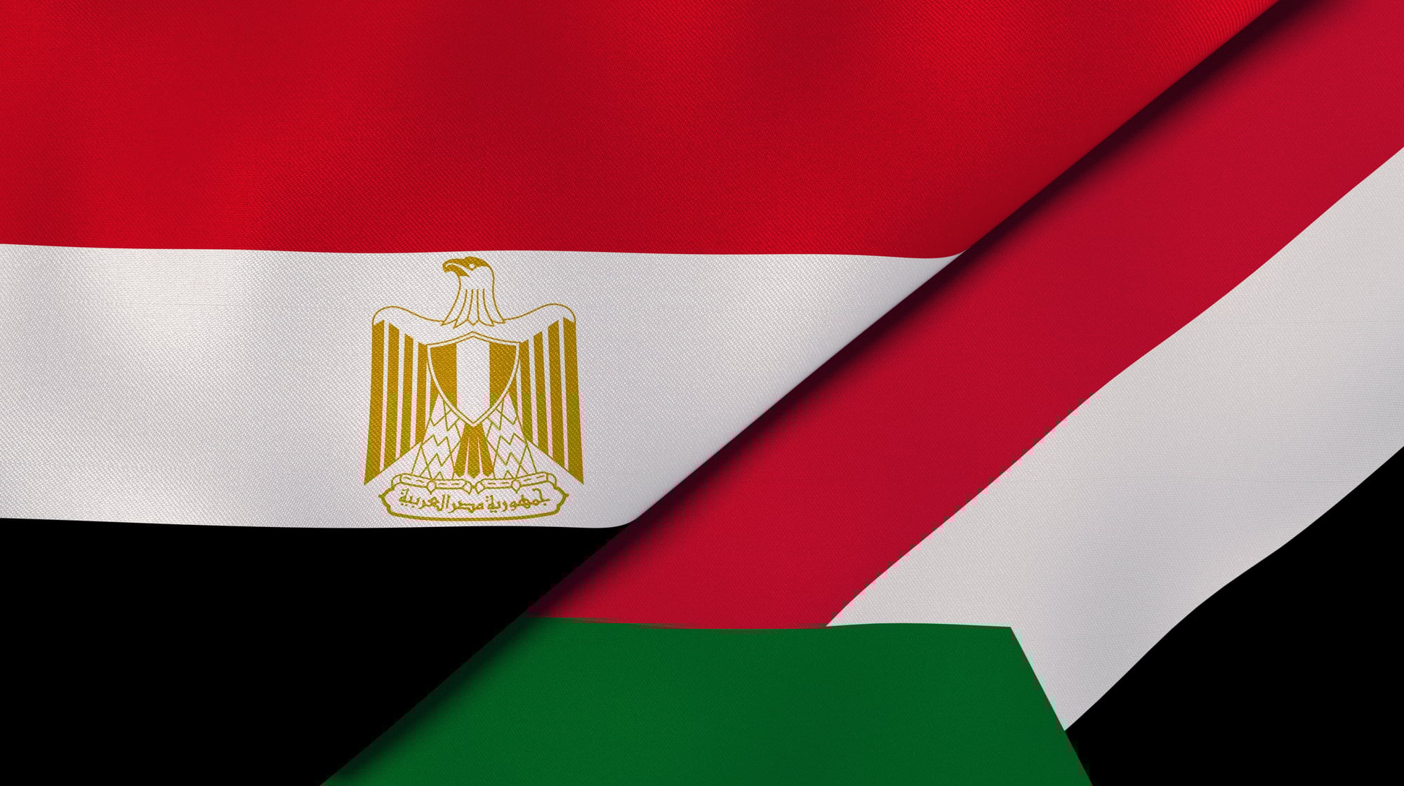
The border between Egypt and Sudan includes two areas that both countries claim and one area that neither country wants. The Hala’ib Triangle is administered by Egypt but claimed by Sudan, while the Bir Tawil area is claimed by neither country, making it one of the few places on Earth that no government wants to govern.
This creates the peculiar situation where Bir Tawil remains unclaimed territory — not because it’s inaccessible or worthless, but because claiming it would weaken each country’s legal position regarding the much more valuable Hala’ib Triangle.
The result is a patch of African desert that exists in legal limbo, technically belonging to nobody.
France And Switzerland

The border between France and Switzerland runs through the middle of Geneva’s airport, which means international travelers can accidentally walk between countries while looking for their departure gate. The French and Swiss sides of the airport operate under different customs and immigration rules, but the building itself straddles the border in ways that can confuse even experienced travelers.
Some airport employees live in France but work in Switzerland, or vice versa, which creates daily commutes that involve crossing international borders to get to work.
The duty-free shops operate under special agreements that allow them to sell to passengers traveling between countries that are technically already part of the same customs union.
The Geometry Of Power

Borders reveal more about human stubbornness than geographic logic. These lines persist not because they make sense, but because changing them requires admitting that someone made a mistake — and nobody wants to be the one to redraw maps that have been official for decades or centuries.
The people living with these bizarre boundaries have mostly figured out workarounds.
They’ve learned which roads to take to avoid customs checks, how to shop for groceries in multiple countries, and when to carry their passports to visit neighbors.
Geography might be destiny, but bureaucracy is eternal.
More from Go2Tutors!

- The Romanov Crown Jewels and Their Tragic Fate
- 13 Historical Mysteries That Science Still Can’t Solve
- Famous Hoaxes That Fooled the World for Years
- 15 Child Stars with Tragic Adult Lives
- 16 Famous Jewelry Pieces in History
Like Go2Tutors’s content? Follow us on MSN.