18 Geographic Anomalies That Don’t Make Sense
Picture this: you’re looking at a map, maybe planning a road trip or just daydreaming about distant places, when something catches your eye. A city that seems impossibly far from where it should be.
A river flowing the wrong direction. A piece of one country sitting inside another like a geographical puzzle piece that got mixed up with the wrong box.
These aren’t mapping errors or outdated atlases. They’re real places where geography seems to have thrown logic out the window and decided to get creative instead.
Some happened because of ancient rivers carving unexpected paths. Others exist because politicians drew lines on maps without bothering to check what was actually on the ground.
A few are just nature being stubborn about following the rules everyone else agreed on.
Point Roberts, Washington
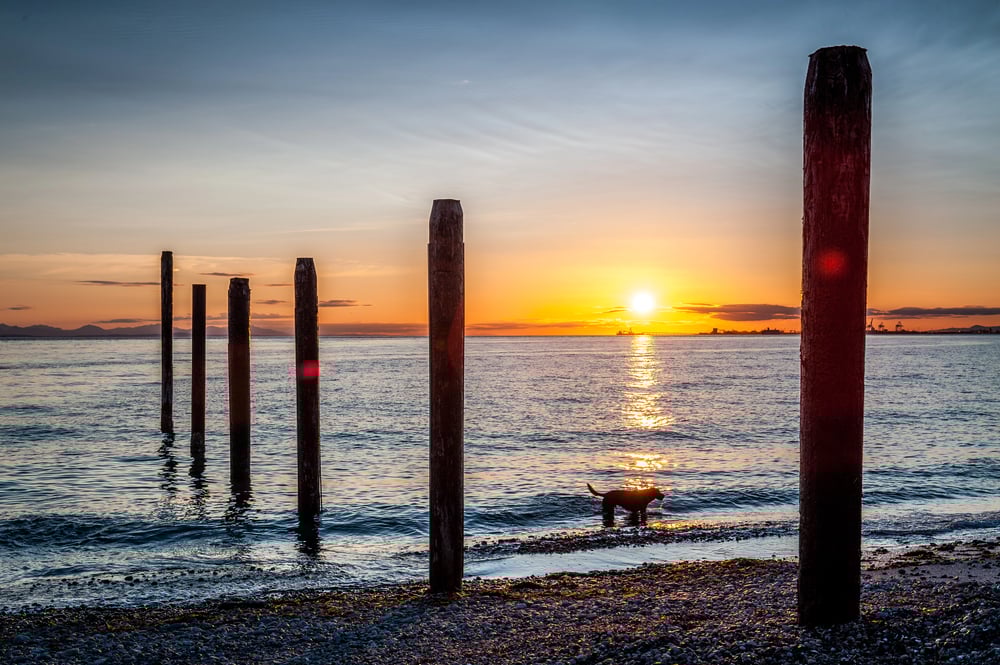
Point Roberts sits at the bottom of a Canadian peninsula, cut off from the rest of Washington State by the 49th parallel. To get there from anywhere else in the US, you have to cross through Canada twice.
The 1,200 residents deal with this geographic hiccup daily. Groceries come from Canada (because it’s closer), but they pay Washington taxes.
Kids ride the bus through two international border crossings just to get to school. During COVID-19 border closures, the place turned into an accidental island where Americans couldn’t reach other Americans without breaking international law.
Baarle-Nassau en Baarle-Hertog
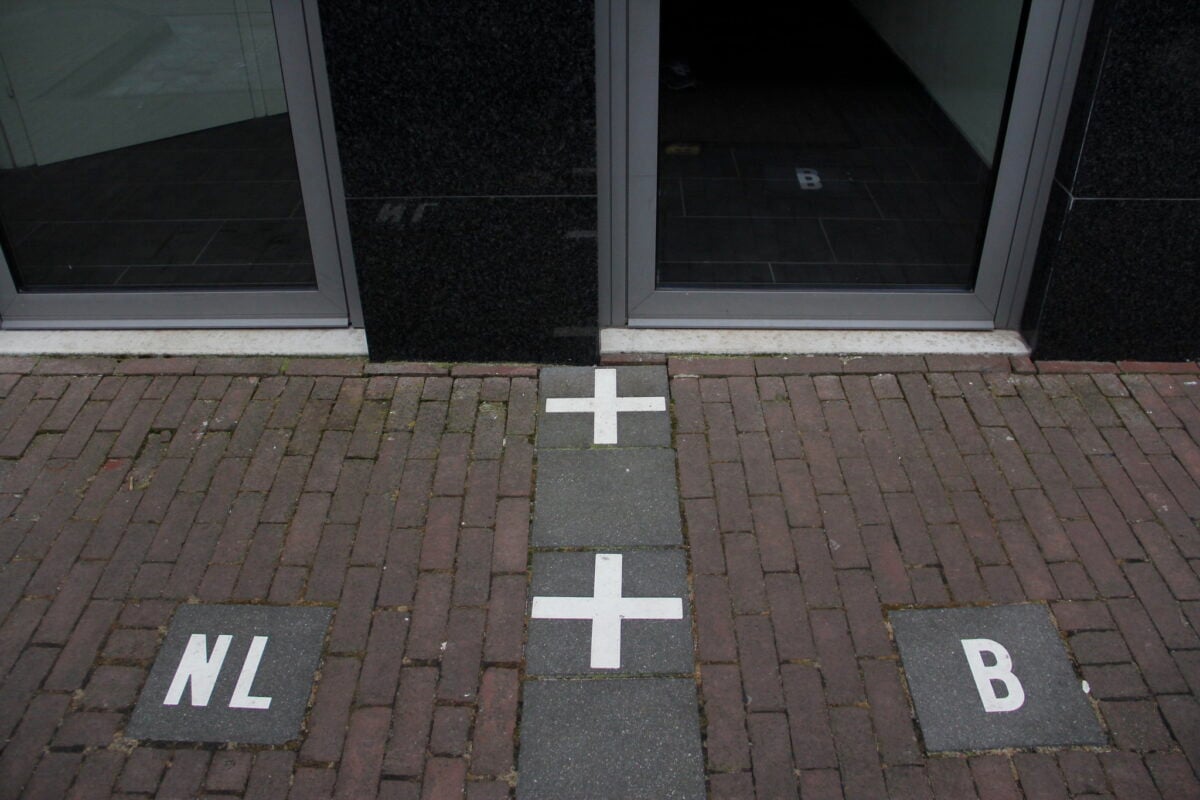
Here’s where the medieval world collided with modern border drawing (and frankly, nobody bothered to clean up the mess afterward), creating a jigsaw puzzle of Dutch and Belgian territory that would make a cartographer weep—or quit their job entirely. Baarle-Nassau belongs to the Netherlands, but it contains approximately 7-8 Belgian enclaves of Baarle-Hertog, some of which contain Dutch enclaves, because apparently someone in the Middle Ages had a sense of humor about property lines and wanted to see how confused they could make people 800 years later.
So you can literally eat lunch in Belgium, walk across the street for coffee in the Netherlands, then return to Belgium to use the bathroom. Which is saying something.
The tax implications alone would drive anyone to drink, but the locals have adapted: restaurants straddle the border so diners can choose which country’s tax rate they prefer, shops display both currencies, and wedding ceremonies require careful attention to exactly which square foot of floor you’re standing on when you say “I do.”
Alaska’s Position
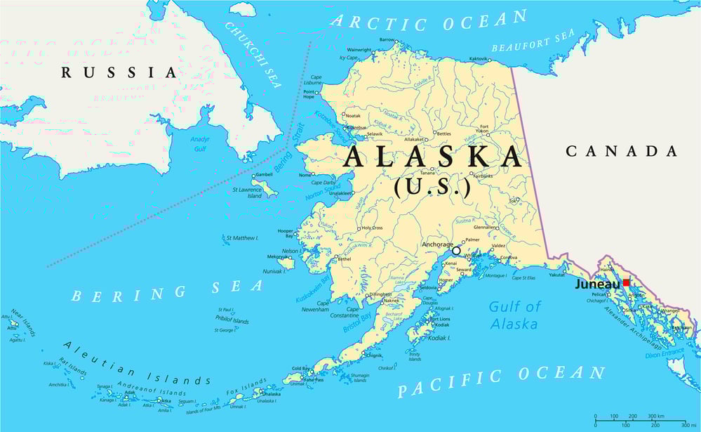
Alaska is closer to Russia than it is to the contiguous United States. The state that Americans think of as their frozen northern frontier is actually hanging out next to Siberia, separated by just 55 miles of water at the Bering Strait.
This creates some delightful confusion about time zones, weather patterns, and basic geography. Alaska’s Aleutian Islands actually cross the International Date Line, which means part of Alaska is technically in tomorrow compared to the rest of America.
Meanwhile, on clear days, you can see Russia from certain points in Alaska, which sounds like a political joke but is actually just an accident of continental drift and ice age geography.
Michigan’s Upper Peninsula
Michigan’s Upper Peninsula feels like geography’s version of a participation trophy—you can have this remote, disconnected piece of wilderness, but don’t expect it to make sense with the rest of your state. The UP (as locals call it) shares exactly zero land borders with lower Michigan; instead, it’s attached to Wisconsin and sits across a body of water from the rest of the state, as if someone placed it there temporarily and forgot to move it to a more logical location.
What makes this even stranger is that Michigan only got the UP as consolation prize: when Michigan and Ohio were fighting over Toledo in the 1830s, Congress basically said “fine, Michigan can’t have Toledo, but here’s this random chunk of wilderness up north that nobody else wants,” which seemed like a terrible deal until someone discovered iron ore and copper up there, turning the geographical booby prize into an economic jackpot.
The bridge connecting the two parts wasn’t built until 1957, which means for over a century, Michiganders had to travel through other states to reach other parts of their own state—assuming they wanted to make the trip at all, since most people in lower Michigan treated the UP like a distant relative they acknowledged at family reunions but didn’t really know.
Kaliningrad
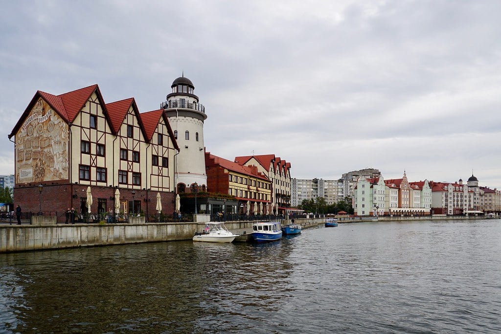
Kaliningrad exists as if someone took a piece of Russia, picked it up, and dropped it 200 miles away, surrounded entirely by NATO countries. This Russian exclave sits between Poland and Lithuania, completely disconnected from the rest of Russia, like a geographical afterthought that nobody knew what to do with.
The region became Russian after World War II, when the Soviet Union claimed it from Germany. But here’s the thing about claiming territory in the middle of other countries: it gets complicated fast.
Russians living there need to travel through foreign nations to visit their own homeland. The European Union surrounds them completely. Military supply lines stretch across unfriendly territory.
It’s strategic in theory, awkward in practice, and geographically absurd by any measure.
Kentucky Bend
Kentucky Bend is a tiny piece of Kentucky that can only be reached by land through Tennessee. The Mississippi River changed course after Kentucky’s borders were drawn, leaving this 17-square-mile bubble stranded on the wrong side of the water.
Eighteen people live there. They have Kentucky mailing addresses but shop in Tennessee.
Their children go to Tennessee schools because that’s the only way to get there without crossing state lines through Missouri. The entire situation exists because rivers don’t respect state boundaries, and state boundaries don’t adapt when rivers decide to take new paths.
Gibraltar’s Airport Runway
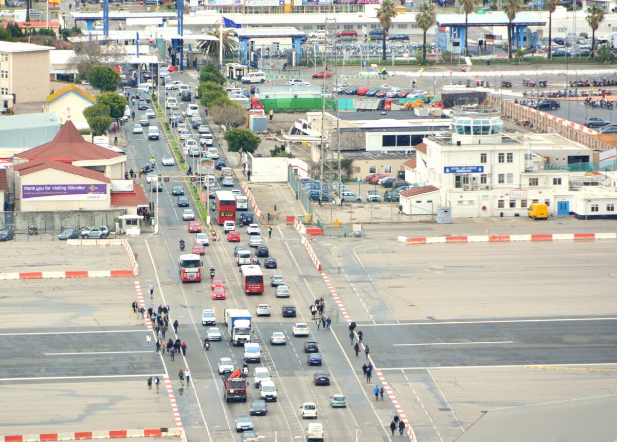
Winston Churchill Avenue—Gibraltar’s main road connecting Spain to the city center—crosses directly through the airport runway. Every time a plane takes off or lands, cars stop and wait. Every time someone needs to drive across town, planes wait.
It’s like someone designed a transportation system as a practical joke (though the real reason is that Gibraltar is basically a large rock with limited flat space, and sometimes you have to choose between putting the runway where the road is or putting the road where the runway is, and apparently nobody wanted to choose). Traffic lights control both cars and aircraft. Pedestrians walk across active runways to catch their flights.
The whole arrangement works because Gibraltar is small enough that everyone just agrees to take turns using the same piece of asphalt.
The Four Corners Monument
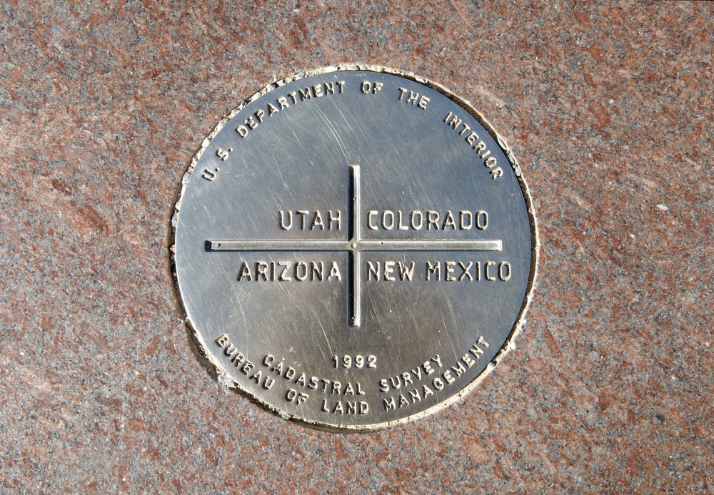
The Four Corners Monument marks the only place in the United States where four states meet at a single point. Colorado, Utah, Arizona, and New Mexico converge in perfect geometric harmony, allowing tourists to stand in four states simultaneously.
Except the monument is in the wrong place. The actual four corners intersection sits about 2,400 feet away, in a spot marked by nothing more than surveying equipment and prairie grass.
The monument sits where early surveyors thought the borders should meet, based on measurements that turned out to be slightly off. But nobody wants to move a famous tourist attraction because of a technicality that most visitors don’t know about anyway.
Delaware’s Unique Shape
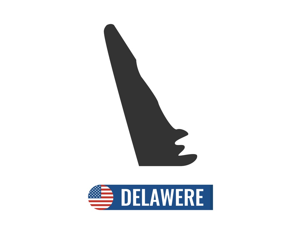
Delaware looks like someone started drawing a normal state shape, got distracted halfway through, and just connected the remaining lines with a ruler. The northern border forms a perfect circle segment around Wilmington, creating the only circular state boundary in America.
This happened because the Dutch wanted to keep Wilmington within Delaware’s borders, so they drew a 12-mile radius around the city and called it a day. The result is a state that looks like a geometric exercise rather than a natural political boundary.
Pennsylvania’s southern border has a corresponding circular bite taken out of it, creating two states that fit together like puzzle pieces designed by someone who only owned a compass and a straight edge.
Northwest Angle, Minnesota
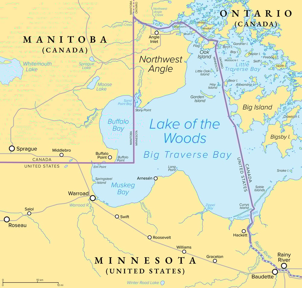
The Northwest Angle is the northernmost point of the contiguous United States, and it belongs to Minnesota despite being completely separated from Minnesota by water and Canadian territory. You can only reach it by driving through Canada or taking a boat across Lake of the Woods.
About 120 people live there, making it one of the most isolated communities in America (which creates an interesting situation where American schoolchildren need Canadian passports to attend American schools, American mail gets delivered through Canadian postal routes, and American cell phone service comes from Canadian towers because that’s what’s closest, meaning your phone bill treats calls to the rest of Minnesota like international roaming).
The whole thing exists because treaty negotiators in 1783 used a map that showed Lake of the Woods as much smaller than it actually is, and when the real borders got surveyed decades later, this little chunk of America ended up on the wrong side of everything.
Campione d’Italia
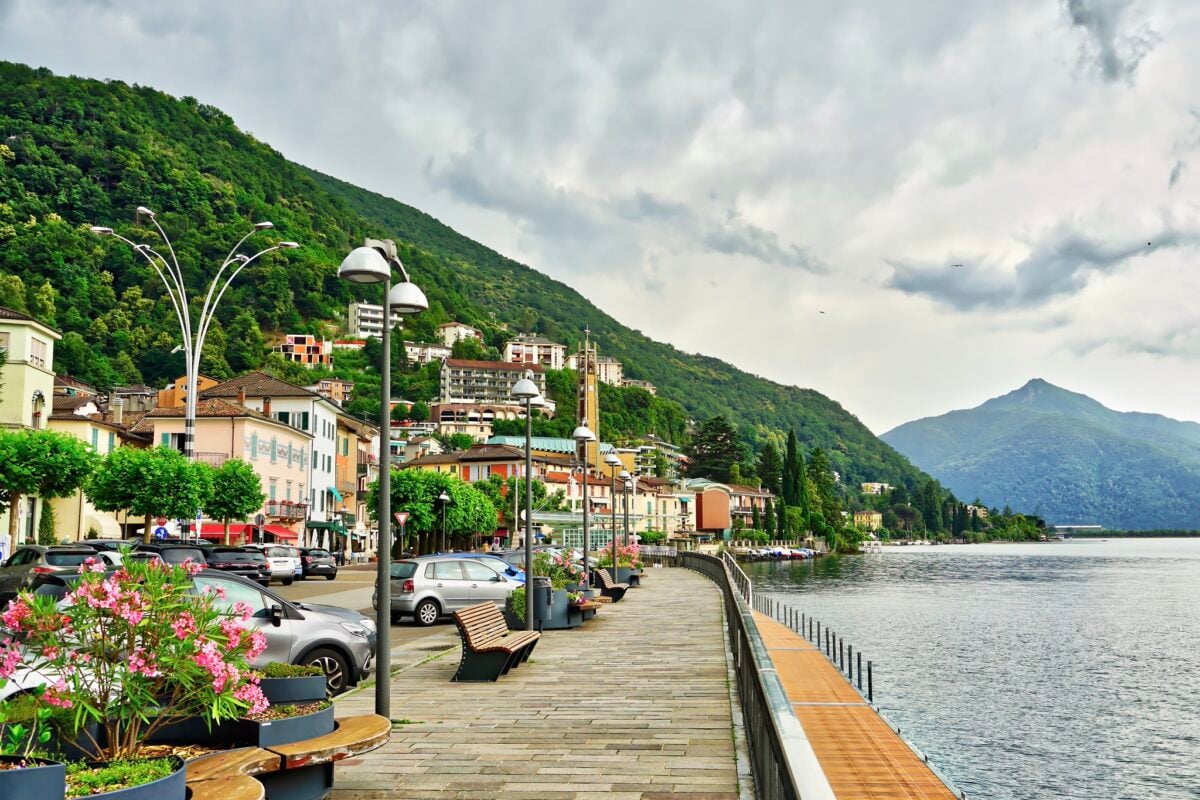
Campione d’Italia is an Italian town completely surrounded by Switzerland, where residents use Swiss currency, Swiss postal services, and Swiss telephone systems, but remain Italian citizens who vote in Italian elections and pay Italian taxes. It’s Europe’s version of geographical confusion made permanent.
The town exists in a regulatory twilight zone. Italian laws technically apply, but Swiss infrastructure runs everything.
Residents need to travel through Switzerland to reach the rest of Italy. The casino operates under Italian gaming laws but accepts only Swiss francs.
Emergency services come from Switzerland, but legal disputes get resolved in Italian courts. The entire arrangement works because everyone involved has agreed to ignore how little sense it makes.
Staten Island’s Location
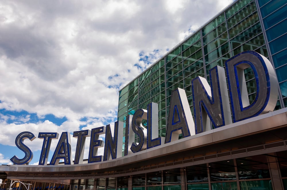
Staten Island belongs to New York but sits much closer to New Jersey. The Verrazzano-Narrows Bridge connects it to Brooklyn, but New Jersey is right there across a narrow channel, close enough that residents can wave to people in another state from their backyard.
This proximity creates daily weirdness. Many Staten Island residents work in New Jersey but live in New York.
They can see New Jersey from their windows but need to travel through Brooklyn and Manhattan to reach most of New York State. The ferry to Manhattan takes longer than driving to New Jersey.
Geography suggests Staten Island should belong to New Jersey, but history, politics, and stubborn adherence to old boundaries keep it firmly planted in New York.
Hyder, Alaska
Hyder sits at the end of a Canadian fjord, accessible only by driving through British Columbia. The 87 residents use Canadian currency, Canadian time zones, and Canadian area codes, but they’re Americans living in Alaska.
The town has no US border station because there’s nowhere to go from Hyder except back into Canada. Residents shop in Stewart, British Columbia, because it’s the closest town with actual stores.
Children attend Canadian schools. Mail gets delivered through the Canadian postal system. Hyder exists in administrative limbo, officially American but practically Canadian by necessity and geography.
Lesotho
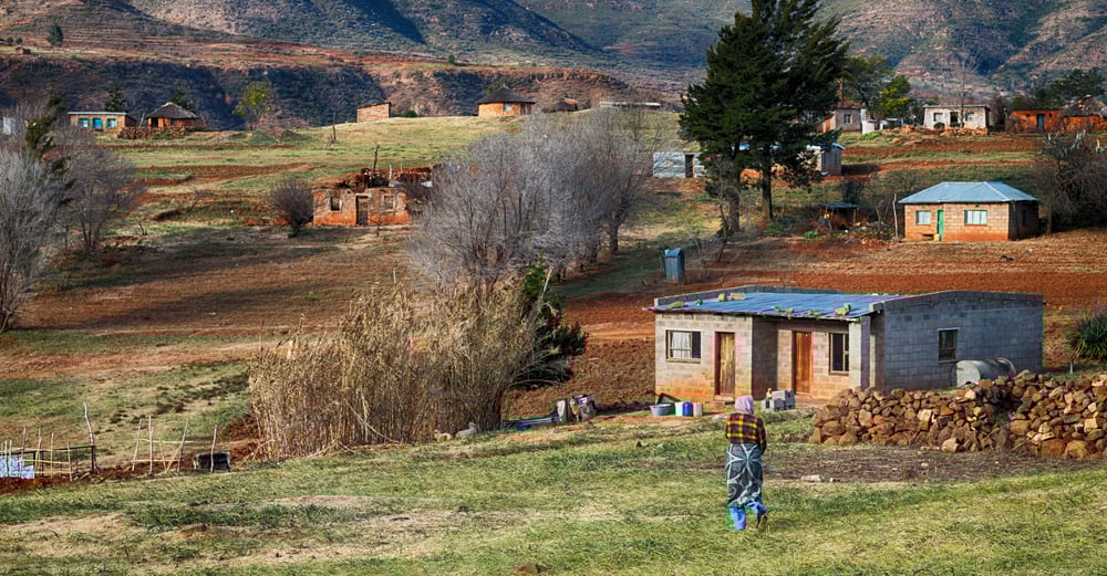
Lesotho is completely surrounded by South Africa, making it one of only three countries in the world entirely enclosed by another country. It’s like South Africa with a pit in the middle, filled by a completely different nation with its own government, currency, and culture.
The arrangement creates endless logistical challenges. All of Lesotho’s imports and exports must pass through South Africa.
Economic policies in South Africa directly affect daily life in Lesotho, despite Lesotho having no say in those policies. Citizens of Lesotho can travel to other African countries, but only by first getting permission to cross South Africa.
Its political independence is constrained by geographical reality.
Vatican City
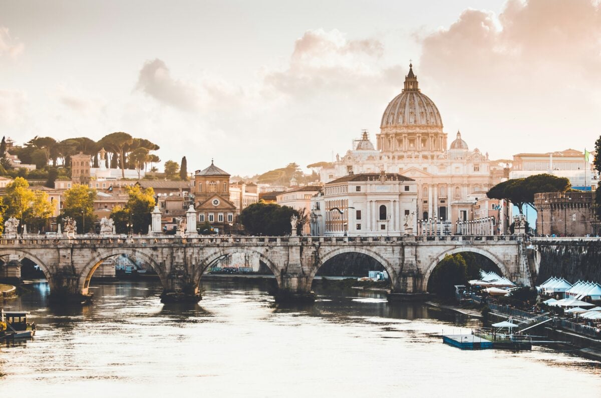
Vatican City occupies 109 acres in the middle of Rome, making it the smallest sovereign nation on Earth. It has its own postal system, railway station, and radio station, all crammed into a space smaller than most shopping malls.
The Vatican issues its own euros, operates its own telephone system, and maintains diplomatic relations with 183 countries from an area you could walk across in 20 minutes. It’s a fully functional nation-state that happens to be smaller than some city parks.
The Swiss Guard provides national defense for a country that’s smaller than the Pentagon parking lot. Papal elections determine the head of state for a nation that most tourists see in its entirety during a single afternoon visit.
San Marino
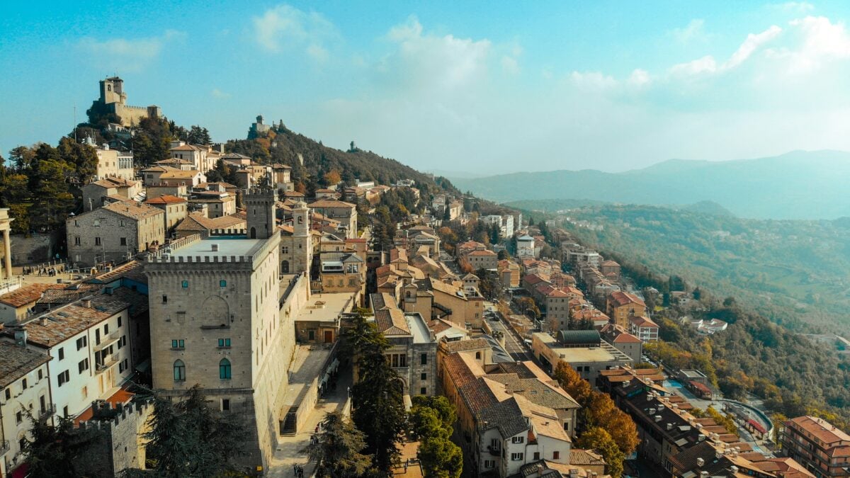
San Marino clings to the slopes of Mount Titano, completely surrounded by Italy, claiming to be the world’s oldest republic still in existence. This 24-square-mile country has its own government, postal system, and national soccer team, all operating from a space roughly the size of Manhattan’s Upper East Side.
The country prints its own euros, issues its own stamps (which are wildly popular with collectors), and maintains full diplomatic relations despite being smaller than most airports. San Marino’s national stadium holds 6,664 people in a country with a population of 34,000, meaning roughly one in five citizens could theoretically attend the same soccer match.
The entire nation could fit inside Disney World with room to spare.
The Welsh-English Border Through Hay-on-Wye
The border between England and Wales runs directly through the middle of Hay-on-Wye, bisecting buildings, streets, and even individual properties. The town’s famous bookshops straddle two countries, and customers can browse English literature in England, then walk ten feet to buy Welsh poetry in Wales.
Some residents live in England but work in Wales, with their commute consisting of walking across the street. The town’s main pub has the border running through the middle of it, which creates interesting questions about which country’s licensing laws apply to which bar stools.
During the COVID-19 pandemic, different restrictions in England and Wales meant that parts of the same building operated under different rules, with customers potentially breaking the law by moving from one end of a room to the other.
Russia’s Time Zone Chaos
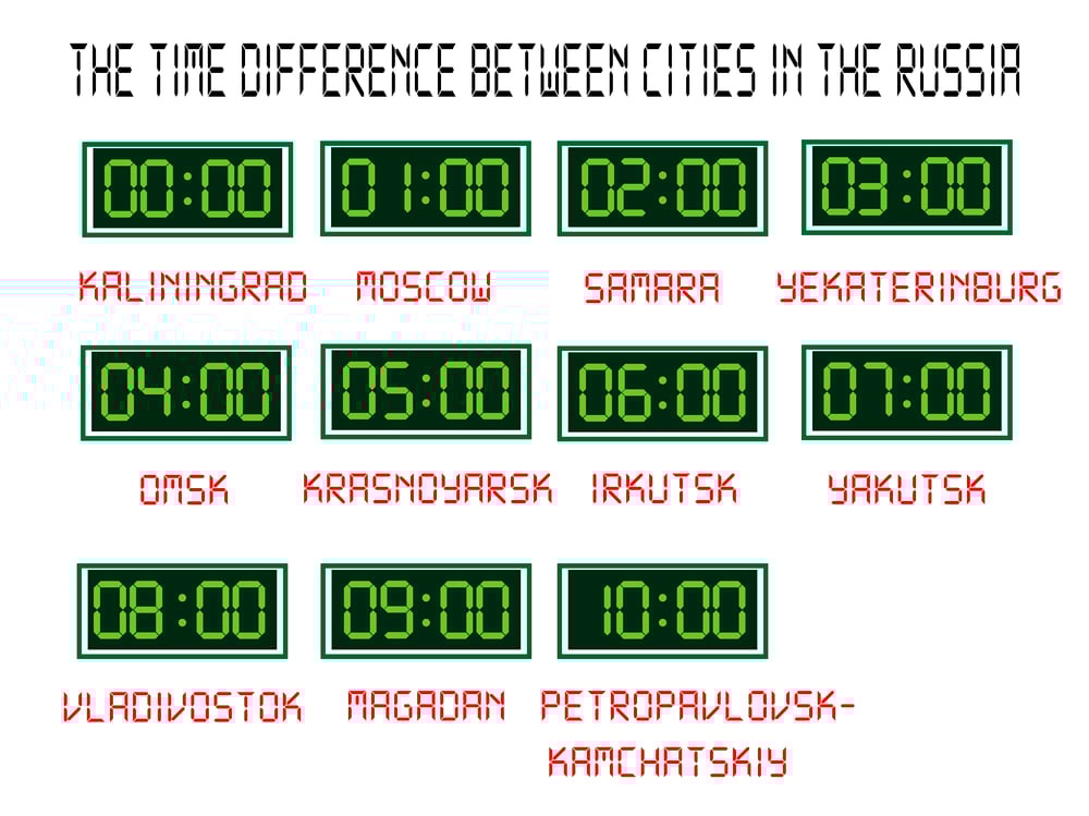
Russia spans eleven time zones, which is more time zones than any other country and creates scheduling nightmares that most people can’t even imagine. When it’s noon in Moscow, it’s 11 PM the same day in Kamchatka—except during certain periods when Russian leadership has experimented with eliminating daylight saving time, reducing the number of time zones, or shifting entire regions to different time standards, creating confusion that extends far beyond Russia’s borders.
This means Russian television networks broadcast the same live program at different times across the country, Russian businesses schedule conference calls across time differences wider than those between New York and London, and Russian families spread across the country can be celebrating New Year’s Eve while their relatives are still eating lunch on December 31st. The Trans-Siberian Railway crosses seven time zones, meaning passengers need to constantly adjust their watches during what’s technically a domestic train journey.
Chile’s Impossible Geography
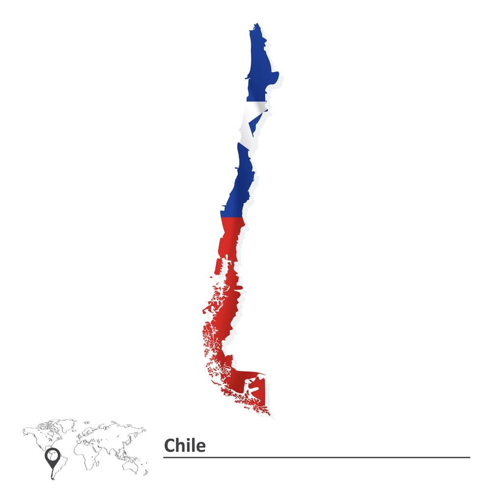
Chile stretches 2,670 miles from north to south but averages only 110 miles wide, making it the skinniest country on Earth relative to its length. It’s like someone took a normal country and stretched it until it became a geographical noodle clinging to South America’s western edge.
This creates climate zones that would normally be separated by continents. Chile contains desert, Mediterranean climate, temperate rainforest, and sub-Antarctic conditions within the same country.
Residents in the north live in one of the world’s driest deserts while residents in the south deal with glaciers and fjords. The country is so long that its northernmost and southernmost cities are farther apart than New York and Denver, but it’s so narrow that you can drive from the Pacific Ocean to the Argentine border in less than two hours.
When Geography Stops Making Sense
These places exist as permanent reminders that the world wasn’t designed by committee. Rivers change course after borders are drawn.
Politicians make deals without consulting maps. Historical accidents become permanent features. What starts as a temporary arrangement becomes a century-old tradition that nobody wants to change.
Perhaps that’s what makes these geographic anomalies so fascinating. They’re proof that logic doesn’t always win, that sometimes the messy, complicated, and slightly absurd solutions are the ones that stick around.
In a world increasingly obsessed with efficiency and optimization, these places persist in being gloriously, stubbornly impractical. And maybe that’s exactly as it should be.
More from Go2Tutors!

- The Romanov Crown Jewels and Their Tragic Fate
- 13 Historical Mysteries That Science Still Can’t Solve
- Famous Hoaxes That Fooled the World for Years
- 15 Child Stars with Tragic Adult Lives
- 16 Famous Jewelry Pieces in History
Like Go2Tutors’s content? Follow us on MSN.