The Most Chilling Discoveries Made by Google Earth
There’s something unsettling about seeing the world from above through a screen. Google Earth promised to bring the planet closer, to make distant places feel accessible with a few clicks.
But sometimes, that bird’s-eye view reveals things that were never meant to be seen. Hidden in satellite imagery are discoveries that have puzzled investigators, horrified communities, and left questions that may never be answered.
Blood Lake in Iraq
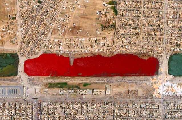
The water turned red overnight. Satellite images captured what locals in Sadr City had been reporting for days — a lake that had transformed from murky brown to deep crimson.
No explanation ever came from officials. The color was too uniform to be algae, too widespread to be industrial runoff.
Residents stopped fishing there. Children were told to stay away.
The red faded after several weeks, but the lake never returned to its original color.
Phantom Island
Coordinates 19°S 159°E showed Sandy Island for decades on maritime charts, and Google Earth dutifully displayed it as a landmass roughly the size of Manhattan (which, for those keeping track, sits about 13 miles long and 2 miles wide at its widest point). So when Australian scientists sailed to those exact coordinates in 2012, they expected to find beaches, maybe some wildlife, possibly even vegetation that had been growing undisturbed for generations — what they found instead was 4,600 feet of open ocean and the unsettling realization that an island that had appeared on maps since the 1870s had never actually existed.
The phantom island had been included in official databases, referenced in scientific papers, and marked on navigation systems used by commercial shipping.
But nobody had ever bothered to verify its existence. So here’s the disturbing part: if cartographers could collectively hallucinate an entire island for over a century, what else might be marked on our maps that isn’t really there?
Desert Patterns
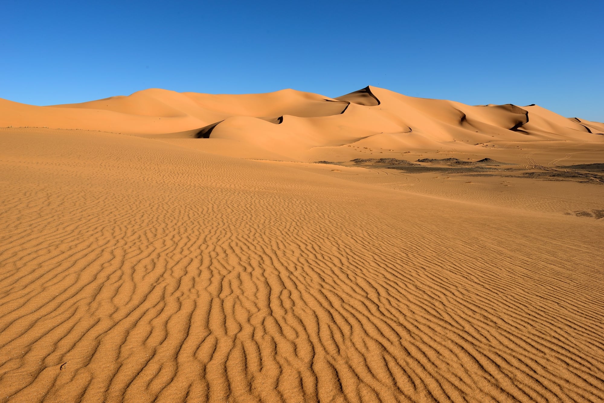
The desert holds its secrets differently than other landscapes. Where forests can swallow evidence and oceans can wash it away, the desert preserves and reveals.
These particular patterns stretch across miles of empty land in Nevada — geometric shapes too precise for wind, too large for human construction, at least the kind that leaves conventional traces.
The lines form triangles and rectangles with mathematical precision. They’re carved into the earth itself, visible only from high altitude.
No roads lead to them. No structures sit nearby. They exist in isolation, as if the desert decided to practice geometry when nobody was watching.
Local authorities don’t discuss them. Military installations operate in the general area, but these patterns sit outside any official boundaries.
Missing Village
The village appeared in satellite images from 2003, complete with roads, buildings, and what looked like agricultural plots. Population estimates suggested several hundred residents
Then it vanished. Not gradually, not through visible destruction — it simply wasn’t there in the next set of images from 2007.
This wasn’t some remote settlement that could be easily overlooked. The coordinates placed it in a region with regular air traffic and established trade routes.
Yet nobody reported its disappearance. No refugee movements were documented. No humanitarian organizations raised alarms about displaced populations.
Underwater Discovery
Lake Macdonnell in South Australia conceals something beneath its pink surface. The unusual coloration comes from algae and bacteria, but the satellite imagery reveals geometric shapes on the lakebed that natural processes don’t typically create.
These formations stretch across several acres and appear deliberately arranged.
The lake’s extreme salinity makes diving dangerous and equipment unreliable. Remote sensing can penetrate the water to some degree, but the mineral content interferes with most scanning technologies.
Whatever lies beneath has remained undisturbed since its discovery.
Antarctica Anomaly
There’s something methodical about how information flows regarding Antarctica (or rather, how it doesn’t flow), and the discovery of what appears to be a massive geometric structure beneath the ice sheet follows that same pattern of official silence and deflected questions — researchers who stumbled across the formation while analyzing Google Earth imagery found what looked disturbingly like artificial construction: straight lines, perfect right angles, and proportions that suggested deliberate design rather than natural geological processes.
The structure measures roughly 400 feet across and sits under several hundred feet of ice that, according to core samples from the general area, has been undisturbed for millennia.
And yet there it sits, geometric and deliberate, in satellite images that anyone can access with a few clicks. But here’s what makes it truly unsettling: despite being visible to anyone with an internet connection, no official expedition has been mounted to investigate it.
The coordinates remain public. The images remain available.
The silence remains absolute.
Crop Circle Factory
The English countryside becomes a canvas every summer for patterns that appear overnight in wheat and barley fields. But this particular location in Wiltshire operates differently.
Satellite imagery shows the same field producing multiple crop circles throughout single growing seasons, with new formations appearing before previous ones have been harvested or deteriorated.
The farmer owns the land but doesn’t discuss the patterns. Local authorities defer questions to agricultural departments that claim no knowledge of unusual activity.
The formations themselves display increasing complexity — mathematical sequences, fractal patterns, designs that require aerial perspective to fully comprehend.
Grid Lines in China
China’s remote regions hide construction projects that dwarf most urban developments. These particular grid lines cover an area larger than many cities, carved into mountainous terrain with precision that suggests advanced surveying equipment and massive earthmoving operations.
No official purpose has been announced for the construction. The lines form perfect squares and rectangles across miles of previously undeveloped land.
Access roads were built, then abandoned. The project appears to have been completed and then simply left empty.
Mass Graves

Satellite imagery doesn’t lie about certain things. The disturbed earth around Raqqa showed patterns that investigators recognized from other conflict zones — long trenches, recently covered, in areas where local populations had reported mass disappearances.
The precision of the imagery made denial impossible.
These discoveries led to war crimes investigations and eventual prosecutions. But they also revealed how much can be hidden in plain sight until someone thinks to look from above.
The graves had been there for months before satellite analysis brought them to light.
Burning Fields
The methane fires in Turkmenistan’s Karakum Desert were supposed to burn out within weeks when geologists lit them in 1971. The natural gas crater, known locally as the “Door to Hell,” continues burning today.
But Google Earth revealed something unexpected about the surrounding area — additional craters that weren’t part of the original collapse.
These smaller formations show evidence of recent activity. Some appear to be burning.
Others seem to be emitting gases that create visible distortions in satellite imagery. The desert around the original crater is becoming increasingly unstable, with new collapses creating fresh openings to underground gas deposits.
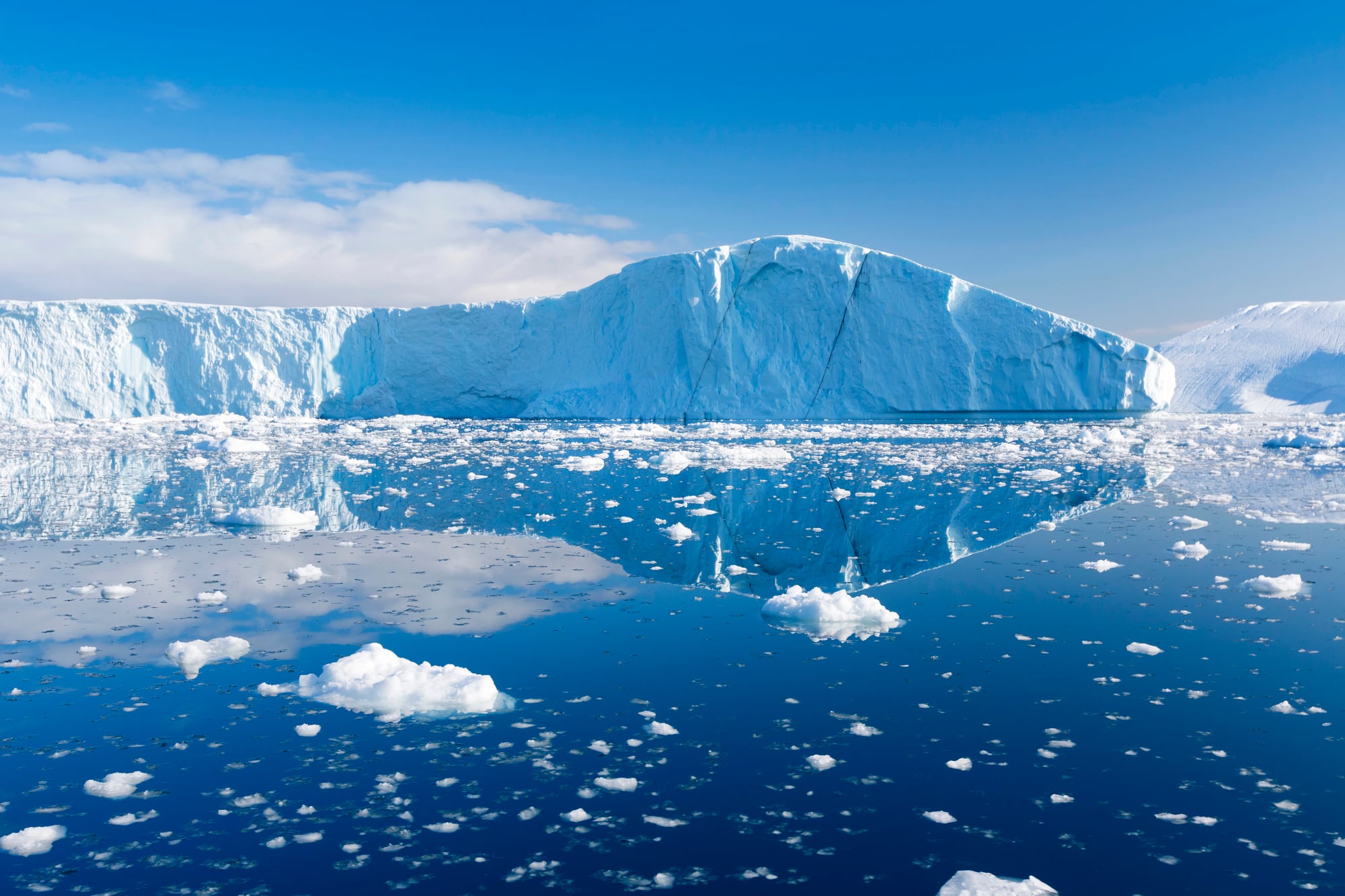
Nuclear Shadows
The Pacific Proving Grounds still bear marks from atomic testing conducted decades ago. But certain atolls show radiation patterns that don’t match historical test records.
Satellite imagery reveals areas of environmental damage that suggest additional detonations or experiments that weren’t publicly documented.
The affected zones remain off-limits to civilian access. Marine life in surrounding waters shows genetic mutations consistent with radiation exposure.
Yet official test records don’t account for the extent of environmental damage visible from orbit.
Vanished Lake
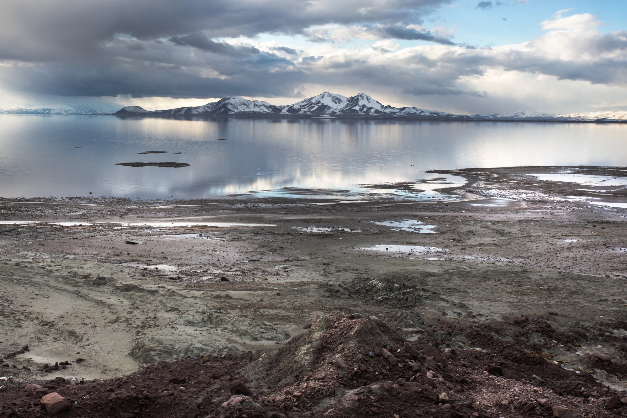
Lake Urmia in Iran was once the largest lake in the Middle East, visible from space as a brilliant turquoise jewel spanning over 2,000 square miles. Now it’s mostly gone.
Satellite imagery from Google Earth documents its disappearance year by year — the shoreline retreating, the water level dropping, until vast salt flats stretch where waves once lapped.
This wasn’t a gradual seasonal change or a temporary drought. This was the systematic death of an ecosystem that had existed for millions of years.
Villages that once relied on fishing found themselves dozens of miles from the nearest water. The lake’s disappearance altered local weather patterns and destroyed agricultural communities that had thrived for generations.
But here’s what makes the discovery truly chilling: Lake Urmia’s destruction was preventable and documented in real-time, yet it continued anyway.
The satellite images provided perfect evidence of an environmental catastrophe unfolding, and the world watched it happen through their computer screens.
When the Sky Reveals Too Much
Looking down at Earth from space used to require being an astronaut or a spy. Now it just requires curiosity and an internet connection.
That democratization of perspective has revealed things that powerful people preferred to keep hidden and natural phenomena that science hasn’t fully explained.
Some discoveries lead to justice, others to more questions. All of them remind us that our planet still holds secrets, even in an age when everything feels mapped and measured and known.
More from Go2Tutors!

- The Romanov Crown Jewels and Their Tragic Fate
- 13 Historical Mysteries That Science Still Can’t Solve
- Famous Hoaxes That Fooled the World for Years
- 15 Child Stars with Tragic Adult Lives
- 16 Famous Jewelry Pieces in History
Like Go2Tutors’s content? Follow us on MSN.