Facts About Asia’s Strangest Borders
You do realize that borders are meant to be simple? Perhaps a checkpoint, a fence, or a line on a map. However, there are some borders in Asia that are so strange that they leave cartographers baffled.
The continent has a number of boundaries that defy reason and sometimes make international relations utterly awkward, ranging from enclaves inside enclaves to disputed territories that no one wants. These aren’t merely map lines. They are the result of wartime agreements, colonial errors, and occasionally the actions of rulers who seemed to take pleasure in creating complexity.
While some of these borders have been heavily militarized areas where tensions are always present, others have kept people in legal limbo for decades. Here are facts about the most bizarre borders in Asia that demonstrate how messy geography can be.
India and Bangladesh Exchanged 162 Enclaves in 2015
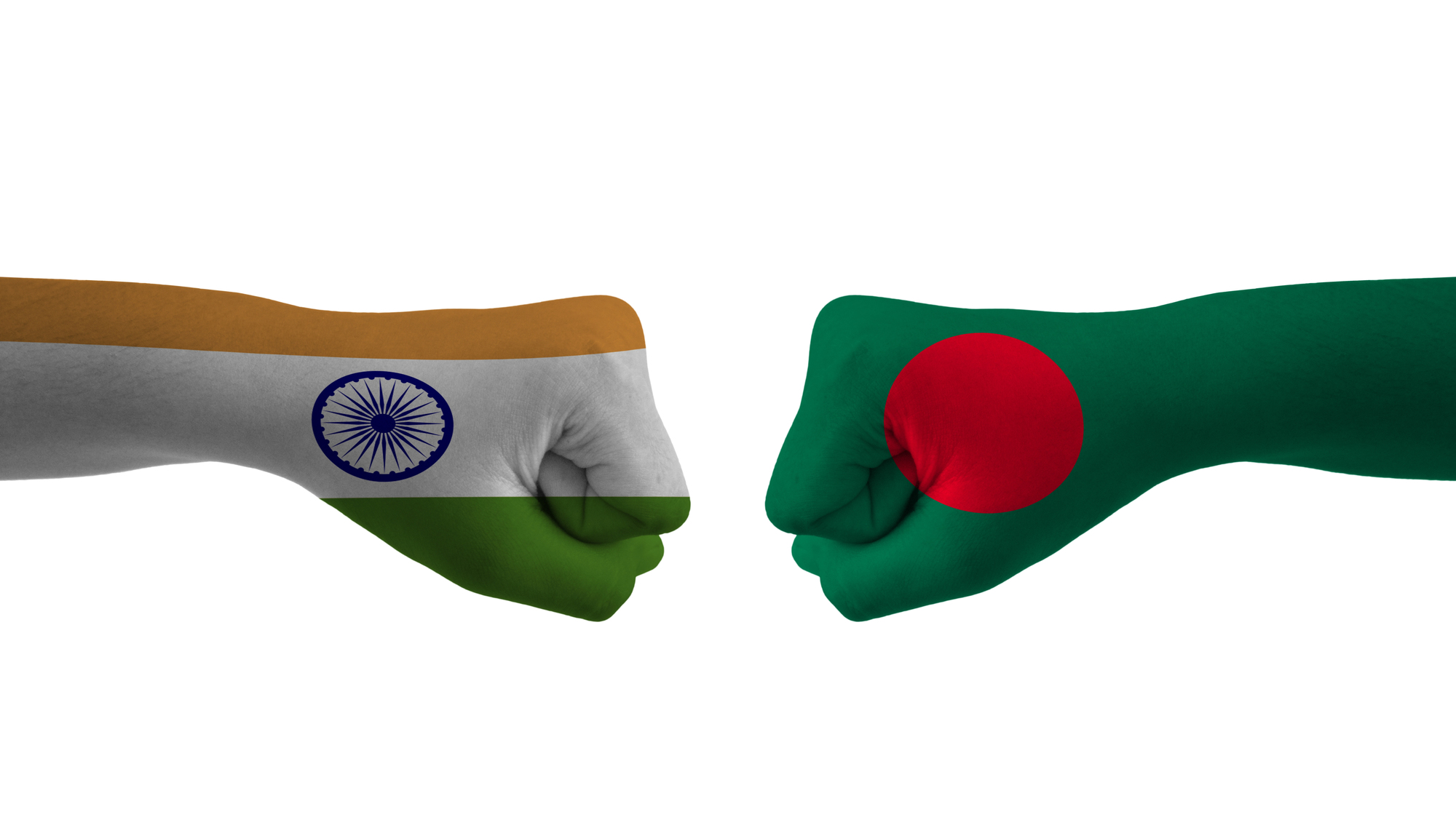
Before 2015, the India-Bangladesh border looked like someone had spilled confetti on a map and called it a day. There were 162 separate enclaves scattered across both countries, with over 51,000 people living in these isolated pockets of land.
India had 111 enclaves inside Bangladesh, while Bangladesh had 51 enclaves inside India. Some enclaves even contained counter-enclaves, creating a dizzying maze of borders. These enclaves originated from treaties between local rulers in the 18th century, possibly including land wagers during card games.
People living in these enclaves were essentially stateless for nearly 70 years, unable to access basic services like healthcare and education because neither country could easily administer these isolated territories.
The Korean DMZ is the Most Heavily Militarized Border on Earth
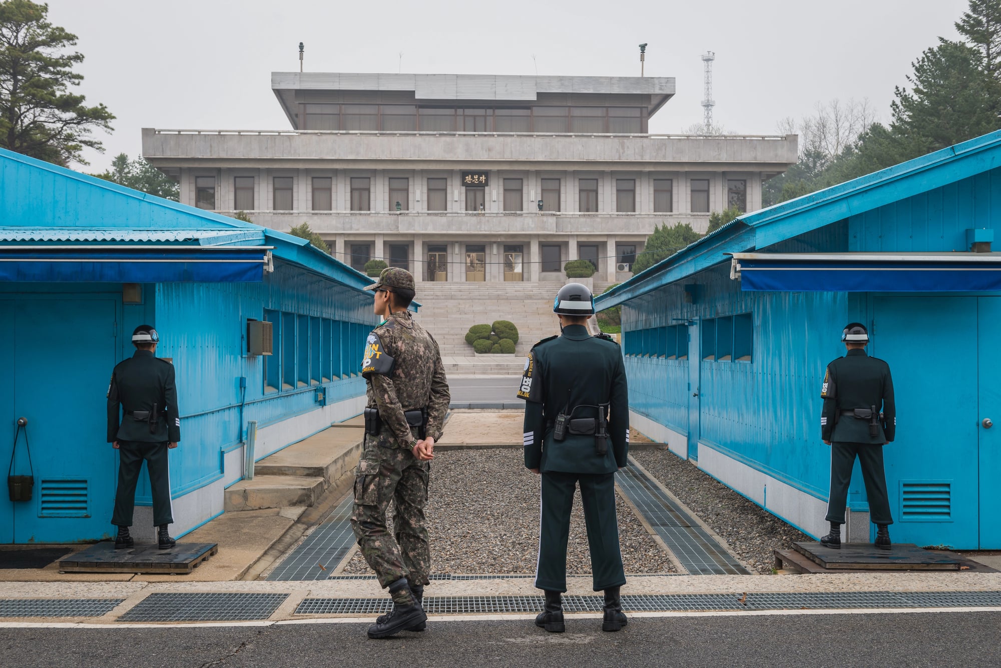
The Korean Demilitarized Zone is possibly the most ironically named place on the planet. Despite being called a demilitarized zone, it’s actually one of the most heavily armed borders in the world, with thousands of troops stationed on both sides.
This 250-kilometer-long, 4-kilometer-wide buffer zone was established in 1953 after the Korean War armistice, and it roughly follows the 38th parallel. Both North and South Korea maintain around 160 and 60 guard posts respectively, with landmines numbering in the millions scattered throughout the area.
The zone has become an accidental nature preserve because humans have largely avoided it for over 70 years, allowing endangered species to thrive in this tense no-man’s-land.
Like Go2Tutors’s content? Follow us on MSN.
The Joint Security Area Has a Border Running Through Conference Tables
Inside the Korean DMZ sits the Joint Security Area, where North and South Korean officials occasionally meet for negotiations. The meeting rooms are distinctive blue buildings where the border literally runs down the middle of the conference tables.
A microphone cable marking the exact demarcation line divides the table, and technically, people sitting on opposite sides are in different countries. Soldiers from both sides stand guard in intentionally intimidating poses, and tourists can actually walk around these rooms and hop from South Korea to North Korea and back again.
The catch is that they definitely cannot leave through the North Korean exit.
China and India Can’t Even Agree on Their Border’s Length

The Line of Actual Control between China and India is so disputed that the two countries can’t even agree on how long it is. India claims the border stretches 3,488 kilometers, while China insists it’s only 2,000 kilometers.
This massive discrepancy exists because neither side agrees on where the border actually runs, particularly in the western sector around Aksai Chin and the eastern sector in Arunachal Pradesh. The 1962 war between the two nations was fought over these territories, and tensions have remained high ever since. In 2020, clashes in the Galwan Valley resulted in at least 20 Indian and 4 Chinese deaths, the first fatalities along this border in 45 years.
Mount Everest’s Summit Sits on an International Border
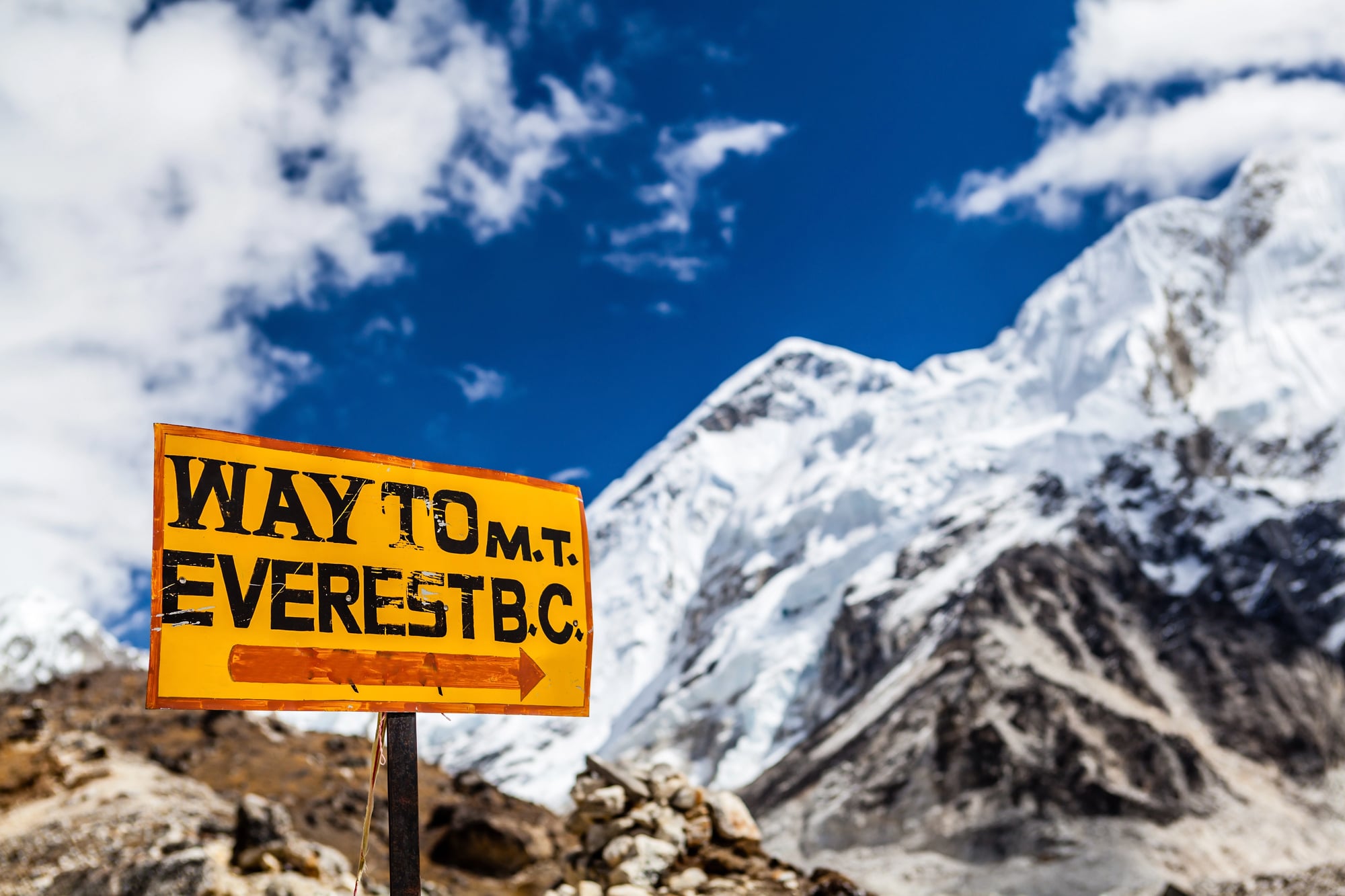
The world’s highest mountain straddles the border between Nepal and the Tibet Autonomous Region of China. Climbers who reach the summit can technically stand in two countries at once, though they’re probably too exhausted and oxygen-deprived to care about geopolitics at that moment.
The Himalayas serve as a natural border across much of the region, but this hasn’t prevented disputes. Different surveys over the years have measured Everest’s height differently, and China and Nepal have occasionally disagreed about the exact elevation.
In 2020, both countries jointly announced a new official height of 8,848.86 meters, finally settling that particular argument.
Like Go2Tutors’s content? Follow us on MSN.
The Wakhan Corridor Was Created as a Buffer Zone
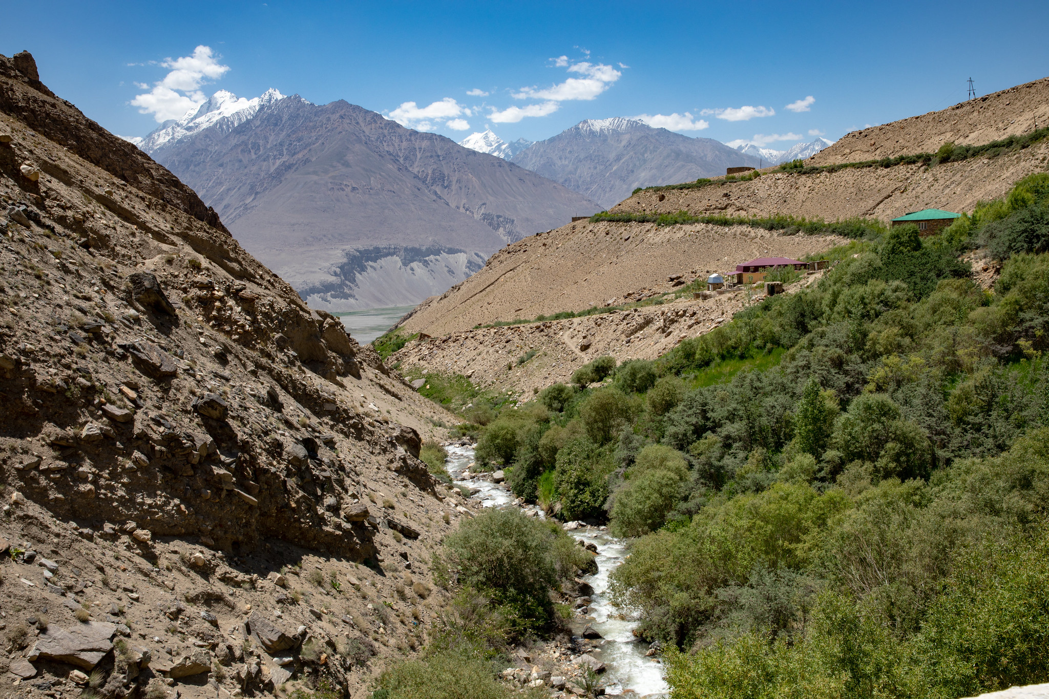
The Wakhan Corridor is a narrow panhandle of Afghan territory stretching eastward between Tajikistan and Pakistan to touch China. This geographic oddity exists because of 19th-century geopolitical maneuvering between the British and Russian empires.
The British wanted a buffer zone between Russian-controlled territory and British India, so they convinced Afghanistan to claim this remote, mountainous corridor. At its narrowest point, the corridor is only about 15 kilometers wide.
The region remains one of the most isolated and sparsely populated areas in Afghanistan, with limited infrastructure and extremely harsh conditions making it difficult for anyone to live there year-round.
Bir Tawil is Land That No Country Wants
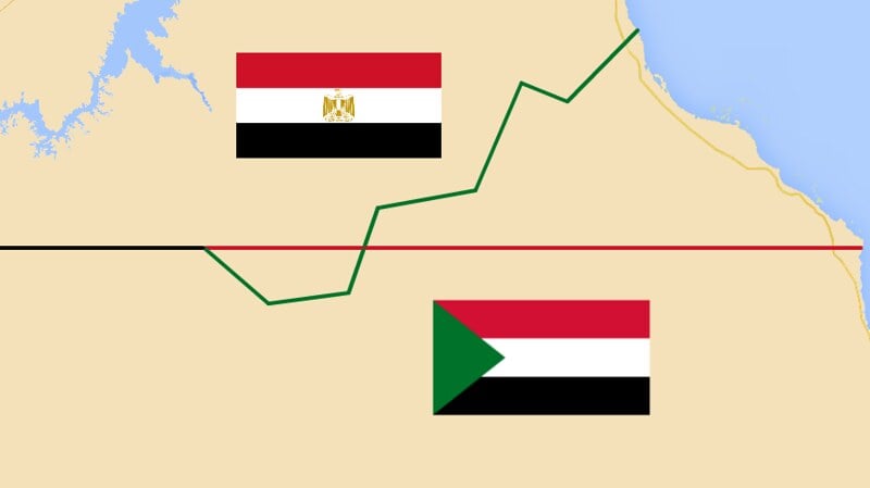
Between Egypt and Sudan lies a patch of desert called Bir Tawil that neither country wants to claim. This 2,000-square-kilometer roadless, uninhabited area remains unclaimed because both nations prefer different historical boundary lines that would give them access to more valuable territory elsewhere.
Egypt and Sudan each favor border demarcations that exclude Bir Tawil from their territory while claiming the more resource-rich Halaib Triangle. The result is that Bir Tawil has become the world’s only significant habitable land that isn’t claimed by any nation.
Several individuals and organizations have attempted to claim it for various reasons, but none of these claims have been recognized internationally.
Bangladesh Has the Fifth-Longest Land Border Despite Its Small Size
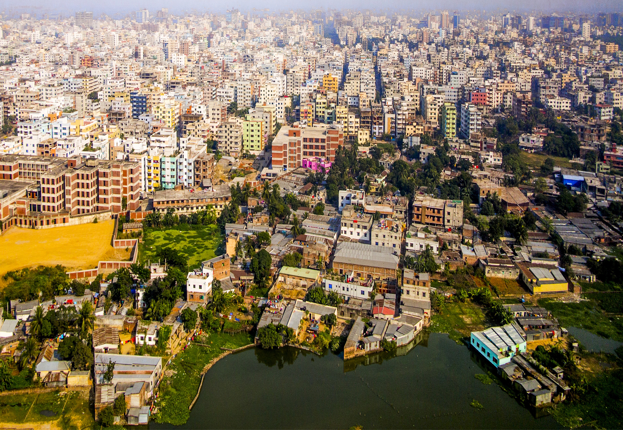
Bangladesh is roughly the size of Iowa, yet it shares a 4,096-kilometer border with India, making it the fifth-longest land border between any two countries in the world. This seems impossible until you look at a map and see how Bangladesh’s shape wraps around Indian territory.
The border meanders, zigzags, and occasionally turns back on itself in bewildering ways. Apart from a short southern border with Myanmar, Bangladesh is almost entirely surrounded by its much larger neighbor. The Radcliffe Line, drawn hastily in 1947 during the partition of India, created this complex boundary that has been the source of disputes, illegal crossings, and bilateral tensions for decades.
Like Go2Tutors’s content? Follow us on MSN.
Arunachal Pradesh is Called South Tibet by China
India’s northeastern state of Arunachal Pradesh is considered an integral part of India, but China refers to the entire region as South Tibet and claims sovereignty over it. The dispute stems from the McMahon Line, drawn in 1914 during the Simla Convention between British India and Tibet.
China never recognized this boundary because it claimed sovereignty over Tibet and was excluded from the agreement. The region covers about 90,000 square kilometers and is home to over a million people who identify as Indian citizens.
China has escalated its claims in recent years, issuing stapled visas to residents of Arunachal Pradesh instead of regular visas, effectively treating them as disputed-territory inhabitants rather than Indian citizens.
Four Tunnels Have Been Discovered Under the Korean DMZ

North Korea secretly dug infiltration tunnels beneath the DMZ, apparently planning to move troops southward in the event of renewed conflict. South Korea has discovered four of these tunnels since 1974, and officials believe more exist.
The tunnels are large enough to allow thousands of soldiers per hour to pass through, and they extend deep into South Korean territory. The Third Tunnel, discovered in 1978, could theoretically enable 30,000 troops to move through it in just one hour.
Today, some of these tunnels are tourist attractions where visitors can walk partway down before reaching barriers that mark how close North Korea came to creating a secret invasion route.
Borders That Keep Making History

The most bizarre borders in Asia demonstrate that political boundaries are frequently determined more by history, power, and chance than by reason or practicality. These peculiarities have left parts of territory in legal limbo, triggered deadly conflicts between nuclear powers, and left residents of enclaves stateless for decades.
After 70 years of isolation, some of these borders have finally been cleared through arduous diplomacy, such as the India-Bangladesh enclave exchange, which granted citizenship and access to essential services to thousands of people. Others are still hotspots where a mistake could have dire repercussions.
Families are still split by the Korean DMZ, military buildups occur frequently along the China-India border, and tensions persist over disputed maritime lines in Asian waters. These borders serve as a reminder that actual people are affected by the lines on maps.
They also show that politics and geography don’t always get along and that sometimes the most chaotic borders are the ones that endure the longest.
Like Go2Tutors’s content? Follow us on MSN.
More from Go2Tutors!

- 16 Historical Figures Who Were Nothing Like You Think
- 12 Things Sold in the 80s That Are Now Illegal
- 15 VHS Tapes That Could Be Worth Thousands
- 17 Historical “What Ifs” That Would Have Changed Everything
- 18 TV Shows That Vanished Without a Finale
Like Go2Tutors’s content? Follow us on MSN.