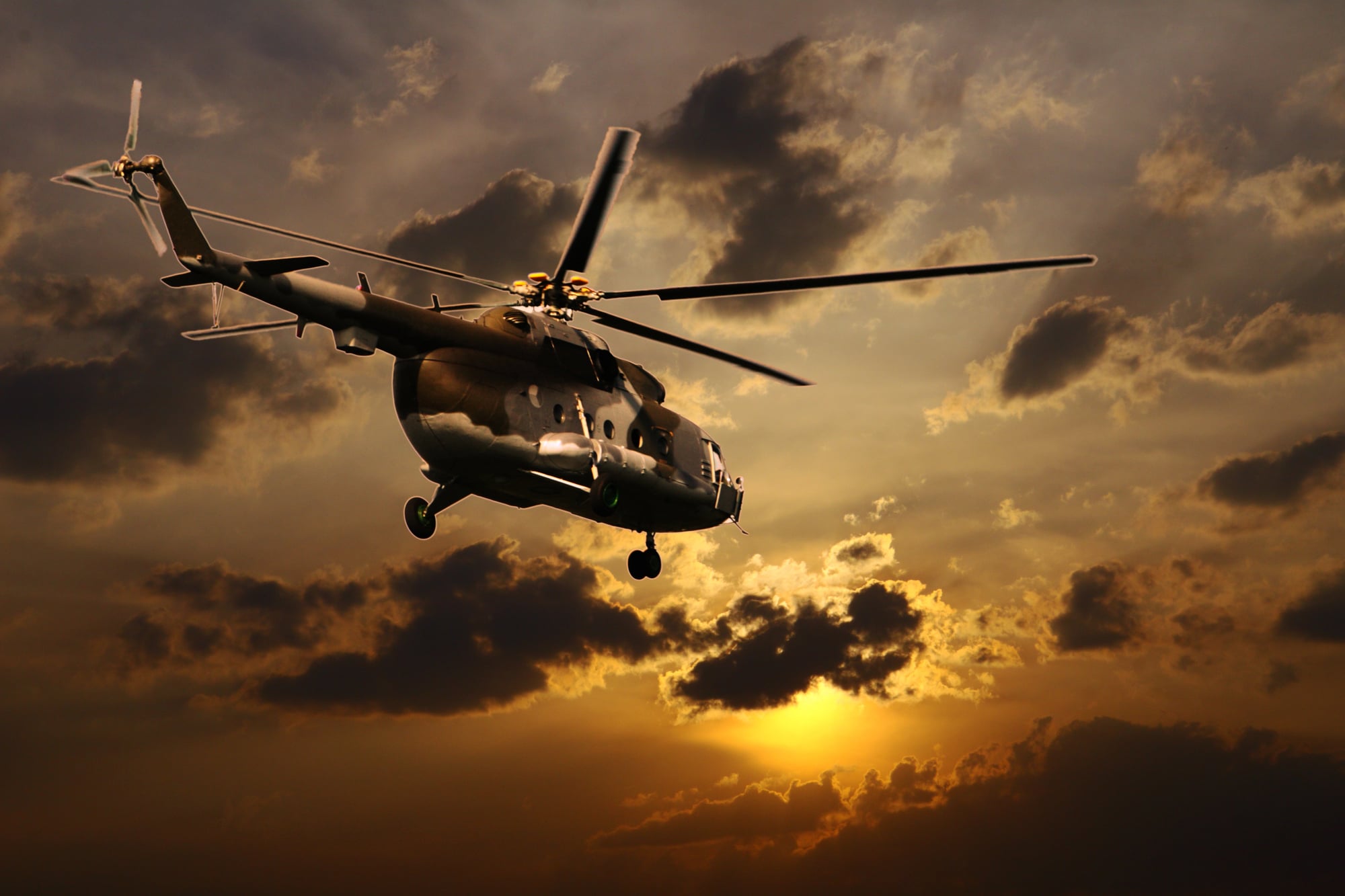
Places You Can Only Reach by Helicopter
Not every spot welcomes quick access on purpose. Far from highways, ports, or trails – cut off by glaciers, rock faces, open sea, or distance alone – some locations stay out of reach. Getting there needs something that can move carefully, hang still, glide close – not just charge forward. In such moments, helicopters aren’t simply faster. Without them, travel wouldn’t happen.
What ties these spots together isn’t comfort, even if some seem remote, yet location. A different kind of land defines each one – where roads would fail, risk lives, or harm nature. Often, being cut off matters on purpose. Entry stays restricted to guard delicate ecosystems, ensure security, or keep their vastness intact, something walking could ruin. Below explores sites reachable solely by air, along with reasons they stay just beyond grasp.
Mount Everest Summit
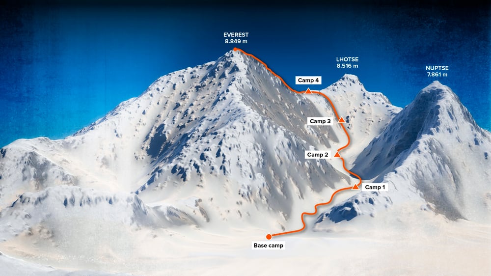
The summit of Mount Everest is not accessible by road, trail, or cable. Even climbers who reach it on foot rely on helicopters for support up to certain elevations, and any direct arrival at the summit itself requires aerial access under rare conditions. The terrain above base camps is simply too extreme for conventional transport.
Helicopter access here is limited, regulated, and often controversial. Thin air, unpredictable winds, and narrow landing windows make flight dangerous. When helicopters do reach high-altitude zones, it is usually for rescue or essential logistics. The summit remains one of the clearest examples of a place where geography sets absolute boundaries.
Tristan da Cunha

Tristan da Cunha is often described as the most remote inhabited island on Earth. There is no airport and no regular ferry service. Ships can take days to reach it, but landing depends heavily on weather and sea conditions. Helicopters provide the only reliable way to move people and supplies ashore.
The island’s isolation shapes daily life. Medical evacuations, official visits, and essential deliveries all depend on aerial access. Without helicopters, Tristan da Cunha would be functionally cut off for long stretches of the year. Its remoteness is not a novelty. It is a defining reality.
Vatnajökull Ice Caves

Beneath Europe’s largest glacier lie ice caves that shift and reform each year. These caves are unreachable by road and often inaccessible even on foot due to unstable ice and changing melt patterns. Helicopters are used to reach safe entry points without crossing hazardous terrain.
Access is tightly controlled, both for safety and preservation. The caves are temporary by nature, forming and collapsing with seasonal changes. Helicopter travel allows brief, precise visits without building permanent infrastructure that would damage the glacier. In this case, aerial access protects what it reveals.
The Pinnacles, Bungle Bungle Range

The Bungle Bungle Range is known for its striped sandstone domes, but the most dramatic views are inaccessible by road. While parts of the surrounding area can be reached by rugged tracks, the heart of the formation is best accessed by helicopter.
The terrain is vast, uneven, and fragile. Helicopter access minimizes environmental impact while offering perspective that ground travel cannot. The formations were long known to Indigenous communities but only gained wider recognition once aerial surveys revealed their scale. In this case, flight did not just provide access. It revealed existence.
Angel Falls

Angel Falls drops nearly 3,200 feet from a flat-topped mountain known as a tepui. Dense jungle surrounds the area, and there are no roads leading to the base or the top. River travel can reach nearby zones, but the most direct access is by helicopter.
The falls are part of a protected national park, where infrastructure development is limited. Helicopters allow controlled access without cutting roads through sensitive ecosystems. The isolation preserves the landscape’s scale and drama, ensuring that the journey remains as striking as the destination.
Svalbard Polar Research Stations

Several research stations in Svalbard are located far from settlements, surrounded by ice, mountains, and open tundra. Roads do not connect these sites, and seasonal conditions make overland travel unreliable. Helicopters provide year-round access for scientists and supplies.
The Arctic environment demands flexibility. Ice shifts, weather changes rapidly, and daylight varies dramatically. Helicopter access allows researchers to respond to conditions rather than fight them. These stations exist precisely because they are remote, offering data impossible to gather elsewhere.
Mount Nyiragongo Crater
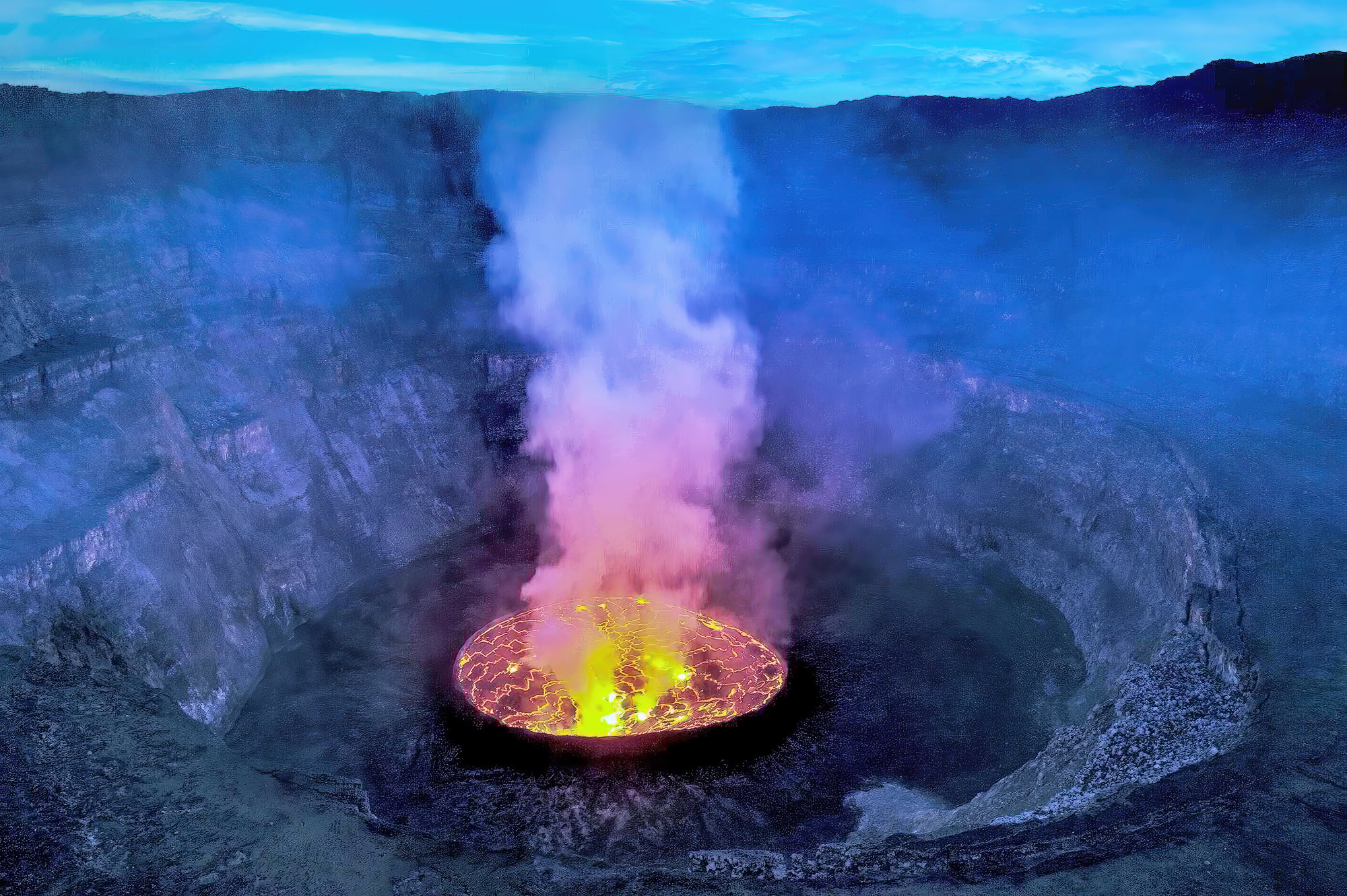
Mount Nyiragongo contains one of the world’s largest lava lakes. The crater rim can be reached by a challenging hike, but direct access to observation points near the lava often requires helicopter support, especially for research and monitoring.
Volcanic terrain is unstable by nature. Paths shift, gases accumulate, and eruptions can alter landscapes overnight. Helicopters provide the only practical way to reach certain vantage points safely. Here, access is dictated by volatility rather than distance.
Fogo Island Sea Stacks

Along rugged coastlines like those near Fogo Island, isolated sea stacks rise from the ocean, unreachable by boat due to strong currents and sheer rock faces. Helicopters allow brief landings on flat surfaces carved by erosion.
These formations are geologically significant but physically hostile. Aerial access allows researchers and photographers to reach them without risking dangerous climbs or unstable landings. The helicopter becomes a tool for observation rather than exploration.
Mount Cook Summit

New Zealand’s highest peak is surrounded by glaciers and steep alpine terrain. While climbers can approach on foot, reaching certain summit zones and adjacent ridgelines requires helicopter support, particularly for safety and rescue operations.
Weather changes rapidly in the Southern Alps, and avalanches are a constant risk. Helicopters provide rapid access when conditions narrow safe windows. In these environments, speed and precision matter more than endurance.
Amazon Canopy Research Platforms

Deep within the Amazon rainforest, some research platforms are suspended above the forest floor, accessible only by helicopter. Roads would fragment ecosystems, and river travel cannot reach elevated sites.
Helicopters allow scientists to study canopy-level processes without clearing large areas of forest. The access method aligns with the research goal: observe without intrusion. These platforms highlight how technology can enable restraint rather than expansion.
Why Helicopter-Only Places Exist
Places accessible only by helicopter are not accidents of poor planning. They are often deliberate choices shaped by terrain, safety, and preservation. Roads and ports leave permanent marks. Helicopters do not.
In many cases, limiting access preserves the character of a place. Fragile environments remain intact. Dangerous terrain remains respected rather than conquered. The difficulty of arrival becomes part of the experience, reinforcing awareness of scale and vulnerability.
Why It Still Matters

Some places exist beyond roads, reachable only by helicopter. Distance guards them – keeps things wild. Just because you can go somewhere does not mean you should. Quiet care sometimes means staying away. Limits shape respect more than entry ever could.
When tech moves forward, people want to link up every corner. Still, spots that need a helicopter to get to show there’s a different way. What makes certain locations special is their difficulty in reaching them – this calls for purpose, honor, and attention from anyone arriving.
More from Go2Tutors!

- The Romanov Crown Jewels and Their Tragic Fate
- 13 Historical Mysteries That Science Still Can’t Solve
- Famous Hoaxes That Fooled the World for Years
- 15 Child Stars with Tragic Adult Lives
- 16 Famous Jewelry Pieces in History
Like Go2Tutors’s content? Follow us on MSN.