Riskiest Roads To Drive
Some roads look pretty from a distance but turn into absolute nightmares the moment tires hit asphalt. Cliffs without guardrails, weather that changes in seconds, curves that appear out of nowhere, and traffic that moves at speeds that should be illegal all combine to create paths that test even the most experienced drivers.
These aren’t just challenging routes. They’re places where mistakes don’t get second chances.
Thousands of people travel these roads every day, either because they have no choice or because they’re chasing adventure. Here are some of the riskiest roads on the planet.
North Yungas Road, Bolivia
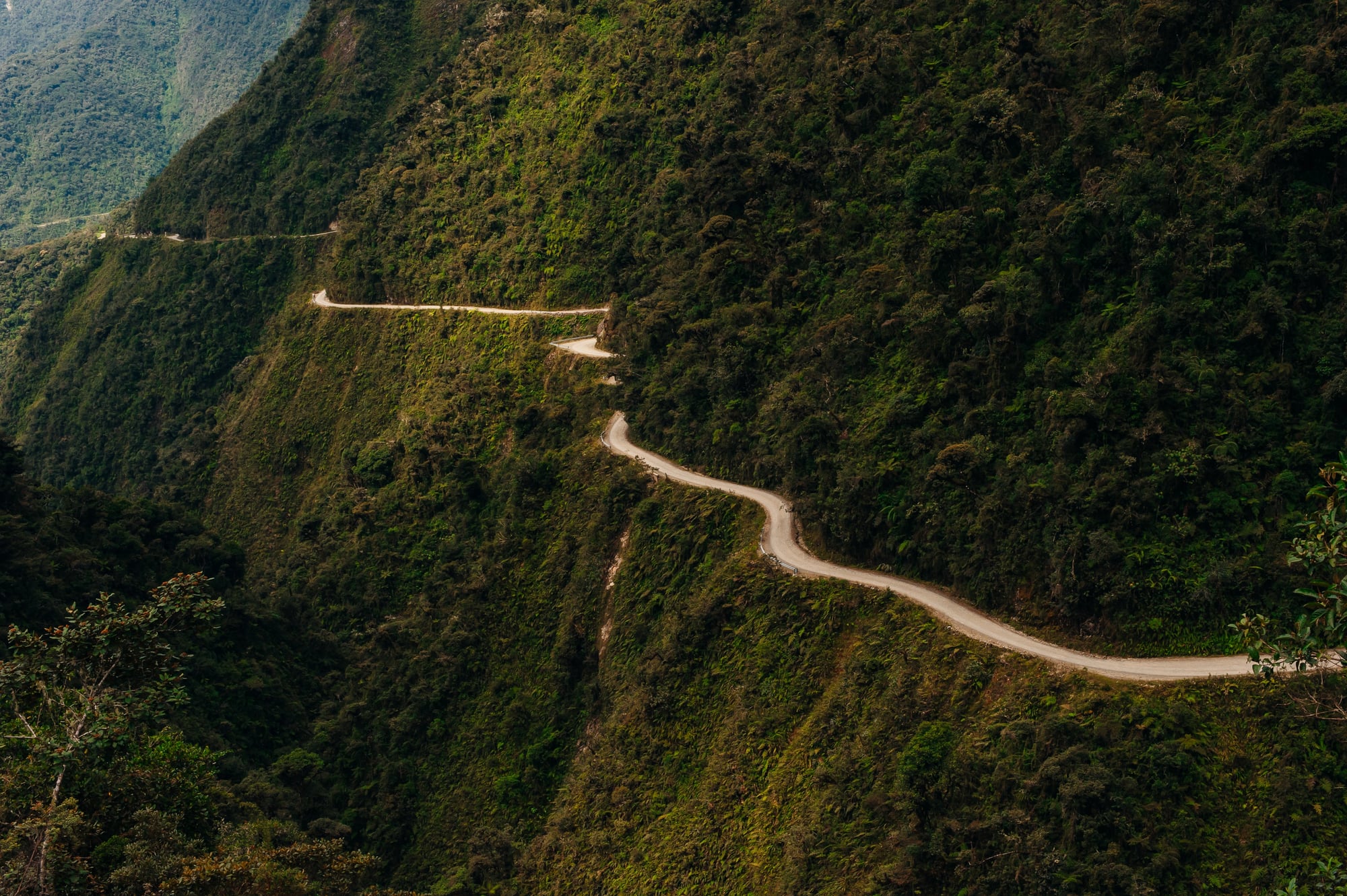
This 43-mile stretch earned its nickname ‘Death Road’ the hard way. Before a safer alternative opened nearby, around 200 to 300 people died here every year.
The road climbs through the Amazon rainforest with hairpin turns so tight that buses have to back up multiple times just to make it around. Fog rolls in without warning and sticks around for hours.
One side of the road hugs a cliff wall while the other side drops straight down, sometimes as far as 2,000 feet. No guardrails exist to stop vehicles from going over the edge.
Rain turns the gravel surface into slippery mud, and landslides block the path regularly. Vehicles passing each other have to coordinate carefully because there’s barely enough room for one car, let alone two going opposite directions.
Interstate 4, Florida
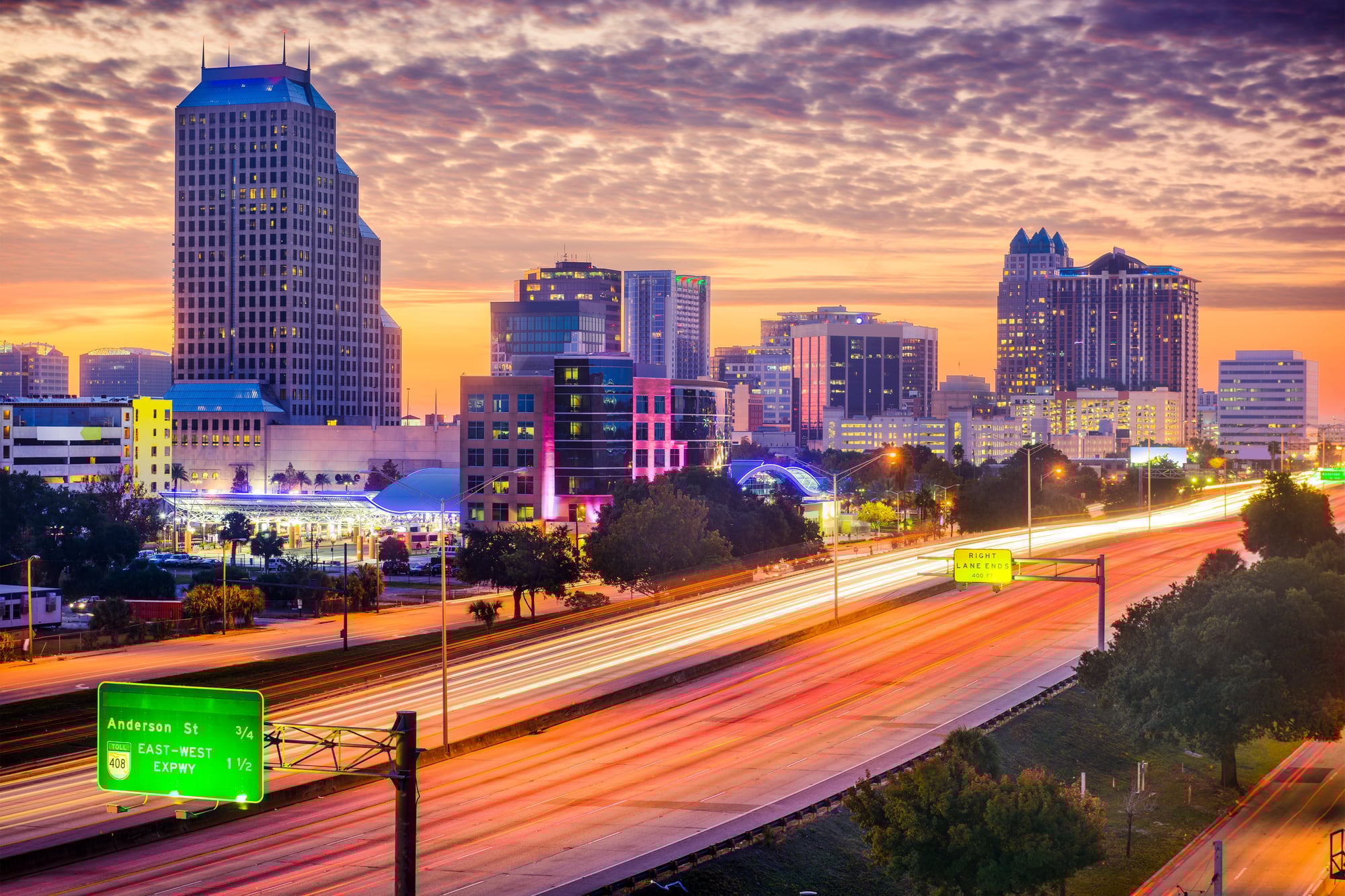
Florida’s Interstate 4 holds the unfortunate title of America’s most dangerous highway. This 132-mile stretch between Tampa and Daytona Beach recorded over 1.13 deaths per mile between 2016 and 2019.
Orlando sits right in the middle of this chaos, where 11 people lost their lives during that period. The road sees constant tourist traffic heading to theme parks mixed with daily commuters who know the route too well.
This combination creates situations where some drivers crawl along trying to find their exit while others zip past at high speeds. The infrastructure hasn’t kept up with the volume of cars using it every day.
Add in Florida’s sudden rainstorms that reduce visibility to almost nothing, and you’ve got conditions that claim lives regularly.
BR-116, Brazil
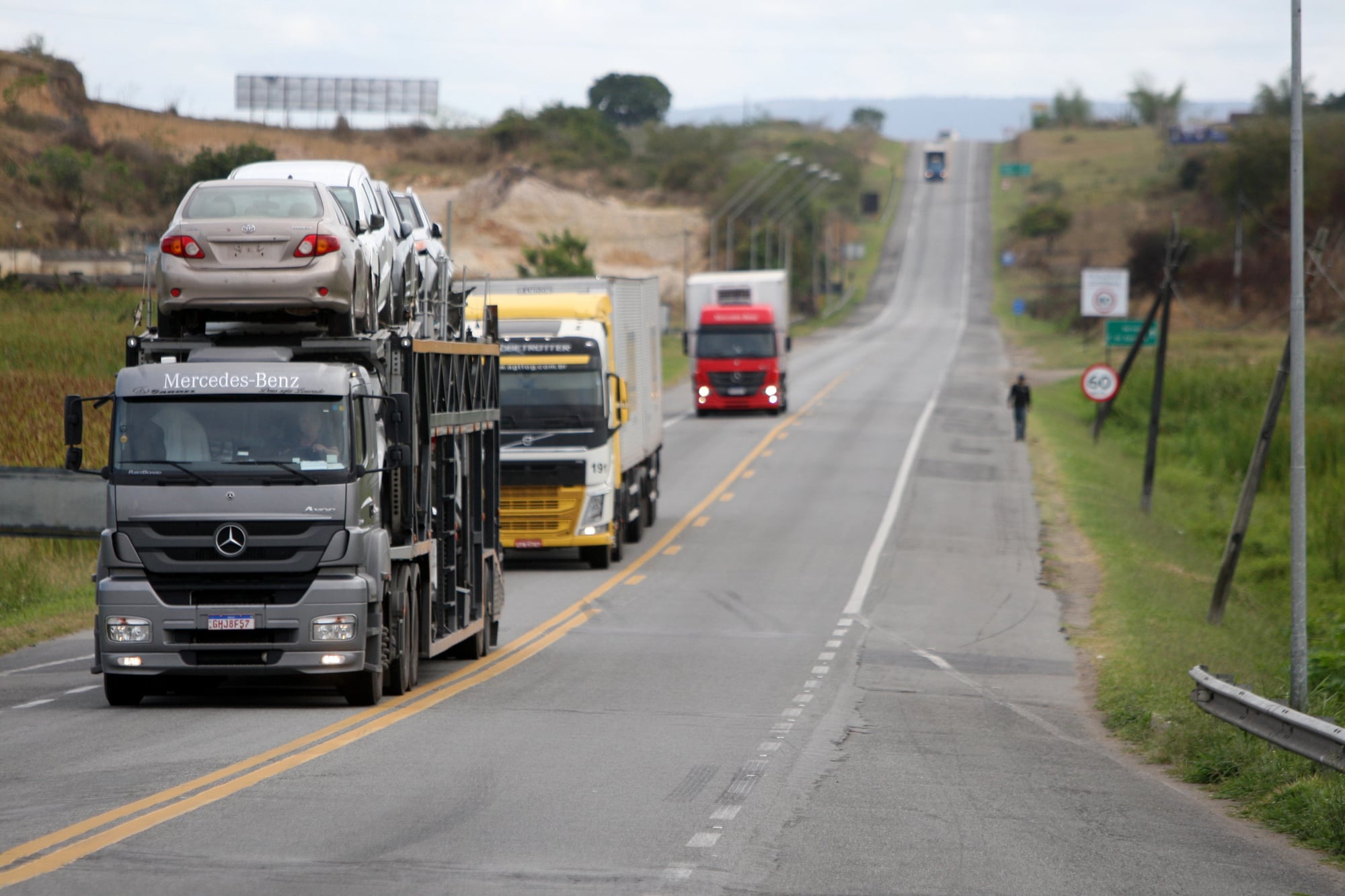
Brazilians call the section between Curitiba and São Paulo ‘Highway of Death’ for a reason. This stretch of Brazil’s longest highway runs along cliffs and through tunnels that were carved decades ago.
The surface quality varies wildly, with some sections smooth and others riddled with potholes that can ruin a car’s suspension. No fences or barriers separate the road from steep drops.
Heavy traffic never stops, even though the road wasn’t designed to handle this many vehicles. Trucks hauling goods between major cities share the narrow lanes with small cars and motorcycles.
Fatal crashes happen so frequently that locals barely react to the news anymore. The combination of poor infrastructure, intense traffic, and challenging terrain creates a daily gamble for everyone using this route.
Karakoram Highway, Pakistan and China

The Karakoram Highway reaches elevations above 15,000 feet, making it one of the highest paved roads anywhere. More than 1,000 workers died building this road back in the 20th century, and another 1,000 people have died driving it since it opened.
Weather at this altitude changes without warning. Clear skies can turn into blinding snowstorms within minutes.
Mudslides and landslides block the road constantly, sometimes trapping travelers for days. During winter months, heavy snow forces the highway to close completely.
The road surface itself shifts and cracks from the extreme temperature changes between seasons. Oxygen gets thin at these heights, which can affect driver alertness and reaction time.
Guoliang Tunnel Road, China
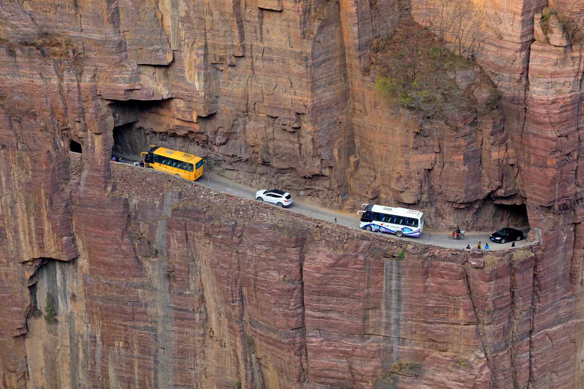
Before 1977, the Chinese village of Guoliang was nearly impossible to reach. Residents carved a tunnel less than a mile long through the Taihang Mountains to connect their town to the outside world.
The tunnel is narrow, with rough walls and a ceiling that varies in height. Windows carved into the mountain side let in light but also remind drivers of the massive drop just beyond the thin rock wall.
The road surface is uneven, and there’s barely enough room for two small cars to pass each other. Sharp turns inside the tunnel require slow speeds and constant attention.
This road isn’t long, but every foot of it demands focus.
Dalton Highway, Alaska
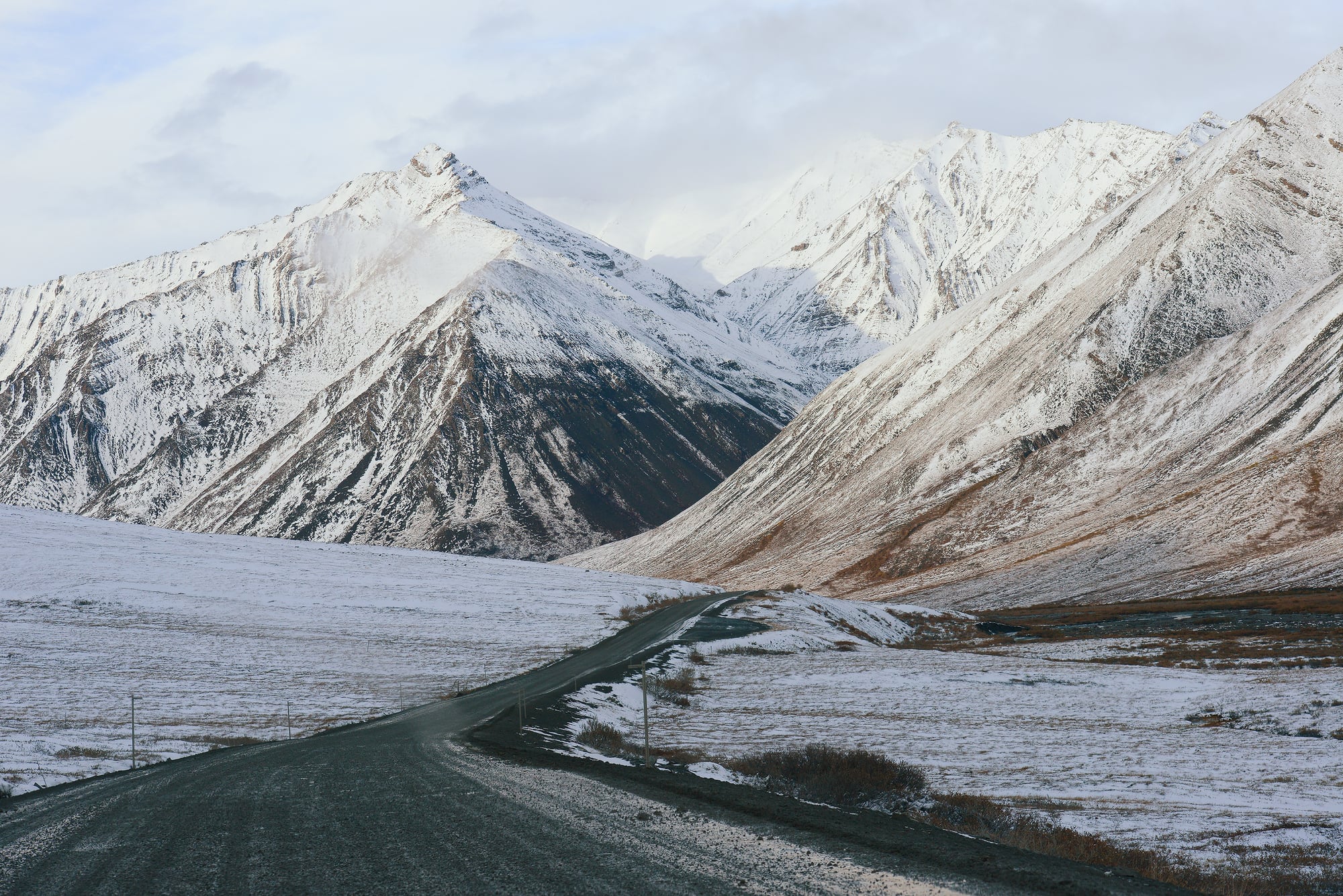
The Dalton Highway stretches 414 miles through Alaskan wilderness, connecting Fairbanks to Deadhorse near the Arctic Ocean. Most of this road is unpaved gravel.
Steep hills, isolation, and brutal weather make this route genuinely dangerous. A 240-mile section has no towns, gas stations, or rest stops at all.
If something goes wrong out there, help might be hours away. The only medical facilities sit at either end of the highway.
Ice covers the road for much of the year, and darkness lasts for months during winter. Flying gravel from trucks damages windshields regularly.
Temperatures can drop to minus 60 degrees Fahrenheit. The TV show ‘Ice Road Truckers’ made this highway famous, but the reality is harsher than any edited episode could show.
Skippers Canyon Road, New Zealand

Hand-carved into a cliff by miners in the late 1800s, Skippers Canyon Road runs about 11 miles through New Zealand’s South Island. The narrow track is mostly one-way with no room to turn around for miles at a time.
No guardrails exist between the road and the Shotover River far below. The road is so narrow that most rental car companies specifically forbid drivers from taking vehicles on it.
Weather conditions change quickly in this area. Wind gusts can reach 30 miles per hour, and fog reduces visibility to nearly zero.
Eight bridges along the route feel rickety and uncertain. Despite the stunning scenery, this road claims nearly 100 lives each year.
Many of those deaths involve tourists unfamiliar with the terrain.
Interstate 95, United States
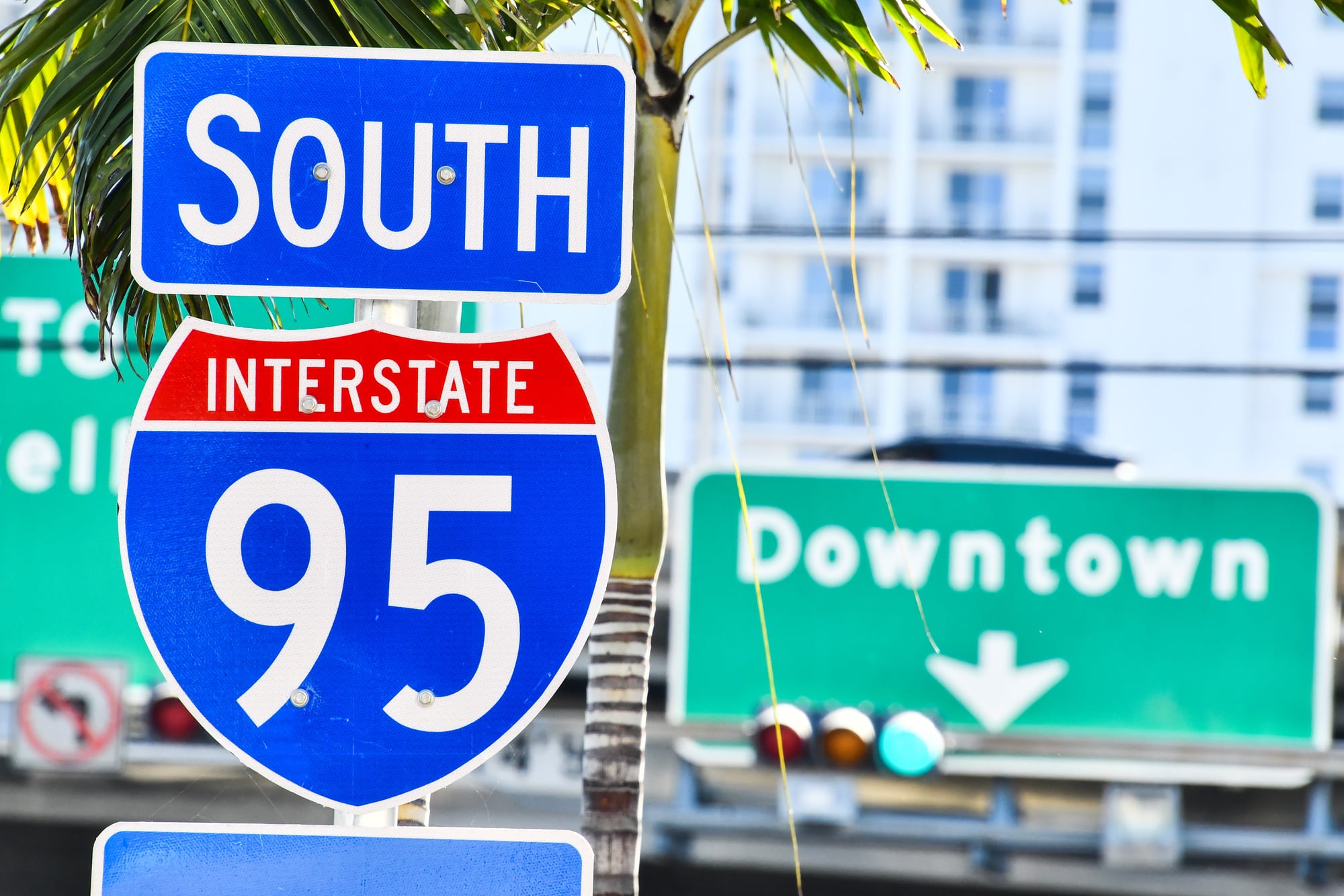
Interstate 95 runs along the entire East Coast, but certain sections stand out for all the wrong reasons. Between 2015 and 2019, this highway recorded 284 total deaths, with a rate of about 14.88 deaths per 100 miles.
The stretch through Jacksonville, Florida saw 48 deaths during that period. In Fort Lauderdale, a single mile of I-95 became the deadliest mile in the entire United States, with 23 fatal crashes between 2000 and 2019.
Winter conditions in the northeast create icy patches and reduced visibility. Heavy traffic in urban areas means one mistake can trigger multi-car pileups.
The highway connects major cities along the coast, so traffic never really stops, even at night.
Sichuan-Tibet Highway, China
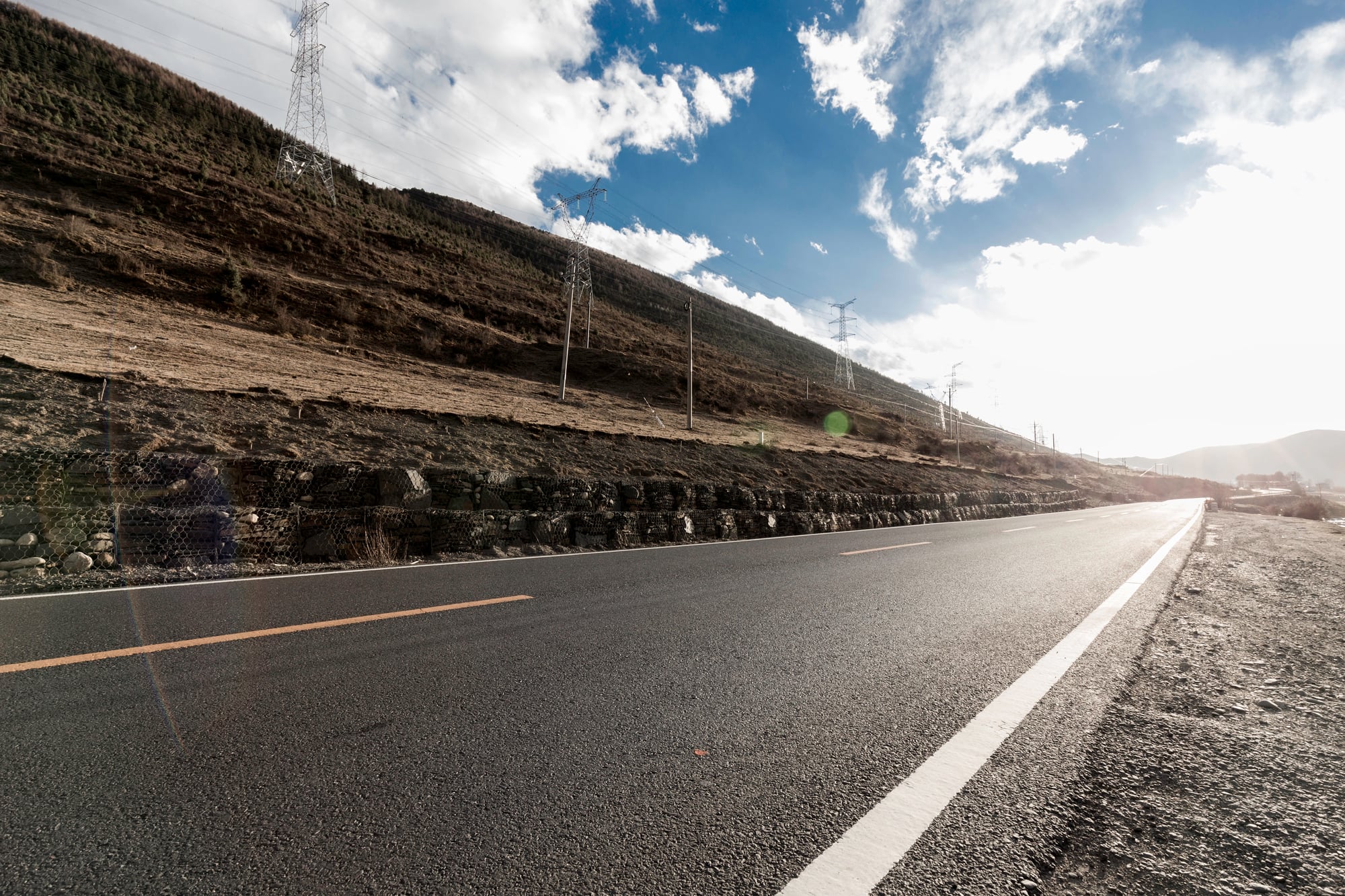
This 1,330-mile road connects China with Tibet through some of the most extreme terrain on Earth. Built nearly three miles above sea level in the early 1950s, the highway passes Buddhist monasteries and herds of yaks while winding through mountain peaks.
Statistics show that roughly 75 out of every 1,000 people who travel this road die on it. Rock slides, mudslides, and avalanches happen constantly.
Treacherous switchbacks on cliffs require perfect timing and steady nerves. The high altitude makes oxygen scarce, which can cloud judgment and slow reaction times.
Weather conditions shift rapidly, turning clear roads into icy death traps within minutes.
Atlantic Ocean Road, Norway
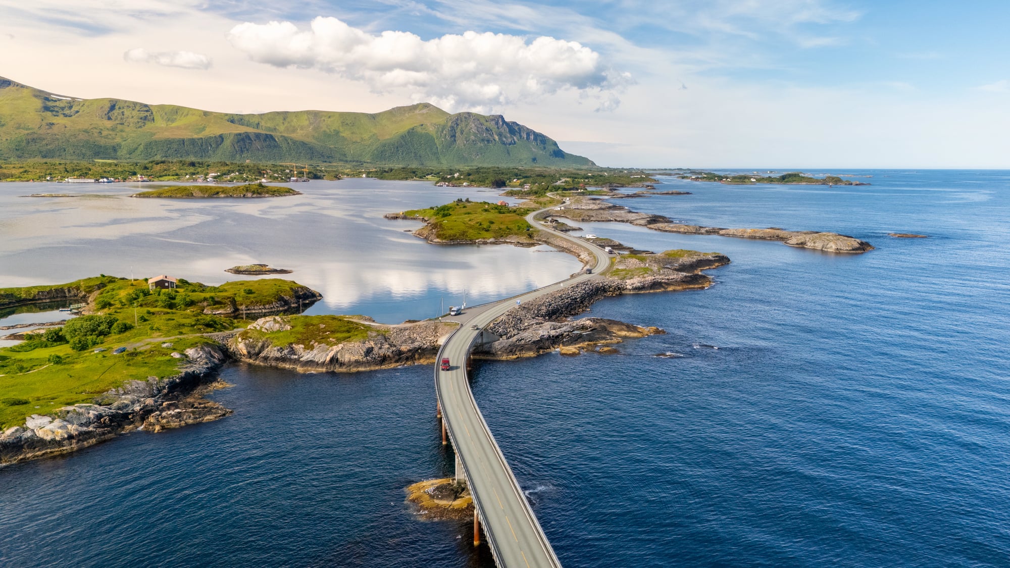
Norway’s Atlantic Ocean Road looks like something from a postcard. The 22-mile route connects small islands with eight bridges that seem to float above the Atlantic.
Beautiful views attract tourists from around the world, but this road demands serious driving skills. Winds regularly reach 30 miles per hour, strong enough to push vehicles into other lanes.
Waves crash over the roadway during storms, covering the surface with water. Visibility drops to dangerous levels when fog rolls in.
The bridges themselves feel exposed and vulnerable when weather turns bad. Despite being considered one of the best coastal drives anywhere, it’s also one that requires total concentration.
Highway 285 and Highway 302, Texas

The area around Pecos, Texas earned the nickname ‘Death Highway’ through a combination of factors that create perfect conditions for crashes. Heavy oil field traffic means large trucks share the road with regular vehicles constantly.
Weather in this region can turn vicious without warning, bringing dust storms that reduce visibility to zero or ice that turns the highway into a skating rink. The roads stretch through isolated areas where emergency services take a long time to arrive.
Long, straight sections encourage speeding, which makes crashes more severe when they happen. The oil boom brought more traffic to roads that weren’t designed to handle this volume or this type of vehicle mix.
US Route 1, Florida

US Route 1 in Florida runs along the entire eastern shore, from Key West at the state’s southernmost point all the way up the coast. Between 2015 and 2019, this road saw 570 people die in 534 crashes.
Brevard County recorded 87 of those deaths, while Miami-Dade County saw 75. The southern section, known as the Overseas Highway, connects Miami to the Florida Keys using ocean bridges.
Some drivers can’t handle the experience of being surrounded by water on both sides. Florida doesn’t have a complete ban on cell phone use while driving, and distracted driving contributes to many crashes here.
The straight sections encourage aggressive drivers to push speeds well above safe limits.
Zoji La Pass, India
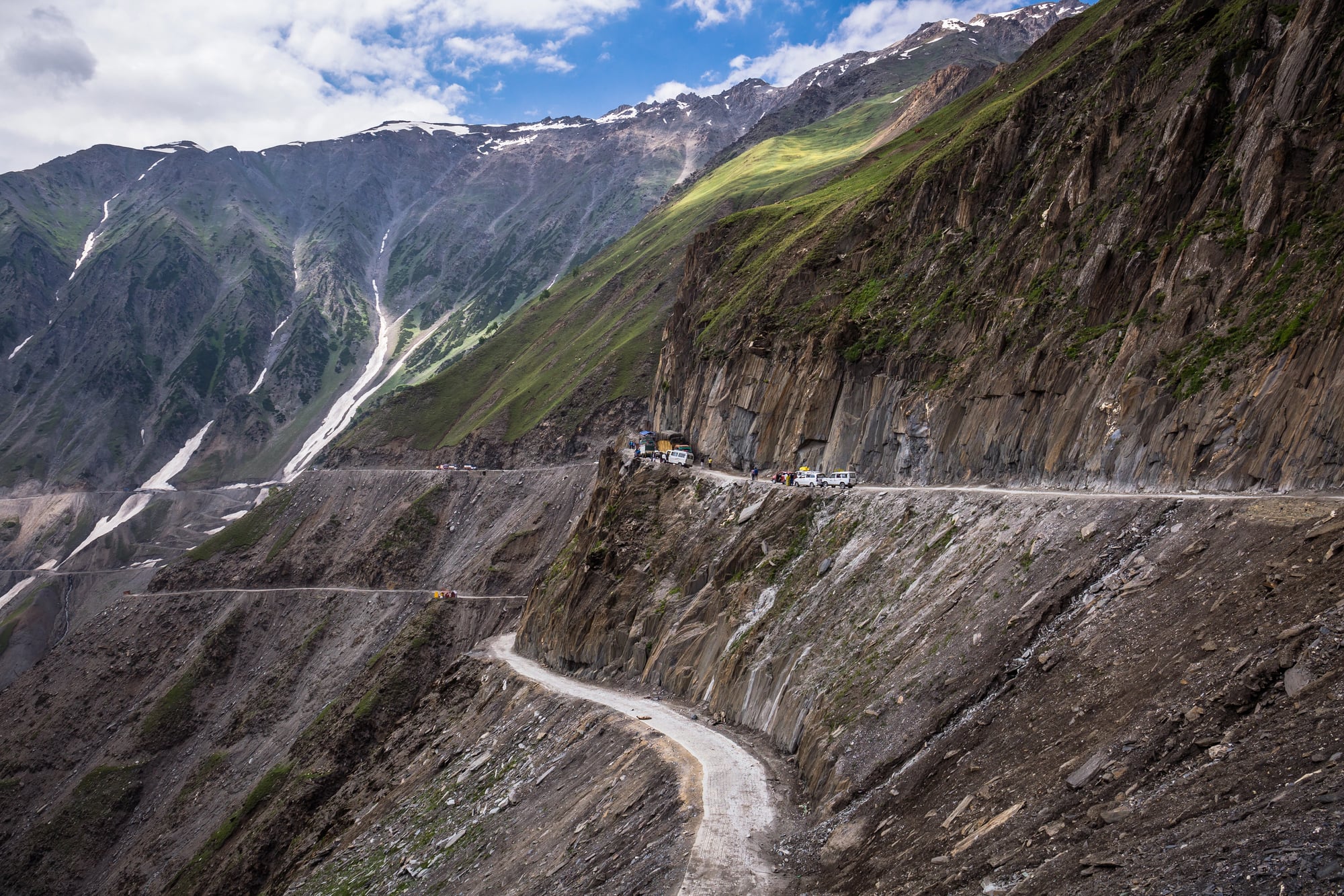
At 11,575 feet above sea level, Zoji La Pass ranks as the second highest road in the Himalayan mountain range. Heavy snow makes the road completely impassable for parts of winter.
When it’s open, the unpaved track turns to sticky mud after storms or heavy rain. The narrow path barely fits one vehicle in many sections, making it nerve-wracking when traffic approaches from the opposite direction.
No barriers or guardrails protect drivers from the steep drops on either side. Visibility can drop to nothing when fog settles in the mountains.
Landslides and falling rocks create obstacles that appear without warning.
Trans-Siberian Highway, Russia

Stretching 6,835 miles from St. Petersburg to Vladivostok, the Trans-Siberian Highway is the third longest highway in the world. Winters last up to 10 months in some sections, bringing snow drifts, whiteout conditions, and temperatures that freeze fuel lines.
Parts of the route require drivers to cross frozen rivers and lakes, hoping the ice is thick enough to support vehicle weight. Infrastructure varies wildly along the route, with some sections paved and maintained while others look like forgotten backroads.
The sheer distance means help can be impossibly far away when problems arise. Drivers face isolation, extreme weather, and unpredictable road conditions all at once.
State Road 138, California
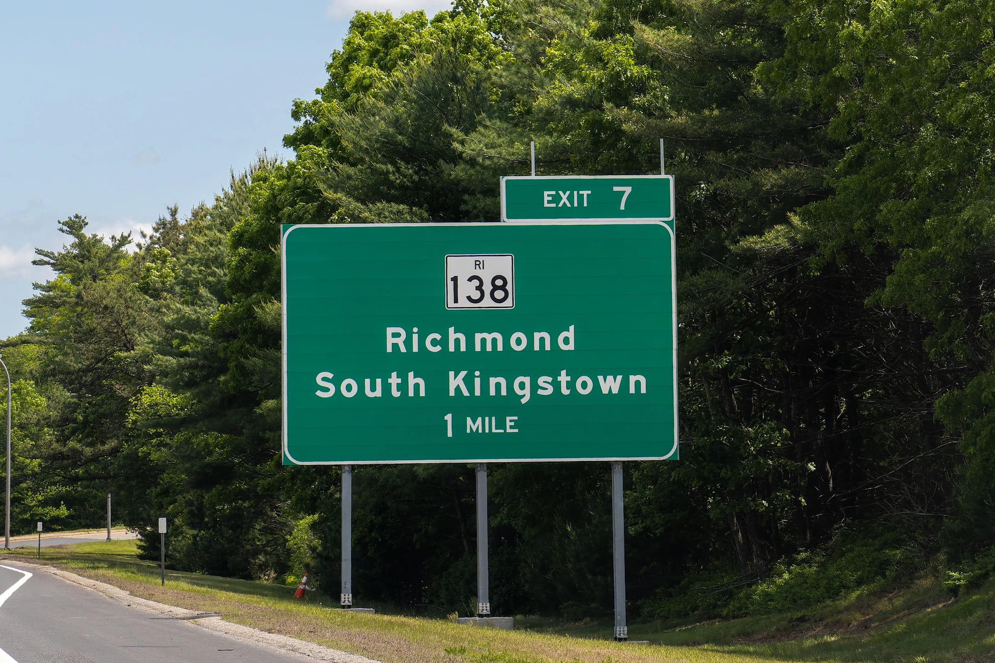
Californians call State Road 138 the ‘Death Trap Highway’ because of how many challenges it throws at drivers. Significant drop-offs line the road with no protective barriers.
Sharp turns appear suddenly, requiring quick reactions. Poor visibility from fog, dust, or harsh sunlight makes it hard to see what’s coming.
Drivers who ignore traffic laws and speed through these conditions create situations that end badly. The road cuts through terrain that would be beautiful if drivers could afford to look at it, but keeping eyes on the road is the only safe option.
Karnali Highway, Nepal
Winding across Nepal’s high mountains, the Karnali Highway covers 155 miles where roughly fifty lives are lost annually. Monsoon or not, travel here tests endurance.
Dust kicks up thick from the rough ground, blinding drivers to whatever lies just beyond. On tight sections, trucks and buses inch by one another, metal brushing metal.
Few spaces allow room for error. Rocks tumble onto the path out of nowhere when hills give way.
When rain comes, parts of the route vanish under rushing water. Pits big enough to wreck a vehicle show up again and again.
On one edge, sheer drops wait silently for any slip. Keeping steady feels shaky no matter how carefully you move.
Road to Hana Hawaii

Winding along Maui’s east coast, the path to Hana stretches 52 miles from Kahului. You’ll cross 59 tight bridges while navigating over six hundred curves.
Depending on the weather, expect to spend two up to four hours getting there. Thick trees line the route, opening suddenly to sweeping sea scenes.
Beauty hides risk here – each scenic mile asks for careful attention. Twist after twist keeps hands busy, eyes locked on the road ahead.
When it comes to bridges, most fit just one car – so timing matters when others approach from the opposite direction. The state’s travel office suggests tourists skip driving here alone, especially in rented vehicles.
People new behind the wheel often guess wrong on bends, freeze up crossing slim overpasses, or lose calm amid endless winding lanes.
When beauty comes with consequences

Walking where land cuts deep, these paths began as a necessity. Through steep rock faces, workers shaped routes step by step.
Stretching far beyond what feels reasonable, some run straight into open horizons. Reaching villages tucked away, they link lives once cut off.
Some come for what they can see, others have no choice but to take the same path. These paths stay dangerous, even when packed with cars or called essential.
Perfect control is needed where conditions never cooperate. Each year, many do not make it through, caught by demands too high for ordinary skill.
Beauty pulls travelers in, yet behind it lies a price paid again and again.
More from Go2Tutors!

- The Romanov Crown Jewels and Their Tragic Fate
- 13 Historical Mysteries That Science Still Can’t Solve
- Famous Hoaxes That Fooled the World for Years
- 15 Child Stars with Tragic Adult Lives
- 16 Famous Jewelry Pieces in History
Like Go2Tutors’s content? Follow us on MSN.