15 Breathtaking Drone Shots Of The World’s Most Densely Packed Cities
There’s something mesmerizing about watching a city breathe from above. The endless grid of rooftops, the arteries of traffic threading between concrete canyons, the way millions of lives unfold in spaces that seem impossibly small when viewed from a drone’s perspective.
These aerial glimpses reveal the beautiful chaos of human density — how we’ve learned to stack our dreams vertically and squeeze entire civilizations into spaces that would have seemed laughably inadequate to our ancestors. The world’s most crowded cities become abstract art when captured from the sky, transforming claustrophobia into something unexpectedly gorgeous.
Hong Kong
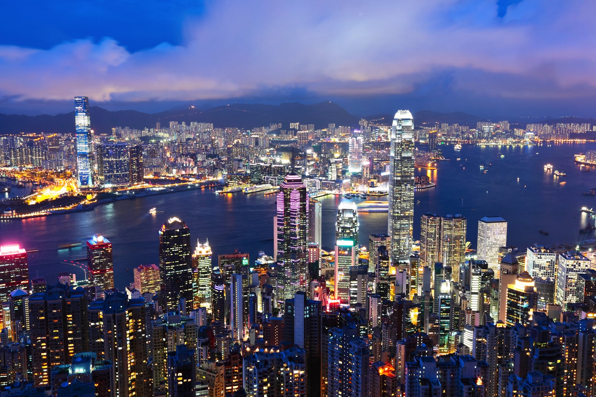
Hong Kong doesn’t mess around with space. 18,200 per square mile.
Apartment buildings that stretch upward like desperate prayers. The drone captures it all — endless towers packed so tightly they seem to lean on each other for support.
Dhaka
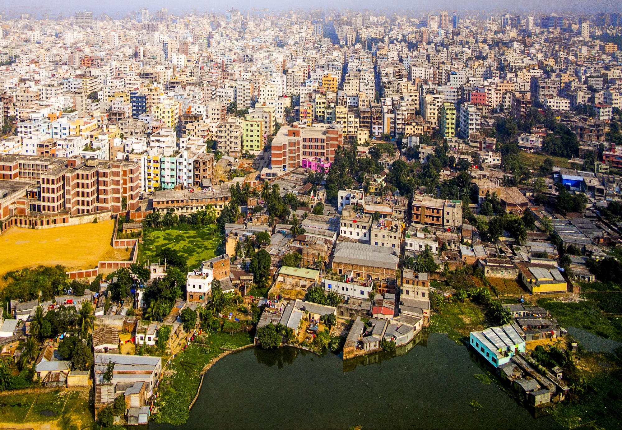
The numbers in Dhaka are staggering (and somehow, when you see the aerial shots, they make perfect sense): over 23 million people crammed into an area that’s basically the size of a large American suburb, which creates a density that defies logic until you witness it from above. The drone footage reveals a city that’s essentially one continuous neighborhood — no breaks, no breathing room, just an uninterrupted tapestry of humanity that stretches to every horizon.
But here’s what strikes you about the aerial perspective: it’s not chaotic at all. Organized.
The way beehives are organized, or coral reefs, or any other system where millions of individual units somehow figure out how to coexist in impossible proximity.
Manila
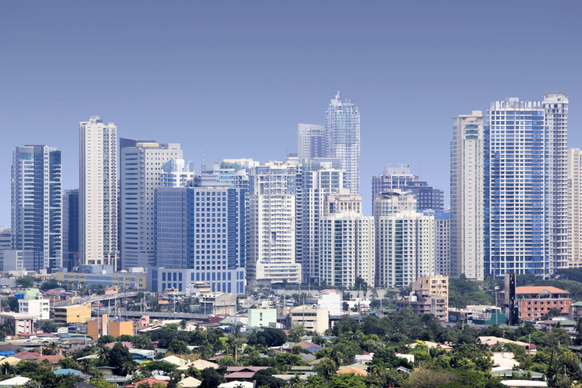
Manila perfects the art of human tetris. Every square inch claimed.
Every rooftop a neighborhood. The drone reveals how creativity becomes necessity when space runs out — bridges between buildings, gardens on fire escapes, entire communities balanced on structures never meant to hold them.
Mumbai
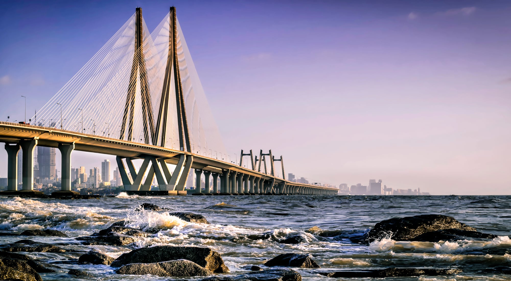
There’s something profound about Mumbai from the sky — the way Dharavi’s corrugated metal roofs catch the light like a vast, improvised mirror, reflecting not poverty but ingenuity, not chaos but a kind of urban metabolism that somehow keeps twenty million people alive and dreaming in a space that was never supposed to hold them. The aerial shots capture those moments when the slums and the skyscrapers exist in the same frame, and you realize they’re not opposite things at all — they’re different verses of the same song about making do, about finding ways to belong when there’s barely enough room to stand.
And the colors. From ground level, Mumbai can feel overwhelming, but from above it becomes a Jackson Pollock painting where every splash of blue tarp and red brick and yellow taxi tells a story about human persistence.
São Paulo
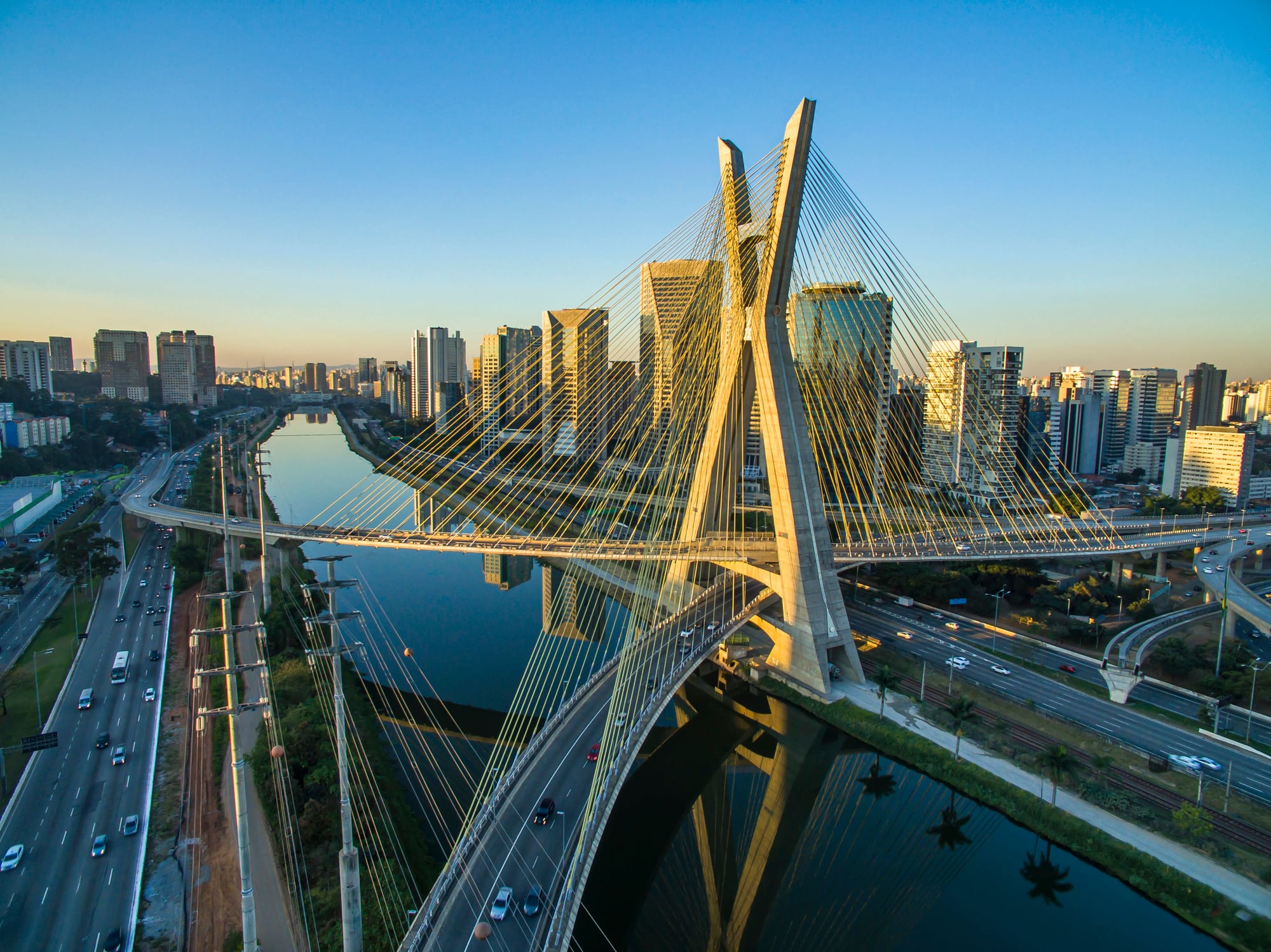
São Paulo spreads like spilled coffee across the landscape. Twenty-two million people.
The drone shots are relentless — just buildings, horizon to horizon, with no end in sight. It’s urban planning by pure momentum.
Lagos

Lagos grows faster than anyone can plan for it (and the aerial footage captures exactly what that looks like): a city that’s essentially making itself up as it goes along, with neighborhoods sprouting organically around highways, markets blooming in spaces between overpasses, and residential areas that follow the logic of available land rather than any master plan. Twenty-five million people figuring it out in real time.
So the drone shots have this quality of capturing a work in progress — not a finished city but a city in the act of becoming, which makes every frame feel urgent and alive.
And here’s the thing about the density: from above, you can see how the informal settlements aren’t scattered randomly but follow their own patterns, their own networks of connection that make perfect sense once you stop expecting them to look like cities designed by committees.
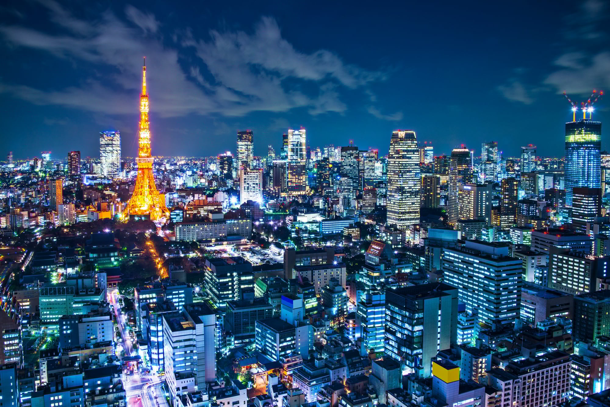
Tokyo
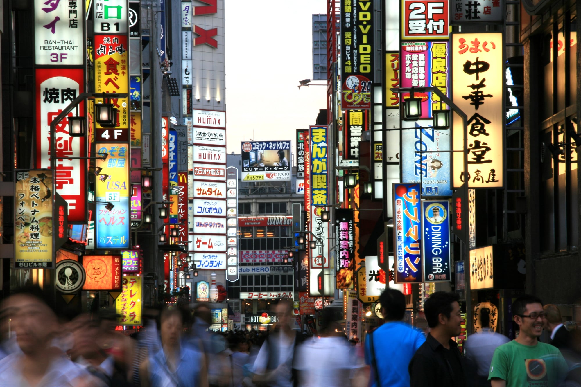
Tokyo feels like a circuit board designed by someone who understood that efficiency can be beautiful. The drone hovers over neighborhoods where every building fits precisely into the urban grid, where density becomes a form of visual music rather than visual noise.
Thirty-seven million people, and somehow it all works. The aerial shots reveal the hidden geometry of a city that’s learned to be crowded without feeling chaotic.
Delhi
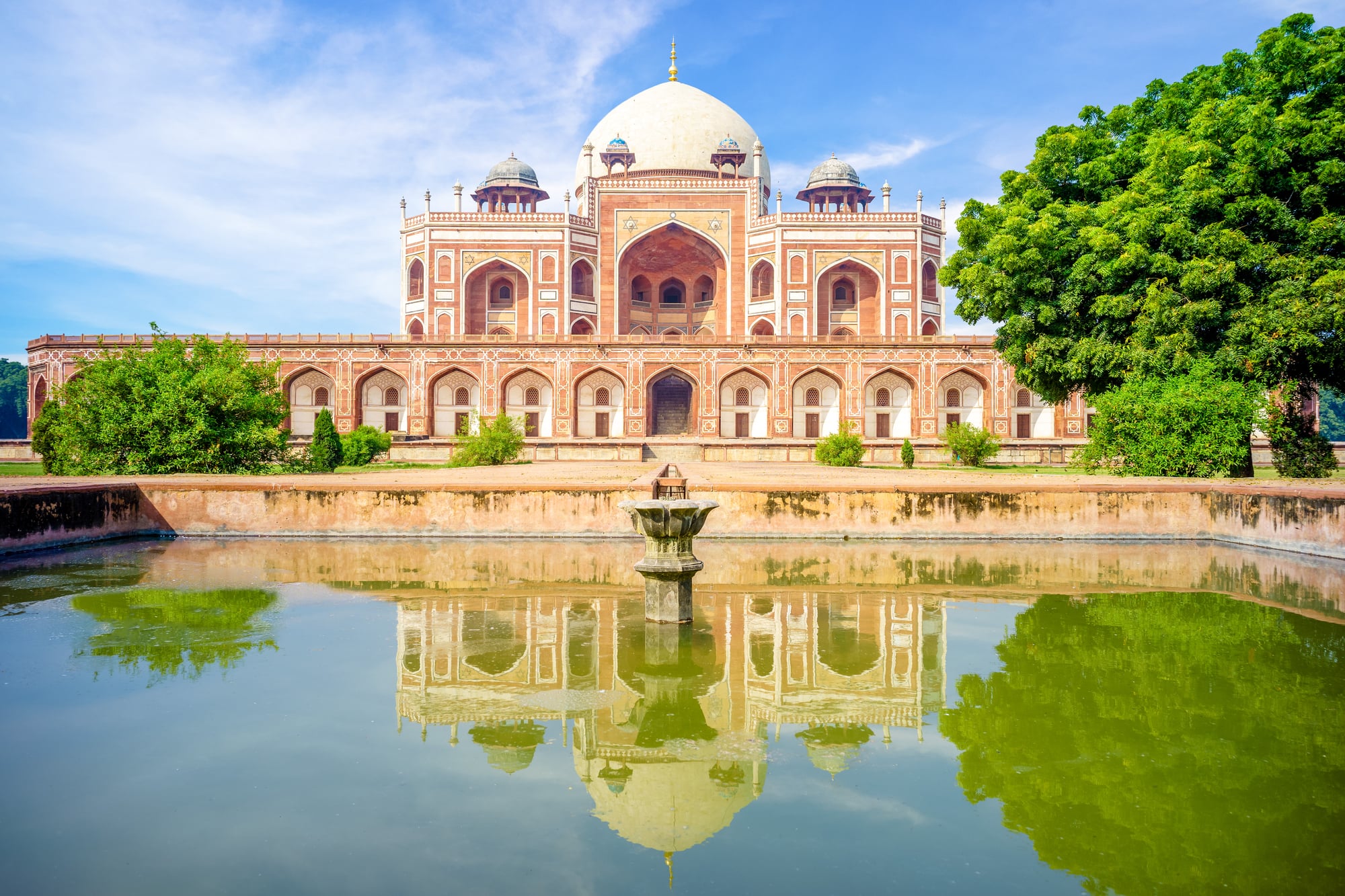
Delhi doesn’t apologize for its intensity. Thirty million people and counting.
The drone captures the beautiful collision between ancient Delhi and modern Delhi — medieval streets threading between glass towers, street markets flowing around shopping complexes like water around stones.
From above, the density becomes a kind of urban archaeology where every layer of the city remains visible.
Shanghai
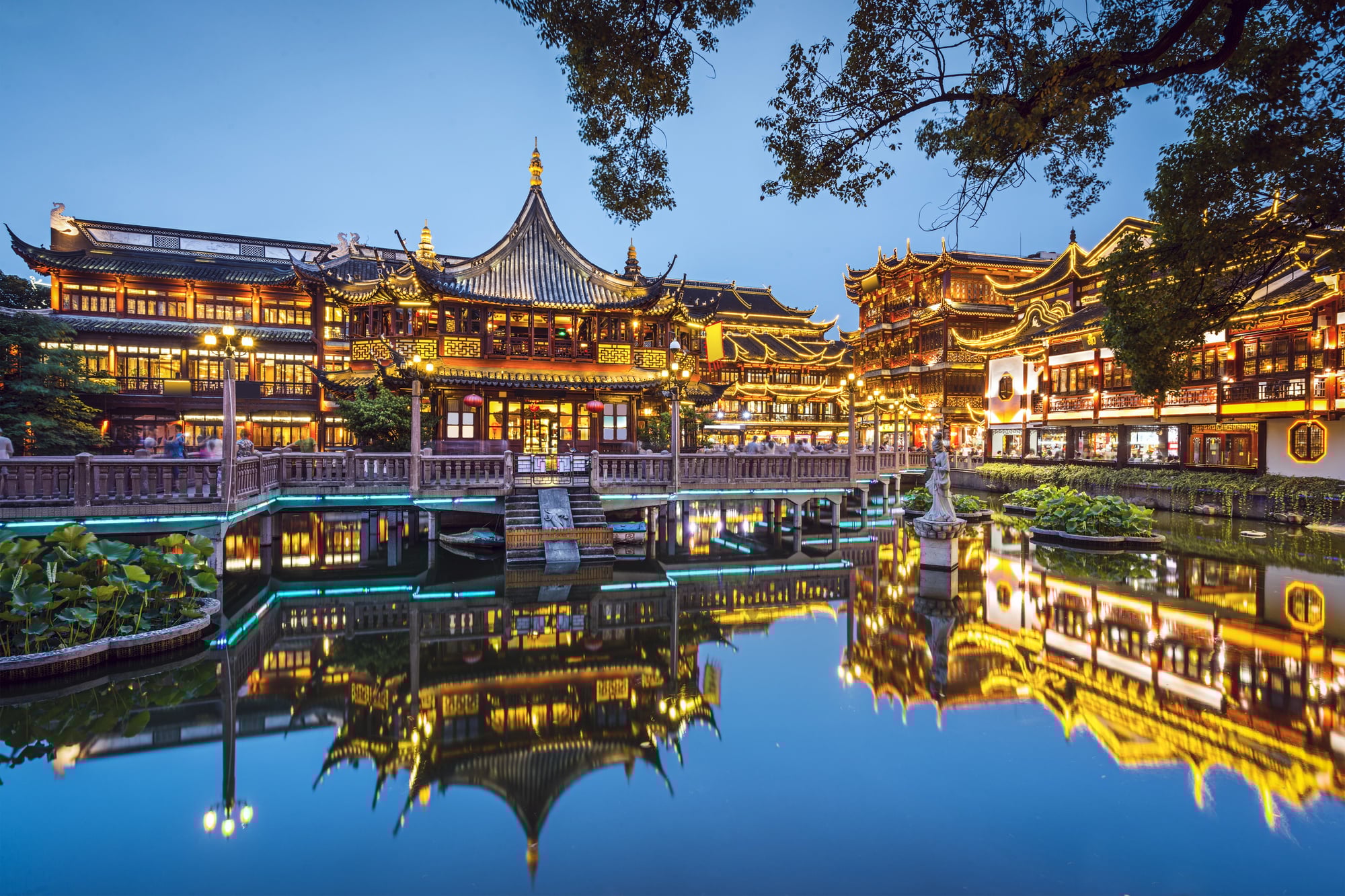
The aerial shots of Shanghai are exercises in vertigo (and not just because of the height): they capture a city that’s essentially been rebuilt from scratch in thirty years, which means the density has a planned quality that’s both impressive and slightly unsettling. Twenty-eight million people living in a city that was designed rather than grown, and you can see it in every frame — the way the residential towers march in formation, the way the highways curve with mathematical precision, the way everything fits together like pieces of a puzzle that was solved before it was built.
But then the drone drops lower and you see the street life flowering in the spaces between the planning, and the whole thing comes alive.
Karachi
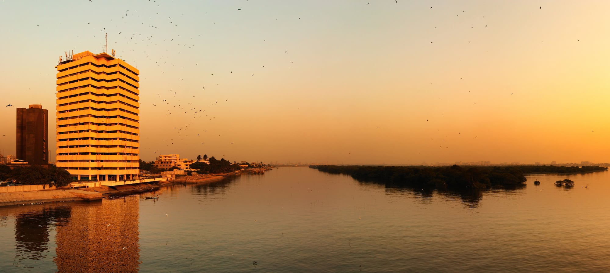
Karachi sprawls with the confidence of a city that’s never met a boundary it couldn’t cross. Sixteen million people in a space that keeps expanding because it has to.
The aerial shots capture neighborhoods that seem to emerge directly from the desert — no transition, just sudden human density where there was empty space moments before.
Istanbul
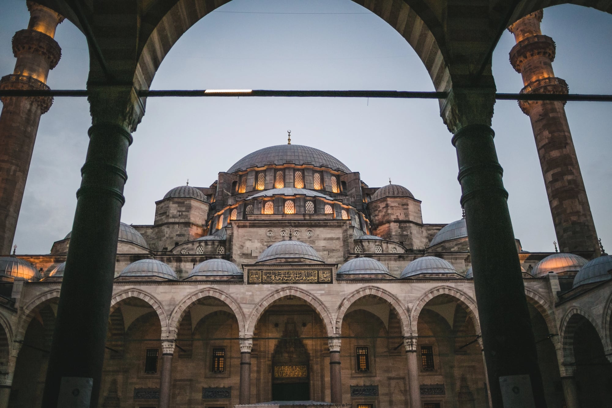
There’s something poetic about Istanbul’s density — the way it flows across hills like a slow-motion avalanche, the way the Bosphorus cuts through fifteen million people like a blue knife, creating two continents of humanity that mirror each other across the water. The drone shots capture the city’s refusal to be contained by geography, spilling across every available surface with the persistence of ivy.
Ancient mosques anchored in seas of apartment buildings. Modern bridges carrying streams of traffic between neighborhoods that have been dense for centuries.
It’s density with a sense of history, where the crowding feels intentional rather than accidental.
Beijing
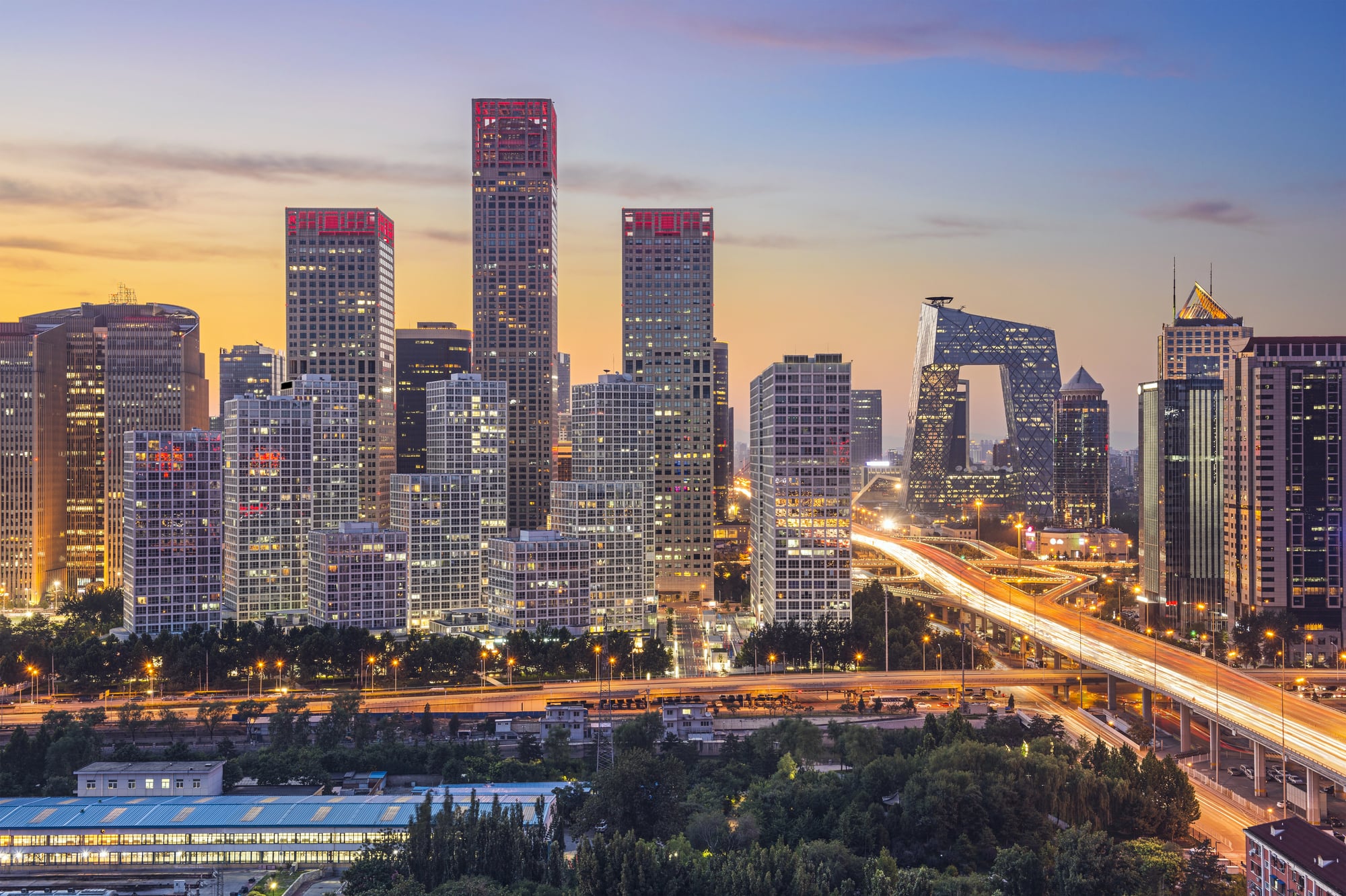
Beijing’s density has the weight of empire behind it. Twenty-two million people arranged in patterns that reflect both ancient Chinese city planning and modern necessity.
The drone reveals the hutongs — narrow alleyways lined with courtyard houses — threading between massive residential complexes like capillaries between organs.
Kinshasa
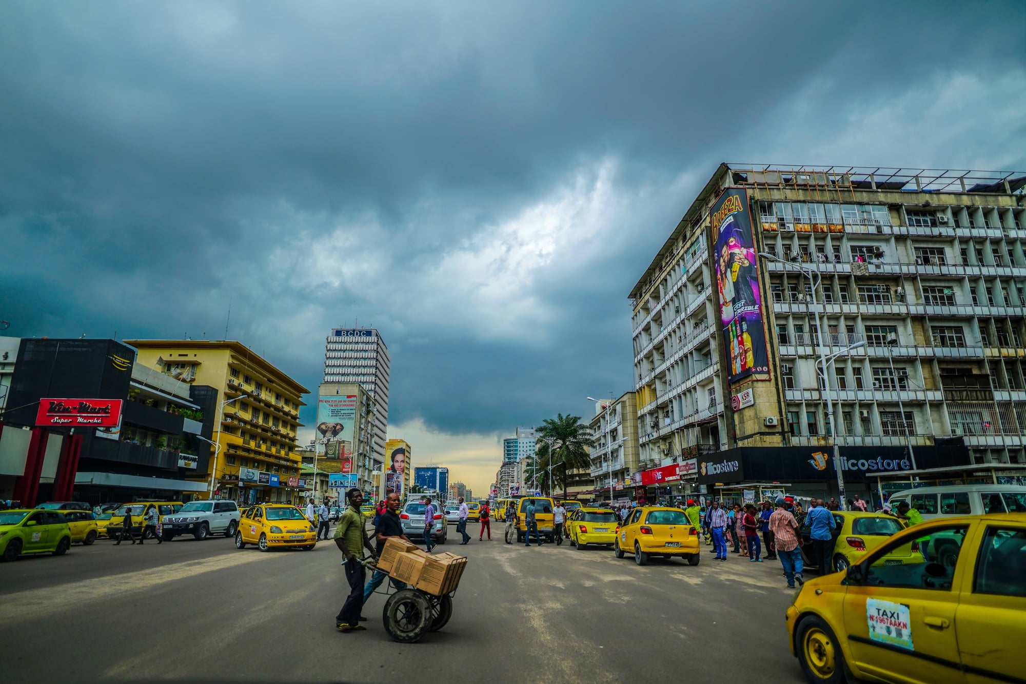
Kinshasa explodes across the landscape with pure demographic energy. Fifteen million people in a city that doubles in size every decade.
The aerial shots capture urban growth in fast-forward — neighborhoods that spring up faster than infrastructure can follow, creating a density that’s part planned city, part improvised solution to the simple problem of where everyone sleeps.
Mexico City
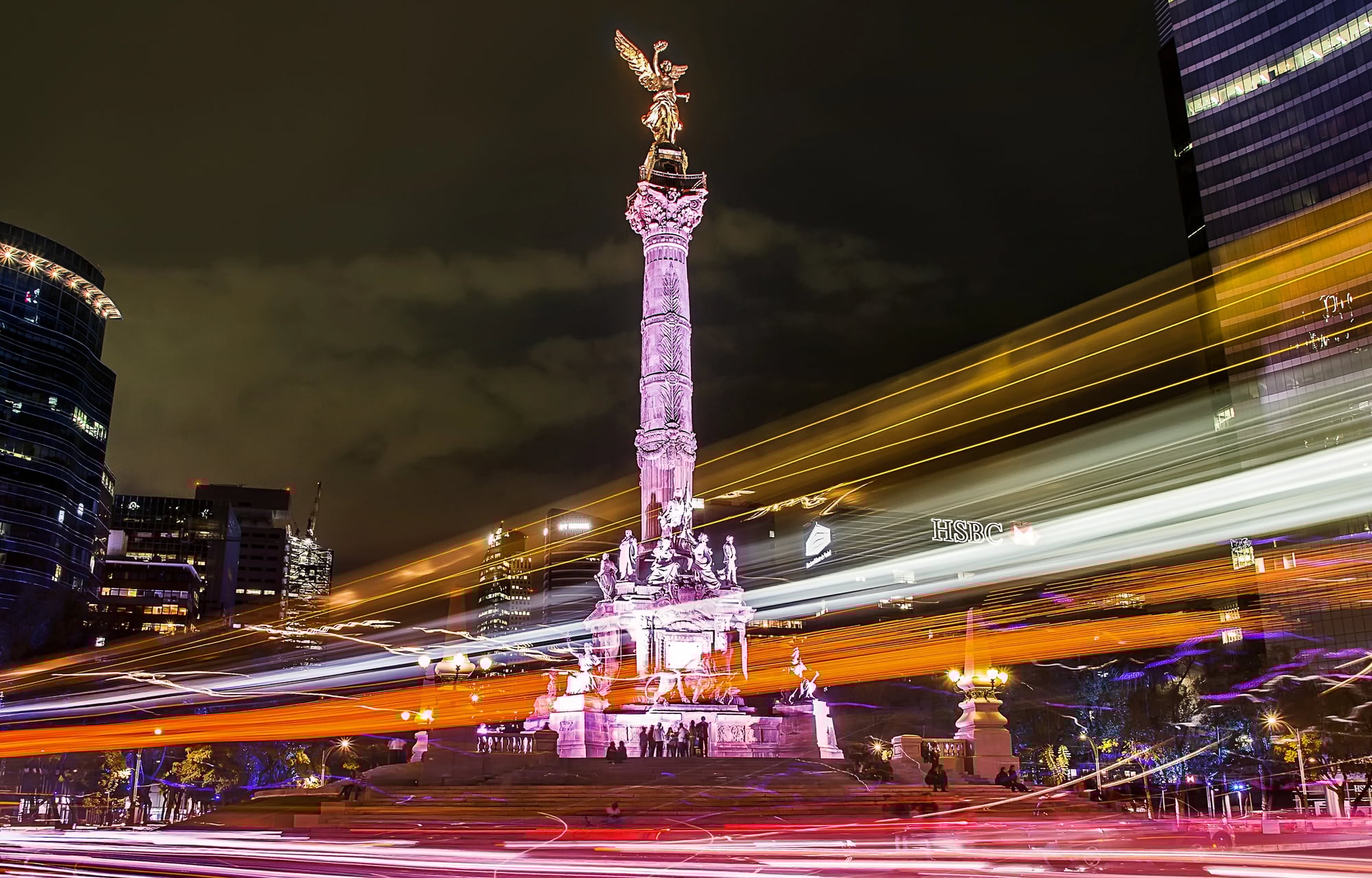
Mexico City sits in a bowl surrounded by mountains (and when you see it from above, that geography suddenly makes perfect sense): twenty-two million people with nowhere to expand but up, creating a density that’s both constrained and magnificent, like a vast urban lake that’s been slowly filling for centuries until it’s reached the brim. The drone shots reveal how the city has learned to work with its natural prison — how neighborhoods climb the hillsides in terraced waves, how the urban center spreads outward in all directions until it meets the mountain walls and stops.
And the scale becomes clear only from the air: this isn’t just a big city but a geographical feature, a human mountain range that happens to be made of concrete and dreams instead of stone.
Chittagong

Chittagong packs its millions into a space between river and sea.
The aerial perspective captures a city that’s learned to build around water — neighborhoods that seem to float on the landscape, connected by bridges and causeways that create a network of human islands.
The density here has a flowing quality, shaped by tides and monsoons into patterns that feel organic rather than imposed.
Above The Beautiful Chaos
Looking at these aerial shots, it becomes clear that density isn’t just a planning problem to be solved — it’s a form of human expression, as distinctive as architecture or art. Each city crowds differently.
Hong Kong stacks vertically with surgical precision. Lagos sprawls with entrepreneurial chaos.
Tokyo creates density that feels like music. These drone shots capture something fundamental about how we live now: most of us in cities, most of those cities packed beyond what previous generations thought possible, and yet somehow it works.
The beautiful chaos continues, seen best from above.
More from Go2Tutors!

- The Romanov Crown Jewels and Their Tragic Fate
- 13 Historical Mysteries That Science Still Can’t Solve
- Famous Hoaxes That Fooled the World for Years
- 15 Child Stars with Tragic Adult Lives
- 16 Famous Jewelry Pieces in History
Like Go2Tutors’s content? Follow us on MSN.