15 places Google Earth Blurs Out
A view opens up when you start scrolling across continents, zooming in where rivers bend or towns cluster. One moment you’re hovering over rooftops, the next lost in patches of blurry terrain with no names.
Smooth textures give way to pixelated gaps, like pieces missing from a puzzle. What seems clear often hides limits just beneath the surface.
Not everything shows up evenly – some areas stay shadowed, distorted, or simply blank. Here lie soft spots, fuzzy blobs, sometimes whole zones gone unclear.
No errors. Never accidents. Decisions sit behind each one – law, fear of risk, deals made in rooms away from view.
While everywhere else gets sharper, these spaces whisper where control holds firm. Here’s a closer look at fifteen places Google Earth blurs out, and what those absences say about how the modern world manages information.
Area 51, Nevada, United States

Area 51 sits deep within the Nevada desert, far from major population centers and even farther from public access. For decades, it has been tied to experimental aircraft testing and classified defense programs.
On Google Earth, the base appears clearer than it once did, yet key details remain softened or indistinct. This partial visibility reflects a careful balance.
The site is acknowledged but not exposed. Buildings can be identified in outline, runways are visible, yet finer detail stops short of revealing operational specifics.
The blur reinforces a long-standing truth: even in the satellite age, some military spaces remain visually protected.
Royal residences, Netherlands

Several Dutch royal properties appear subtly obscured from overhead view. Unlike heavily fortified military sites, these locations sit within urban environments and are publicly accessible at street level.
The blurring is understated, often noticeable only when compared to surrounding buildings. That restraint reflects European privacy standards rather than secrecy in the traditional sense.
The aim is not to hide existence, but to limit intrusive detail. In this case, digital distance replaces physical barriers, showing how privacy can be enforced without walls or fences.
HAARP Facility, Alaska, United States

The HAARP research facility lies in a sparsely populated region of Alaska, surrounded by forest and open land. Its purpose is openly documented as atmospheric research, yet its association with defense funding has made it a frequent subject of speculation.
On Google Earth, parts of the facility appear intentionally unclear. The blurring is less about mystery and more about classification boundaries tied to research infrastructure.
Even when a site’s function is public, the mechanisms behind it may still be shielded from close inspection.
Keowee Dam, South Carolina, United States
Keowee Dam plays a crucial role in supporting nearby nuclear energy facilities by supplying cooling water. Infrastructure tied to energy generation is often treated as sensitive, even when it has no visible security presence on the ground.
The dam’s blurred appearance reflects a precautionary approach. It is less about hiding the structure itself and more about limiting detailed overhead information.
This quiet restriction highlights how civilian infrastructure can carry strategic weight in a digital mapping context.
Israeli military installations, Israel
For many years, satellite imagery over Israel was subject to strict resolution limits. Although some of those rules have relaxed, several military installations still appear blurred or softened on Google Earth.
These restrictions stem from national security concerns shaped by regional instability. The uneven visibility of different sites reveals how mapping platforms must navigate country-specific legal frameworks.
The result is a landscape where visibility depends as much on geopolitics as geography.
Russian strategic facilities, Russia
Across Russia’s vast territory, certain military and strategic sites remain obscured. These include facilities linked to missile forces and other defense assets considered essential to national security.
The blurring is inconsistent, reflecting a mix of historical imagery, updated policy decisions, and regional sensitivity. Still, the overall message remains clear.
Strategic capability often comes with visual limitations, especially when viewed through foreign-owned platforms.
Île Longue naval base, France

Île Longue, located on the coast of Brittany, serves as a key component of France’s nuclear deterrent. On Google Earth, parts of the peninsula appear muted despite the surrounding coastline being sharply defined.
This contrast makes the blur especially noticeable. It signals where civilian geography ends and strategic infrastructure begins.
France’s approach mirrors that of other nuclear-capable nations, where deterrence extends beyond hardware into information control.
RAF Menwith Hill, England

RAF Menwith Hill is visually distinctive, marked by large white radar domes that rise above the landscape. Despite this unmistakable presence, detailed overhead imagery remains limited.
The base’s role in intelligence and communications explains the restriction. While its outline is impossible to hide, fine-grain detail is treated as sensitive.
The site illustrates how visibility can be partial without being fully obscured, offering presence without precision.
Shenzhen corporate zones, China
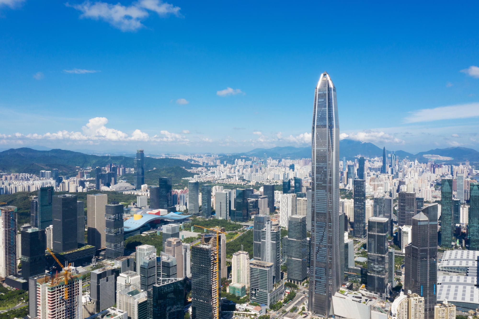
In China, mapping regulations tightly control how geographic data is displayed. Certain areas tied to major corporate or government-linked developments have appeared blurred or simplified on Google Earth.
These restrictions are less about individual sites and more about centralized control of spatial information. The softened imagery reflects a national approach to cartography, where accuracy is filtered through regulation rather than technical capability.
Volkel Air Base, Netherlands
Volkel Air Base sits within a largely rural area, surrounded by farmland that appears crisp and detailed. The base itself, however, is visibly softened in contrast.
This distinction reflects its role within broader defense arrangements. While the base is not hidden from existence, detailed imagery is limited.
The effect is subtle yet intentional, drawing an invisible line around strategic space.
Mazagon Dock Shipbuilders, Mumbai, India

Mazagon Dock Shipbuilders operates in one of India’s busiest cities, constructing naval vessels within a dense urban setting. Portions of the facility appear blurred despite nearby commercial docks being clearly visible.
This selective obscuring reflects India’s approach to protecting defense manufacturing information. The contrast between civilian and military maritime infrastructure highlights how visibility is carefully managed even in crowded environments.
Yongsan Garrison, Seoul, South Korea

Yongsan Garrison once served as a major foreign military installation in the heart of Seoul. Over time, as the site transitioned toward civilian use, its visibility on Google Earth shifted.
Earlier imagery shows greater blurring, while newer views reflect changing control and purpose. This evolution demonstrates how digital restrictions can follow political and urban transformation rather than remain fixed.
Pine Gap, Northern Territory, Australia
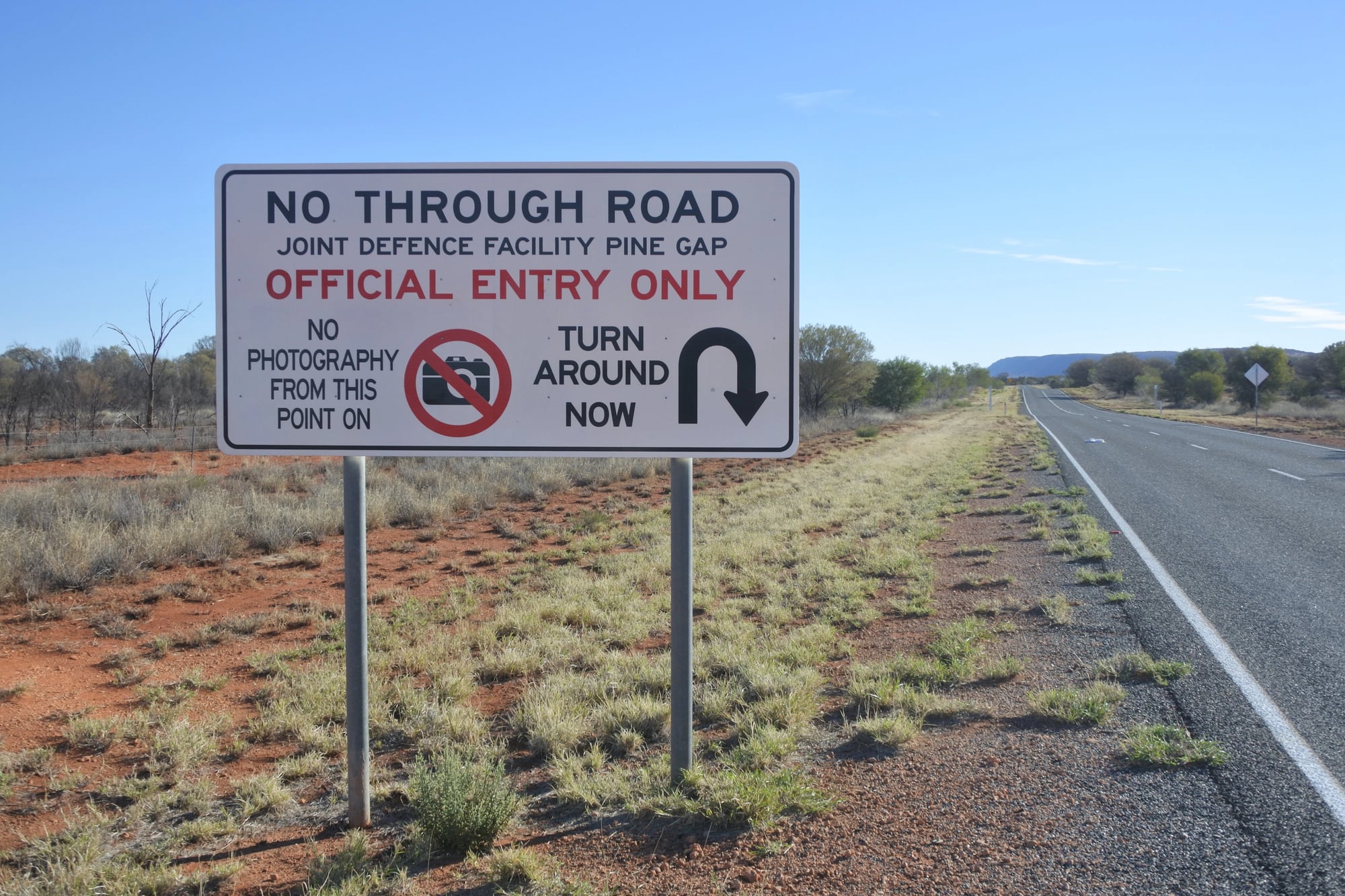
Pine Gap sits in remote central Australia, far from major population centers. Despite its isolation, it remains one of the most carefully treated locations on mapping platforms.
The facility’s intelligence role explains the cautious presentation. Structures are visible, but clarity stops short of revealing detail.
Pine Gap shows that remoteness does not equal openness when strategic interests are involved.
Leadership compounds, North Korea

In North Korea, satellite imagery varies widely depending on location and purpose. Compounds associated with national leadership often appear less defined than surrounding areas.
This limited visibility aligns with broader information control practices within the country. Even when buildings can be identified, detail is constrained.
The blur reflects not just security concerns, but an entire system built around restricted access.
Vatican internal facilities, Vatican City

Vatican City is among the most photographed places in the world, yet some internal areas appear softened from above. While major landmarks are clearly visible, certain operational zones are less distinct.
As a sovereign entity, the Vatican applies its own standards of discretion. The restrained imagery reflects institutional privacy rather than secrecy, maintaining boundaries within an otherwise open environment.
Where visibility still ends
Out there where Google Earth goes fuzzy, it is not just about secret sites staying out of view. Power, rules, and official hands shape what we can see, not just software choices.
What looks like full coverage still hides things in plain sight. Even now, when everything seems exposed, soft patches on the image whisper otherwise.
From high above, certain lines remain firm, drawn long before satellites got into position.
More from Go2Tutors!

- The Romanov Crown Jewels and Their Tragic Fate
- 13 Historical Mysteries That Science Still Can’t Solve
- Famous Hoaxes That Fooled the World for Years
- 15 Child Stars with Tragic Adult Lives
- 16 Famous Jewelry Pieces in History
Like Go2Tutors’s content? Follow us on MSN.