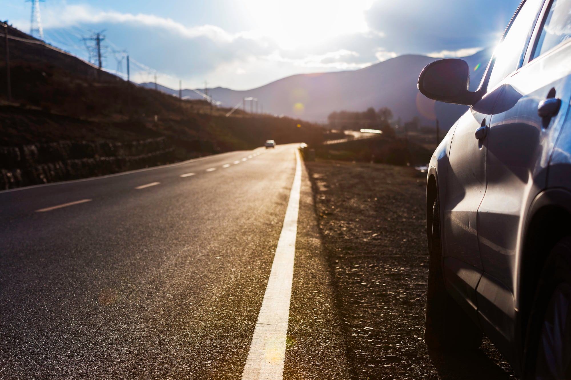
16 Most Dangerous Roads for Drivers in the World
Some roads were never meant to be traveled by regular drivers. They twist through mountains where fog blocks any view beyond the hood of your car, or they carve paths along cliff edges where one wrong turn means a thousand-foot drop with no guardrail to stop it.
These aren’t just challenging drives — they’re reminders that some places on Earth remain stubbornly hostile to human passage, no matter how advanced our vehicles become. Every year, thousands of drivers underestimate these routes, thinking modern cars and GPS can overcome geography and weather that has been claiming lives for decades.
The roads on this list have earned their reputations through statistics that road engineers prefer not to discuss publicly and accident rates that would shut down highways in more populated areas.
North Yungas Road
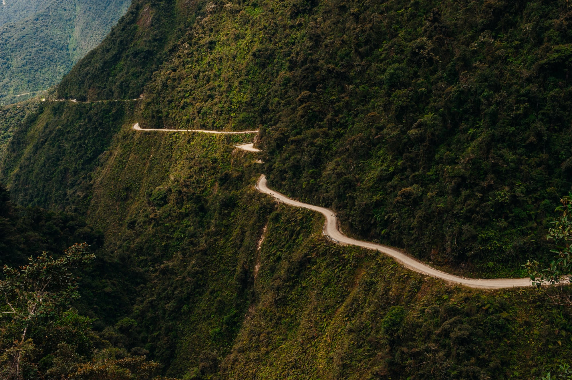
Death Road doesn’t get its nickname from tourism marketing. This Bolivian mountain pass drops 15,000 feet over 40 miles, with sections barely wide enough for a single vehicle and no barriers between the road and the void below.
Rain turns the dirt surface into a mudslick that has sent entire buses tumbling into the canyon. The road connects La Paz to the Amazon rainforest, which means it can’t simply be abandoned despite killing an estimated 200 to 300 travelers annually (though recent improvements have reduced this number).
Locals drive it because they have to. Tourists drive it because they think they should.
Both groups frequently regret the decision about halfway down.
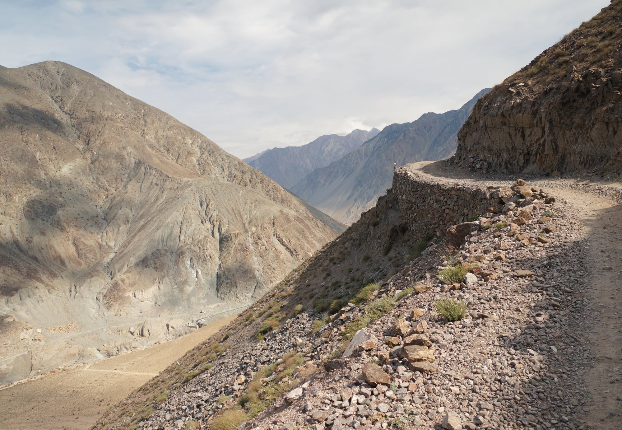
Karakoram Highway
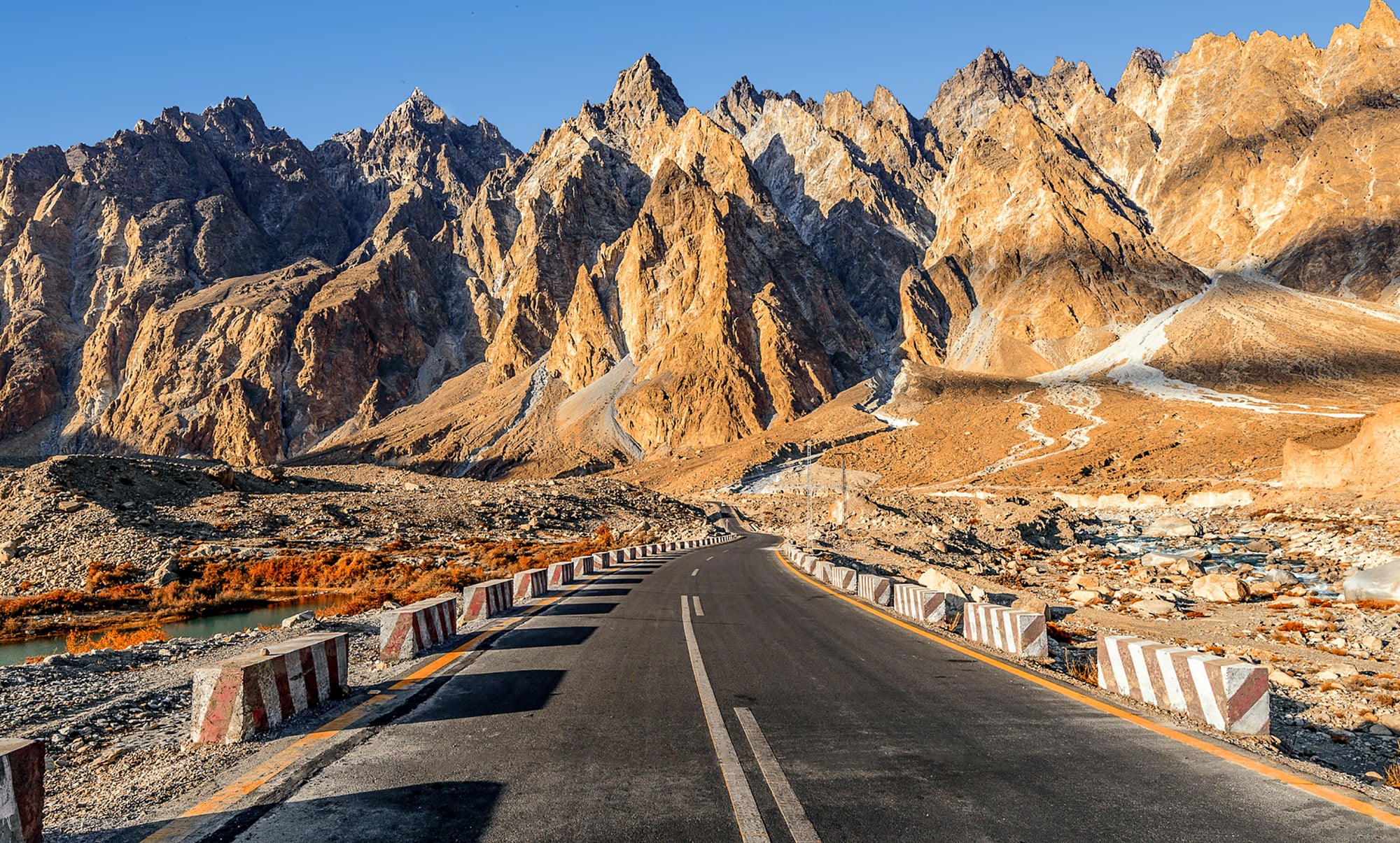
When China and Pakistan decided to connect their countries through some of the world’s most aggressive mountain terrain, the construction alone killed nearly 900 workers — and that was before anyone actually started driving on it regularly. The Karakoram Highway, also known as the Friendship Highway (which is either optimistic or darkly ironic), runs for 800 miles through the Himalayas and Karakorum mountain ranges, reaching altitudes that make breathing difficult and thinking even harder.
Landslides here aren’t seasonal inconveniences; they’re geological facts of life that can bury entire sections of road without warning. And then there’s the altitude sickness, which turns what should be straightforward driving decisions into confused gambles with physics.
The scenery is spectacular, assuming you can spare the attention to look at it while navigating hairpin turns at 15,000 feet above sea level (where both your car and your brain are running on reduced oxygen). But here’s the thing about the Karakoram: it’s not just the road that wants to kill you.
The weather changes fast enough to trap drivers in blizzards that weren’t forecasted, and the remoteness means that when something goes wrong — mechanical failure, medical emergency, or just getting genuinely lost — help isn’t coming quickly. So you sit there, somewhere between China and Pakistan, discovering that all those dramatic mountain photos on social media never quite captured how small and fragile a car feels when surrounded by peaks that scrape the sky.
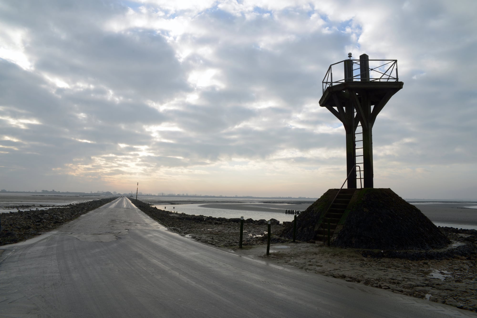
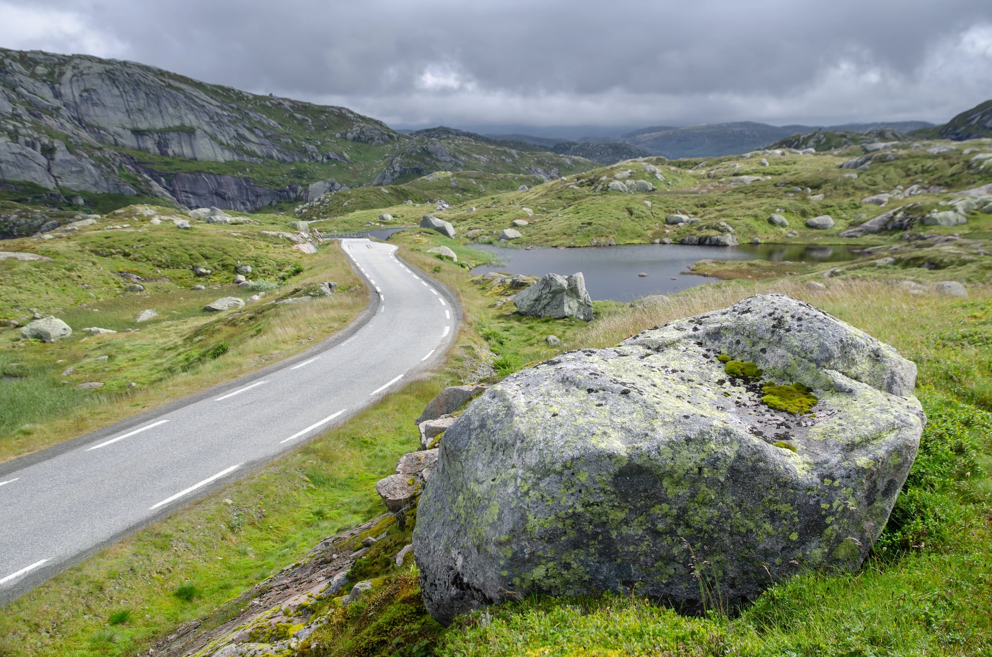
Atlantic Road
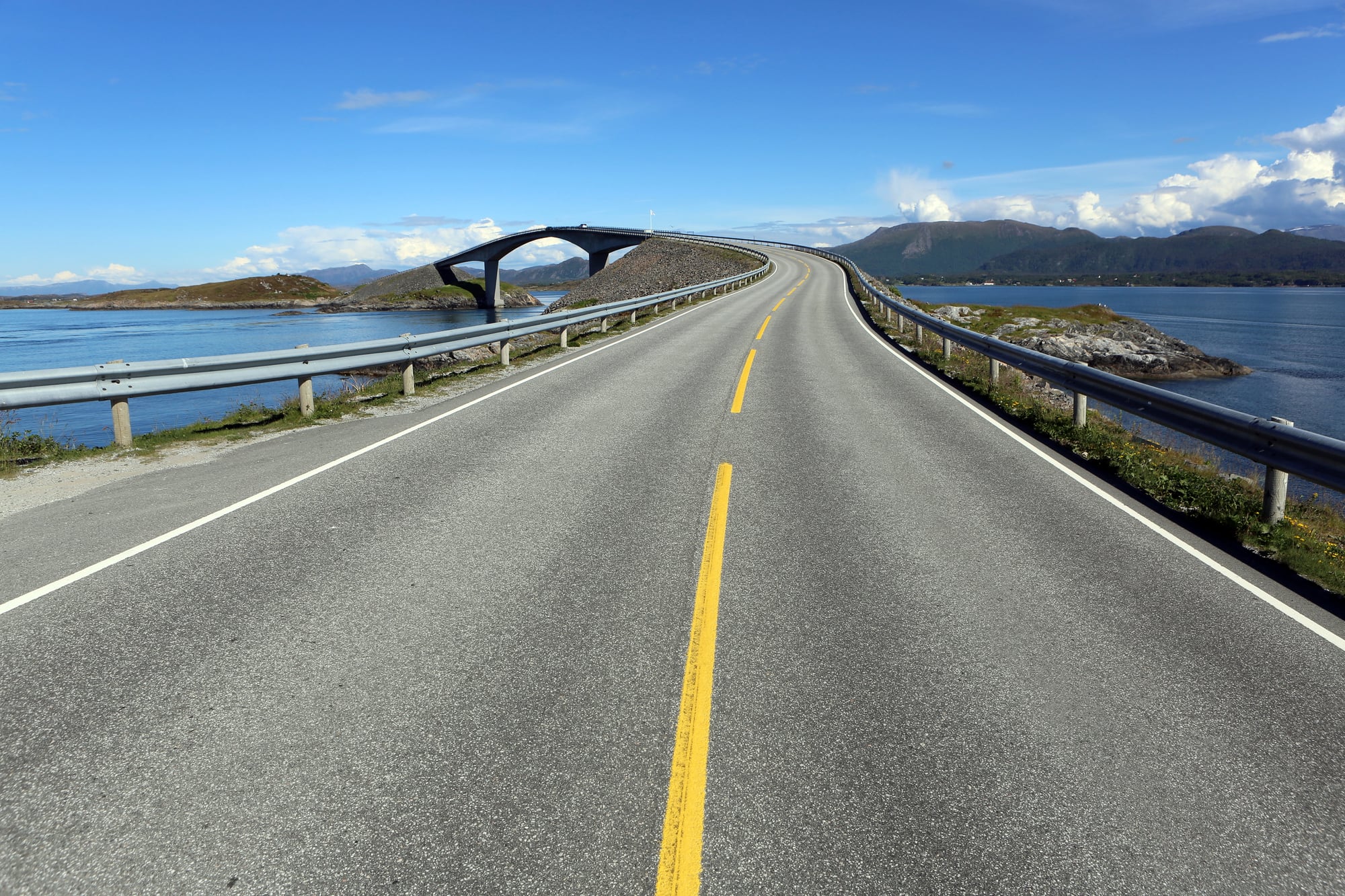
Norway’s Atlantic Road looks deceptively manageable in tourism photos — just a series of bridges connecting small islands along the coast. What those photos don’t convey is how the North Atlantic behaves when storms roll in, turning this scenic drive into something that feels more like navigating a ship than driving a car.
The road’s bridges arch high enough to let boats pass underneath, but that same design makes them vulnerable to crosswinds that can shove vehicles sideways without warning. During winter storms, waves crash over the bridges with enough force to flip cars or sweep them off the roadway entirely.
The Norwegian government built barriers along some sections, but there’s only so much engineering can do when you’re essentially driving through the middle of an ocean that doesn’t particularly care about human transportation needs.
Stelvio Pass
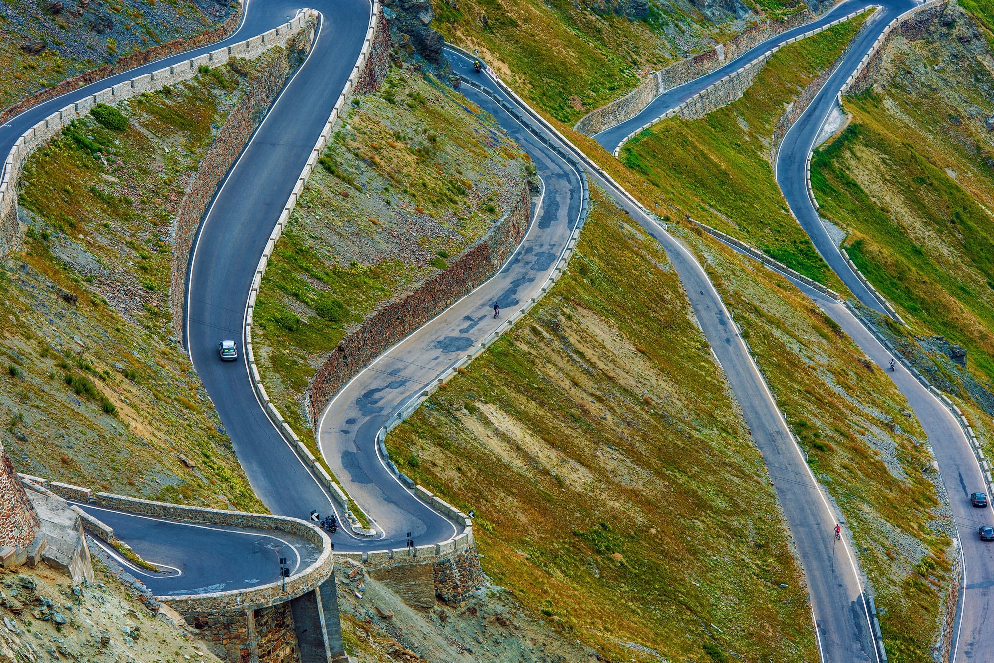
The Italian Alps contain 48 hairpin turns packed into a road that climbs nearly 9,000 feet, and each one of those turns represents a moment where physics and driver skill negotiate whether the car stays on the pavement. Stelvio Pass is technically a marvel of road engineering — a route that shouldn’t exist but does, carved into mountainsides that seem too steep for anything except mountain goats.
Professional drivers love Stelvio Pass because it tests everything: braking, acceleration, spatial judgment, and the ability to think three turns ahead while managing the turn you’re currently in. Amateur drivers hate it for exactly the same reasons.
The pass is only open during summer months, which should tell you something about what winter conditions do to a road that’s already challenging enough when the weather cooperates.
Passage Du Gois
Twice daily, the Atlantic Ocean reclaims a road in France that connects the mainland to Noirmoutier Island. This isn’t poetic language — the tide literally covers the road with several feet of water, making it impassable for about half of every day.
Drivers who miscalculate the timing find themselves stranded on elevated platforms built specifically for this purpose, watching their cars disappear beneath the waves. The road surface, when exposed, is covered with seaweed and marine debris that makes traction unpredictable.
Add the psychological pressure of racing against an incoming tide, and Passage du Gois becomes a driving experience that combines navigation skills with tidal charts. Getting it wrong doesn’t just mean being late to your destination; it means explaining to your insurance company why your car is currently underwater.
Guoliang Tunnel
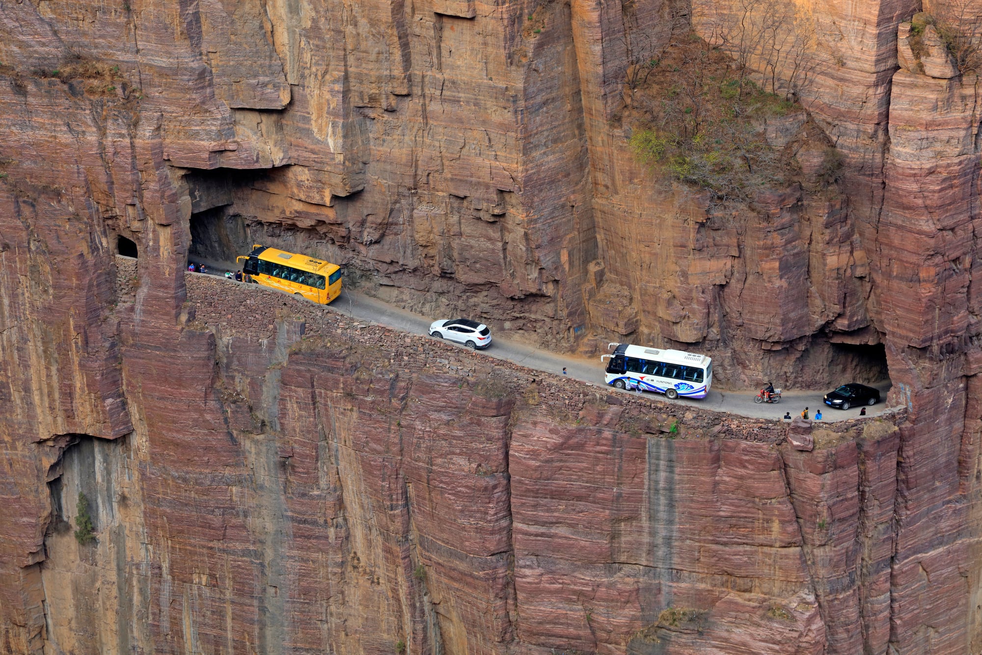
Chinese villagers carved this tunnel through a mountain using hand tools, which explains why it feels less like a road and more like driving through someone’s ambitious but terrifying art project. The Guoliang Tunnel is barely wide enough for one vehicle, with “windows” cut into the rock that provide light but also serve as constant reminders of the thousand-foot drop just beyond the thin mountain wall.
What makes this tunnel particularly nerve-wracking isn’t just the tight quarters or the cliff-side location — it’s the knowledge that the entire thing was built by people who had never constructed a tunnel before and were making engineering decisions based on hope and determination rather than formal training. And yet it works, sort of, assuming you don’t mind spending ten minutes driving through a mountain while wondering whether the next window opening will be the one where the whole thing finally gives up and crumbles.
James Dalton Highway
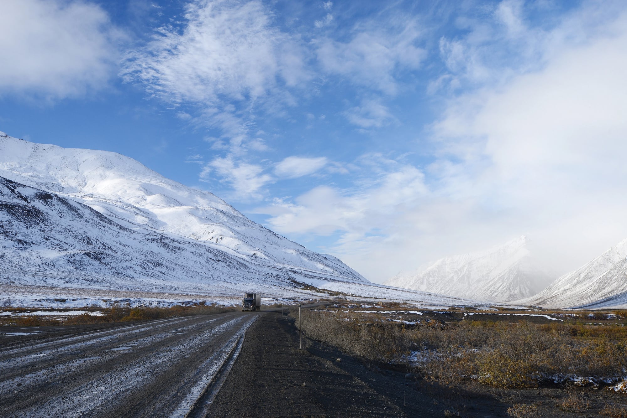
Alaska’s Dalton Highway runs 414 miles through terrain that actively discourages human presence. Built to supply oil fields in the Arctic, it’s a gravel road that crosses mountain ranges, tundra, and climate zones where temperatures can drop to 80 below zero.
There are exactly three towns along the entire route, which means that when things go wrong — and on the Dalton Highway, things frequently go wrong — help is measured in hours, not minutes. The road surface destroys tires and windshields with regularity (truckers budget for both as routine expenses rather than occasional repairs).
But it’s not just the gravel that causes problems: it’s the isolation combined with weather that can change from manageable to life-threatening faster than most drivers can react. The aurora borealis is spectacular up here, but that’s assuming you’re in a position to enjoy it rather than huddled in a broken-down car, burning seat cushions to stay warm while waiting for assistance that may not arrive until the next day.
So here’s what happens on the Dalton Highway that doesn’t happen on normal roads: you start thinking about your fuel consumption not just in terms of cost, but in terms of whether you have enough gas to keep the engine running for heat if you get stranded. You check your spare tire obsessively because the nearest replacement might be 200 miles away.
And you start to understand why experienced drivers pack emergency food, extra clothing, and communication equipment as standard operating procedure rather than paranoid over-preparation. Because the Dalton Highway doesn’t care about your schedule, your comfort, or your assumptions about how roads are supposed to work.
BR-319
Brazil’s BR-319 connects Manaus to Porto Velho through 550 miles of Amazon rainforest, and during rainy season, calling it a “road” becomes generous to the point of fiction. The unpaved sections turn into rivers of mud deep enough to swallow vehicles entirely, while wooden bridges rot and collapse faster than maintenance crews can replace them.
This highway represents what happens when infrastructure meets an ecosystem that views human construction as a temporary inconvenience. Trees fall across the road daily.
Streams change course and wash out bridges. The road surface simply disappears in places, leaving drivers to navigate by GPS through what looks more like a jungle trail than a federal highway.
Yet thousands of drivers attempt BR-319 every year because it’s often the only overland route between major cities in this part of Brazil.
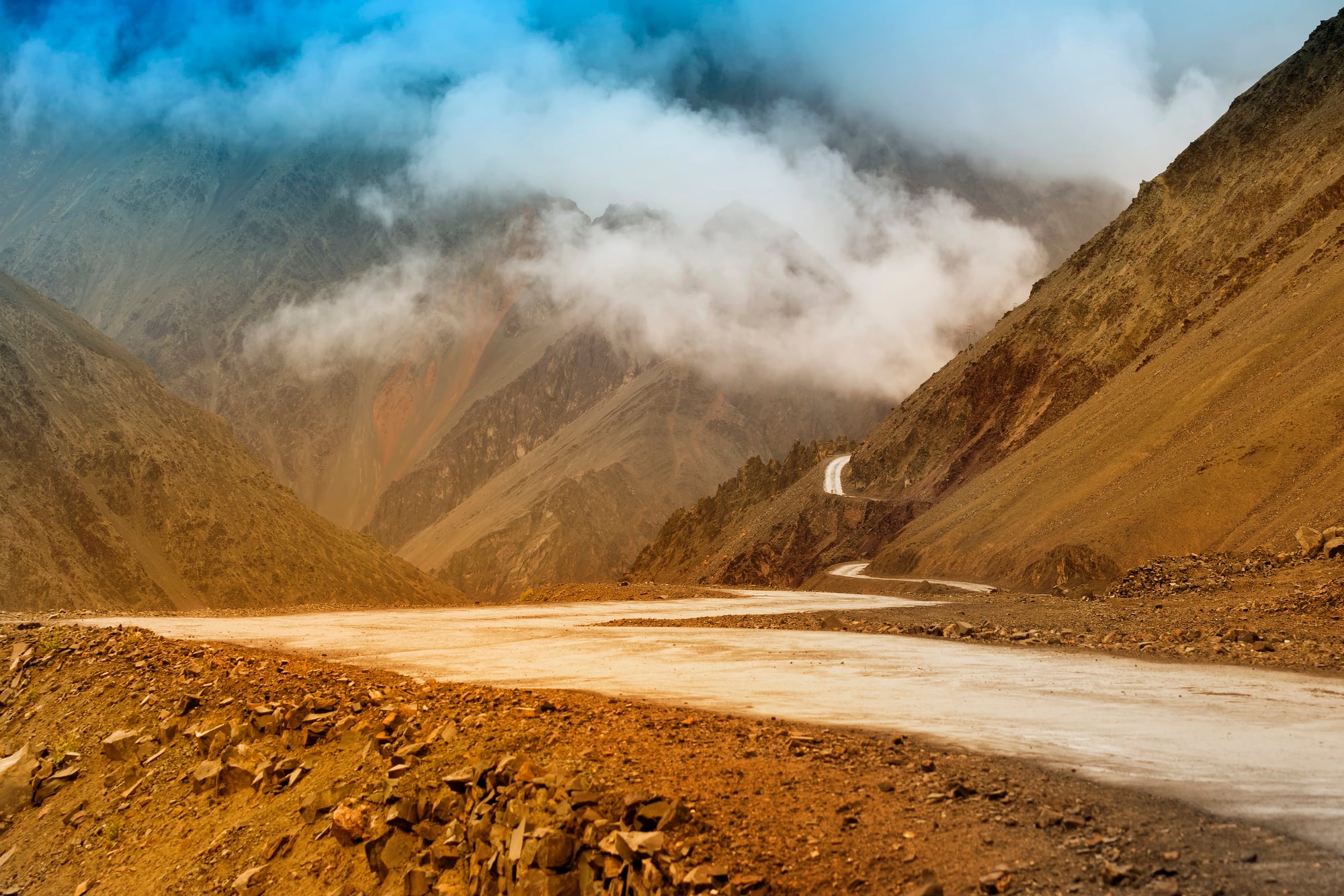
Sichuan-Tibet Highway
China’s Sichuan-Tibet Highway climbs through altitudes that make breathing difficult and weather that makes visibility optional. At over 2,000 miles long, it’s less a single dangerous road than a collection of hazardous driving conditions linked together: mountain passes above 16,000 feet, unmarked drop-offs, and weather systems that can dump snow in summer and create whiteout conditions with no warning.
The highway crosses dozens of mountain ranges, each with its own microclimate and specific ways of threatening drivers. Oxygen levels drop low enough to cause altitude sickness, which impairs judgment at exactly the moments when clear thinking becomes most critical.
Landslides and rockslides are routine, not exceptional — the road maintenance crews treat clearing debris as a daily activity rather than an emergency response.
Fairy Meadows Road
Pakistan’s route to Fairy Meadows earned the designation as one of the world’s most dangerous roads by combining extreme narrowness with extreme consequences for mistakes. The road is barely wide enough for a single jeep, with no guardrails and drop-offs that measure in thousands of feet.
Local drivers refuse to attempt it, which means visitors must either walk or hire specialized drivers who have experience with terrain that seems designed to reject vehicles entirely. The road surface varies from loose gravel to exposed rock, neither of which provides reliable traction.
Passing other vehicles requires careful choreography and considerable luck, since there’s literally no room for error. The destination — views of Nanga Parbat, the world’s ninth-highest mountain — may justify the risk for some travelers, but the road itself serves as a harsh reminder that some places were never intended for automotive access.
Zoji Pass
The Indian military keeps Zoji Pass open because it connects Kashmir to Ladakh, but that doesn’t mean they’ve managed to make it safe. At 11,500 feet elevation, the pass is subject to sudden weather changes that can create blizzard conditions in minutes.
The road is unpaved, unlit, and unforgiving — essentially a mountain track that serves as a critical supply route despite being fundamentally unsuited for regular traffic. Avalanches close the pass regularly during winter months, sometimes for weeks at a time (and the road remains treacherous even when officially “open,” because avalanche risk doesn’t follow administrative schedules).
But what makes Zoji Pass particularly dangerous isn’t just the altitude or the weather — it’s the combination of military necessity and civilian access that creates traffic scenarios where supply convoys, tourist vehicles, and local transport all compete for space on a road that barely accommodates any of them safely. The result is a driving experience where navigation skills, weather awareness, and diplomatic negotiation with other drivers all become essential survival tools.
Skippers Canyon Road
New Zealand carved Skippers Canyon Road into cliffsides to reach gold mining sites in the 1800s, and the engineering reflects the urgency and optimism of that era more than any modern understanding of vehicular safety. The road is so narrow and precarious that rental car companies specifically prohibit driving on it — a clause that exists because too many tourists have discovered that scenic mountain roads in New Zealand can be just as dangerous as anywhere else in the world.
The road drops 3,000 feet over 16 miles, with sections where two vehicles simply cannot pass each other safely. Tourists often attempt Skippers Canyon because it leads to bungee jumping sites and scenic overlooks, but the road itself provides more adrenaline than most people bargain for.
Local tour operators use it regularly, but they drive vehicles specifically modified for the conditions and follow protocols developed over decades of experience with a route that tolerates no casual mistakes.
Taroko Gorge Road
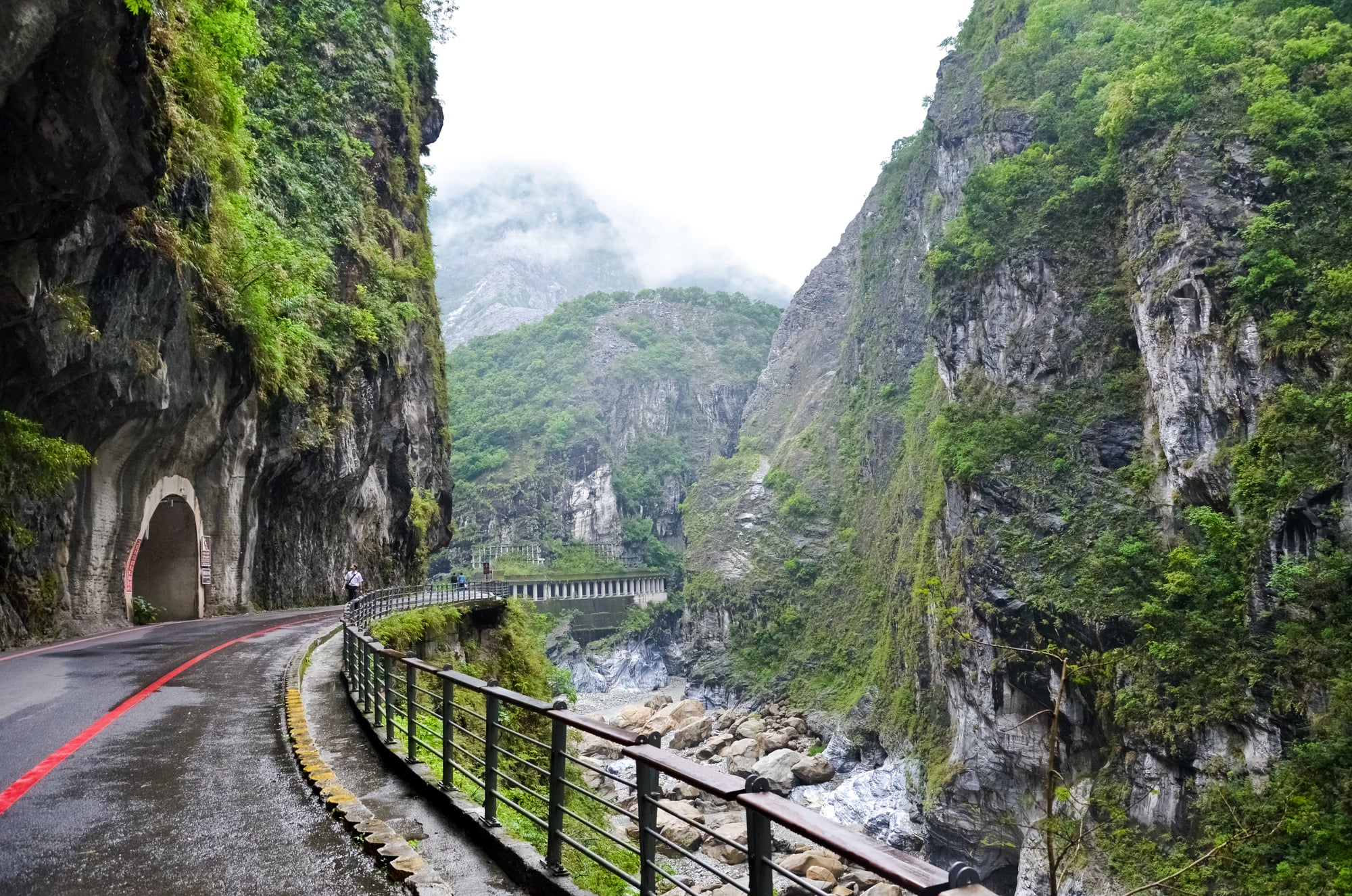
Taiwan’s Taroko Gorge Road winds through marble cliffs and tropical mountains, creating scenery spectacular enough to distract drivers from road conditions that demand complete attention. The road is narrow, winding, and subject to rockslides that can block traffic without warning.
Typhoons make everything worse by triggering landslides and creating flooding that turns mountain streams into torrents capable of washing out bridges. What makes Taroko Gorge Road particularly challenging isn’t just the terrain — it’s the combination of tour buses, motorcycles, and private vehicles all navigating the same tight curves and narrow tunnels.
The gorge attracts millions of visitors annually, which means that in addition to managing challenging road conditions, drivers must also manage traffic scenarios that would be complex on normal highways and become genuinely hazardous on a mountain road with limited visibility and no room for evasive maneuvering.
Lysebotn Road
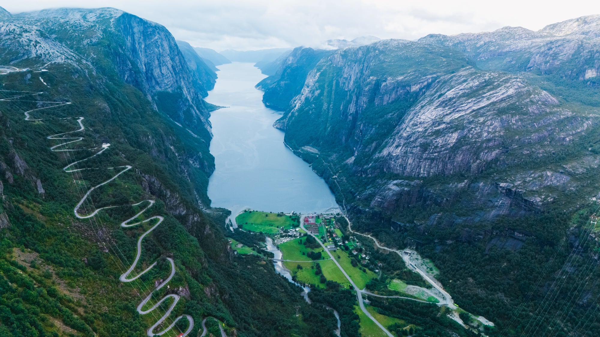
Norway’s Lysebotn Road descends 3,000 feet through 27 hairpin turns, each one offering spectacular fjord views and the opportunity to discover whether your brakes can handle sustained mountain driving. The road was built to access a hydroelectric plant, which means it was designed for utility rather than tourist comfort — though it has become a destination for drivers who specifically seek out challenging mountain routes.
The turns are tight enough that larger vehicles must reverse and reposition to navigate them safely, which creates interesting traffic situations when tour buses and private cars meet at narrow switchbacks. Winter conditions make the road impassable, but summer brings its own challenges in the form of increased traffic and tourists who may not be prepared for serious mountain driving.
The fjord views are genuinely stunning, assuming you can spare the attention to appreciate them while managing turns that require full concentration.
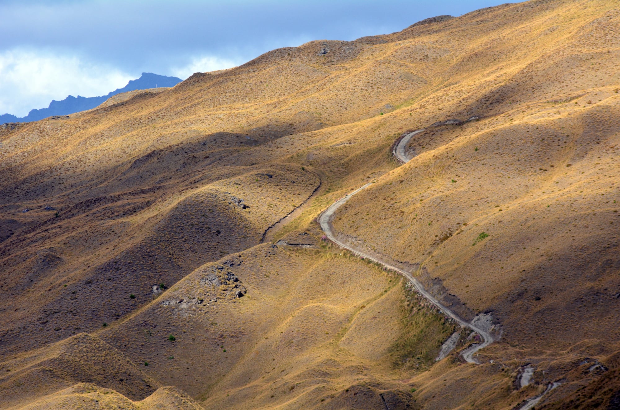
Canning Stock Route
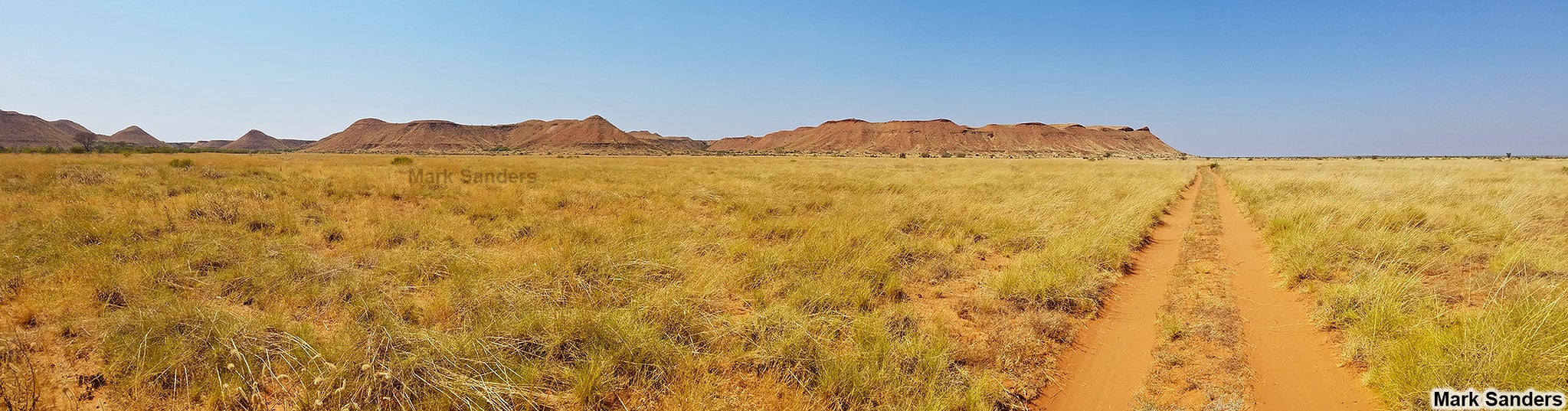
Australia’s Canning Stock Route crosses 1,100 miles of desert terrain so remote and hostile that attempting it represents a deliberate choice to drive through one of Earth’s most unforgiving environments. Originally created to move cattle between grazing areas, the route now serves primarily as a challenge for four-wheel drive enthusiasts who want to test their vehicles and navigation skills against conditions that break both regularly.
There are no services, no cell phone coverage, and no guarantee that other travelers will pass by if something goes wrong. Water sources are scarce and sometimes contaminated.
The track surface varies from sand dunes that can bog down vehicles for hours to rocky sections that destroy tires and suspension systems. GPS becomes essential because traditional landmarks are few and the route itself can be obliterated by windstorms that reshape the desert overnight.
Drivers who attempt the Canning Stock Route typically travel in convoys with redundant supplies and communication equipment because the alternative — being stranded alone in the Great Sandy Desert — is essentially a death sentence. And here’s what makes the Canning Stock Route different from other dangerous roads: it’s not trying to get you anywhere in particular.
There are no cities at either end that justify the risk, no economic necessity that makes the danger worthwhile. People drive it specifically because it’s difficult and remote, which means that every vehicle breakdown, every navigation error, and every equipment failure represents a purely voluntary encounter with an environment that has no interest in human survival.
Chapman’s Peak Drive
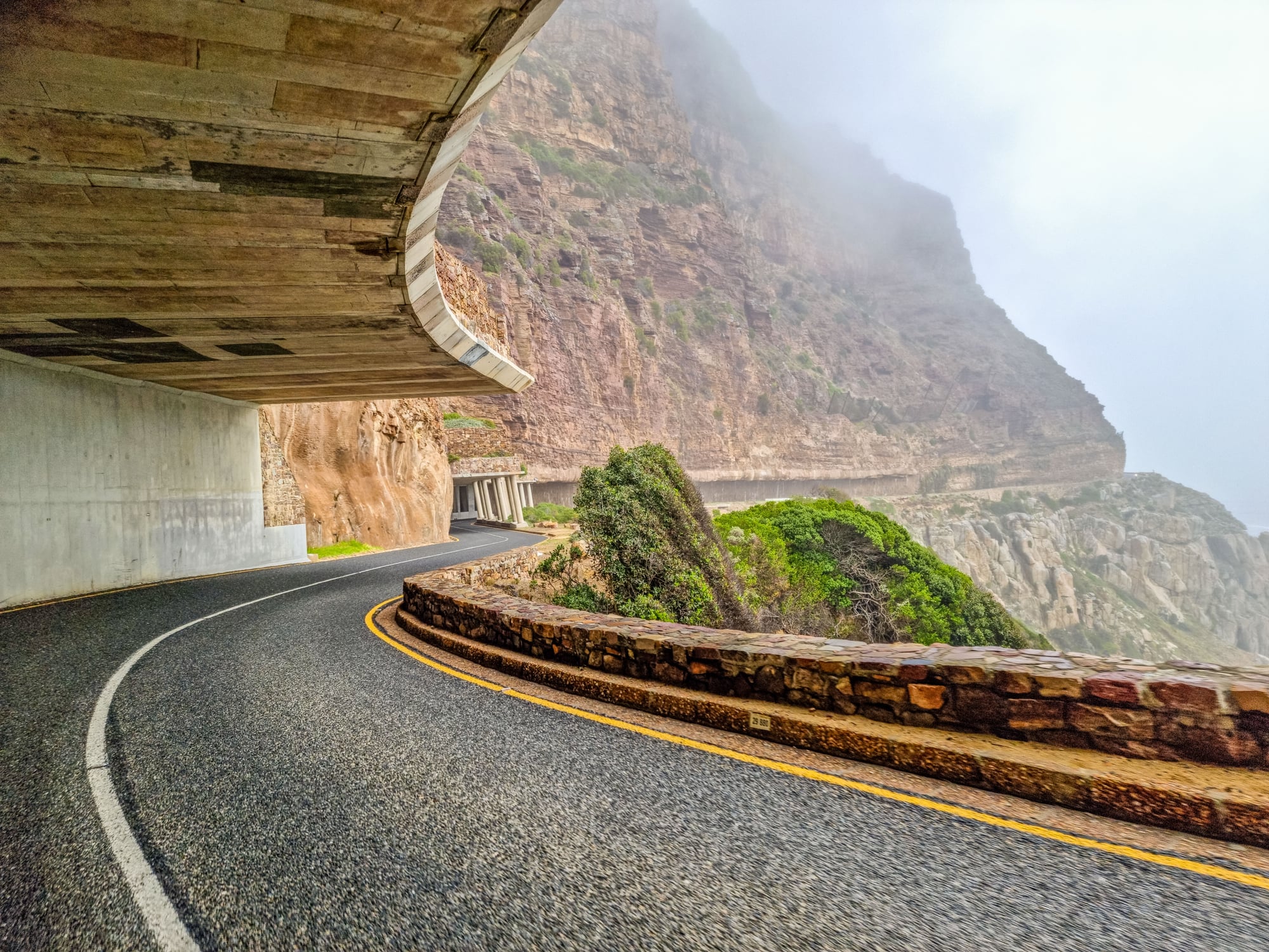
South Africa’s Chapman’s Peak Drive hugs the coastline between Hout Bay and Noordhoek, offering some of the world’s most spectacular ocean views along with road conditions that have killed enough people to require extensive safety improvements including rock netting, barriers, and regular geological monitoring. The road was carved into cliff faces that are inherently unstable, which means that rockslides aren’t occasional hazards — they’re ongoing geological processes that road engineers attempt to manage rather than prevent.
The drive attracts tourists specifically because of its dramatic scenery, but the same cliff-hugging route that provides spectacular views also means there’s no margin for error. High winds are common along the coast, and during storms, waves can crash against the cliffs with enough force to send spray across the roadway.
The South African government has invested heavily in safety improvements, but Chapman’s Peak Drive remains fundamentally a road built in a location where roads probably shouldn’t exist — spectacular, popular, and persistently dangerous despite extensive engineering efforts to make it safer.
The Road Home
These roads exist because humans are remarkably persistent about going places that geography suggests we should avoid. Each one represents a different bargain with hostile terrain: trading safety for access, convenience for adventure, or simply accepting danger as the price of reaching destinations that can’t be reached any other way.
What they share isn’t just statistical danger, but a quality that separates them from ordinary driving experiences. They demand skills and attention that most drivers never develop because most roads don’t require them.
They punish small mistakes severely and offer no forgiveness for overconfidence or poor preparation. And they serve as reminders that despite all our technological advances, some places on Earth remain stubbornly difficult to navigate safely.
The drivers who travel these roads regularly — locals who have no choice, professionals who transport goods and people, and enthusiasts who seek out challenging drives — develop a respect for conditions that can change from manageable to deadly faster than most people can react. They understand that the real danger isn’t just the roads themselves, but the gap between what these routes demand and what most drivers are prepared to handle.
More from Go2Tutors!

- The Romanov Crown Jewels and Their Tragic Fate
- 13 Historical Mysteries That Science Still Can’t Solve
- Famous Hoaxes That Fooled the World for Years
- 15 Child Stars with Tragic Adult Lives
- 16 Famous Jewelry Pieces in History
Like Go2Tutors’s content? Follow us on MSN.