17 Old Tricks to Navigate Without a Compass
Long before the advent of GPS technology and the maps that guide it, people have been crossing deserts, seas, forests, and vast expanses of grassland with little more than observation and memory. Navigation has not been a luxury, it has been a necessity.
If you have ever lost your sense of direction, you will know that you have lost much more than just time. These techniques were not magical.
They were based on the patterns and movements of the natural world: the movement of the sun, the pattern of the stars, the way the wind shapes the sand, or the way the water cuts the earth. Many of these techniques are still used today in wilderness survival courses, though few people use them as a matter of course.
So, let’s take a closer look at 17 time-tested tricks for navigating without a compass. Let’s take a look at the way nature can be used as a guide.
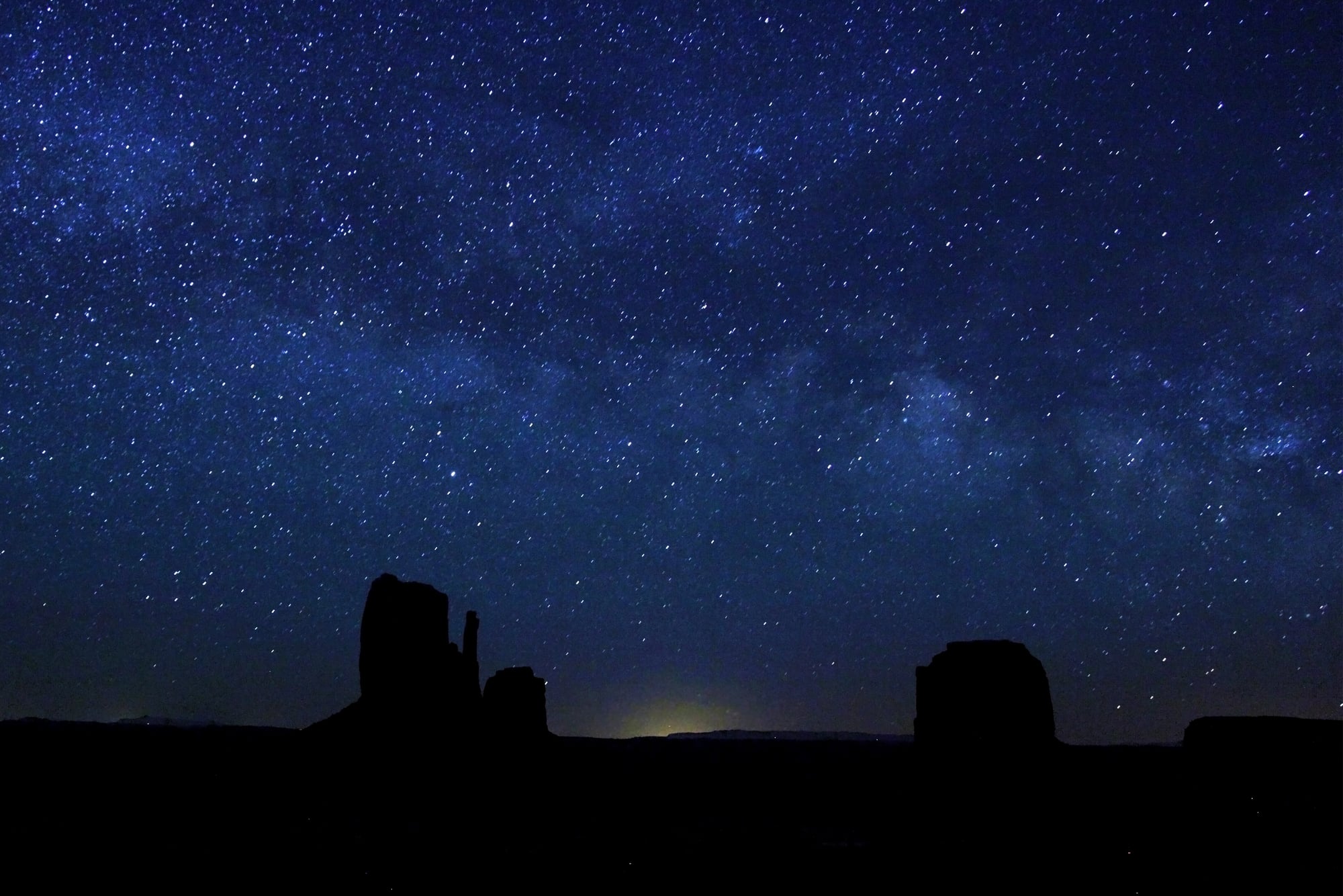
The North Star
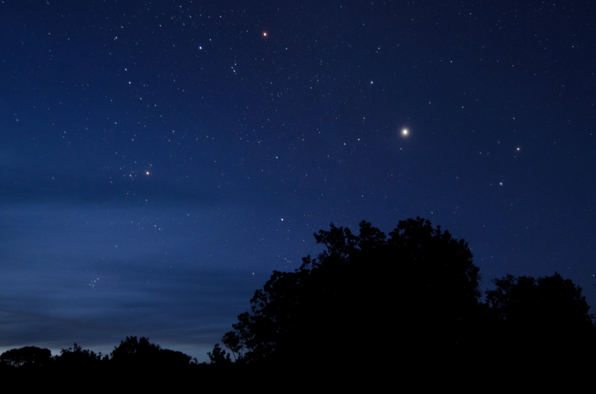
In the Northern Hemisphere, there is a star called Polaris, or the North Star, that is almost directly above the North Pole. It is different from all other stars because while all other stars rotate around it, it stays in almost the same place.
In order to find the North Star, you must first find the Big Dipper and point to the two stars at the end of its ‘bowl.’ They point to the star that is to the north.
It was used as a guiding star for travelers and sailors across the land.
The Shadow Stick Method

A simple stick placed upright in the ground can become a directional tool. Mark the tip of its shadow with a stone.
Wait 15 to 20 minutes, then mark the new shadow tip. Draw a line between the two marks.
That line runs roughly west to east, with the first mark indicating west and the second east. It is low-tech, but effective when the sun is visible.
The Analog Watch Trick

With an analog watch, direction can be estimated using the sun. In the Northern Hemisphere, point the hour hand at the sun.
The midpoint between the hour hand and 12 o’clock roughly indicates south. This method depends on daylight and clear skies, but it has helped countless hikers orient themselves quickly without specialized tools.
Sun’s Daily Arc

The sun rises in the east and sets in the west — a basic fact that becomes powerful in the field. Around midday, it sits roughly toward the south in the Northern Hemisphere.
Tracking the sun’s arc over time provides directional consistency. Even without exact measurements, observing its path offers reliable orientation cues.
Moss And Tree Growth

It is often said that moss grows on the north side of trees. In reality, moss grows where moisture and shade persist.
In some climates, that may correlate with northern exposure, but it is not universal. However, tree growth can reveal patterns.
In open areas, branches may grow thicker on the sunnier southern side. Observing multiple trees rather than a single trunk improves accuracy.
River Flow Direction

Rivers almost always flow downhill toward larger bodies of water. In many regions of North America, major rivers trend generally southward, though local geography matters.
Following a river downstream can eventually lead to settlements, roads, or coastlines. Waterways historically served as natural highways long before paved roads.
Prevailing Wind Patterns

In some regions, consistent wind directions shape vegetation and terrain. Coastal trees may lean inland from persistent ocean winds.
Sand dunes often form with gentle slopes facing prevailing winds. Recognizing these patterns requires local knowledge, but in open landscapes they provide subtle directional hints.
The Southern Sky Method
While Polaris guides northern travelers, the Southern Hemisphere lacks a single bright pole star. Instead, navigators locate the Southern Cross constellation and extend its long axis downward to approximate south.
Though less relevant in the continental United States, this method has guided explorers across oceans and deserts for centuries.
The Moon’s Orientation

The crescent moon can offer directional clues. When the crescent appears, a line drawn through its tips roughly points toward the sun’s position below the horizon.
This technique is less precise than solar tracking, but it provides supplemental orientation at night.
Tree Rings

If a tree is cut, growth rings may appear thicker on the side receiving more sunlight. In some climates, that corresponds with southern exposure.
However, environmental factors vary widely. This method is best used cautiously and in combination with others.
Anthills And Insect Activity

In certain regions, ant colonies build mounds with gentle slopes facing the sun to maximize warmth. This may suggest southern orientation in the Northern Hemisphere.
Still, species behavior differs. Observing several mounds increases reliability.
Ocean Swells
Experienced sailors learn to read long-distance swells that move consistently across open water. Even when winds shift, underlying swell patterns often persist.
Before modern instruments, Pacific navigators relied heavily on this skill to maintain direction between islands.
Sand Dune Formation

In desert environments, sand dunes typically form with a gradual slope facing the prevailing wind and a steeper drop on the opposite side. Recognizing dune orientation can help determine consistent wind direction over time, which often aligns with cardinal patterns in that region.
Cloud Movement
High-altitude clouds often move in predictable directions based on regional weather systems. Observing cloud drift over time can reveal general east-west trends.
Though not exact, this method supplements other indicators when terrain cues are limited.
Urban Clues

In developed areas, satellite dishes often face south in the United States to align with geostationary satellites. Churches historically oriented entrances toward the west and altars toward the east.
Even subtle architectural patterns can offer directional hints when natural signs are unavailable.
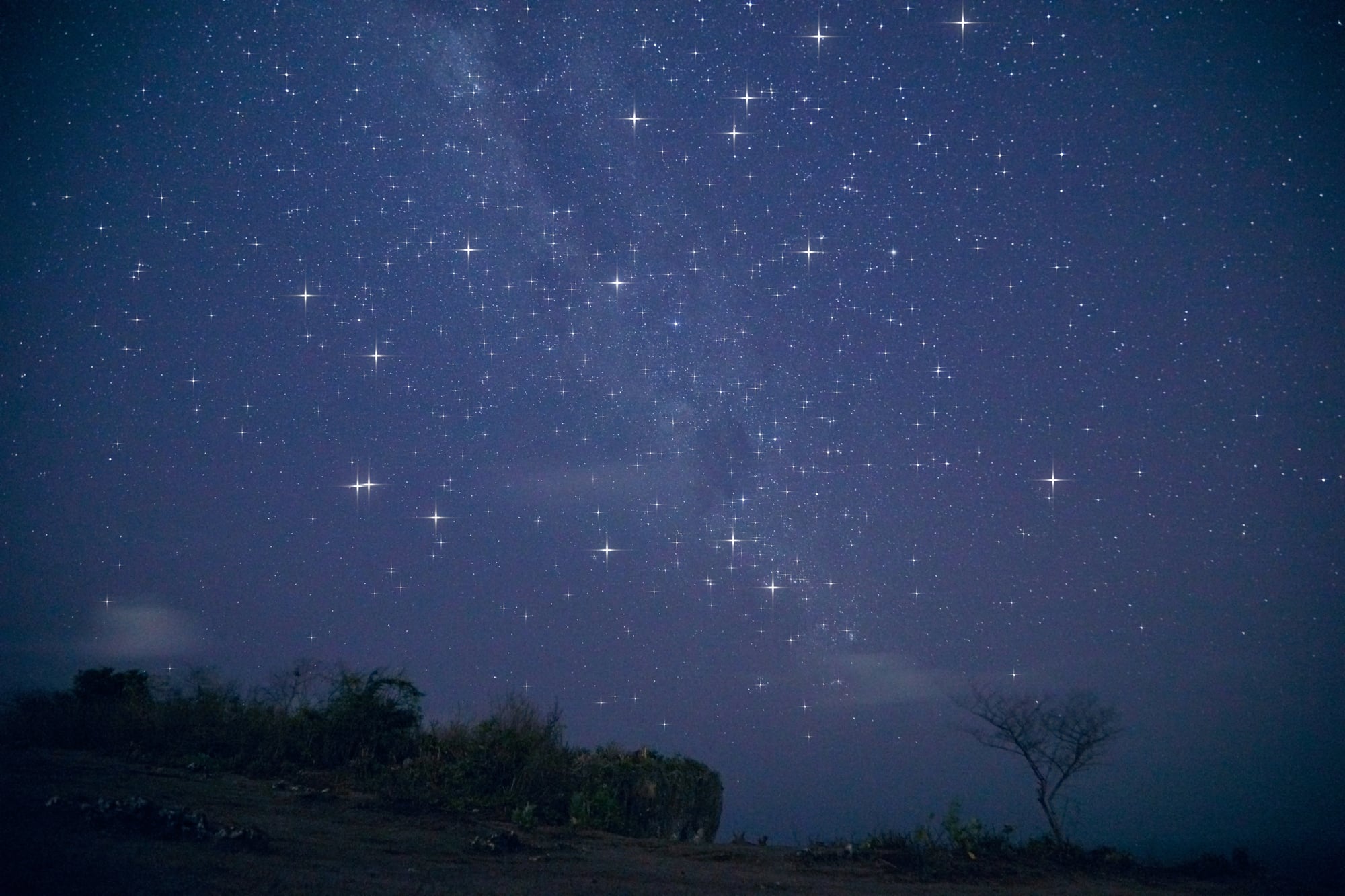
Stars’ Rotational Pattern
All visible stars in the Northern Hemisphere appear to rotate around Polaris. By observing the circular motion of stars over time, direction becomes clearer.
Patience enhances accuracy. The longer one watches, the more apparent the rotation becomes.
Why These Skills Still Matter

Modern navigational tools are incredibly reliable, unless they’re not. Batteries die, signals disappear, and screens shatter.
In those instances, awareness supplants the need for the tools. The old methods have been refined over time because they’re based on the observation of patterns in nature that never change.
They’re not perfect, but they’re reliable. They’re cumulative, providing layers of clarity instead of confusion.
Navigating without a compass is less about memorizing techniques and more about observing the world around you. The sky changes with the seasons, the land has stories to tell, and the wind leaves its mark on the world.
Before the world was charted by satellites, people learned to read the world around them. The knowledge is still available to anyone who will look up, look around, and slow down enough to see the directions that are hiding in plain sight.
More from Go2Tutors!

- The Romanov Crown Jewels and Their Tragic Fate
- 13 Historical Mysteries That Science Still Can’t Solve
- Famous Hoaxes That Fooled the World for Years
- 15 Child Stars with Tragic Adult Lives
- 16 Famous Jewelry Pieces in History
Like Go2Tutors’s content? Follow us on MSN.