17 Rare Clouds That Blow Meteorologists’ Minds
The sky above us serves as nature’s ever-changing canvas, displaying atmospheric artwork that occasionally defies belief. While most of us recognize the common puffy cumulus or wispy cirrus clouds, the atmosphere occasionally produces formations so unusual that even weather experts stop and stare. These atmospheric anomalies combine specific temperature conditions, moisture levels, and air movements to create spectacles that seem almost otherworldly.
Here is a list of 17 rare cloud formations that leave even seasoned meteorologists amazed by their unusual characteristics and striking appearances.
Mammatus Clouds
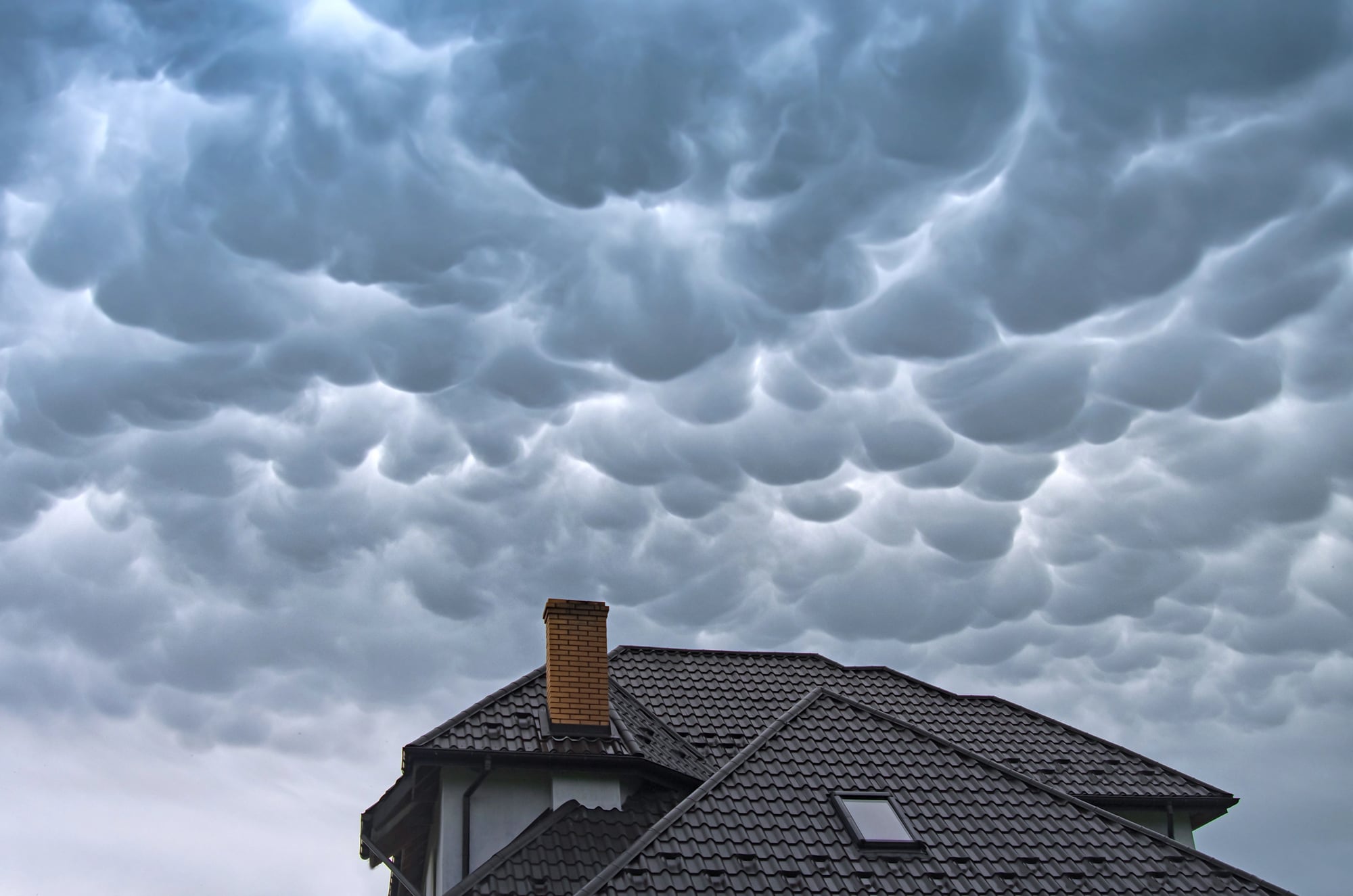
These distinctive clouds feature bulbous protrusions hanging from their undersides, resembling pouches or bubbles sagging toward the earth. Mammatus formations typically appear after severe thunderstorms when pockets of negative buoyancy cause the cloud base to extend downward.
They often glow with spectacular orange or golden hues during sunset, creating an almost apocalyptic scene that can last anywhere from 15 minutes to several hours.
Morning Glory Clouds

These rare, tube-shaped clouds can stretch for hundreds of miles across the sky like giant atmospheric rollers. The Australian Gulf of Carpentaria sees these formations most predictably, particularly during spring months when temperature conditions are just right.
Glider pilots actually travel thousands of miles just to ‘surf’ these clouds, riding the powerful updrafts that form along their leading edges.
Like Go2Tutors’s content? Follow us on MSN.
Kelvin-Helmholtz Clouds
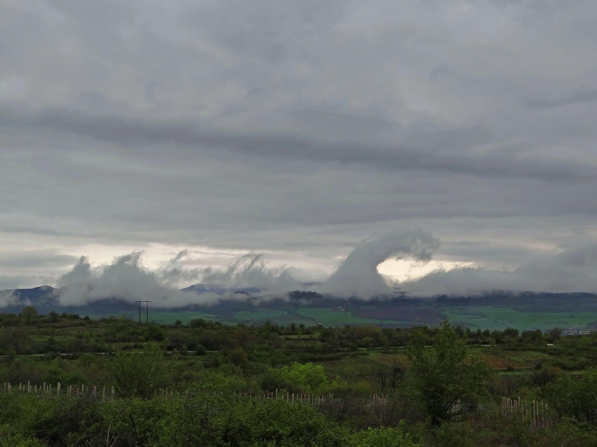
Looking exactly like breaking ocean waves frozen in the sky, these formations occur when two air layers move at different speeds. The faster upper layer drags the top of the cloud along with it, creating those distinctive curling crests.
These formations rarely last more than a minute or two before the delicate wave patterns dissolve back into ordinary clouds, making them particularly prized sightings among weather enthusiasts.
Noctilucent Clouds
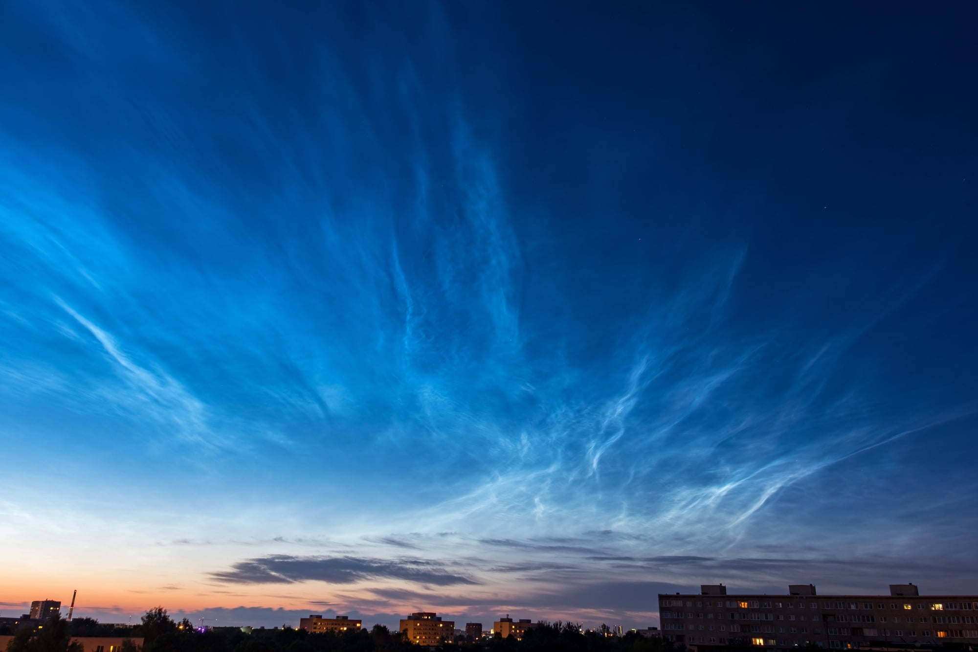
These electric-blue clouds form at the edge of space, nearly 50 miles above Earth’s surface. They’re composed of ice crystals that reflect sunlight long after sunset, creating an eerie glow against the darkening sky.
Once incredibly rare, these formations have become more common in recent decades, possibly due to changes in atmospheric methane levels and temperature patterns at high altitudes.
Lenticular Clouds
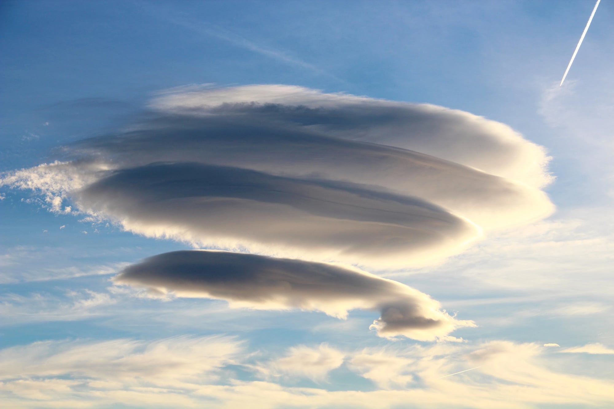
These lens-shaped formations often trigger UFO reports due to their smooth, saucer-like appearance. They form when stable, moist air flows over a mountain or tall structure, creating standing wave patterns in the atmosphere.
Unlike most clouds that drift with the wind, lenticular formations appear stationary as the air continuously condenses and evaporates at the same location, creating the illusion of a hovering disc.
Like Go2Tutors’s content? Follow us on MSN.
Fallstreak Holes

These circular or elliptical gaps in cloud layers occur when supercooled water droplets suddenly freeze and fall away. Aircraft passing through these cloud layers often trigger the freezing process, leaving a clear hole surrounded by wispy trails of ice crystals.
The contrast between the hole and surrounding clouds creates what looks like a perfect cutout in the sky, earning them nicknames like ‘hole punch clouds.’
Asperitas Clouds

Only officially recognized by meteorologists in 2017, these formations feature dark, chaotic undulations resembling a stormy ocean surface viewed from below. They form when unstable atmospheric conditions create pockets of varying density within cloud layers.
Despite their turbulent, sometimes ominous appearance, asperitas clouds rarely produce severe weather and mostly create dramatic scenery for sky gazers.
Roll Clouds

These tube-shaped, horizontal clouds seem to be entirely isolated from other types of clouds. They usually arise in conjunction with thunderstorm activity at outflow boundaries, which are the borders of cold air.
Roll clouds travel like slow-motion atmospheric logs rolling across the sky, occasionally turning clearly as they advance, in contrast to their morning glory cloud siblings.
Like Go2Tutors’s content? Follow us on MSN.
Pyrocumulus Clouds

Directly above intense heat sources, such as volcanic eruptions or wildfires, these striking formations arise. Ash and water vapor are carried upward by rising heated air and condense into these characteristic cauliflower-shaped clouds.
In a fascinating feedback loop, they can sometimes help put out the fires that gave rise to them by growing big enough to produce rain and lightning under extreme conditions.
Nacreous Clouds
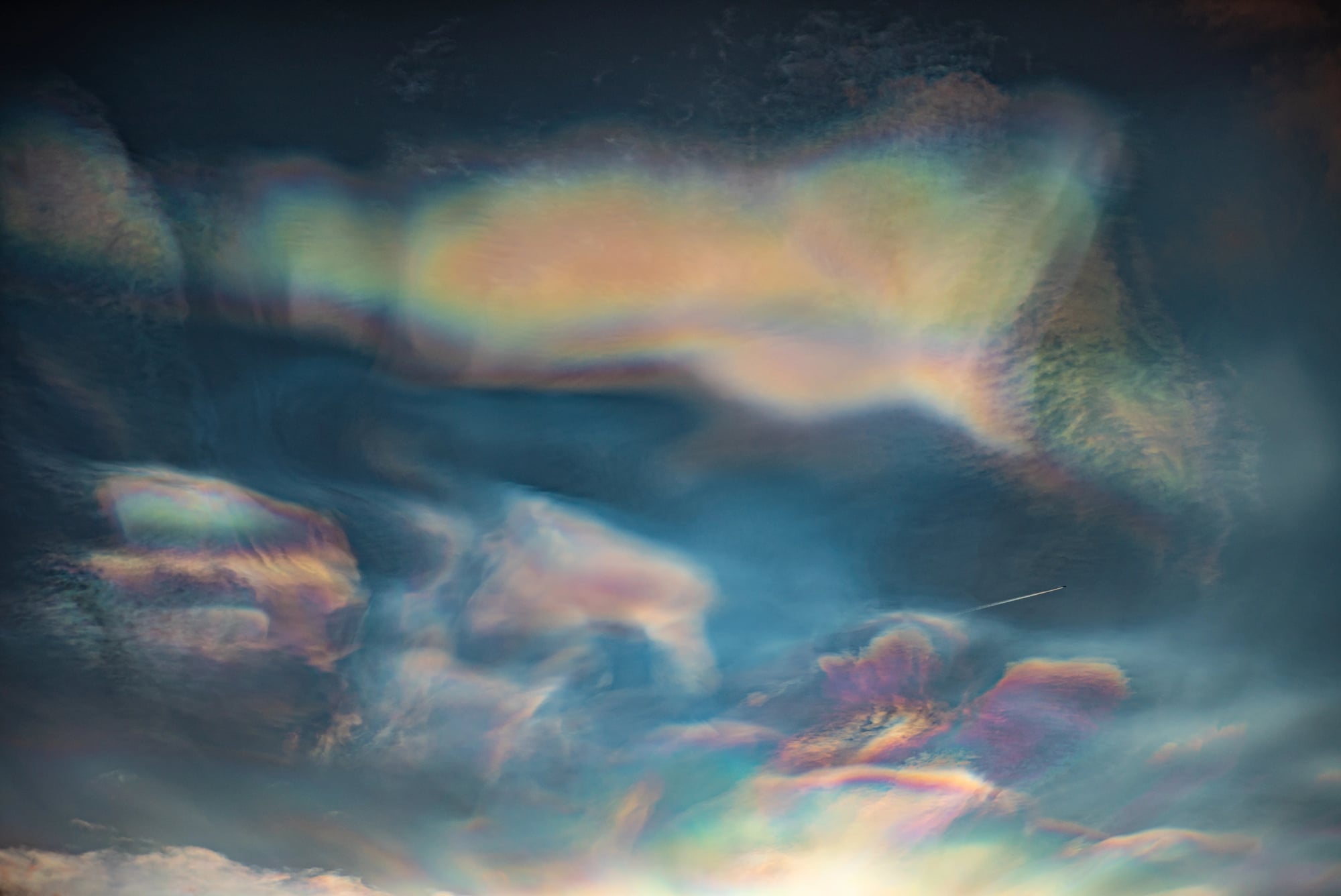
Also called polar stratospheric clouds, these formations appear in winter polar regions when the stratosphere reaches temperatures below -108°F. Their iridescent, pearl-like colors come from sunlight diffracting through tiny ice crystals at high altitudes.
Though stunningly beautiful, these clouds actually participate in chemical reactions that damage the ozone layer, making them both spectacular and scientifically significant.
Undulatus Asperatus

These wave-like formations create the impression of a turbulent sea overhead, with dramatic swirls and patterns that seem almost painted across the sky. They typically form ahead of thunderstorm systems when warm and cold fronts collide.
Their dramatic appearance belies their generally harmless nature – they rarely produce precipitation despite looking like harbingers of doom.
Like Go2Tutors’s content? Follow us on MSN.
Cirrus Kelvin-Helmholtz

These high-altitude variations of Kelvin-Helmholtz waves form in cirrus clouds, creating delicate rippling patterns that resemble fish skeletons or feathers. They appear when wind shear affects ice crystal clouds at 20,000 feet or higher.
Their formation requires such precise atmospheric conditions that they typically last only minutes before dissolving, making them among the most fleeting cloud phenomena.
Cavum Clouds
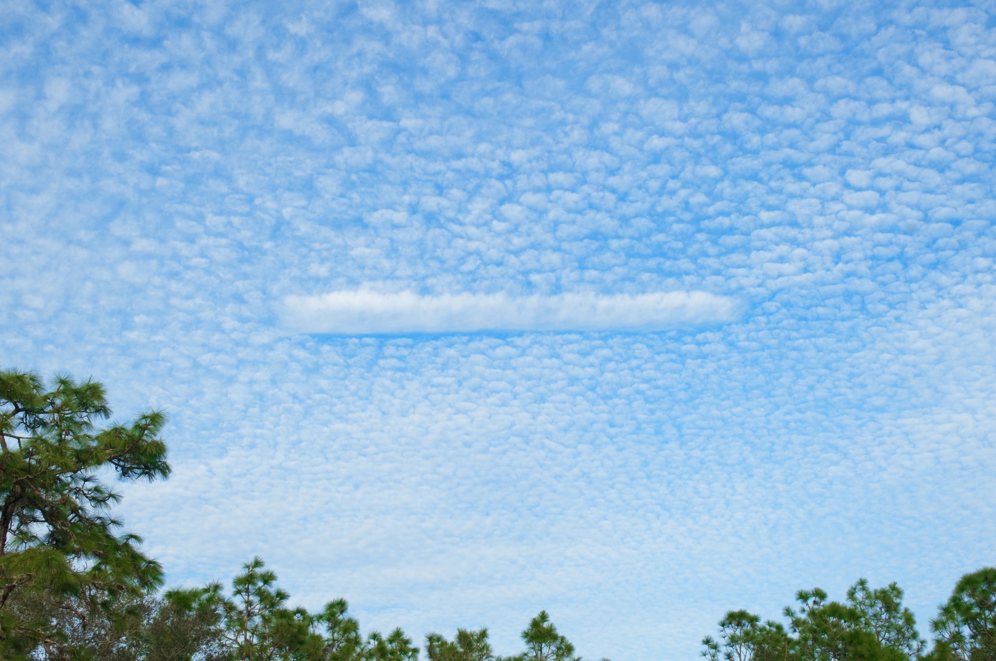
These circular gaps in cloud layers form when aircraft pass through supercooled water droplet clouds, causing the droplets to freeze and fall. Unlike fallstreak holes, cavum formations specifically refer to the initial circular gap before it elongates.
The process begins when aircraft introduce ice nuclei into clouds that contain water droplets existing below freezing temperature but still in liquid form.
Shelf Clouds
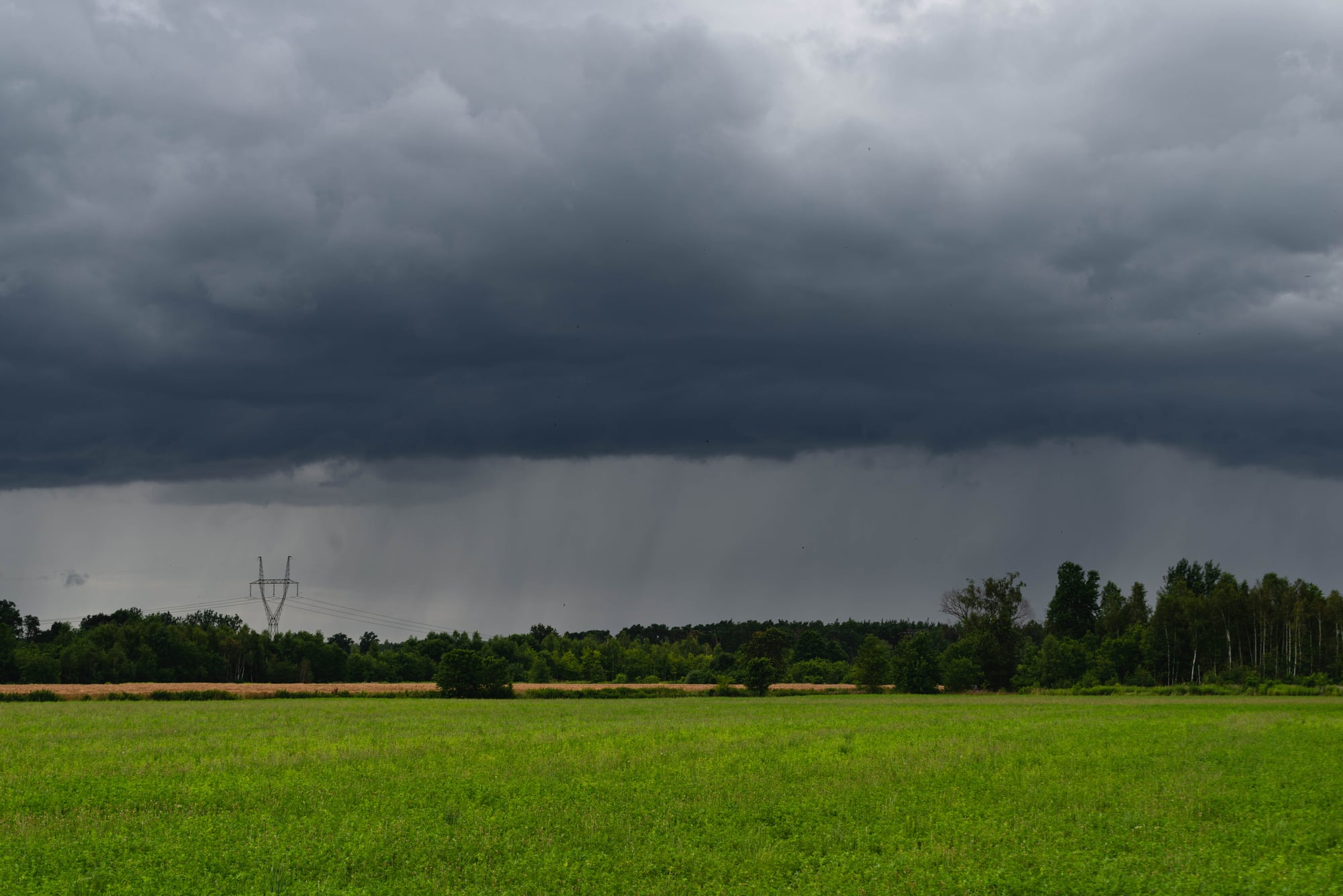
These menacing, horizontal wedge-shaped formations extend from the leading edge of thunderstorms. The cooler downdraft air from the storm spreads out ahead of the system, forcing warm air upward where it condenses into these dramatic shelf-like structures.
Though intimidating in appearance, they simply mark the boundary between different air masses and help meteorologists track storm movement.
Like Go2Tutors’s content? Follow us on MSN.
Actinoform Clouds

These rare formations create perfect spoke-wheel patterns that can span hundreds of miles yet remain nearly invisible from the ground. They form over oceans when marine layer clouds organize into these geometric patterns for reasons still not fully understood.
Weather satellites first discovered these formations in the 1960s, and meteorologists continue studying them to understand their role in regional climate patterns.
Fog Bow
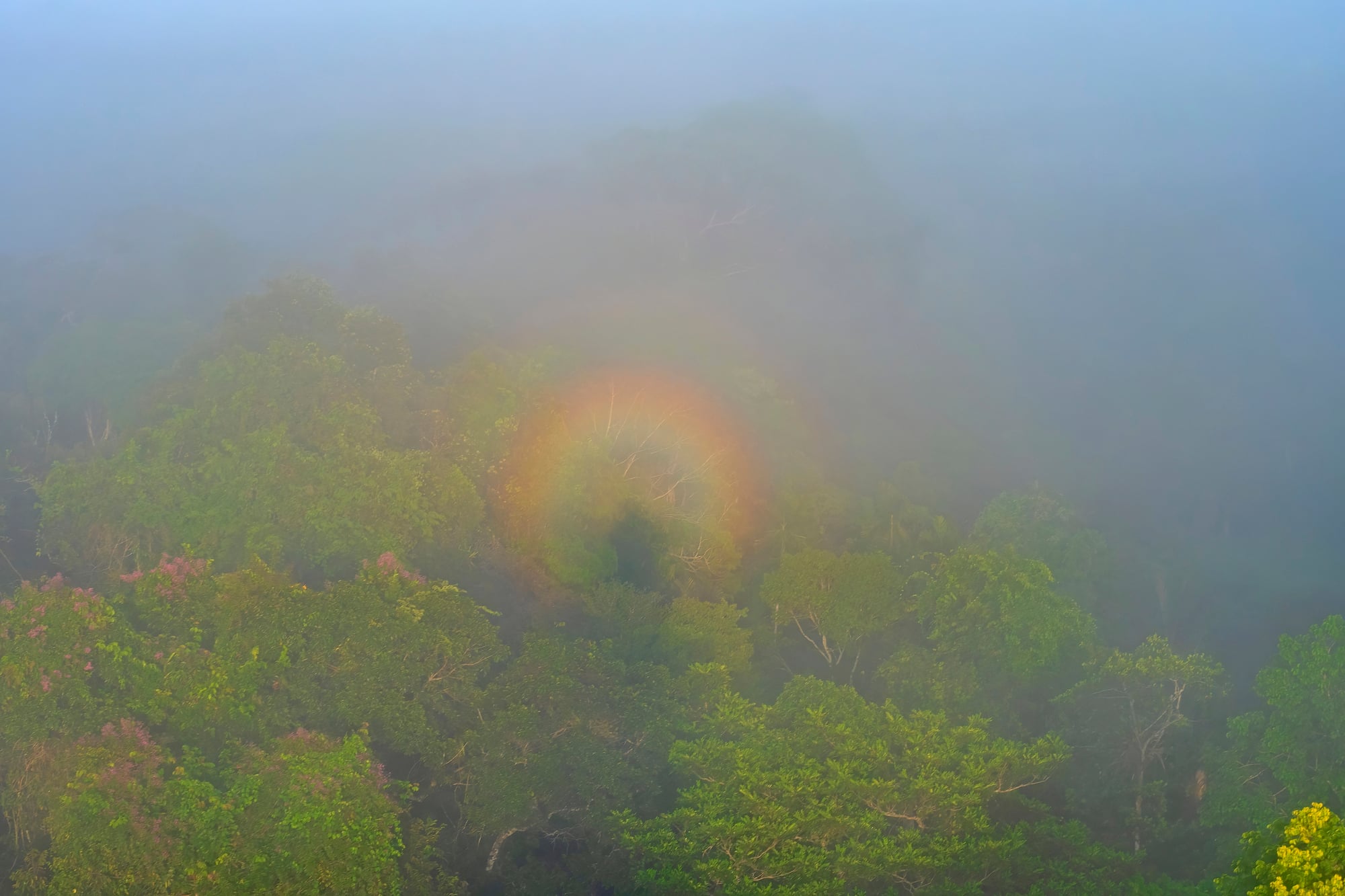
Similar to rainbows but appearing in fog rather than rain, these ethereal white arcs form when sunlight interacts with tiny water droplets in fog banks. The droplets in fog are much smaller than raindrops, causing light to diffract differently and creating a ghostly white bow instead of the colorful spectrum seen in rainbows.
They appear most commonly in thin morning fog when the sun sits low on the horizon.
Cap Clouds
These stationary formations sit like hats atop mountains, remaining fixed in place even in strong winds. They form when moist air is forced upward by the mountain, cooling to its condensation point directly above the peak.
While ordinary clouds drift with prevailing winds, cap clouds continually regenerate in the same location as new air rises and condenses, creating the illusion of a mountain wearing a permanent white beret.
Like Go2Tutors’s content? Follow us on MSN.
Weather Beyond Predictions

These extraordinary cloud formations remind us that despite sophisticated weather models and satellite systems, the atmosphere still produces phenomena that surprise even experts. Each rare cloud type represents a perfect alignment of specific atmospheric conditions, creating visual spectacles that connect us with the dynamic systems constantly at work above our heads.
The next time you glance skyward, remember that you might witness something truly exceptional – a fleeting atmospheric sculpture that even meteorologists consider a once-in-a-lifetime sight.
More from Go2Tutors!

- 16 Restaurant Chains That Went Too Fast
- 12 Things Sold in the 80s That Are Now Illegal
- 15 Strange Things People Have Tried to Ban (And Failed)
- 16 Collectibles People Tossed Out Too Soon
- 17 Myths from Your Childhood That Were Actually Based on Real Things
Like Go2Tutors’s content? Follow us on MSN.