Ancient Trade Routes That Shaped the Borders We Know Today
There’s something quietly remarkable about the roads you’ve never walked. The routes caravans traced across deserts, merchants followed through mountain passes, and ships hugged along coastlines weren’t just commercial corridors — they were the scaffolding on which civilizations organized themselves, and when those civilizations hardened into kingdoms, empires, and modern nation-states, the borders they drew often followed the routes already worn into the earth by centuries of human movement.
The connections below range from direct and well-documented, where a specific treaty was drawn along a specific corridor, to more interpretive claims about a country’s lingering “geographic self-concept” — both are worth taking seriously, but they’re not quite the same kind of claim.
The Silk Road
The Silk Road wasn’t a single road — it was a braided network of overland and maritime paths stretching roughly 4,000 miles from China’s eastern coast to the Mediterranean, and the political geography it generated is still legible in the modern world. Central Asian states like Uzbekistan and Tajikistan exist in roughly the forms they do because of the garrison towns, oasis cities, and regional power centers the Silk Road made commercially viable.
Samarkand became a major city because it sat at a junction where trade routes converged, and political power followed commercial gravity, the way it usually does.
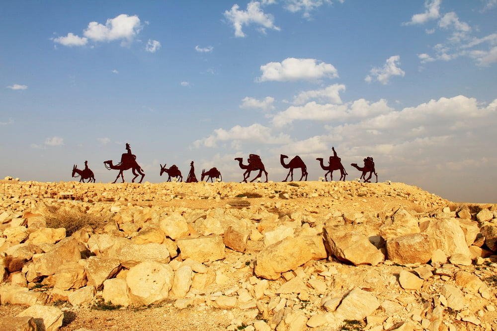
The Incense Route

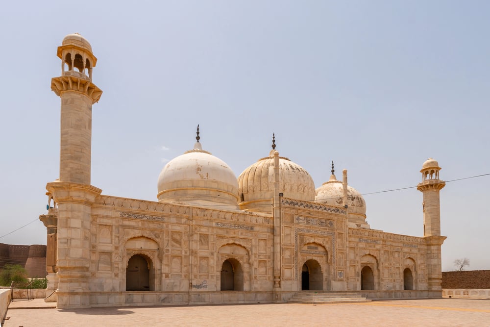
The Incense Route ran roughly 1,200 miles across the Arabian Peninsula, from the frankincense-producing regions of southern Arabia through the Hejaz and into the Levant. It generated enough wealth to sustain a succession of states whose territorial claims left lasting marks on the region.
The Nabataean Kingdom, centered at Petra, owed much of its prosperity to its position as a critical transit point on the route, and the memory of that geography still shapes how Jordan and Saudi Arabia meet at their borders today.
The Trans-Saharan Routes
The Trans-Saharan trade routes connected sub-Saharan Africa to the Mediterranean world across nearly a thousand miles of desert, funneling gold, salt, and enslaved people northward for centuries. The empires that controlled the chokepoints — Ghana, Mali, and Songhai — grew rich enough to project political authority across enormous territories, and their historical footprints align closely with the corridors of commercial power the network created.
The borders later drawn by European colonial powers in the 19th century were often indifferent to these older alignments, which is part of why so many still feel arbitrary on the ground.
The Amber Road
Amber moved south from the Baltic coast to the Mediterranean for thousands of years, and the corridor it carved through Central Europe — running roughly from modern Denmark and Poland southward through the Czech Republic, Austria, and Italy — connected cultures that would otherwise have had little commercial reason to interact. The political relationships those connections seeded eventually shaped some of the alliances and territorial arrangements that became modern Central Europe, though attributing specific national orientations entirely to a resin trade is more suggestive than provable.
The Maritime Spice Routes
The spice routes weren’t just about nutmeg and pepper — they were about who controlled the sea lanes, and that question reorganized large parts of the world. Portuguese, Dutch, and Spanish empires drew colonial boundaries according to where the spice trade made territorial control commercially worthwhile, and those boundaries became, in a real and traceable sense, the territorial foundations of modern Indonesia, Malaysia, Sri Lanka, and coastal India.
The division of the island of Timor between Portugal and the Netherlands — formalized through a series of 19th-century treaties and finally fixed by the Permanent Court of Arbitration in 1914 — is the direct ancestor of today’s Indonesia–Timor-Leste border. The driving commercial good in that specific case was sandalwood rather than spice, but the underlying dynamic of European rivalry organizing a border around trade access is the same.
The Royal Road of Persia
Achaemenid Persia built the Royal Road — spanning roughly 1,700 miles from Susa to Sardis — as both a military supply line and a commercial artery. The road stitched together an empire spanning modern Iran, Iraq, Turkey, and parts of Egypt, and the administrative regions Persia created to manage that corridor — satrapies with defined territorial boundaries — became templates that later empires reused.
How much of Iran’s modern geographic self-concept owes specifically to this memory is more a matter of historical interpretation than settled fact, but the administrative template itself is well documented.
The Hanseatic Trade Network
The Hanseatic League was a commercial alliance, not an empire, and yet it shaped the political geography of Northern Europe more decisively than many empires did. By controlling trade across the Baltic and North Seas through a network of allied cities including Lübeck, Hamburg, Riga, and Tallinn, the League determined which cities mattered and, consequently, which territories became valuable enough to fight over.
The fact that Tallinn’s old town still looks like a Hanseatic merchant city reflects genuine continuity rather than mere nostalgia.
The Indian Ocean Trade Network

The Indian Ocean was among the world’s most productive commercial spaces for centuries before European arrival. Arab, Indian, Malay, East African, and Chinese merchants established a web of sea routes that created persistent cultural and commercial ties between regions now separated by hard national borders.
The Swahili city-states of East Africa and the trading sultanates of coastal India are direct products of this network, and the modern border between Tanzania and Mozambique runs through a coastline that functioned as a largely continuous commercial zone for most of recorded history.
The Tea Horse Road

The Tea Horse Road connected Yunnan Province in southwestern China with Tibet and on into South Asia, at elevations frequently exceeding 13,000 feet. The route exchanged tea for horses across some of the most forbidding terrain on earth, and the political relationships it sustained between Chinese imperial administrations and Tibetan regional powers form part of the deep historical backdrop to the dispute over Tibet’s status that continues today, alongside the more directly relevant 20th-century political history.
The Mississippian Trade Networks

Long before European contact, Indigenous trade networks in North America moved copper from the Great Lakes, shells from the Gulf Coast, and obsidian from the Rocky Mountains across thousands of miles of continent. The Mississippian culture, centered at Cahokia near present-day St. Louis, sat at the commercial heart of these networks.
State lines in the American Midwest often trace river boundaries — the Mississippi, the Ohio, the Missouri — that were already trade corridors long before European settlement, because commercially important waterways were the obvious place to draw an administrative line.
The Via Maris
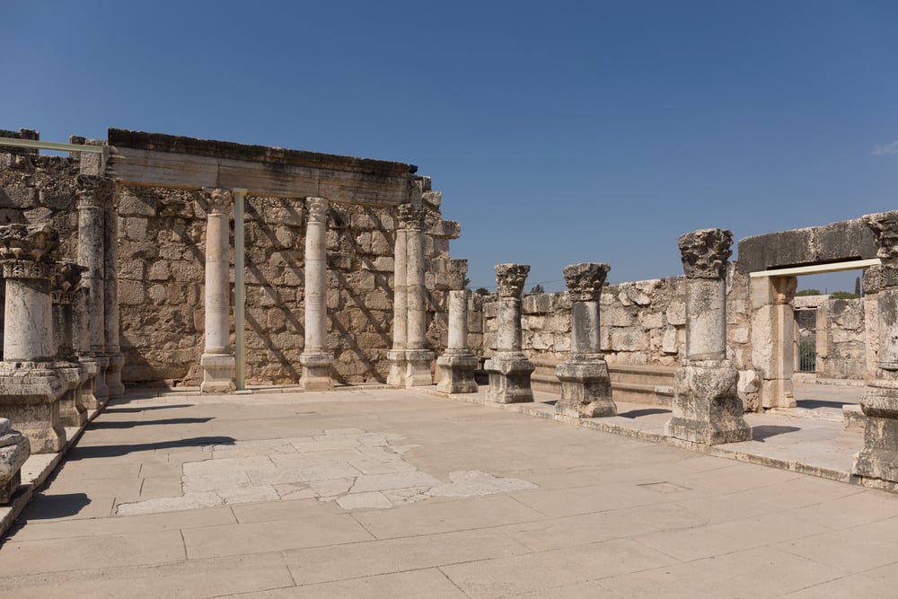
The Via Maris — the Way of the Sea — ran along the eastern Mediterranean coast from Egypt through Canaan and into Mesopotamia, and for millennia it was among the most strategically valuable corridors in the ancient world. Every empire that moved through the region — Egyptian, Assyrian, Babylonian, Persian, Greek, Roman — understood that controlling this route meant controlling the flow of goods and armies between Africa and Asia.
The modern borders of Israel, Palestine, Lebanon, and Syria sit across a landscape organized for thousands of years around this corridor, though the contemporary territorial disputes in the region have far more immediate and specific 20th-century causes than ancient trade geography alone.
The Silk Road’s Maritime Branch

The maritime branch of the Silk Road ran from China’s southern ports through the South China Sea, around the Malay Peninsula, and into the Indian Ocean, the Persian Gulf, and the Red Sea. The geography it generated of contested islands and sea lanes overlaps substantially with the territorial disputes of the contemporary South China Sea.
China’s claims to the Spratly and Paracel Islands draw partly on centuries of Chinese commercial navigation through those waters, and rival claimants — Vietnam, the Philippines, Malaysia — make parallel arguments grounded in their own historical maritime presence.
The Camino de Santiago
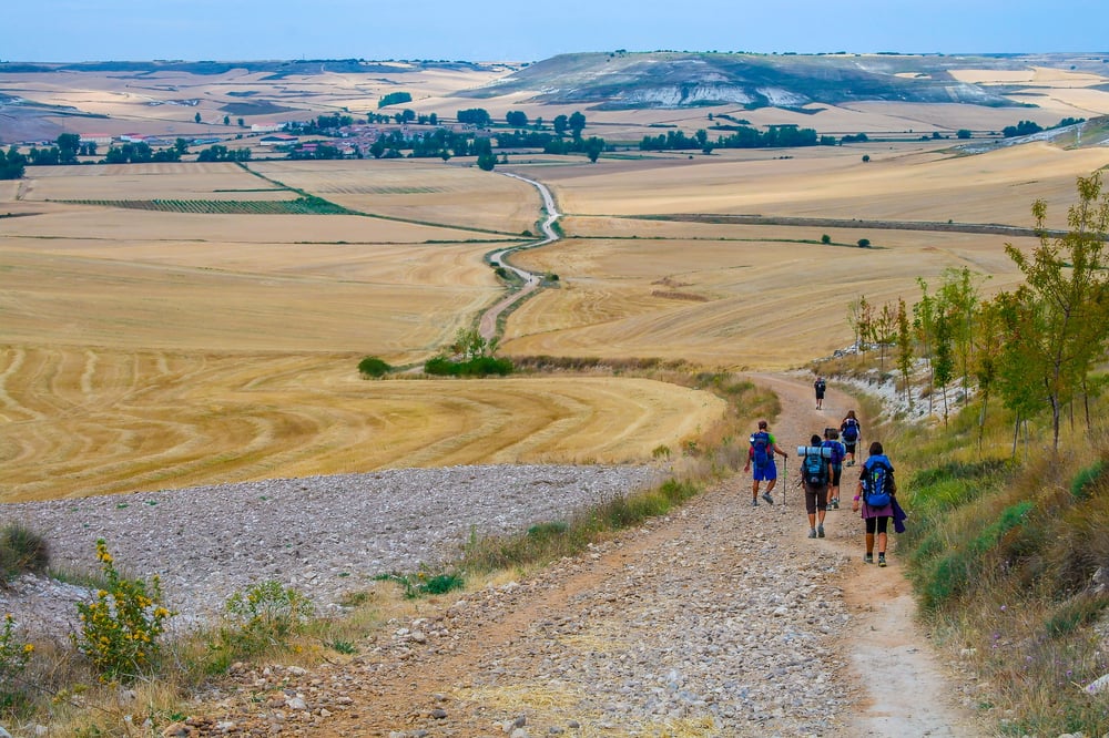
The Camino de Santiago is remembered today as a pilgrimage route, but its medieval function was as much commercial as spiritual. The routes converging on Santiago de Compostela in northwestern Spain pulled merchants, craftspeople, and settlers from across Europe into the Iberian Peninsula, and the economic activity they generated helped fuel the political consolidation of Christian kingdoms during the Reconquista.
The modern borders of Spain and Portugal reflect, in part, the territorial arrangements that the Camino’s commercial and military geography helped make viable.
The Grand Trunk Road

The Grand Trunk Road is one of the oldest continuously used roads in the world, running roughly 1,500 miles from Bengal in the east to Kabul in the west. It connected the subcontinent’s commercial heartland across the Gangetic Plain, through the Punjab, and into Afghanistan, and the powers that controlled it controlled much of the subcontinent.
When the British drew the borders of India and Pakistan in 1947, the partition line cut across the Grand Trunk Road’s path through Punjab, dividing a commercial geography that had taken roughly two thousand years to form in a process that took weeks.
The Gold and Salt Routes of West Africa
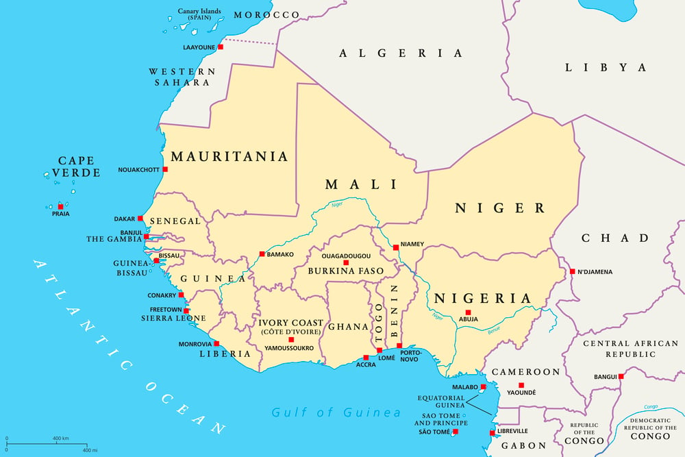
Salt moved south from the Sahara; gold moved north from the forest zones. This exchange sustained some of history’s most powerful African empires.
The Ghana Empire, the Mali Empire, and Songhai each organized their territories around controlling nodes in this trade, and the modern states of Mali, Senegal, Guinea, and Ghana — the last a name deliberately chosen in the 1950s to invoke that historical weight — sit broadly where commercial gravity pooled for centuries.
The Portage Routes of the Great Lakes
The waterway networks of North America’s interior — the Great Lakes connected to the Mississippi basin by short overland portages — provided the commercial logic behind French colonial expansion into the continent’s heart. French traders and missionaries followed Indigenous trade corridors westward from the St. Lawrence River, establishing forts and settlements at the portage points where goods changed from canoe to shoulder and back again.
Cities including Chicago, Detroit, and Sault Ste. Marie exist where they do because trade needed exactly those points first.
The Frankincense Triangle

Southern Arabia, the Horn of Africa, and the Indian subcontinent formed a commercial triangle moving frankincense, myrrh, and other aromatics across the ancient world for thousands of years. The territories around the Gulf of Aden — modern Yemen, Djibouti, Somalia, Eritrea — were organized around controlling access to this trade, and the region’s continued political fragmentation reflects, in part, the long difficulty of maintaining unified control over a geography multiple powers have always wanted simultaneously.
The Varangian Route
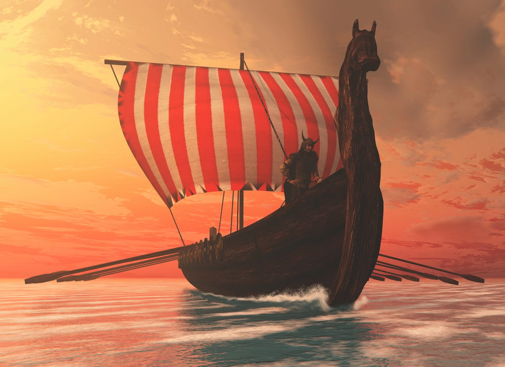
Norse traders and warriors known as the Varangians carved a river route from Scandinavia through the lakes and rivers of what is now Russia and Ukraine, down to the Black Sea and on to Constantinople — the route “from the Varangians to the Greeks.” This roughly 1,500-mile corridor was the commercial spine along which Kievan Rus’, the shared political ancestor of both Russia and Ukraine, organized itself.
The modern border between the two countries runs across a landscape that was, for centuries, a single river-based commercial corridor.
Baltic Control and the Teutonic Knights

Control of the Baltic Sea was a commercial question as much as a military one, and the territorial arrangements it generated lasted centuries. The Teutonic Knights established their Baltic territory in the 13th century largely to control trade flowing out of the eastern Baltic, and the political geography that emerged from their state became part of the territorial logic behind the later rise of Prussia.
The modern borders of Poland, which shifted dramatically westward after World War II, absorbed territory — including the city of Gdańsk — that had been organized around Baltic trade access for centuries before the 20th-century border changes that actually determined today’s map.
The Silk Road and Chinese Border Logic

China’s borders to the west and northwest broadly follow the historical extent of Chinese commercial and military reach along the Silk Road’s overland branches. Xinjiang was historically the gateway through which Silk Road traffic entered and exited the Chinese imperial world, and Gansu Province — a long, narrow corridor of territory — makes little geographic sense except as the Silk Road’s principal land approach.
Contemporary administrative claims over these regions rest on a far more complex and contested mix of more recent political history alongside this older commercial geography.
The Phoenician Maritime Network
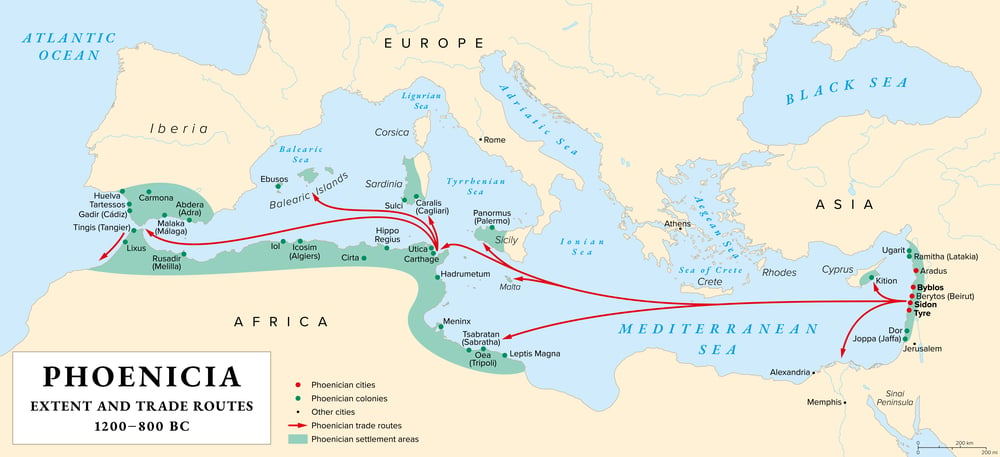
The Phoenicians built something more durable than an empire: a commercial network of city-states and trading posts stretching from modern Lebanon across the Mediterranean to the Atlantic coasts of Morocco and Spain. The cities they founded along that network — Carthage in Tunisia, Cádiz in Spain, Leptis Magna in Libya — became the seeds of later territorial arrangements that hardened into Roman provinces and eventually fed into modern national identities, though the line from a specific ancient trading post to a modern country’s self-concept inevitably runs through many later, more immediate historical layers.
The Khyber Pass and the Durand Line
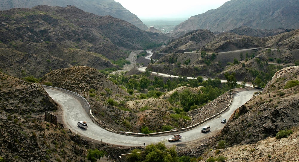
The Khyber Pass itself is only about 33 miles long, but it has generated more geopolitical consequence per mile than almost any comparable stretch of terrain on earth. Every major power moving goods or armies between Central Asia and the Indian subcontinent passed through it, from Alexander the Great’s army to NATO supply convoys.
The modern border between Afghanistan and Pakistan — the Durand Line, agreed in 1893 between British diplomat Mortimer Durand and Afghan Emir Abdur Rahman Khan as part of the “Great Game” rivalry with Russia — runs directly through the pass and divides the Pashtun communities who have lived on both sides for centuries. Afghanistan has never formally recognized the line as a permanent international border, and the instability it has produced is, at its root, a case of a colonial-era boundary cutting directly across a connection that commerce and kinship had maintained for two millennia.
The Portolan Charts and Mediterranean Borders
The portolan charts — the precise, merchant-made navigation charts of the medieval Mediterranean — recorded which sea routes were commercially important enough to map carefully. The coastal territories those charts documented most obsessively — the Italian city-states, the Adriatic coast, the Aegean islands — are territories whose political fragmentation and persistent regional significance track closely with their historical value as nodes in Mediterranean maritime trade.
The Adriatic coast of Croatia still resembles a string of independent-minded port towns because, for most of its history, that’s functionally what it was.
The Geography of Commerce Never Forgets
Maps want you to believe that borders are final — drawn in crisp lines, color-coded and clean, carrying the implicit claim that this is settled and agreed upon. But underneath those lines, older geometries persist: the camel paths, the river portages, the sea lanes worn smooth by countless keels don’t disappear when someone draws a line across them.
Not every border dispute is secretly an ancient trade dispute in costume — the 20th century supplied plenty of its own causes for conflict — but often enough, when you trace a contested border back far enough, you find a road, a river crossing, or a mountain pass that mattered to merchants long before it mattered to any government.
More from Go2Tutors!

- The Romanov Crown Jewels and Their Tragic Fate
- 13 Historical Mysteries That Science Still Can’t Solve
- Famous Hoaxes That Fooled the World for Years
- 15 Child Stars with Tragic Adult Lives
- 16 Famous Jewelry Pieces in History
Like Go2Tutors’s content? Follow us on MSN.