24 Cities Swallowed by Sand, Water, or Jungle
Cities are built to feel permanent, with stone walls, paved streets and buildings meant to stand for generations. Nature has other plans.
Some of the places on this list were buried by drifting dunes, others were drowned by storms, earthquakes or new dams, and others vanished under forest canopy until lasers found them again. A few are still being swallowed right now.
Kolmanskop
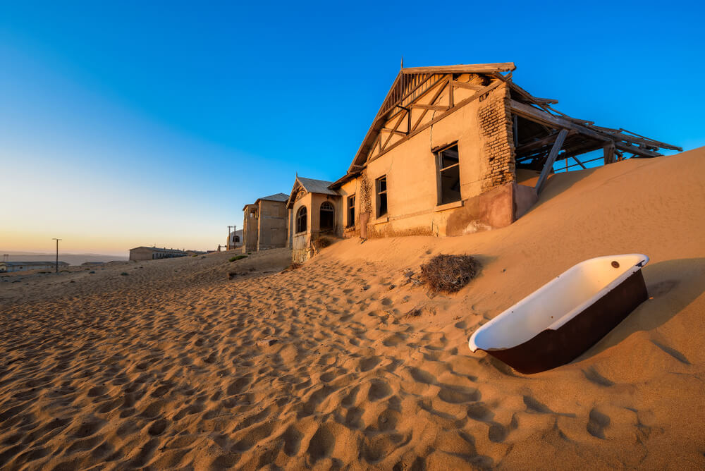
In 1908, a railway worker named Zacharias Lewala picked up a sparkling stone near the Namibian coast and showed it to his supervisor. It was a diamond, and within a few years the German colonial town of Kolmanskop had grown up in the desert, complete with a hospital, a dance hall, a theater, a skittle alley and an ice factory.
As richer deposits were found farther south, residents drifted away, and the town was abandoned by the mid-1950s. Sand now fills its houses up to the windowsills. Photographers buy permits to capture rooms where dunes have replaced the furniture.
Ubar
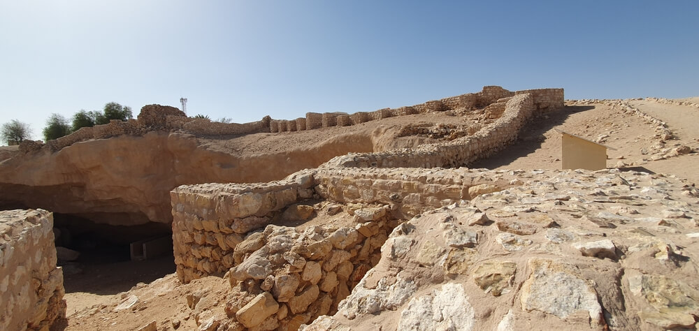
Ancient texts and the Quran describe a wealthy incense-trading city called Ubar, or Iram, that was destroyed and swallowed by the desert. T.E. Lawrence reportedly called it the Atlantis of the Sands. In the early 1990s, filmmaker Nicholas Clapp and a team including explorer Ranulph Fiennes used NASA satellite imagery to trace old caravan routes converging on a site at Shisr in Oman.
Excavations revealed a fortress built over a limestone cavern that had partly collapsed, perhaps explaining legends of the city sinking into the earth. Scholars still debate whether the site is the legendary Ubar.
Niya
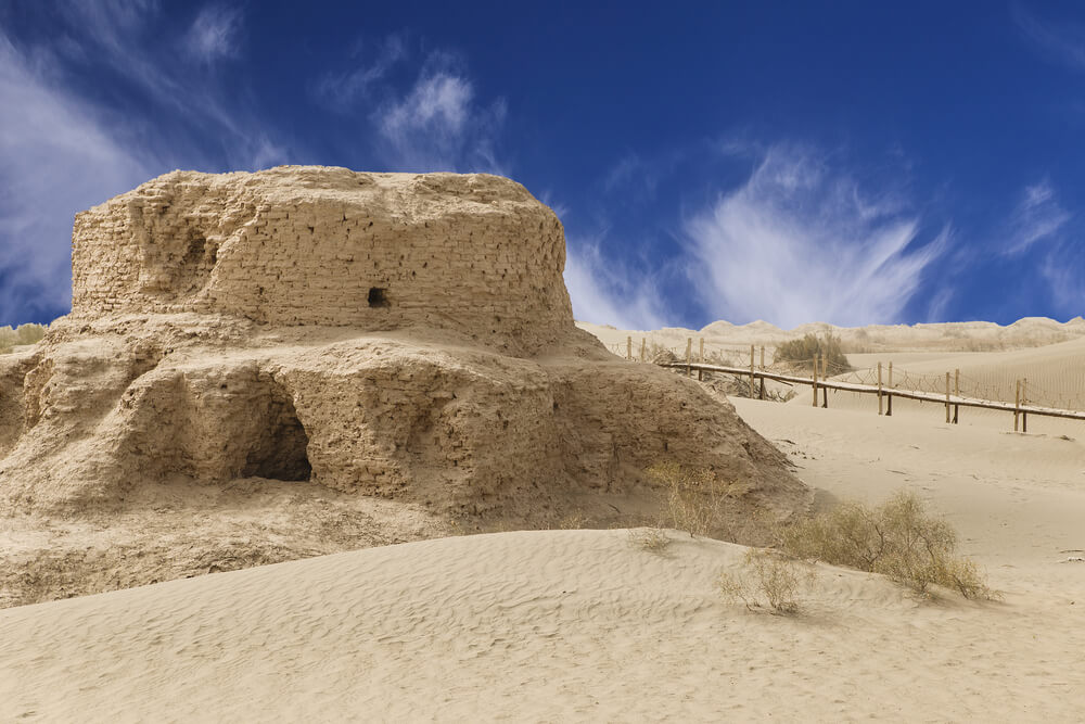
Niya was a prosperous oasis town on the southern Silk Road in what is now China’s Xinjiang region, until it was abandoned around the 4th century and gradually buried by the Taklamakan Desert. Explorer Aurel Stein reached the ruins in 1901 and found houses, orchards and hundreds of wooden tablets written in Kharosthi script, some still bound and sealed.
The dry sand had preserved timber, textiles and documents remarkably well. Later excavations uncovered a richly furnished tomb with a brocade armband woven with a prophecy about the East. The site remains remote and is visited mainly by researchers.
Loulan
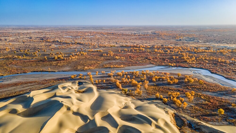
The ancient kingdom of Loulan controlled a key stop on the Silk Road near the shores of Lop Nur in western China. As the lake shrank and rivers shifted, the city was abandoned and buried by sand around the 4th century.
Swedish explorer Sven Hedin found its ruins in 1900 almost by accident, after a guide went back to retrieve a lost spade and stumbled onto wooden buildings. Later digs uncovered documents, coins and the well-preserved Beauty of Loulan, a mummy roughly 3,800 years old found in 1980. Lop Nur itself is now a dry salt flat.
Skara Brae
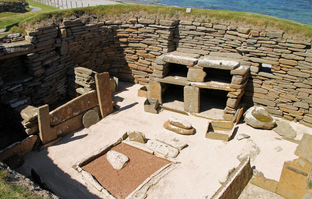
— Photo by CyclingScot
A violent storm in the winter of 1850 stripped the grass and sand from a dune on the Bay of Skaill in Orkney, Scotland, exposing a cluster of stone houses. Skara Brae turned out to be a Neolithic village about 5,000 years old, older than Stonehenge and the Great Pyramid of Giza.
Its houses still contain stone dressers, beds and hearths, all preserved because sand buried the settlement for millennia. Researchers believe drifting sand contributed to the village’s abandonment. Coastal erosion now threatens the site that the sand once protected.
Chinguetti
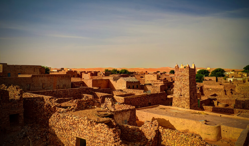
Founded in the 13th century, Chinguetti in Mauritania became a major stop for caravans and pilgrims crossing the Sahara and a center of Islamic scholarship. Its old stone houses still hold family libraries with thousands of handwritten manuscripts on law, astronomy and religion.
For decades, dunes advancing from the desert have buried streets and homes on the town’s edges, and residents regularly dig sand away from doorways. UNESCO listed the old town as a World Heritage Site in 1996.
Many families have left for the capital, leaving a few librarians to guard the books against sand and heat.
Timgad
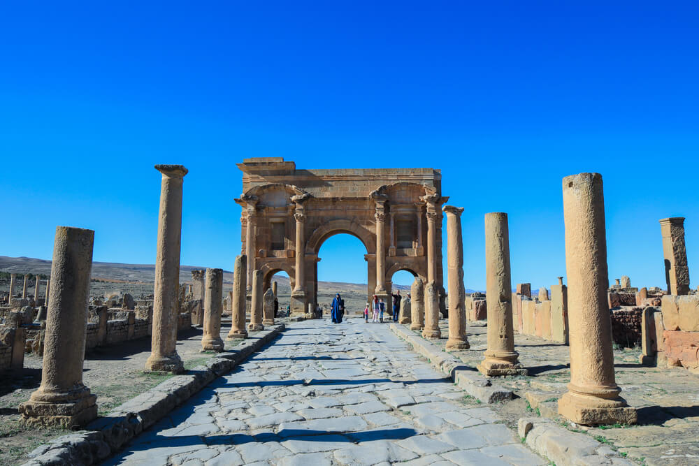
The Roman emperor Trajan founded Timgad around AD 100 as a colony for veterans in what is now northeastern Algeria. Built on a strict grid, it had a forum, a library, public baths and a theater seating thousands.
After centuries of decline and abandonment, windblown sand buried much of the city, which helped preserve its layout. French archaeologists began excavating it in 1881, revealing one of the clearest examples of Roman town planning anywhere.
Its triumphal arch and colonnaded streets now stand out against the bare plateau, a grid of stone with no city left around it.
Leptis Magna
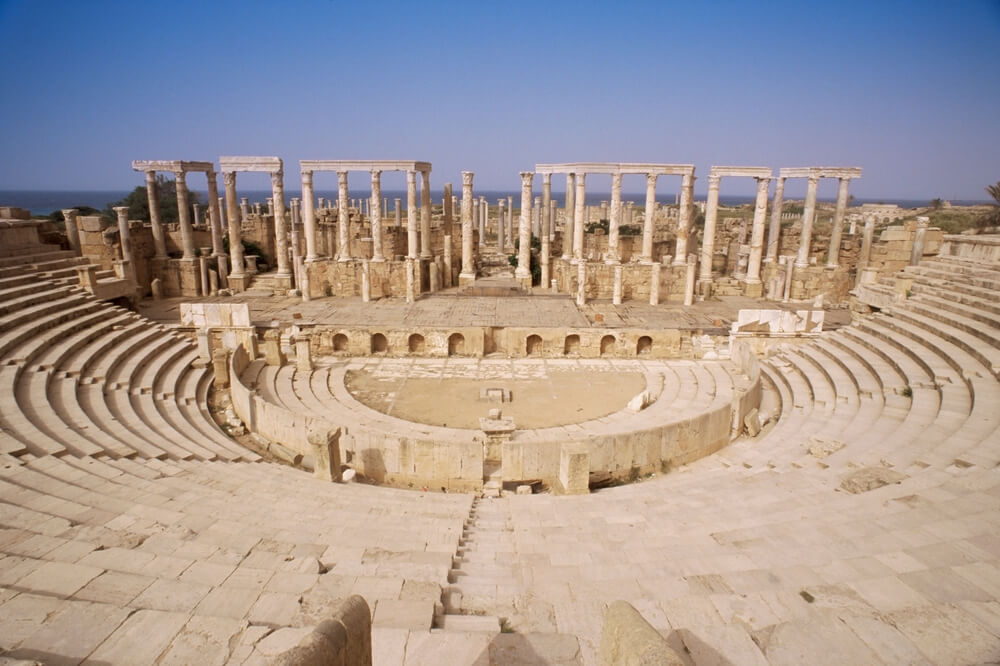
Leptis Magna on the Libyan coast grew into one of the grandest cities of the Roman Empire, especially after its native son Septimius Severus became emperor in AD 193. He showered it with monuments, a new forum and an enlarged harbor.
After the city declined, sand from the desert gradually buried the ruins, protecting them from stone robbers for centuries. In the 1600s and 1700s, columns were still being hauled away, and some ended up in France and in a mock ruin in England.
Italian archaeologists excavated the site extensively in the 20th century.
Dunwich
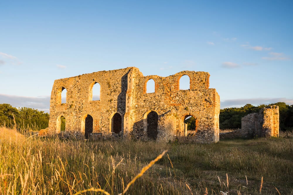
In the early Middle Ages, Dunwich on the Suffolk coast was a busy port and one of the larger towns in England, with several churches, monasteries and a thriving trade. Violent storms, especially one in 1286, battered the coastline and choked the harbor with shingle.
Over the following centuries, the sea claimed street after street, and churches toppled off the eroding cliffs one by one. The last section of All Saints Church fell in the early 1900s.
Today Dunwich is a tiny village, and divers have mapped the remains of its lost churches on the seabed.
Thonis-Heracleion
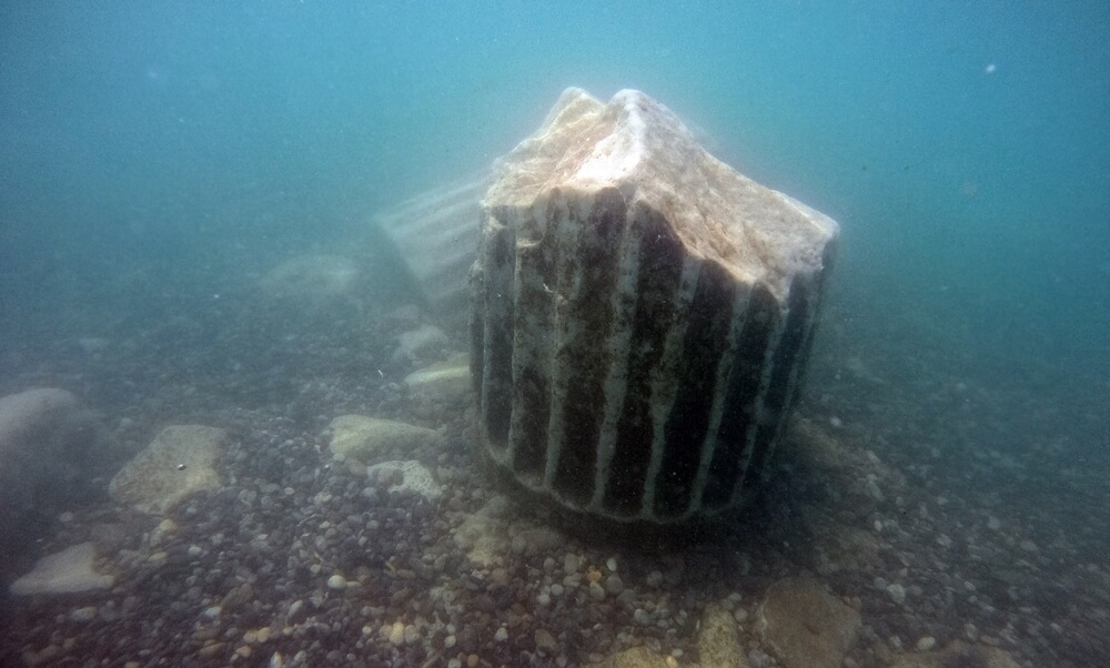
Greek writers described Heracleion as a major Egyptian port at the mouth of the Nile, but for centuries nobody knew where it had been. In 2000, underwater archaeologist Franck Goddio and his team located its remains in Abu Qir Bay, roughly 6.5 kilometers off the coast and about 10 meters underwater.
Divers have found colossal statues, temple remains, gold coins and dozens of ancient shipwrecks. A combination of earthquakes, rising water and soil liquefaction likely caused the city to sink.
A stone slab found there confirmed that Heracleion and the Egyptian city of Thonis were the same place.
Port Royal
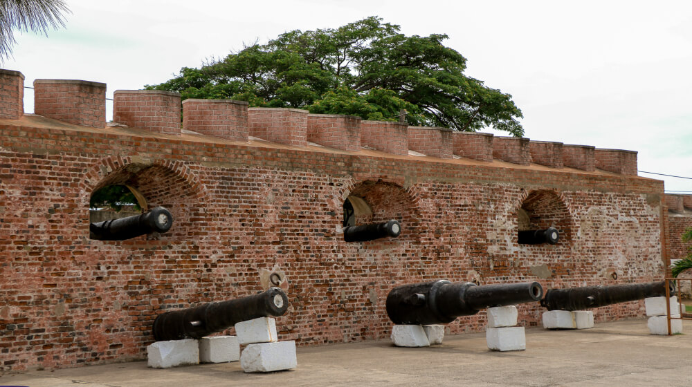
During the 1600s, Port Royal in Jamaica was one of the richest and rowdiest towns in the Caribbean, a base for privateers and merchants. On June 7, 1692, a powerful earthquake caused much of the town, built on loose sand, to liquefy and slide into the harbor.
Roughly two-thirds of the town disappeared beneath the water within minutes, and thousands died. Archaeologists have recovered buildings, tools and a pocket watch that stopped at 11:43, believed to mark the time of the disaster. What remains is now a small fishing village.
Pavlopetri
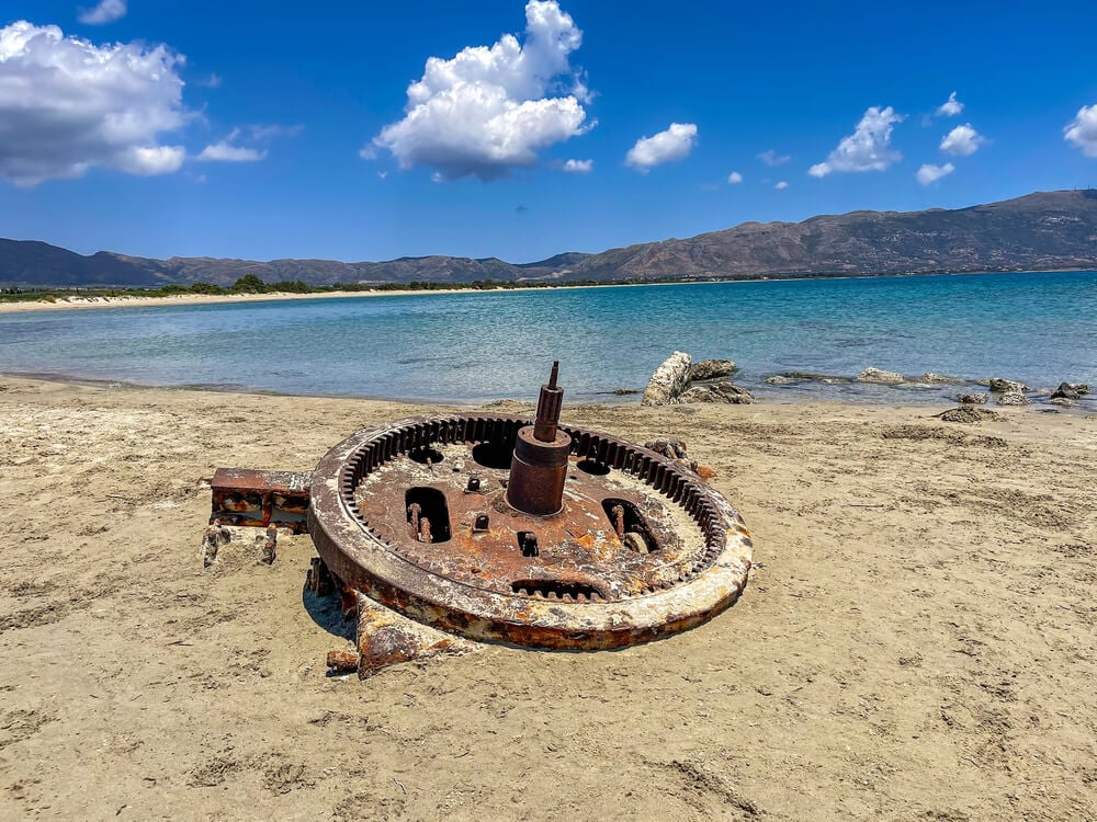
Off the coast of southern Greece lies Pavlopetri, a town whose streets, buildings and tombs sit in just a few meters of water. Oceanographer Nicholas Flemming discovered it in 1967, and later surveys showed it was occupied for much of the Bronze Age, beginning around 5,000 years ago.
Earthquakes and rising sea levels gradually submerged it, possibly around 1000 BC. The shallow water lets snorkelers see the outlines of walls and streets from the surface.
It is often described as the oldest known submerged town with a complete plan.
Baiae
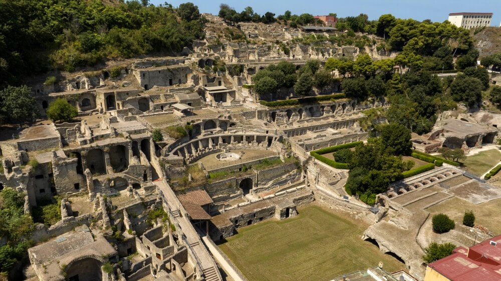
Baiae, on the Bay of Naples, was a luxury resort for Roman elites, home to villas linked to figures including Julius Caesar and Nero. The area sits on an active volcanic field, and slow ground movements known as bradyseism gradually lowered much of the town beneath the sea.
Today, divers explore an underwater archaeological park where mosaic floors, statues and villa walls lie a few meters down. Italy designated the protected park in 2002.
Some of the original statues have been moved to a museum and replaced with copies on the seabed.
Shicheng

Shicheng, known as Lion City, was founded in eastern China more than 1,300 years ago and flourished as a regional center at the foot of Five Lion Mountain. In 1959, the government flooded the valley for a hydroelectric project, creating Qiandao Lake and submerging the city under roughly 26 to 40 meters of water.
Residents were relocated to new towns. In 2001, divers rediscovered the city and found its walls, carved stone lions and wooden beams in remarkably good condition. Cold, still water had protected it from erosion and sunlight.
Villa Epecuen
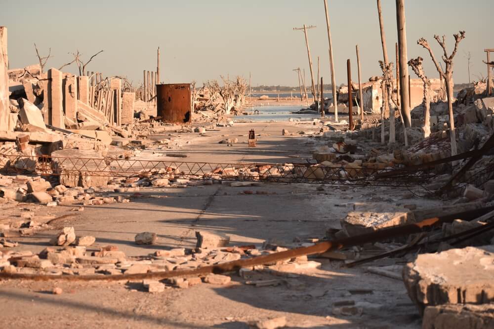
Villa Epecuen, a resort town in Argentina’s Buenos Aires Province, grew popular in the 1920s thanks to a salty lake said to have healing properties. Thousands of visitors a year came to soak in its waters.
On November 10, 1985, after unusually heavy rains, a protective embankment failed and the lake flooded the town, eventually leaving it about 10 meters underwater. As the water receded in the 2000s, ruined streets and buildings reappeared, crusted with salt.
Pablo Novak, its last resident, lived among the ruins until his death in 2022.
Rungholt
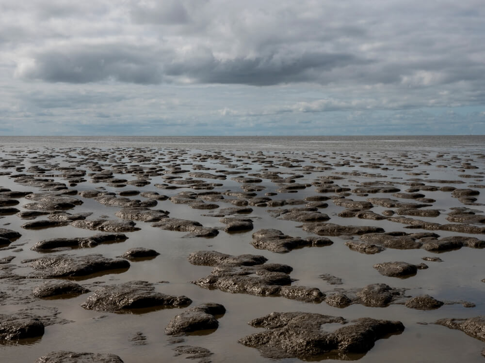
Rungholt was a prosperous trading town on the North Frisian coast of what is now Germany until a massive storm surge in January 1362, known as the Grote Mandrenke, drowned it along with much of the surrounding coastline. For centuries, Rungholt was half legend, a cautionary tale about pride and divine punishment.
Fishermen and mudflat walkers occasionally found remains in the Wadden Sea. In 2023, researchers announced they had located the foundations of a large church believed to belong to the lost town.
The site lies beneath tidal flats that are exposed only at low tide.
Angkor
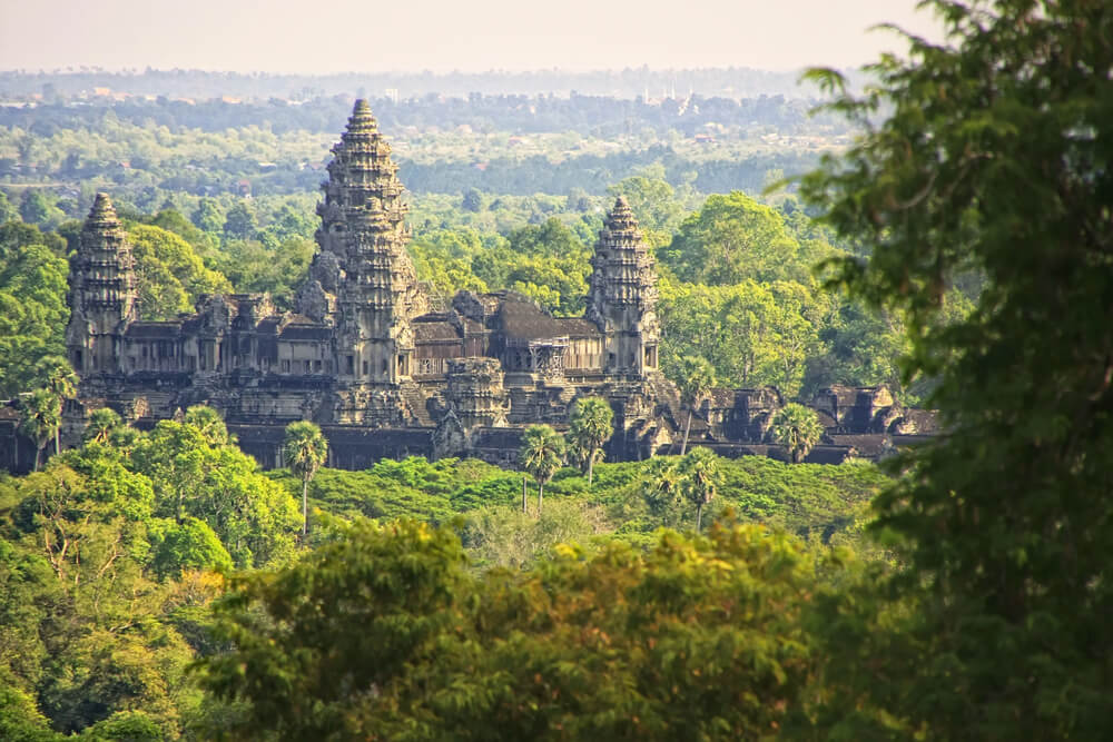
The Khmer capital at Angkor in Cambodia was among the largest cities of the medieval world, with temples, reservoirs and canals spread across hundreds of square kilometers. After the capital moved south in the 15th century, the forest gradually closed over much of the city, though monks kept Angkor Wat itself in use.
French explorer Henri Mouhot’s writings in the 1860s brought it widespread attention in Europe. In 2012, airborne laser scans revealed a vast network of roads, neighborhoods and canals hidden beneath the vegetation.
Ta Prohm, where tree roots still grip temple walls, shows what the jungle did to the rest.
Tikal
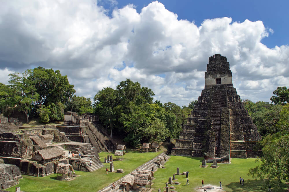
Tikal in northern Guatemala was one of the most powerful Maya cities, with towering pyramids and a population that may have reached tens of thousands. After it was abandoned in the 10th century, rainforest covered its plazas and temples so thoroughly that only the tops of the tallest pyramids poked through.
A Guatemalan expedition reached the ruins in 1848, and major excavations followed in the 20th century. Laser surveys published in 2018 revealed thousands of previously hidden structures in the surrounding region.
Fans of Star Wars may recognize its skyline from the 1977 film, where it stood in for a rebel base.
Ciudad Perdida
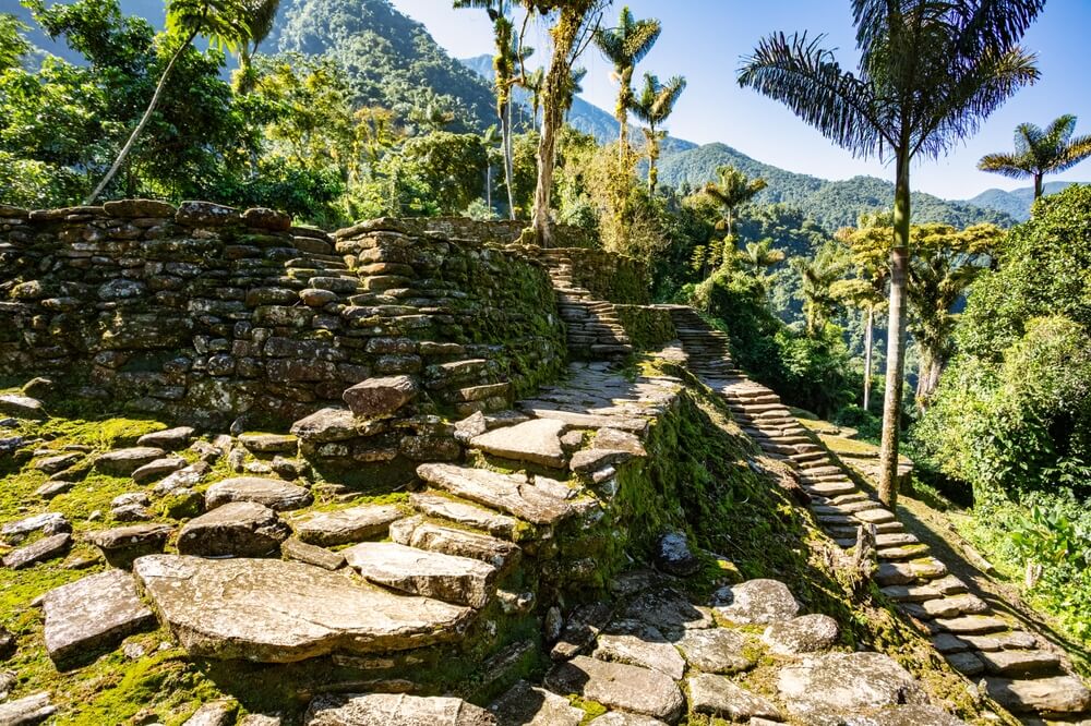
High in Colombia’s Sierra Nevada de Santa Marta, the city known as Teyuna or Ciudad Perdida was built by the Tairona people around AD 800, centuries before Machu Picchu. Its terraces, stone paths and circular platforms were abandoned during the Spanish conquest and gradually swallowed by dense forest.
Treasure hunters rediscovered it in 1972 and looted its tombs before authorities stepped in. Reaching the site still requires a multiday hike through the jungle and a climb of about 1,200 stone steps.
Indigenous communities descended from the Tairona never lost track of it.
El Mirador
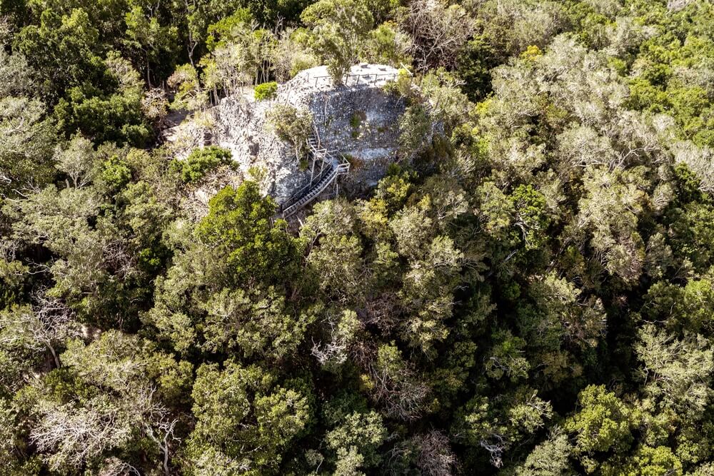
El Mirador in northern Guatemala flourished centuries before Tikal, reaching its peak between about 300 BC and AD 150. Its La Danta complex is among the largest pyramids in the world by volume.
The rainforest buried the city so thoroughly that the site was barely studied until the late 20th century, and archaeologist Richard Hansen has led research there for decades. A laser survey published in 2022 revealed hundreds of settlements in the surrounding basin linked by raised causeways.
Visitors usually reach it by a multiday trek or helicopter, which keeps the crowds small.
Mahendraparvata
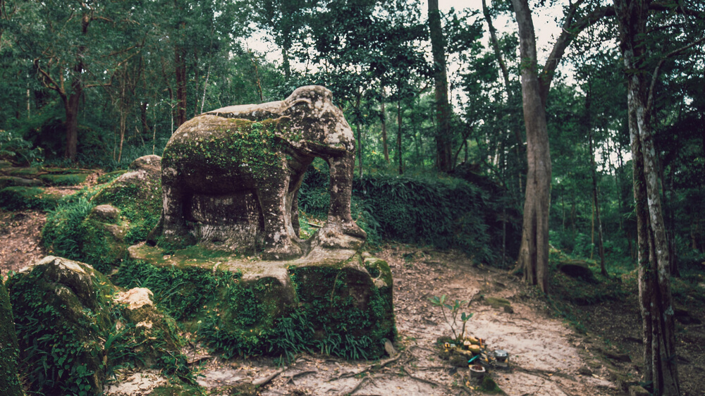
Ancient inscriptions mention Mahendraparvata, an early capital of the Khmer Empire founded in the 9th century on the Phnom Kulen plateau in Cambodia. Dense forest and landmines made the area difficult to study, and much of the city was invisible from the ground.
In 2012, researchers flew a helicopter fitted with lidar, a laser-scanning system, over the plateau and revealed a grid of roads, temples and reservoirs beneath the trees. The findings, published in 2013, confirmed a planned urban landscape centuries older than Angkor Wat.
Further surveys have continued to map its extent.
Upano Valley Cities
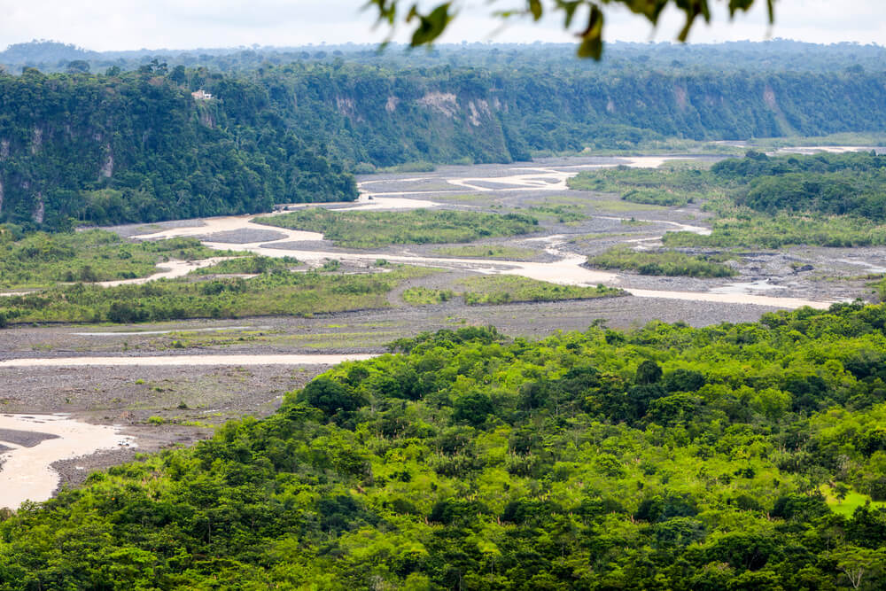
Researchers published laser surveys of Ecuador’s Upano Valley in January 2024 showing a network of settlements hidden under Amazon forest. The scans revealed thousands of earthen platforms, plazas and straight roads, some running for kilometers, built by people who lived there between roughly 500 BC and AD 600.
Archaeologist Stephen Rostain had studied the area for decades, but the laser images showed far more than ground surveys ever had. The findings challenged the old idea that the Amazon could not support large, planned urban centers.
Volcanic eruptions may have contributed to the region’s abandonment.
Caracol
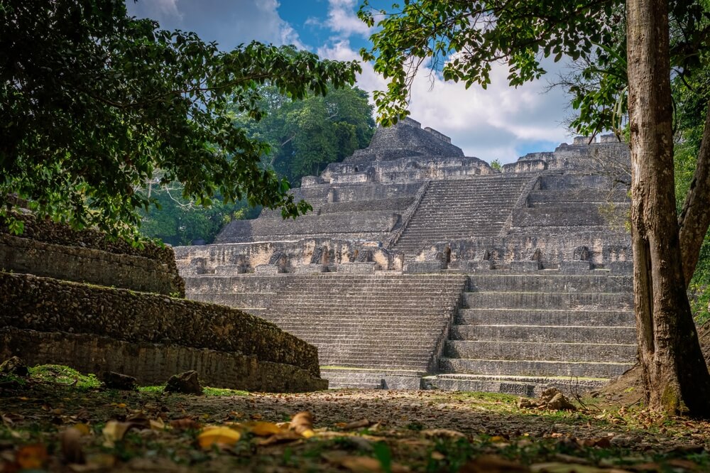
Caracol in western Belize was a major Maya city that defeated Tikal in a war in AD 562, according to inscriptions. At its peak, it may have held more than 100,000 people spread across a vast area of farm terraces and causeways.
The jungle covered it after its decline, and in 2009, archaeologists Arlen and Diane Chase used airborne laser scanning to map the city in days, a task that would have taken decades on foot. Its Caana pyramid is still the tallest human-made structure in Belize.
The site is protected within a forest reserve.
Valeriana
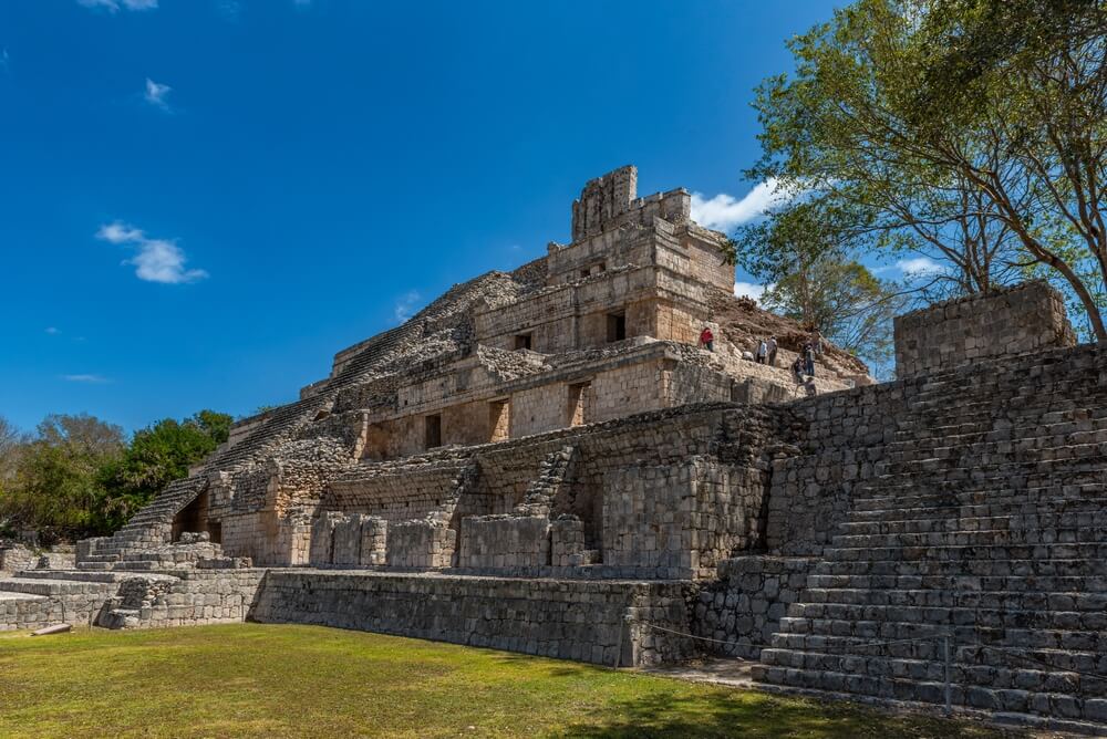
Doctoral student Luke Auld-Thomas announced the discovery of a lost Maya city in Campeche, Mexico, in 2024 without ever setting foot in the jungle to find it. He located it by reanalyzing laser data collected years earlier for an environmental project.
The survey revealed plazas, pyramids and a reservoir among thousands of structures, and the team named the city Valeriana after a nearby lagoon. The ruins lie surprisingly close to a main road and a modern town.
The discovery suggested that many more Maya cities remain hidden in plain sight.
Ground Never Stops Moving
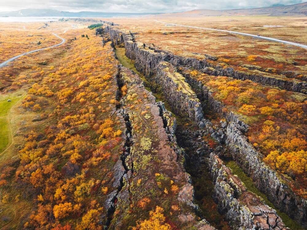
Sand, water and forest work differently, but all three are patient. Dunes advance a few meters a year, seas creep upward, and tree roots push into the smallest gap between stones.
Given enough time, any of them can erase a city that took centuries to build. Several of these places were famous in their day, and none of their residents expected to be forgotten.
The strangest part is how much these forces also preserve. Sand protected the houses of Skara Brae and the tablets of Niya, cold water kept the carvings of Shicheng sharp, and the jungle hid Maya causeways from looters and bulldozers alike.
Lasers and satellites are now pulling these cities back into view faster than ever. The next great discovery is probably already waiting under some forest canopy or desert dune.
More from Go2Tutors!

- 16 Historical Figures Who Were Nothing Like You Think
- 12 Things Sold in the 80s That Are Now Illegal
- 15 VHS Tapes That Could Be Worth Thousands
- 17 Historical “What Ifs” That Would Have Changed Everything
- 18 TV Shows That Vanished Without a Finale
Like Go2Tutors’s content? Follow us on MSN.