15 Nations That Have Surprising Geographic Features
When you think about geography, certain images probably come to mind—France’s rolling vineyards, Egypt’s vast deserts, or Norway’s dramatic fjords. But scratch beneath the surface, and you’ll discover that many countries harbor geographic secrets that would make your jaw drop. From underground rivers that could swallow entire cities to mountains that shouldn’t exist where they do, our planet loves throwing curveballs.
These hidden wonders often get overshadowed by more famous landmarks, yet they’re just as remarkable. Here is a list of 15 nations that pack surprising geographic features you probably never knew existed.
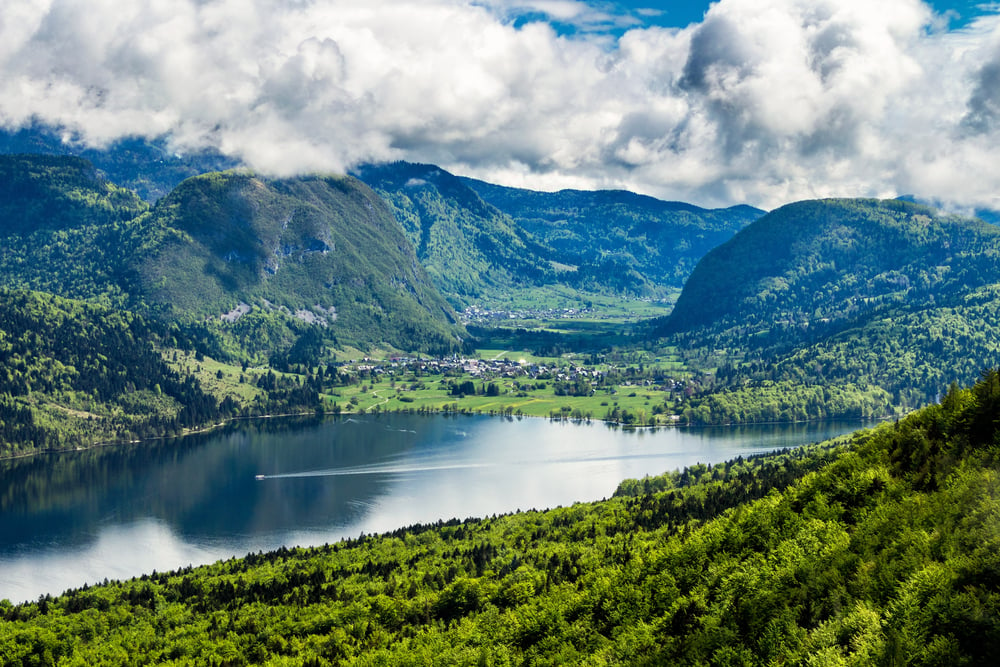
Slovenia
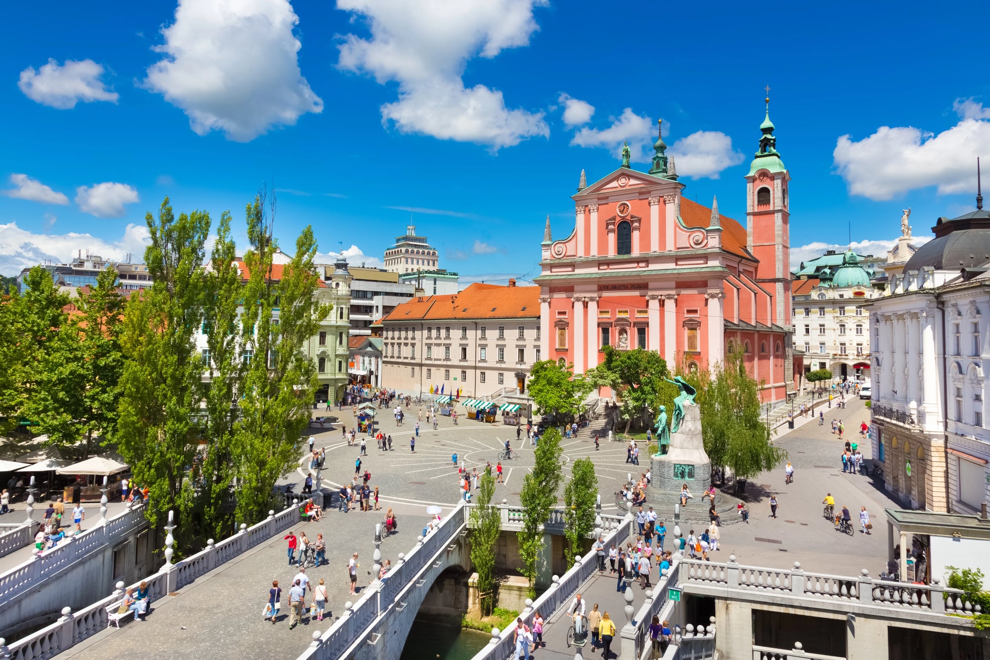
This tiny European country might be small enough to drive across in a few hours, but it punches way above its weight in the geographic surprise department. Slovenia sits on top of one of the world’s most extensive underground river systems, with over 8,000 caves carved into its limestone bedrock.
The Škocjan Caves alone contain underground chambers so massive they could fit the Statue of Liberty with room to spare. What makes this even more mind-bending is that Slovenia has more karst landscape per square mile than almost anywhere else on Earth.
Madagascar
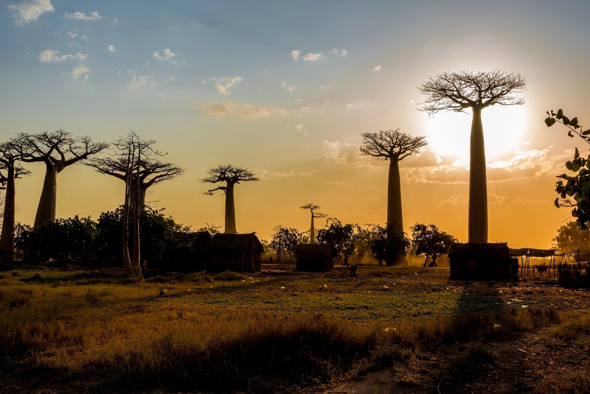
Most people know Madagascar for its lemurs and unique wildlife, but the island’s geology tells an even more fascinating story. This chunk of land broke away from Africa about 160 million years ago and has been drifting solo ever since, making it one of the world’s oldest isolated landmasses.
The island contains rocks that are over 3 billion years old—some of the most ancient on our planet. Madagascar also has tsingy formations, razor-sharp limestone pinnacles that create landscapes so alien they look like something from another world.
Like Go2Tutors’s content? Follow us on MSN.
Chile
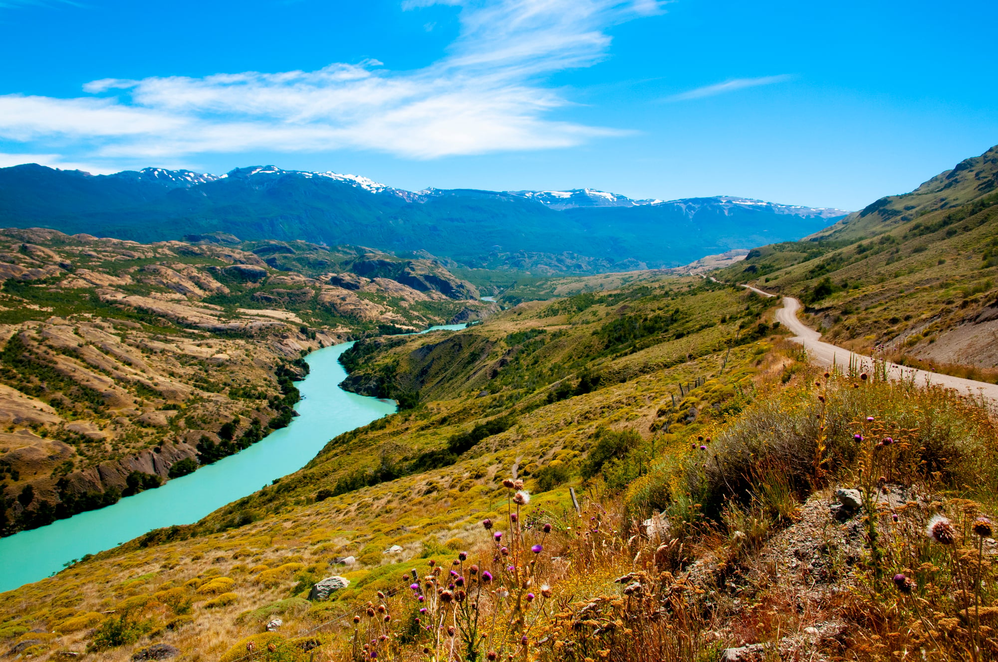
Chile’s ridiculous shape—stretching 2,600 miles from north to south but averaging only 110 miles wide—already makes it geographically odd. But here’s the kicker: this skinny country contains virtually every climate zone on Earth within its borders.
You can find bone-dry deserts in the north, Mediterranean climates in the center, temperate rainforests in the south, and polar conditions at the bottom. It’s like someone took samples from different continents and stitched them together in one impossibly long strip.
Finland
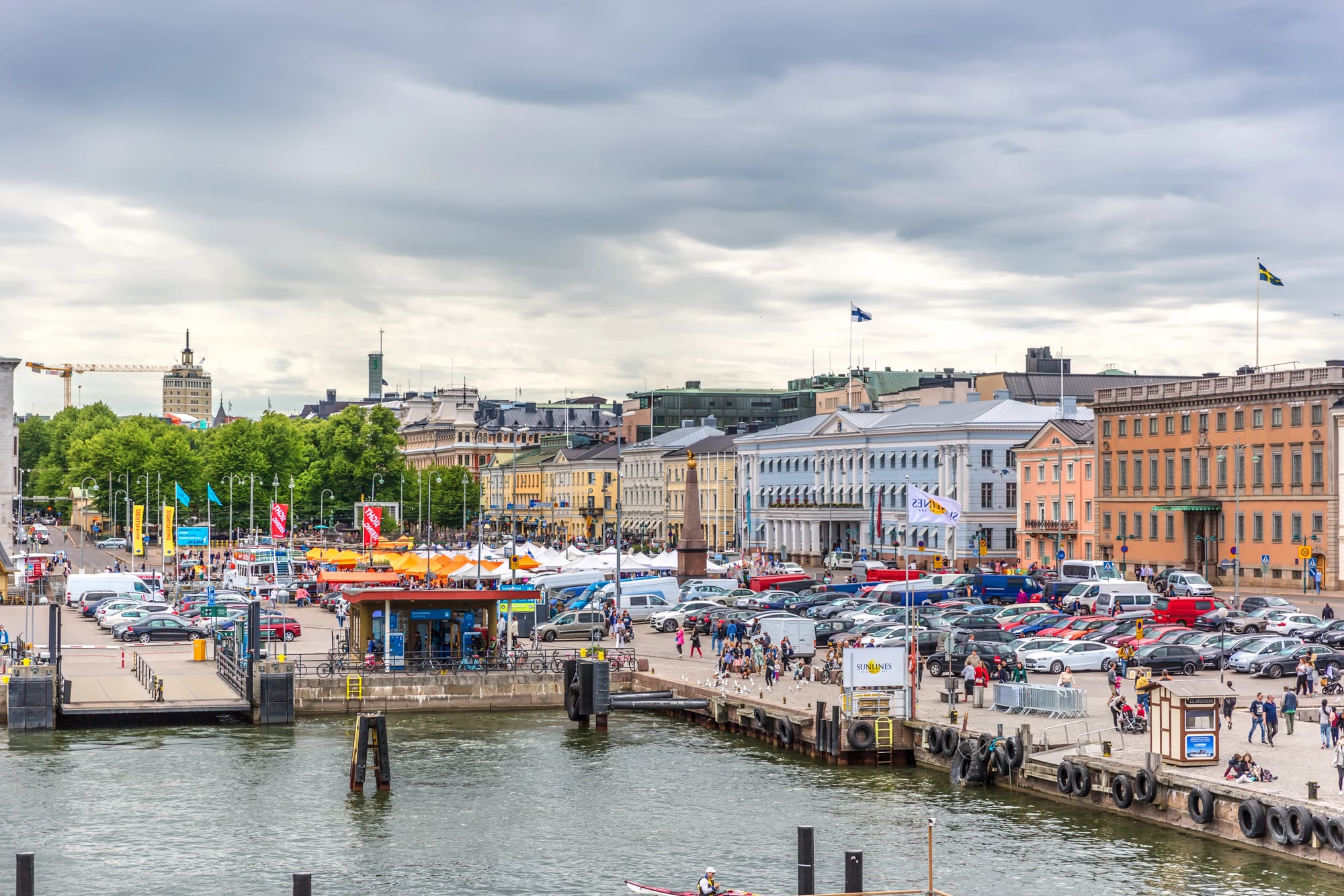
Finland has more islands than you could visit in several lifetimes—officially 267,570 islands that are at least 500 square meters in size. But that’s not the surprising part. What’s really wild is that Finland is still rising out of the sea at a rate of about 0.4 inches per year due to post-glacial rebound.
The massive ice sheets that covered the region during the last ice age were so heavy they actually compressed the land, and now that the ice is gone, the ground is slowly bouncing back up.
Lesotho
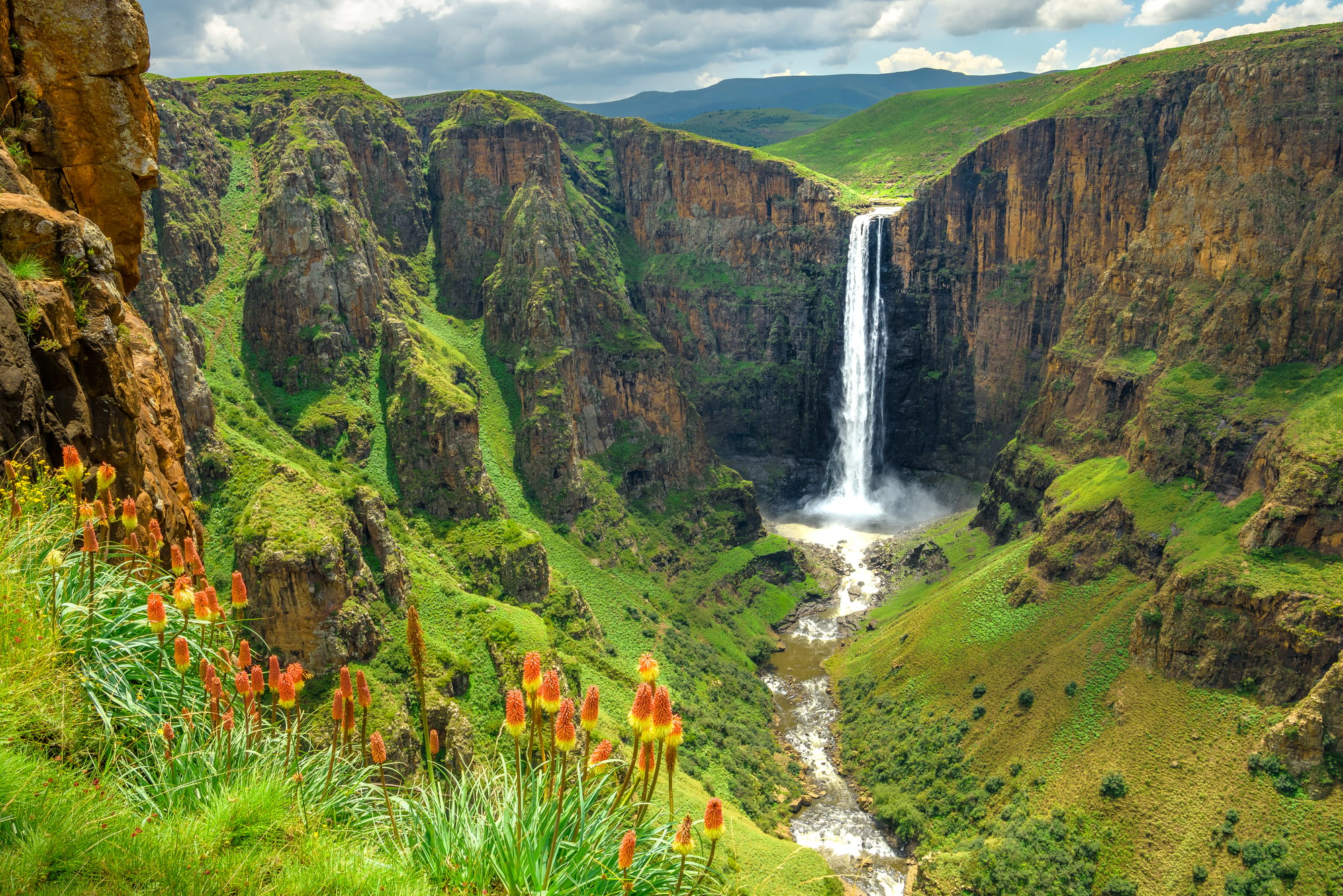
Lesotho holds the distinction of being the only country on Earth where every square inch of territory sits above 3,280 feet in elevation. This landlocked nation, completely surrounded by South Africa, is basically one big mountain kingdom.
But here’s the geography plot twist: Lesotho actually exports water to South Africa through massive mountain reservoirs and tunnels. The tiny mountain country literally sells water to its much larger, more populous neighbor.
Like Go2Tutors’s content? Follow us on MSN.
Bangladesh
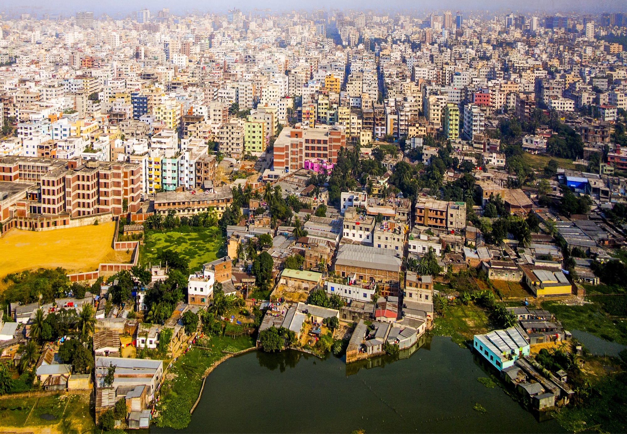
Despite being one of the most densely populated countries on the planet, Bangladesh experiences one of nature’s most dramatic annual transformations. During monsoon season, roughly one-third of the entire country disappears underwater in what’s essentially a controlled flood.
This isn’t a disaster—it’s how the land has worked for thousands of years. The flooding deposits nutrient-rich silt that makes Bangladesh’s soil incredibly fertile, supporting agriculture that feeds 170 million people in an area smaller than Florida.
Bhutan
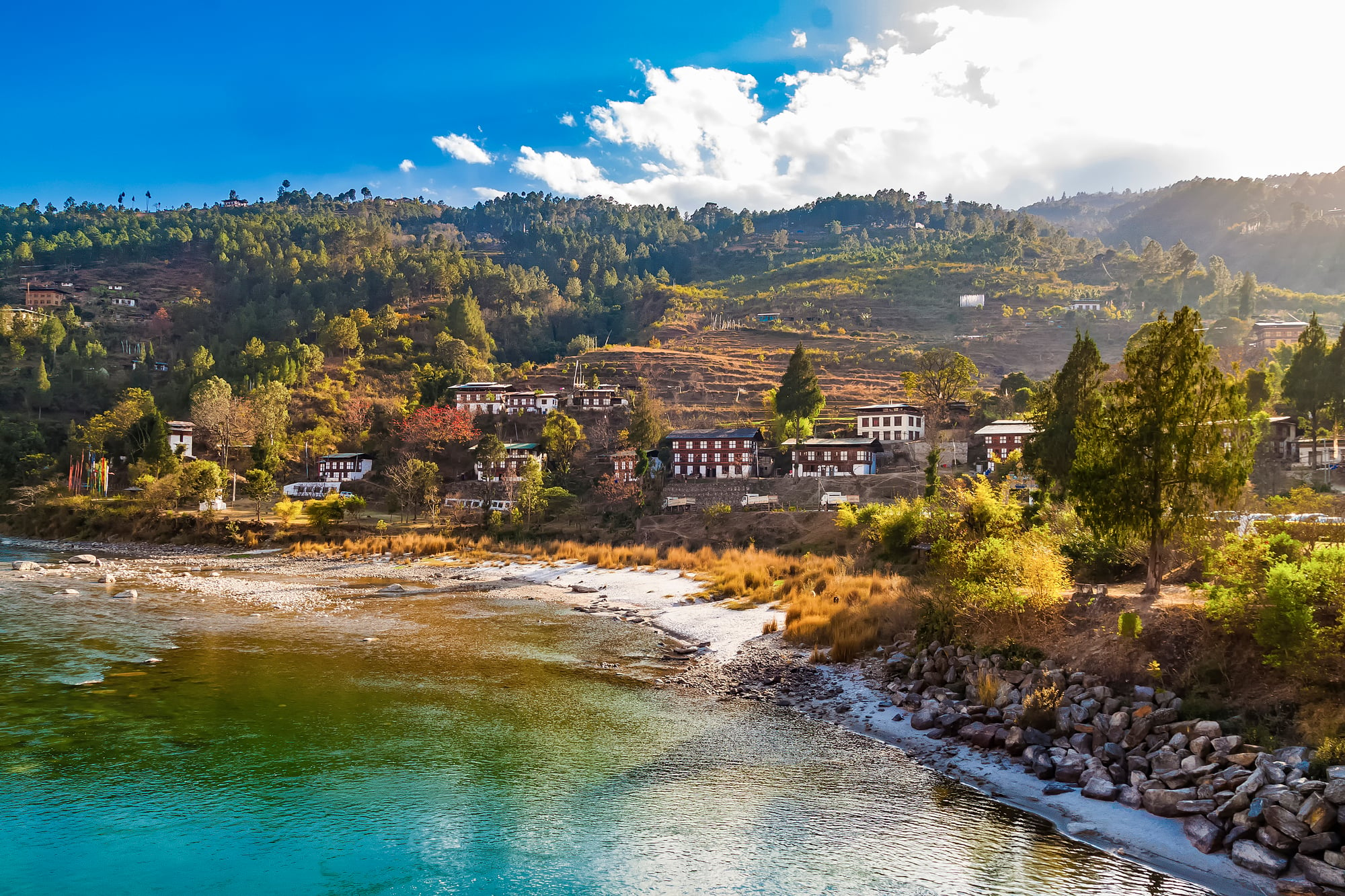
This Himalayan kingdom doesn’t just measure Gross National Happiness instead of GDP—it also has some seriously surprising geography. Bhutan is carbon-negative, meaning it absorbs more carbon dioxide than it produces, largely because over 70% of the country is covered in forests.
But the real shocker is elevation: Bhutan’s highest point reaches over 24,000 feet, while its lowest point is just 650 feet above sea level, creating a vertical range that encompasses everything from subtropical jungles to glacial peaks.
Netherlands
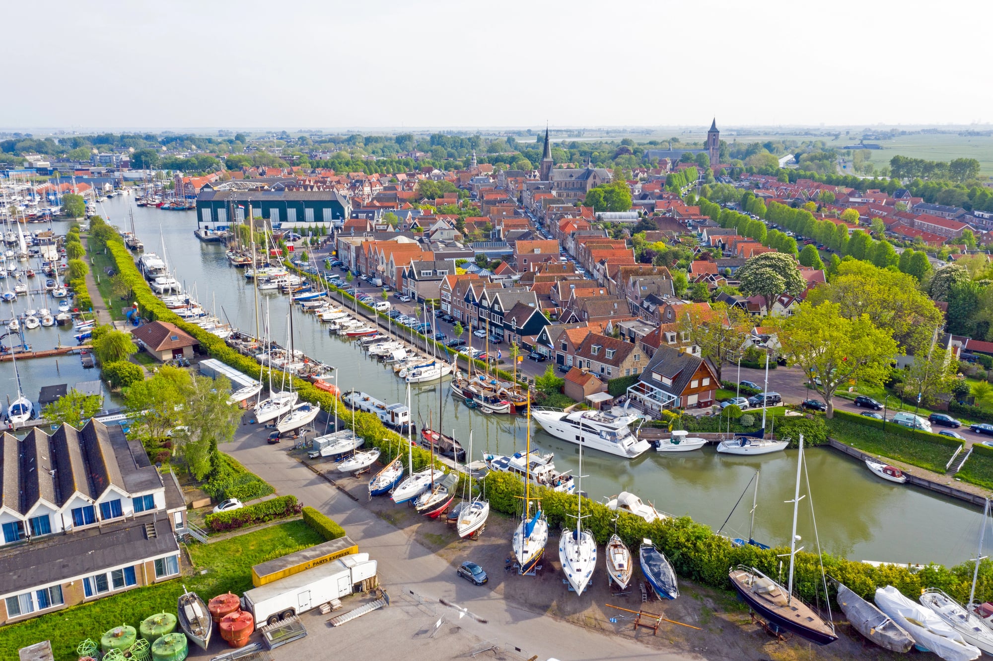
Everyone knows the Netherlands is flat and parts of it are below sea level, but the engineering behind keeping this country dry is absolutely bonkers. About 26% of the Netherlands exists below sea level, and without constant human intervention, roughly two-thirds of the country would be underwater.
The Dutch have basically built an entire nation on land they’ve stolen back from the sea using an intricate system of dikes, pumps, and polders that has to run 24/7 to keep millions of people from getting very wet feet.
Like Go2Tutors’s content? Follow us on MSN.
Norway
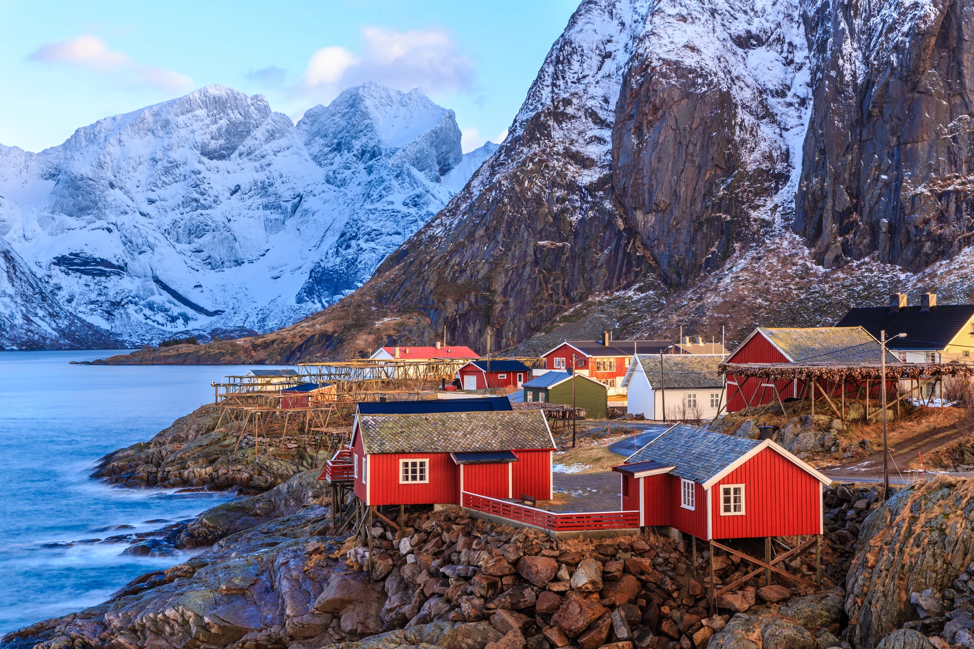
Norway’s coastline is so convoluted and jagged that if you could somehow straighten it out, it would stretch for 15,626 miles—more than halfway around the entire Earth. This is thanks to the country’s 50,000 islands and countless fjords carved by glaciers.
But here’s the part that really messes with your head: some of Norway’s fjords are so deep that their bottoms sit far below sea level, creating underwater valleys that plunge down over 4,000 feet.
Kazakhstan
As the world’s ninth-largest country, Kazakhstan has room for plenty of geographic surprises, but this one takes the cake: the Aral Sea, once the world’s fourth-largest lake, has almost completely disappeared within a single human lifetime.
What was once a massive body of water covering 26,000 square miles has shrunk to less than 10% of its original size, leaving behind a surreal landscape of rusted ships sitting in what’s now desert. It’s like someone pulled the plug on a bathtub the size of South Carolina.
Iceland
Iceland sits directly on top of the Mid-Atlantic Ridge, meaning the island is literally being pulled apart at a rate of about 0.8 inches per year. You can actually visit Thingvellir National Park and stand in the rift valley where the North American and Eurasian tectonic plates are slowly separating.
But Iceland’s real geographic feature is that it’s one of the few places on Earth where you can see the ocean floor above sea level, thanks to all that volcanic activity pushing up material from deep beneath the waves.
Like Go2Tutors’s content? Follow us on MSN.
Australia
Australia is the only country that’s also a continent, but that’s just the beginning of its geographic weirdness. The continent is moving north at about 2.7 inches per year—fast enough that GPS coordinates have to be regularly updated to stay accurate.
Australia also contains the world’s largest monolith (Uluru), the world’s largest sand island (Fraser Island), and deserts that are so mineral-rich they glow different colors when viewed from space.
Canada
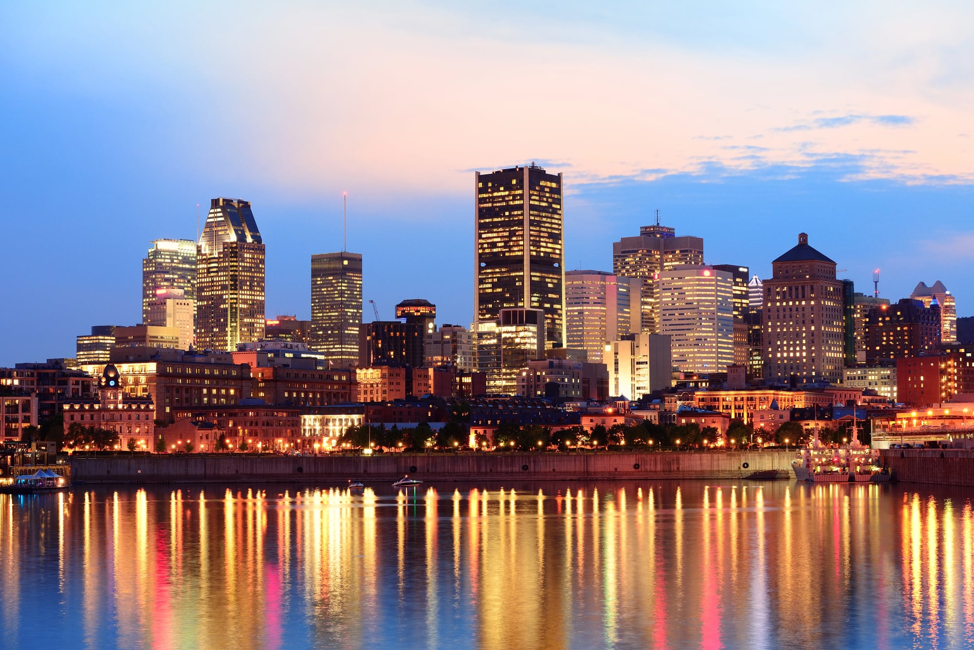
Canada has more lakes than the rest of the world combined—over 2 million of them. But the real mind-bender is Hudson Bay, which creates a gravity anomaly so significant it can be measured from space.
The bay sits over an area where the Earth’s gravitational pull is actually weaker than normal, likely due to the massive ice sheets that once pressed down on the region. This means if you weigh yourself in Hudson Bay, you’ll technically weigh slightly less than you would almost anywhere else on Earth.
Russia
Russia spans 11 time zones, which everyone knows, but here’s something that might surprise you: the country contains about 20% of the world’s unfrozen fresh water. Lake Baikal alone holds more fresh water than all the Great Lakes combined, and it’s so old and isolated that it contains species found nowhere else on Earth.
The lake is also so deep—over a mile at its deepest point—that if you could somehow stand it upright, it would be taller than four Empire State Buildings stacked on top of each other.
Like Go2Tutors’s content? Follow us on MSN.
Japan
Japan consists of 6,852 islands, though only about 430 are inhabited. But the country’s position on the Pacific Ring of Fire creates some truly wild geography: Japan experiences about 1,500 earthquakes per year and has over 100 active volcanoes.
The islands are also moving—Japan actually shifted about 8 feet eastward during the 2011 earthquake and tsunami. Mount Fuji, the country’s most famous peak, is technically still an active volcano that could erupt at any time.
The World Keeps Surprising Us
These geographic oddities remind us that our planet is far more dynamic and unpredictable than most maps suggest. While we tend to think of countries as fixed entities with stable borders and predictable landscapes, the reality is that Earth is constantly reshaping itself through forces both subtle and dramatic.
From Finland slowly rising out of the sea to Japan sliding across the ocean floor, these nations prove that geography is anything but static—it’s a living, breathing story that continues to unfold beneath our feet.
More from Go2Tutors!

- 16 Historical Figures Who Were Nothing Like You Think
- 12 Things Sold in the 80s That Are Now Illegal
- 15 VHS Tapes That Could Be Worth Thousands
- 17 Historical “What Ifs” That Would Have Changed Everything
- 18 TV Shows That Vanished Without a Finale
Like Go2Tutors’s content? Follow us on MSN.