Biggest Lakes Ranked by Surface Size
Water dominates Earth’s geography, yet most people think of oceans first. Lakes get less attention despite holding massive volumes of freshwater and shaping entire regions’ climates, economies, and cultures.
The largest ones stretch so far you can’t see across them, making the distinction between lake and sea feel arbitrary at times.
Caspian Sea
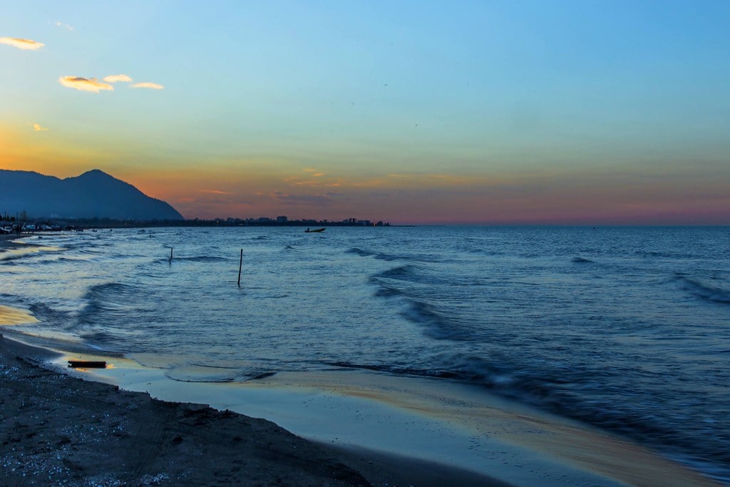
At 371,000 square kilometers, the Caspian Sea dwarfs every other lake on Earth. The name tricks people into thinking it’s an ocean, and geologically it once was.
Millions of years ago, the Caspian connected to the Mediterranean through what’s now the Black Sea. Tectonic shifts landlocked it, leaving behind saltwater that never quite became fresh.
Five countries border the Caspian: Russia, Kazakhstan, Turkmenistan, Iran, and Azerbaijan. This creates complex geopolitics around resource extraction, particularly oil and natural gas reserves beneath the lakebed.
The legal status remains disputed—is it a sea or a lake? That distinction determines whether international maritime law or different agreements govern it. The water level fluctuates significantly over decades.
Climate change and dam construction on feeder rivers have caused notable drops in recent years. Some coastal towns that once sat at the water’s edge now stand kilometers inland.
The Caspian sturgeon population, source of most of the world’s caviar, has collapsed due to overfishing and habitat destruction.
Lake Superior

North America’s largest lake covers 82,100 square kilometers, straddling the U.S.-Canada border. The name fits perfectly—it sits at a higher elevation than the other Great Lakes, which makes it geographically superior.
The Ojibwe people called it Gichigami, meaning “great sea,” which feels more accurate when you’re standing on its shores watching waves that could pass for ocean swells. Lake Superior contains enough water to flood all of North and South America to a depth of 30 centimeters.
That statistic sounds made up but it’s accurate. The lake holds roughly ten percent of the world’s surface freshwater.
You could pour all the other Great Lakes into Superior and still have room left over. The water stays cold year-round, averaging around 4 degrees Celsius even in summer.
This preserves shipwrecks remarkably well. Over 350 known wrecks rest on the lake bottom, some intact enough that divers report seeing personal effects and cargo exactly where they sank decades or centuries ago.
The cold water slows decomposition and prevents the organisms that typically break down wooden vessels in warmer waters. November storms on Superior have earned legendary status among sailors.
The lake generates its own weather systems, and the fetch—the distance wind can blow across open water—creates waves that have sunk massive freighters. The Edmund Fitzgerald went down in 1975 during a November storm, killing all 29 crew members and inspiring a Gordon Lightfoot song that made the tragedy part of North American folklore.
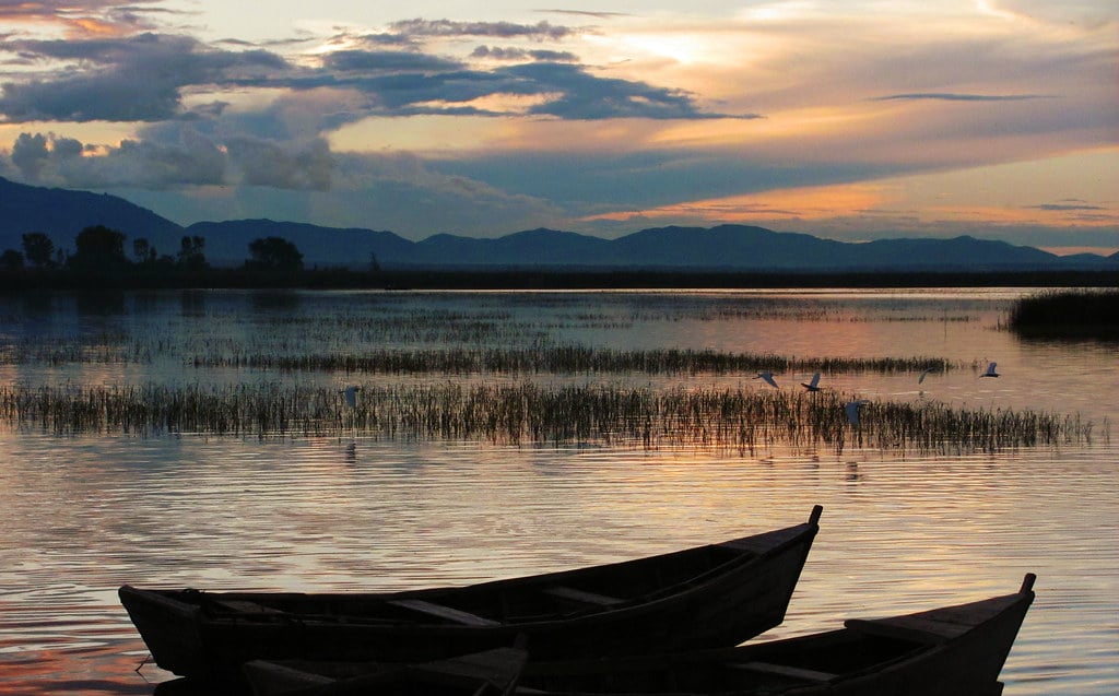
Lake Victoria

Africa’s largest lake spans 68,800 square kilometers across Uganda, Kenya, and Tanzania. Victoria sits in a shallow basin, with an average depth of just 40 meters despite its enormous surface area.
That shallowness makes it vulnerable to environmental changes that deeper lakes can better withstand. The Nile River begins its journey at Lake Victoria, though this wasn’t always obvious. Nineteenth-century European explorers searched for the Nile’s source for decades.
John Hanning Speke reached the lake in 1858 and declared it the source, though critics questioned this claim for years afterward. The debate consumed Victorian-era geographic societies with an intensity that seems quaint now but mattered tremendously then.
Over 30 million people live in the lake’s basin, depending on it for drinking water, fishing, and transportation. The Nile perch introduction in the 1950s fundamentally altered the ecosystem.
This large predatory fish thrived, but it decimated hundreds of native cichlid species found nowhere else on Earth. The perch created a commercial fishing industry that employs thousands, but at the cost of biodiversity that can never be recovered.
Water hyacinth invasion causes ongoing problems. The plant forms dense mats that block sunlight, kill aquatic plants beneath it, prevent fishing boats from moving freely, and clog water intake pipes for cities and industries.
Millions of dollars get spent annually trying to control it, with limited long-term success.
Lake Huron
The second-largest Great Lake covers 59,600 square kilometers. Huron connects to Lake Michigan through the Straits of Mackinac, and some geographers argue they should count as a single lake since they sit at the same elevation and water flows freely between them.
But tradition and politics keep them separate on maps. Georgian Bay, technically part of Lake Huron, almost qualifies as its own lake.
The bay covers 15,000 square kilometers and contains 30,000 islands, creating a maze of waterways that attracted First Nations peoples for millennia before European contact. The rocky, pine-covered landscape inspired Canadian artists of the Group of Seven, whose paintings defined a certain vision of Canadian identity.
Manitoulin Island in Lake Huron holds the distinction of being the world’s largest freshwater island. It contains several lakes, which contain their own islands.
This creates a geographic oddity—islands within lakes within islands within lakes. The nested geography appeals to people who enjoy recursive patterns in nature.
Lake Michigan

The only Great Lake entirely within the United States covers 58,000 square kilometers. Michigan means “great water” in the Ojibwe language, which again seems more accurate than calling it merely a lake.
Chicago, Milwaukee, and dozens of smaller cities line its shores, making it the most urbanized of the Great Lakes. The lake effect snow phenomenon makes Michigan’s eastern shore famous among winter sports enthusiasts and dreaded by residents.
Cold air moving across the relatively warm lake water picks up moisture, then dumps it as snow when the air hits land. Cities on the eastern shore regularly receive several meters of snow each winter, far more than areas just a hundred kilometers inland.
Sand dunes along the eastern shore rank among the largest freshwater dunes anywhere. The Indiana Dunes and Sleeping Bear Dunes attract tourists who expect beach experiences without ocean saltwater.
The dunes shift constantly, burying forests and occasionally revealing them again decades later, creating ghostly landscapes of dead trees emerging from sand.
Lake Tanganyika

East Africa’s rift valley contains this 32,900-square-kilometer lake, the world’s longest and second-deepest. Tanganyika stretches 673 kilometers north to south but remains relatively narrow, typically 50 kilometers across.
Four countries border it: Tanzania, Democratic Republic of Congo, Burundi, and Zambia. The depth—over 1,400 meters at its deepest point—creates unusual conditions.
The bottom layers of water don’t mix with surface water, creating essentially separate aquatic environments stacked on top of each other. The deep water lacks oxygen and can’t support most life forms.
Everything lives in the upper few hundred meters. Biodiversity exceeds most other lakes.
Over 300 fish species live in Tanganyika, most of them endemic cichlids found nowhere else. The lake essentially functions as an evolutionary laboratory where species adapted to specific niches in ways that teach scientists about how speciation works.
Darwin might have loved Tanganyika as much as he loved the Galápagos. The lake’s age contributes to its biodiversity.
While most lakes formed recently in geological time, Tanganyika has existed for 9-12 million years. That extended timeline allowed species to evolve, diversify, and fill every available ecological niche.
Younger lakes simply haven’t had time for that level of specialization.
Lake Baikal
Siberia’s Lake Baikal covers only 31,500 square kilometers, but its depth compensates for its relatively modest surface area. At 1,642 meters deep, Baikal contains more water than any other lake on Earth—roughly 23% of the world’s liquid surface freshwater.
You could drain all five Great Lakes into Baikal and it would only be about 90% full. The lake’s age staggers comprehension.
Baikal formed 25-30 million years ago, making it by far the oldest lake on Earth. Most lakes last only thousands of years before sediment fills them in or climate changes dry them up.
Baikal persists because it sits in an active continental rift zone that keeps deepening. Over 1,700 species of plants and animals live in Baikal, two-thirds of them endemic.
The Baikal seal, one of the world’s few freshwater seal species, thrives despite being hundreds of kilometers from any ocean. How seals reached Baikal remains debated—did they swim up rivers from the Arctic Ocean during some past connection? The question remains unresolved.
The water achieves remarkable clarity. You can see down 40 meters in some areas, giving the lake an otherworldly blue appearance.
Russian Orthodox believers consider Baikal sacred, calling it a sea rather than a lake out of respect. That spiritual connection has helped protect it from some industrial development, though pollution threats persist.
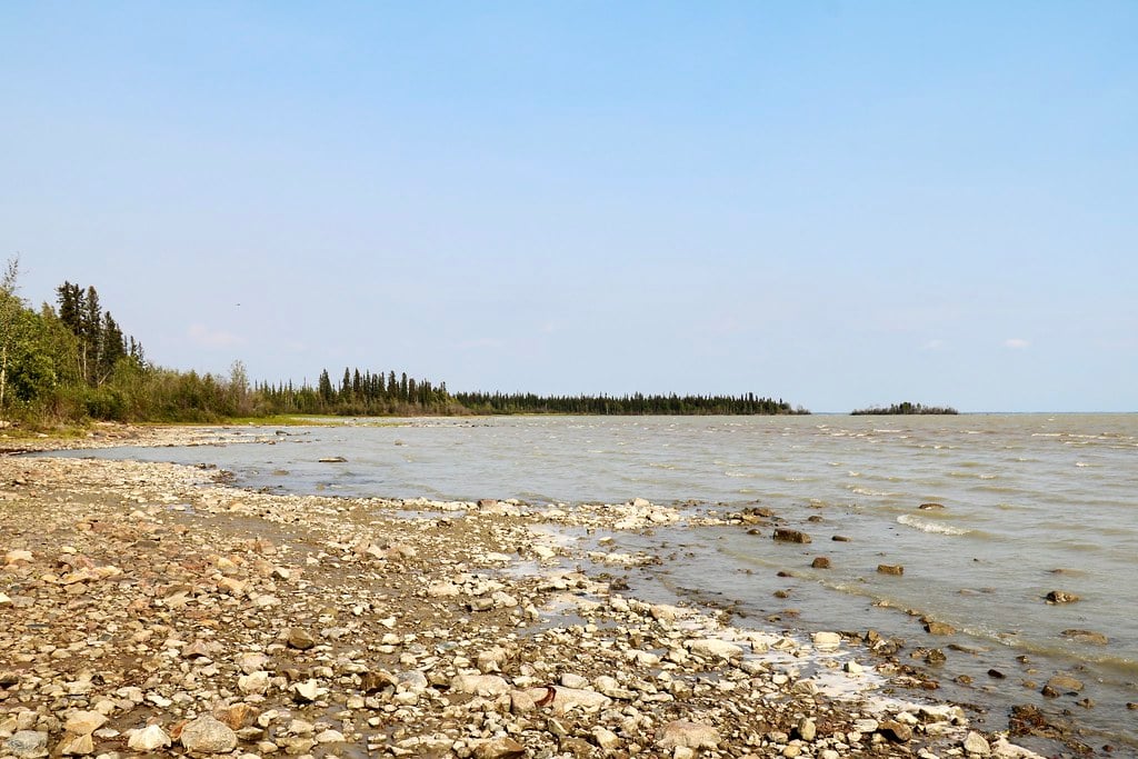
Great Bear Lake
Canada’s largest lake spans 31,000 square kilometers in the Northwest Territories. Most people outside Canada have never heard of it, which makes sense given that no roads reach it and the nearest significant town, Délįne, has a population under 600.
Great Bear Lake freezes completely from November to July. Even in summer, the water temperature barely exceeds 10 degrees Celsius.
These conditions create challenges for fish species, yet the lake supports excellent populations of lake trout, northern pike, and Arctic grayling that attract sport fishers willing to make the difficult journey. The Déline Got’ine people have lived on the lake’s shores for thousands of years.
Their oral history describes the lake as the dwelling place of a powerful spirit that must be respected. That traditional knowledge helped them live sustainably in an environment that European newcomers found nearly uninhabitable.
Uranium mining near the lake during the 1940s and 1950s provided material for the atomic weapons dropped on Japan. The mine closed in 1960, leaving behind radioactive waste that the Déline people believe caused elevated cancer rates in their community.
The environmental legacy of those wartime operations remains controversial decades later.
Lake Malawi
This 29,600-square-kilometer lake occupies the southern section of Africa’s rift valley, bordered by Malawi, Mozambique, and Tanzania. The name varies—Lake Nyasa appears on many maps, particularly those from Mozambique and Tanzania.
Different colonial histories produced different names, and politics ensures neither side will compromise. Malawi holds more fish species than any other lake on Earth—somewhere between 500 and 1,000 species depending on which taxonomist you ask.
The vast majority are cichlids that evolved into a dazzling variety. Aquarium enthusiasts worldwide keep Malawi cichlids, appreciating their bright colors and relatively easy care requirements.
The lake provides protein for millions of people living in one of the world’s poorest regions. Overfishing pressures the ecosystem, but for many communities, the alternative to fishing means hunger.
Balancing conservation with human needs presents challenges that affluent outsiders often oversimplify. Climate change threatens the lake’s stratification patterns. Like Tanganyika, Malawi’s deep water doesn’t mix with surface layers.
But warming temperatures could disrupt this pattern, potentially releasing nutrients from deep water that could trigger algae blooms, oxygen depletion, and ecosystem collapse.
Great Slave Lake
Canada’s second-largest lake covers 27,000 square kilometers, sitting in the Northwest Territories just below the Arctic Circle. The name derives from the Slavey people who lived in the region, though the English homonym unfortunately suggests something entirely different.
Great Slave Lake reaches 614 meters deep, making it North America’s deepest lake. That depth combined with northern latitude means the water stays cold year-round.
Even in summer, temperatures rarely exceed 15 degrees Celsius near the surface. Yellowknife, the capital of the Northwest Territories, sits on the lake’s northern shore.
The city’s 20,000 residents represent by far the largest population concentration on any northern Canadian lake. Ice roads across the frozen lake allow winter access to remote communities and diamond mines that helped transform the territory’s economy.
The lake freezes thick enough that trucks can drive across it, typically from late November through late April. These ice roads become temporary highways complete with speed limits and weight restrictions.
When they break up in spring, communities accessible only by ice road face isolation until the next winter or must rely on expensive air transport.
Lake Erie
The smallest and shallowest Great Lake by volume covers 25,700 square kilometers. Erie’s average depth of just 19 meters makes it vulnerable to temperature fluctuations, pollution, and algae blooms that deeper lakes resist better.
Algae blooms plague Erie more than any other Great Lake. Phosphorus runoff from agricultural land feeds the algae, creating vast green mats on the surface that deplete oxygen, kill fish, and produce toxins that contaminate drinking water supplies.
Toledo, Ohio, warned residents not to drink tap water for several days in 2014 when toxins from an algae bloom reached dangerous levels. The lake’s shallowness makes it prone to seiche events—rapid water level changes caused by wind and atmospheric pressure.
Water can drop or rise over a meter in just hours, creating dangerous conditions for boats and people near shore. Despite these problems, Erie supports valuable commercial and recreational fisheries.
Walleye, yellow perch, and smallmouth bass populations remain healthy enough to sustain industries worth hundreds of millions of dollars annually. The lake’s productivity stems partly from its shallowness—sunlight reaches the bottom across large areas, supporting plant growth that feeds fish.
Lake Winnipeg
This Canadian lake covers 24,500 square kilometers in Manitoba. Winnipeg means “muddy waters” in Cree, referring to the lake’s brownish color caused by suspended sediment from inflowing rivers.
The Red River, which flows through Winnipeg city, carries agricultural runoff that creates similar algae problems as Lake Erie faces. Lake Winnipeg served as a critical transportation link for the fur trade.
Voyageurs paddled massive canoes loaded with beaver pelts along routes connecting the lake to Hudson Bay, the Great Lakes, and Arctic rivers. Those trade networks helped establish the Canadian state before roads or railways existed.
The lake’s fishery focuses primarily on walleye, sauger, and whitefish. Commercial fishing operations ship products worldwide, though quantities have decreased as recreational fishing increased.
Balancing these competing uses creates ongoing management challenges. Indigenous communities, particularly Cree and Ojibway peoples, maintain cultural and economic connections to the lake stretching back thousands of years.
Their knowledge of seasonal patterns, fish behavior, and weather conditions exceeds anything recorded in scientific literature, yet governments only recently began incorporating traditional knowledge into management decisions.
Lake Ontario

The smallest Great Lake by surface area at 19,000 square kilometers nonetheless holds impressive volume due to its depth—average 86 meters, maximum 244 meters. Ontario sits at a lower elevation than the other Great Lakes, receiving its outflow before sending it down the Saint Lawrence River to the Atlantic Ocean.
Toronto and Hamilton on the Canadian side, Rochester and other cities on the American side, give Ontario shorelines extensive urban development. This population density created pollution problems that improved following the Great Lakes Water Quality Agreement in 1972, though issues persist.
The lake doesn’t freeze completely even in severe winters. Its depth and the Saint Lawrence River’s constant outflow keep at least some water open year-round.
This moderates the climate along the shorelines, creating microregions where snow falls less heavily and temperatures stay milder than in areas just a few kilometers inland.
Lake Ladoga
Europe’s largest lake spans 17,700 square kilometers in northwestern Russia, near Saint Petersburg. Over 660 islands dot its surface, creating complex shoreline geography that historically provided defensive advantages and smuggling opportunities.
During World War II, Ladoga gained fame as the “Road of Life” that sustained Leningrad during the Nazi siege. Supply trucks crossed the frozen lake in winter, bringing food and supplies to the starving city.
Thousands died when trucks broke through thin ice or German artillery struck convoys, but the route kept the city alive. The Neva River flows from Lake Ladoga through Saint Petersburg to the Baltic Sea.
This connection made the lake strategically valuable throughout Russian history. Peter the Great recognized the importance when he established his new capital at the mouth, giving Russia year-round access to Europe.
Where Water Writes the Map

Water here does not just fill valleys. It builds weather patterns, feeds industries, draws lines between nations, and shelters life you cannot find anywhere else. Ice left behind long ago carved some basins slowly.
Deep cracks in Earth’s crust hold others, still widening after ages. Everyone speaks their own rock-born tale.
Lakes big in size share common struggles no matter where they sit. Runoff from farms mixes with waste from factories. Outside creatures slip in, throwing off balance built over time.
Shifts in weather tweak warmth levels, change how rain falls. Fish populations vanish – centuries of evolution undone by too much catching.
More people now mean rivers and lakes must stretch further than ever before. Lakes remain, storing more fresh water than countless rivers and endless wells together.
Older than kingdoms, shaped through frozen epochs, changed by moving continents – they endure. At their edges, where ripples mimic tides, it hits: lakes aren’t merely part of Earth.
Slowly, season after season, they build what surrounds them. Rock, water, living things – all woven tight, formed by time before speech, felt without needing names.
More from Go2Tutors!

- The Romanov Crown Jewels and Their Tragic Fate
- 13 Historical Mysteries That Science Still Can’t Solve
- Famous Hoaxes That Fooled the World for Years
- 15 Child Stars with Tragic Adult Lives
- 16 Famous Jewelry Pieces in History
Like Go2Tutors’s content? Follow us on MSN.