Largest Deserts Based On Total Surface Area
Most people picture sand dunes and scorching heat when they think of deserts. That image comes from movies and postcards showing the Sahara.
But deserts exist wherever precipitation falls too rarely to support much life, which includes places so cold that water stays frozen most of the year. The largest deserts on Earth might surprise you.
Antarctic Desert

Antarctica covers 14.2 million square kilometers, making it by far the largest desert on the planet. Yes, desert. The continent receives less than 50 millimeters of precipitation annually across most of its interior, which qualifies it as a desert by any scientific definition.
The precipitation falls as snow that never melts, accumulating over millennia into ice sheets kilometers thick. The cold creates a different kind of harsh environment than hot deserts.
Temperatures in interior regions drop below minus 80 degrees Celsius in winter. Wind speeds exceed 300 kilometers per hour during blizzards.
These conditions make Antarctica more hostile to human life than the Sahara ever could be. No permanent human population exists in Antarctica.
Scientists rotate through research stations, staying months or sometimes over winter, but everyone eventually leaves. The continent belongs to no country, governed instead by the Antarctic Treaty that reserves it for peaceful scientific research.
This international agreement represents one of humanity’s more successful exercises in setting aside territorial ambitions. The ice sheets hold roughly 70 percent of Earth’s freshwater.
If they melted completely, global sea levels would rise about 60 meters, drowning every coastal city on the planet. That won’t happen quickly, but warming temperatures have accelerated melting at the edges.
The continent functions as a kind of planetary thermostat, and we’re adjusting the settings without fully understanding the consequences.
Arctic Desert
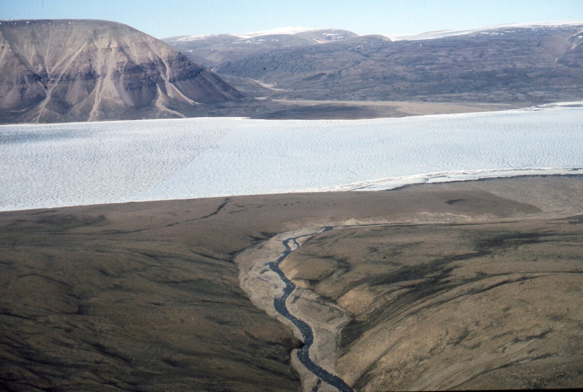
The Arctic Desert encompasses roughly 13.9 million square kilometers across northern Alaska, Canada, Greenland, Iceland, Norway, Sweden, Finland, and Russia. Like Antarctica, the Arctic qualifies as a desert through lack of precipitation rather than heat. Most areas receive less than 250 millimeters annually.
Unlike Antarctica, the Arctic includes human communities that have lived there for thousands of years. Inuit, Sami, and dozens of other indigenous groups developed cultures adapted to extreme cold, limited vegetation, and months of darkness followed by months of continuous daylight.
Permafrost—permanently frozen ground—underlies much of the Arctic. This creates unique engineering challenges.
Buildings require special foundations that won’t melt the permafrost and cause structures to sink. Roads buckle and crack.
Pipelines must account for ground that shifts as it freezes and thaws at different rates. Climate change affects the Arctic faster than anywhere else on Earth.
Temperatures rise twice as fast as global averages. Sea ice extent decreases each decade. Permafrost thaws, releasing methane that accelerates warming.
These changes threaten not just polar bears and seals but entire human communities whose traditional ways of life depended on stable ice conditions.
Sahara Desert

Now we get to what most people picture when they hear “desert.” The Sahara spans 9.2 million square kilometers across North Africa, stretching from the Atlantic Ocean to the Red Sea.
It covers parts of Morocco, Algeria, Tunisia, Libya, Egypt, Mauritania, Mali, Niger, Chad, and Sudan. The Sahara wasn’t always a desert.
Six thousand years ago, the region supported grasslands with rivers, lakes, and abundant wildlife. Rock art from that period shows giraffes, elephants, and hippos in areas that now receive almost no rain.
Gradual climate shifts dried the region, though the exact causes remain debated among scientists. Temperature extremes define the Sahara. Summer days regularly exceed 50 degrees Celsius in the sun.
Winter nights can drop below freezing. That 70-degree temperature swing between day and night causes rocks to crack from expansion and contraction, creating the sand that forms the iconic dunes.
Only about 20 percent of the Sahara consists of sand dunes. The rest includes gravel plains, rocky plateaus, and mountain ranges.
The Ahaggar and Tibesti mountains rise over 3,000 meters, occasionally receiving snow that looks absurdly out of place against the surrounding desert. Humans inhabit the Sahara through adaptation and technology.
Oases provide water and support small agricultural communities. Modern cities like Cairo, Tripoli, and Nouakchott sit at the desert’s edges.
The Tuareg and other nomadic groups still follow traditional routes between water sources, maintaining knowledge passed down through generations.
Arabian Desert

The Arabian Peninsula hosts 2.3 million square kilometers of desert spanning Saudi Arabia, Yemen, Oman, the United Arab Emirates, Kuwait, Qatar, and Jordan. The Rub’ al Khali—the Empty Quarter—occupies the southern portion and represents one of the most inhospitable regions on Earth.
The Empty Quarter receives almost no rainfall, sometimes going years between precipitation events. Sand dunes reach heights of 250 meters, among the tallest in the world.
The landscape shifts constantly as wind reshapes dunes. GPS coordinates from one year might show sand dunes where gravel plains existed the year before. Oil wealth transformed the Arabian Desert from a sparsely populated backwater to a global economic powerhouse.
Dubai, Riyadh, and other cities rose from small trading posts to gleaming metropolises within a few decades. This required massive desalination plants to provide freshwater and air conditioning systems running constantly against temperatures that exceed human survivability outdoors.
The desert’s ancient history predates oil wealth by millennia. Incense trade routes crossed the region, connecting Mediterranean civilizations to India and East Africa. Camel caravans carried frankincense and myrrh worth their weight in gold.
The ruins of those trading posts now sit abandoned in the sand, their names forgotten except by archaeologists.
Gobi Desert
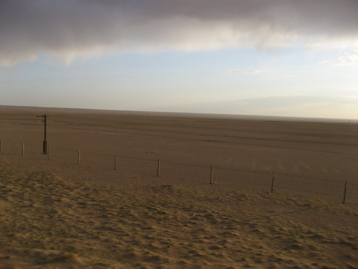
Central Asia’s Gobi Desert covers 1.3 million square kilometers across northern China and southern Mongolia. Unlike sandy deserts, the Gobi consists mostly of bare rock and gravel.
The name “Gobi” actually means “waterless place” in Mongolian, which captures its essence better than the word “desert.” The Gobi occupies a rain shadow created by the Himalayan mountains to the south.
Air masses lose their moisture as they rise over the mountains, leaving little precipitation for the Gobi. This creates one of Earth’s driest regions despite being relatively far from the equator.
Temperature extremes rival anything the Sahara produces. Summer heat reaches 45 degrees Celsius. Winter cold drops to minus 40 degrees Celsius.
That 85-degree annual temperature range makes it one of the most temperature-variable deserts on the planet. You need completely different survival equipment depending on the season.
The Gobi has yielded extraordinary paleontological discoveries. Fossilized dinosaur eggs found there in the 1920s proved that dinosaurs laid eggs, which wasn’t previously known.
The desert’s aridity preserves fossils exceptionally well. Sandstorms occasionally erode away sediment and expose new fossil beds that attract scientists from around the world.
Desertification expands the Gobi southward into what was once grassland. Overgrazing by livestock, climate change, and decreased rainfall contribute to this expansion.
China has attempted massive tree-planting programs to slow the advance, with limited success. The desert advances roughly 3,600 square kilometers per year.
Kalahari Desert
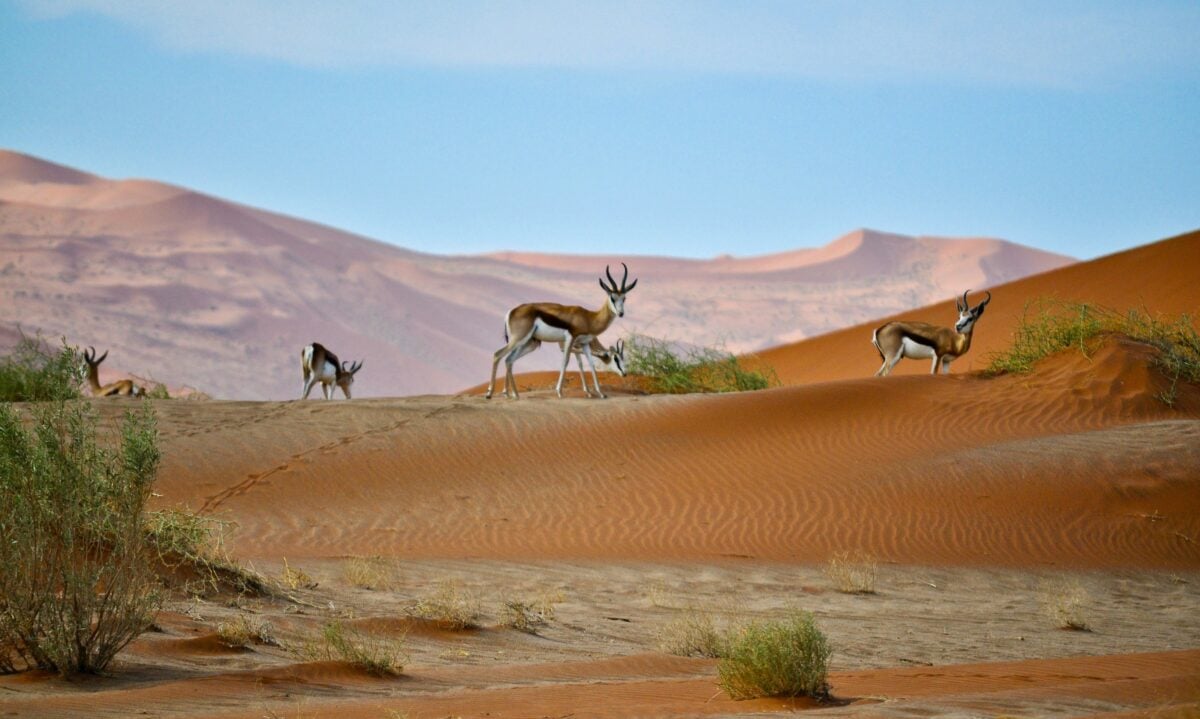
Southern Africa’s Kalahari spans 900,000 square kilometers across Botswana, Namibia, and South Africa. The Kalahari receives more rainfall than most deserts—between 150 and 500 millimeters annually in different regions—which creates a semi-arid environment supporting more vegetation than typical deserts.
The San people have lived in the Kalahari for at least 20,000 years. Their hunter-gatherer lifestyle adapted perfectly to the environment’s cycles of drought and occasional abundance.
They developed sophisticated knowledge of which plants provide water, which animals to hunt in different seasons, and how to navigate using stars and landmarks. Wildlife thrives in the Kalahari in ways unusual for deserts.
Lions, cheetahs, hyenas, and other predators hunt antelope, wildebeest, and zebras that congregate around seasonal water sources. The Okavango Delta, where the Okavango River empties into the Kalahari instead of reaching the ocean, creates one of Africa’s most productive ecosystems.
Red sand gives the Kalahari its distinctive appearance. The iron oxide coating on each grain catches sunlight and creates landscapes that glow orange at sunrise and sunset.
Vegetation grows on many dunes, stabilizing them so they don’t shift like dunes in the Sahara or Arabian Desert.
Patagonian Desert

South America’s largest desert covers 670,000 square kilometers in southern Argentina. The Andes Mountains create a rain shadow that blocks moisture from the Pacific Ocean, leaving Patagonia dry and windswept.
The constant wind defines the region as much as the lack of rain. Wind speeds regularly exceed 100 kilometers per hour.
Trees grow bent sideways, shaped by decades of relentless wind. Dust devils—small whirlwinds that pick up sand and debris—dance across the landscape almost daily.
The wind generates so much energy that Argentina has built extensive wind farms across Patagonia. Temperatures stay relatively cool compared to other deserts.
Summer highs rarely exceed 30 degrees Celsius, while winter brings snow and subzero temperatures. The cold desert environment supports unique wildlife including guanacos, rheas, and various rodent species adapted to the conditions.
Charles Darwin crossed Patagonia in 1834 during the Beagle voyage. His observations of the region’s geology and fossils contributed to his developing theories about evolution.
The desert preserves fossils excellently, similar to the Gobi, revealing extinct species that once thrived when the climate was wetter.
Great Victoria Desert
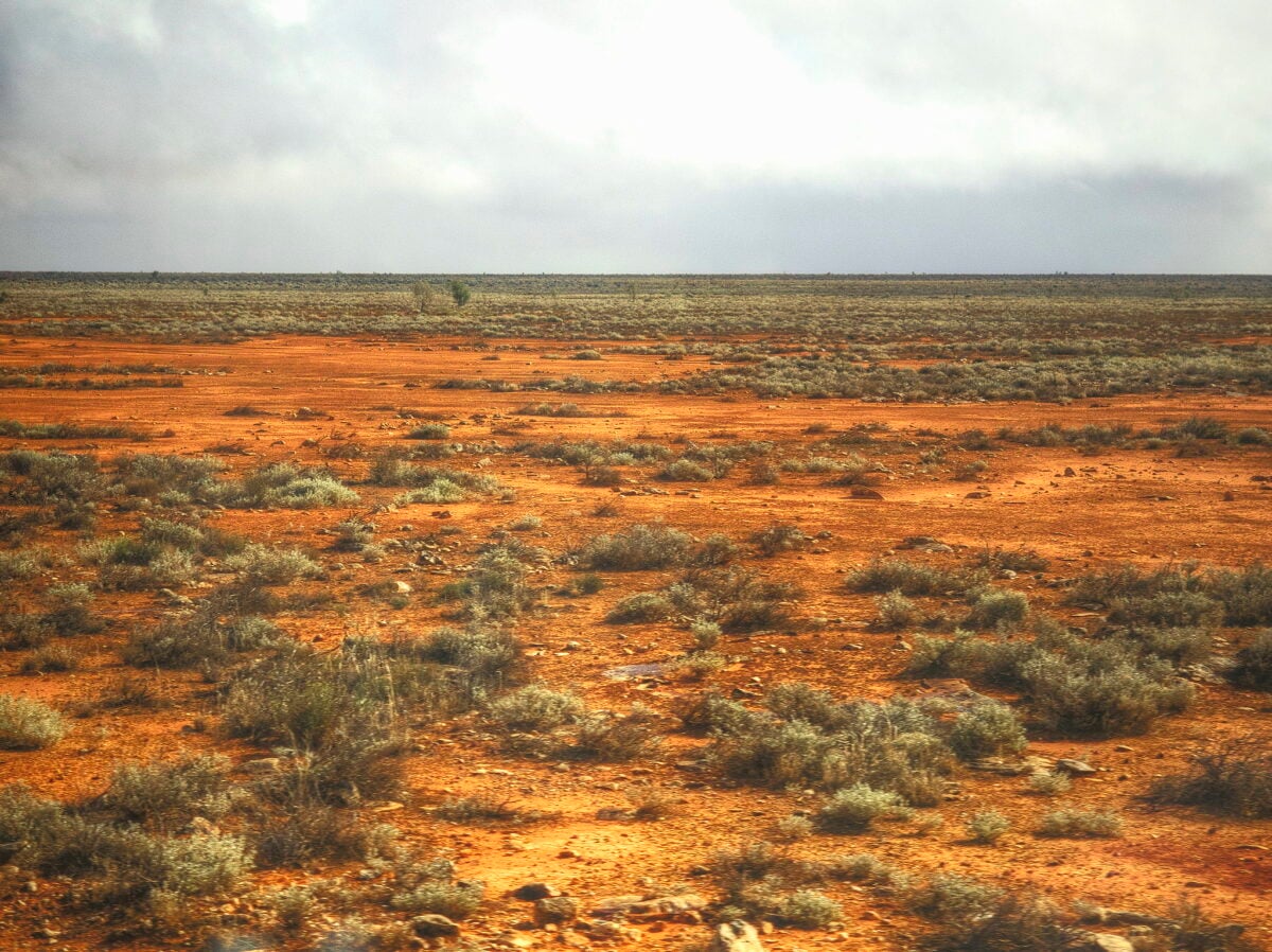
Australia’s largest desert spreads across 348,750 square kilometers in Western Australia and South Australia. Aboriginal peoples have inhabited the region for at least 40,000 years, developing intimate knowledge of its scarce water sources and seasonal patterns.
Red sand dunes dominate the landscape, running parallel to each other for hundreds of kilometers. Desert vegetation including spinifex grass and acacia shrubs grows on the dunes, providing habitat for reptiles, small mammals, and birds adapted to extreme heat and minimal water.
Summer temperatures exceed 40 degrees Celsius regularly, while winter nights can drop near freezing. The temperature variation requires animals to have behavioral adaptations—they’re active at dawn and dusk, sheltering during the heat of day and the cold of night.
The desert’s remoteness has made it attractive for controversial purposes. British nuclear weapons testing occurred in the Great Victoria Desert during the 1950s, exposing Aboriginal communities to radioactive fallout.
That history remains contentious, with ongoing effects on people who lived in or traveled through contaminated areas.
Syrian Desert

The Middle Eastern Syrian Desert covers 520,000 square kilometers across Syria, Jordan, Iraq, and Saudi Arabia. The region serves as a transitional zone between the Mediterranean climate to the west and the Arabian Desert to the south.
Rainfall varies from around 200 millimeters in the west to almost nothing in the east. Ancient cities once prospered in the Syrian Desert, supported by sophisticated irrigation systems and trade routes.
Palmyra stood as a major trading center, its ruins still impressive despite recent damage from conflict. These cities demonstrated that human ingenuity can support civilization even in harsh environments, at least temporarily.
The Syrian Desert contains significant oil and gas reserves that helped shape modern Middle Eastern geopolitics. Pipelines cross the desert, carrying energy resources to ports and refineries.
Control of these routes and resources has contributed to regional conflicts stretching back decades. Bedouin tribes traditionally moved across the Syrian Desert following seasonal patterns, herding sheep, goats, and camels.
Modern borders and conflicts have disrupted these traditional routes, forcing many Bedouin into settled communities. That transition has eroded traditional knowledge of desert navigation and survival.
Great Basin Desert

North America’s largest cold desert spans 492,000 square kilometers across Nevada, Utah, Oregon, Idaho, and California. Unlike hot deserts, the Great Basin receives most precipitation as winter snow.
Summer temperatures exceed 35 degrees Celsius, but winter cold drops well below freezing. The desert sits at high elevation, mostly between 1,200 and 1,800 meters above sea level.
This altitude contributes to the cold winters and creates a landscape dominated by sagebrush rather than cacti. The vegetation gives the region a distinctive gray-green color unlike the red and yellow hues of hot deserts.
Mountain ranges run north-south through the Great Basin, creating a series of valleys with no outlet to the ocean. Water from mountain snowmelt collects in these valleys, forming seasonal lakes that evaporate during summer.
This leaves behind salt flats, the most famous being the Bonneville Salt Flats used for land speed record attempts. Native American groups including Paiute, Shoshone, and Ute peoples developed cultures adapted to the Great Basin’s challenges.
They moved seasonally between valleys and mountains, harvesting different resources as they became available. The arrival of European settlers and the subsequent near-extinction of bison disrupted these patterns fundamentally.
Chihuahuan Desert

Straddling the Mexico-U.S. border, the Chihuahuan Desert covers 450,000 square kilometers, most of it in Mexico. The desert occupies a high plateau between mountain ranges, with elevations mostly above 1,000 meters.
This high elevation creates temperature patterns distinct from lower-elevation hot deserts. The Chihuahuan Desert supports remarkable biodiversity for an arid region.
Over 3,500 plant species grow there, including many types of cacti, yuccas, and agaves. The agave plants provide raw material for tequila and mezcal production, making the desert economically significant beyond its mineral resources.
Monsoon rains arrive during summer, transforming the landscape temporarily. Plants that looked dead during the dry season suddenly bloom. Ephemeral streams fill gullies.
The desert transitions from brown and gray to green within days. Animals time their breeding to these wet periods when food becomes abundant.
The Rio Grande flows through the Chihuahuan Desert, creating a ribbon of green in the surrounding brown. Human settlements concentrate along the river, depending on its water for agriculture, drinking, and industry.
Disputes over water rights between Mexico and the United States have persisted for over a century, growing more contentious as population increases and climate change reduces river flow.
Karakum Desert

Turkmenistan’s Karakum Desert spans 350,000 square kilometers, covering roughly 70 percent of the country. The name means “black sand,” referring to dark soil in some areas rather than the light-colored sand typical of many deserts.
The landscape alternates between sand dunes, clay flats, and gravel plains. Natural gas reserves beneath the Karakum have made Turkmenistan wealthy relative to its neighbors.
The country exports gas to Russia, China, and other markets. This resource wealth has shaped Turkmenistan’s development and its relationships with neighboring countries competing for Central Asian energy resources.
The Karakum Canal, one of the world’s longest irrigation canals, carries water from the Amu Darya River across the desert. The canal enabled cotton cultivation in areas that couldn’t otherwise support agriculture.
However, it also contributed to the catastrophic shrinking of the Aral Sea by diverting water from rivers that fed it. The Darvaza gas crater, nicknamed the “Door to Hell,” burns continuously in the northern Karakum.
Soviet geologists accidentally created the crater in 1971 when their drilling rig collapsed into an underground cavern. They lit the escaping gas on fire to prevent methane release, expecting it to burn out within weeks.
It’s still burning five decades later.
Taklamakan Desert

China’s Taklamakan Desert occupies 337,000 square kilometers in the Tarim Basin, surrounded by mountains on three sides. The name allegedly means “you go in and you don’t come out” in Uyghur, which captures the desert’s reputation for being particularly dangerous to cross.
The Taklamakan is one of the world’s largest sandy deserts, with sand dunes covering most of its surface. Some dunes reach heights of 200 meters.
The sand shifts constantly, burying ancient towns that flourished along the Silk Road. Archaeologists occasionally discover these buried settlements, preserved by the dry conditions.
The Silk Road skirted the Taklamakan’s edges rather than crossing directly through it. Camel caravans followed oases at the desert’s perimeter, moving between trading posts.
These routes connected China to Central Asia, the Middle East, and eventually Europe. Control of these routes meant wealth and power for whatever empire could secure them.
Modern highways now cross the Taklamakan, built on special foundations that prevent the road from being buried by shifting sand. Workers constantly clear sand that blows across the pavement.
The highway construction required engineering solutions to problems most road builders never encounter, including how to prevent sand dunes from migrating across the roadway.
Namib Desert

The coastal Namib Desert in Namibia covers about 81,000 square kilometers along the Atlantic Ocean. The Namib claims to be the world’s oldest desert, with arid or semi-arid conditions persisting for at least 55 million years.
That age allowed unique species to evolve, found nowhere else on Earth. The Benguela Current flows northward along the coast, bringing cold water from Antarctica.
This cold current creates persistent fog that rolls inland most mornings. Desert plants and animals have adapted to harvest water from this fog.
Specialized beetles, for instance, position themselves on dunes so fog condenses on their bodies and drips into their mouths. The desert meets the ocean in dramatic fashion.
Sand dunes come right up to the beach, creating surreal landscapes where golden sand contrasts with the blue ocean. The Skeleton Coast earned its name from the whale skeletons and shipwrecks scattered along it.
Dense fog caused countless ships to run aground over centuries. Namibia’s government recognized the Namib’s ecological importance by establishing extensive protected areas.
Tourists visit to see unique wildlife including desert-adapted elephants, lions, and rhinos. The desert’s clear skies and minimal light pollution also make it excellent for stargazing and astronomy.
Where Dryness Defines the World

These deserts demonstrate that “dry” manifests in countless forms. Some freeze, some bake. Some shift constantly, others remain stable for millennia.
Some support surprising biodiversity, others barely sustain any life at all. But they all share one characteristic: water scarcity shapes everything.
Deserts cover roughly one-third of Earth’s land surface and are expanding as climate patterns shift. Understanding these environments matters because millions of people live in or near deserts, and billions depend on rivers that originate in regions becoming more arid.
The empty spaces hold value beyond resources like oil or minerals. They provide a perspective impossible to gain in crowded places.
They remind us that Earth contains places where human influence barely registers, where nature operates by rules older than civilization. Standing in the middle of any great desert, surrounded by nothing but sand or rock or ice stretching to every horizon, you understand your own smallness in ways that cities and forests never quite convey.
That understanding might be the desert’s most important lesson—that vast spaces exist where human concerns simply don’t matter, and those spaces will outlast whatever we build on their edges.
More from Go2Tutors!

- The Romanov Crown Jewels and Their Tragic Fate
- 13 Historical Mysteries That Science Still Can’t Solve
- Famous Hoaxes That Fooled the World for Years
- 15 Child Stars with Tragic Adult Lives
- 16 Famous Jewelry Pieces in History
Like Go2Tutors’s content? Follow us on MSN.