14 Bizarre Weather Patterns Found Only in Specific Places
Although weather is one of nature’s most erratic elements, several places around the world have meteorological events that are so unusual that they seem inexplicable. These weather patterns, which are unique to Earth and are influenced by particular geographical features, atmospheric conditions, and environmental elements, are not your normal thunderstorms or blizzards.
Instead, they are ideal storms of exceptional circumstances. Clouds that form in precisely straight lines and lightning that strikes nonstop for months are just two examples of how nature’s inventiveness is displayed in the most surprising manner.
These exceptional weather occurrences frequently become distinguishing features of their localities, drawing both visitors and scientists who wish to see something genuinely uncommon. Here is a list of 14 odd weather patterns that are unique to particular locations worldwide.
Morning Glory Clouds in Northern Australia
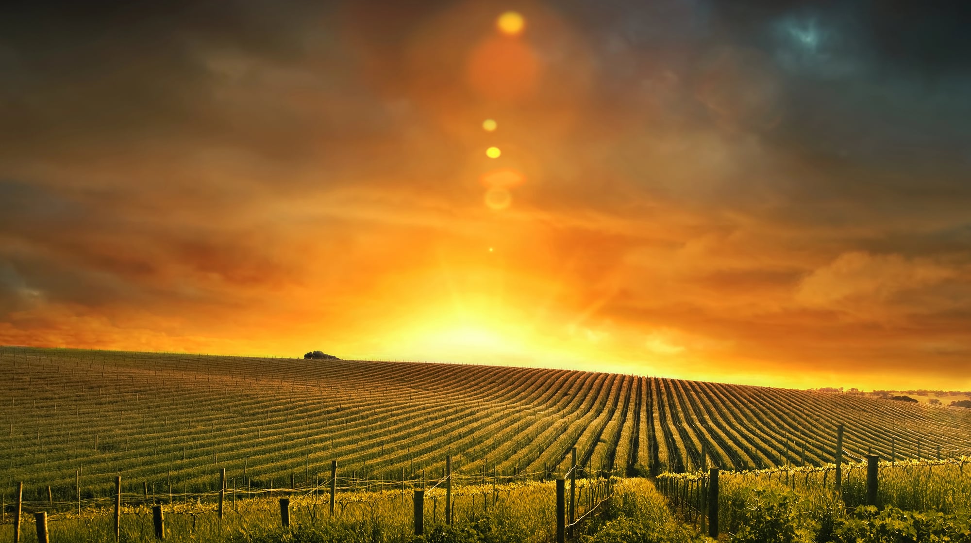
The Morning Glory clouds of northern Australia create one of the most spectacular and predictable cloud formations on Earth, appearing as massive rolling cylinders that can stretch over 600 miles long. These rare roll clouds form when sea breezes from the Gulf of Carpentaria collide with dry inland air, creating a wave-like atmospheric disturbance that manifests as a distinct tube-shaped cloud.
Glider pilots travel from around the world to ride these atmospheric waves, which can reach heights of 6,000 feet and move at speeds up to 35 mph.
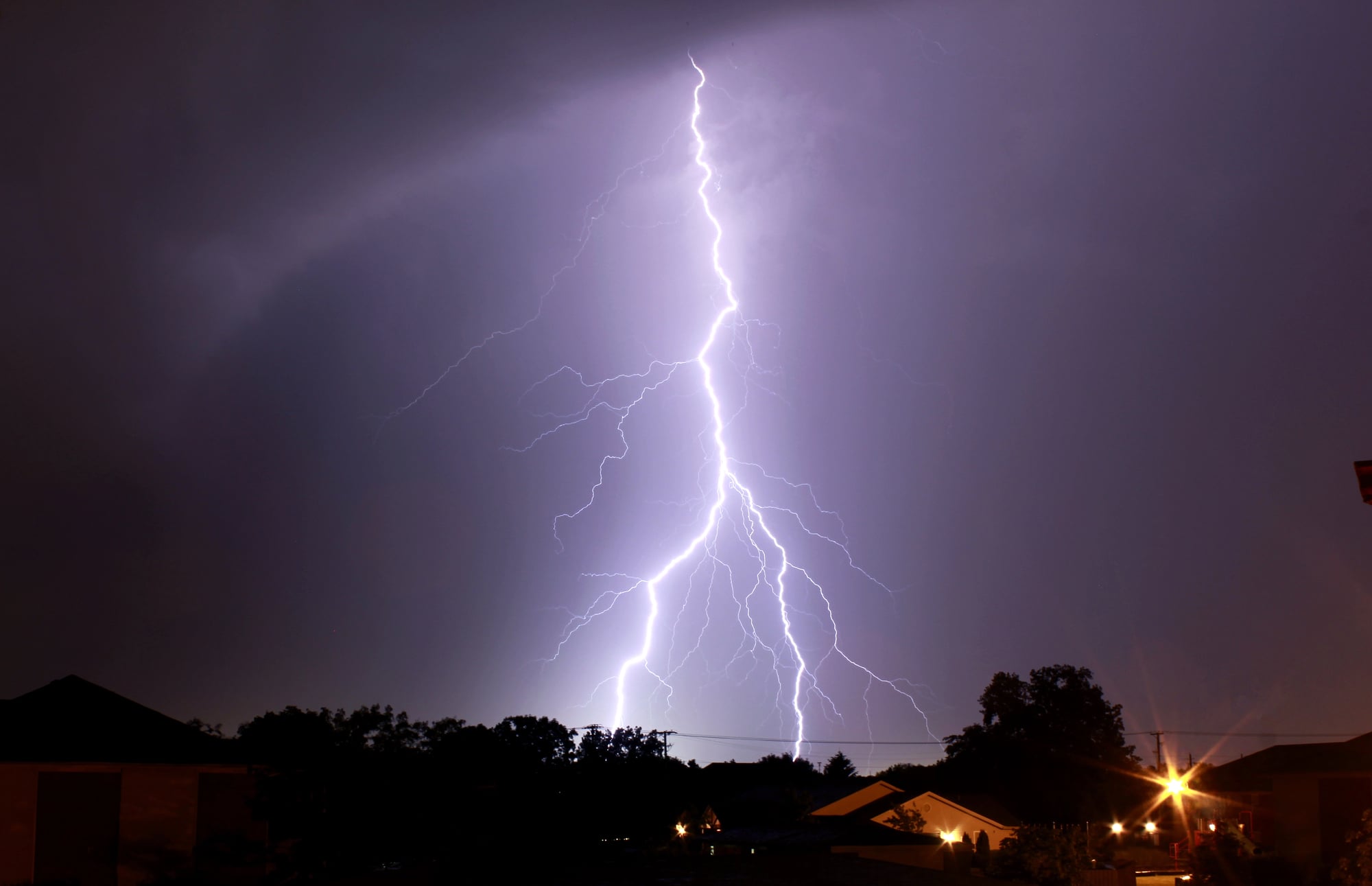
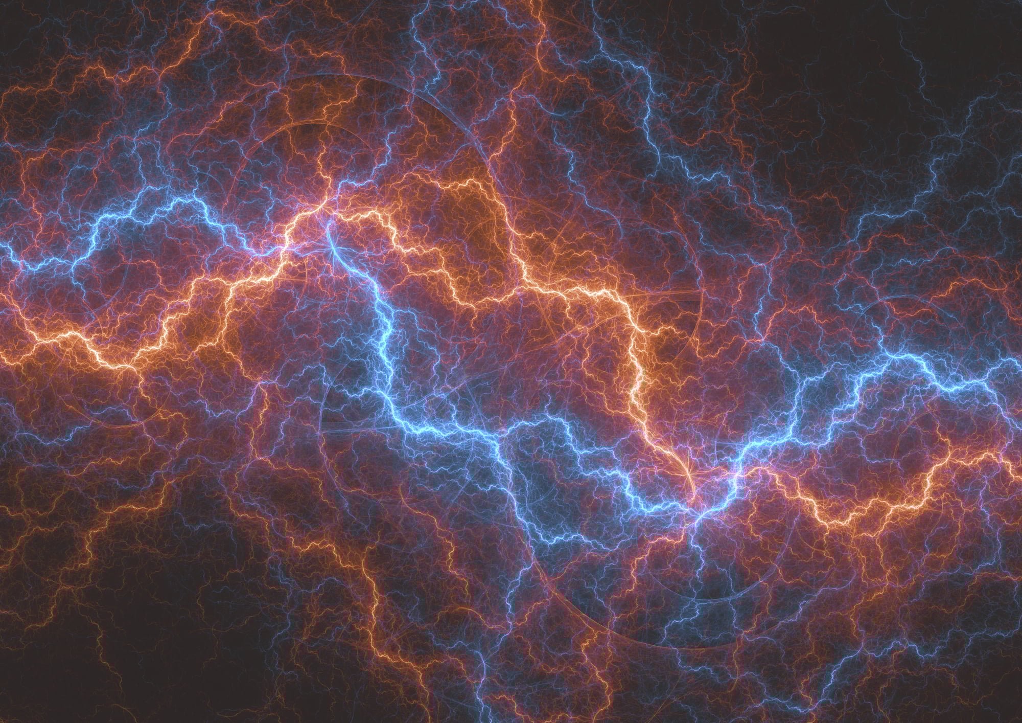
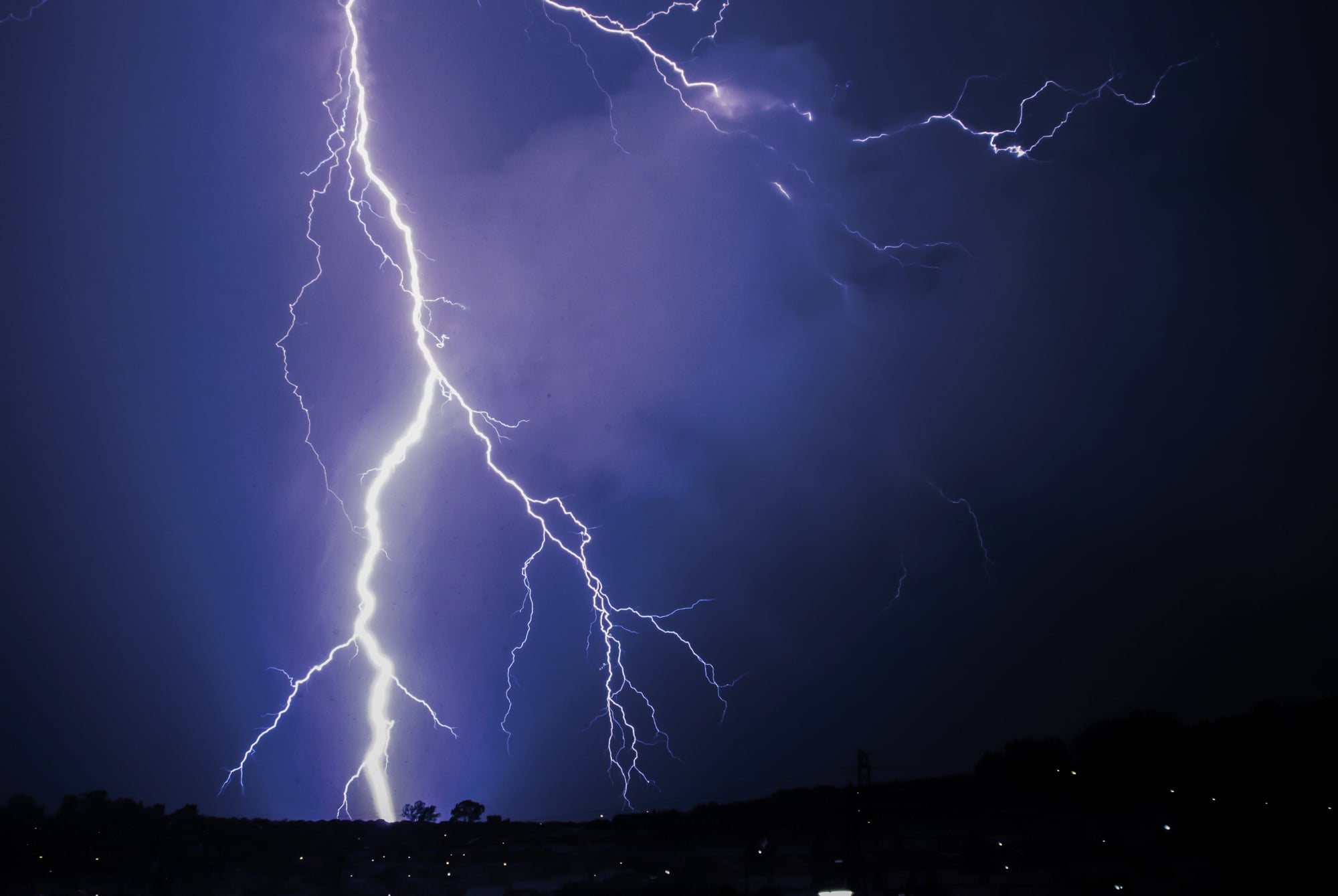
Catatumbo Lightning in Venezuela
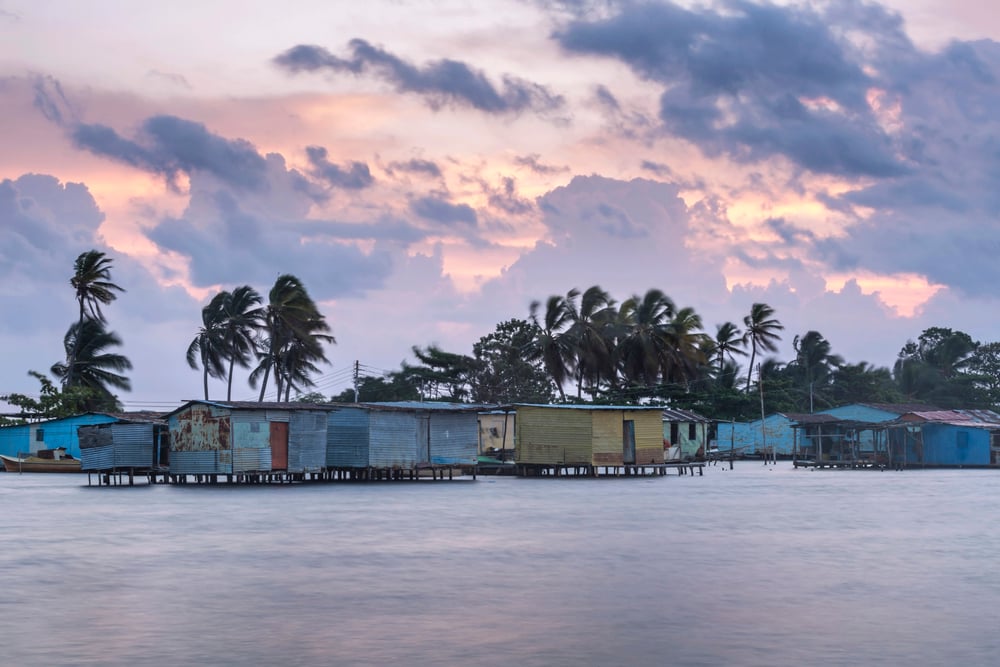
The Catatumbo Lightning phenomenon occurs at the mouth of the Catatumbo River in Venezuela, where lightning strikes almost continuously for up to 300 nights per year. This localized storm system produces an average of 250 lightning strikes per minute during peak activity, creating a natural light show that can be seen from over 100 miles away.
The unique geography of Lake Maracaibo, surrounded by mountains and fed by rivers carrying methane from oil deposits, creates the perfect conditions for this perpetual electrical storm.
Like Go2Tutors’s content? Follow us on MSN.
Ball Lightning in Various Locations
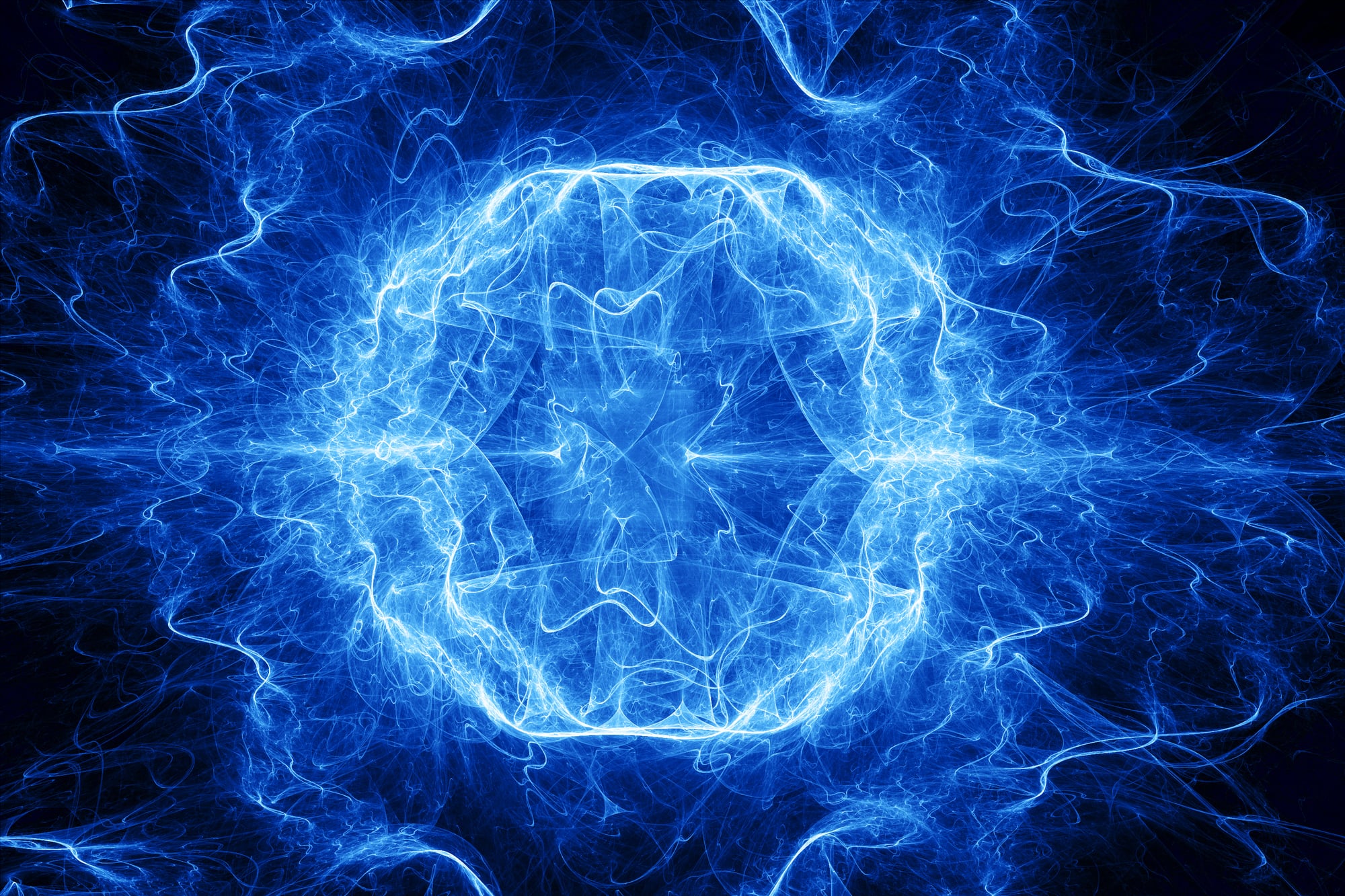
Ball lightning remains one of the most mysterious weather phenomena, appearing as glowing spheres that float through the air for several seconds before disappearing or exploding. These rare occurrences have been reported worldwide but seem to favor certain geographical areas with specific electromagnetic conditions, particularly regions with high mineral content in the soil.
Scientists still debate the exact mechanism behind ball lightning, but witnesses describe seeing tennis-ball-sized orbs of light that can pass through walls and windows without causing damage.
Frost Flowers in the Arctic
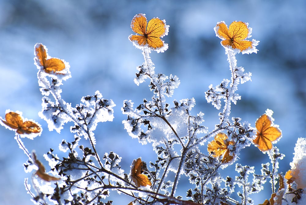
Frost flowers bloom like delicate crystal gardens on newly formed sea ice in Arctic regions, creating intricate ice formations that look more like artwork than weather phenomena. These structures form when water vapor sublimates directly onto the ice surface in extremely cold conditions, building up in thin, petal-like layers that can grow several inches tall.
The process requires very specific temperature and humidity conditions that occur only in the polar regions during the coldest months of winter.
Fire Rainbows in Mid-Latitude Regions
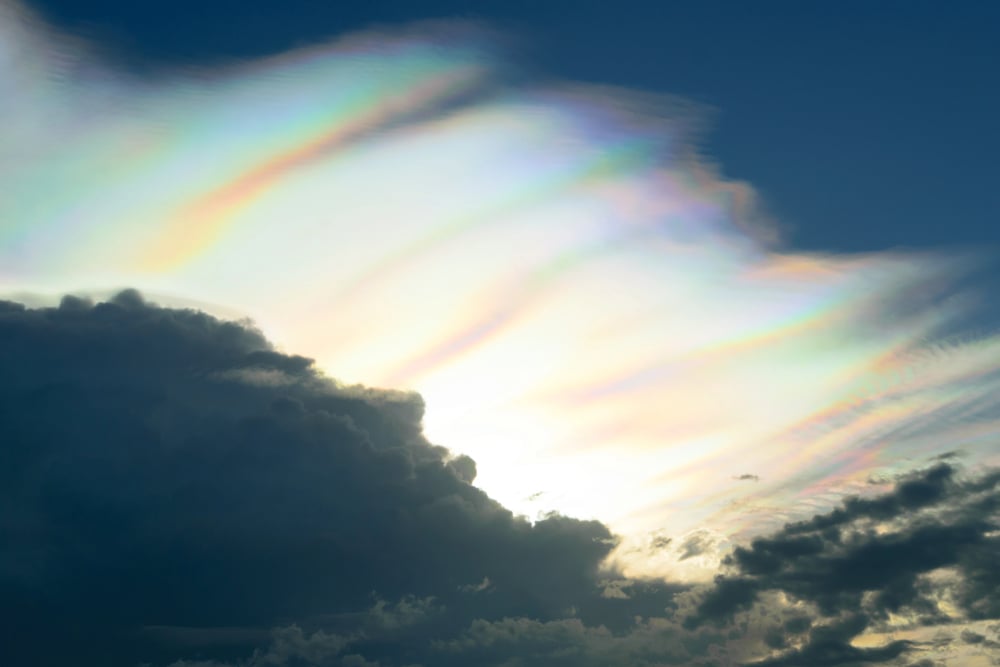
Fire rainbows, technically called circumhorizontal arcs, create stunning displays of color that appear as flames painted across the sky in certain mid-latitude locations. These optical phenomena require the sun to be at least 58 degrees above the horizon and high-altitude cirrus clouds containing hexagonal ice crystals oriented in just the right way.
The resulting effect looks like a rainbow that’s been stretched horizontally across the sky, with colors so vivid they appear to be burning.
Like Go2Tutors’s content? Follow us on MSN.
St. Elmo’s Fire on Mountain Peaks
St. Elmo’s Fire appears as a blue or violet glow around pointed objects during thunderstorms, most commonly observed on mountain peaks and ship masts in specific atmospheric conditions. This electrical phenomenon occurs when the atmosphere becomes charged enough to create a continuous electrical discharge, causing the air molecules to glow with an eerie light.
Sailors have reported seeing St. Elmo’s Fire dancing on their masts for centuries, and mountaineers sometimes witness it flickering around metal equipment during storms.
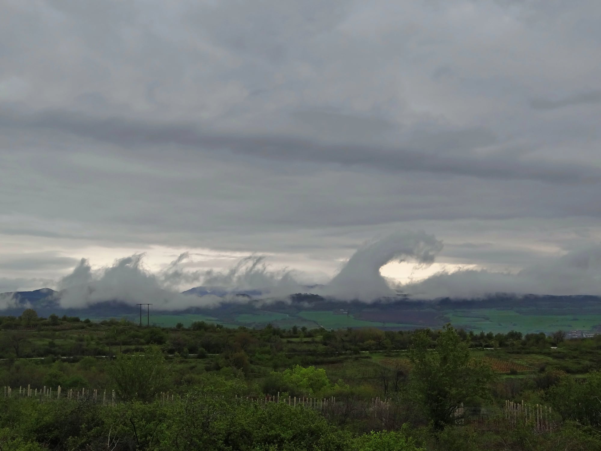
Mammatus Clouds in Tornado Alley
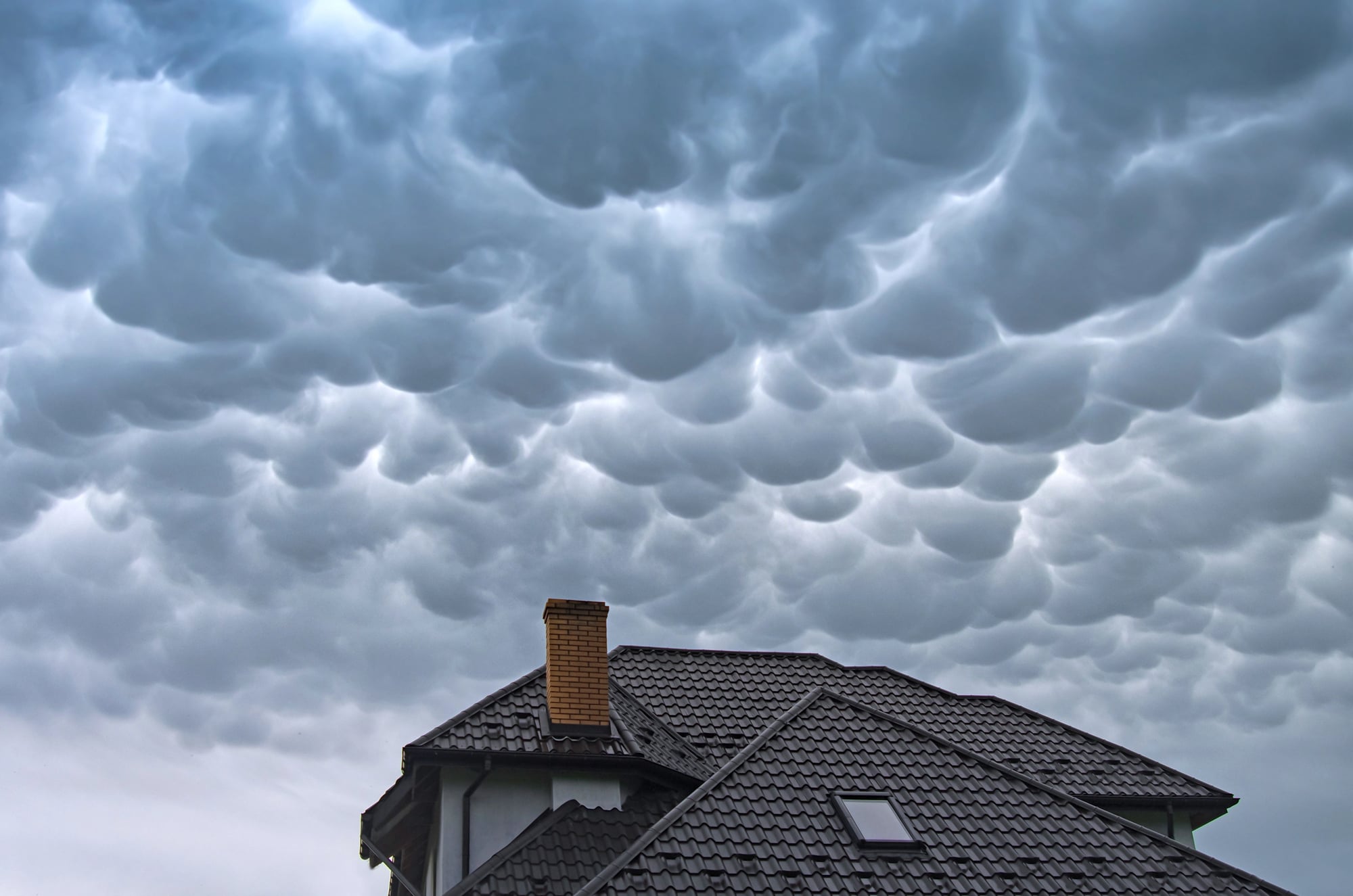
Mammatus clouds create an otherworldly appearance with their distinctive pouch-like protrusions that hang from the cloud base like giant grapes or cotton balls. These formations are most commonly seen in the American Great Plains, particularly in areas prone to severe thunderstorms where cold, dense air sinks rapidly through warmer air below.
The result is a cloud formation that appears to droop downward instead of billowing upward like typical clouds, creating an ominous and beautiful sight that often signals severe weather.
Like Go2Tutors’s content? Follow us on MSN.
Green Flash at Tropical Sunsets
The green flash phenomenon occurs in tropical and subtropical locations where atmospheric conditions allow observers to see a brief green light just as the sun disappears below the horizon. This optical illusion happens when the atmosphere acts like a prism, separating the sun’s light into different colors, with green being the last visible wavelength before the sun completely sets.
The effect lasts only a few seconds and requires exceptionally clear atmospheric conditions, making it a rare treat for those lucky enough to witness it.
Sprites Above Thunderstorms
Sprites are massive electrical discharges that occur high above thunderstorms, appearing as red or orange flashes that can stretch up to 50 miles into the upper atmosphere. These phenomena were only discovered in recent decades because they’re nearly impossible to see from ground level and last for just milliseconds.
Sprites typically occur above the most intense thunderstorms and are thought to be triggered by particularly powerful positive lightning strikes that reach from the storm cloud to the ground.
Ice Circles in Northern Rivers
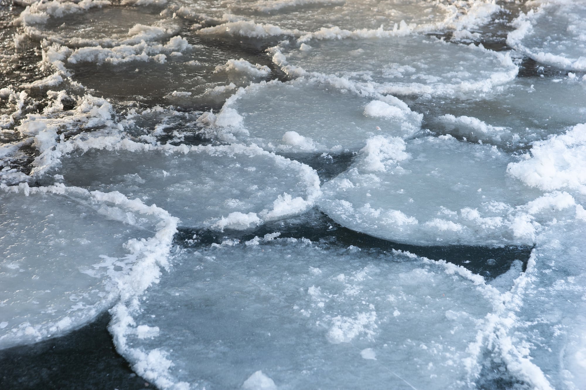
Ice circles form in slow-moving rivers in northern climates when a combination of rotating water currents and freezing temperatures creates perfectly round discs of ice that spin slowly in the water. These natural formations can range from a few feet to over 300 feet in diameter, rotating like giant frozen records in the river current.
The phenomenon requires very specific conditions including the right water temperature, current speed, and air temperature that occur most commonly in Scandinavia and northern North America.
Like Go2Tutors’s content? Follow us on MSN.
Asperitas Clouds Worldwide
Asperitas clouds are so unusual that they weren’t officially recognized as a distinct cloud type until 2017, appearing as dramatic undulating wave patterns that look like ocean waves viewed from below. These formations create some of the most photogenic and dramatic skyscapes on Earth, with their turbulent appearance suggesting stormy weather even when conditions are relatively calm.
The clouds form when different air masses with varying temperatures and humidity levels interact in complex ways that create the distinctive wave-like pattern.
Volcanic Lightning in Active Volcanic Regions
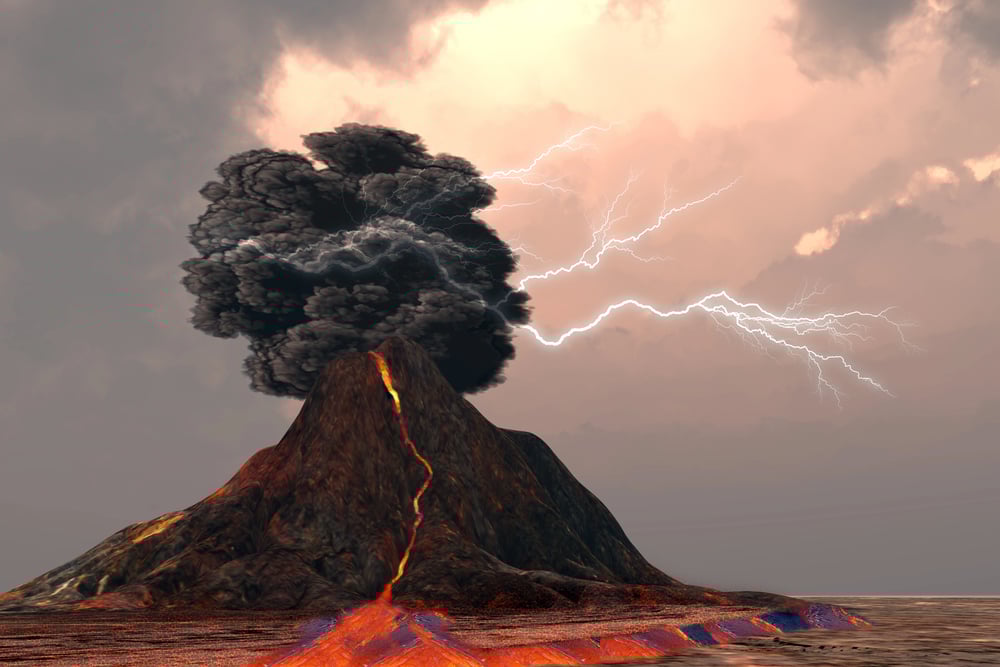
Volcanic lightning occurs when ash particles in volcanic plumes create electrical charges that discharge as lightning bolts within the ash cloud itself. This phenomenon creates spectacular displays of electrical activity that appear to emanate directly from the volcano, with lightning bolts dancing through the ash plume in ways that seem to defy natural law.
The electrical charges build up as ash particles collide and rub against each other during explosive eruptions, creating conditions similar to those in severe thunderstorms.
Sundogs in Cold Climates
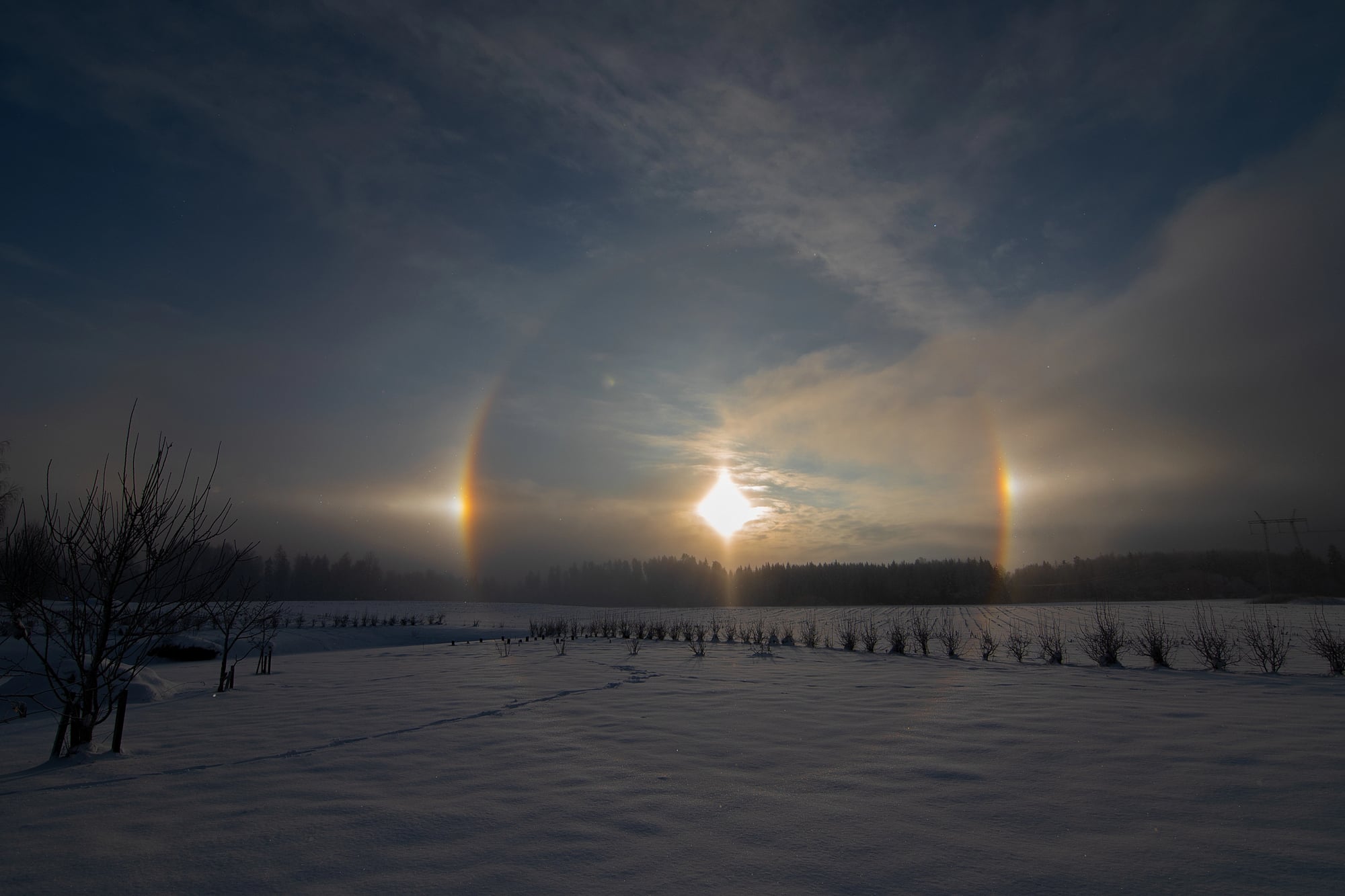
Sundogs appear as bright spots of light on either side of the sun, creating the illusion of three suns in the sky when atmospheric conditions are just right. These optical phenomena occur most commonly in very cold climates where ice crystals in the atmosphere act like millions of tiny prisms, refracting sunlight into brilliant colored spots.
Sundogs are often accompanied by light pillars and halos, creating complex displays of atmospheric optics that can last for hours in the right conditions.
Like Go2Tutors’s content? Follow us on MSN.
Kelvin-Helmholtz Clouds in Mountainous Areas
Kelvin-Helmholtz clouds form distinctive wave patterns that look like ocean breakers frozen in mid-crash, appearing most commonly in mountainous regions where wind shear creates the right atmospheric conditions. These clouds form when two layers of air move at different speeds, creating a rolling motion that manifests as a series of perfect spirals or waves in the cloud formation.
The resulting clouds look so much like breaking waves that they’re sometimes called ‘fluctus’ clouds, from the Latin word for wave.
Nature’s Unique Weather Theater
These extraordinary weather phenomena remind us that our planet’s atmospheric system is far more complex and creative than most people realize. Each of these unique patterns results from a perfect combination of geography, atmospheric conditions, and timing that occurs nowhere else on Earth.
While modern meteorology has explained the science behind these events, witnessing them in person still feels like encountering magic in the natural world. These rare weather patterns serve as natural laboratories where scientists can study atmospheric physics in action, while also providing some of the most breathtaking displays that nature has to offer.
More from Go2Tutors!

- 16 Restaurant Chains That Went Too Fast
- 12 Things Sold in the 80s That Are Now Illegal
- 15 Strange Things People Have Tried to Ban (And Failed)
- 16 Collectibles People Tossed Out Too Soon
- 17 Myths from Your Childhood That Were Actually Based on Real Things
Like Go2Tutors’s content? Follow us on MSN.