17 Times Weather Disasters Struck Without Warning
Weather forecasting has come a long way, yet Mother Nature still throws curveballs that leave meteorologists scratching their heads. Some storms develop so fast they outpace our best warning systems. Others hit areas where nobody expects severe weather. The result? Disasters that catch people completely unprepared.
These aren’t your typical hurricanes with days of advance notice. We’re talking about events that went from calm skies to catastrophe in minutes. Flash floods, surprise tornadoes, microbursts that appear out of nowhere. Here’s a look at 17 weather disasters that struck without giving anyone time to prepare.
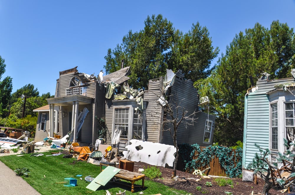
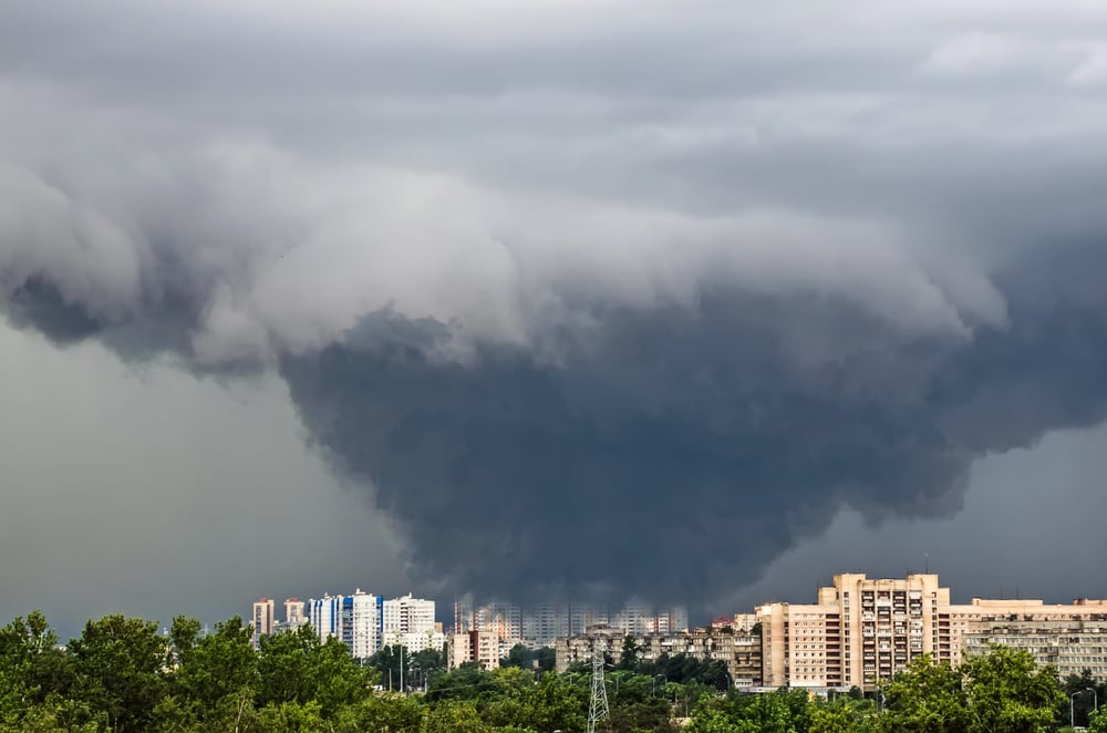
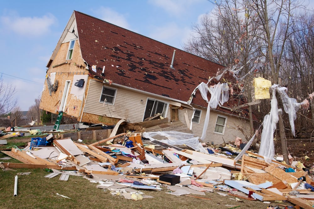
The June 2012 Derecho
Nobody in Chicago expected to wake up on June 29, 2012, to winds that would rival a hurricane. This derecho — essentially a land hurricane — raced 700 miles in half a day, bringing 80+ mph winds from Illinois to the Atlantic.
Power grids collapsed like dominoes. Trees that had stood for decades were uprooted in seconds.
Most people had never even heard the word ‘derecho’ before this storm introduced itself so violently.
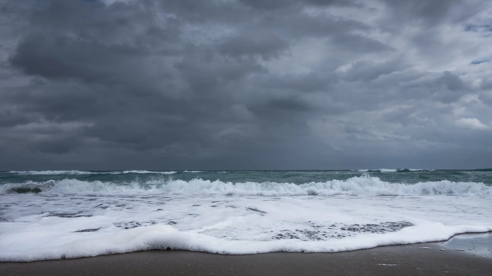
Big Thompson Canyon Flash Flood
The narrow walls of Colorado’s Big Thompson Canyon became a death trap in 1976 when a rogue thunderstorm decided to park itself overhead for four hours straight. Over a foot of rain fell during that time.
The canyon turned into a giant funnel, concentrating all that water into a 25-foot-per-second wall of destruction. Campers enjoying a summer evening suddenly found themselves running for their lives as 144 people perished in what seemed like nature’s ultimate ambush.
Like Go2Tutors’s content? Follow us on MSN.
Delta 191 at Dallas-Fort Worth
Pilots train for engine failures, bird strikes, even hijackings. But on August 2, 1985, Delta Flight 191 encountered something invisible and deadly — a microburst that slammed the aircraft into the ground just short of Dallas-Fort Worth’s runway.
These columns of rapidly sinking air can flip wind directions in seconds, creating forces no pilot can overcome. The crash killed 137 people and led to the development of wind shear detection systems at airports nationwide.
The Johnstown Flash Flood of 1977
You’d think Johnstown, Pennsylvania would’ve learned from its 1889 disaster, but nature had other plans. On July 19-20, 1977, thunderstorms stalled over the city like a broken record, dropping a foot of rain in 10 hours.
This wasn’t some dam bursting — just Mother Nature opening the floodgates from above. The city’s drainage system threw up its hands in defeat as 84 people lost their lives to water that rose faster than anyone imagined possible.
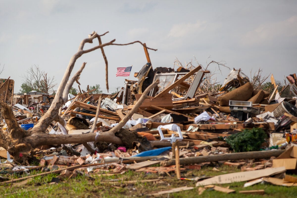
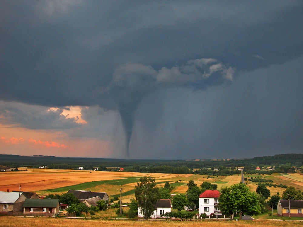
Moore, Oklahoma Tornado Outbreak
Moore, Oklahoma knows tornadoes. They’ve rebuilt this town multiple times.
But the EF5 that hit on May 20, 2013, caught even tornado veterans off guard. Sure, there were warnings, but this storm went from weakling to monster faster than you could say ‘take cover.’
Winds exceeded 200 mph as it plowed through two elementary schools. The tornado’s path shifted unexpectedly, turning safe zones into danger zones in the blink of an eye.
Like Go2Tutors’s content? Follow us on MSN.
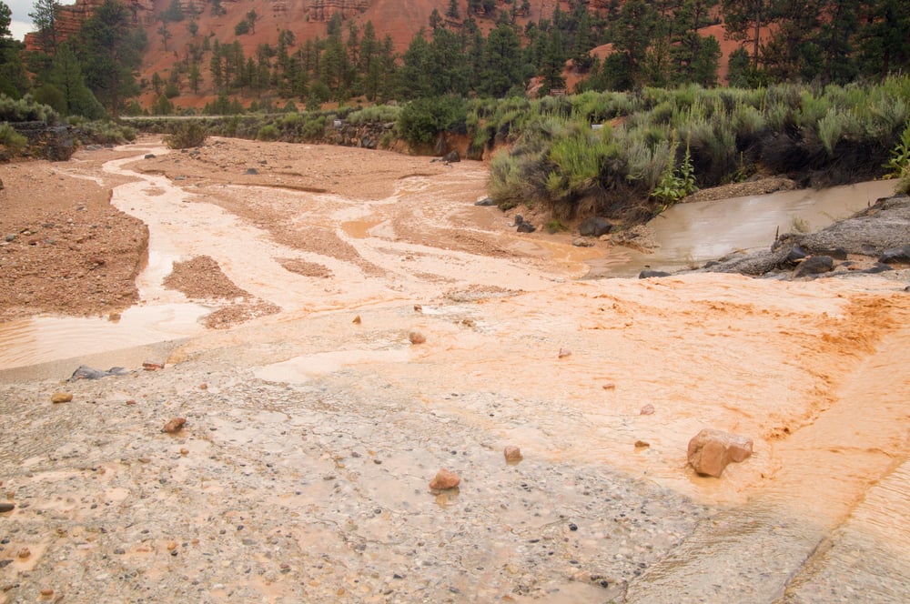
The Heppner Flash Flood
Picture this: a beautiful morning in Heppner, Oregon, not a cloud in the sky. Meanwhile, miles away in the mountains, a thunderstorm was brewing up trouble.
Nobody in town knew death was racing downhill toward them at 40-foot-high speeds. When that wall of water hit on June 14, 1903, it wiped out most of downtown in 30 minutes.
247 people never saw it coming — literally. The storm that killed them happened so far away they couldn’t even see the clouds.
Straight-Line Winds in Minnesota
Campers in Minnesota’s Boundary Waters expected mosquitoes and maybe some rain on July 4, 1999. What they got was nature’s version of a giant invisible bulldozer.
Straight-line winds exceeding 90 mph flattened millions of trees across 665,000 acres. No funnel cloud to warn anyone.
No characteristic roar of a tornado. Just sudden, overwhelming destruction that looked like hundreds of twisters had hit simultaneously.
Wilderness visitors went from peaceful camping to survival mode without any transition.
The Rapid City Flash Flood
Rapid City, South Dakota was fast asleep when disaster struck at 3 a.m. on June 9, 1972. Thunderstorms had been dumping rain in the Black Hills — 15 inches in six hours.
Most folks had no idea their peaceful creek was turning into a monster. By the time water started entering homes, it was too late to run.
238 people died, and over 1,300 homes were destroyed. The city’s warning systems were about as useful as a chocolate teapot.
Like Go2Tutors’s content? Follow us on MSN.
The Jarrell Tornado
Jarrell, Texas experienced one of the most violent tornadoes ever recorded on May 27, 1997, when an F5 twister moved at just 15 mph — giving it extra time to obliterate everything in its path. The tornado was so intense it literally scoured the earth down to bedrock in places.
What made it particularly deadly was how it developed rapidly from seemingly ordinary storm conditions. 27 people died as the tornado erased entire neighborhoods, moving so slowly that its 260+ mph winds had time to completely pulverize concrete foundations.
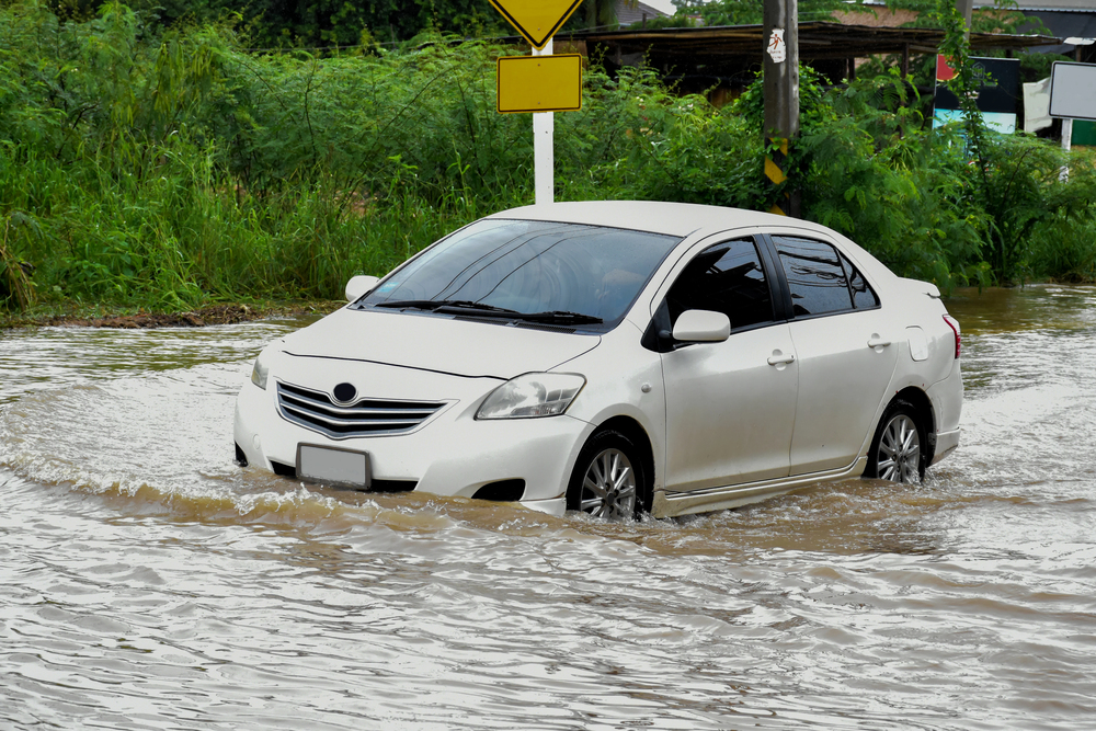
Kansas City Flash Flooding

Rush hour traffic in Kansas City turned deadly on September 12, 1977, when the sky opened up and refused to close. Sixteen inches of rain in 12 hours — that’s more than some places get all year.
Underpasses became death traps as water rose faster than cars could escape. Drivers found themselves choosing between abandoning their vehicles or drowning in them.
25 people made the wrong choice or simply ran out of time to make any choice at all.
The Lubbock Tornado
Lubbock, Texas thought May 11, 1970, would be just another spring day with some typical severe weather. The F5 tornado that carved through downtown had different ideas.
Weather conditions looked ripe for storms, sure, but this particular twister intensified so rapidly that forecasters couldn’t keep up. In 20 minutes, it destroyed over 9,000 homes and businesses, proving that even when you’re expecting severe weather, you might not be expecting severe enough.
Like Go2Tutors’s content? Follow us on MSN.
Australian Cyclone Tracy
Christmas 1974 in Darwin, Australia started normally enough. By Christmas night, the city had been virtually wiped off the map.
Cyclone Tracy went from tropical depression to Category 4 monster in 24 hours — barely enough time to say ‘Merry Christmas,’ let alone evacuate a city. Tracy’s compact size concentrated its fury over Darwin’s metropolitan area like a focused laser beam of destruction.
Mother Nature’s gift that year was learning how quickly paradise can become hell.
The Shadyside Flash Flood

3 a.m. is when most people are deep in dreamland, not fighting for their lives against rushing water. But that’s exactly what happened in Shadyside, Ohio, on June 14, 1990.
A slow-moving storm complex decided to camp out overhead, dropping 5 inches of rain in 90 minutes. The nearby creek transformed from babbling brook to raging river while people slept.
26 residents never woke up, trapped in homes that became death chambers as water levels rose faster than consciousness.
The August 2020 Iowa Derecho
Iowa’s cornfields became a war zone on August 10, 2020, when a derecho with hurricane-force winds barreled across the state for hours. This land hurricane packed sustained winds of 100+ mph, flattening millions of acres of crops and destroying thousands of homes.
Cedar Rapids took a direct hit, with winds so powerful they turned downtown buildings into concrete confetti. The derecho developed rapidly from a cluster of morning thunderstorms, giving residents little time to prepare for what would become the costliest thunderstorm disaster in U.S. history.
Like Go2Tutors’s content? Follow us on MSN.
The Willow Creek Flash Flood

An atmospheric river sounds peaceful, almost poetic. The one that hit Willow Creek, California, on December 22, 1964, was anything but.
This ‘river in the sky’ dumped over 20 inches of rain in 24 hours on the coastal mountains. The actual Willow Creek rose 30 feet above normal, turning a small town Christmas into a nightmare that killed 19 people.
Residents went to bed expecting Santa Claus and woke up to what became known as the Christmas Flood of 1964.
Birmingham Tornado Super Outbreak
April 27, 2011, started with meteorologists warning Alabama about severe weather. What they couldn’t predict was the rapid-fire tornado factory that would develop.
Birmingham got hit by multiple tornadoes as supercells formed faster than warnings could be issued. The outbreak produced 62 tornadoes in Alabama alone — some spinning up within minutes of each other.
It was like trying to warn people about individual raindrops in a thunderstorm.
The Phoenix Haboob

Phoenix residents thought they knew desert weather until July 5, 2011, when a wall of dust 100 miles wide came rolling across the city like something from a disaster movie. These haboobs develop from thunderstorm outflows, creating dust storms that turn day into night in seconds.
Thousands of motorists on Interstate highways suddenly found themselves driving blind as visibility dropped to zero. Rush hour became survival hour as cars crawled along freeways they could no longer see.
Like Go2Tutors’s content? Follow us on MSN.
Nature’s Ultimate Reality Check

These disasters prove that weather prediction, despite all our satellites and supercomputers, still has major blind spots. Each event taught meteorologists hard lessons about atmospheric behavior that textbooks can’t capture.
Some storms develop too fast for our warning systems. Others hit places where people aren’t prepared for that type of weather.
The common thread? Nature doesn’t read our forecasts before deciding what to do next. These 17 disasters remind us that for all our technological advances, we’re still guests in an atmosphere that plays by its own rules.
More from Go2Tutors!

- 16 Historical Figures Who Were Nothing Like You Think
- 12 Things Sold in the 80s That Are Now Illegal
- 15 VHS Tapes That Could Be Worth Thousands
- 17 Historical “What Ifs” That Would Have Changed Everything
- 18 TV Shows That Vanished Without a Finale
Like Go2Tutors’s content? Follow us on MSN.