18 Most Heavily Fortified Borders On Earth
Beside being marked on paper, borders show up as barriers across land – sometimes steel, sometimes guards watching day and night. Where conflict once flared, concrete rose.
Movement of people pushed governments to seal stretches where footpaths used to cross freely. Hidden trails for goods shifted how checkpoints multiplied.
In some places, it is not a line you pass – it is an area you enter under watch. Fences grow longer because old arguments never settled.
Here’s a closer look at eighteen of the most heavily fortified borders on earth and the infrastructure that defines them.
Korean Demilitarized Zone
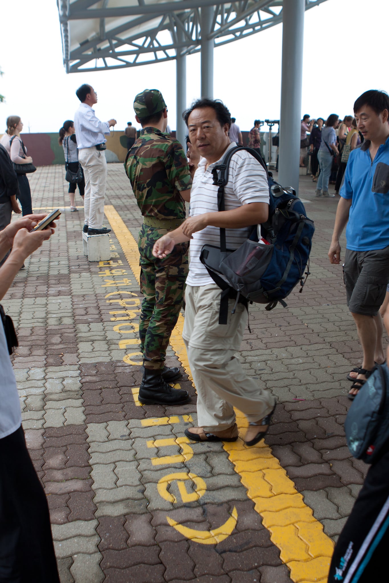
The border between North Korea and South Korea is one of the most heavily fortified areas of land on the globe. The Demilitarized Zone, which is about 160 miles wide, was established after the Korean War ceasefire in 1953.
The zone is 2.5 miles wide. The zone is not demilitarized at all.
It is lined with barbed wire, guard towers, and land mines. The border is under surveillance around the clock.
The border is not a peace border, but rather a ceasefire border.
India–Pakistan Border
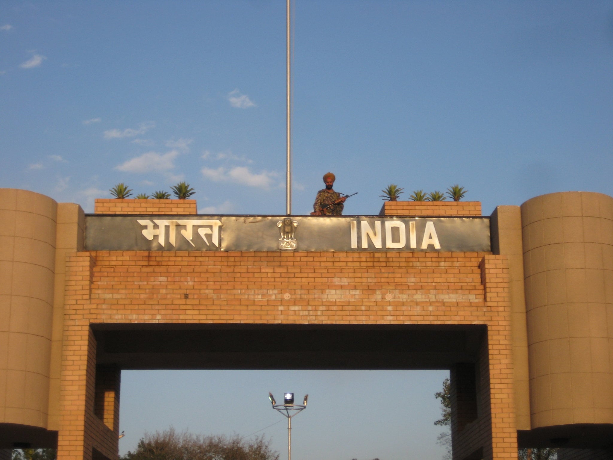
The border between India and Pakistan, particularly along the Line of Control in Kashmir, is marked by extensive fencing, floodlights, and military patrols. In some sections, India has constructed a double-row fence equipped with motion sensors.
Even so, the terrain varies dramatically, from plains to rugged mountains. Both countries maintain a significant troop presence along sensitive areas.
Decades of tension have shaped one of the most militarized boundaries in the world.
Israel–West Bank Barrier
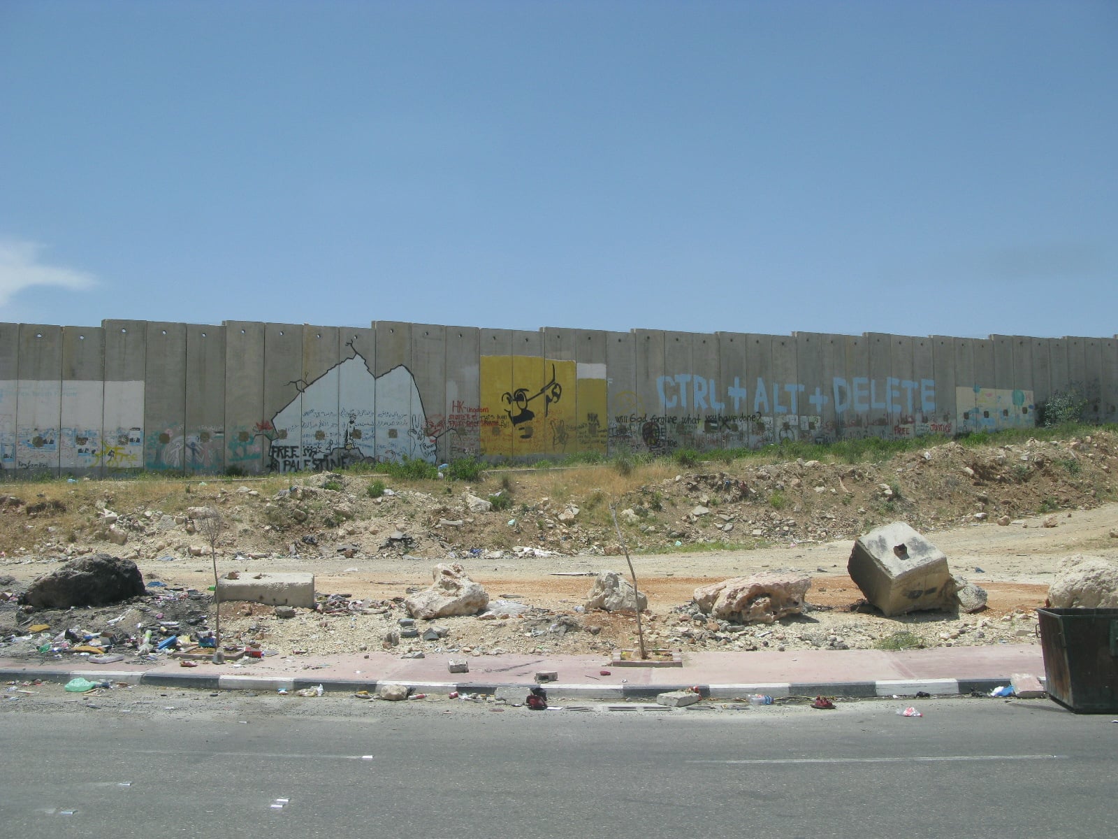
The barrier separating Israel and parts of the West Bank consists of a mix of concrete walls, fences, trenches, and surveillance systems. Construction began in the early 2000s amid heightened security concerns.
In urban areas, towering concrete sections rise several stories high. In rural stretches, layered fencing and patrol roads dominate the landscape.
The structure remains one of the most internationally debated border fortifications in modern history.
United States–Mexico Border
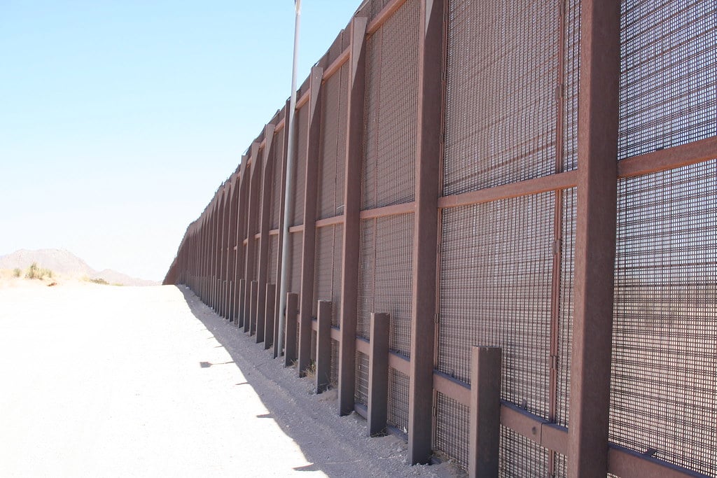
The border between the United States and Mexico spans nearly 2,000 miles. Fortified sections include steel fencing, vehicle barriers, surveillance towers, and advanced monitoring systems such as drones and ground sensors.
Still, the level of fortification varies by region. Urban crossing points feature layered barriers and controlled entry systems, while remote desert areas rely more heavily on surveillance technology and patrols.
Saudi Arabia–Yemen Border
Saudi Arabia has constructed a multi-layered security barrier along much of its border with Yemen. The fortification includes fencing, watchtowers, radar systems, and patrol roads.
The region’s desert terrain presents logistical challenges, yet the barrier stretches for hundreds of miles. Security concerns tied to regional instability have driven its expansion and continued reinforcement.
Morocco–Western Sahara Berm
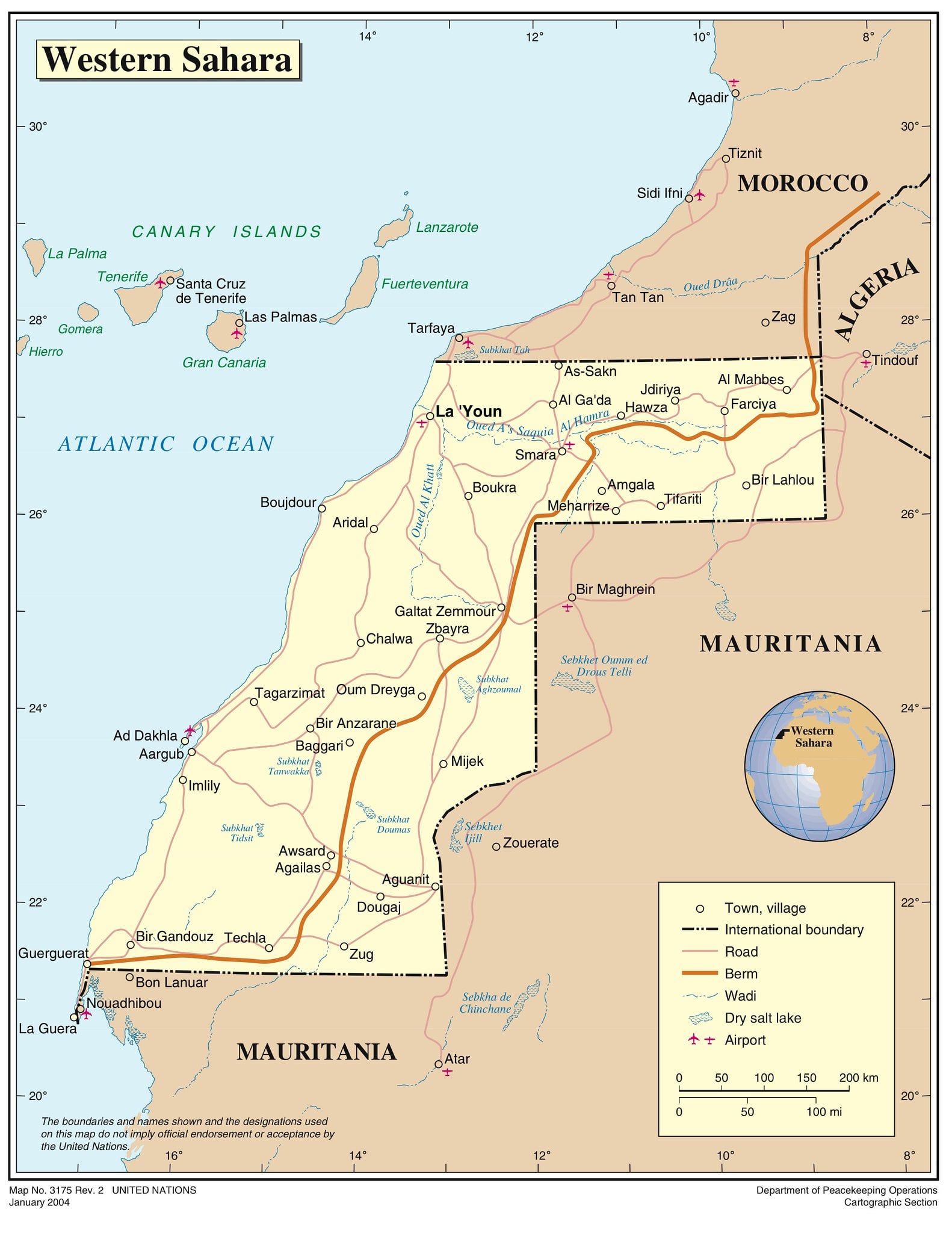
The Moroccan berm is a massive sand wall stretching over 1,600 miles across Western Sahara. Built during the conflict between Morocco and the Polisario Front, it is reinforced with barbed wire, trenches, and minefields.
On the other hand, its appearance differs from concrete border walls. It resembles a continuous earthen ridge cutting across the desert.
Despite its simplicity, it is heavily monitored and remains a defining feature of the region.
Greece–Turkey Border
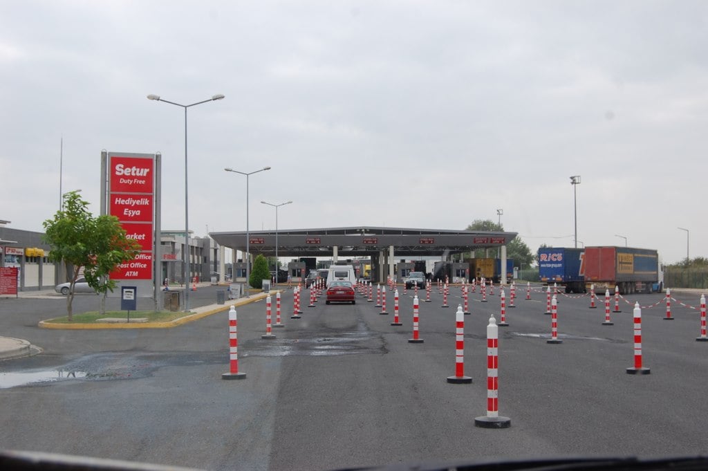
Along parts of its land border with Turkey, Greece has erected fencing and increased patrol presence in response to migration flows. The Evros River region features steel barriers and surveillance equipment.
Even so, geography plays a significant role. Rivers, wetlands, and rural farmland shape how fortifications are deployed.
The infrastructure reflects both physical landscape and political realities.
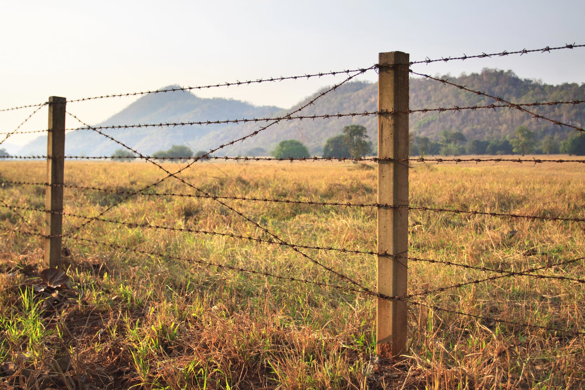
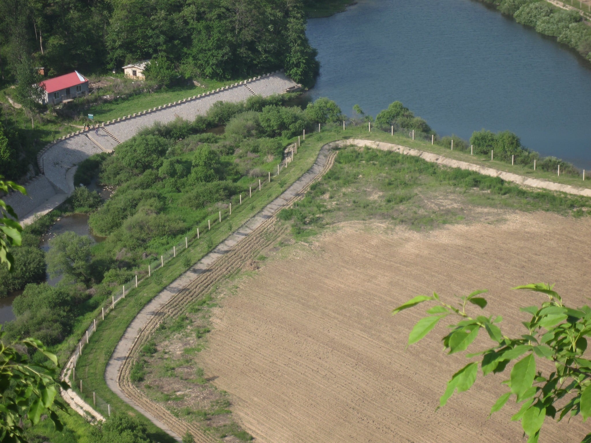
India–Bangladesh Border
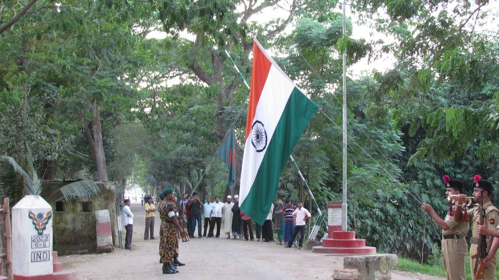
The India–Bangladesh border includes extensive fencing across large portions of its 2,500-mile length. Floodlights illuminate many sections at night, and patrol roads allow rapid response.
The fortifications aim to control unauthorized crossings and smuggling. In some rural areas, fencing runs directly alongside villages and agricultural land, illustrating how fortified borders can intersect with daily civilian life.
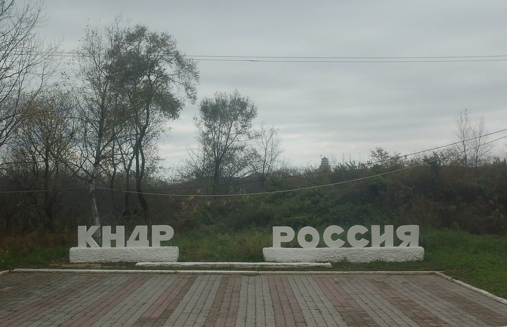
China–North Korea Border
The border between China and North Korea is not uniformly walled, but heavily monitored sections include fencing, guard posts, and surveillance systems. The Yalu and Tumen Rivers form natural barriers in many areas.
Still, where land crossings exist, physical fortifications and strict enforcement are visible. The boundary reflects sensitive geopolitical dynamics in Northeast Asia.
Egypt–Gaza Border
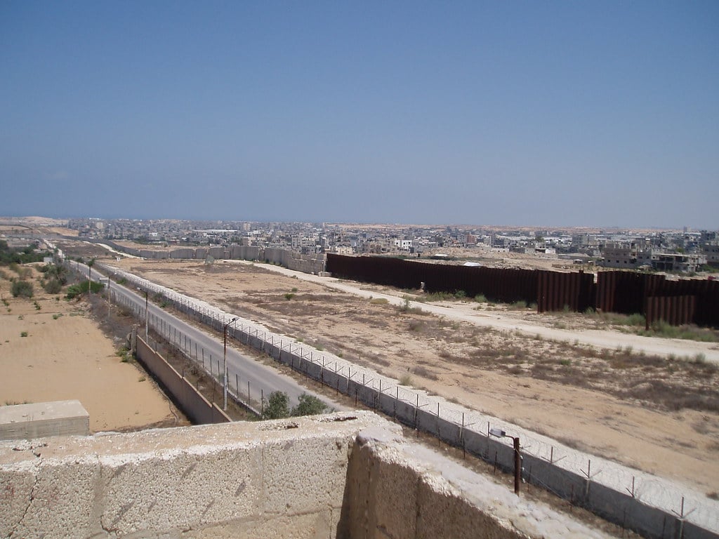
Egypt constructed a fortified barrier along its border with Gaza, including steel fencing and underground measures designed to prevent tunneling. Security checkpoints monitor authorized crossings.
The infrastructure reflects regional security concerns and complex political relationships. Layers of enforcement underscore the strategic importance of the crossing points.
Spain–Morocco Borders At Ceuta And Melilla
Spain’s enclaves of Ceuta and Melilla in North Africa are surrounded by multiple layers of fencing. The barriers include tall steel fences topped with security features and monitored by cameras and patrol units.
Despite their relatively short length compared to other borders, these enclaves are among the most physically fortified land crossings in Europe. Their unique geography shapes the intensity of security infrastructure.
Iran–Pakistan Border
Iran has built fencing and reinforced sections along parts of its border with Pakistan. Patrol units and surveillance equipment monitor regions associated with smuggling and militant activity.
The rugged terrain makes continuous wall construction difficult. Instead, fortifications combine physical barriers with active military oversight.
Botswana–Zimbabwe Border

Botswana erected electric fencing along sections of its border with Zimbabwe, initially citing livestock disease prevention. Over time, the fencing has also served broader border management purposes.
While less militarized than some others on this list, the physical barrier spans significant distances. Its presence illustrates how fortified borders are not always rooted solely in military conflict.
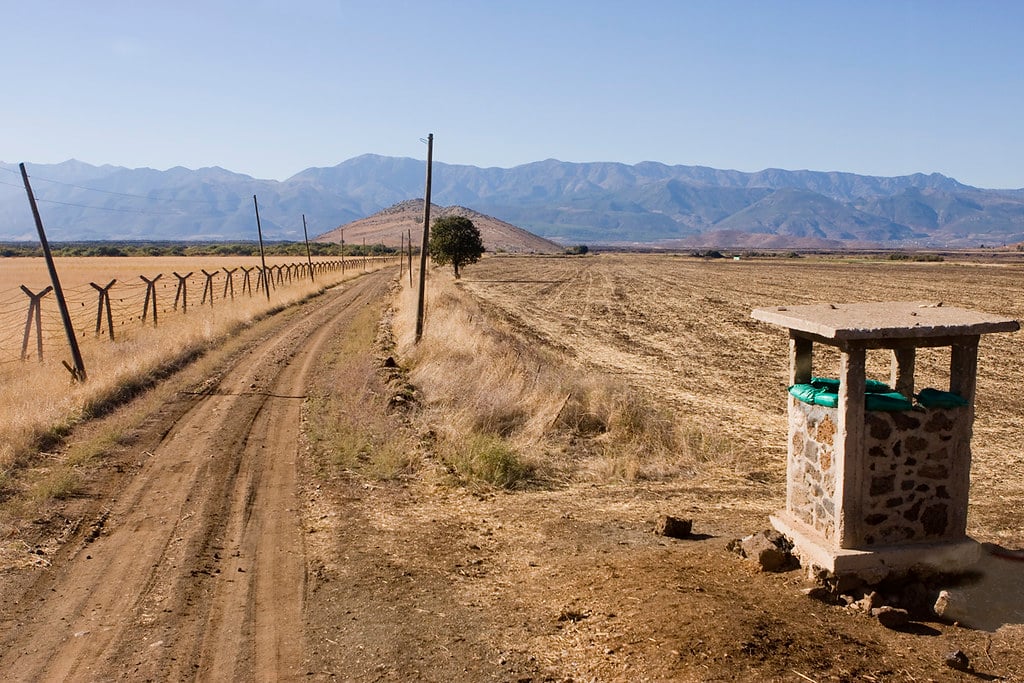
North Korea–Russia Border
Though relatively short at roughly 11 miles, the border between North Korea and Russia is tightly controlled. Fencing and restricted access define the crossing area near the Tumen River.
Even with its limited length, the boundary remains strategically significant. Strict oversight reflects broader regional sensitivities.
Thailand–Malaysia Border

Thailand has reinforced parts of its southern border with Malaysia through fencing and increased security patrols. Certain areas feature checkpoints and monitoring systems aimed at preventing insurgent movement.
The infrastructure varies across jungle terrain, blending physical barriers with law enforcement presence. Geography often dictates the type of fortification used.
Turkey–Syria Border
Turkey constructed extensive walls and fencing along much of its border with Syria during the Syrian conflict. Concrete segments, watchtowers, and surveillance equipment stretch for hundreds of miles.
The fortifications are among the longest continuous border walls built in recent decades. Their scale reflects the intensity of regional instability.
Armenia–Azerbaijan Line Of Contact

The border and line of contact between Armenia and Azerbaijan have featured trenches, fortified positions, and military outposts for decades. Although the situation has shifted over time, heavy fortifications remain in sensitive areas.
The landscape includes mountainous terrain, which complicates but does not eliminate defensive infrastructure. The area has seen recurring flare-ups, reinforcing the importance placed on physical barriers.
Cyprus Green Line
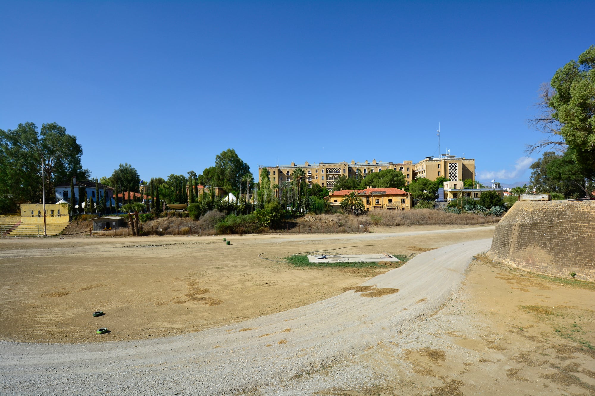
The Green Line, which separates the island of Cyprus, has been under the supervision of United Nations peace forces since the 1970s. Though it has not been completely walled off, it has been fortified with some walls, checkpoints, and restricted areas.
In the case of cities such as Nicosia, the physical partitions and buffer zones are clearly visible. This border has been designed with a frozen conflict in mind, rather than an internationally recognized border.
Lines That Shape More Than Maps
Walls across frontiers do not rise suddenly. Years pass while tensions grow – people move, governments shift, distrust builds.
Barriers take shape slowly, piece by heavy piece. Steel fencing appears first, then sensors blink along dirt mounds.
Watchtowers follow, standing like silent judges. Each slab of concrete carries a history nobody asked for.
Technology hums beside rusting metal, always listening. What looks solid on maps is really layers of decisions made under pressure.
Landmarks become traps. Lines drawn long ago now pulse with alarms.
Now machines watch more than walls do. Still, the goal stays the same – limiting who passes through disputed zones.
Where land meets law, tension shows. Lines drawn long ago now pulse with sensors, patrols, silence.
What looks flat on maps hides layers of power, fear, history. Some spots grow harder to reach because they matter more to those in charge.
More from Go2Tutors!

- The Romanov Crown Jewels and Their Tragic Fate
- 13 Historical Mysteries That Science Still Can’t Solve
- Famous Hoaxes That Fooled the World for Years
- 15 Child Stars with Tragic Adult Lives
- 16 Famous Jewelry Pieces in History
Like Go2Tutors’s content? Follow us on MSN.