18 Strongest Earthquakes Recorded in History
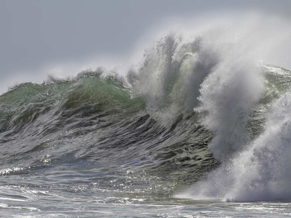
When the ground beneath our feet suddenly shifts and shakes, it’s a stark reminder of the immense forces at work deep within our planet. Earthquakes have shaped civilizations, toppled empires, and left lasting scars on both the landscape and human memory. These seismic events, measured by their magnitude on the Richter scale, represent some of nature’s most devastating displays of raw power.
The earthquakes on this list represent the most powerful seismic events ever recorded by modern instruments. Here is a list of 18 of the strongest earthquakes in documented history.
Great Chilean Earthquake (1960)

The most powerful earthquake ever recorded struck Chile on May 22, 1960 — registering a staggering 9.5 magnitude. This monster quake didn’t just shake the ground; it literally changed the shape of the Chilean coastline while triggering tsunamis that crossed the Pacific Ocean. The tremors were so intense they caused the Earth to ring like a bell for several days afterward, a phenomenon scientists call ‘free oscillations.’
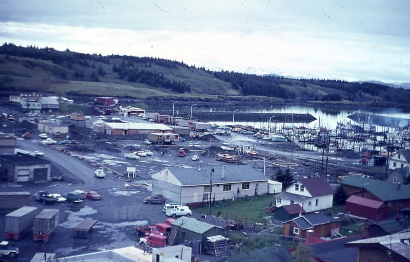
Prince William Sound, Alaska (1964)
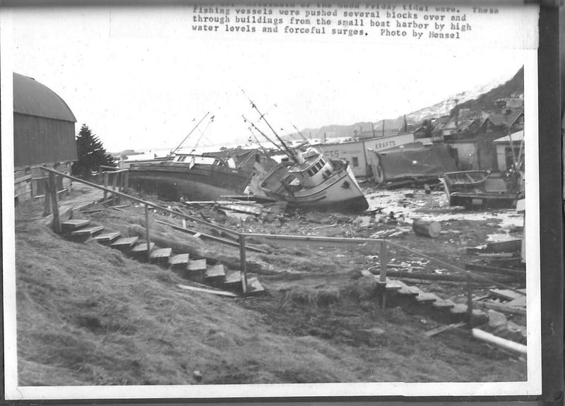
Alaska’s Good Friday earthquake on March 27, 1964, packed a 9.2 magnitude punch that lasted nearly four minutes. Though the shaking was severe enough to liquefy the ground in Anchorage — causing entire neighborhoods to slide into the ocean — this earthquake holds the record for the longest duration of shaking ever recorded. Some areas experienced violent motion for up to seven minutes.
Indian Ocean Earthquake (2004)
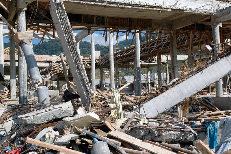
The underwater earthquake off the coast of Sumatra on December 26, 2004, measured 9.1 magnitude and created one of the deadliest natural disasters in modern history. The quake shifted the entire island of Sumatra by about 50 feet and altered the Earth’s rotation — making days slightly shorter. The resulting tsunami waves reached heights of 100 feet in some coastal areas, traveling at speeds of up to 500 miles per hour across the ocean.
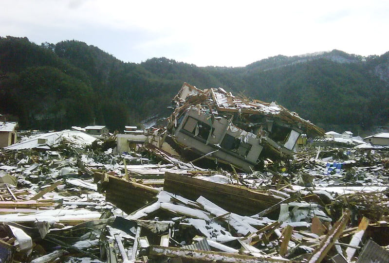
Tohoku, Japan (2011)
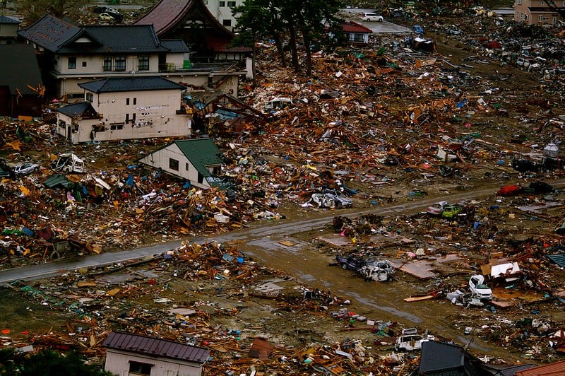
Japan’s devastating 9.1 magnitude earthquake on March 11, 2011 — moved the entire country about 8 feet closer to North America. The shaking was so powerful that it shifted the Earth’s axis by about 6.5 inches and sped up the planet’s rotation. This earthquake also triggered the Fukushima nuclear disaster, proving that even the most prepared nations can be overwhelmed by nature’s fury.
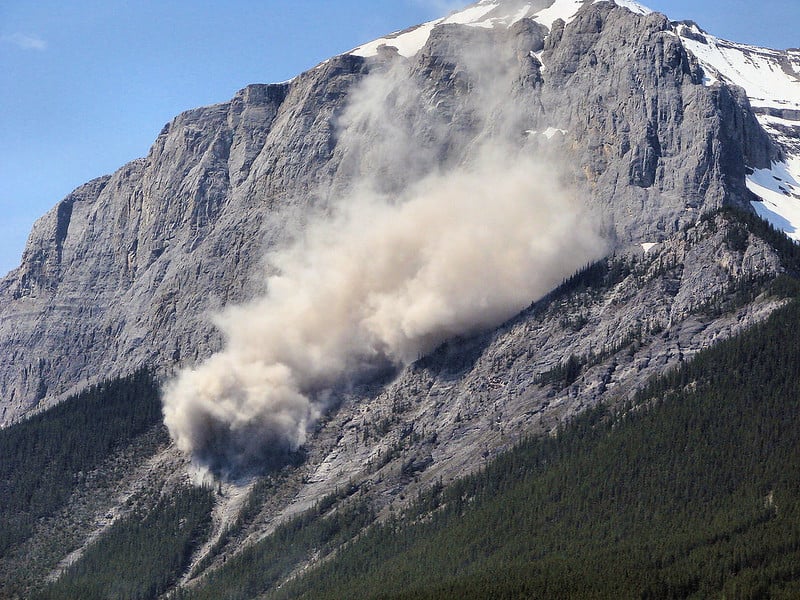
Kamchatka Peninsula, Russia (1952)

The remote Kamchatka Peninsula experienced a 9.0 magnitude earthquake on November 4, 1952 — generating tsunamis reaching heights of 30 feet. Despite its massive size, this earthquake caused relatively little damage due to the sparsely populated region. Yet the event served as a wake-up call for scientists about the seismic potential of the Pacific Ring of Fire.
Offshore Bio-Bio, Chile (2010)
Chile was hit again by a 8.8 magnitude earthquake on February 27, 2010 — just 50 years after the Great Chilean Earthquake. This quake was so powerful that it shortened the length of Earth’s days by 1.26 microseconds due to the redistribution of mass. The earthquake also shifted the city of Concepción about 10 feet to the west while lifting some coastal areas by several feet.
Ecuador-Colombia Border (1906)
The massive 8.8 magnitude earthquake that struck the Ecuador-Colombia border on January 31, 1906 — created a rupture zone stretching over 300 miles along the coast. The earthquake generated tsunamis that reached as far as Japan, demonstrating the global reach of major seismic events. This earthquake remained the strongest recorded in South America until the 1960 Chilean earthquake surpassed it.
Rat Islands, Alaska (1965)
The remote Rat Islands in Alaska’s Aleutian chain experienced an 8.7 magnitude earthquake on February 4, 1965. This earthquake created a tsunami that reached heights of 35 feet on nearby Shemya Island — though the isolated location meant that despite its enormous magnitude, the earthquake caused minimal damage to human infrastructure.
Assam, India (1950)

The 8.6 magnitude earthquake that struck Assam, India, on August 15, 1950 — created some of the most dramatic landscape changes ever recorded. The quake caused massive landslides that temporarily dammed rivers and created new lakes. Some areas experienced ground uplift of up to 30 feet, while others sank by similar amounts — permanently altering the region’s topography.
Northern Sumatra, Indonesia (2005)

Just three months after the devastating 2004 Indian Ocean earthquake, the same region was struck by another massive 8.6 magnitude quake on March 28, 2005. This earthquake occurred on the same fault system as its predecessor — causing additional tsunami waves. The back-to-back disasters highlighted the ongoing seismic instability of the region and the importance of tsunami warning systems.
Tibet (1950)
The 8.6 magnitude earthquake that shook Tibet on August 15, 1950, created avalanches and landslides that were visible from space. The earthquake caused the Brahmaputra River to change course and created temporary lakes that lasted for months. Despite its remote location, the earthquake was felt across a vast area, from India to Mongolia.
Andreanof Islands, Alaska (1957)
The Andreanof Islands in Alaska’s Aleutian chain were rocked by an 8.6 magnitude earthquake on March 9, 1957. This earthquake generated a Pacific-wide tsunami that caused damage in Hawaii and was detected as far away as Chile. The remote location of the Aleutian Islands makes them a natural laboratory for studying large earthquakes with minimal human impact.
Kuril Islands, Russia (1963)
The sparsely populated Kuril Islands experienced an 8.5 magnitude earthquake on October 13, 1963, that created a significant tsunami in the Pacific. The earthquake caused ground ruptures that were visible for miles and altered the coastline of several islands. This event demonstrated the seismic hazard posed by the Kuril-Kamchatka subduction zone.
Banda Sea, Indonesia (1938)

The 8.5 magnitude earthquake that struck the Banda Sea on February 1, 1938, created a massive tsunami that affected islands across the region. The earthquake caused severe damage to buildings and infrastructure on nearby islands, despite the relatively sparse population. This event highlighted the vulnerability of Indonesia’s many islands to seismic activity.
Atacama, Chile (1922)

Chile’s Atacama region was struck by an 8.5 magnitude earthquake on November 11, 1922, that created a tsunami reaching heights of 30 feet along the coast. The earthquake caused significant damage to mining operations in the region and temporarily disrupted Chile’s important copper industry. The event demonstrated how major earthquakes can have far-reaching economic impacts beyond immediate physical damage.
Kuril Islands, Russia (1994)
Another massive 8.3 magnitude earthquake struck the Kuril Islands on October 4, 1994, generating a tsunami that reached heights of 30 feet on nearby coasts. The earthquake caused ground shaking that was felt across a vast area of the North Pacific. This event reinforced the understanding that the Kuril Islands region is one of the most seismically active areas on Earth.
Kanto, Japan (1923)

The Great Kanto earthquake of September 1, 1923, measured 8.2 magnitude and devastated the Tokyo-Yokohama area. The earthquake struck at lunchtime when many people were cooking, leading to widespread fires that caused more damage than the shaking itself. This disaster led to major improvements in building codes and emergency preparedness in Japan.
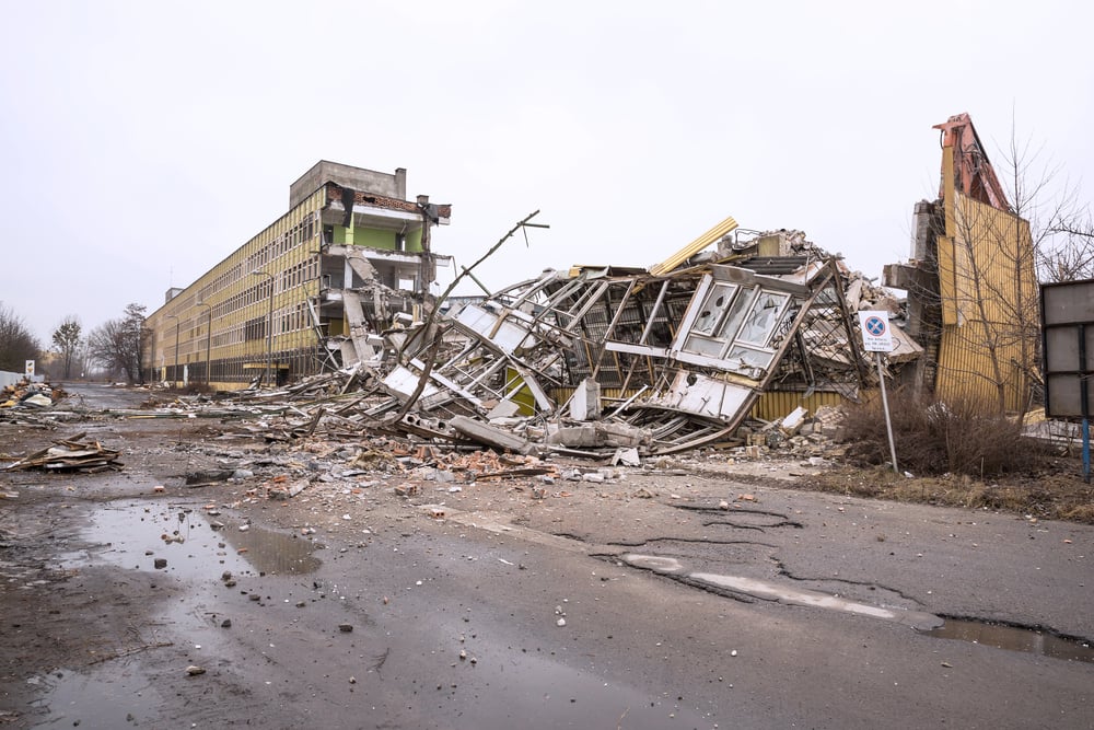
San Francisco, California (1906)
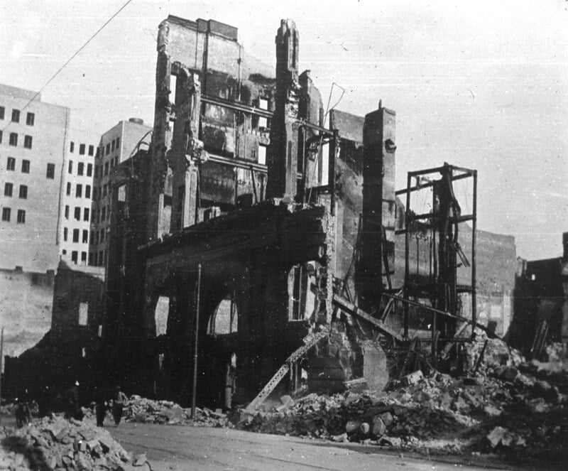
The famous San Francisco earthquake of April 18, 1906, registered 8.0 magnitude and became one of the most studied earthquakes in history. The earthquake and subsequent fires destroyed about 80% of San Francisco and led to major advances in seismic science. This event marked the beginning of modern earthquake research and highlighted the importance of building earthquake-resistant structures.
Nature’s Ultimate Reality Check

These colossal earthquakes remind us that despite all our technological advances, we’re still at the mercy of the forces that shape our planet. Each of these events taught humanity valuable lessons about preparedness, building design, and the importance of understanding the ground beneath our feet. The science of seismology has advanced dramatically since the early 1900s, allowing us to better predict and prepare for these natural disasters. While we can’t prevent earthquakes, we can certainly learn to live more safely with them, turning the lessons of the past into protection for the future.
More from Go2Tutors!

- 16 Historical Figures Who Were Nothing Like You Think
- 12 Things Sold in the 80s That Are Now Illegal
- 15 VHS Tapes That Could Be Worth Thousands
- 17 Historical “What Ifs” That Would Have Changed Everything
- 18 TV Shows That Vanished Without a Finale
Like Go2Tutors’s content? Follow us on MSN.