31 Borders Drawn by Outsiders That Still Cause Conflict Today
Some lines on a map look perfectly innocent until you learn who drew them, when, and why. A treaty signed in a European capital.
A colonial administrator with a ruler and no particular interest in who lived on either side. A great power carving up a continent it had never walked across.
These decisions — made in conference rooms and palaces, often in an afternoon — have outlasted the empires that made them by a century or more, and the people who inherited those lines are still sorting out the consequences. The borders below didn’t emerge from the communities they divided.
They were imposed, negotiated away, or simply drawn to satisfy someone else’s interests. That’s not ancient history. It’s the architecture of most of today’s active conflicts.
The Durand Line (Afghanistan-Pakistan)
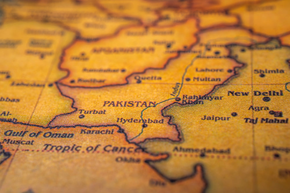
The Durand Line is one of the most contested borders on earth, and it was drawn in 1893 by a British diplomat who needed to separate British India from Afghan territory — fast, cleanly, and without much local consultation. It cut straight through Pashtun tribal lands, splitting a people between two countries that would later become nuclear-armed rivals.
Afghanistan has never formally recognized it as a permanent boundary, and the resulting ambiguity functions like a standing invitation to armed groups operating across it.
The Sykes-Picot Line (Middle East)
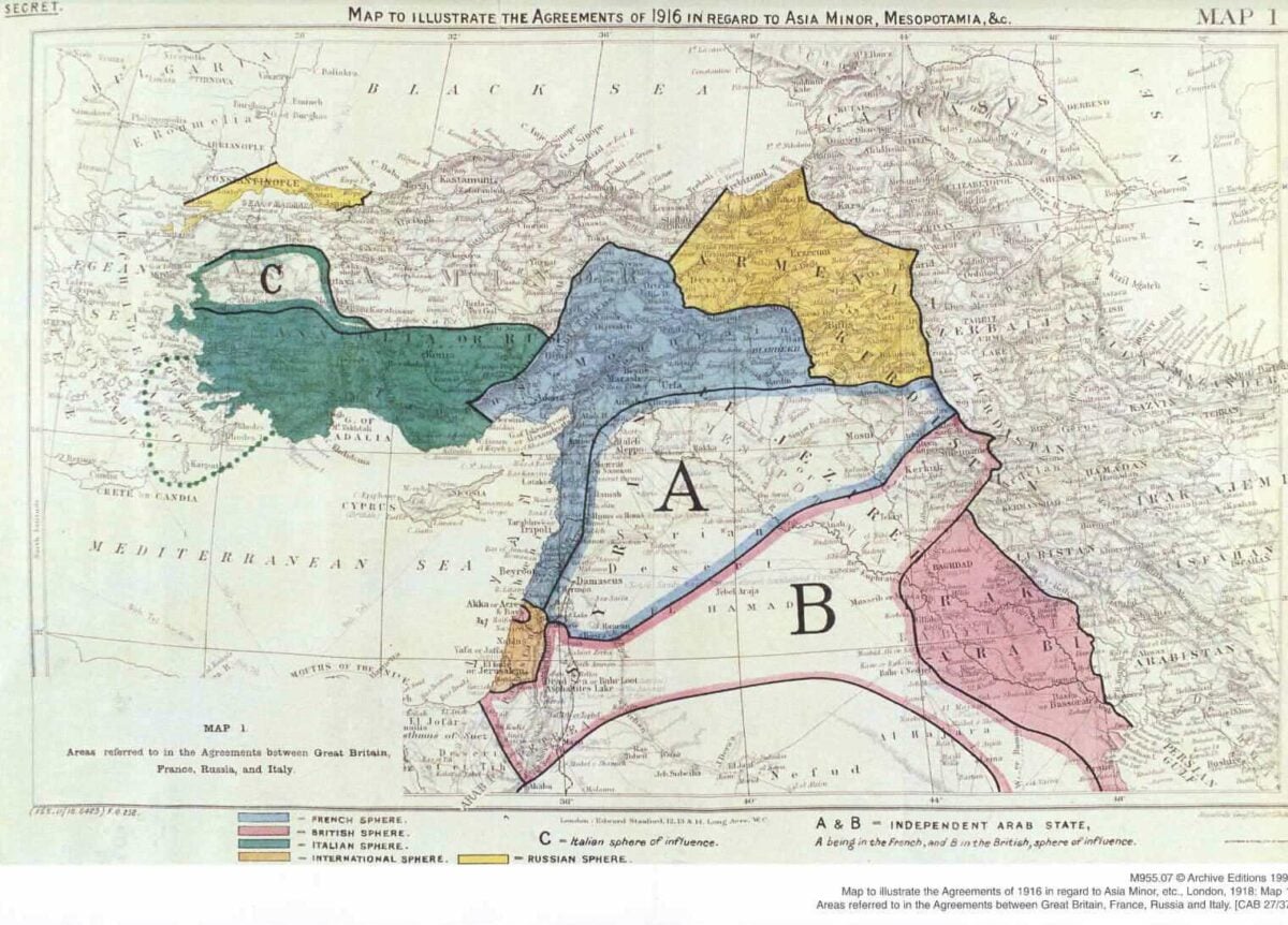
Two men — one British, one French — divided the Arab world between their respective empires in 1916 while the Ottoman Empire was still collapsing around them. Mark Sykes and François Georges-Picot drew borders that ignored ethnic, religious, and tribal realities in favor of colonial spheres of influence: straight lines, artificial states, and a region that has been combustible ever since.
ISIS explicitly named Sykes-Picot in its propaganda when it bulldozed the Iraq-Syria border crossing in 2014 — which is, to be fair, a remarkably accurate piece of historical grievance.
The 38th Parallel (North Korea-South Korea)
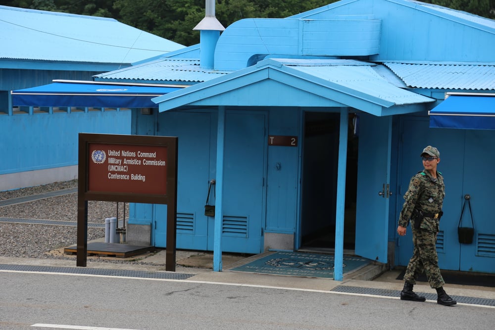
The 38th parallel was chosen by two American officers in 1945 — using a National Geographic map, working late at night with no expertise in Korean affairs and roughly 30 minutes to make the decision — as a temporary administrative line to divide Soviet and American occupation zones. It was never meant to be permanent. It became permanent.
The Korean War killed an estimated 2.5 million people trying to redraw it, failed, and the line has sat there ever since, now fortified as the most militarized border on the planet, separating families who haven’t spoken in seventy years.
The Radcliffe Line (India-Pakistan)
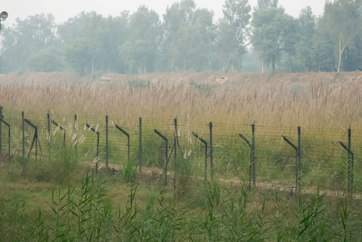
Cyril Radcliffe arrived in India in July 1947, had never been there before, and was handed the task of dividing the subcontinent into two nations within five weeks. The Radcliffe Line — the border between India and Pakistan — was announced two days after independence, triggering one of the largest forced migrations in human history: somewhere between 10 and 20 million people displaced, and somewhere between 200,000 and 2 million killed.
Radcliffe reportedly burned his papers and never returned to India. The line he left behind remains one of the most dangerous in the world.
The McMahon Line (India-China)
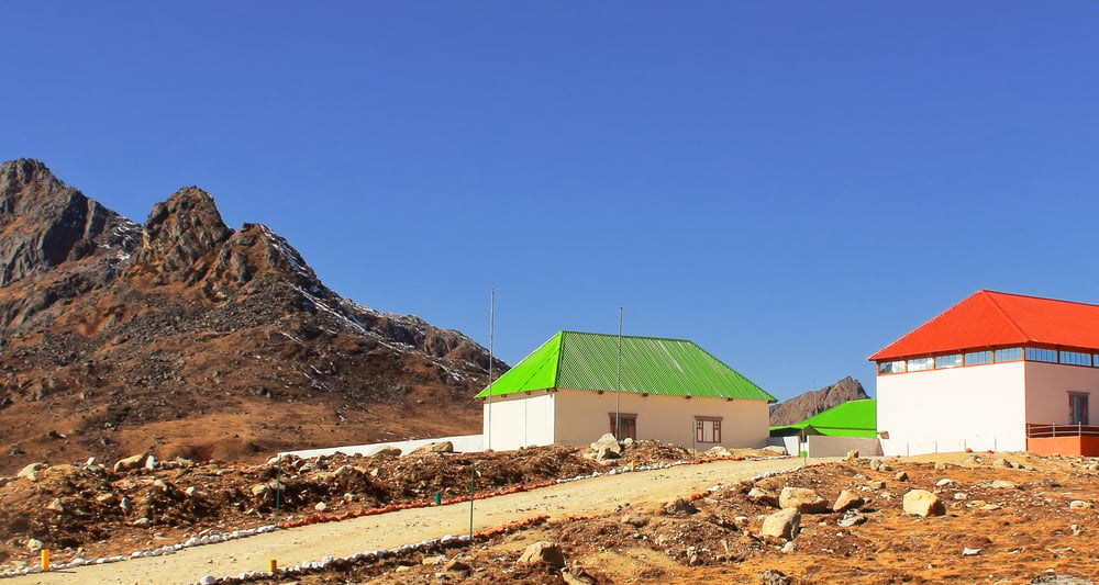
The McMahon Line, drawn at a 1914 convention in Simla, was the British Empire’s attempt to define the border between Tibet and British India across the eastern Himalayas — without China agreeing to it. China has never recognized it.
The 1962 Sino-Indian War was fought partly over this dispute, and India and China still exchange accusations, troop deployments, and occasional confrontations along what both sides call the Line of Actual Control. The original line drawn by Henry McMahon remains the source of a standoff between two nuclear powers.
The Balochistan Division
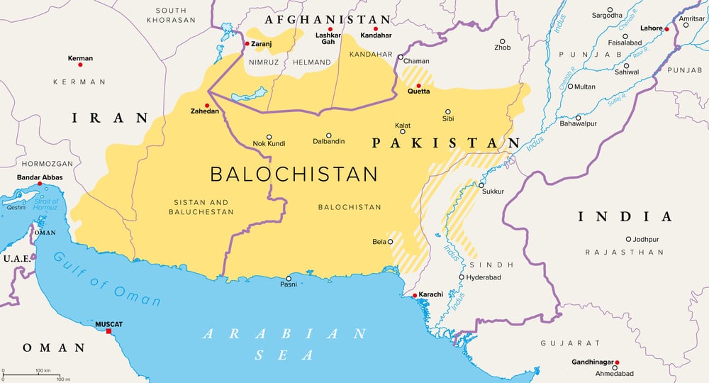
Balochistan — split between Pakistan, Iran, and Afghanistan — is a case study in what happens when you divide an ethnic group three ways without asking them. The Baloch people have never had a nation-state, and armed insurgencies in Pakistani Balochistan have run nearly continuously since the 1940s.
Pakistan’s military treats the region as a security problem; the Baloch treat it as an occupation. Neither framing is new, and neither is going anywhere.
The Nigeria-Cameroon Border (Bakassi Peninsula)
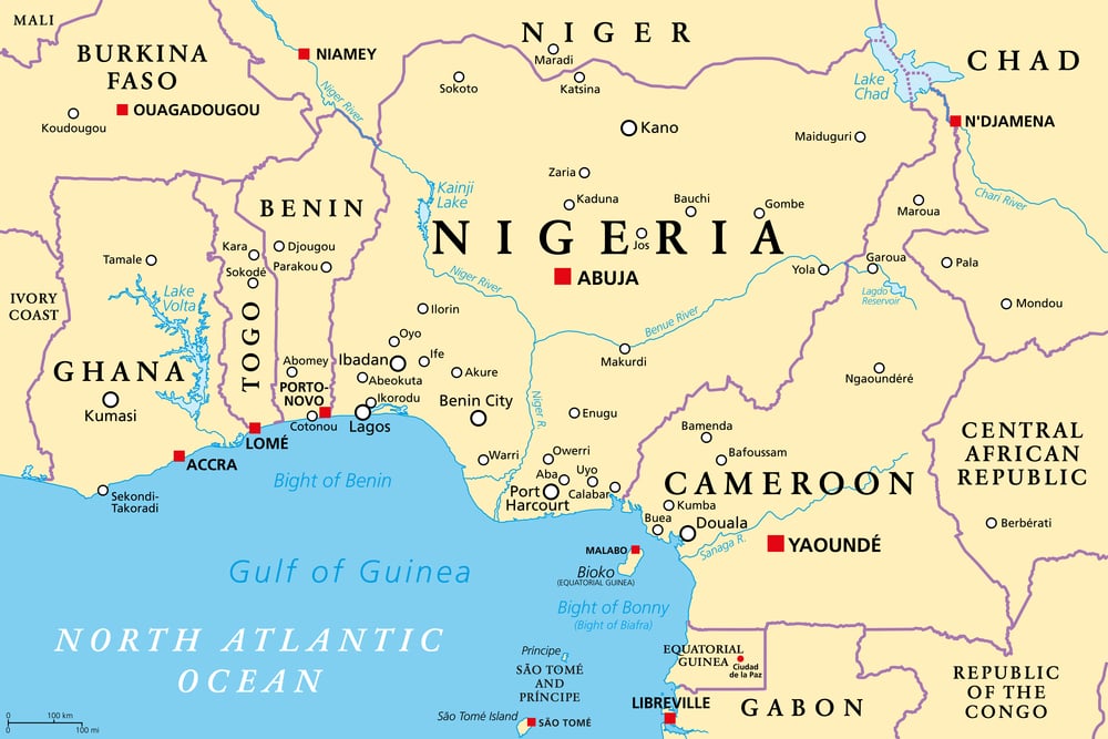
The border between Nigeria and Cameroon was drawn by British and German colonial authorities in 1906 and 1913 — agreements between Europeans about African land. The Bakassi Peninsula, oil-rich and densely populated by Nigerian-speaking communities, was assigned to what became Cameroon, and Nigeria spent decades refusing to accept it.
The International Court of Justice ruled in Cameroon’s favor in 2002; Nigeria formally handed over Bakassi in 2008. Many of the residents still don’t accept the ruling, which is a fairly understandable response to being transferred between countries without a vote.
The Somali Borders
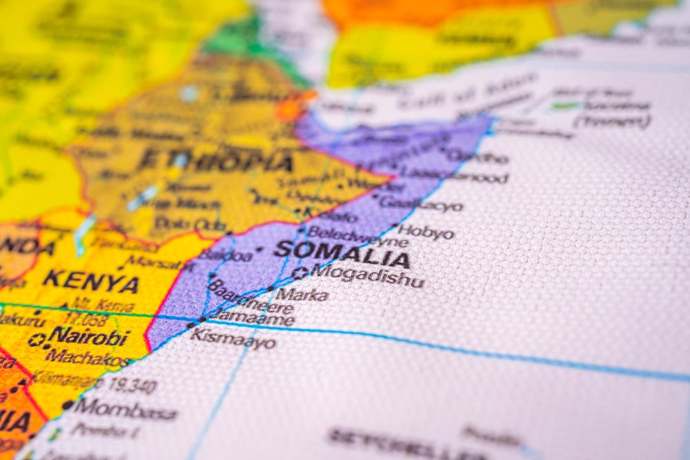
The Somali people were divided among five colonial territories: British Somaliland, Italian Somaliland, French Somaliland (now Djibouti), the Ogaden region (given to Ethiopia), and the Northern Frontier District (given to Kenya). The flag of Somalia still bears a five-pointed star representing those five Somali territories — a symbol of a unification that never happened.
The Ogaden has seen repeated wars between Somalia and Ethiopia; the Northern Frontier District generated a low-level insurgency; and the colonial borders have contributed to a state that collapsed in 1991 and has never fully recovered.
The Israel-Palestine Lines
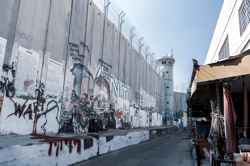
The borders of Israel and Palestine are inseparable from the 1947 UN Partition Plan, which proposed dividing British Mandatory Palestine between Jewish and Arab communities — a proposal accepted by one side and rejected by the other. The 1948 war that followed, the 1967 war that followed that, and the occupation of the West Bank and Gaza since then have all turned on questions of where lines are drawn and by whose authority.
These aren’t abstract geopolitical disputes. They’re questions about who gets to live where, answered differently depending on which map you’re looking at.
The Western Sahara Line
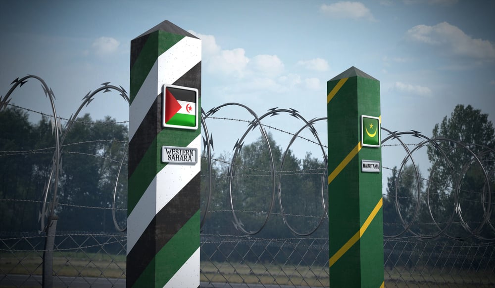
Spain colonized Western Sahara and then, in 1975, simply handed it over to Morocco and Mauritania rather than allowing the indigenous Sahrawi people to vote on self-determination. Morocco built a 1,700-mile sand wall — the Berm — to separate the territory it controls from the Sahrawi-controlled east.
The Polisario Front, backed by Algeria, still claims the territory. The UN has been trying to organize a referendum since 1991. It has not happened.
The Berm just sits there, stubborn and unhelpful, across one of the emptiest landscapes on earth.
The Sykes-Picot Legacy in Syria-Iraq
The Syrian civil war and the rise of ISIS both have roots in borders drawn to benefit France and Britain, not the people living inside them. Iraq’s borders placed Sunni, Shia, and Kurdish populations inside a single state under Sunni minority rule — a configuration that required a dictatorship to hold together and fell apart the moment the dictatorship was removed.
Syria’s borders were similarly artificial, similarly coercive, and similarly unstable under pressure. The post-2003 and post-2011 collapses weren’t surprises to anyone who’d looked at a map drawn in 1916.
The Kurdish Regions (Turkey, Iraq, Syria, Iran)
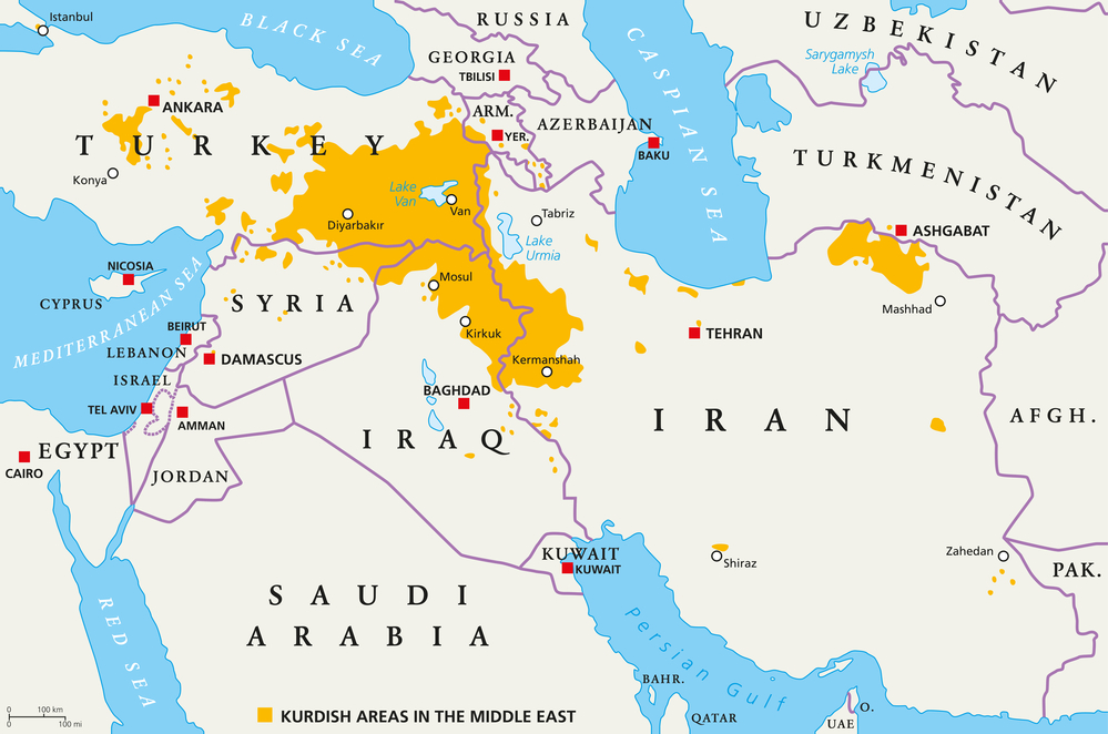
The Kurds — with somewhere around 30 to 40 million people — are one of the largest ethnic groups in the world without a state. The Treaty of Sèvres in 1920 promised them one; the Treaty of Lausanne in 1923 took it back.
They were divided between Turkey, Iraq, Syria, and Iran, and each of those countries has dealt with Kurdish populations through varying combinations of suppression, assimilation, and violence. The PKK insurgency in Turkey has claimed over 40,000 lives. Iraqi Kurdistan functions as a semi-autonomous region.
The question of Kurdish statehood remains politically explosive in every country it touches.
The Wakhan Corridor (Afghanistan)
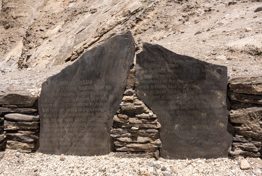
The Wakhan Corridor — that narrow finger of Afghan territory stretching east toward China — was created in 1893 specifically so that Russia and Britain never had to share a border. It’s one of the more openly cynical pieces of border drawing in history: a buffer zone shaped like an afterthought, 220 miles long and sometimes less than 10 miles wide, cutting through the Pamir Mountains and leaving the Wakhi and Kyrgyz people inside it largely forgotten.
It solved a problem for two empires. It solved nothing for anyone who lived there.
The Chagos Islands (British Indian Ocean Territory)
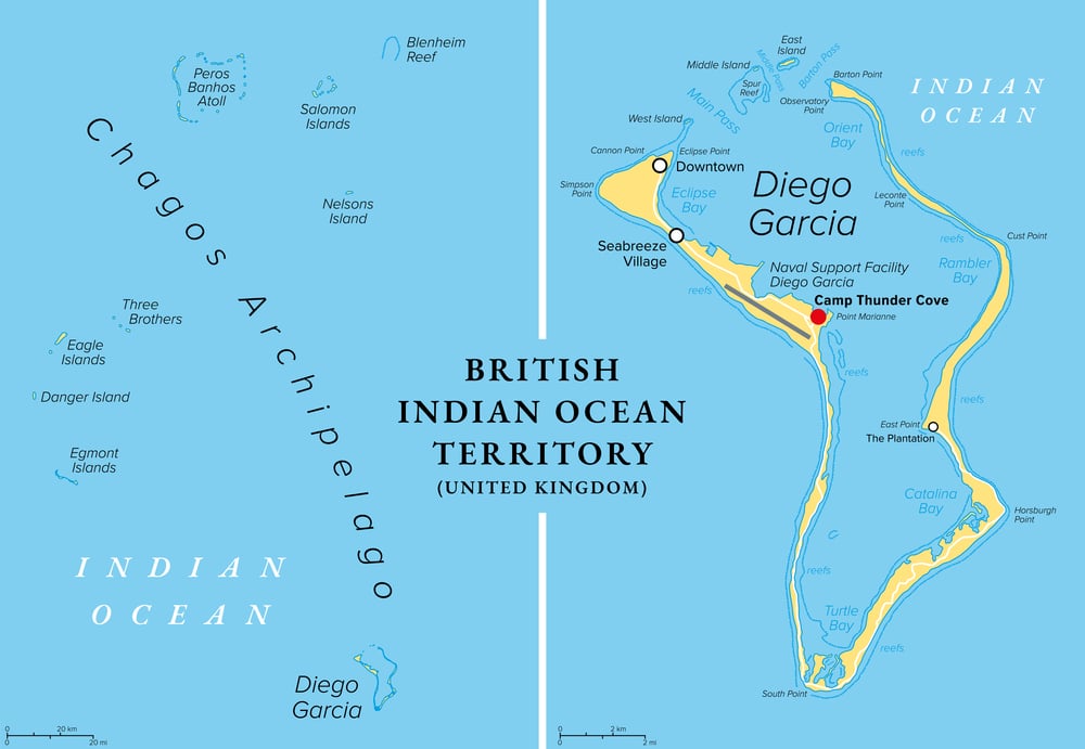
Britain detached the Chagos Islands from Mauritius in 1965 — before granting Mauritius independence — specifically to build an American military base on Diego Garcia. The entire Chagossian population was forcibly removed between 1968 and 1973.
The International Court of Justice ruled in 2019 that Britain’s continued administration of the islands is illegal. Britain ignored it. The Chagossians are still in exile, and Diego Garcia is still operating as a major U.S. military installation, which tells you something about which interests borders actually serve.
The Cyprus Green Line
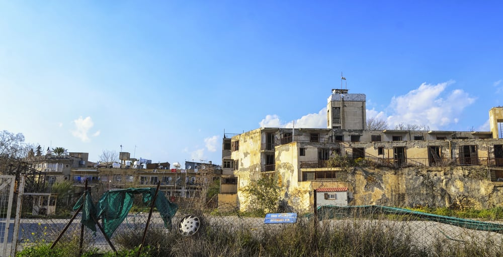
The Green Line in Cyprus was first drawn by a British general in 1964 on a map of Nicosia using a green chinagraph pencil — hence the name. It was a ceasefire line between Greek Cypriot and Turkish Cypriot communities. In 1974, after a Greek junta-backed coup and a Turkish military intervention, the island was formally divided.
The north declared independence as the Turkish Republic of Northern Cyprus, recognized by exactly one country (Turkey). The Green Line became a UN buffer zone. Cyprus has been partitioned ever since, and reunification talks have collapsed so many times that the failure itself has become routine.
The Cambodian-Vietnamese Border
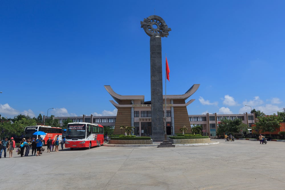
French Indochina was administered as a single colonial unit, and when it was decolonized, the internal administrative lines became international borders — often with little regard for the ethnic Vietnamese living in Cambodia or the Khmer Krom people living in southern Vietnam. The Khmer Rouge’s genocidal ideology was explicitly irredentist, obsessed with reclaiming territory lost to Vietnam.
The Cambodian-Vietnamese War of 1978-1979 killed hundreds of thousands. The border remains contested in specific sections, and Cambodian nationalists still invoke historical territory when it’s politically convenient.
The Ogaden Region (Ethiopia-Somalia)
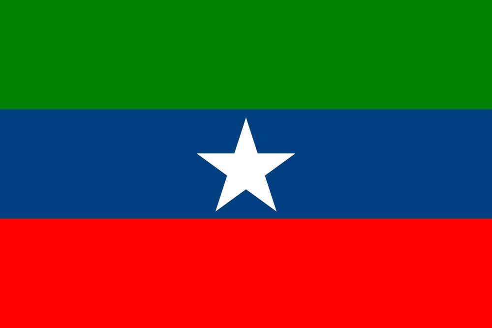
The Ogaden was handed to Ethiopia by Britain after World War II, despite being predominantly Somali in population. Ethiopia and Somalia fought two major wars over it — in 1964 and in 1977-1978 — and the Ogaden National Liberation Front has run an insurgency there for decades.
Ethiopia’s response has included documented human rights abuses that international organizations have described as collective punishment. It’s a conflict that exists precisely because someone in London decided that a piece of Somali-inhabited land should belong to a non-Somali state, and no one on the ground ever agreed.
The Kashmir Line of Control
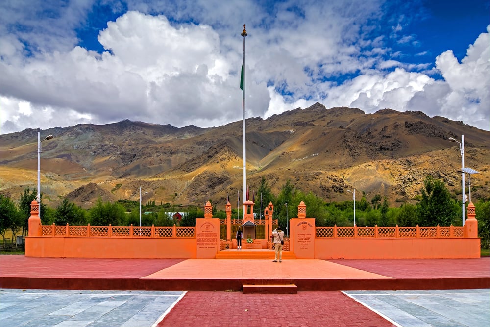
Kashmir was a princely state at the time of partition, and its Hindu maharaja’s decision to accede to India — rather than Pakistan — triggered the first Kashmir War in 1947. The ceasefire line that ended that war became the Line of Control: a de facto border that neither India nor Pakistan recognizes as permanent and that neither has been able to change through three subsequent wars.
Both countries are nuclear-armed. Both claim the entire territory.
The Line of Control is, in some ways, the most dangerous border in the world — and it was produced by the speed and chaos of a partition designed in five weeks.
The Spratly and Paracel Islands (South China Sea)
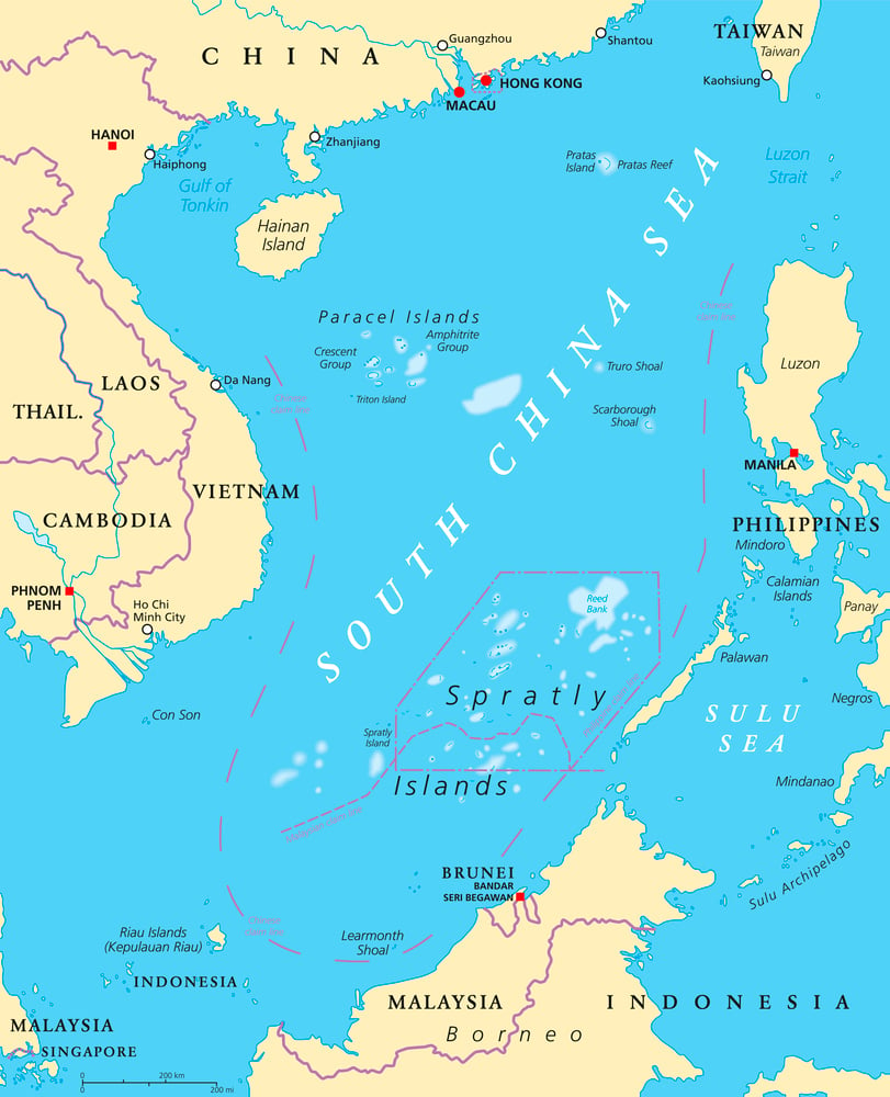
The colonial-era agreements that governed the South China Sea left the Spratly and Paracel Islands in a state of deliberate ambiguity — convenient for the colonial powers, catastrophic for everyone who came after. China, Vietnam, the Philippines, Malaysia, Taiwan, and Brunei all assert overlapping claims, most of which trace back to different colonial-era maps and treaties.
China has built artificial islands and installed military hardware. The United States runs freedom of navigation operations nearby.
The original ambiguity hasn’t been resolved — it’s just been militarized.
The Iraq-Kuwait Border
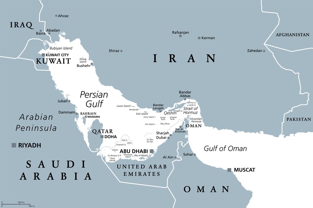
The Iraq-Kuwait border was drawn by Britain in 1922 at the Uqair Conference, giving Kuwait control over coastal territory that Iraq considered — and still considers — historically Iraqi. Britain had strategic reasons for the configuration; Iraq’s opinion wasn’t the priority.
Saddam Hussein’s 1990 invasion of Kuwait explicitly invoked this historical grievance, describing Kuwait as a British invention and Iraq’s “19th province.” The grievance was real. The invasion was not a legitimate remedy for it. The border remains the same.
The Eritrea-Ethiopia Border
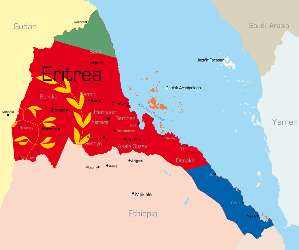
Italy colonized Eritrea; Britain then administered it; the UN federated it with Ethiopia in 1952; Ethiopia absorbed it outright in 1962. Eritrea fought a 30-year independence war, won it in 1991, and formally became independent in 1993.
Then Ethiopia and Eritrea fought a border war from 1998 to 2000 — one of the deadliest conflicts of the late 20th century, killing somewhere between 70,000 and 100,000 people — over a colonial-era border that neither side had drawn. The Algiers Agreement in 2000 assigned the disputed town of Badme to Eritrea; Ethiopia refused to hand it over until 2018.
The Sahel Borders (Mali, Niger, Burkina Faso)
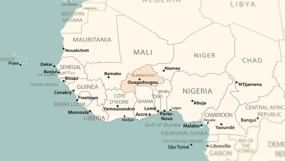
The borders of Mali, Niger, and Burkina Faso were drawn by France to consolidate its West African empire — not to reflect the movement patterns of Tuareg nomads, Fulani herders, or any of the dozens of other groups who lived across that terrain. The Tuareg have launched major rebellions in Mali in 1963, 1990, 2006, and 2012.
The 2012 rebellion — which led to an Islamist takeover of northern Mali and a French military intervention — has since metastasized into a regional crisis spanning six countries. The borders didn’t cause the grievances, but they contain them poorly.
The Tigray Region (Ethiopia)
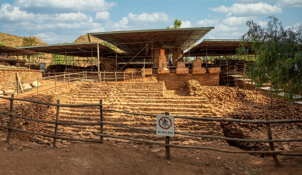
Ethiopia’s internal borders were redrawn in 1991 along ethnic and linguistic lines — an attempt to address the country’s diversity — but the Tigray region’s boundaries, and the political status of territories like Western Tigray, were contested from the start. The Tigray War that began in 2020 was partly a conflict about those internal borders, about who administered disputed territories, and about whether the federal arrangement would survive the TPLF’s loss of national power.
It killed an estimated 300,000 to 500,000 people before a ceasefire in 2022.
The Nagorno-Karabakh Line
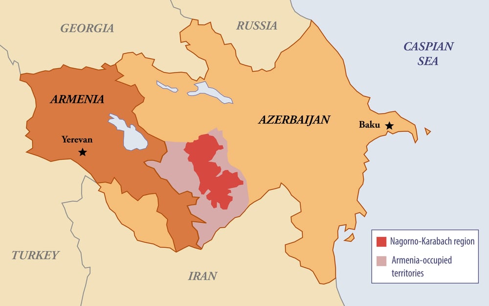
Stalin, in 1921, assigned Nagorno-Karabakh — an ethnically Armenian region — to Soviet Azerbaijan. His reasons were bureaucratic and cynical: it kept two Soviet republics dependent on Moscow to manage their antagonism.
When the Soviet Union collapsed, the antagonism had nowhere to go. Armenia and Azerbaijan fought a war from 1988 to 1994; Azerbaijan retook the territory in a 2020 war; and in 2023, a lightning offensive ended with almost the entire ethnic Armenian population — around 100,000 people — fleeing within days. The region is now empty of the people it was originally assigned to protect.
The Western Sahara-Mauritania-Morocco Lines
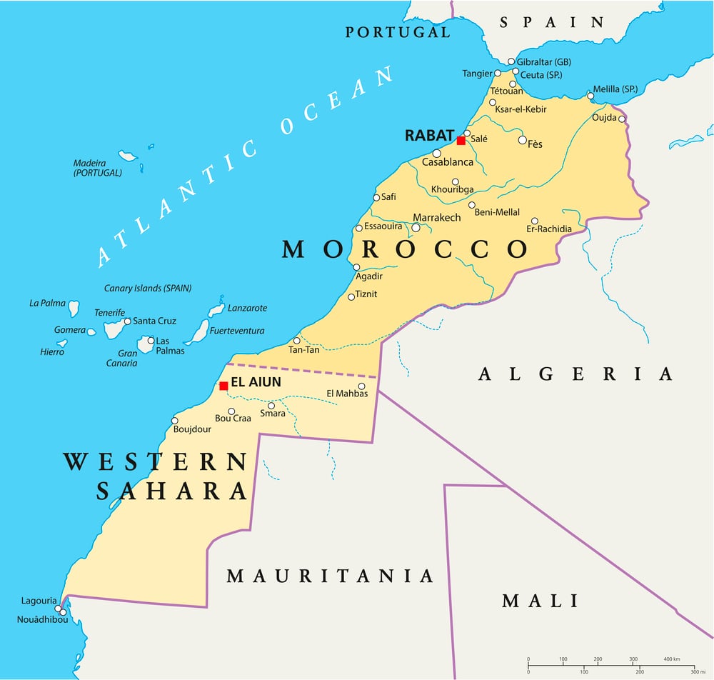
When Spain withdrew from Western Sahara in 1975, it signed the Madrid Accords — splitting the territory between Morocco and Mauritania in exchange for fishing rights. Neither country had a compelling historical claim; Spain simply needed an exit.
Mauritania eventually renounced its claim under military pressure from the Polisario Front. Morocco has held the northern two-thirds ever since.
The African Union recognizes the Sahrawi Arab Democratic Republic as a member state. Morocco does not recognize the African Union’s recognition. Everyone is still arguing about a division made in Madrid.
The Bosnia-Herzegovina Internal Lines
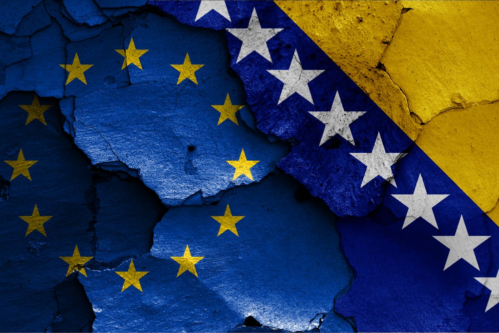
The Dayton Agreement of 1995 ended the Bosnian War by freezing the ethnic cleansing into a constitutional structure: Bosnia was divided into two entities — the Federation of Bosnia and Herzegovina and Republika Srpska — drawn roughly along the lines of where each side’s forces stood when the guns stopped. The Republika Srpska’s leadership now regularly threatens secession, challenges the authority of Bosnian state institutions, and maintains ties with Belgrade and Moscow that make Sarajevo’s EU accession path considerably more complicated.
The Dayton Agreement was a successful ceasefire and a dysfunctional constitution simultaneously, and Bosnia has been living inside that contradiction for thirty years.
The Congo Basin Borders
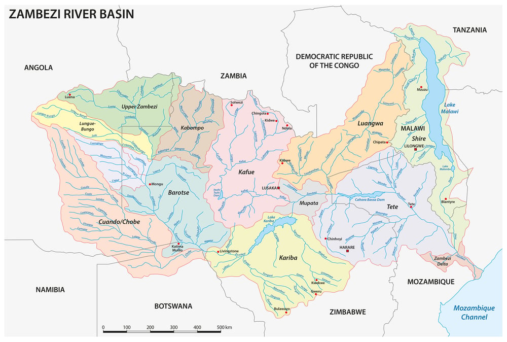
The Congo was carved at the Berlin Conference and given to King Leopold II of Belgium as personal property — not a colony of the Belgian state, but the private estate of one man, under whom somewhere between 1 and 10 million people died from forced labor and atrocity. The borders that defined the Congo Free State, then Belgian Congo, then the Democratic Republic of Congo have remained essentially unchanged through every subsequent government.
They contain over 200 ethnic groups, the second-largest rainforest on earth, and mineral wealth that has funded conflicts killing millions since independence in 1960. The borders weren’t drawn for any of the people inside them.
The Rwandan-Burundian Division
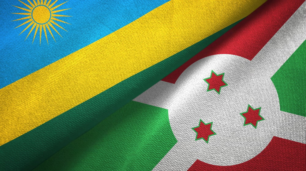
The borders between Rwanda and Burundi were an artifact of German and then Belgian colonial administration, and the Belgian decision to institutionalize the Hutu-Tutsi distinction — issuing identity cards that fixed ethnic categories that had previously been more fluid — directly fed the ideological framework that produced the 1994 genocide. The border between Rwanda and Burundi didn’t cause that history, but the colonial administrative logic that drew it also hardened the ethnic categories that made genocide possible.
They’re the same decision at different scales.
The Papua New Guinea-Indonesia Line (West Papua)
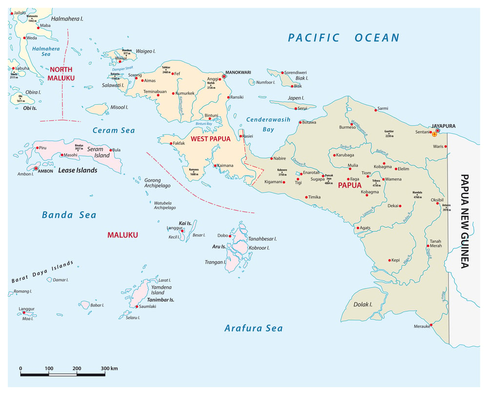
The western half of the island of New Guinea was incorporated into Indonesia in 1969 following a UN-supervised “Act of Free Choice” in which 1,025 hand-picked representatives voted unanimously to remain part of Indonesia — an act so transparently engineered that the UN never endorsed the result as legitimate. West Papuans have maintained an independence movement since, facing military suppression that international human rights organizations have documented in detail.
The border between Papua New Guinea and Indonesia runs straight through the island’s interior, a colonial line that has never been meaningfully renegotiated.
The Trans-Dniester Line (Moldova)
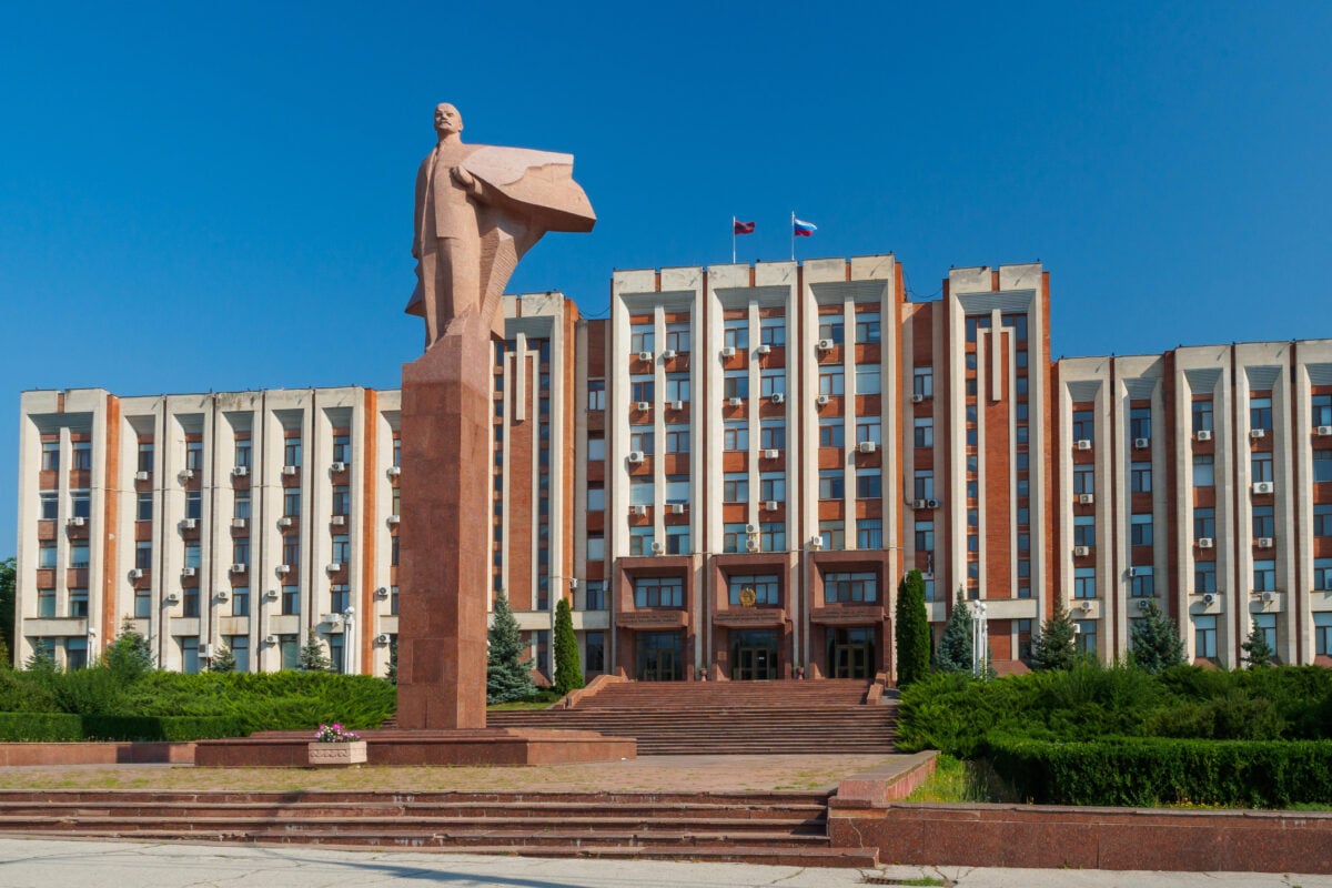
Trans-Dniester — a narrow strip of land between the Dniester River and the Ukrainian border — declared independence from Moldova in 1990 with Soviet military backing, and has remained a frozen conflict ever since. The Russian 14th Army has maintained a presence there, and the territory functions as a de facto Russian protectorate recognized by no UN member state, including Russia itself.
The border between Trans-Dniester and Moldova is patrolled by joint peacekeeping forces and disputed by every party for different reasons. It exists because Soviet administrative lines became international borders when the USSR collapsed, and this particular line left a Russian military presence on the wrong side of one of them.
The Lines That Won’t Stay Still
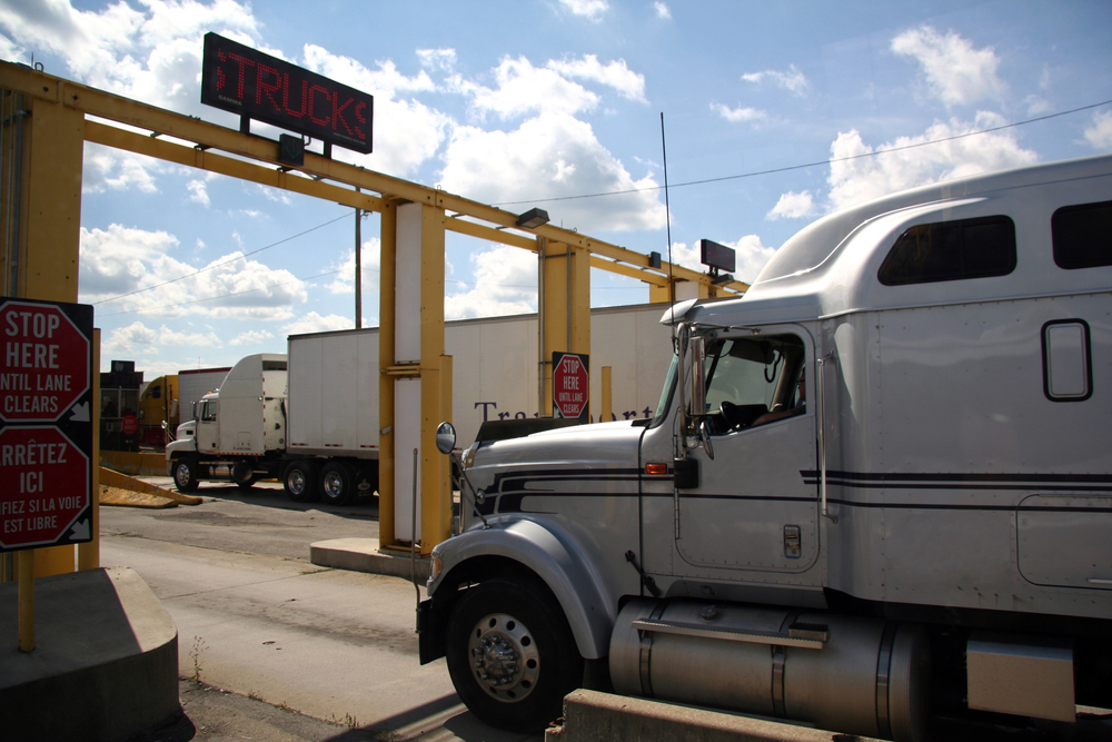
The pattern across these 33 cases is consistent enough to read as a rule rather than a coincidence: borders imposed by outside powers on people who had no role in drawing them tend to require ongoing violence to maintain. The architects of those borders — European foreign ministries, colonial administrators, Cold War strategists — calculated their own interests and called the result geography.
The people on the ground received those calculations as facts about their lives, and then spent generations discovering what happens when the facts don’t fit. That’s not an argument for redrawing every contested border — the cure for colonial-era lines is rarely another round of line-drawing, and the chaos of renegotiation tends to produce more displacement than the original border did.
It’s an argument for honesty about why the lines are where they are, who benefits from treating them as permanent, and why the people still living inside those calculations might see the matter differently than the diplomats who inherited them did.
More from Go2Tutors!

- The Romanov Crown Jewels and Their Tragic Fate
- 13 Historical Mysteries That Science Still Can’t Solve
- Famous Hoaxes That Fooled the World for Years
- 15 Child Stars with Tragic Adult Lives
- 16 Famous Jewelry Pieces in History
Like Go2Tutors’s content? Follow us on MSN.