Common Geographical Myths Completely Disproven
Geography seems straightforward enough. Mountains exist, rivers flow, borders divide nations. Yet somewhere between elementary school lessons and casual conversation, certain “facts” about our planet have taken root that simply aren’t true.
These myths persist because they sound reasonable, get repeated often, and rarely face serious scrutiny until someone decides to actually check.
The Great Wall of China Is Visible From Space
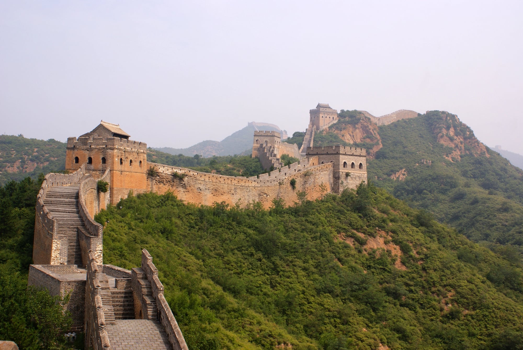
This claim falls apart the moment anyone bothers to check with actual astronauts. The Great Wall isn’t visible from space with the unaided eye.
Not from low Earth orbit, not from the moon, not from anywhere humans have traveled beyond our atmosphere.
The myth persists because it sounds impressive and confirms what people want to believe about human achievement. Reality is less dramatic: the wall is narrow, made of materials that blend with the surrounding landscape, and lacks the contrast needed to stand out from hundreds of miles above.
Alaska is the Largest US State by Both Area and Population
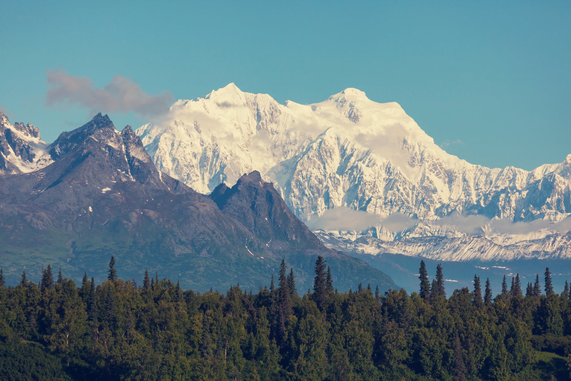
Alaska dominates in size but ranks dead last in population density. The state contains 663,300 square miles but fewer than 750,000 residents (and that number fluctuates based on oil industry employment).
So while Alaska could swallow Texas, California, and Montana with room left over, finding another human being there can prove challenging outside of Anchorage and Fairbanks. The vastness works against population growth — when your nearest neighbor lives forty miles away and winter temperatures hit negative fifty, social gatherings become logistically complex events rather than casual drop-ins.
And yet (this surprises people who picture Alaska as endless wilderness) the state contains some of the most densely packed wildlife populations on the continent. Kodiak bears, caribou herds, salmon runs that turn entire rivers silver — the animals figured out how to thrive in conditions that keep human settlements small and scattered. But that’s a different kind of density than what census takers measure, and it doesn’t change the fact that Alaska remains America’s most sparsely populated state despite being its largest.
Africa is a Country
This geographical confusion runs deeper than simple ignorance. Treating Africa as a single entity rather than a continent of 54 distinct countries reflects a fundamental misunderstanding of scale, diversity, and political complexity that has real consequences.
Africa spans all four hemispheres and contains every climate zone found on Earth. The Sahara Desert alone covers an area larger than the continental United States.
Nigeria and Chad share a border but have as much in common culturally as Norway and Greece. Egypt and South Africa exist on the same continent but operate in completely different economic, political, and social realities.
The persistence of this myth matters because it shapes how people think about African politics, economics, and culture — as monolithic rather than magnificently varied.
Greenland is Larger Than Australia
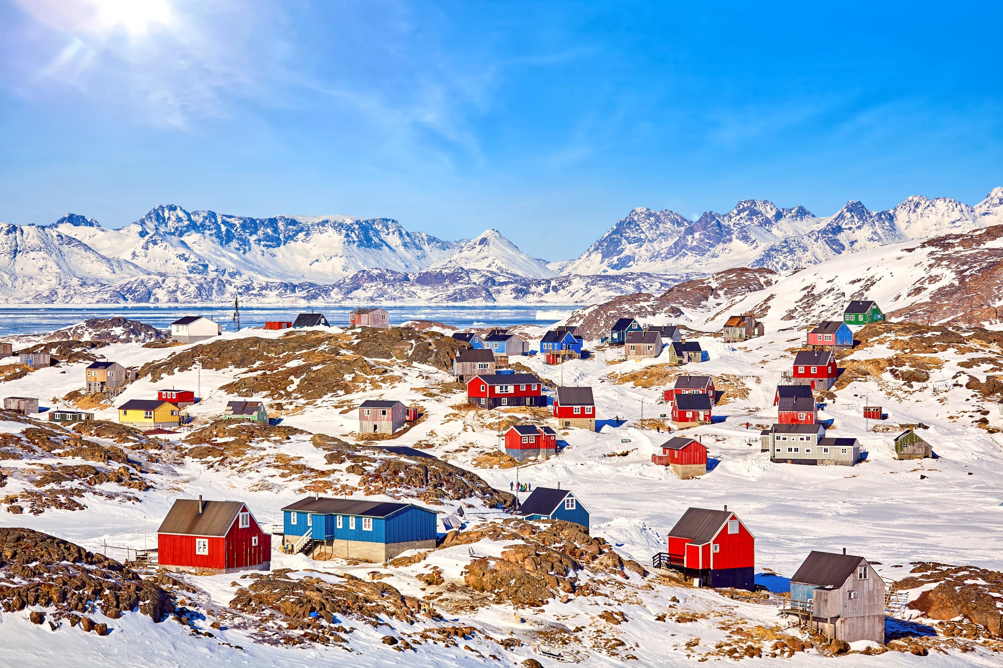
Maps lie about this constantly. The Mercator projection, which most world maps use, stretches landmasses near the poles until they appear enormous compared to their actual size.
Greenland looks massive on these maps — sometimes larger than South America — but it’s actually about one-fourth the size of Australia. This same distortion makes Alaska look larger than Mexico and Russia appear to dominate half the planet.
Australia covers 2.97 million square miles. Greenland covers 836,000 square miles.
The Sahara Desert is Pure Sand
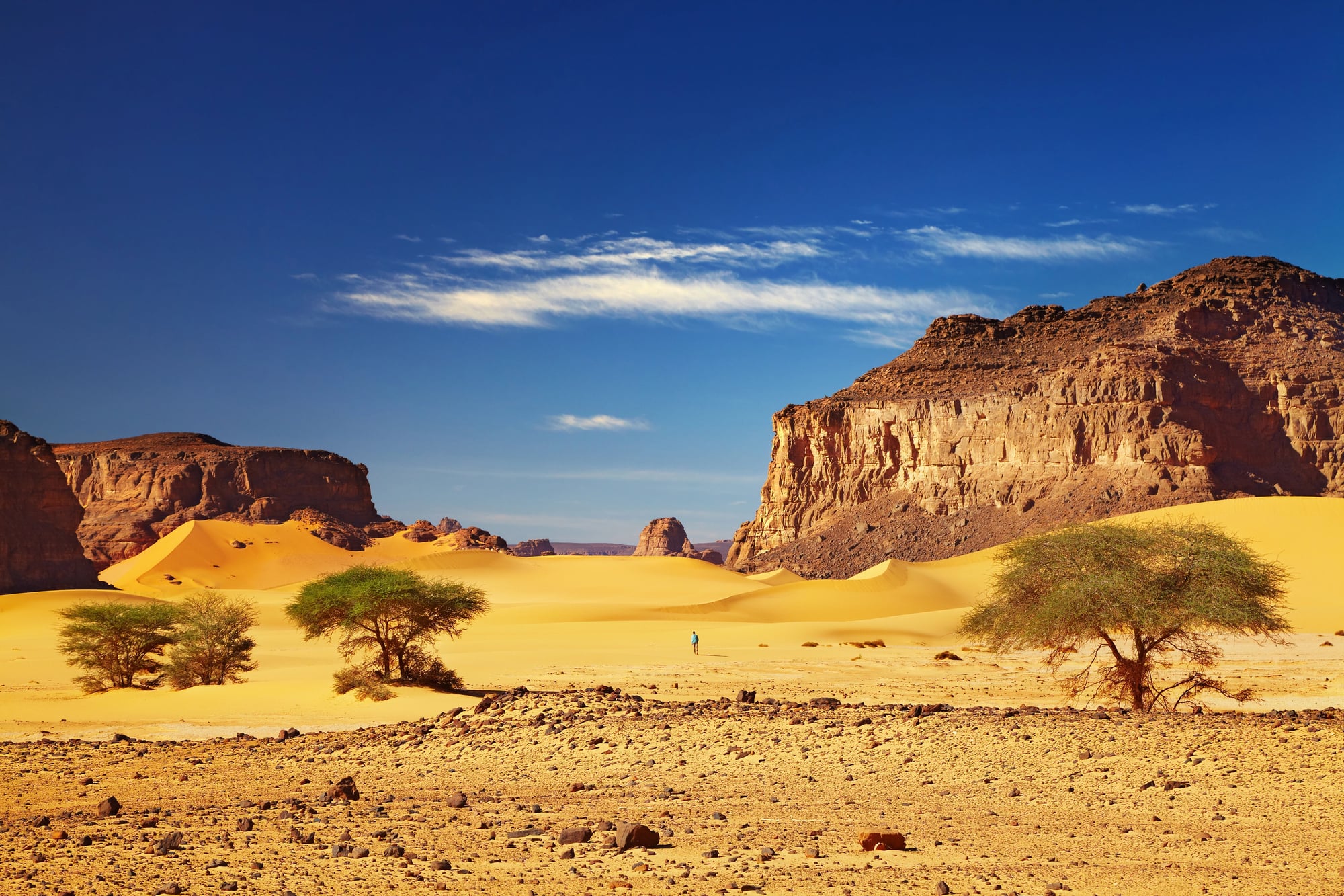
Picture the Sahara and most people imagine endless sand dunes rolling toward the horizon. The reality includes mountains, rocky plateaus, gravel plains, and occasional oases with actual vegetation (though sand dunes do exist and can reach heights that would impress anyone accustomed to beach sand).
The desert spans multiple countries and contains varied terrain that changes dramatically depending on location — from the Atlas Mountains in Morocco to the volcanic peaks of the Hoggar range in Algeria.
Sand dunes, the postcard image of the Sahara, actually cover less than twenty percent of the desert’s total area. The rest consists of hamada (stone plateaus), reg (gravel plains), and scattered mountain ranges that break up the monotony.
But sand photographs better than rocks, so the dune image dominates popular perception of what the world’s largest hot desert actually contains. The Sahara is vast enough to encompass multiple ecosystems, not just the sandy wasteland that appears in movies and travel brochures.
Mount Everest is the Tallest Mountain on Earth
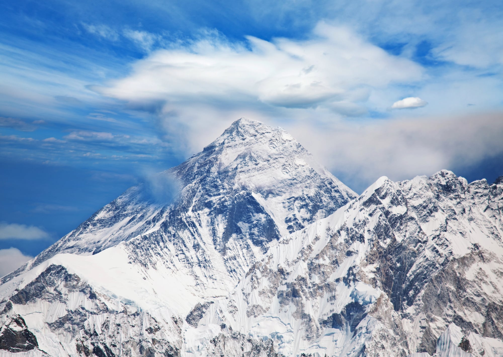
Everest holds the record for highest elevation above sea level, but calling it the “tallest” mountain depends on how measurement gets defined. Mauna Kea in Hawaii rises 33,500 feet from its base on the ocean floor to its summit — significantly taller than Everest’s 29,032 feet above sea level.
The confusion comes from mixing “highest” with “tallest.” Everest sits on the Tibetan Plateau, already elevated thousands of feet above sea level before the mountain even begins.
Mauna Kea starts at the bottom of the Pacific Ocean and climbs continuously to its peak. This isn’t semantic hairsplitting. The distinction matters for understanding how mountains form and how geographic records get established.
Russia Spans Eleven Time Zones
Russia officially operates on eleven time zones, but this represents a political decision rather than a geographical necessity. The country could function with fewer zones if it chose to, and has actually changed the number several times based on administrative convenience rather than solar positioning.
Time zones are human inventions imposed on geography, not natural features of the landscape. China, nearly as wide as Russia, uses a single time zone for the entire country.
Russia’s eleven zones reflect a preference for keeping local solar time roughly aligned with clock time across its vast territory, but this creates complications for everything from television scheduling to business coordination that other large countries avoid by accepting greater divergence between sun position and official time.
The Nile is the World’s Longest River
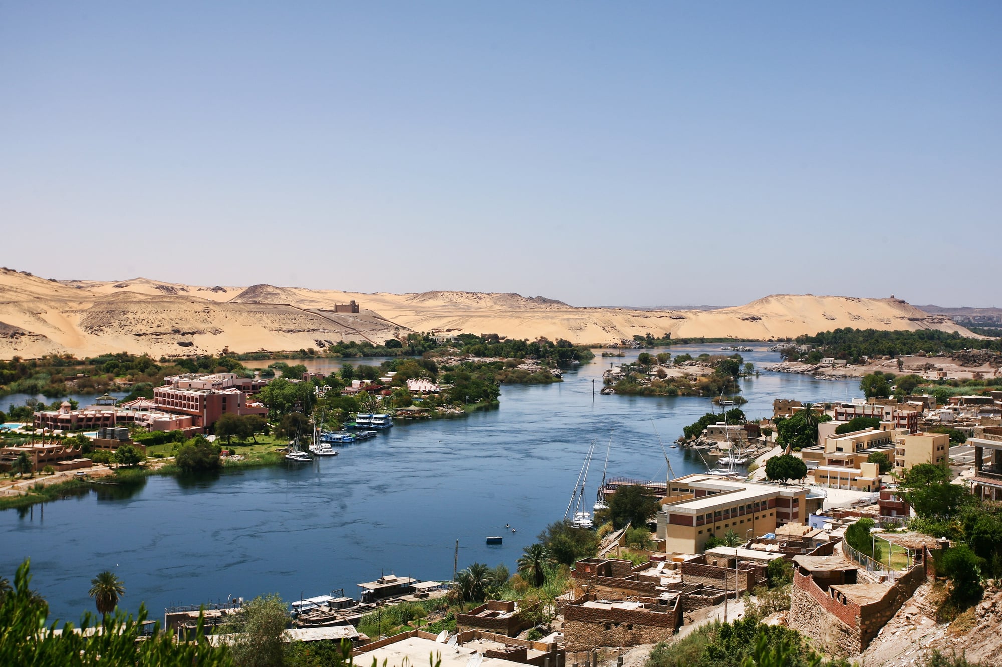
The Amazon recently claimed this title after more precise measurements of its full length, including tributaries and source points. The competition between these two rivers has intensified as satellite mapping technology provides more accurate measurements of river systems that were previously estimated based on incomplete ground surveys.
Rivers change length over time as they carve new channels, flood plains shift, and tributaries alter course. The Nile measures approximately 4,135 miles while the Amazon stretches roughly 4,345 miles.
But both numbers remain somewhat fluid (quite literally) as the rivers themselves continue reshaping their paths through sediment deposits and erosion patterns. Geography textbooks take time to update, so many still list the Nile as longest despite more recent measurements favoring the Amazon.
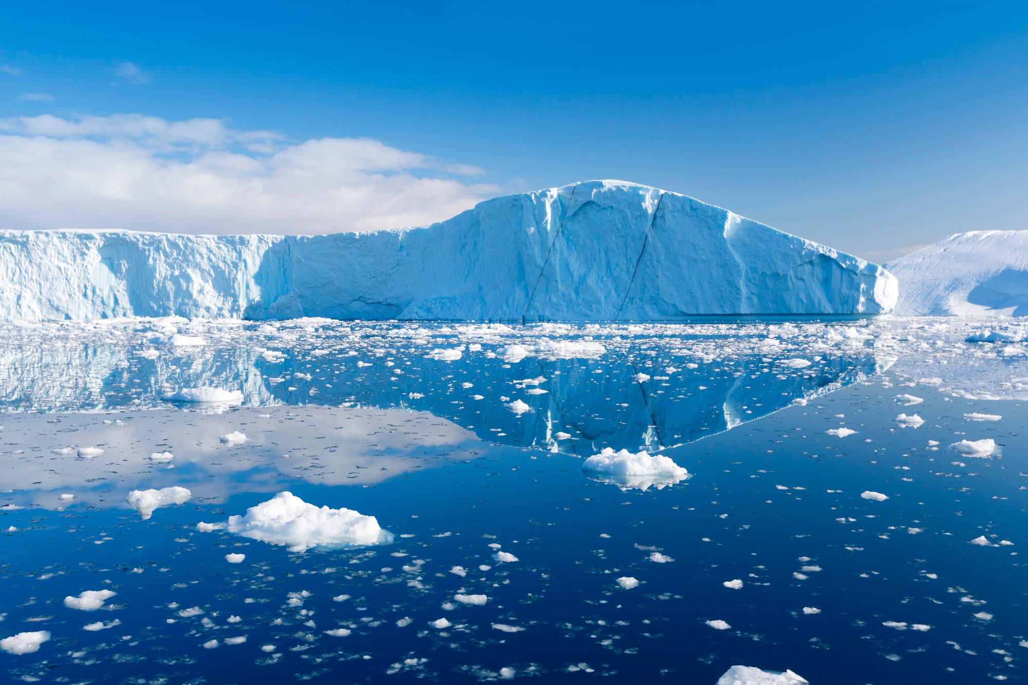
Antarctica is Just Ice and Snow
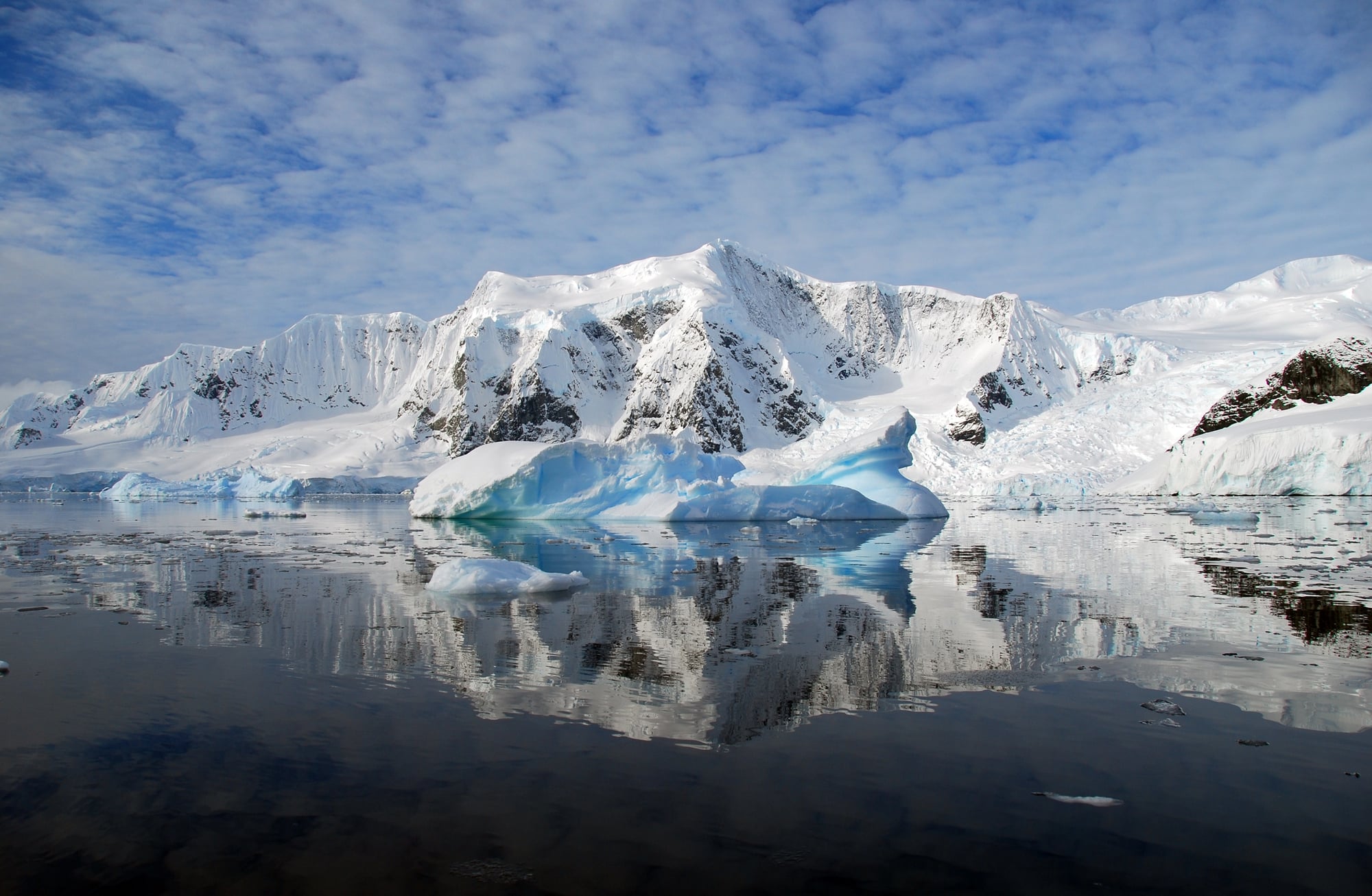
Antarctica contains one of the world’s largest deserts, active volcanoes, liquid lakes buried beneath ice, and mountain ranges that rival the Alps. The continent holds 70 percent of the world’s fresh water, but most of it stays locked in ice sheets that can reach depths of nearly three miles.
The McMurdo Dry Valleys contain no snow or ice despite being located in Antarctica. These valleys experience extreme katabatic winds that strip away all moisture, creating a landscape that resembles Mars more than typical polar terrain.
The highest maximum wind speed (37.8 m/s) was recorded at Lake Fryxell during a katabatic event in mid-October, approximately 85 mph. NASA uses this area to test equipment for Mars missions because the conditions are so similar to what spacecraft encounter on other planets.
Beneath the ice, Antarctica contains coal deposits, suggesting the continent once supported forests in a much warmer climate.
Australia is Both a Country and a Continent
Australia the country and Australia the continent are not identical. The continent of Australia includes several nations: Australia, Papua New Guinea, and various Pacific island nations depending on which geographical definition gets used.
The confusion arises because the country of Australia dominates the continental landmass, covering about 86 percent of the total area. But Papua New Guinea occupies the eastern half of New Guinea island, which sits on the same continental shelf as Australia and is considered part of the Australian continent by most geographical standards.
This distinction matters for understanding regional politics, trade relationships, and cultural connections in the South Pacific.
The Dead Sea is Below Sea Level
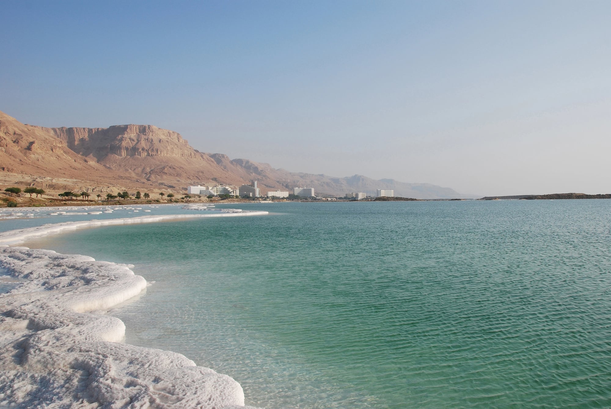
This one happens to be true, but the myth is that the Dead Sea is the lowest point on Earth’s surface. It’s the lowest point on dry land, sitting 1,412 feet below sea level.
The Challenger Deep in the Mariana Trench reaches down 36,200 feet below sea level. The Dead Sea’s extreme salinity — nearly ten times saltier than regular seawater — does make it nearly impossible for most life forms to survive there, hence the name.
But calling it the lowest point on Earth overlooks the vast underwater geography that extends far deeper beneath sea level.
Longitude and Latitude Lines Exist in Nature
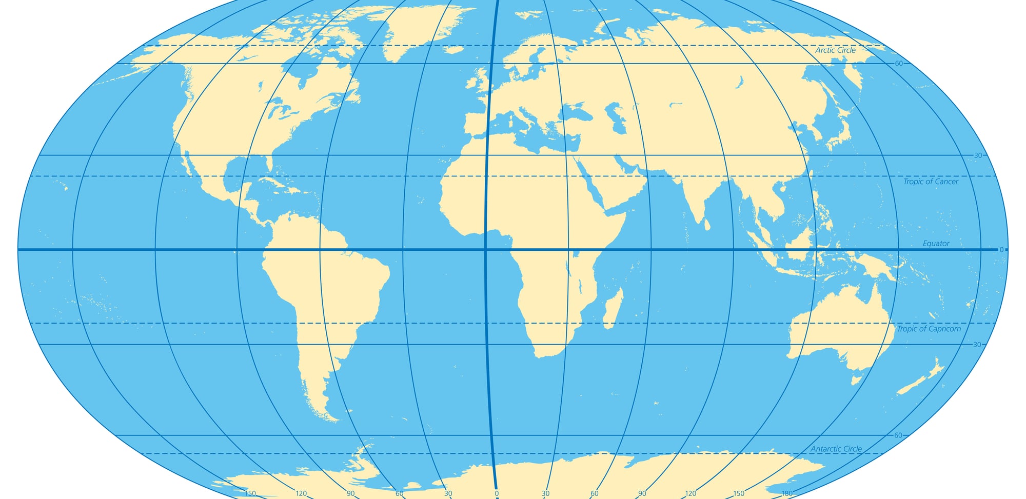
These grid lines are human inventions overlaid on the planet for navigation and mapping purposes. No natural features correspond to longitude and latitude lines — they exist purely as mathematical concepts to help locate positions on Earth’s surface.
The equator does correspond to a physical reality (the widest point of Earth’s circumference), and the poles mark the axis of rotation, but all other latitude lines are arbitrary divisions. Longitude lines are even more artificial since the prime meridian (zero degrees longitude) was chosen by international agreement in 1884 rather than any natural geographic feature.
Modern GPS systems make these imaginary lines incredibly useful for precise navigation, but they remain human constructs rather than features of the natural world.
Looking Beyond the Surface
Maps, textbooks, and casual conversation carry these myths forward because they serve a purpose — they simplify a complex world into manageable chunks of information. The problem comes when simplification hardens into certainty, and “close enough” becomes “definitely true.”
Geography, like most sciences, rewards curiosity over assumption and careful observation over inherited wisdom. The planet keeps revealing new complexities to anyone willing to look past the convenient fictions that make navigation easier but understanding shallower.
More from Go2Tutors!

- The Romanov Crown Jewels and Their Tragic Fate
- 13 Historical Mysteries That Science Still Can’t Solve
- Famous Hoaxes That Fooled the World for Years
- 15 Child Stars with Tragic Adult Lives
- 16 Famous Jewelry Pieces in History
Like Go2Tutors’s content? Follow us on MSN.