Facts About Ancient Mayan Ruins in Guatemala
Guatemala is one of those places that stays with you long after you leave. The jungle presses in from every direction, and somewhere beneath it — sometimes visible, sometimes not — lie the remains of one of the most complex civilizations the world has ever seen.
The ancient Maya didn’t just build temples. They built cities, tracked the stars, developed a written language, and left behind a record of their lives carved in stone.
Here’s what you should know about the ruins they left behind.
Tikal Is the Largest Excavated Site in the Americas
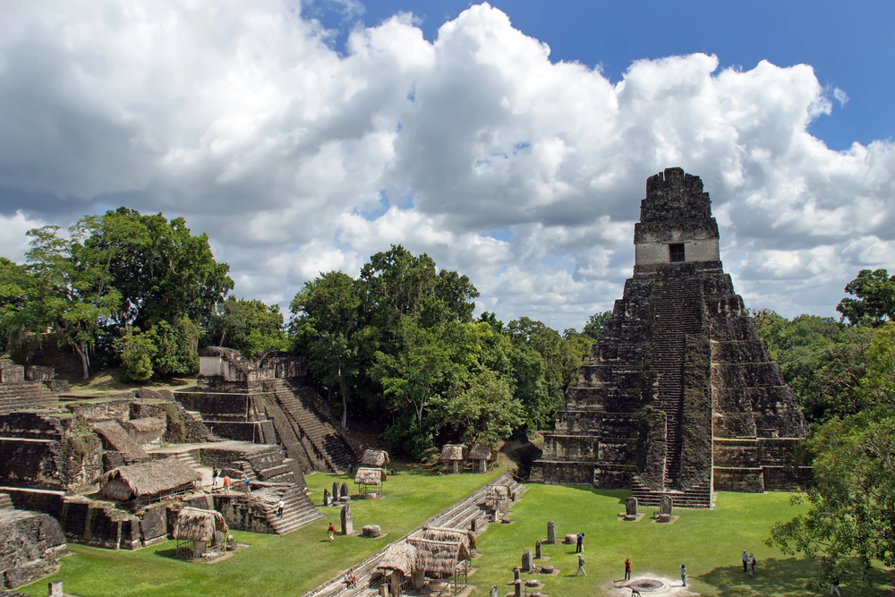
Tikal sits in the northern Petén region and covers roughly 222 square miles. Only a fraction has been fully excavated.
The site contains over 3,000 structures, including six major temple-pyramids, palaces, plazas, and reservoirs. At its peak around 800 CE, the city had a population estimated between 100,000 and 200,000 people.
The tallest structure, Temple IV, rises about 230 feet above the jungle floor. Stand at its top and you’re looking out over a canopy that stretches to the horizon in every direction.
On a quiet morning before the tour groups arrive, the only sounds are howler monkeys and birds.
El Mirador Predates Tikal by Over a Thousand Years

Most people haven’t heard of El Mirador, and that’s partly because getting there requires a five-day trek through dense jungle. But this site deserves attention.
El Mirador is considered one of the earliest and largest Maya cities ever discovered, dating back to roughly 300 BCE.
The site contains La Danta, one of the largest pyramids on earth by total volume. It rises about 230 feet and was built on a natural hill, making its mass even more impressive.
The entire El Mirador basin contains hundreds of connected sites linked by ancient raised causeways called sacbeob.
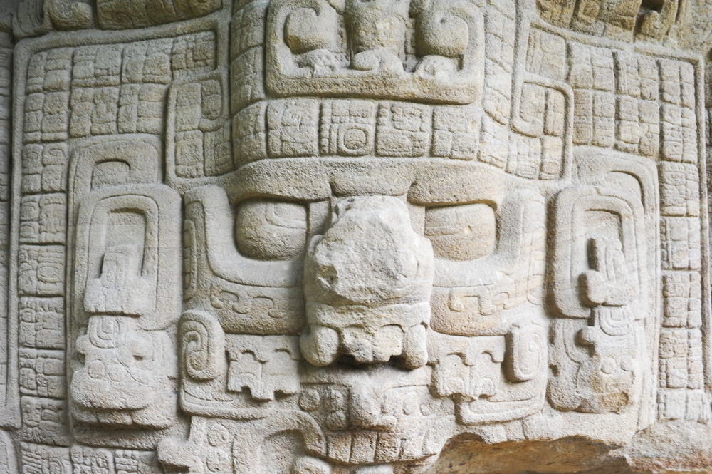
The Maya Writing System Was Fully Deciphered Only in Recent Decades
For a long time, scholars could read numbers and dates in Maya inscriptions but not much else. The full decipherment of Classic Maya hieroglyphics only came together in the latter half of the 20th century, thanks to the work of researchers like Yuri Knorozov, Tatiana Proskouriakoff, and Linda Schele.
What they found was remarkable. The inscriptions at Guatemalan sites like Tikal, Quiriguá, and Yaxhá record real historical events — the births, deaths, and military victories of actual rulers.
These aren’t just religious texts. They’re history books carved into stone and stela.
Quiriguá Has the Tallest Stone Monuments in the Maya World
Quiriguá sits in the Motagua Valley in southeastern Guatemala, and it’s smaller and less visited than Tikal. But for anyone interested in Maya art and sculpture, it’s extraordinary.
The site contains a series of carved stone stelae, some reaching nearly 35 feet tall and weighing over 60 tons.
Stela E is the tallest known Maya stela ever erected. The carvings on these monuments are detailed, intricate, and remarkably well preserved.
Quiriguá is a UNESCO World Heritage Site, and it deserves more foot traffic than it gets.
Many Ruins Are Still Hidden Under the Jungle
Satellite imaging and lidar technology — a laser-based remote sensing method — have transformed how archaeologists understand Maya settlements in Guatemala. A 2018 lidar survey of the Petén region revealed more than 60,000 previously unknown structures beneath the jungle canopy.
This means cities, causeways, agricultural terraces, and defensive walls that nobody knew existed. The Maya landscape was far more densely populated and interconnected than previously thought.
Entire urban networks are sitting undiscovered, waiting for future excavation.
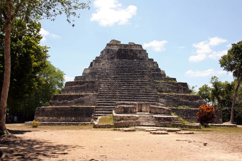
Yaxhá Sits Between Two Lakes

Yaxhá is one of the most visually striking sites in Guatemala, perched on a ridge between Lake Yaxhá and Lake Sacnab in the Petén region. It was one of the largest Maya cities of the Classic period and contains temples, palaces, and an astronomical complex.
Visiting at sunset is worth planning around. Temple 216 offers a clear view over the lake and the surrounding jungle, and watching the light change from up there is the kind of thing you remember for years.
The site also gained international attention after being used as a filming location for a season of Survivor.
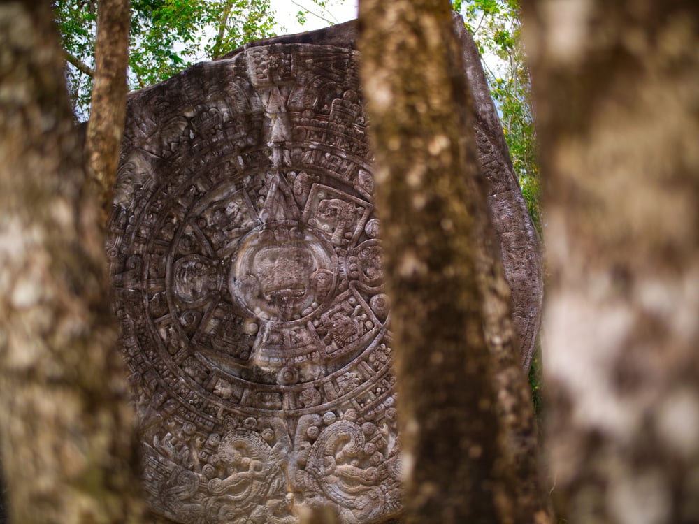
The Maya Calendar Was Remarkably Accurate
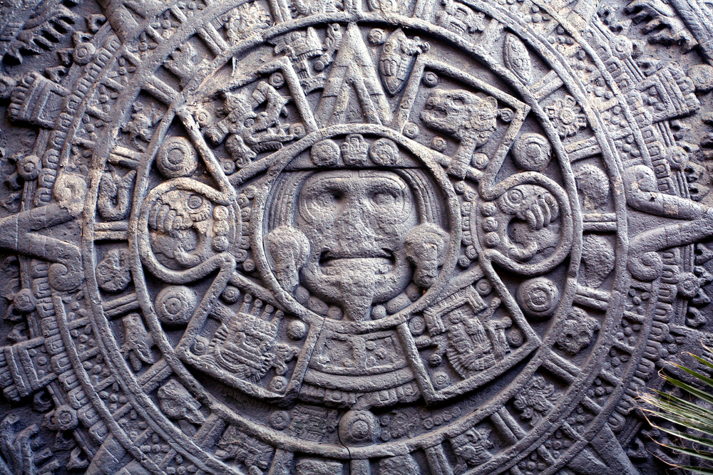
The ruins of Guatemala contain numerous carved calendar inscriptions, and what they represent is impressive. The Maya developed multiple interlocking calendars, including a 365-day solar calendar and a 260-day ritual calendar.
They also used the Long Count calendar, which tracks time in cycles stretching back millions of years. Their calculation of the solar year was accurate to within a fraction of a day — more precise than the Julian calendar used in Europe at the same time.
Many Guatemalan sites contain astronomical alignments built directly into their architecture.
Copán Was a Major Center for Astronomy and Writing
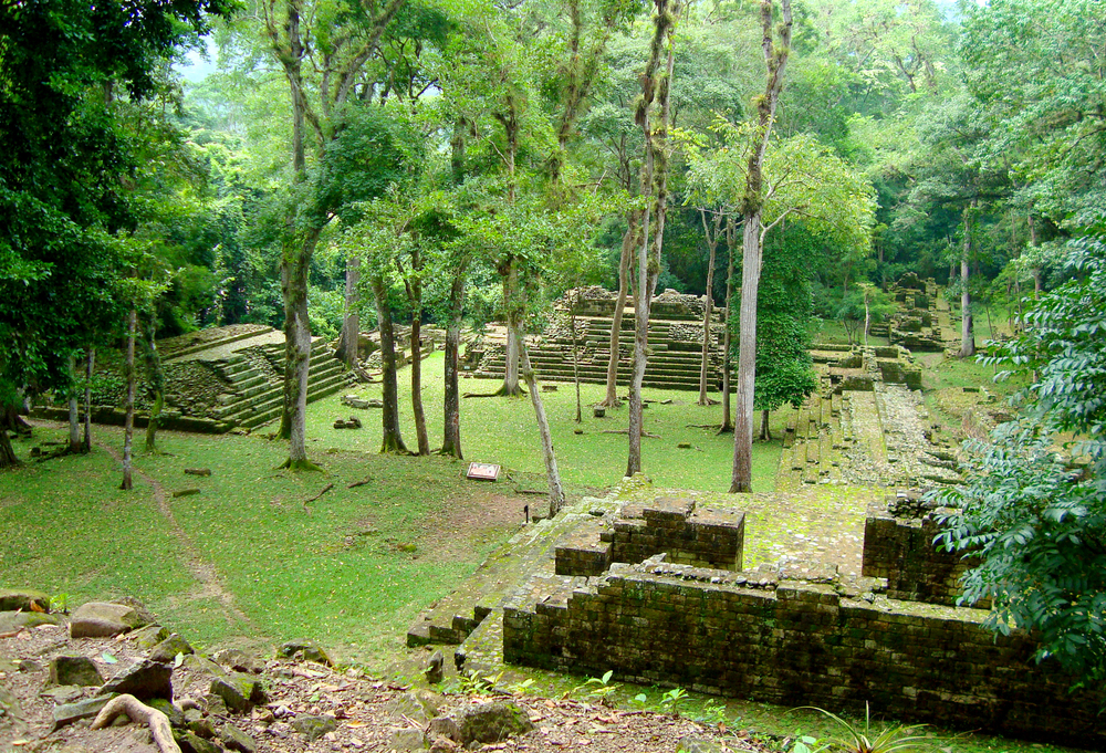
Copán straddles the border between Guatemala and Honduras, with the main ceremonial site sitting just inside Honduras. But the broader Copán polity extended into Guatemala, and the site’s influence throughout the Maya world was enormous.
The Hieroglyphic Stairway at Copán contains the longest known Maya text ever discovered — 2,200 glyphs carved into 63 stone steps. It reads like a royal chronicle, documenting the lineage and history of Copán’s rulers across multiple dynasties.
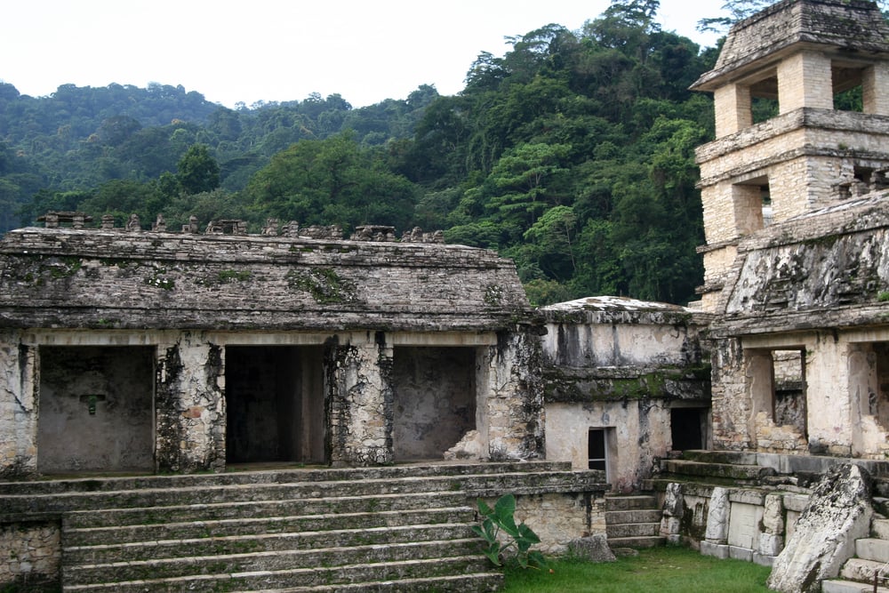
Iximché Was the Capital of the K’iche’ Maya
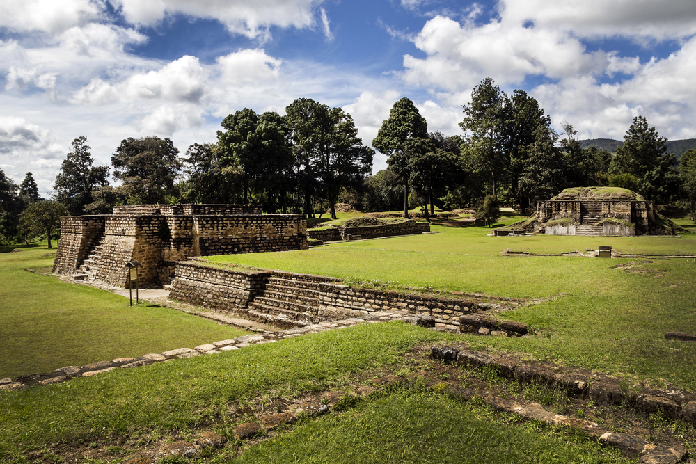
Some ruins in Guatemala do not belong to ancient jungle-covered Maya cities. Perched in the mountains close to Tecpán, Iximché served as the seat of power for the Kaqchikel Maya.
This place hummed with life even as Pedro de Alvarado stepped onto its soil in 1524. A short-lived partnership bloomed between the newcomers and local rulers – until trust gave way to violence.
High up where the air stays fresh, you’ll find two ancient ballcourts alongside pyramid bases and open squares. Unlike places like Tikal or Yaxhá hidden in lowland forests, this spot breathes differently – cooler, quieter.
Even now, Maya people come back to Iximché, keeping old ways alive through rituals that echo across time. What stands here isn’t just stone – it moves with presence, shaped by those who return.
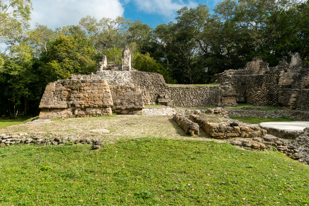
Dos Pilas Founded as Strategic Defense Position
Perched in Guatemala’s Petexbatún area, Dos Pilas carries a story bigger than most Mayan places. Back in the 600s AD, it began as Tikal’s outpost – meant to stretch power through politics and troops.
Over time though, loyalty shifted toward Calakmul instead – a sworn enemy of Tikal. Wars followed – one after another – ripping calm from much of western Petén.
When the fighting never stopped, the place fell apart by the 700s. Digging through layers of rubble, researchers uncovered temple stones repurposed into barricades – proof people were breaking down grand buildings just to survive longer.
By then, hope was already gone.
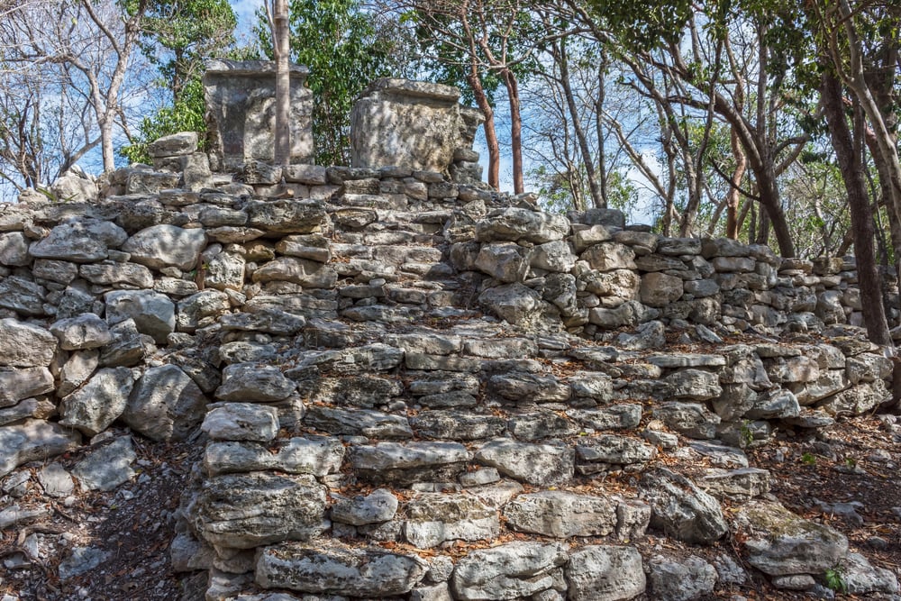
Sacul and Ixkun Hold Nearly Unknown Carvings
Hidden among Guatemala’s backroads lie scores of overlooked spots – places like Sacul and Ixkun, tucked into the southeast corner of Petén. These quiet ruins carry stone carvings etched with messages once used by scholars to map out ancient power ties between distant Maya cities.
Out here, there are no welcome desks, paved trails, or signs explaining what you’re looking at. Getting close often involves finding someone from the area who knows the way, then bouncing along uneven ground.
Yet if your interest in Maya life is real, these places give an experience bigger spots rarely provide – a quiet sense of discovery, like stepping where few have ever paused.
The Classic Maya Collapse Remains Uncertain
Long after 800 CE, city by city across Guatemala’s flatlands, people began to leave. Crowds thinned fast – carved stone markers fell silent.
Thick green growth crept back over open squares and step-pyramids once kept bare. Experts name this shift the Classic Maya Collapse.
For many years now, answers have slipped their grasp. Scientists now think several problems hit at once – dry years lasting too long, farms stretched too thin, trees cut down widely, battles within cities, leaders losing control, and routes for goods breaking apart.
One reason alone cannot cover it all. It seems certain the Maya did not vanish – they adapted, moving people toward northern areas like the Yucatán or up into mountain zones.
Families tracing back to those old communities remain in parts of Guatemala right now.
The Ruins Are Just One Piece
Not just the ruins speak volumes, though they do. Over twenty distinct Maya languages echo across Guatemala today, every one tied to unique customs, cloth patterns, fabric stories passed by voice alone.
Strolling markets in places like Chichicastenango or Sololá reveals something older than stone – not stuck, never still, always changing yet rooted deep. Hidden beneath fthick trees, broken stone walls whisper of grand designs long past.
Up in the mountains, life carries on where old ways still shape days. Down below, rivers feed villages that remember centuries without forgetting them.
One shows how much could be made. The other reveals what stays when everything else fades. Notice one, you see craft.
Notice both, you understand time.
More from Go2Tutors!

- The Romanov Crown Jewels and Their Tragic Fate
- 13 Historical Mysteries That Science Still Can’t Solve
- Famous Hoaxes That Fooled the World for Years
- 15 Child Stars with Tragic Adult Lives
- 16 Famous Jewelry Pieces in History
Like Go2Tutors’s content? Follow us on MSN.