Famous Explorers Who Redrew Global Maps
The world looked completely different on maps just a few centuries ago. Huge blank spaces covered areas where explorers hadn’t ventured, and cartographers filled unknown regions with guesses, myths, and sometimes drawings of sea monsters.
Brave individuals risked everything to venture into these unmapped territories, and their discoveries literally changed how humanity saw the planet. These weren’t just adventurers looking for thrills.
They were people who expanded human knowledge and connected distant civilizations for the first time. Their journeys transformed blank parchment into detailed charts that sailors, traders, and future explorers would depend on for generations.
Here are the people who fundamentally changed our understanding of Earth’s geography.
Zheng He

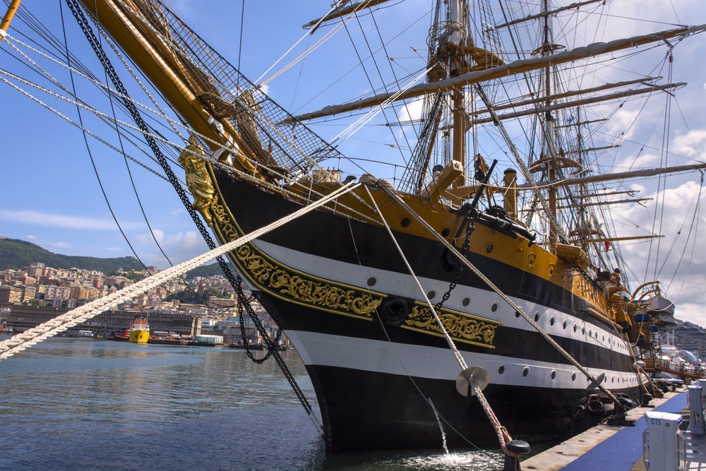
Chinese Admiral Zheng He commanded massive treasure fleets that dwarfed anything Europe would build for another century. Between 1405 and 1433, he led seven major expeditions across the Indian Ocean, visiting Southeast Asia, India, the Persian Gulf, and the east coast of Africa.
His ships measured over 400 feet long, making Columbus’s vessels look like dinghies by comparison. Zheng He’s voyages established trade networks and diplomatic relationships across a huge swath of the world.
The maps his crews created showed distances, ports, and navigation routes that Chinese sailors would use for years. His explorations proved China had the capability to dominate global exploration, though political changes at home ended these voyages abruptly.
Ferdinand Magellan

Magellan set out to find a western route to the Spice Islands and ended up proving the Earth was round through the hardest way possible. His expedition became the first to circumnavigate the globe, though Magellan himself died in the Philippines before completing the journey.
The voyage discovered the strait at South America’s southern tip that now bears his name, connecting the Atlantic and Pacific Oceans. Only 18 of the original 270 crew members survived the three-year ordeal.
The expedition’s maps revealed the true vastness of the Pacific Ocean, which earlier cartographers had dramatically underestimated. Magellan’s route proved that all the world’s oceans connected, fundamentally changing how people understood global geography.
James Cook

Captain James Cook made three major voyages that filled in more blank spaces on world maps than perhaps any other explorer. He charted New Zealand’s coastline with such accuracy that his maps remained in use for over a century.
Cook’s expeditions mapped the eastern coast of Australia, proving it was a massive continent rather than a series of islands. He ventured further south than any previous explorer, searching for the mythical southern continent and disproving many theories about what existed in the far south.
His maps of the Pacific Islands were so detailed that they became the foundation for all later navigation in that region. Cook combined exploration with serious scientific work, bringing astronomers and naturalists who documented everything they encountered.
Vasco da Gama

Vasco da Gama found the sea route from Europe to India around Africa’s southern tip, opening a path that would change global commerce forever. Previous European attempts to reach Asia by sea had failed or turned back.
Da Gama’s successful 1497-1499 voyage proved ships could sail from Europe to India and back, though the journey was brutal and many crew members died. His route around the Cape of Good Hope allowed Europeans to bypass Middle Eastern middlemen who controlled overland spice trade.
The maps created from his journey showed accurate coastlines of southern Africa and the route across the Indian Ocean. This discovery shifted the balance of global power and made Portugal enormously wealthy.
Amerigo Vespucci
Vespucci gets his name on two continents because he figured out something Columbus never accepted. The lands across the Atlantic weren’t Asia but entirely new continents unknown to Europeans.
His voyages along South America’s coast between 1499 and 1502 provided detailed observations that proved this was a ‘New World.’ Vespucci’s letters and maps circulated widely in Europe, and a German cartographer decided to name the new continents ‘America’ in his honor.
His careful latitude measurements and coastal descriptions helped future explorers navigate South American waters. Vespucci understood that longitude was nearly impossible to measure accurately at sea, so he focused on detailed latitude readings and coastal features that sailors could actually use.
Marco Polo

Marco Polo didn’t draw maps himself, but his journey to China and back revolutionized European understanding of Asia. He traveled the Silk Road to Kublai Khan’s court and spent 17 years in China before returning to Venice in 1295.
The book about his travels became a medieval bestseller, even though many people thought he was exaggerating or lying. His descriptions of Chinese cities, the Mongol Empire, Southeast Asia, and the route between Europe and China gave cartographers information they’d never had before.
Maps created after his accounts showed a much more accurate picture of Asia’s size and layout. Christopher Columbus carried a copy of Marco Polo’s book on his voyage, using it to guide his expectations of what he’d find.
Leif Erikson
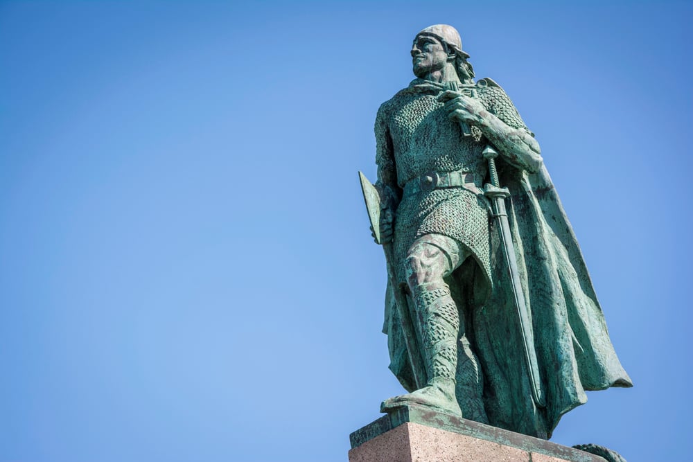
This Norse explorer reached North America roughly 500 years before Columbus, landing in what’s now Newfoundland around the year 1000. The Vikings established a settlement called L’Anse aux Meadows, though it didn’t last long.
Norse sagas describe Erikson’s voyages to lands he called Helluland, Markland, and Vinland, which historians believe were Baffin Island, Labrador, and Newfoundland. The Vikings created mental maps and oral traditions rather than written charts, which is why their discovery didn’t change European cartography at the time.
Archaeological evidence proves the Norse reached North America centuries before other Europeans. If their maps had survived and been shared, the entire history of exploration might have unfolded differently.
Alexander von Humboldt
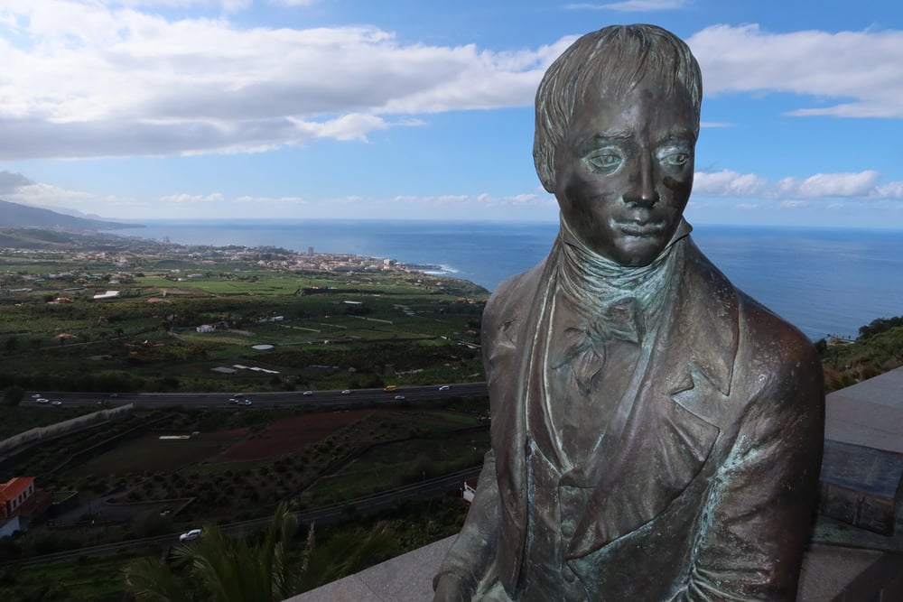
Humboldt explored South America between 1799 and 1804, creating maps that went beyond simple geography to show climate zones, plant distribution, and geological features. He invented the concept of isotherms, those lines on weather maps showing areas of equal temperature.
His maps connected physical geography with climate, vegetation, and even human cultures in ways no one had attempted before. Humboldt measured everything he could, from mountain heights to magnetic variations to ocean currents.
His approach transformed cartography from simple location marking into a scientific discipline that showed relationships between different aspects of the natural world. Scientists across multiple fields used his maps and methods for decades.
Henry Hudson

Hudson made four attempts to find northern passages to Asia, exploring areas that would become crucial to understanding North America’s geography. His 1609 voyage up the river that now bears his name established Dutch claims to the region that became New York.
Hudson’s 1610 expedition discovered the massive bay in northern Canada that’s named after him, though his crew mutinied and left him to die there. His explorations proved no easy northwest passage existed at practical latitudes.
The maps his voyages produced showed the true extent of North America’s eastern coast and the harsh realities of Arctic exploration. Hudson’s tragic end didn’t diminish how his discoveries helped fill in the northern portions of world maps.
David Livingstone
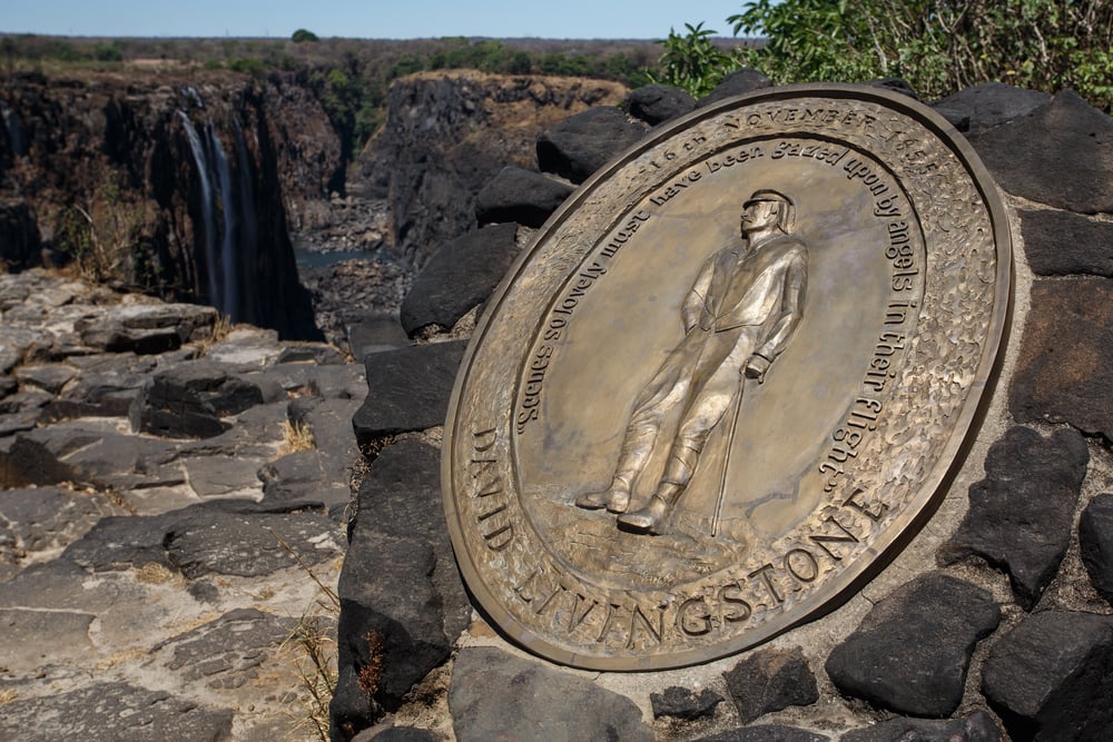
Livingstone spent three decades exploring Africa’s interior in the mid-1800s, mapping regions Europeans had never documented. He traced the Zambezi River, discovered Victoria Falls, and explored Lake Tanganyika and the headwaters of the Nile.
His maps and reports challenged European assumptions about the ‘Dark Continent’ and provided the first detailed information about central and southern Africa’s geography. Livingstone walked thousands of miles, often sick with malaria and other diseases, documenting everything he saw.
His work opened Africa to European colonization, which had devastating consequences for African peoples. The maps he created showed rivers, lakes, mountains, and potential trade routes that would guide both missionaries and colonizers.
Roald Amundsen

Amundsen conquered both polar regions, creating maps of Earth’s most extreme environments. He led the first expedition to successfully navigate the Northwest Passage between 1903 and 1906, proving a route through the Arctic existed.
His team became the first to reach the South Pole in 1911, beating Robert Scott’s ill-fated British expedition. Amundsen’s Arctic flight in 1926 made him possibly the first person to reach the North Pole as well, though this claim remains disputed.
His detailed observations and maps of polar regions filled in the last major blank spaces on world maps. Amundsen understood that successful exploration required learning from indigenous peoples, adopting Inuit techniques that kept his expeditions alive where others perished.
Ibn Majid

This Arab navigator from the 15th century wrote books about sailing the Indian Ocean that became essential guides for sailors. Ibn Majid possessed incredibly detailed knowledge of winds, currents, stars, and coastal features throughout the Indian Ocean region.
His navigational poems and prose works functioned as verbal maps that pilots memorized. Some historians believe he helped guide Vasco da Gama’s fleet from Africa to India, though this remains controversial.
Ibn Majid’s work preserved centuries of Arab and Indian maritime knowledge that had never been written down systematically before. His descriptions helped European cartographers understand Indian Ocean navigation and create more accurate charts of Asian coastlines.
Lewis and Clark
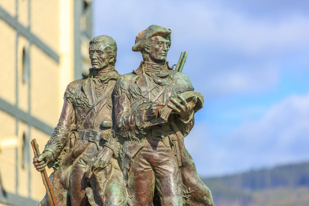
Meriwether Lewis and William Clark led the first American expedition to cross the western portion of the continent to the Pacific coast. Their 1804-1806 journey mapped the Missouri River, crossed the Rocky Mountains, and followed the Columbia River to the ocean.
The expedition created detailed maps showing mountain ranges, rivers, and indigenous territories that filled in huge blank areas on American maps. Lewis and Clark documented plants, animals, and Native American tribes, creating a comprehensive picture of the western landscape.
Their maps opened the American West to settlement and expansion, fundamentally changing the continent’s future. The expedition proved overland travel to the Pacific was possible, though far more difficult than anyone had hoped.
Ernest Shackleton

Hardly anyone went farther south than Shackleton did during his 1907–1909 journey – just ninety-seven miles stood between him and the pole. Though the goal was exploration, it was survival that made his later trip legendary.
Trapped by sea ice, the Endurance broke apart silently beneath shifting floes. Mapping remote stretches of land wasn’t planned after such a wreck, yet records still grew.
Much of what we know about Antarctica’s coastlines started with those efforts. Few expected so much data would come from such failure.
What stood out was how his efforts revealed just how vast the continent really is, along with the harsh conditions explorers would face. Because of Shackleton’s charts, teams later on could navigate around towering mountains, massive glaciers, and sprawling ice shelves.
Abu Abdullah Muhammad al-Idrisi

Back in 1154, under the patronage of Sicilian King Roger II, Abu Abdullah Muhammad al-Idrisi drew up a world map far ahead of its time. At that royal court, he put together what became known as the ‘Tabula Rogeriana’.
Instead of relying on just one source, he pulled knowledge from Islamic scholars, old Greek texts, and reports by people then traveling long distances. From the Atlantic Ocean all the way to China, his work captured vast stretches of land with surprising precision.
Across continents – Europe, North Africa, and parts of Asia – he marked cities, paths used for trade, flowing rivers, and towering mountain ranges. For hundreds of years, his drawing stayed ahead of all others in showing the world right.
Facing south upward, it followed a style common among Muslim mapmakers. It carried details Europeans lacked on their own charts until much later.
From blank spaces to borderlines

Out there beyond known shores, those drawing new lines on paper changed everything. Not only did they trace waterways and edges of land, but they stitched distant worlds together – worlds once blind to one another.
It turned out the planet held more space, more variety, than minds had dared suppose. Trade across oceans grew from their efforts, then empires followed, laying paths toward today’s tightly linked globe.
Yet power shifted too, tipping heavily toward Europe, which remade continents while erasing many native lives. Now orbiting machines scan every inch of terrain, yet it began with people stepping forward using little more than wood, ink, and daring – no matter why they went.
More from Go2Tutors!

- The Romanov Crown Jewels and Their Tragic Fate
- 13 Historical Mysteries That Science Still Can’t Solve
- Famous Hoaxes That Fooled the World for Years
- 15 Child Stars with Tragic Adult Lives
- 16 Famous Jewelry Pieces in History
Like Go2Tutors’s content? Follow us on MSN.