Historic Maps That Changed Exploration
Maps have always been more than just paper and ink. They’ve been passports to the unknown, tools for conquest, and keys to understanding our world. Before GPS and satellite imagery, cartographers relied on travelers’ tales, astronomical observations, and pure imagination to chart territories nobody had fully explored.
Some of these early maps got things spectacularly wrong, while others were so accurate they’re still impressive today. The maps that changed exploration didn’t just show where things were—they inspired people to go there.
Here is a list of historic maps that redirected the course of human discovery and opened new chapters in our understanding of the planet.
Babylonian World Map
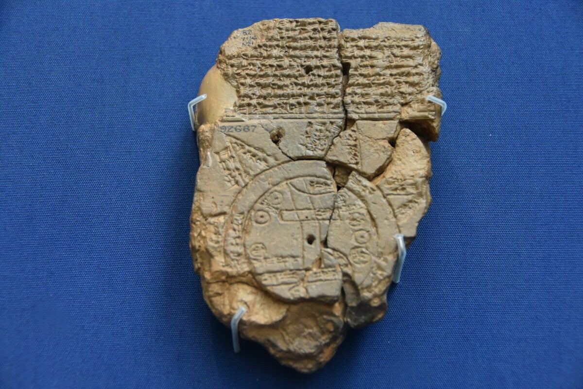
Created around 600 BC, this clay tablet represents one of the earliest known attempts to map the entire world. The Babylonians placed their city at the center, surrounded by a circular ocean and distant lands they called ‘regions beyond’.
It’s primitive by modern standards, but it established a crucial concept: the world could be represented on a flat surface, making it comprehensible and discussable.
Ptolemy’s Geography
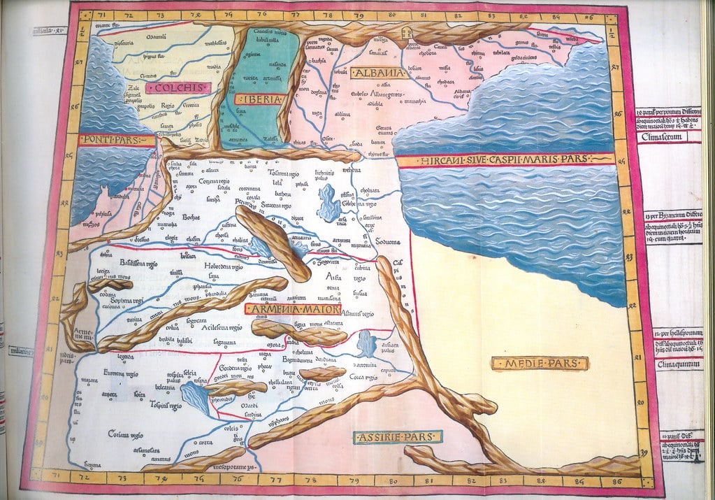
When Claudius Ptolemy compiled his geographical treatise in the 2nd century AD, he didn’t just list places—he provided coordinates. His work included instructions for projecting the curved Earth onto flat maps, complete with longitude and latitude lines.
Renaissance Europeans rediscovered Ptolemy’s text in the 15th century, and it became the foundation for virtually every map printed in the early age of exploration, despite getting the size of Asia wrong and not knowing the Americas existed.
Tabula Rogeriana
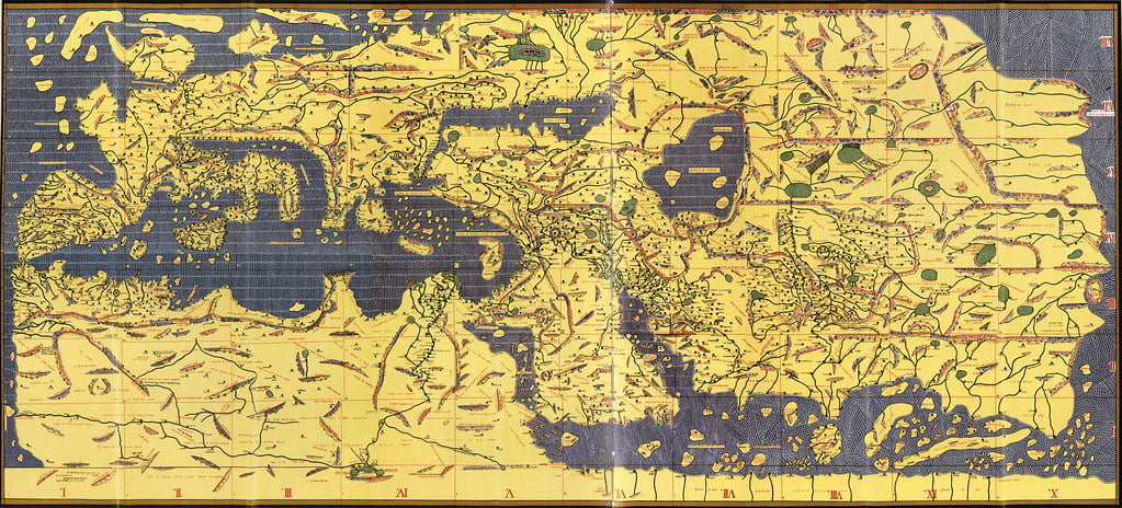
In 1154, the Arab geographer Muhammad al-Idrisi created this masterpiece for King Roger II of Sicily. Unlike European maps of the same period, the Tabula Rogeriana was oriented with south at the top and included remarkably accurate details about Africa, Asia, and Europe based on accounts from travelers and merchants.
It remained one of the most detailed world maps for three centuries and proved that Islamic scholars possessed geographical knowledge far beyond what Europeans had at the time.
Hereford Mappa Mundi
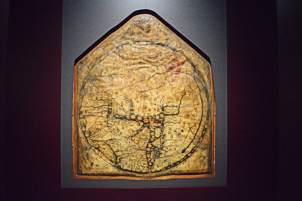
This massive medieval map from around 1300 wasn’t designed for navigation—it was meant to tell the story of Christian history and theology. Jerusalem sits at the center, and the map includes biblical scenes, mythical creatures, and historical events mixed with actual geography.
While it seems bizarre to modern eyes, it reveals how medieval Europeans understood their place in the world and shows the transition from religious to scientific cartography that would come later.
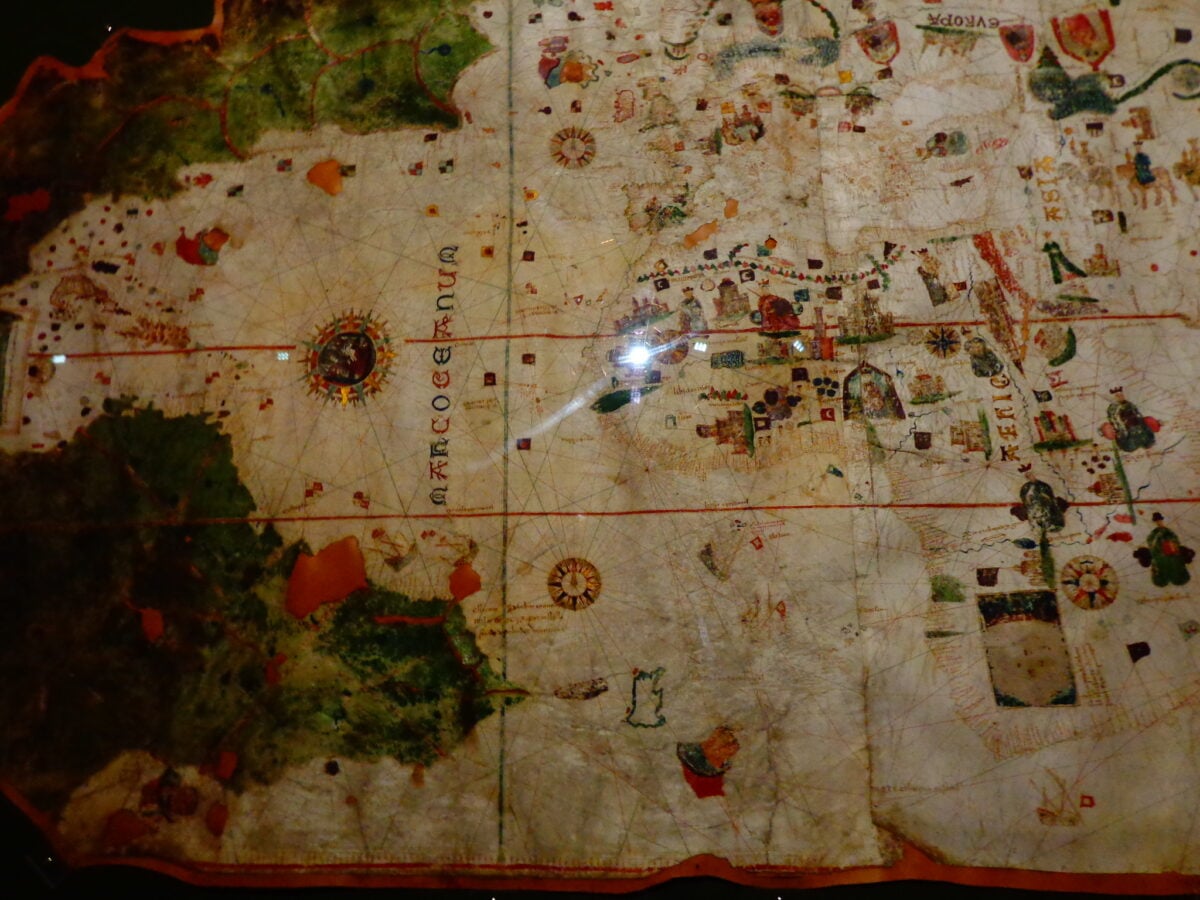
Catalan Atlas
Crafted in 1375 by Abraham Cresques for the King of Aragon, this six-panel masterpiece combined portolan chart accuracy with decorative medieval style. It showed trade routes across Asia, included a depiction of Marco Polo’s travels, and featured detailed information about African kingdoms.
The Catalan Atlas was one of the first European maps to incorporate knowledge from both Islamic and Asian sources, making it a truly multicultural document.
Gangnido Map
Korea’s Gangnido map from 1402 offers a fascinating non-European perspective on world geography. It placed China at the center, depicted Korea significantly larger than its actual size, and showed a recognizable outline of Africa centuries before European explorers would fully chart it.
The map demonstrates that detailed geographical knowledge existed in East Asia independent of European cartography.
Fra Mauro Map

Completed around 1450 by the Venetian monk Fra Mauro, this circular map measured over six feet in diameter and represented the culmination of medieval mapmaking. It incorporated information from Marco Polo’s travels, Portuguese explorations of Africa, and Arab geographical texts.
Fra Mauro even noted areas of uncertainty, showing an emerging scientific skepticism that would define later cartography.
Juan de la Cosa Map
In 1500, Juan de la Cosa created the first known map to show the Americas after Columbus’s voyages. As a navigator who had sailed with Columbus, de la Cosa had firsthand knowledge of the Caribbean and South American coasts.
His map also depicted the discoveries of other explorers like John Cabot, making it the first document to combine multiple European explorations of the New World into a single comprehensive view.
Cantino Planisphere
This 1502 Portuguese map was essentially an act of espionage—Italian agent Alberto Cantino smuggled it out of Portugal to his employer, the Duke of Ferrara. The map revealed Portuguese discoveries along the African coast, showed the newly discovered Brazil, and included the line of demarcation from the Treaty of Tordesillas that divided the world between Spain and Portugal.
Its level of detail about Africa and India demonstrated just how far Portuguese explorers had ventured.
Waldseemüller Map
Martin Waldseemüller’s 1507 map made history by being the first to use the name ‘America’ for the New World, honoring explorer Amerigo Vespucci. The map depicted the Americas as separate continents distinct from Asia, a radical idea at the time when many still believed Columbus had reached the East Indies.
Only one copy of the original 1,000 printed maps survives today, and the Library of Congress purchased it for $10 million in 2003.
Piri Reis Map
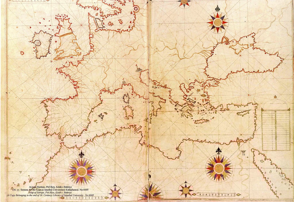
Turkish admiral and cartographer Piri Reis created this 1513 map by compiling information from about twenty different sources, including maps captured from Columbus’s crew. The map showed remarkably accurate coastlines of South America and Africa, and it sparked endless speculation because it appears to show geographical features that Europeans supposedly hadn’t discovered yet.
Whether through lucky guessing or access to lost sources, Piri Reis created one of the most intriguing cartographic documents of the Renaissance.
Mercator Projection
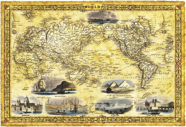
Gerardus Mercator revolutionized navigation in 1569 with his cylindrical map projection that maintained constant compass bearings as straight lines. Sailors could plot a course by drawing a straight line between two points, making ocean navigation dramatically simpler.
The Mercator projection became so dominant that it’s still used today, though it famously distorts the size of landmasses near the poles—Greenland looks enormous compared to Africa, even though Africa is actually fourteen times larger.
Theatrum Orbis Terrarum
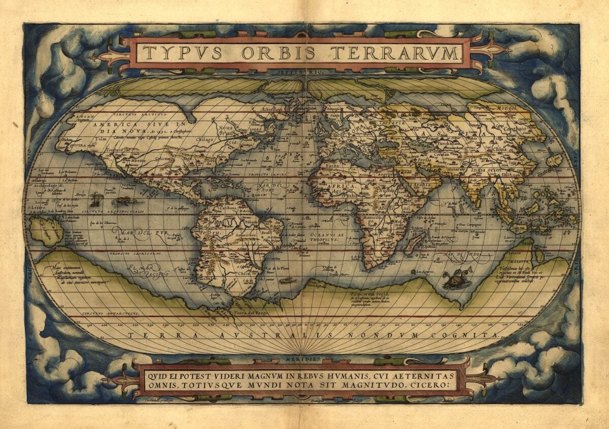
Abraham Ortelius published this atlas in 1570, and it’s considered the first modern atlas. Rather than being a single map, it compiled 53 maps of different regions into one bound volume with accompanying text.
Ortelius standardized map sizes and formats, making geographical information more accessible. The atlas went through 42 editions and was translated into seven languages, spreading standardized geographical knowledge across Europe.
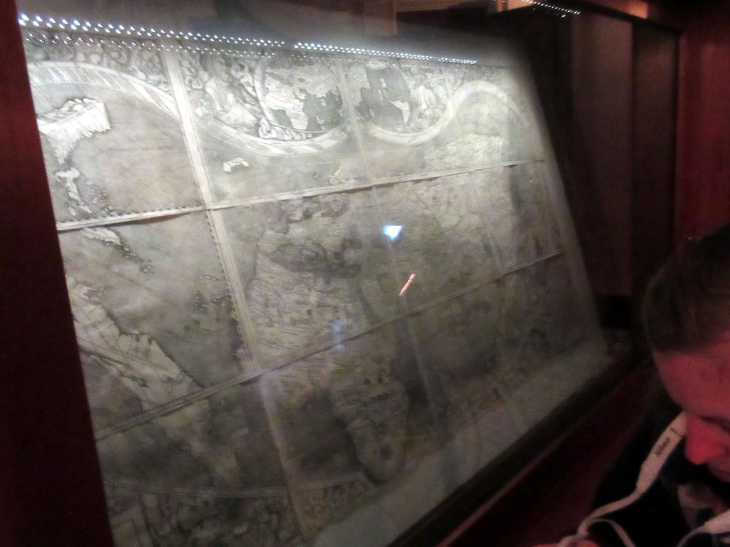
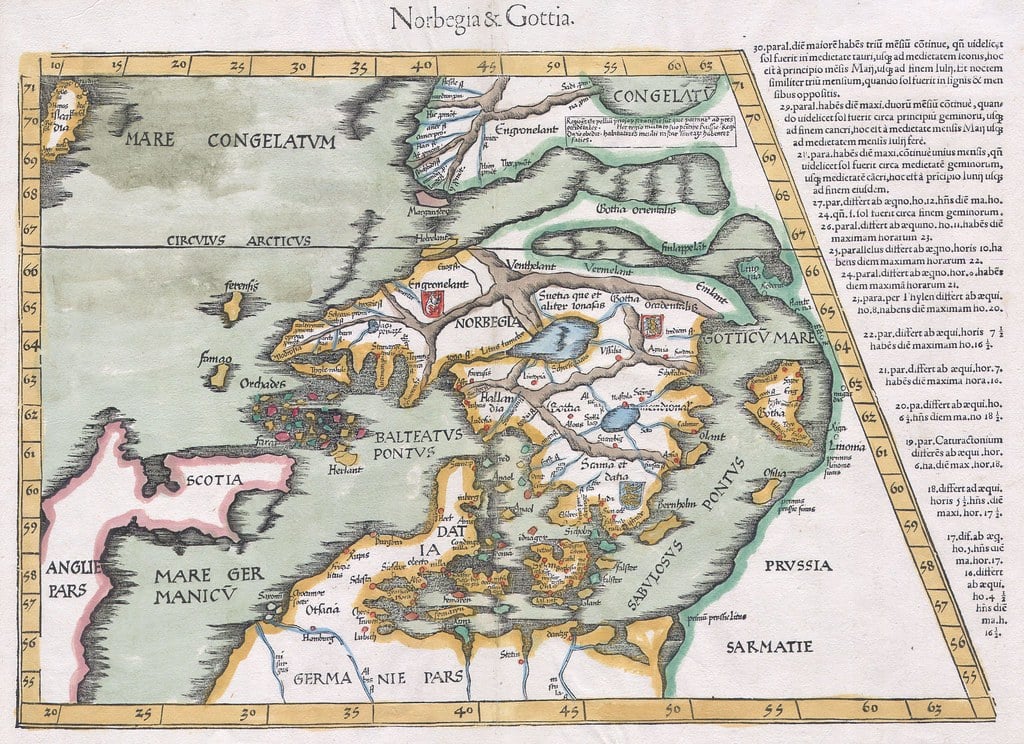
Carta Marina
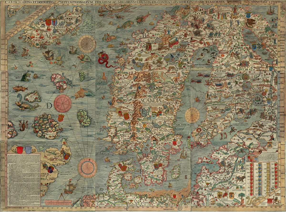
Created by Swedish ecclesiastic Olaus Magnus in 1539, this extraordinarily detailed map of Scandinavia depicted not just geography but also culture, wildlife, and maritime hazards. It showed whaling operations, military conflicts, and sea monsters that supposedly lurked in northern waters.
The Carta Marina remained the most accurate map of the Nordic countries for a century and provided crucial information for anyone attempting to navigate or understand the region.
Tabula Peutingeriana
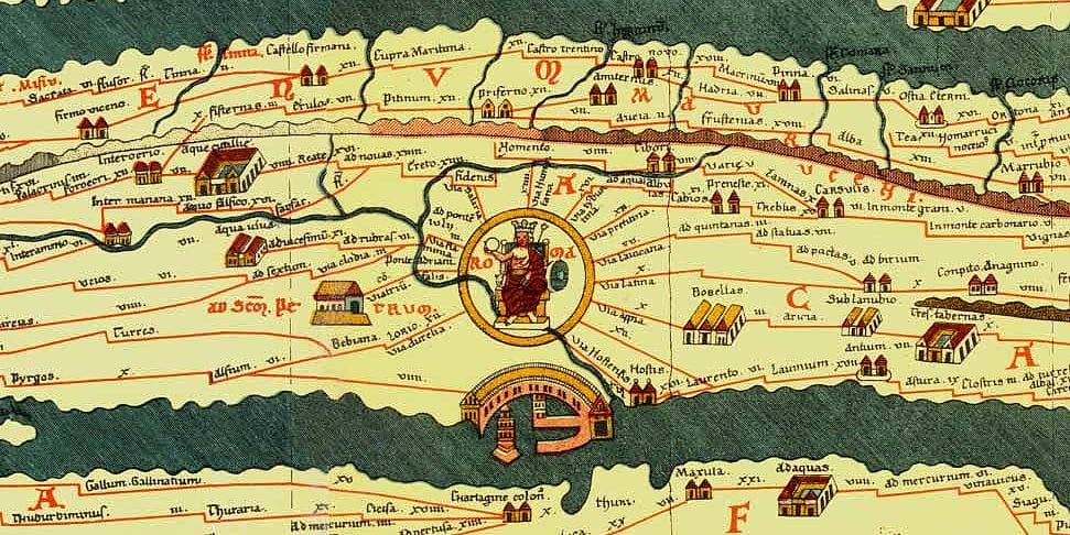
This Roman road map survived as a medieval copy of a 4th or 5th-century original, showing the road network spanning the Roman Empire from Britain to India. Stretched across nearly 23 feet in length but only about a foot tall, it distorted geography to emphasize routes and distances between cities.
For historians, it provides invaluable information about Roman infrastructure and how Romans conceptualized their vast empire.
Portolan Charts
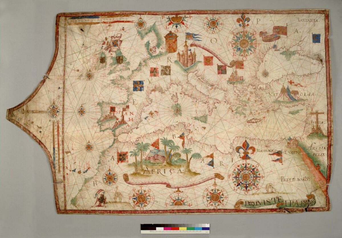
These nautical charts emerged in the 13th century and revolutionized Mediterranean navigation. Unlike earlier maps, portolan charts featured rhumb lines radiating from compass roses and remarkably accurate coastlines based on actual measurements from sailors.
They didn’t show the interior of continents but gave navigators precisely what they needed: accurate coastal outlines and bearing lines for plotting courses between ports.
Lewis and Clark Maps
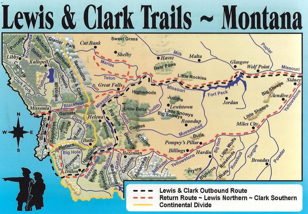
Between 1804 and 1806, Meriwether Lewis and William Clark led an expedition across the American West and created maps documenting their journey. Their charts filled in one of the last blank spaces on North American maps, showing the Rocky Mountains, rivers systems, and the route to the Pacific.
These maps influenced westward expansion and helped establish American territorial claims to the Pacific Northwest.
The Lines That Connected Worlds
These maps represent more than cartographic achievement—they’re evidence of humanity’s relentless drive to understand and explore. Each one built upon previous knowledge while adding new discoveries, creating an evolving picture of our planet.
The progression from religious worldviews to scientific accuracy mirrors our broader intellectual history. Today’s satellite imagery and digital mapping may seem light-years beyond these historic documents, but they’re all part of the same story of curiosity and discovery that began when someone first scratched a map into clay thousands of years ago.
More from Go2Tutors!

- The Romanov Crown Jewels and Their Tragic Fate
- 13 Historical Mysteries That Science Still Can’t Solve
- Famous Hoaxes That Fooled the World for Years
- 15 Child Stars with Tragic Adult Lives
- 16 Famous Jewelry Pieces in History
Like Go2Tutors’s content? Follow us on MSN.