Largest National Parks by Protected Land
Protected wilderness areas exist at scales that challenge comprehension. Some national parks span territories larger than entire countries, preserving ecosystems that might otherwise disappear under development pressure.
These vast reserves represent humanity’s occasional willingness to leave nature alone, to set aside land not for what it can produce but for what it already is.
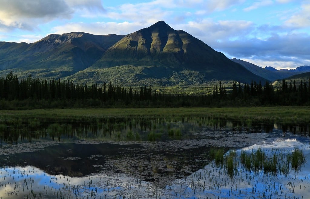
Northeast Greenland National Park
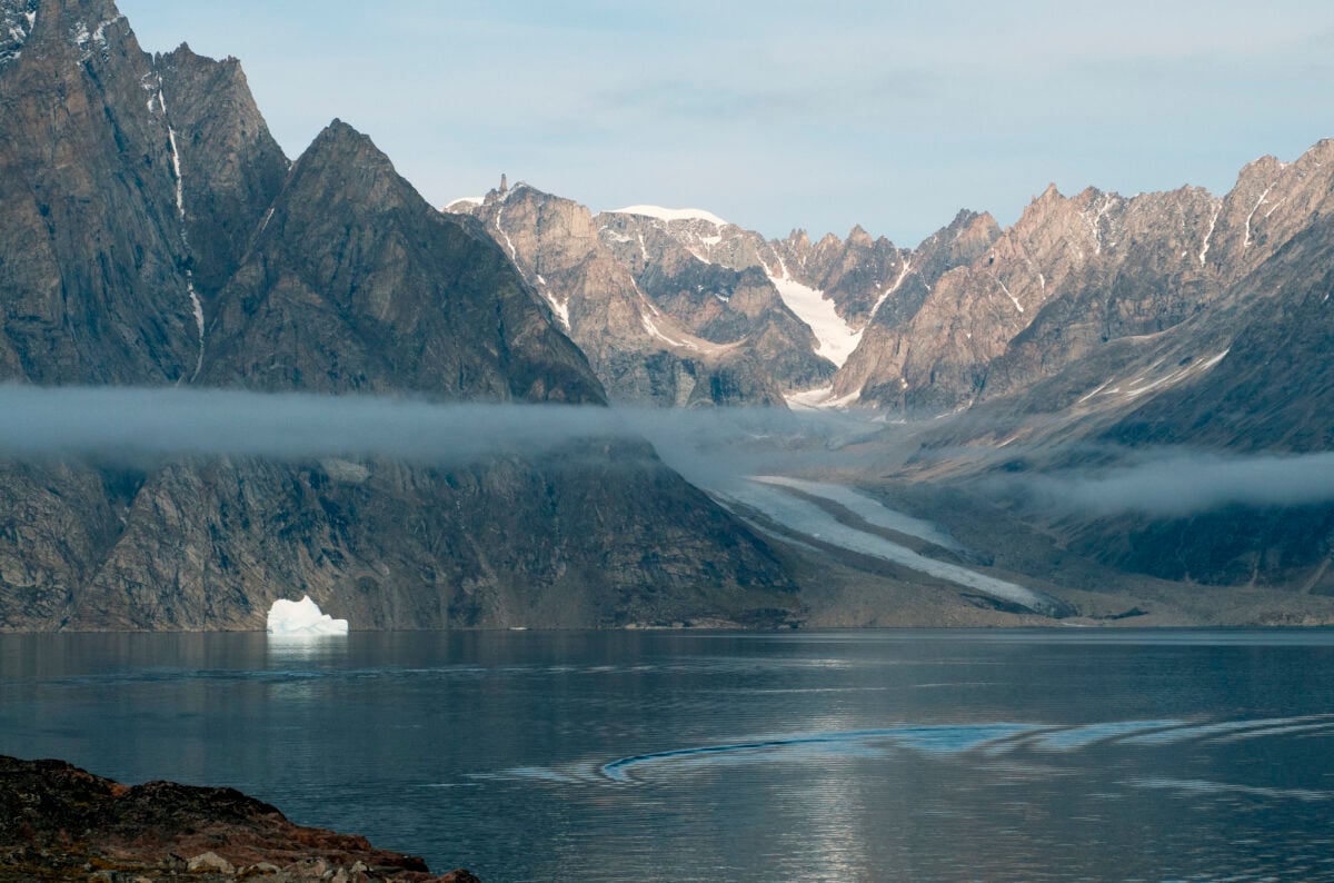
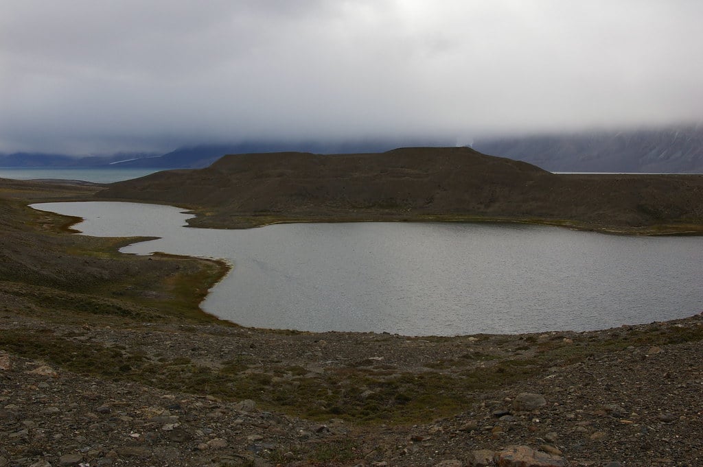
At 972,000 square kilometers, Northeast Greenland National Park dwarfs every other protected area on Earth. The park covers most of Greenland’s northeastern territory, stretching from the ice sheet interior to the Arctic Ocean coast.
To put that size in perspective, the park exceeds the land area of France and Germany combined. No permanent human population lives within the park boundaries.
A handful of research stations house scientists temporarily, and occasional military patrols monitor the remote coastline. Otherwise, the park belongs to polar bears, musk oxen, Arctic foxes, and various bird species adapted to extreme conditions.
The landscape alternates between massive ice formations and rare ice-free valleys where tough vegetation survives summer months. Temperatures stay brutally cold year-round, with winter lows dropping below minus 50 degrees Celsius.
The environment tests the limits of what complex life can endure on this planet. Climate change affects the park dramatically. Ice melts faster each decade, altering ecosystems that evolved over millennia.
Some scientists view the park as a preview of what Arctic regions will experience as global temperatures rise. The changes happening there forecast what’s coming elsewhere, though most of humanity pays little attention to such distant warnings.
Access requires special permits and significant resources. You can’t simply decide to visit Northeast Greenland National Park.
The logistics of reaching it, surviving in it, and leaving it safely limit visitors to organized scientific expeditions and adventure tourists with substantial budgets and Arctic experience.
Kavango-Zambezi Transfrontier Conservation Area
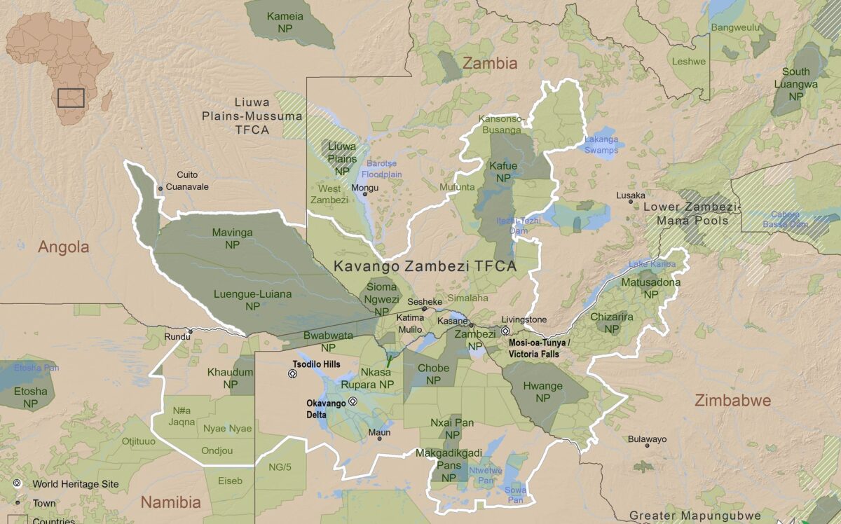
Spanning 520,000 square kilometers across Angola, Botswana, Namibia, Zambia, and Zimbabwe, KAZA represents the world’s largest land-based transboundary conservation area. The name comes from the Kavango and Zambezi rivers that flow through the region, providing water that sustains one of Africa’s most important wildlife populations.
The creation of KAZA required unprecedented cooperation between five countries with different political systems, languages, and conservation priorities. The 2011 treaty establishing the conservation area allowed wildlife to migrate freely across borders that previously fragmented their natural ranges.
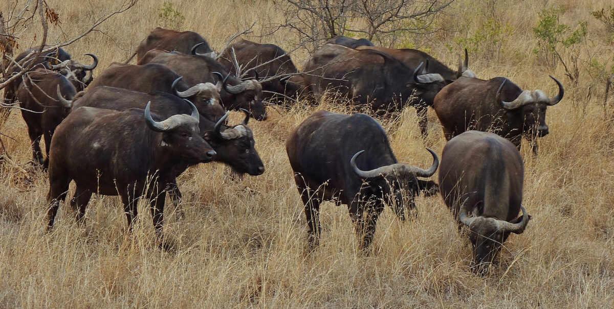
Elephants, lions, buffalo, and other species now follow seasonal patterns without encountering fences and checkpoints. Over 200,000 elephants live within KAZA boundaries, representing roughly half of Africa’s remaining savanna elephant population.
The conservation area protects critical migration corridors between the wet season and dry season ranges. Without these corridors, elephant populations would concentrate in smaller areas, causing overgrazing and ecosystem damage.
Victoria Falls sits within KAZA, drawing tourists whose spending helps fund conservation efforts. The economic argument for protecting wildlife often succeeds where purely environmental arguments fail.
When local communities benefit financially from protected areas, they’re more likely to support conservation rather than viewing it as an obstacle to development. Human-wildlife conflict presents ongoing challenges.
Elephants raid crops, predators kill livestock, and dangerous animals occasionally attack people. KAZA’s management structure attempts to address these conflicts through compensation programs and community involvement, but tensions persist between conservation goals and local residents’ immediate needs.
Papahānaumokuākea Marine National Monument
This marine protected area covers 1.5 million square kilometers of ocean northwest of the main Hawaiian Islands. Papahānaumokuākea protects coral reefs, seamounts, and deep ocean habitats supporting over 7,000 species, a quarter of them found nowhere else on Earth.
The Northwestern Hawaiian Islands create the physical foundation for the monument. These islands and atolls represent the older end of the Hawaiian volcanic chain, formed millions of years before the Big Island and gradually eroding back into the ocean.
The process creates unique habitats as volcanic rock transforms into coral atolls, supporting specialized species at each stage. Native Hawaiian culture considers the area sacred. The name Papahānaumokuākea comes from Hawaiian cosmology—Papa and Wākea, the earth mother and sky father who created the Hawaiian Islands.
The designation as a protected area acknowledges both ecological and cultural significance, recognizing that these dimensions can’t be separated cleanly. Fishing prohibitions within the monument allow fish populations to recover.
Protected areas function as refuges where fish grow larger and reproduce more successfully than in fished areas. Some of these fish eventually move outside the monument boundaries, supporting fisheries in surrounding waters through a spillover effect.
Climate change threatens the monument’s coral reefs. Warming ocean temperatures cause coral bleaching events that kill or weaken coral colonies.
The northwestern reefs experience less direct human impact than populated areas, which might help them survive environmental stresses better. But no reef system anywhere remains entirely safe from climate impacts.
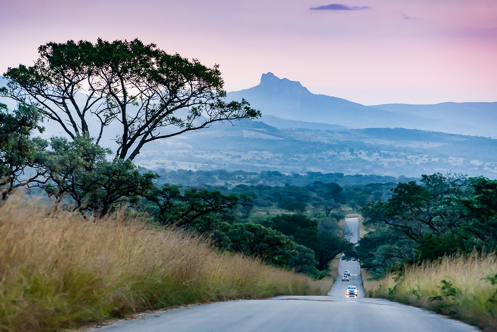
Great Limpopo Transfrontier Park
Southern Africa’s Great Limpopo Transfrontier Park links protected areas in Mozambique, South Africa, and Zimbabwe across 37,572 square kilometers. Kruger National Park in South Africa forms the core, with additional areas in Mozambique’s Limpopo National Park and Zimbabwe’s Gonarezhou National Park.
The transfrontier concept allows animals to access habitats across borders that civil wars and political divisions had previously cut off. Elephants that once confined themselves to Kruger’s boundaries now move into Mozambique’s less crowded terrain.
This expansion reduces population density pressures while giving animals access to resources unavailable in a single park. Mozambique’s portion of the park suffered severe impacts during the country’s civil war from 1977 to 1992.
Wildlife populations collapsed as soldiers hunted for food and poachers killed elephants for ivory to fund weapons purchases. Recovery required decades of restocking animals from South Africa and intensive anti-poaching efforts.
Kruger National Park alone attracts over a million visitors annually, making it South Africa’s premier wildlife destination. The park offers everything from budget camping to luxury lodges, democratizing access to African wildlife experiences beyond what exclusive private reserves provide.
That accessibility serves conservation by creating broad public support for protecting wild spaces.
Quttinirpaaq National Park
Canada’s northernmost national park covers 37,775 square kilometers on Ellesmere Island in Nunavut. Quttinirpaaq means “top of the world” in Inuktitut, which accurately describes its location just 720 kilometers from the North Pole.
The park protects Arctic desert, glaciers, and ice caps in conditions that make Antarctica seem almost welcoming by comparison. Fewer than 100 people visit Quttinirpaaq annually.
Getting there requires flying to Resolute Bay, then chartering another flight to the park, which costs thousands of dollars before you even arrive. Once there, you’re entirely self-sufficient in an environment where mistakes prove fatal quickly.
The park maintains no facilities, no trails, and no emergency services. Summer temperatures occasionally reach 10 degrees Celsius, which counts as warm in this environment.
Most of the year sees temperatures well below freezing. The landscape remains snow-covered even during the 24-hour daylight of Arctic summer.
Plants grow low to the ground, and only the hardiest species survive at all. Musk oxen, Arctic hares, and Arctic wolves live in the park year-round.
These animals evolved specific adaptations for extreme cold and food scarcity. Their survival demonstrates nature’s remarkable ability to colonize even the most inhospitable environments Earth offers, though climate change now challenges adaptations that developed over millions of years.
Namib-Naukluft National Park
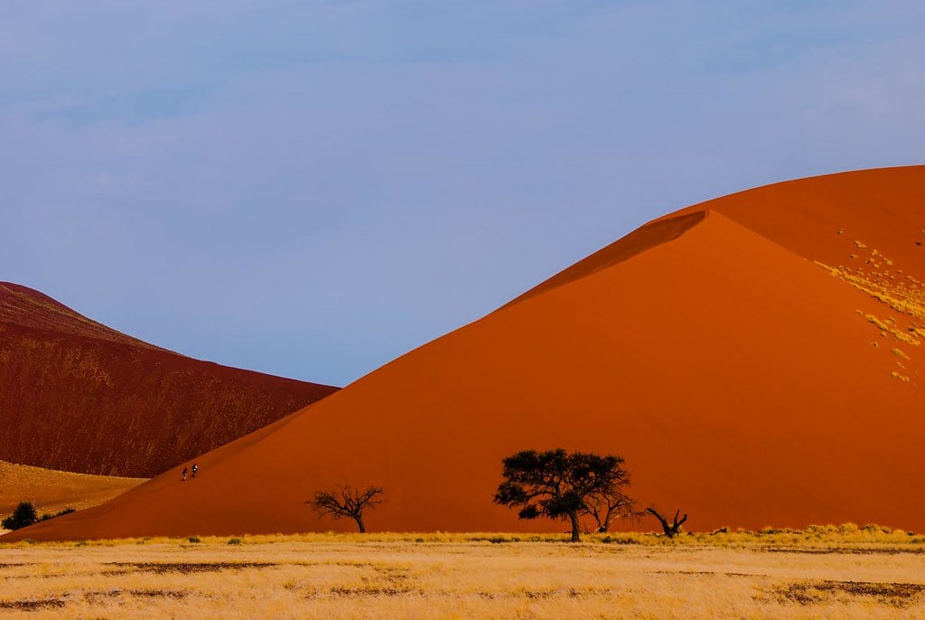
Namibia’s largest park encompasses 49,768 square kilometers of desert landscape along the Atlantic coast. The Namib Desert, which gives the park its name, claims status as the world’s oldest desert with arid conditions persisting for at least 55 million years.
That immense age allowed unique species to evolve, found nowhere else on Earth. The landscape presents extraordinary visual drama.
Massive red sand dunes rise over 300 meters high, among the tallest dunes anywhere. The dunes meet the ocean at the Skeleton Coast, where fog rolls inland most mornings.
Desert-adapted animals and plants harvest water from this fog, demonstrating evolution’s creative solutions to survival challenges. Sossusvlei, a clay pan surrounded by towering dunes, attracts photographers from around the world.
The contrast between white clay, red dunes, and blue sky creates compositions that look almost artificial in their color saturation. Dead camel thorn trees stand in the pan, preserved by the dry conditions for hundreds of years, creating surreal scenes of long-dead forests in the desert.
Wildlife includes desert-adapted elephants, black rhinoceros, oryx, and springbok. These animals survive conditions that would kill typical savanna species.
The elephants, for instance, can go days without drinking and know every water source across hundreds of kilometers of territory. That knowledge passes between generations, making each elephant population a repository of survival information accumulated over centuries.
Wood Buffalo National Park
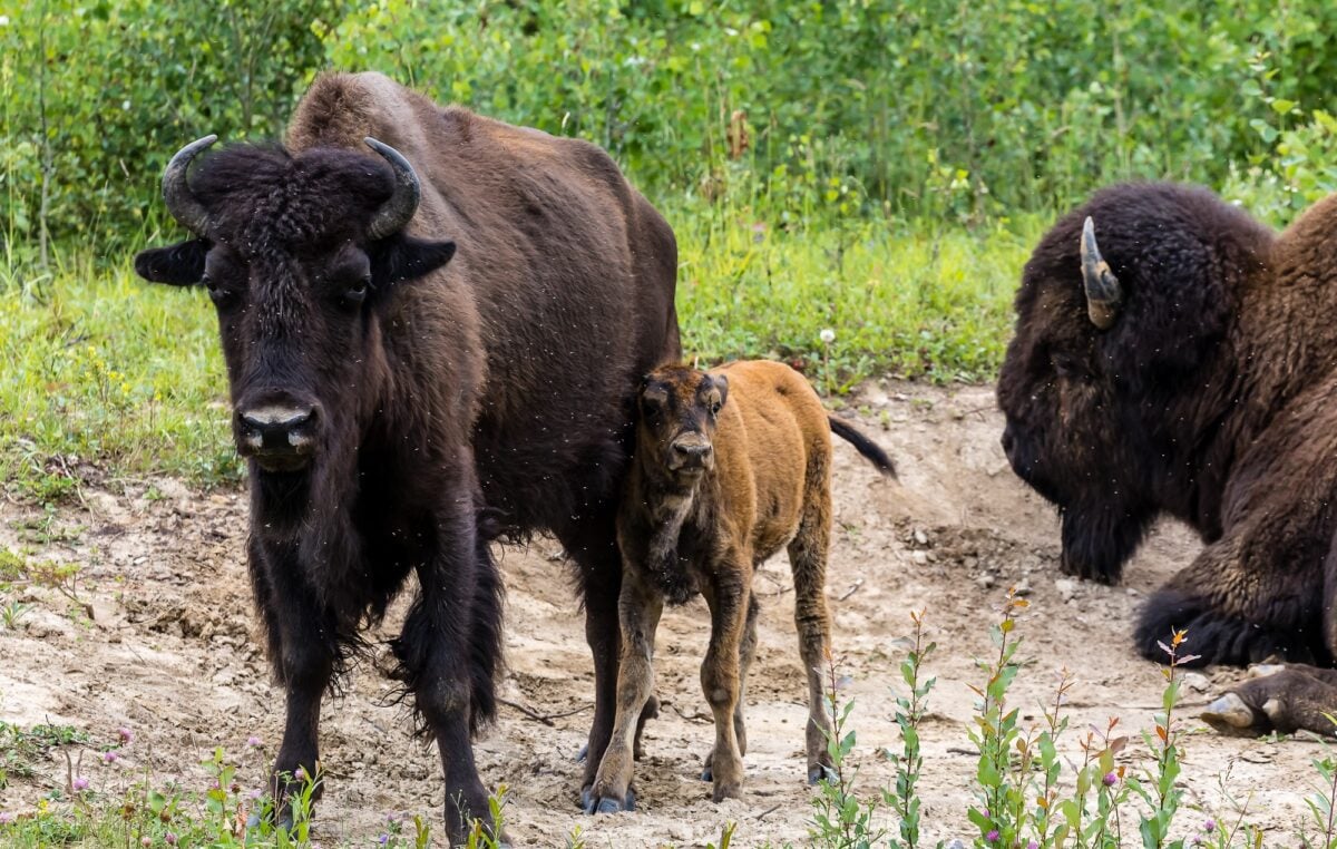
Canada’s largest national park spans 44,741 square kilometers across Alberta and the Northwest Territories. The park protects the last remaining natural habitat where wood bison, North America’s largest land mammal, roam freely.
These massive animals stand nearly two meters tall at the shoulder and can weigh almost a ton. The park sits at the intersection of boreal forest and northern prairie, creating a diverse habitat that supports not just bison but wolves, black bears, and one of the world’s largest free-roaming populations of wood bison descendants.
The ecosystem functions much as it did before European contact, which makes Wood Buffalo scientifically valuable for understanding pre-industrial North American ecology. Whooping cranes, among the world’s rarest birds, breed exclusively in Wood Buffalo National Park.
The entire wild population nests in remote wetlands within park boundaries. Protection of this breeding habitat helped the species recover from just 15 individuals in 1941 to several hundred today.
That success story demonstrates how protected areas can prevent extinction when implemented before populations collapse completely. The park’s Peace-Athabasca Delta represents one of the world’s largest inland freshwater deltas.
Water levels fluctuate dramatically between seasons, creating dynamic wetland habitats that support millions of migratory birds. The delta’s ecological importance extends far beyond the park boundaries, as birds breeding there disperse across the Americas.
Death Valley National Park
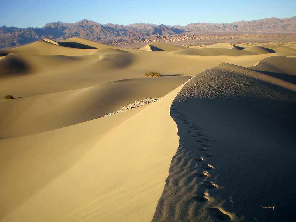
California’s Death Valley protects 13,650 square kilometers of extreme desert landscape. The name reflects the harsh reality of this environment—summer temperatures regularly exceed 50 degrees Celsius, making it one of the hottest places on Earth.
Badwater Basin sits 86 meters below sea level, the lowest point in North America. The landscape appears lifeless at first glance, but over 1,000 plant species grow in Death Valley.
They survive through various adaptations: deep roots reaching underground water, seeds that germinate only after rare rain events, and dormancy strategies that allow years of waiting for suitable conditions. These plants demonstrate that life finds ways to persist even in seemingly impossible environments.
Gold and silver mining scarred parts of Death Valley during the 19th century. Ghost towns dot the landscape, abandoned when ore deposits played out or water sources dried up.
These remnants remind visitors that the desert defeated most human attempts to profit from it, though modern tourism proves more sustainable than extraction industries ever managed. Spring wildflower blooms transform Death Valley when winter rains arrive.
The timing and location vary unpredictably, requiring luck and local knowledge to witness. In good years, hillsides explode with color—yellow, purple, pink, and orange flowers covering ground that looks barren the rest of the year.
These displays attract thousands of visitors who flood the park for a few brief weeks.
Wrangell-St. Elias National Park
Alaska’s Wrangell-Saints. Elias covers 53,321 square kilometers, making it America’s largest national park. The park contains North America’s largest concentration of peaks above 4,900 meters, including Mount Saint Elias at 5,489 meters.
Massive glaciers flow between these peaks, creating landscapes that look more like they belong in polar regions than temperate zones. The park’s size exceeds six Yellowstones or Switzerland, yet fewer than 80,000 people visit annually.
The remoteness keeps crowds minimal. Most of the park remains wilderness without trails, roads, or facilities.
You can hike for days without seeing another person or any sign of human presence beyond occasional aircraft overhead. Wildlife includes grizzly bears, Dall sheep, caribou, and one of North America’s healthiest populations of mountain goats.
The varied terrain from coastal rainforest to alpine tundra supports diverse species. Predator-prey relationships function naturally without human management, allowing visitors to witness ecological processes that disappeared from most of North America centuries ago.
Mining history runs deep in Wrangell-St. Elias. The Kennecott Mines operated from 1911 to 1938, extracting copper ore from deposits discovered by prospectors who followed rumors of green mountains—copper-rich rock staining the landscape.
The abandoned mine buildings now stand as historical monuments, preserved by cold dry conditions that slow decay to almost nothing.
Kruger National Park
South Africa’s flagship park covers 19,485 square kilometers, roughly the size of Wales. Kruger represents Africa’s wildlife experiences in the popular imagination—elephants at waterholes, lions lounging in shade, leopards in trees, and endless herds of antelope stretching to horizons.
The park’s establishment in 1898 came partly from conservation concerns but also from colonial attitudes about separating humans from wildlife. Indigenous peoples who lived in the area for thousands of years faced forced removal.
That history complicates Kruger’s conservation success story. The wildlife survived, but at a high human cost that conservation narratives often minimize or ignore entirely.
Kruger maintains excellent infrastructure compared to most African parks. Paved roads connect rest camps offering accommodations from budget huts to luxury lodges.
This accessibility brings wildlife experiences to middle-class tourists who couldn’t afford exclusive private reserves. The fees fund park operations and justify the economic argument for conservation.
The park faces constant pressure from poaching, particularly for rhinoceros horn valued in traditional Asian medicine markets. Despite aggressive anti-poaching efforts including armed patrols and surveillance technology, poachers continue killing rhinos.
The economic incentives for poaching outweigh most deterrents in regions where poverty leaves few alternatives for earning substantial money.
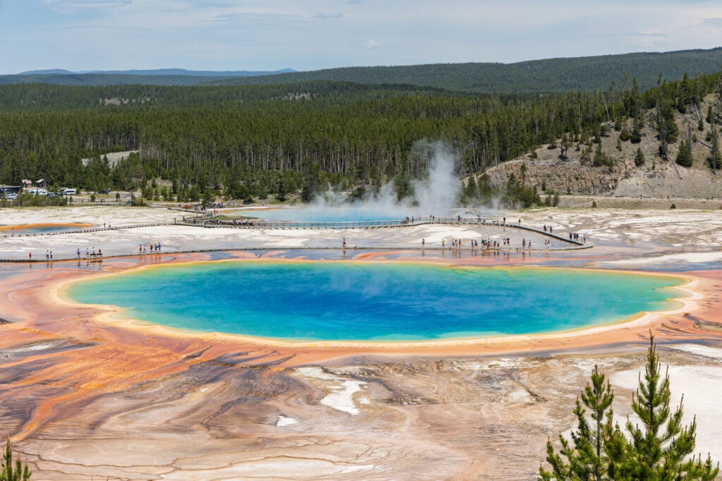
Yellowstone National Park
America’s first national park, established in 1872, covers 8,991 square kilometers across Wyoming, Montana, and Idaho. Yellowstone set the template for national parks worldwide.
The concept of preserving wilderness for public benefit rather than private profit represented a radical idea that gradually spread across the globe. Geothermal features make Yellowstone unique among protected areas.
Over 10,000 geysers, hot springs, mud pots, and fumaroles dot the landscape, representing over half of the world’s geothermal features. Old Faithful geyser erupts roughly every 90 minutes, providing a predictable natural spectacle that has attracted visitors for over a century.
The supervolcano beneath Yellowstone causes these geothermal features. The caldera measures 55 by 72 kilometers, filled with magma that heats groundwater and drives the surface features.
The volcano erupts roughly every 600,000 years, and the last eruption occurred about 640,000 years ago. Scientists monitor seismic activity carefully, though predicting the next eruption remains impossible with current technology.
Wolf reintroduction in 1995 fundamentally changed Yellowstone’s ecology. Absent for 70 years, wolves returned and reduced elk populations in valleys where they’d overgrazed willows and aspen.
The trees recovered, which stabilized riverbanks and created habitat for beavers. The cascading effects demonstrated how apex predators structure entire ecosystems—remove the top predator and everything shifts in unexpected ways.
Kakadu National Park
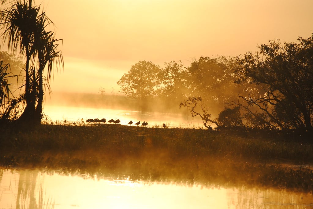
Australia’s largest national park protects 19,804 square kilometers in the Northern Territory. Kakadu contains ancient rock art, wetlands supporting millions of birds, and ecosystems transitioning between the tropical coast and the dry interior.
Aboriginal people have lived continuously in this landscape for at least 65,000 years, making their cultural connection to the land among the oldest on Earth. Rock art tells stories spanning millennia.
Some paintings depict extinct megafauna that disappeared over 40,000 years ago. Others show contact with Macassan traders from Indonesia who visited the coast for centuries before European arrival.
The art functions as a historical record, a spiritual expression, and a teaching tool, though outsiders understand only fragments of its full meaning. Seasonal changes transform Kakadu dramatically.
The wet season brings massive rainfall that floods lowlands and creates temporary wetlands. Millions of birds arrive to breed in these ephemeral habitats. The dry season concentrates wildlife around permanent water sources, making animal viewing easier.
These seasonal extremes require species to adapt to feast-or-famine cycles. Mining proposals threaten areas near Kakadu’s boundaries.
The Ranger uranium mine operated just outside the park until recently, leaving contamination concerns that persist decades after extraction stopped. The tension between economic development and conservation remains contentious in regions where mining provides employment and the protected area restricts resource access.
Galápagos National Park
Ecuador’s Galápagos Islands protect 7,995 square kilometers across 13 major islands and numerous smaller ones. Charles Darwin’s visit in 1835 provided observations that helped him develop evolutionary theory.
The islands’ isolation allowed species to evolve unique adaptations found nowhere else, making the archipelago irreplaceable for understanding how evolution works. Giant tortoises, the islands’ namesake species, live over 100 years and weigh up to 250 kilograms.
Different islands host distinct tortoise subspecies adapted to local conditions. Some have dome-shaped shells for grazing low vegetation, while others have saddle-shaped shells allowing neck extension to reach higher plants.
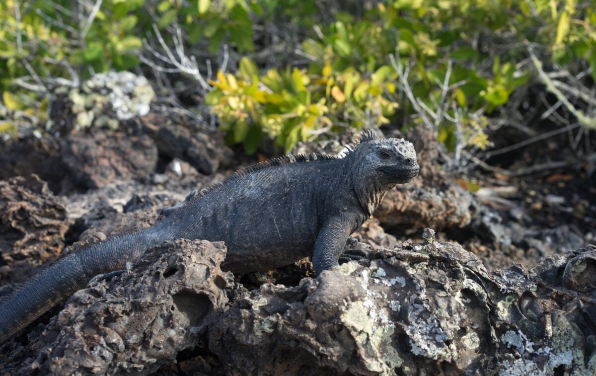
These variations demonstrate evolution responding to different environmental pressures on different islands. Marine iguanas represent the world’s only sea-going lizard.
These creatures evolved from land iguanas that colonized the islands, then adapted to eating algae underwater. They dive up to 30 meters deep and can hold their breath for nearly an hour.
Evolution solved the problem of no terrestrial food by creating a reptile that functions almost like a marine mammal. Tourism brings both benefits and threats to the Galápagos.
Visitor fees fund conservation, and economic benefits convince Ecuador to maintain protection. But tourist presence stresses the ecosystem.
Introduced species accidentally brought on ships and planes threaten native species. Balancing tourism revenue against ecological impact requires constant vigilance and sometimes unpopular restrictions on visitor numbers and activities.
Vatnajökull National Park
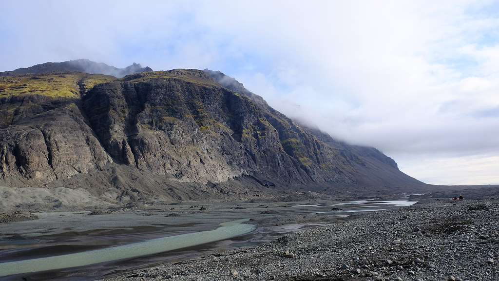
Iceland’s largest national park encompasses 14,967 square kilometers, roughly 14 percent of Iceland’s total land area. The park protects most of Vatnajökull glacier, Europe’s largest ice cap by volume.
The landscape combines glaciers, volcanoes, and waterfalls into a geology textbook come to life. Vatnajökull glacier covers eight active volcanic systems.
When volcanoes erupt beneath the ice, meltwater floods burst from the glacier’s edge with catastrophic force. These glacial outburst floods reshape the landscape in hours, moving boulders the size of houses and depositing sediment across vast outwash plains.
The combination of fire and ice creates uniquely dynamic environments. The park includes Dettifoss, Europe’s most powerful waterfall by volume.
Glacial meltwater plunges 44 meters over a 100-meter-wide cliff, creating a roar audible from kilometers away. The power of the water demonstrates the energy stored in glaciers—frozen water that eventually returns to rivers with force accumulated over centuries of snowfall.
Climate change shrinks Vatnajökull measurably each year. The glacier loses more ice during summer than winter snowfall replaces.
This pattern accelerated over recent decades. If current trends continue, the ice cap could disappear within a few centuries, fundamentally altering Iceland’s landscape and hydrology in ways that ripple through the entire ecosystem.
Where Boundaries Create Sanctuary
Wild spaces kept safe show we care about more than quick gains. Choosing to save wild places happened because someone saw worth in untouched land, despite cities bringing bigger paychecks.
Across years and faraway lands, these picks added up – quiet havens where nature runs on its own terms. Floods shift borders where trees once stood tall. Poachers slip through gaps when guards look away.
Outside plants choke native growth near riverbanks. Hungry families clear brush for firewood and crops.
Guarding these places takes more than promises on paper. Maps gather dust unless boots patrol muddy trails.
Data matters only if someone watches the changes. Quiet work holds each boundary in place.
Still, these spots remain, keeping room for raw life amid a tamed planet. Out here, people see clearly – they aren’t on top.
Great stretches stay ruled by wind, soil, and animal instinct. A deer walks past without noticing you; cliffs rise like ancient walls – suddenly, your size feels different.
This shift matters most when deciding to shield such areas. Not because they serve us.
Because they survive us.
More from Go2Tutors!

- The Romanov Crown Jewels and Their Tragic Fate
- 13 Historical Mysteries That Science Still Can’t Solve
- Famous Hoaxes That Fooled the World for Years
- 15 Child Stars with Tragic Adult Lives
- 16 Famous Jewelry Pieces in History
Like Go2Tutors’s content? Follow us on MSN.