Most Confusing Borders Ever
When you think about borders between countries, you probably imagine a simple line on a map. Maybe there’s a fence, a river, or a sign that says ‘Welcome to Canada’ or something like that.
But some borders around the world are so weird and complicated that even the people who live there get confused about which country they’re actually in.
Ready to see just how strange international boundaries can get? Let’s jump into some of the most head-scratching borders on the planet.
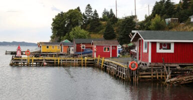
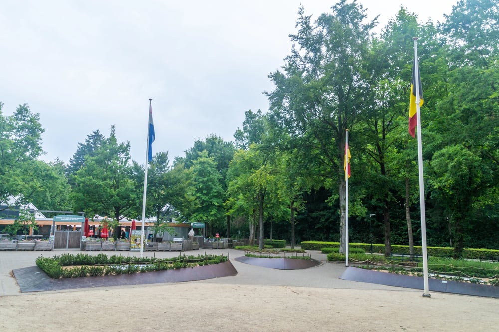
Baarle-Nassau and Baarle-Hertog
The border between Belgium and the Netherlands gets really strange in two small towns that basically share the same space. Baarle-Nassau belongs to the Netherlands while Baarle-Hertog is part of Belgium, but they’re completely mixed together like a puzzle.
There are 30 separate pieces of Belgium inside the Netherlands, and some of those Belgian pieces even have tiny Dutch pieces inside them. People’s houses can be split between two countries, and the rule is that whichever country your front door opens into is the one you officially live in.
Restaurants sometimes have lines painted on their floors showing where one country ends and another begins.
The Gambia
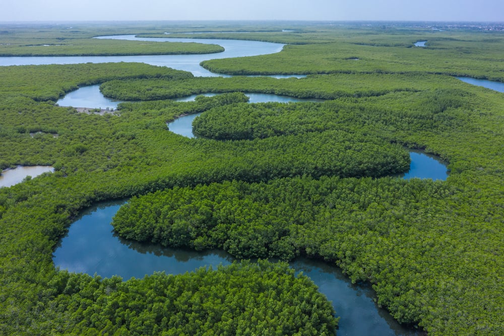
This tiny African country looks like someone took a ruler and drew a line along the Gambia River, then colored it in as a separate nation. The Gambia is completely surrounded by Senegal except for its short Atlantic coastline, making it one of the most unusual country shapes in the world.
It’s only about 30 miles wide at most points but stretches inland for about 200 miles. The border exists because British colonizers controlled the river while France controlled the land around it, and when independence came, this weird shape just stuck.
Point Roberts, Washington
This small piece of American land can only be reached by car if you drive through Canada first. Point Roberts sits below the 49th parallel, which marks most of the US-Canada border, but it dangles off the bottom of Canadian territory.
The 1,300 people who live there have to cross international borders twice just to reach the rest of their own country. Kids growing up there attend school in Canada because it’s closer, and everyone needs a passport just to buy groceries in the main part of Washington state.
Cooch Behar enclaves
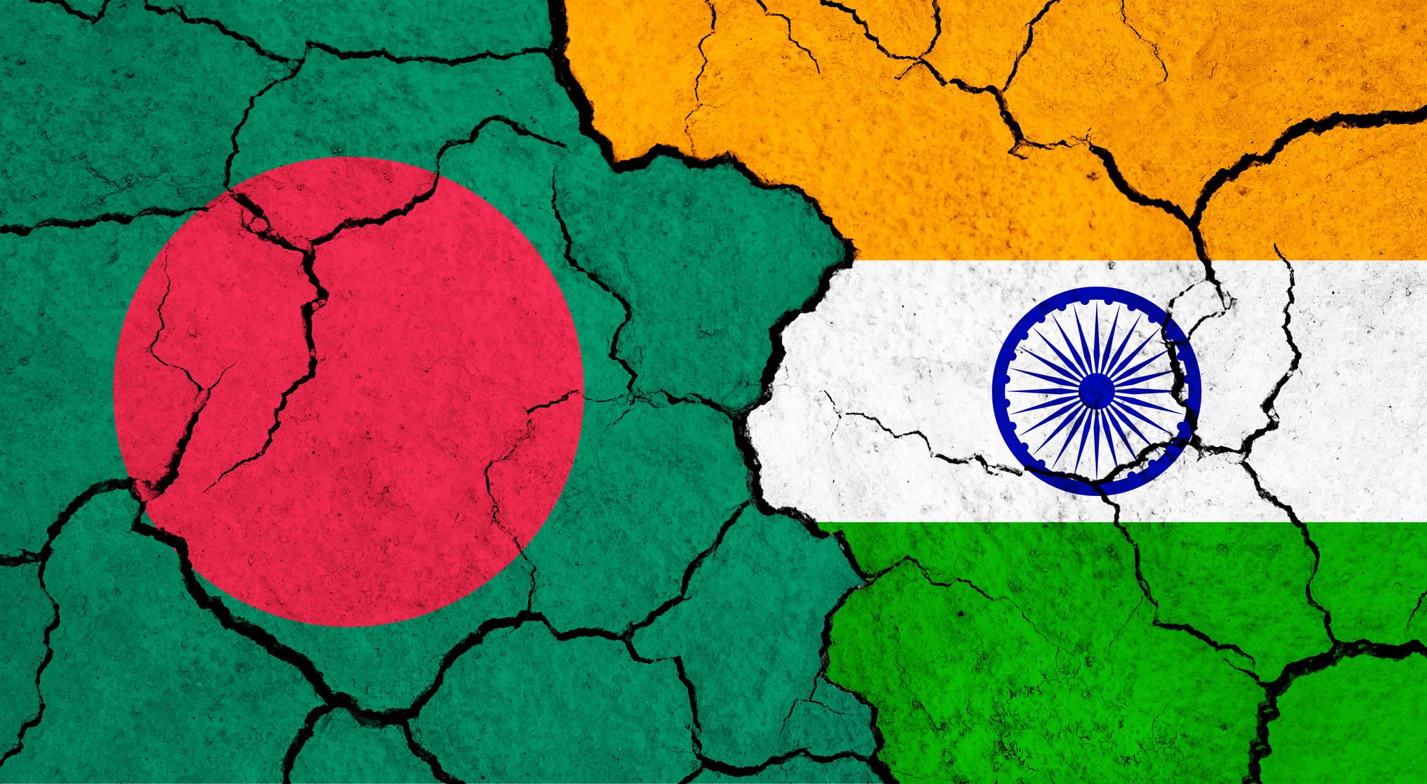
India and Bangladesh used to have the most ridiculous border situation ever recorded, with 198 separate enclaves scattered between the two countries. Some Indian villages were completely surrounded by Bangladesh, which was itself surrounded by India.
There were even enclaves within enclaves within enclaves, going three levels deep. People living in these areas couldn’t access basic services from either government and were basically stuck in administrative limbo.
Thankfully, both countries signed a deal in 2015 to swap territories and fix this mess.
Pheasant Island
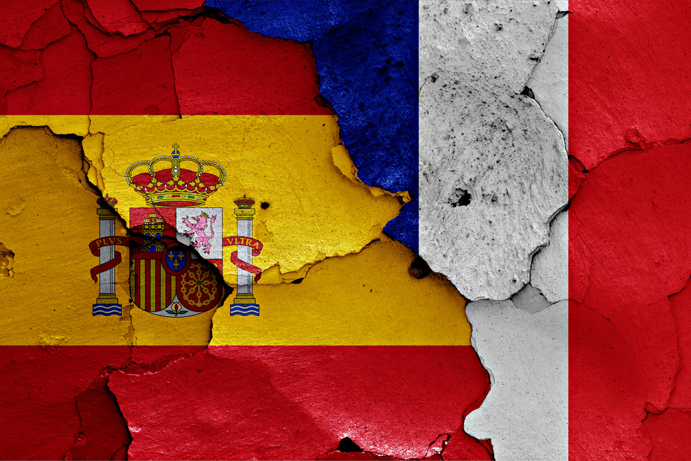
This tiny island in a river between Spain and France changes countries every six months like clockwork. For half the year it belongs to Spain, then it switches to France, then back again.
This bizarre arrangement has been going on since 1659 when the two countries signed a peace treaty there. The island is only about 200 feet long and completely uninhabited except for some birds.
Both countries technically share sovereignty, but they take turns being in charge through this strange time-share system.
Bir Tawil
Here’s a piece of land that neither Egypt nor Sudan wants to claim, which is basically unheard of in international relations. The confusion comes from two different border definitions from the colonial era that contradict each other.
Each country claims the definition that gives them more valuable territory elsewhere, which means both reject Bir Tawil. This 800-square-mile patch of desert sits unclaimed by any nation, making it one of the only places on Earth with no government.
A few random people have tried to claim it as their own kingdom, but no other country recognizes these attempts.
Hans Island
Canada and Denmark spent decades in the friendliest territorial dispute imaginable over this tiny rock between Greenland and Ellesmere Island. Military teams from each country would visit the island, take down the other nation’s flag, plant their own, and leave a bottle of alcohol as a calling card.
Canadians left whisky while Danes left schnapps, and this went back and forth for years. In 2022, both countries finally agreed to split the island down the middle, creating the only land border between Canada and Europe.
The Belgian-German border at Vennbahn
A railway line built in the 1800s created one of Europe’s strangest borders when it passed through this region. Germany gave Belgium the railroad and a strip of land it runs on, but this cut off five small pieces of Germany from the rest of the country.
These German areas are completely surrounded by Belgium but still belong to Germany. The weirdest part is that the actual railway tracks count as Belgian territory, so you can stand in Germany, step over the tracks, and be in a different part of Germany with Belgium in between.
Campione d’Italia
This Italian town sits completely inside Switzerland, separated from the rest of Italy by a lake and mountains. It became a weird financial haven because it used Swiss currency and phone networks but followed Italian laws.
The casino there attracted Swiss visitors who could gamble without technically leaving their country’s neighborhood. Things got complicated when the European Union started cracking down on tax havens, and now the town struggles with its split identity.
Residents can work in Switzerland without permits, but they still vote in Italian elections.
Tomb of Suleyman Shah
Turkey maintains a small piece of territory inside Syria that contains nothing but an old tomb and the soldiers who guard it. This 25-acre plot is officially Turkish soil even though it’s about 17 miles from the actual border.
When the Syrian civil war got too close, Turkey actually moved the tomb and its guards to a different location in 2015. The new spot is closer to the border but still technically Turkish territory inside Syria.
Both countries have agreed to this arrangement through various treaties over the years.
The Northwest Angle
Minnesota has a chunk of land that juts up into Canada, making it impossible to reach from the rest of the state without crossing the border. This happened because mapmakers in the 1700s thought a particular river went in a different direction than it actually does.
About 120 people live in the Northwest Angle year-round, and they have to report to Canadian customs and then US customs every time they want to visit the rest of Minnesota. The area is popular with fishermen who don’t mind the hassle of crossing borders twice.
Sastavci village
This Serbian village got split down the middle when Yugoslavia broke apart and new countries formed. One half became part of Croatia while the other stayed in Serbia, cutting the community right in two.
Families found themselves on opposite sides of an international border overnight. People who had walked across the street to visit neighbors now needed passports.
The border cuts through farms, and some residents own fields they can’t legally access without going through border control.
Neum corridor
Bosnia and Herzegovina has a tiny strip of coastline that cuts Croatia into two pieces along the Adriatic Sea. This 12-mile stretch is the country’s only access to the sea, making it incredibly valuable despite its small size.
Croatia built a bridge over the corridor in 2022 to connect its two parts without having to cross the Bosnian border. Before the bridge, Croatians driving along the coast had to go through passport control twice to stay in their own country.
The corridor exists because of territorial deals made centuries ago under the Ottoman Empire.
Chagos Archipelago
Britain and Mauritius both claim these islands in the Indian Ocean, creating a sovereignty dispute that’s lasted decades. The UK separated the islands from Mauritius before granting independence, then leased the biggest island to the United States for a military base.
The original inhabitants were forced to leave and have been fighting to return ever since. International courts have sided with Mauritius, but Britain still administers the territory.
The confusion over who actually owns these islands affects everything from fishing rights to military operations.
Walvis Bay
This coastal town in South Africa sat encircled by Namibia, a leftover quirk from colonial times. Independence came to Namibia, yet South Africa held onto the harbor – its location too vital to let go.
A strip of shore and the city became an island within a nation. People lived under South African rule, though every direction they looked led into Namibia.
Only in 1994 did South Africa hand over authority, closing the chapter.
Madha and Nahwa
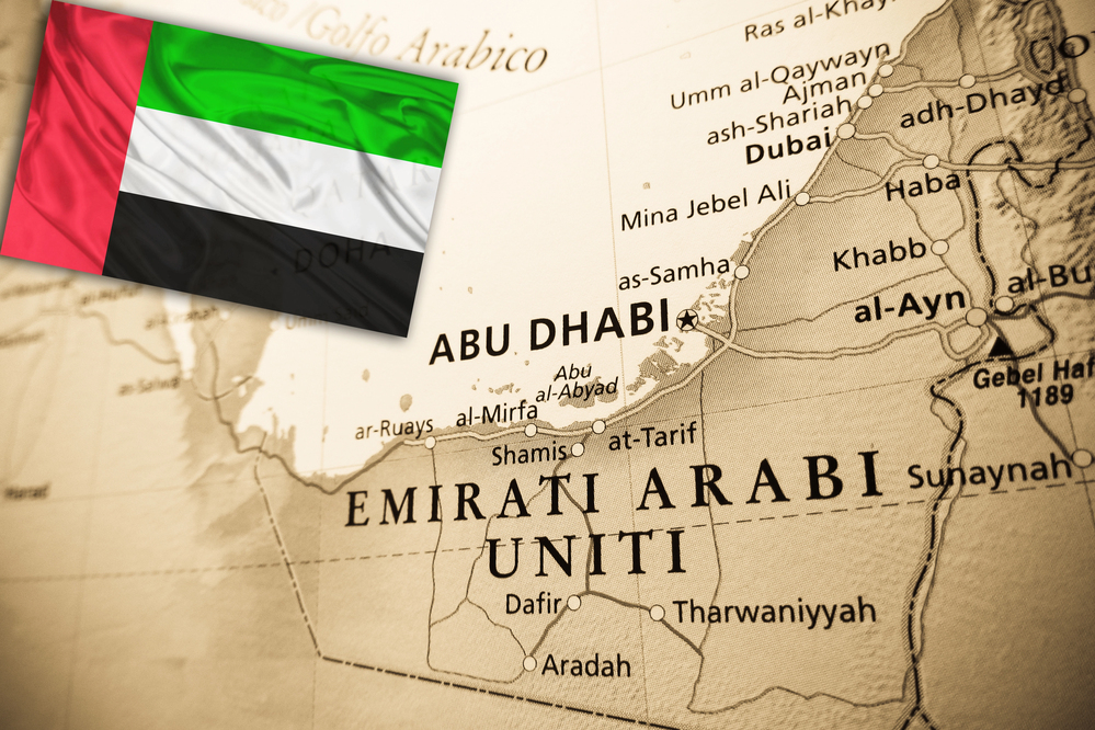
A chunk of Oman – Madha – is tucked into the United Arab Emirates like a stone in someone else’s pocket. Inside that Omani patch lies Nahwa, a small village tied to the UAE once more.
This creates layers: Emirati land, then Omani ground, followed again by Emirati space – all packed tight across just kilometers. Residents of Nahwa wake up enclosed by foreign soil which itself is wrapped in their homeland.
These lines on the map trace back to tribal zones shaped long before oil changed everything and countries drew neat edges.
When lines on maps create chaos in real life
Strange lines on maps show how messy real life can be. Drawn long ago by distant rulers, old treaties, or simple errors, they now shape daily struggles for those nearby.
A few have found solutions; many still puzzle travelers, locals, and officials without clear answers. When you pass through an ordinary crossing with just a marker and booth, think – yours might have been tangled like the rest.
More from Go2Tutors!

- The Romanov Crown Jewels and Their Tragic Fate
- 13 Historical Mysteries That Science Still Can’t Solve
- Famous Hoaxes That Fooled the World for Years
- 15 Child Stars with Tragic Adult Lives
- 16 Famous Jewelry Pieces in History
Like Go2Tutors’s content? Follow us on MSN.