Most Impressive Waterways Ever Carved By Human Hands
There’s something almost arrogant about humans deciding to carve new paths for water. Rivers have spent millions of years finding their own way to the sea, yet here we are with shovels and dynamite, convinced we can do it better.
The thing is, sometimes we actually can. These artificial waterways didn’t just move water from point A to point B — they moved entire civilizations forward, connected continents, and turned impossible dreams into concrete reality.
Panama Canal
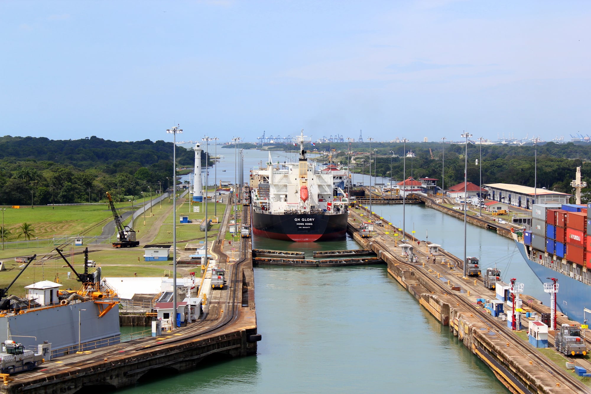
The Panama Canal reads like a fever dream someone had after staring at a map too long. Take the biggest ships in the world, lift them 85 feet above sea level using nothing but water and concrete chambers, then lower them back down on the other side of a mountain range — because walking around South America takes too long.
The engineering makes no logical sense until you see it working. Ships the size of city blocks glide into locks that fill and empty like bathtubs, except these bathtubs move 52 million gallons of water in 15 minutes.
The Culebra Cut, where they essentially moved an entire mountain one shovelful at a time, still looks like something that shouldn’t exist. It’s a 500-foot-wide slice through solid rock that took 34 years and 25,000 lives to complete, and it still gets wider every year because the rock won’t stop sliding.
But here’s what makes it genuinely impressive: it changed everything. Ships that used to take months to reach their destinations now get there in weeks.
The global economy literally revolves around a ditch in Central America that most people couldn’t find on a map.
Suez Canal
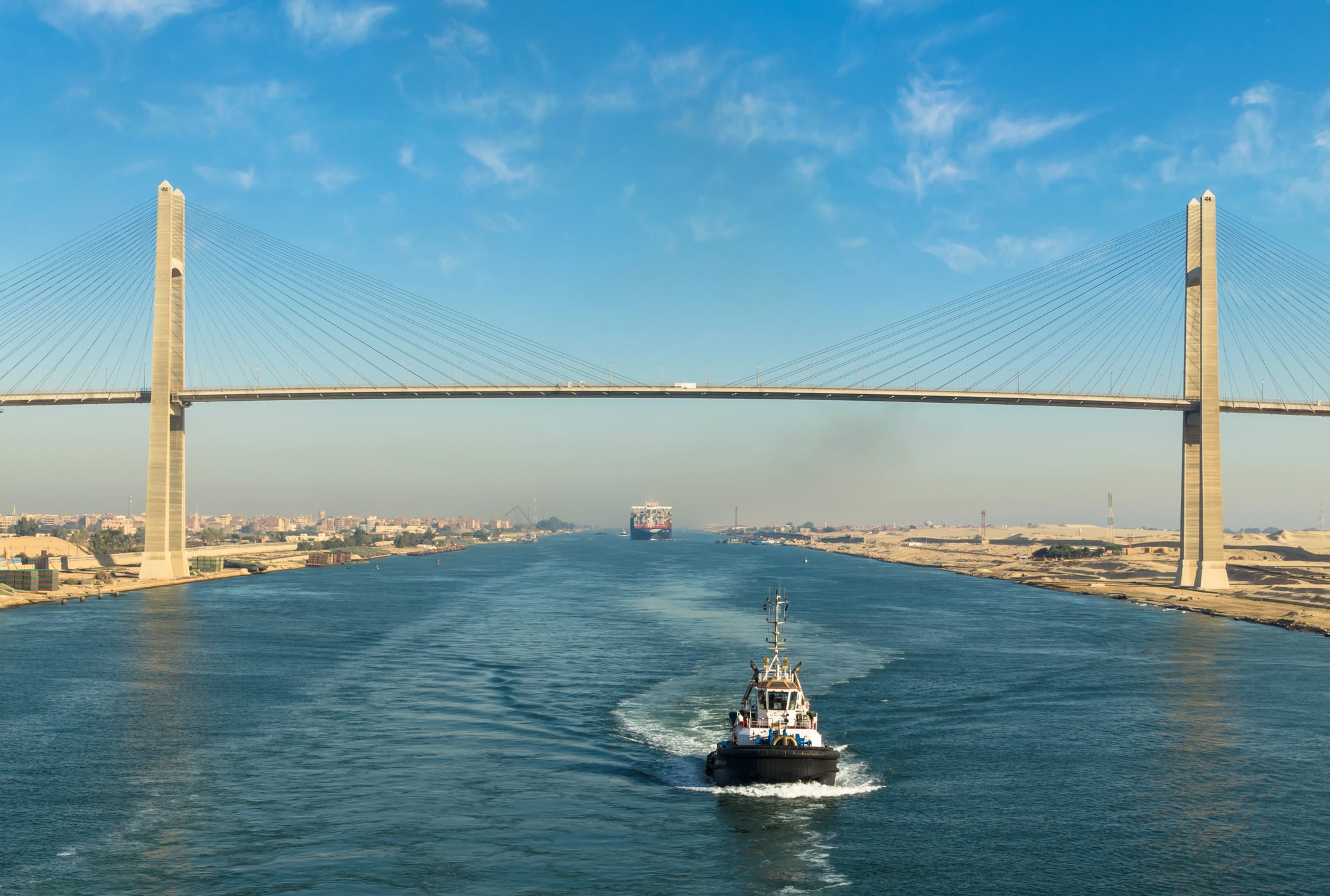
Critics called it Ferdinand de Lesseps’ folly when construction began in 1859, and to be fair — the man was proposing to dig a 120-mile trench through desert sand with hand tools and primitive dredging equipment (though the bit about using forced labor from local populations was considerably less admirable, and fortunately, that brutal practice was eventually stopped). And yet, what emerged from that decade of backbreaking work was something that fundamentally altered how the world moved its goods.
The canal connects the Mediterranean and Red Seas through a landscape so flat that ships can traverse its entire length without a single lock — which sounds simple until you consider that this required moving 600 million cubic feet of sand and rock, much of it in temperatures that regularly topped 120°F.
So the Suez became the shortcut that everyone needed but no one thought possible. Ships traveling from Europe to Asia could skip the long journey around Africa’s Cape of Good Hope, shaving 4,300 miles off the trip.
The canal’s strategic importance became clear almost immediately. Whoever controlled this narrow strip of water controlled trade between East and West. Nations have gone to war over it, and for good reason — about 12% of global trade still flows through this artificial river carved through Egyptian sand.
Grand Canal Of China
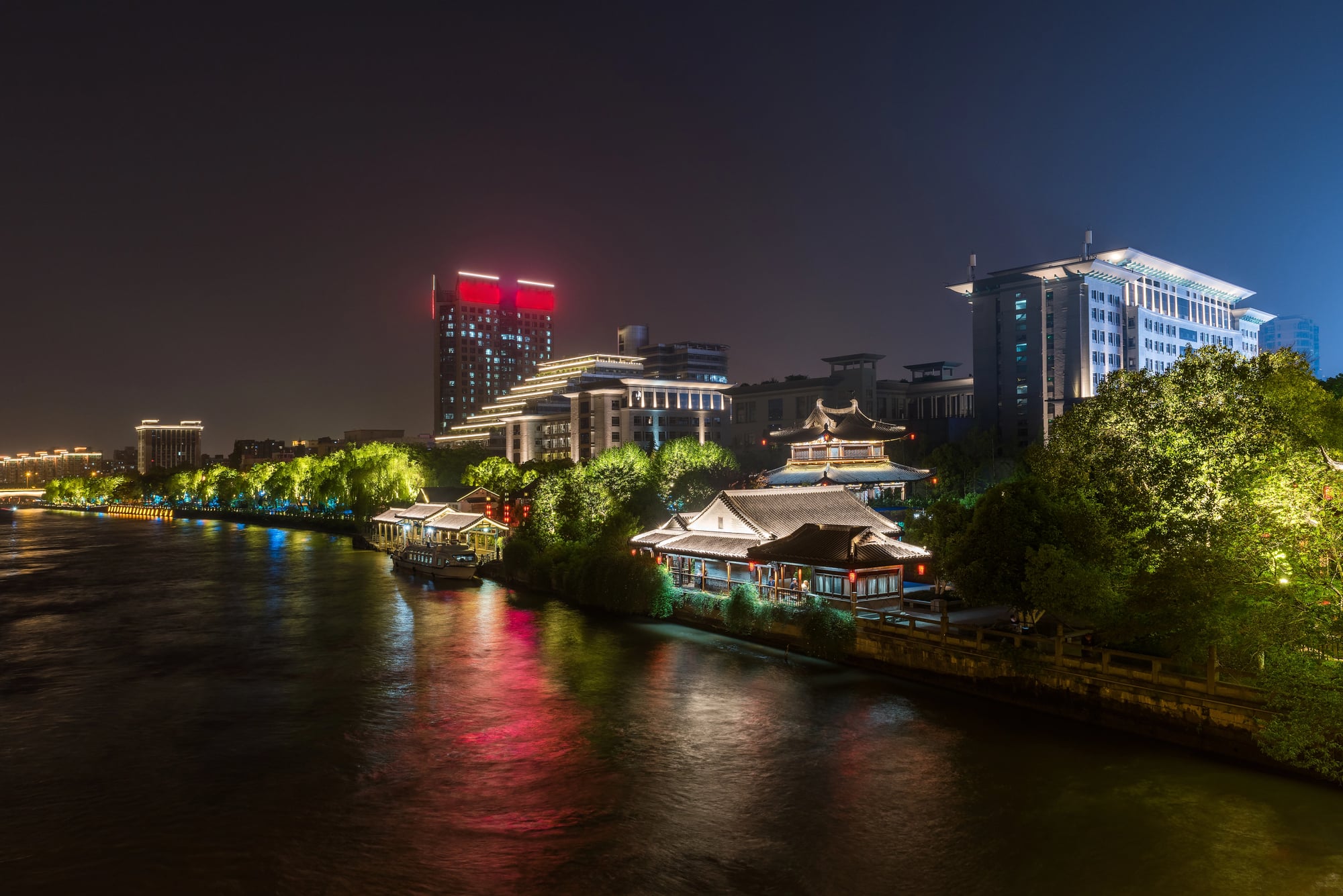
Think of the Grand Canal as China’s ancient internet — not for information, but for rice, silk, and tax revenue flowing between the agricultural south and political north. Emperors understood something fundamental about power: you can’t rule an empire if you can’t feed your capital or move your armies quickly between distant provinces.
This wasn’t built in a generation or even a century. Construction began during the Spring and Autumn period, continued through multiple dynasties, and reached its final form during the Yuan Dynasty — a span of roughly 2,000 years of continuous digging, dredging, and engineering.
The result stretches 1,100 miles from Beijing to Hangzhou, making it not just the longest artificial waterway in the world, but one of humanity’s most persistent infrastructure projects. What makes the Grand Canal remarkable isn’t just its length, but its ingenuity.
Ancient Chinese engineers solved problems that would challenge modern builders: they created a water staircase using pound locks centuries before similar technology appeared in Europe, carved channels through mountains, and designed flood control systems that kept the canal navigable through seasonal variations that could swing water levels by dozens of feet.
The canal didn’t just connect cities — it connected China’s agricultural heartland with its political center, creating the economic foundation for imperial power that lasted centuries. New York had a problem.
Erie Canal
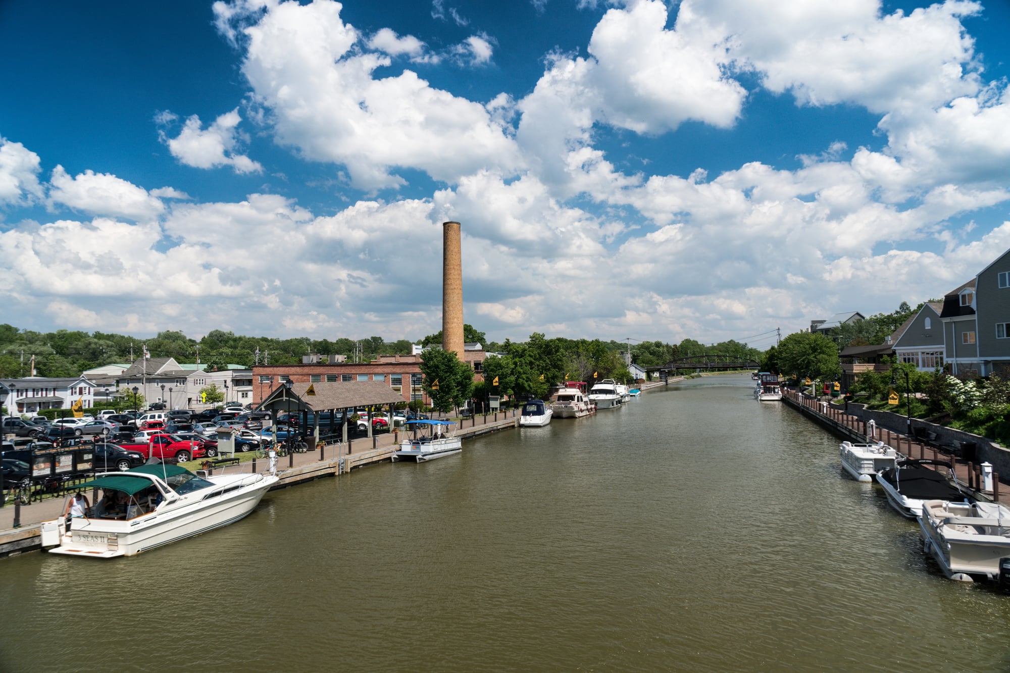
So they dug a ditch. A 363-mile ditch from Albany to Buffalo, rising and falling through 83 locks to navigate the variable terrain between the Hudson River and Lake Erie.
Critics called it “Clinton’s Folly” after the governor who championed the project, and their skepticism wasn’t entirely unreasonable — the United States had never built anything like this before, and most of the workers were farmers and immigrants learning engineering principles on the job. But the Erie Canal worked better than anyone expected.
Shipping costs dropped by 90% almost overnight. Towns sprouted along its route like flowers after rain.
The canal paid for itself within nine years through tolls, and suddenly every other state wanted their own artificial river. The Erie Canal didn’t just connect New York to the Great Lakes — it turned New York City into the commercial capital of America.
And opened the entire Midwest to settlement and development.
Amsterdam’s Canals
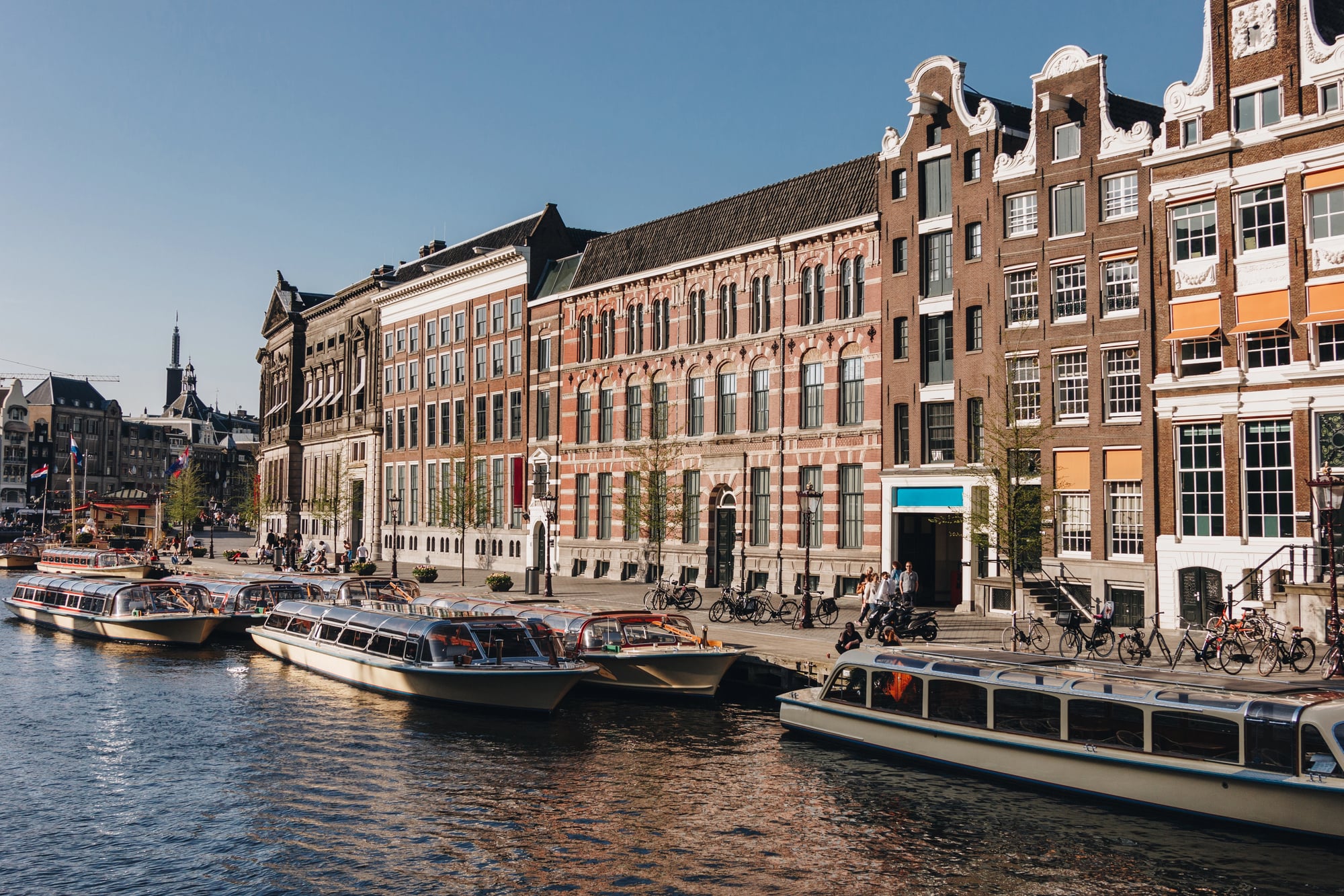
Amsterdam solved an impossible puzzle: how do you build a major city in a swamp that sits mostly below sea level? The answer involved digging more than 100 kilometers of canals in concentric rings, driving thousands of wooden piles deep into the soft ground to create foundations, and turning water from an enemy into infrastructure.
The city’s famous ring canals — Herengracht, Prinsengracht, Keizersgracht, and Singel — weren’t just transportation networks, they were the bones of urban planning that worked with water instead of against it. Each canal served multiple purposes: transportation for goods and people, drainage for a city that would otherwise flood, and property boundaries that created some of the most valuable real estate in Europe.
The wealthy built narrow, tall houses along the water because property taxes were based on street frontage, leading to the distinctive Amsterdam architecture that still defines the city today. But Amsterdam’s canals represent something more significant than clever engineering — they demonstrate how humans can work with natural constraints rather than simply overpowering them.
Instead of draining the marshes and fighting flooding forever, the Dutch embraced water as a partner in urban design. The result is a city that has thrived for 400 years in a location where most engineers would say cities can’t exist.
Corinth Canal
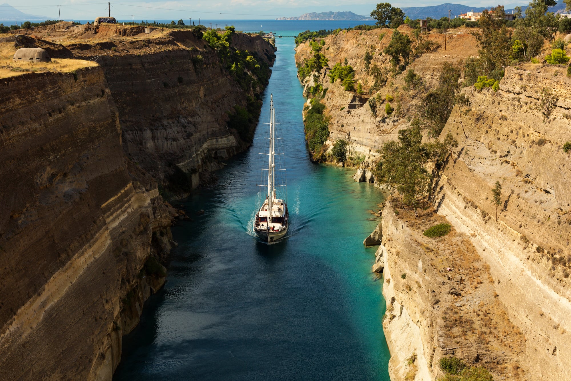
The Corinth Canal is pure stubbornness carved into rock. For centuries, ships traveling between the Aegean and Ionian seas had to sail around the entire Peloponnese peninsula — a dangerous journey that added days to what should have been a short trip.
The isthmus connecting the Peloponnese to mainland Greece was only four miles wide, but it rose 285 feet above sea level and consisted mostly of solid rock. Ancient Greeks tried to solve this problem by building the diolkos, a stone roadway where ships were pulled across the isthmus on wheeled platforms — which worked, but only for smaller vessels and only when you had enough enslaved workers to drag several tons of ship and cargo uphill.
The Romans considered digging a canal but abandoned the project. It wasn’t until 1893, using steam-powered excavation equipment and dynamite, that engineers finally carved a narrow channel straight through the rock.
The Corinth Canal is more monument than practical waterway. At only 70 feet wide, it’s too narrow for modern cargo ships, and the rock walls rise so steeply on both sides that the canal feels more like a crack in the earth than something humans built.
But it works. Ships still use it, and it remains one of the most dramatic examples of humans simply refusing to accept that geography gets to dictate where boats can go.
Kiel Canal

Germany looked at the Danish peninsula and saw a problem: German naval ships traveling between the North and Baltic seas had to navigate around Denmark, through waters controlled by other nations, adding hundreds of miles to what should have been a short trip. The solution was typically German — methodical, ambitious, and slightly over-engineered.
The Kiel Canal cuts 61 miles across the base of the Jutland peninsula, connecting the North Sea with the Baltic through a series of locks and artificial lakes. But this wasn’t just about convenience — it was about naval strategy.
Germany built the canal wide enough and deep enough for their largest battleships, turning it into a strategic asset that allowed rapid movement of naval forces between two seas without leaving German-controlled waters. Construction required moving 80 million cubic meters of earth and rock, creating what was essentially an artificial river flowing uphill through a landscape of rolling hills and marshes.
The canal opened in 1895, and within decades it became one of the world’s busiest artificial waterways. Today, more than 30,000 ships transit the canal annually, making it more heavily trafficked than the Panama Canal — which is saying something for a ditch most people have never heard of.
Moscow Canal
Stalin had simple requirements for the Moscow Canal: make it happen fast, make it big enough for large ships, and don’t worry about the cost in human lives or rubles. The result was 80 miles of artificial waterway connecting Moscow to the Volga River, built in under five years using mostly forced labor from political prisoners.
The engineering challenges were significant — Moscow sits on high ground, meaning the canal had to climb through a series of locks and reservoirs to reach the city. Engineers built 11 locks, created several artificial lakes, and installed pumping stations to maintain water levels during dry seasons.
The canal turned Moscow into a “port of five seas,” connecting Russia’s landlocked capital to maritime trade routes reaching the White Sea, Baltic Sea, Black Sea, Azov Sea, and Caspian Sea. But the Moscow Canal’s dark history can’t be separated from its technical achievements.
An estimated 200,000 prisoners worked on the project, and thousands died from harsh conditions, inadequate food, and brutal work schedules. The canal opened in 1937 to great fanfare, but it stands as a reminder that impressive engineering doesn’t always come from admirable motives or acceptable methods.
Welland Canal
Niagara Falls creates a beautiful problem for ships trying to navigate the Great Lakes system. The 326-foot elevation difference between Lake Erie and Lake Ontario turns what should be a simple water route into an impassable barrier — unless you’re willing to dig around it.
The Welland Canal does exactly that, carrying ships between the two lakes through a series of locks that climb and descend like a liquid staircase. The current canal, the fourth version built since 1829, uses eight massive locks to lift ships up the Niagara Escarpment.
Each lock chamber large enough to handle vessels more than 700 feet long. But the Welland Canal represents more than just clever engineering — it’s what turned the Great Lakes into an inland sea accessible to ocean-going vessels.
Ships from around the world can now travel from the Atlantic Ocean through the St. Lawrence Seaway, across all five Great Lakes, carrying cargo to cities like Chicago, Detroit, and Duluth that sit more than 1,000 miles from the nearest ocean. The canal transformed the economic geography of North America by turning landlocked cities into international ports.
Manchester Ship Canal
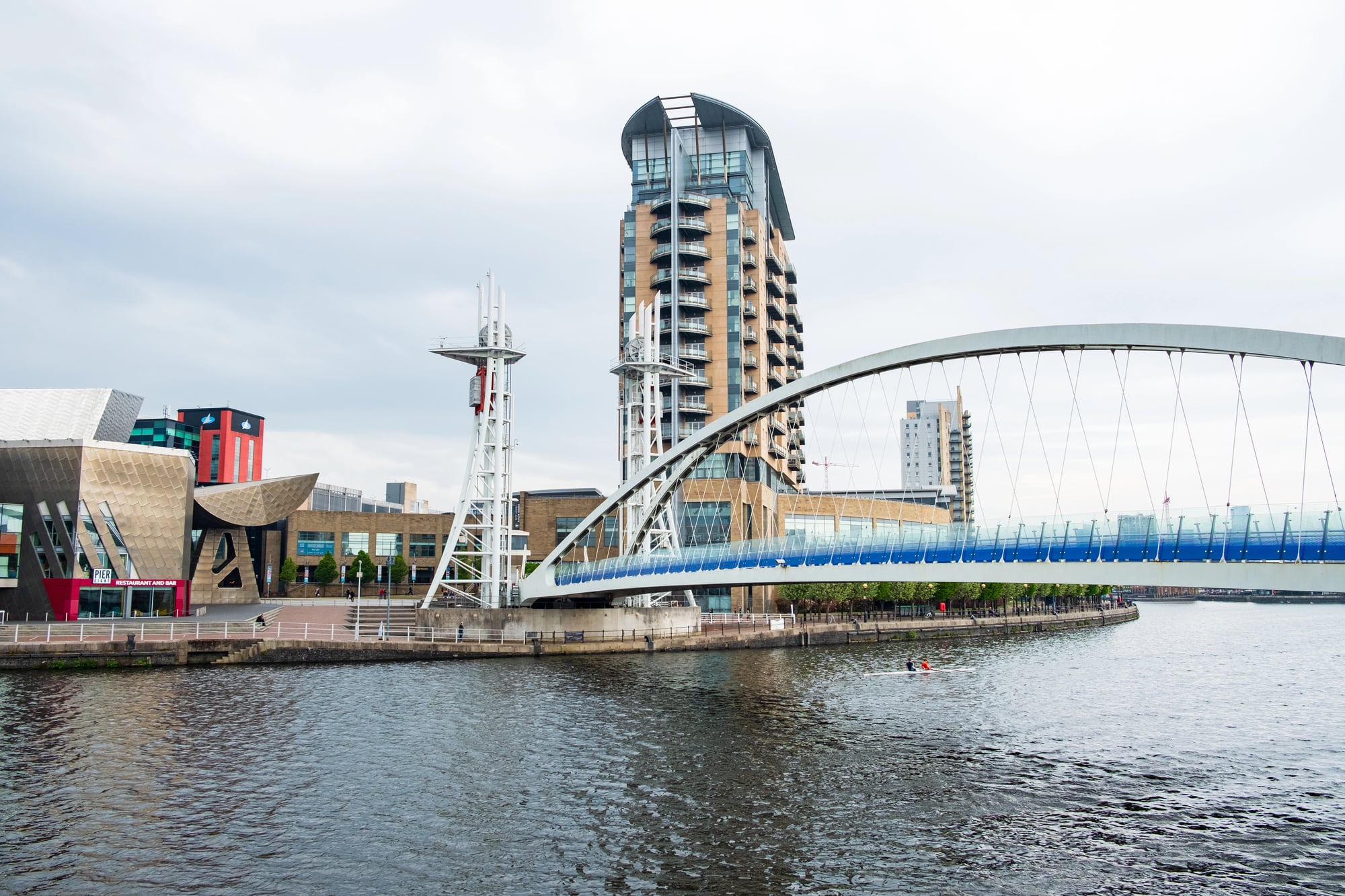
Manchester had grown rich on cotton mills and manufacturing, but the city sat 40 miles inland from the sea, connected to global trade only through the port of Liverpool. Liverpool’s dock companies charged high fees and controlled access to international markets, creating a chokehold on Manchester’s economy that industrialists found increasingly intolerable.
So Manchester decided to bring the sea to the city. The Manchester Ship Canal, completed in 1894, turned a small inland river into a shipping channel capable of handling ocean-going vessels up to 600 feet long.
The project required widening and deepening the existing River Irwell and Mersey, building massive locks, and creating what was essentially an artificial fjord stretching from the Irish Sea to Manchester’s doorstep. The canal worked exactly as intended.
Manchester became Britain’s third-largest port despite being dozens of miles from the ocean. Ships from around the world docked in the heart of England’s industrial north, loading cotton goods and manufactured products directly from the factories that produced them.
The canal broke Liverpool’s monopoly on northwest England’s trade and proved that geography doesn’t have to determine economic destiny — sometimes you can just dig your way to a better location.
Bridgewater Canal
The Bridgewater Canal doesn’t look like much — just a narrow waterway connecting coal mines near Worsley to the growing city of Manchester. But this unremarkable ditch launched the canal age in Britain and demonstrated that artificial waterways could transform entire economies.
Francis Egerton, the 3rd Duke of Bridgewater, faced a simple business problem: his coal mines were producing more coal than he could profitably transport to market using horses and wagons over muddy roads. The cost of overland transportation made his coal expensive and limited his potential customers to those living relatively close to the mines.
The canal changed everything. Coal that cost 7 pence per hundredweight to transport by road could be moved by canal for 3.5 pence. The price of coal in Manchester dropped by half almost immediately, making it affordable for more people and industries.
More importantly, the canal proved that artificial waterways could generate enormous profits — the Bridgewater Canal paid back its construction costs within a few years and continued generating wealth for decades. The success of the Bridgewater Canal triggered “canal mania” across Britain, as investors and engineers rushed to build similar waterways connecting mines, factories, and cities.
Within 50 years, Britain had constructed more than 4,000 miles of artificial waterways, creating the transportation network that powered the Industrial Revolution.
Houston Ship Channel

Houston sits 50 miles inland from the Gulf of Mexico, connected to the sea by Buffalo Bayou — a shallow, winding waterway barely deep enough for small boats. This was not obviously the location for what would become one of America’s largest ports, but Houston’s boosters had bigger plans than geography seemed to support.
The Houston Ship Channel began as an ambitious dredging project, deepening and straightening Buffalo Bayou to create a navigable waterway for ocean-going ships. The work started in 1914, and engineers have been deepening and widening the channel ever since.
Gradually transforming a sleepy bayou into a 52-mile shipping corridor capable of handling the world’s largest vessels. The project succeeded beyond anyone’s expectations.
The Port of Houston now handles more cargo than any other U.S. port except Los Angeles and Long Beach, despite being located in what was originally a coastal swamp. The ship channel turned Houston into a global energy capital, providing deep-water access for oil refineries, chemical plants, and shipping companies.
That needed to move petroleum products to international markets. The channel proves that with enough dredging equipment and persistence, almost any waterway can become a superhighway for global trade.
St. Lawrence Seaway
The St. Lawrence Seaway solved a continental-scale problem: how do you connect the Great Lakes, which contain 20% of the world’s fresh water, to ocean shipping routes? The natural St. Lawrence River provided a partial answer, but rapids, shallow sections, and seasonal ice made reliable navigation impossible for large vessels.
The solution required cooperation between the United States and Canada to build a system of locks, canals, and deepened channels that would allow ocean-going ships to travel more than 2,300 miles inland from the Atlantic to ports like Duluth, Minnesota. The project took decades to complete and required relocating entire communities whose homes would be flooded by the new waterway.
But the Seaway worked. Ships from around the world can now carry cargo directly to cities in the heart of North America, turning places like Chicago and Detroit into international ports despite being hundreds of miles from the nearest ocean.
The Great Lakes became an inland sea accessible to global trade, fundamentally changing the economic geography of both countries and proving that continental barriers are just engineering problems waiting for sufficient political will and funding to solve them.
Where Water Meets Ambition
These waterways share something beyond impressive engineering — they represent moments when entire civilizations decided that geography wasn’t permanent, that rivers could be redirected, mountains could be cut through, and seas could be connected by human will and enough shoveling.
Some took decades to build, others took centuries, but all of them changed the world in ways their builders probably never fully imagined. They remind us that the most audacious infrastructure projects often seem impossible right up until the moment they start working exactly as intended.
More from Go2Tutors!

- The Romanov Crown Jewels and Their Tragic Fate
- 13 Historical Mysteries That Science Still Can’t Solve
- Famous Hoaxes That Fooled the World for Years
- 15 Child Stars with Tragic Adult Lives
- 16 Famous Jewelry Pieces in History
Like Go2Tutors’s content? Follow us on MSN.