Shipwrecks Visible from Google Earth
Something about seeing a shipwreck from above changes how you think about it. When you zoom in on these vessels through satellite imagery, they stop being just stories and become real places you can almost touch.
Google Earth turns maritime disasters into accessible landmarks, frozen in time and waiting for anyone with an internet connection to discover them.
The SS American Star Off Fuerteventura
The Atlantic Ocean claimed this luxury liner slowly. You can track the SS American Star’s decay through historical imagery on Google Earth, watching it break apart year by year off the coast of Fuerteventura in the Canary Islands.
The ship ran aground in 1994 during a towing operation, and the waves have been dismantling it ever since. What makes this wreck striking from above is how the stern section is completely separated from the bow.
The two pieces sit hundreds of feet apart now, like puzzle pieces that will never fit back together.
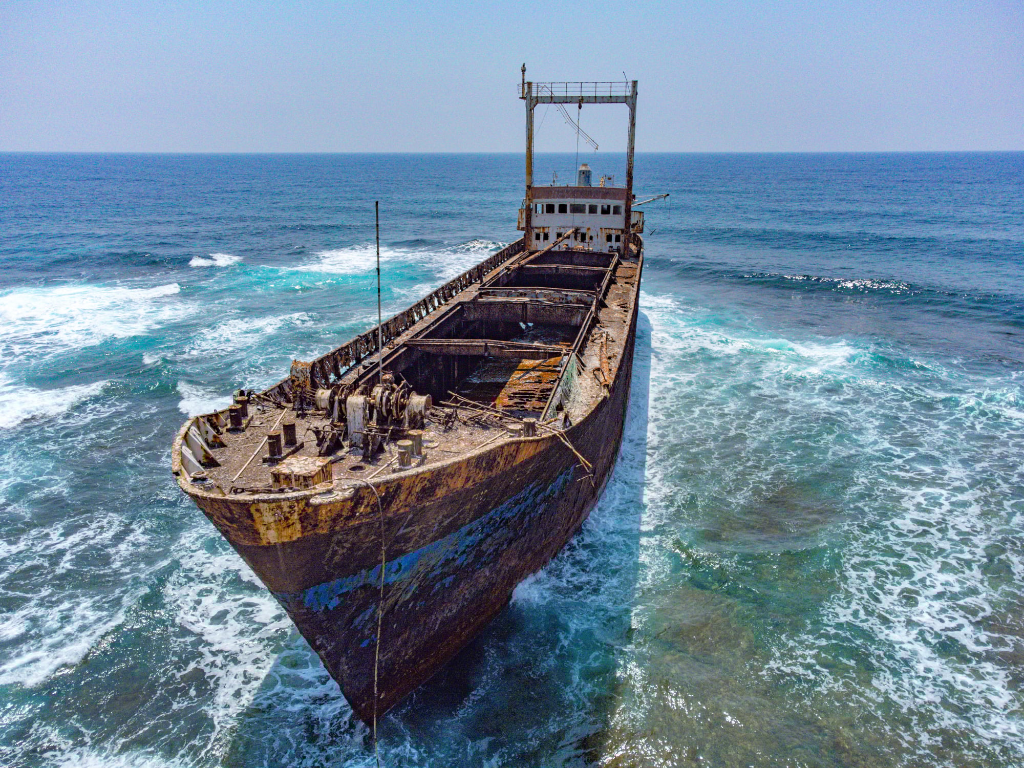
Edro III in Cyprus
Close to Peyia Beach in Cyprus, this cargo ship rests only steps from land – people stroll near it like it belongs there. When the storm hit in 2011, the Edro III got stuck, its hull scraping rock as waves pushed it sideways.
Crew members left just in time, climbing down before the sea claimed the boat for good. There, visible through Google Earth, lies the ship stuck along the shore.
Its reddish-brown frame stands out vividly beside the sea’s bright blue tones – snapped often by cameras, perhaps more than any other wreck nearby.
The Jassim in Sudan

Red Sea diving guides know this Saudi cargo ship well. The Jassim sank in 2003 near the Wingate Reef, and now it serves as an artificial reef teeming with marine life.
When you view it from above, the ship appears to float in impossibly clear turquoise water. The wreck rests in shallow water, which makes every detail visible from the satellite.
You can trace the outline of the deck and see where coral has started to colonize the structure.
MV Captayannis in Scotland

Two ships collided in the River Clyde in 1974, and the MV Captayannis was the one that didn’t make it. The Greek sugar carrier sank near Glasgow, and parts of it still poke above the waterline decades later.
Google Earth shows this wreck as a dark shape beneath the murky Scottish waters. The vessel serves as a reminder that major shipping disasters happen in rivers and harbors, not just open ocean.
Sweepstakes in Lake Huron

A few wrecks aren’t buried under sea waves at all. Freshwater swallowed the Sweepstakes in Big Tub Harbour back in 1885, yet its icy grip kept the ship nearly untouched.
From the surface, every part of the old wood frame shows clearly – clear water holds the wreck like glass does light. This wreck draws divers in, thanks to how easily you can float above and spot every detail.
Seen from Google Earth, its outline pops – water clarity makes the vessel seem freshly sunk, though almost 140 years have passed. Arriving by boat, sunlight cuts through the surface, revealing ribs of rusted metal cradled in sand.
Time slows here. You stare down; it stares back.
SS Maheno on Fraser Island

This passenger liner from the early 1900s ended its days as a floating hospital ship during World War I. After the war, the Maheno was being towed to a scrapyard in Japan when a cyclone hit in 1935.
The towline snapped, and the ship washed up on Fraser Island, Australia. From satellite imagery, the wreck appears as a rusty skeleton on the beach.
Sand has partially buried parts of the hull, but the distinctive boilers and framework still stand out against the white sand. Tourists visit this wreck regularly because you can drive right up to it on the beach.
Plassey on Inisheer Island

The Aran Islands off the Irish coast hold this famous cargo vessel. The Plassey ran aground during a storm in 1960, and the crew escaped just before the ship broke apart.
Locals pulled the wreck further inland to protect it from complete destruction by the Atlantic waves. Google Earth shows the Plassey sitting in a field of rocks and grass, nowhere near the water anymore.
The ship appears in the opening credits of a popular Irish TV comedy, which brought it international attention beyond shipwreck enthusiasts.
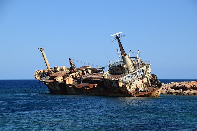
Dimitrios Near Gythio, Greece
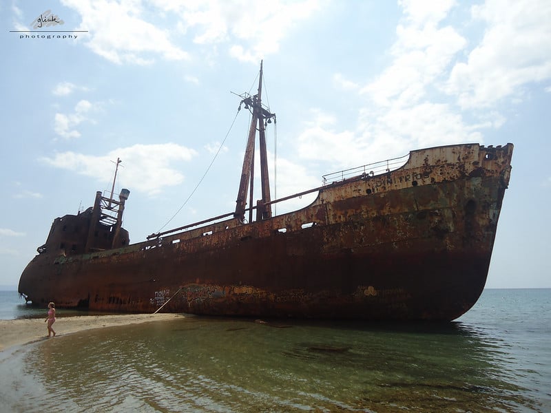
This cargo ship has one of the most photogenic wrecks in the Mediterranean. The Dimitrios ran aground off the coast of Gythio in 1981 under mysterious circumstances—some say deliberately for insurance fraud, others blame bad weather and poor navigation.
The wreck sits on a sandy beach called Valtaki, and you can walk right up to it. From above, the rust-streaked hull creates a striking contrast against the pale sand and blue-green water.
The ship lists heavily to one side, giving it a particularly dramatic appearance in satellite imagery.
Eduard Bohlen in Namibia

This German cargo ship provides one of the strangest sights on Google Earth. The Eduard Bohlen ran aground in 1909 off the Skeleton Coast of Namibia.
But here’s what makes it weird: the wreck now sits about 1,300 feet inland from the current shoreline. The coast changed over the past century, and the ship that once fought the waves now rests in desert sand.
From above, you can see this massive vessel surrounded by nothing but dunes, looking completely out of place yet perfectly preserved by the dry climate.
Semiramis in the Red Sea

The Egyptian coast holds numerous wrecks, but the Semiramis stands out because of its location. This passenger ferry sank in shallow water near Hurghada in 1993 after hitting a reef.
The wreck sits upright on the sea floor, and you can see its entire outline from Google Earth. Diving operations use this wreck as a training site because it rests in relatively shallow, calm water.
The satellite view shows why—the ship appears to hover in light blue water, clearly visible from space.
Desdemona in Antarctica

Few people think about shipwrecks in the Antarctic, but they exist. The Desdemona, a Norwegian whaling vessel, sank in the 1950s near Deception Island.
The wreck rests in black volcanic sand, surrounded by ice and snow for most of the year. Google Earth captures this eerie scene: a ship’s remains in one of the most remote locations on Earth.
The contrast between the dark hull and white ice makes the wreck particularly visible from above, even though almost no one will ever see it in person.
Vou in the Solomon Islands

World War II left countless wrecks scattered across the Pacific. The Vou, a small cargo vessel, sank near Guadalcanal during the war.
The wreck sits in shallow water with parts still visible above the surface. From satellite imagery, you can see the ship’s outline against the coral reef.
The surrounding water shifts between different shades of blue and green, marking where the reef meets deeper channels. This wreck serves as a navigation hazard even today, decades after it went down.
The World Discoverer in the Solomon Islands
This cruise ship has a more recent story. The World Discoverer struck an uncharted reef in 2000 while carrying tourists through the Solomon Islands.
The crew managed to beach the vessel in Roderick Bay to prevent it from sinking in deep water, and everyone escaped safely. Google Earth shows the ship still sitting where it was beached, slowly rusting away in tropical heat.
The white superstructure has turned brown in places, and vegetation has started growing on parts of the deck. This wreck has become a local landmark, though the remote location keeps most visitors away.
SS Francisco Morazan in Michigan
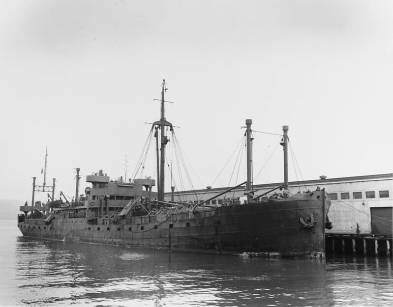
Off the coast of South Manitou Island, Lake Michigan pulled down a Liberian cargo ship back in 1960. A fierce November storm swirled around it while the captain guessed wrong about where he was.
After that, jagged stones ripped open the hull. Then everything sank under cold water.
A shape breaks the surface near land, seen easily when standing on shore. From overhead, satellite images outline every part of the hull, with the back half caved in but the front still holding its form.
Freshwater clarity exposes structures on deck and inside storage areas – details seawater usually swallows from view.
Murmansk in Vladivostok
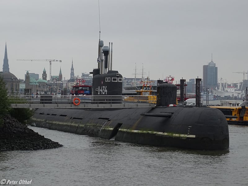
This Russian submarine rests in shallow water near Vladivostok, partially visible from above. The exact circumstances of how it ended up there remain murky, but satellite imagery clearly shows the distinctive shape of a submarine hull beneath the water’s surface.
Where Technology Meets History

Google Earth turned shipwreck hunting into an armchair activity. You don’t need diving certification or a boat—just coordinates and curiosity.
Each wreck tells its own story of storms, wars, navigational errors, or simple bad luck. Some rest in museums of clear tropical water. Others corrode on remote beaches where few people will ever stand.
The satellite passes overhead every few years, capturing these vessels in their slow transformation from ships to memories. You can watch them rust, sink deeper into sand, or break apart under waves.
The technology preserves moments that the ocean works constantly to erase.
More from Go2Tutors!

- The Romanov Crown Jewels and Their Tragic Fate
- 13 Historical Mysteries That Science Still Can’t Solve
- Famous Hoaxes That Fooled the World for Years
- 15 Child Stars with Tragic Adult Lives
- 16 Famous Jewelry Pieces in History
Like Go2Tutors’s content? Follow us on MSN.