10 Weather Patterns Scientists Can’t Explain
Weather has always been one of nature’s most fascinating mysteries. Despite decades of advanced technology, satellite imagery, and computer modeling, meteorologists still encounter phenomena that leave them scratching their heads. These unexplained weather patterns challenge our understanding of atmospheric science and remind us that Earth’s climate system holds secrets we’re still trying to unlock.
From mysterious lights dancing across the sky to storms that behave in ways that defy conventional wisdom, our planet continues to surprise even the most experienced researchers. Here is a list of 10 weather patterns that continue to puzzle scientists around the world.
Morning Glory Clouds
The Morning Glory cloud phenomenon appears almost exclusively in northern Australia — creating massive roll clouds that can stretch for hundreds of miles. These rare formations look like giant tubes rolling across the sky, often appearing in a series of up to ten clouds at once.
Scientists understand the basic mechanics involve colliding air masses and temperature inversions, yet they can’t explain why this specific region produces such consistent and dramatic examples while similar conditions elsewhere rarely create comparable results.
Rogue Waves

These massive ocean waves can tower 80 feet or higher, appearing suddenly in otherwise normal sea conditions and posing serious threats to ships and offshore structures. For decades, sailors’ reports of these monster waves were dismissed as folklore until satellite data confirmed their existence.
Scientists know they result from multiple wave systems converging — though predicting when and where these giants will form remains largely impossible due to the complex interactions of ocean currents, wind patterns, and wave interference.
Microbursts
These intense downdrafts of air can slam into the ground with devastating force, creating winds that exceed 150 mph and spread outward in all directions. Microbursts are particularly dangerous to aircraft during takeoff and landing — as they can cause sudden altitude loss and wind shear.
While meteorologists understand the basic process involves rapidly cooling air that becomes denser and falls, they struggle to predict exactly when and where these invisible hazards will strike, making them one of aviation’s most feared weather phenomena.
Noctilucent Clouds
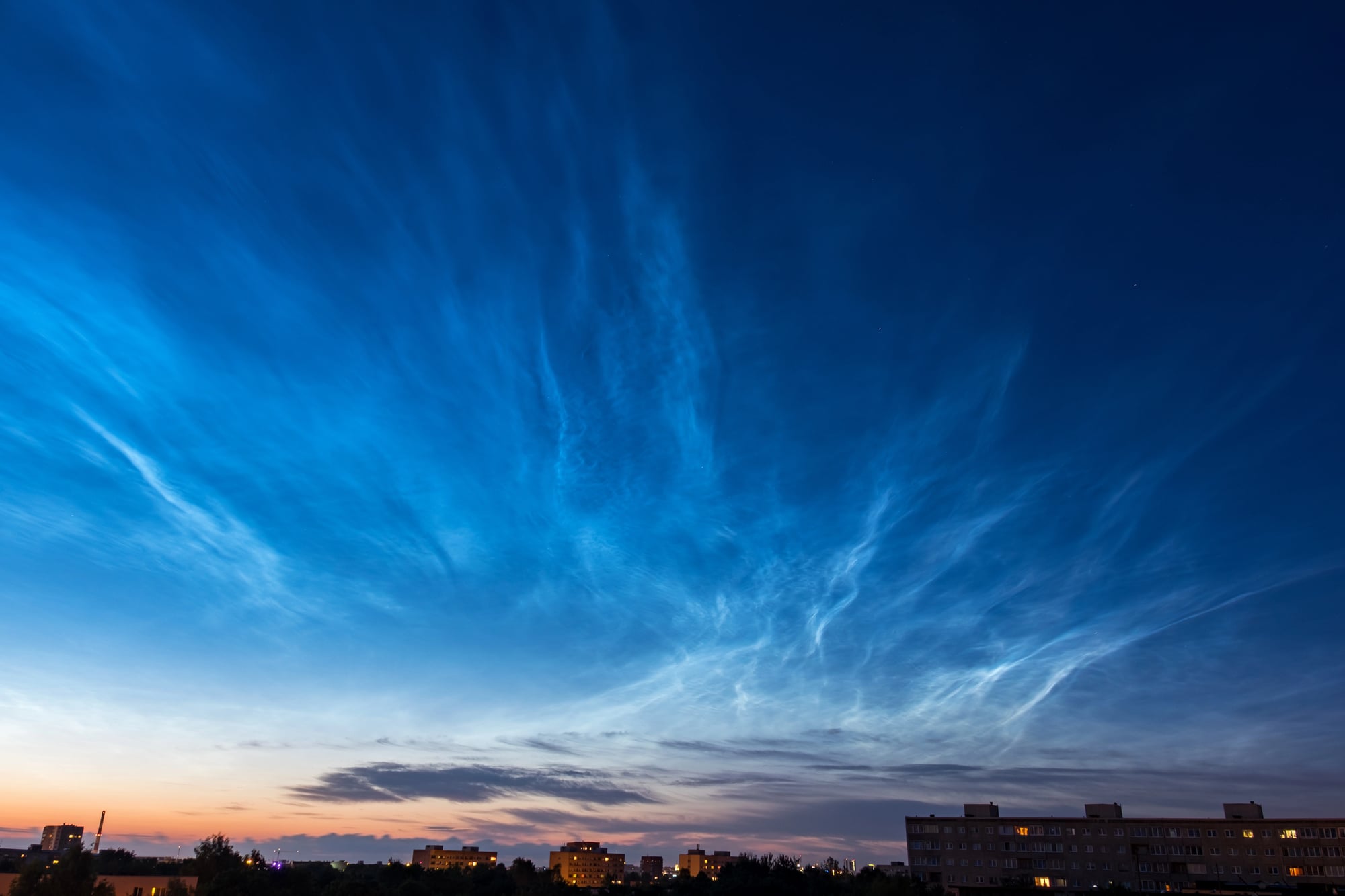
These ethereal, silvery-blue clouds appear in the mesosphere about 50 miles above Earth’s surface, becoming visible only during twilight hours when the sun illuminates them from below. They’re made of ice crystals forming around tiny particles — possibly from meteor dust or volcanic ash.
What puzzles scientists is why these clouds have become more frequent and brighter over the past few decades, with some researchers suggesting connections to climate change or increased atmospheric methane, though no definitive explanation exists.
Waterspouts
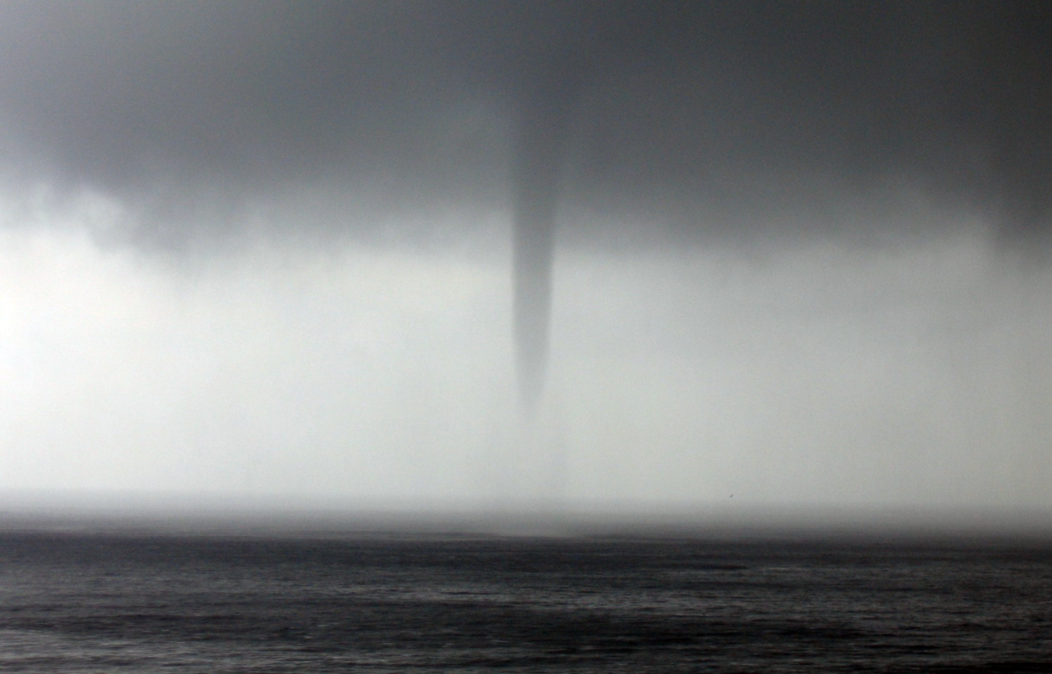
These tornado-like formations over water can appear suddenly and move unpredictably, creating spinning columns that connect the ocean surface to storm clouds above. Unlike their land-based cousins, waterspouts often form in relatively calm weather conditions — developing rapidly without the typical warning signs meteorologists look for.
The exact mechanisms that trigger their formation and determine their strength remain poorly understood, making them difficult to forecast and potentially dangerous to marine traffic.
Mammatus Clouds
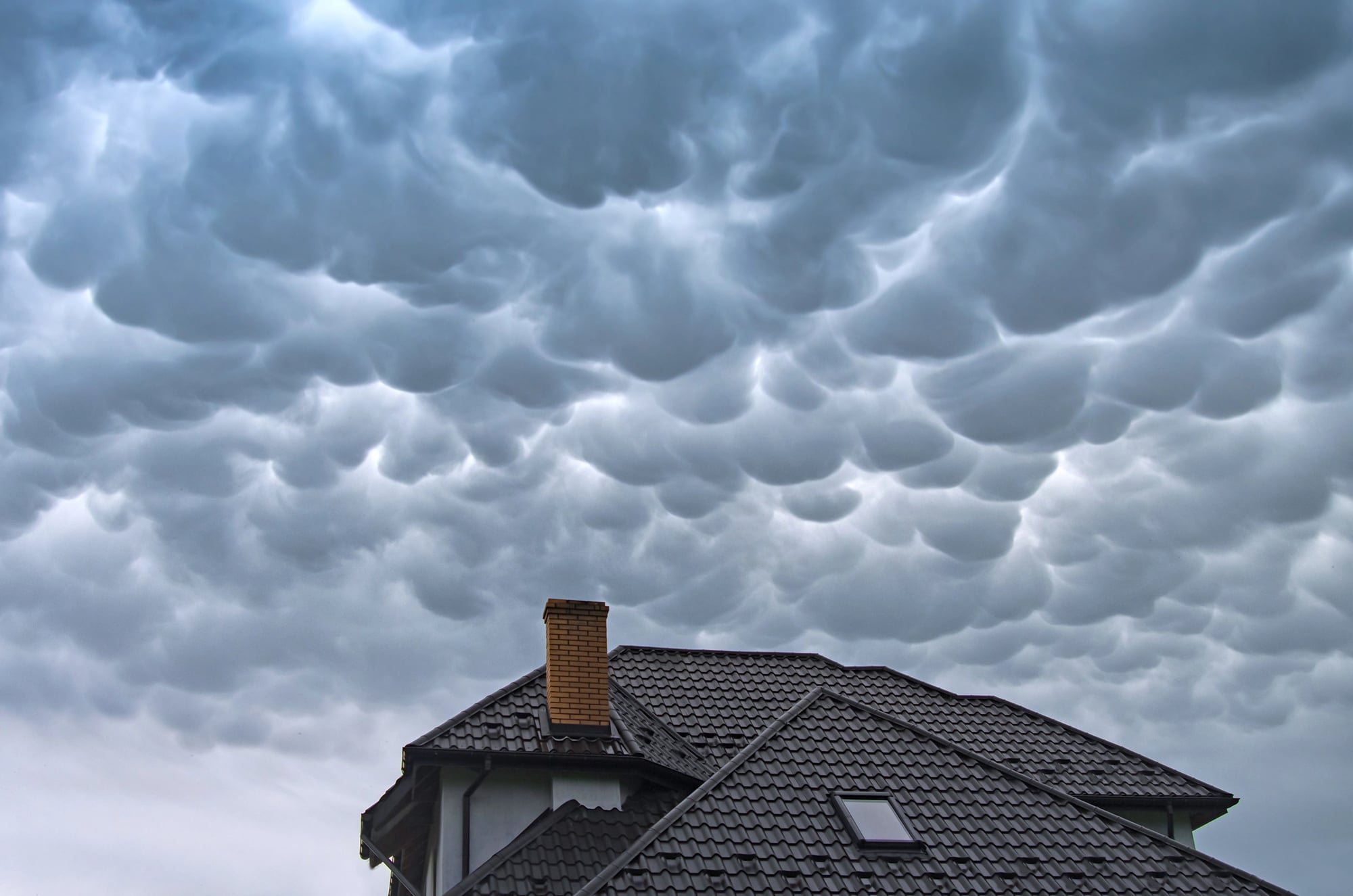
These distinctive cloud formations hang from the sky like giant pouches or udders — creating an ominous appearance that often signals severe weather. Unlike typical clouds that rise due to warm air ascending, mammatus clouds form when cold, dense air sinks through warmer air below.
Scientists understand the basic physics involved, yet they can’t explain why some storms produce these dramatic formations while others with seemingly similar conditions don’t, or why the pouches take on such distinct and uniform shapes.
Kelvin-Helmholtz Waves
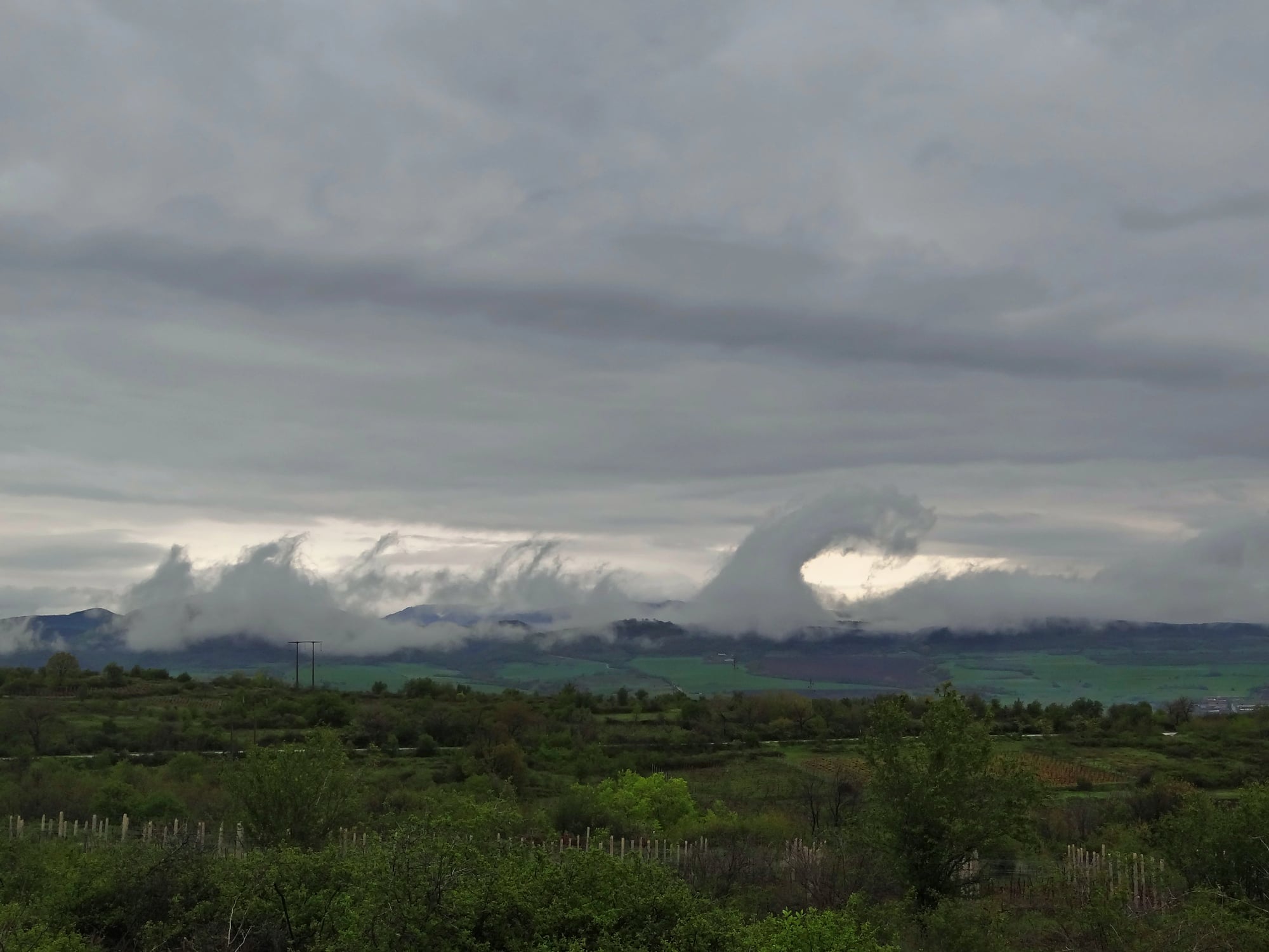
These clouds create a distinctive wave pattern that looks like ocean swells frozen in the sky — forming when air masses of different speeds slide past each other. The faster-moving air creates a shearing effect that produces the characteristic rolling pattern, similar to waves breaking on a beach.
While the basic mechanism is understood, scientists struggle to predict when atmospheric conditions will be stable enough for these photogenic formations to develop and persist long enough for observers to witness them.
Asperitas Clouds
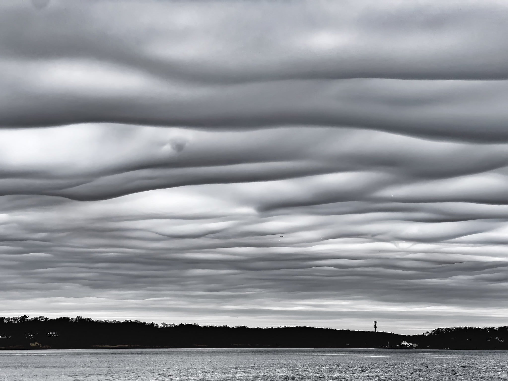
Only officially recognized as a new cloud type in 2017, these dramatic formations create an undulating, wave-like appearance that resembles looking up at the ocean surface from underwater. They appear dark and stormy yet rarely produce significant precipitation, defying typical associations between threatening-looking clouds and severe weather.
Researchers are still studying the specific atmospheric conditions that create these relatively rare formations and why they seem to be observed more frequently in recent years.
Fire Whirls
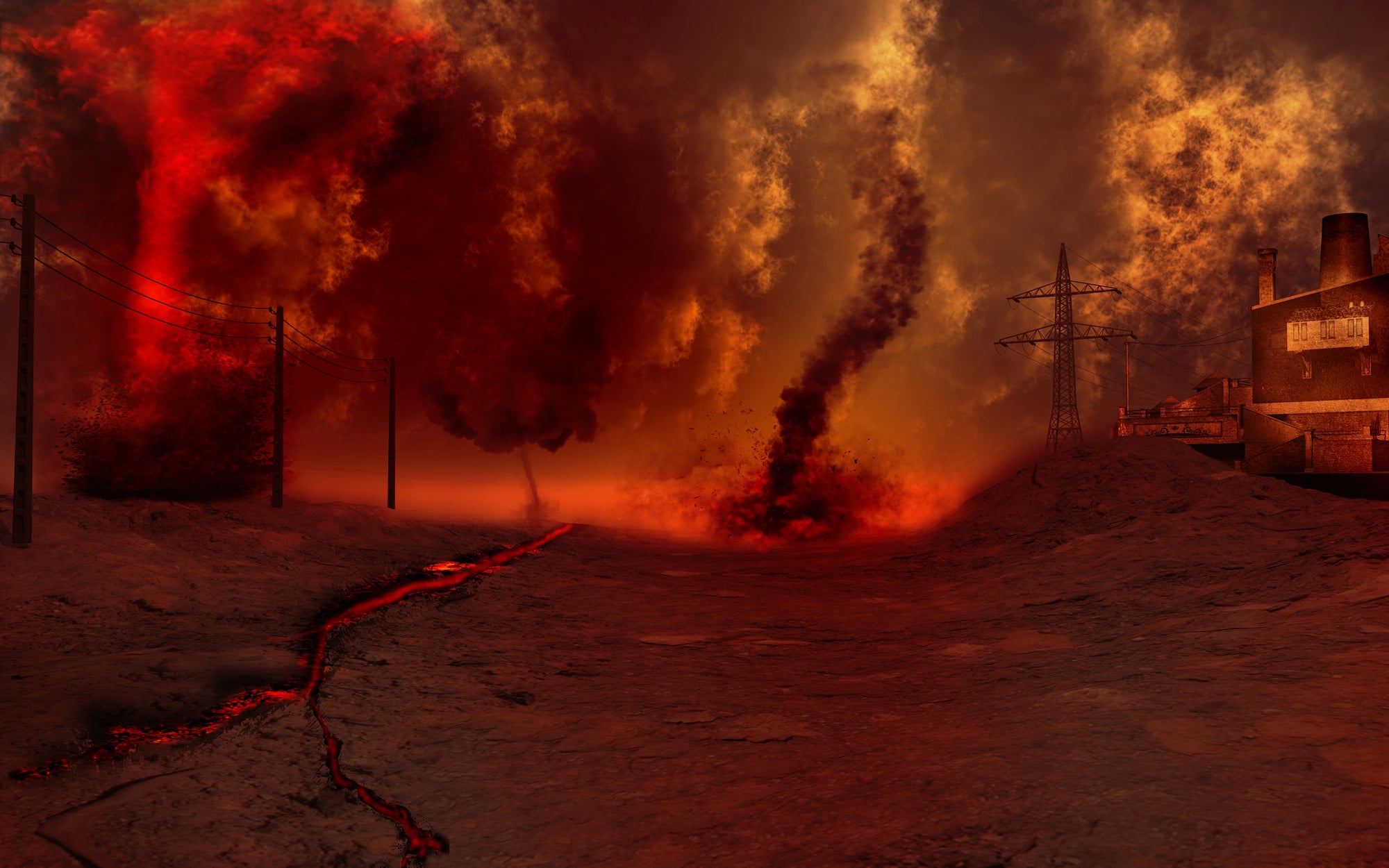
These spinning columns of flame can reach hundreds of feet in height and move unpredictably across landscapes, creating their own weather patterns and wind systems. They form when intense heat creates strong updrafts that begin rotating due to wind shear or the surrounding topography.
What makes them particularly puzzling is their ability to generate their own wind patterns, sometimes moving against prevailing winds and creating localized weather conditions that can intensify or change direction without warning.
Atmospheric Rivers

These narrow corridors of concentrated moisture in the sky can transport water vapor equivalent to 15 times the flow of the Mississippi River, creating intense precipitation when they encounter mountain ranges.
Though scientists understand these ‘rivers in the sky’ form due to specific pressure patterns and moisture transport, they struggle to predict their exact paths and intensity. These phenomena can bring beneficial rainfall to drought-stricken areas or cause devastating floods, making accurate forecasting crucial but challenging.
Nature’s Ongoing Mystery
These unexplained weather patterns remind us that despite all our technological advances, Earth’s atmosphere still holds countless secrets waiting to be discovered. Each phenomenon represents a puzzle piece in the larger picture of how our planet’s climate system operates, challenging scientists to develop new theories and measurement techniques.
As climate change continues to alter global weather patterns, understanding these mysteries becomes increasingly important for protecting communities and predicting future atmospheric behavior.
The fact that we can observe and document these phenomena with modern technology while still being unable to fully explain them highlights both how far meteorology has advanced and how much we still have to learn about our dynamic atmosphere.
More from Go2Tutors!

- The Romanov Crown Jewels and Their Tragic Fate
- 13 Historical Mysteries That Science Still Can’t Solve
- Famous Hoaxes That Fooled the World for Years
- 15 Child Stars with Tragic Adult Lives
- 16 Famous Jewelry Pieces in History
Like Go2Tutors’s content? Follow us on MSN.