18 Facts About Ancient Maritime Navigation
The horizon was both promise and threat to ancient sailors. Without GPS, radar, or even reliable maps, they ventured across vast oceans using nothing but observation, intuition, and techniques passed down through generations.
These maritime pioneers developed navigation methods so sophisticated that modern sailors still respect their ingenuity. Their story isn’t just about getting from point A to point B — it’s about humanity’s relationship with the sea itself.
Dead Reckoning Was the Foundation

Dead reckoning kept sailors alive. They tracked speed, time, and direction to calculate position.
No stars, no landmarks — just math and hope. Most captains got it wrong eventually.
Polynesian Wayfinders Read Wave Patterns
The Marshall Islanders created stick charts that mapped ocean swells around islands, and these weren’t decorative artifacts gathering dust in some chief’s hut — they were working navigation tools that could mean the difference between finding land and disappearing into the Pacific’s endless blue. Master navigators (called palu in the Caroline Islands) spent decades learning to feel the subtle differences in wave patterns, understanding how swells bent around distant islands they couldn’t yet see, reading the ocean’s surface like a topographical map written in water.
And the remarkable thing about this knowledge wasn’t just its accuracy, but how it was transmitted: entirely through apprenticeship and oral tradition, passed from one navigator to another across generations without ever being written down. No textbooks.
The Magnetic Compass Arrived Late in History

Chinese sailors used magnetic compasses by the 11th century. Europeans didn’t adopt them until the 12th century.
For most of human maritime history, direction came from the sky or educated guesswork. The compass didn’t solve navigation — it just made one piece slightly more reliable.
Stars Were the Original GPS System

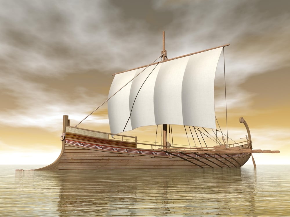
Celestial navigation works like this: stars rise and set at predictable points on the horizon, and if you know which star corresponds to which direction (Polaris points north in the Northern Hemisphere, the Southern Cross helps you find south below the equator), you can maintain course even when land disappears entirely. The Vikings used a sun compass during the day and switched to star navigation at night, while Arab navigators developed the kamal — a small wooden rectangle with a knotted string that let them measure the angle of stars above the horizon with surprising precision.
But here’s what makes this remarkable: these sailors weren’t just following a single star like some maritime paint-by-numbers system; they were reading entire star patterns, tracking how constellations wheeled across the sky throughout the night, using stars as both compass and clock simultaneously (since stellar positions change predictably with both time and season). So when clouds blocked their primary navigation stars, experienced sailors could switch to backup constellations without missing a beat.
Lead Lines Measured Ocean Depth
Sailors dropped weighted ropes to gauge depth and sample the seafloor. Different bottoms meant different locations.
Sand, mud, shells, rocks — each told a story about where they were. Good navigators knew their local waters by taste, smell, and the feel of what the lead line brought up.
Bird Behavior Revealed Land’s Direction

Certain seabirds fly toward land at dusk and toward feeding grounds at dawn. Vikings and Polynesian navigators watched flight patterns like traffic controllers, understanding that birds don’t waste energy flying toward empty ocean when solid ground offers roosting spots and protection from storms.
Land-based birds spotted far from shore were even more valuable — they meant an island or continent lay within a day or two of sailing, close enough for a small bird to make the journey but far enough that land remained invisible on the horizon. The direction birds flew at different times of day became a compass rose written in wings and instinct.
Viking Sun Compasses Used Shadow Navigation

Vikings carved sun compasses into wooden discs with radiating lines. They tracked the sun’s shadow throughout the day to maintain consistent bearing.
Even under cloudy skies, they used crystal “sunstones” that polarized light to locate the sun’s position. These weren’t primitive tools.
Ancient Maps Were More Art Than Science
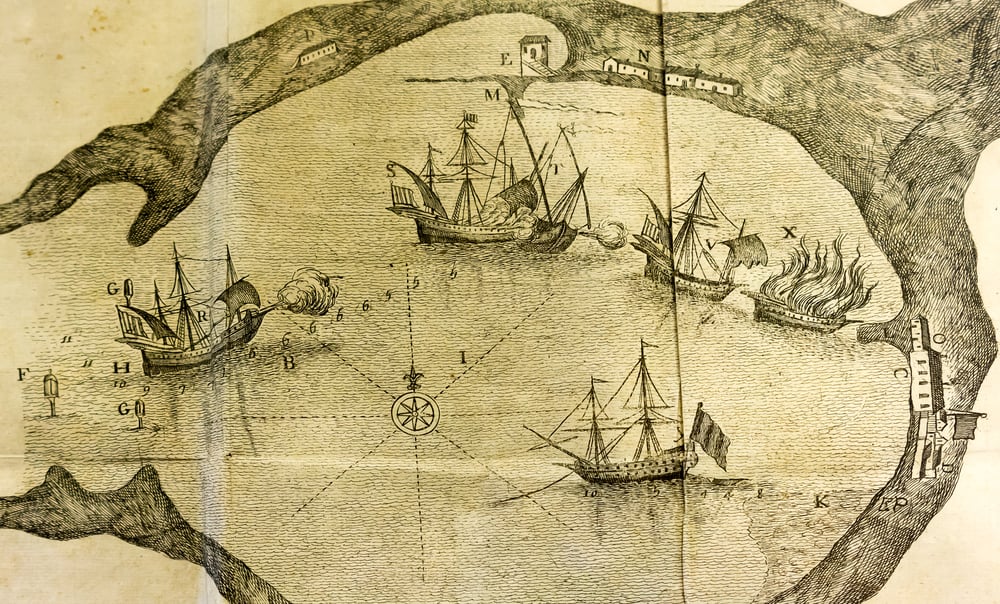
Early maritime charts prioritized practical information over geographic accuracy, and this wasn’t because ancient cartographers lacked precision — it was because sailors needed different information than modern GPS users expect from maps. A medieval portolan chart might show the coastline of Italy stretched and distorted compared to satellite imagery, but it would mark every safe harbor, every rocky outcrop that could sink a ship, every reliable source of fresh water along the coast with meticulous detail (because that’s what kept crews alive during long voyages).
Wind roses — elaborate compass designs — dominated the center of these charts not as decoration but as working tools, showing the prevailing wind directions that determined whether a particular route was viable during specific seasons. And the legendary “Here be dragons” warnings that appeared on maps marking unexplored regions.
Ocean Currents Became Underwater Highways
Smart sailors rode ocean currents like rivers in the sea. The Gulf Stream, discovered by ancient mariners long before Benjamin Franklin mapped it, could add or subtract weeks from Atlantic crossings.
Fighting a major current was futile. Working with it made the difference between profit and bankruptcy on trading voyages.
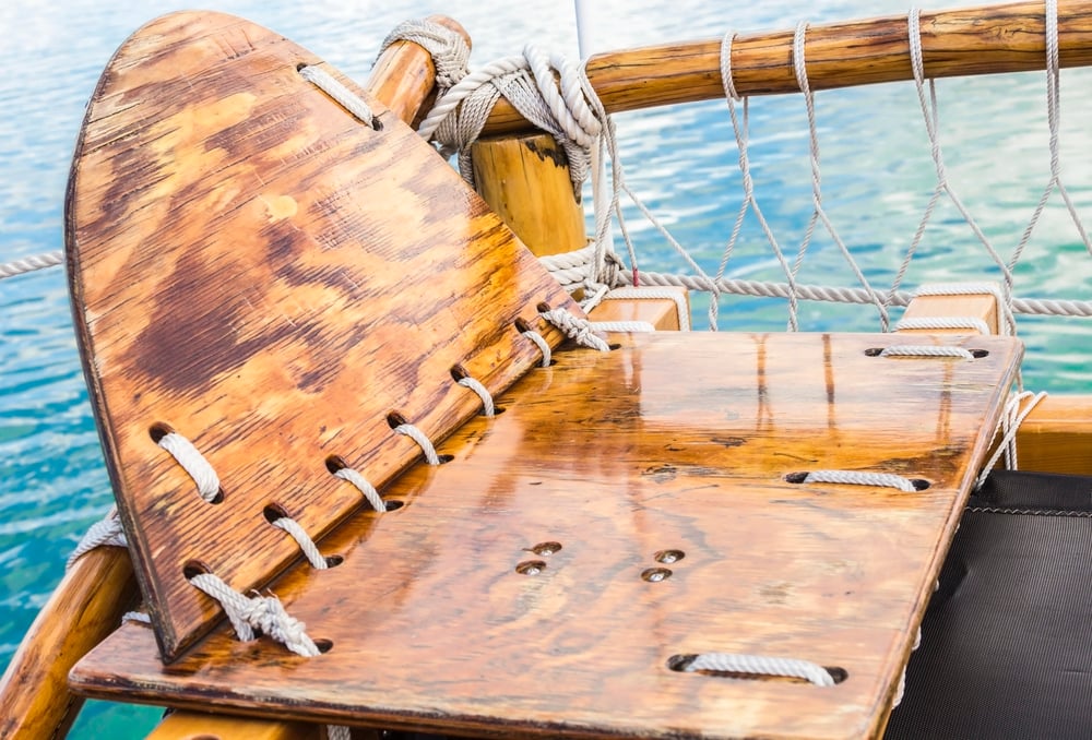
Sounding Poles Worked in Shallow Waters
You can’t talk about maritime navigation without acknowledging that most ancient sailing happened within sight of land, hugging coastlines where water depth mattered more than stellar navigation, and here’s where sounding poles earned their reputation as lifesavers rather than just measuring tools. These long wooden or metal rods let sailors probe ahead in shallow harbors and river mouths, feeling for underwater obstacles that could punch pits in hulls or strand vessels during low tide, but they also served a navigation function that modern sailors often miss: the rhythm of sounding created an audio map of the seafloor (experienced hands could distinguish between striking sand, mud, rock, or coral just from the sound and feel transmitted up the pole).
And in fog-shrouded waters where visibility dropped to nothing, systematic sounding provided the only reliable method for following channels and avoiding sandbars that shifted with storms and seasons. The sailor working the sounding pole wasn’t just measuring depth — he was reading the underwater landscape like braille.
Weather Patterns Predicted Seasonal Winds
Monsoons made Indian Ocean trade possible. Sailors learned to time departures with seasonal wind reversals.
Miss the window and wait six months for favorable winds to return. Ancient trading schedules revolved around weather patterns, not market demand.
Coastal Piloting Used Landmark Recognition

Distinctive rock formations, mountain profiles, and harbor entrances became navigation markers passed down through sailing families. Captains memorized coastlines like addresses.
This knowledge was closely guarded. Experienced pilots commanded high fees for guiding ships through dangerous local waters.
Echo Sounding Detected Hidden Rocks
Sailors shouted toward cliffs and timed the echo to estimate distance from shore. The technique worked well enough to avoid running aground in fog.
Horns and drums amplified the effect. Some crews developed sophisticated systems of acoustic ranging that rivaled modern depth sounders for accuracy.
Tidal Charts Guided Harbor Navigation
Understanding tidal patterns was life or death in many ancient ports, and this knowledge went far deeper than simply knowing when high tide occurred — experienced harbor pilots understood how different phases of the moon affected tide height, how seasonal variations changed tidal ranges, how local geography created tidal races and slack water periods that could help or hinder ships trying to enter narrow channels. The same harbor entrance that welcomed ships during high tide could become a ship-killing maze of exposed rocks and sandbars six hours later, so timing wasn’t just important for convenience; it determined whether a voyage ended successfully or with the crew swimming for shore while their vessel broke apart on hidden obstacles.
And because tidal patterns vary dramatically from place to place (the Mediterranean has barely noticeable tides while the Bay of Fundy sees 50-foot tidal ranges), this knowledge was intensely local, passed down through generations of pilots who knew every quirk and exception in their home waters. Tidal knowledge was inherited wisdom.
Sand Glasses Measured Time at Sea

Hourglasses and sand glasses kept track of watches and sailing time. Crews flipped them religiously to maintain accurate dead reckoning calculations.
Time was distance when you knew your speed. Lose track of time and lose your position on the featureless ocean.
Loglines Calculated Ship Speed

Sailors dropped a knotted rope behind the ship and counted knots that passed in a measured time interval. This gave them speed in “knots” — a term still used today.
The accuracy depended on consistent knot spacing and precise timing. Sloppy measurement accumulated into serious navigation errors over long voyages.
Cross-Staff Measured Stellar Angles

The cross-staff let navigators measure the angle between celestial objects and the horizon. Knowing this angle and the date gave them latitude with surprising precision.
Using a cross-staff required steady hands and clear skies. Cloudy weather for days could leave navigators completely lost about their north-south position.
Ancient Sailors Trusted Their Senses

Before instruments, navigation was a sensory experience that engaged every aspect of human perception, and the best navigators developed an almost supernatural ability to read subtle environmental cues that landlubbers would never notice. They could smell land before seeing it — the scent of vegetation, smoke from cooking fires, or the distinctive odor of shallow water mixing with deeper ocean currents carried on offshore breezes that told experienced noses an island lay somewhere ahead.
Water color revealed depth and bottom composition: the brilliant turquoise that meant coral reefs and dangerous shallows, the deep blue-black of abyssal depths, the greenish tinge that indicated plankton blooms or river outflow from distant shores. And the most skilled navigators claimed they could taste differences in seawater that revealed their location.
The Sea’s Language Endures

These ancient techniques didn’t disappear when GPS satellites began orbiting overhead. Modern naval academies still teach celestial navigation as backup for electronic systems that can fail when you need them most.
Experienced sailors continue reading wave patterns, watching bird behavior, and sensing weather changes with methods their ancestors would recognize. The sea doesn’t change its fundamental nature just because humans invented better tools for crossing it.
More from Go2Tutors!

- The Romanov Crown Jewels and Their Tragic Fate
- 13 Historical Mysteries That Science Still Can’t Solve
- Famous Hoaxes That Fooled the World for Years
- 15 Child Stars with Tragic Adult Lives
- 16 Famous Jewelry Pieces in History
Like Go2Tutors’s content? Follow us on MSN.