Countries That Share No Land Borders
Start anywhere on Earth where land meets sea. Some places just float apart, cut off by waves instead of borders.
Not every nation rubs shoulders with another – some stand alone, wrapped in ocean. Water replaces walls here, distance builds difference.
History moves differently when there is no next door. Decisions come from within, not through treaties or crossings.
Even food costs shift because trucks can’t drive across saltwater.
Out on the open sea, you’ll find countries made up of islands. A few are just small dots across the vast Pacific waters.
Then there’s the large one – so big it counts as its own continent too. They all have that faraway feel, like they sit at the outer rim of everything.
Reaching them usually takes longer than most trips. Once you arrive, things seem shifted somehow, not quite like elsewhere.
Japan
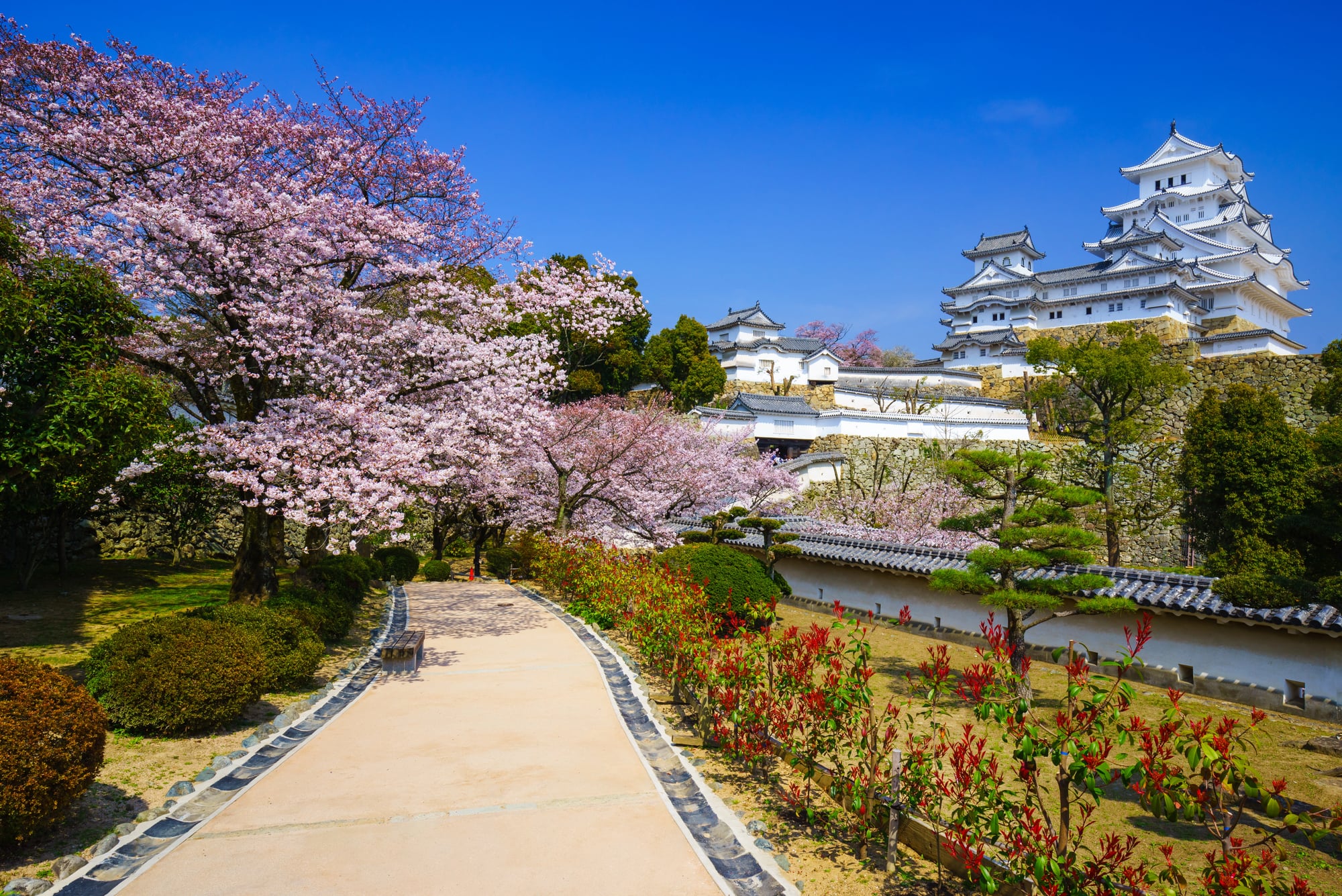
Four main islands and thousands of smaller ones make up this nation of 125 million people. Japan’s separation from the Asian mainland—about 50 kilometers at the closest point between Tsushima Island and South Korea—has allowed a distinctive culture to develop over millennia.
The lack of land borders meant that for over two centuries during the Edo period, Japan could effectively seal itself off from the outside world. Try doing that when you share a border with anyone.
The geography also meant that invasion was difficult. The Mongols tried twice in the 13th century and failed both times, partly due to typhoons that the Japanese later called kamikaze, or divine wind.
That isolation is still felt today. Japan processes immigration differently than European countries with porous borders, and the cultural homogeneity—sometimes a source of pride, sometimes of criticism—stems directly from being surrounded by sea.
Australia
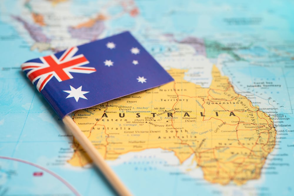
It’s easy to forget that Australia counts as a country with no land borders because it’s so big. The entire continent belongs to one nation, which means the nearest neighbors are Papua New Guinea (about 150 kilometers across the Torres Strait) and Indonesia.
That’s a lot of ocean between you and everyone else.
This isolation explains the strange wildlife. Marsupials evolved separately here for millions of years.
It also explains the distinctive Australian identity—part British, part Pacific, entirely its own thing. When your closest major trading partners are thousands of kilometers away, you develop a certain self-reliance.
Iceland
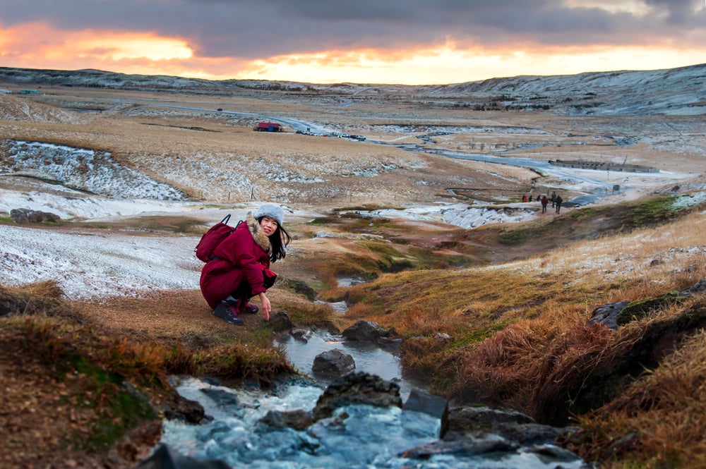
Sitting just below the Arctic Circle, Iceland is the most sparsely populated country in Europe. The nearest landmass is Greenland, about 280 kilometers to the northwest.
Scotland lies roughly 800 kilometers to the southeast. That’s a lot of cold Atlantic in between.
The isolation preserved Old Norse language and traditions better than anywhere else in Scandinavia. Icelanders can still read the medieval sagas in something close to the original language.
The geography also means that when Iceland’s economy collapsed in 2008, there was no quick fix coming across the border. They had to sort it out themselves.
New Zealand

Two main islands plus a scattering of smaller ones sit about 1,500 kilometers southeast of Australia at the closest point. That distance is significant.
It meant that Polynesian settlers who became the Māori arrived only around 750 years ago—making New Zealand one of the last major landmasses on Earth to be inhabited by humans.
The isolation continues to matter. New Zealand’s COVID-19 response in 2020 relied heavily on the fact that borders were easy to control when you’re surrounded by ocean.
Biosecurity is taken seriously here because introduced species have devastated native wildlife. When you’re an island, what comes in stays in.
Cuba

The largest island in the Caribbean floats about 145 kilometers (90 miles) south of Florida. That short distance has defined Cuban politics for generations.
Close enough to influence, far enough to resist—the Strait of Florida might as well be a moat.
Cuba’s isolation became more pronounced after the 1959 revolution. The U.S. embargo turned the island into an economic experiment in self-sufficiency.
Cars from the 1950s still run on Havana’s streets partly because new ones couldn’t get in. The geography didn’t cause the politics, but it made certain political choices more sustainable.
Madagascar

Breaking off from the Indian subcontinent about 88 million years ago, Madagascar drifted into isolation. The result is one of the most unusual ecosystems on the planet.
Lemurs exist here and nowhere else. Over 90% of the wildlife is found only on this island.
But isolation has costs. Madagascar remains one of the poorest countries in the world.
The lack of land connections to African markets and infrastructure means development has been slow. Shipping everything is expensive.
Geography gives, and geography takes away.
Sri Lanka

Just 30 kilometers separates Sri Lanka from India’s southern tip at the narrowest point. A chain of limestone shoals called Adam’s Bridge almost connects them—according to legend, it once did.
But that narrow gap has been enough to create a distinct national identity.
The island was known to ancient traders as Lanka, Serendib, and Ceylon. Its position in the Indian Ocean made it a crucial stop on maritime trade routes.
Everyone from the Portuguese to the Dutch to the British wanted it. Being an island didn’t provide protection from colonization, but it did help create a culture that borrowed from many sources while remaining recognizably its own.
The Philippines
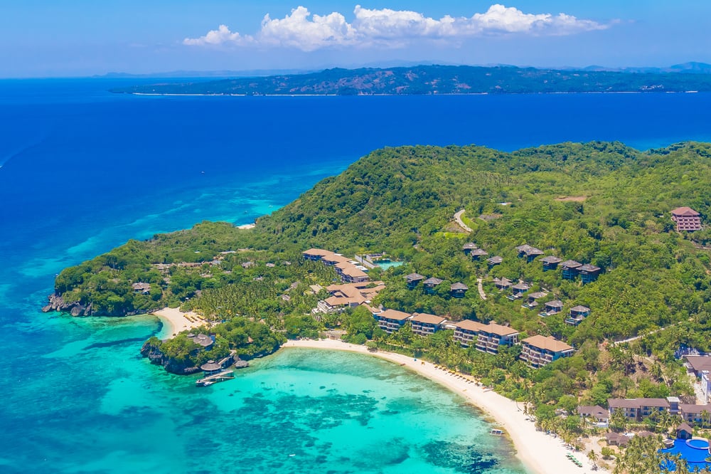
More than 7,600 islands spread across the western Pacific make up this nation of over 110 million people. The nearest neighbors are Taiwan to the north and Malaysia and Indonesia to the south and southwest, all separated by significant stretches of sea.
The archipelago nature of the Philippines creates internal challenges that landlocked countries don’t face. Moving goods from one island to another requires ships or planes.
Regional identities are strong. The national language, Filipino, had to be constructed somewhat artificially from Tagalog because the islands had developed their own distinct languages.
Unity is harder when water separates everything.
Ireland

The island of Ireland sits at Europe’s western edge, separated from Great Britain by the Irish Sea. The Republic of Ireland occupies most of the island, with Northern Ireland (part of the United Kingdom) in the northeast.
But Ireland as a state shares no land borders—Northern Ireland is a different jurisdiction.
That positioning at the edge of Europe meant Ireland was the launching point for emigrants heading to America. It also meant the country avoided the worst of continental Europe’s wars, though it didn’t escape British colonization.
The sea provided protection and limitation in equal measure.
Jamaica
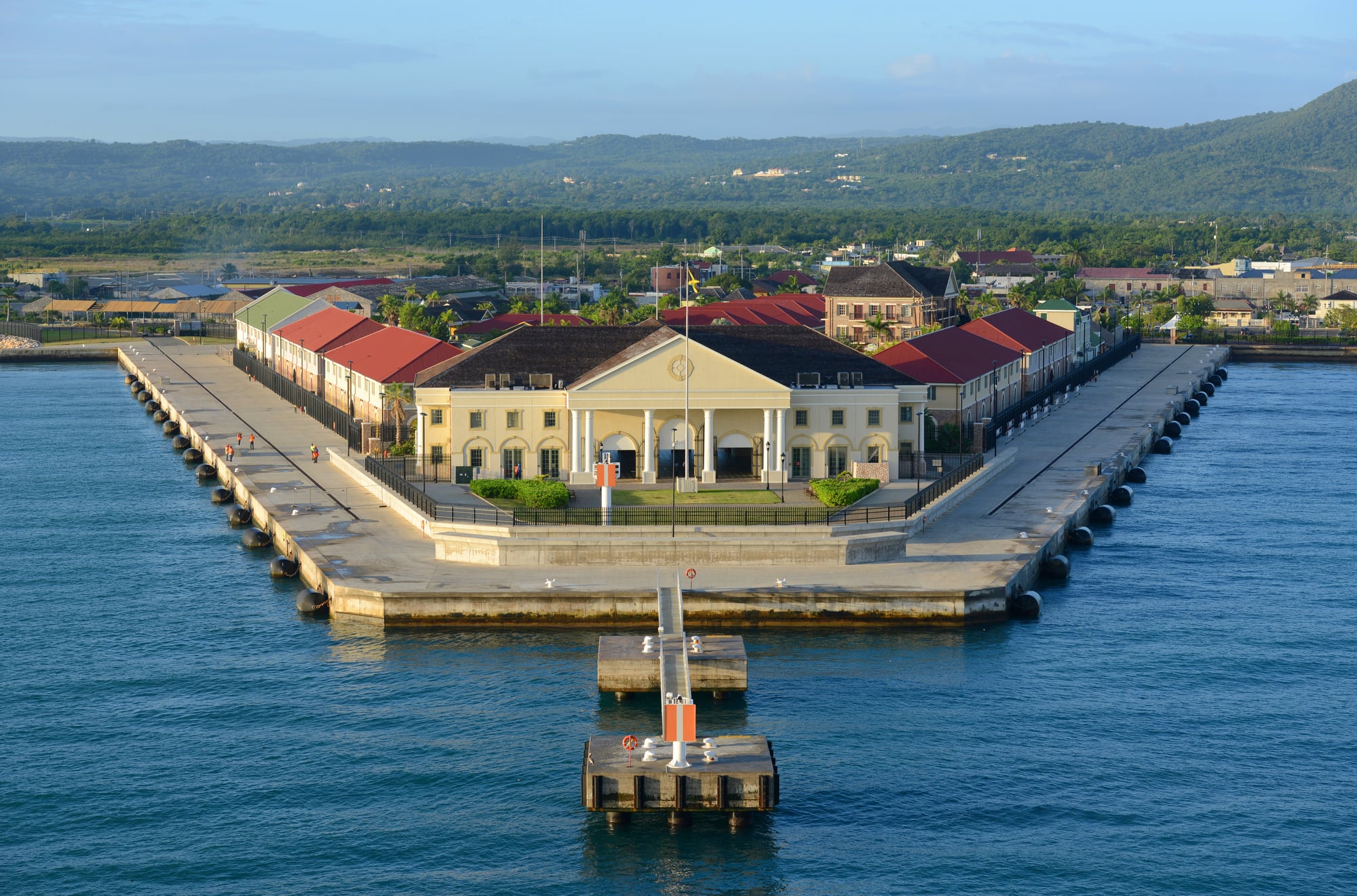
About 140 kilometers south of Cuba and 190 kilometers west of Haiti, Jamaica sits in the heart of the Caribbean. The island is small—roughly 235 kilometers long and 80 kilometers wide—but its cultural influence has been massive.
Reggae music traveled from this island to the entire world. So did Jamaican patois, jerk seasoning, and a distinctive approach to life that travelers recognize immediately.
Islands have a way of concentrating culture. When you can’t spread out, you go deep.
Taiwan

The Taiwan Strait separates this island from mainland China—about 130 kilometers at its narrowest point, 180 kilometers on average. That gap is one of the most politically significant stretches of water on Earth.
Whether Taiwan is a country depends on who you ask, but it functions as one in every practical sense.
The strait has prevented military resolution of the Chinese Civil War for over 70 years. Taiwan developed separately, becoming a democracy while the mainland remained under single-party rule.
Mountains of military hardware point across that narrow stretch of sea. Geography postpones certain questions indefinitely.
Singapore

This city-state sits at the southern tip of the Malay Peninsula, connected to Malaysia only by two causeways and a bridge. Technically, there’s no land border in the traditional sense—water separates them everywhere except those constructed crossings.
Singapore’s island status forced creativity. With no natural resources and limited space, the country had to become useful to everyone else.
It became a port, a financial center, a place where things got done efficiently. When you can’t grow your own food or pump your own oil, you’d better make yourself indispensable.
Bahrain

This small archipelago in the Persian Gulf consists of 33 islands, the largest being Bahrain Island. Causeway bridges now connect Bahrain to Saudi Arabia, but the country itself remains surrounded by water.
The island’s strategic position has made it valuable to empires throughout history. Portuguese, Persian, and British powers all controlled it at various points.
Today it hosts a major U.S. naval base. Being an island in a politically sensitive region means everyone wants a piece of you.
Where the Map Ends and the Water Begins

Few people around means fewer distractions. Yet getting away isn’t simple.
Travel happens only by boat or plane. Going somewhere else takes planning.
Crossing into a new nation? Not possible on foot.
Driving for lower prices or sunnier skies stays out of reach. What shows up must fly or float here first.
Leaving works the same way.
Still, lines on a map bring disagreements too. People show up, having walked far through your land.
Troops gather where roads cross into your country. Islands deal with unique problems – yet standing face to face with an armed neighbor?
That rarely comes up.
Out past the last road, some nations sit along a rim. Each one carries its own story, way of life, path through time.
Still, each touches an open stretch – where earth runs into sea without warning. This meeting point changes how people live.
Always did.
More from Go2Tutors!

- The Romanov Crown Jewels and Their Tragic Fate
- 13 Historical Mysteries That Science Still Can’t Solve
- Famous Hoaxes That Fooled the World for Years
- 15 Child Stars with Tragic Adult Lives
- 16 Famous Jewelry Pieces in History
Like Go2Tutors’s content? Follow us on MSN.