Historic Maps That Changed Exploration
Maps have always been more than just lines drawn on paper. They’ve shaped how humanity viewed its world, guided explorers into the unknown, and sometimes even sparked wars over what they revealed.
From clay tablets baked in ancient Mesopotamia to the intricate charts of the Renaissance, every generation of mapmakers tried to push the known boundaries a little further. Here’s a look at historic maps that completely reshaped how people explored and understood the world around them.
Ptolemy’s Geography Map
Around 150 AD, Claudius Ptolemy created a groundbreaking collection of maps and texts known as Geography. This work compiled nearly all known geographic data of the ancient world, covering Europe, Asia, and Africa.
Ptolemy introduced the revolutionary idea of latitude and longitude, setting the standard for centuries. Even though his world was smaller than reality, his influence was enormous. When medieval scholars rediscovered his work through Arabic translations, it reignited Europe’s fascination with scientific cartography—and ultimately inspired explorers to test his limits.
Tabula Peutingeriana
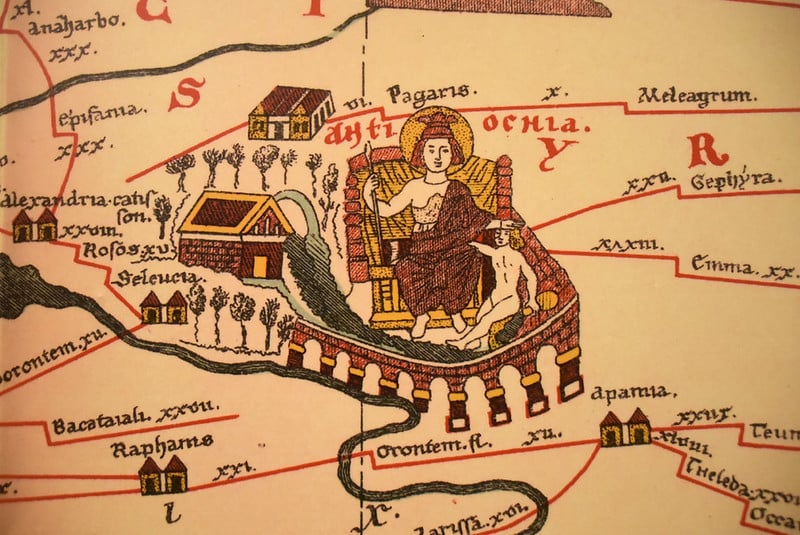
Originally drawn in the 4th century and preserved through a 13th-century copy, the Tabula Peutingeriana was more a travel guide than a map. Shaped like an impossibly long scroll, it stretched across the Roman Empire, tracing roads from Britain all the way to India.
Rather than accurate geography, it offered what travelers actually needed—distances, stops, and major cities. In a way, it was the Roman Empire’s version of Google Maps for merchants, soldiers, and officials crisscrossing 250,000 miles of imperial roads.
Hereford Mappa Mundi
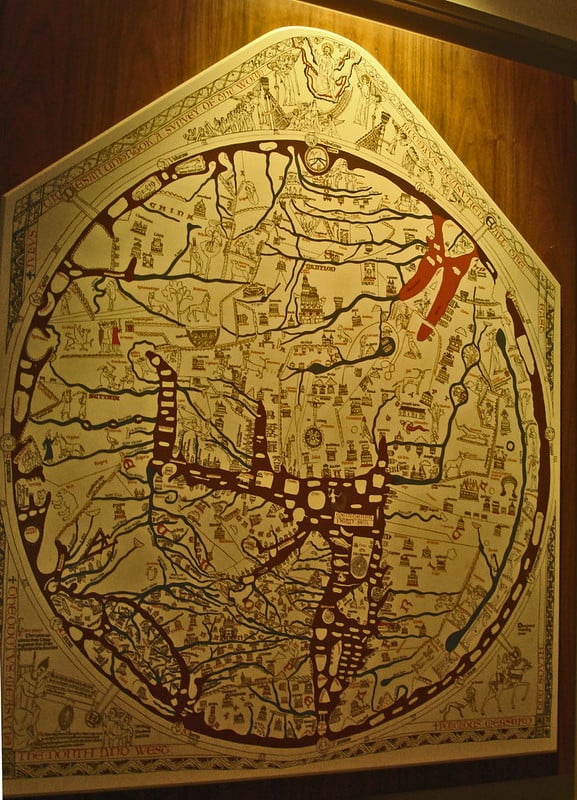
Created around 1300, the Hereford Mappa Mundi remains the largest medieval map ever discovered—over five feet wide and drawn on vellum. It placed Jerusalem at its center with the East positioned at the top, blending biblical history, myths, and geography into one vast visual story.
Nearly 500 drawings and 1,000 captions crowd its surface, mixing dragons, cities, and scriptural scenes. Rather than a navigator’s tool, it was a lesson in faith and worldview, showing how medieval Christians believed heaven, earth, and history fit together.
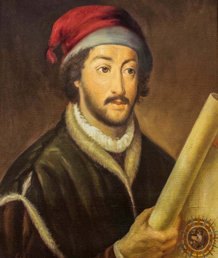
Pietro Vesconte’s Portolan Chart
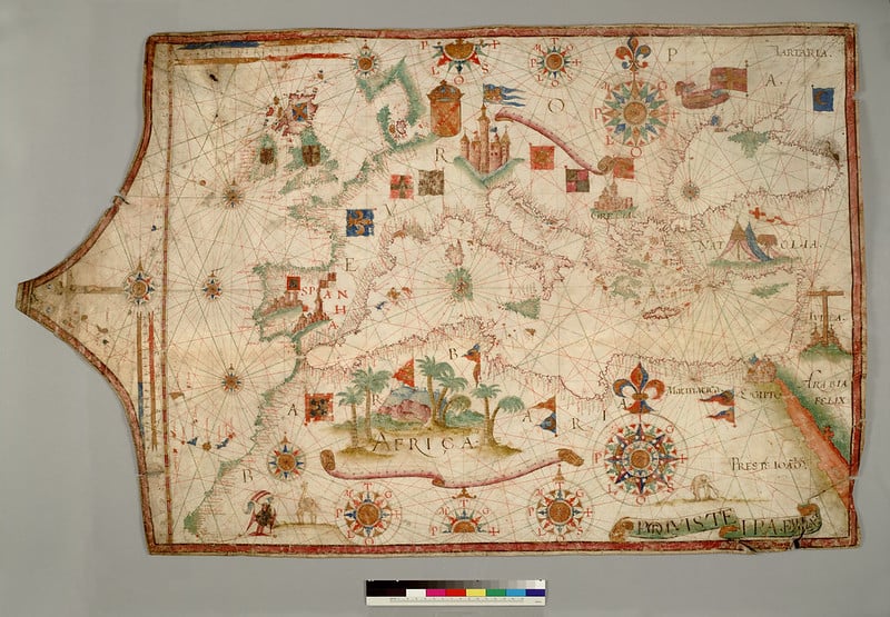
In the early 1300s, Pietro Vesconte changed navigation forever. His portolan charts were the first to combine compass bearings with measured distances, resulting in maps that were astonishingly accurate for sailors.
Vesconte was among the first cartographers to sign and date his maps—turning his craft into a recognized science. His crisp depictions of coastlines, ports, and sea routes became indispensable to Mediterranean merchants and explorers.
Catalan Atlas

When the Catalan Atlas appeared in 1375, it was unlike anything before it. Created by Majorcan mapmaker Cresques Abraham, it combined geography, storytelling, and art into one extraordinary piece.
Spread across six lavish vellum sheets decorated with gold and silver, it portrayed not only coastlines and trade routes but also notes on exotic lands, rulers, and customs. It even drew from Marco Polo’s accounts. To medieval Europeans, it wasn’t just a map—it was a window into the wider world.
Gangnido Map
In 1402, Korean scholars Yi Hoe and Kwon Kun created the Gangnido map, blending Chinese, Korean, and Islamic sources into a comprehensive view of the world. Remarkably, it included Europe and Africa—proof of the Silk Road’s far-reaching exchange of ideas.
Korea appeared prominently (naturally), but what stood out was how detailed East Asia looked compared to contemporary European maps. The Gangnido reminds us that advanced cartography didn’t belong to the West alone.
Fra Mauro Map
Between 1457 and 1459, Venetian monk Fra Mauro produced a circular map that broke from old conventions. Commissioned by King Afonso V of Portugal, his chart placed south at the top—an intentional challenge to Ptolemy’s outdated design.
Incorporating new information from Arab and Venetian explorers, Fra Mauro correctly depicted the Indian Ocean as open rather than landlocked. For the time, it was a masterpiece of precision and open-mindedness.
Martin Behaim’s Erdapfel

Completed in 1492, just before Columbus’s first voyage, Martin Behaim’s Erdapfel is the oldest surviving terrestrial globe. It captured how Europeans imagined the world right before everything changed.
Based heavily on Ptolemy and Marco Polo, the globe underestimated Earth’s size and showed a single ocean between Europe and Asia—a mistake that convinced Columbus the Indies were a short sail westward. In hindsight, it was beautifully wrong.
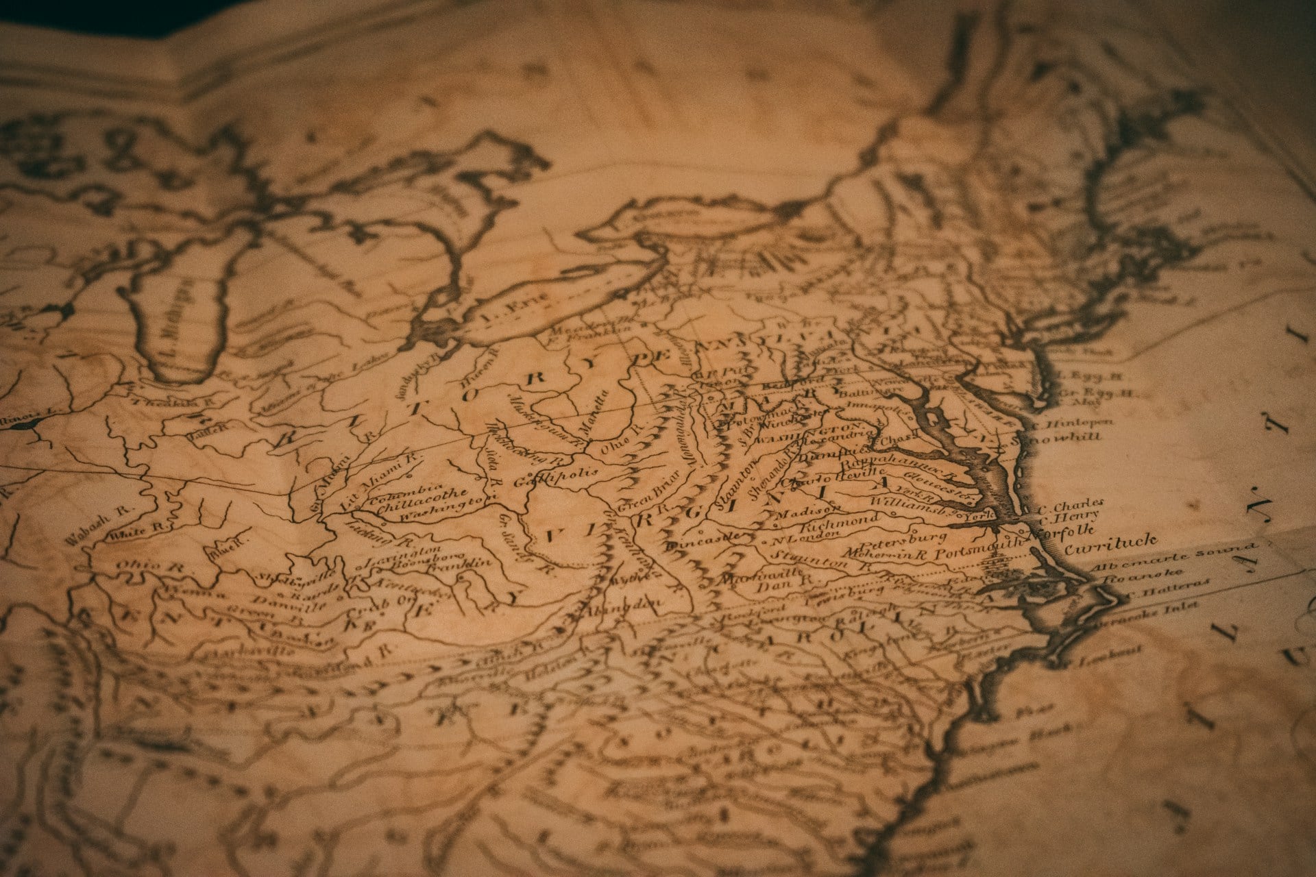
Juan de la Cosa Map
In 1500, Spanish navigator Juan de la Cosa, who had sailed with Columbus, drew the first known map to include the Americas. It outlined the Caribbean and northern South America with surprising detail and even included parts of North America from John Cabot’s expeditions.
For Europeans at the dawn of the 16th century, it was the first glimpse of a “New World.”
Cantino Planisphere

Drawn in 1502, the Cantino Planisphere might be the world’s first case of map-related espionage. Italian agent Alberto Cantino bribed his way into Portugal’s secret map archives and smuggled this chart home.
It displayed Portuguese discoveries in Africa, India, and Brazil with stunning precision and was among the earliest to show the Americas as separate from Asia. For Renaissance Europe, it was like leaking classified world data.
Waldseemüller Map
In 1507, Martin Waldseemüller printed a massive 8-foot-wide map that would change geography forever—it was the first to call the new continent America. Inspired by Amerigo Vespucci’s voyages, Waldseemüller realized these lands were distinct from Asia.
He even included the Pacific Ocean—six years before Europeans officially saw it. Few maps in history have left such a permanent mark on language and global perception.
Piri Reis Map

In 1513, Ottoman admiral Piri Reis compiled a world map using sources from Columbus’s voyages, Arab maps, and ancient charts. Only a fragment survives, but it shows astonishing accuracy in its depiction of the Atlantic coasts of Europe, Africa, and South America.
Piri claimed he gathered intelligence from a Spanish sailor who had traveled with Columbus—making his map one of the earliest syntheses of Old and New World knowledge.
Gerardus Mercator’s Projection

By 1569, navigation had gone global—and Gerardus Mercator gave sailors the map they needed. His projection preserved angles, letting navigators plot straight-line courses across oceans.
Though it exaggerated areas near the poles (making Greenland look massive compared to Africa), its practicality outweighed its flaws. For centuries, Mercator’s projection dominated mapmaking and continues to shape how we visualize the world today.
Abraham Ortelius’s Theatrum Orbis Terrarum
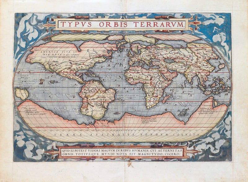
In 1570, Abraham Ortelius published Theatrum Orbis Terrarum—the world’s first modern atlas. Unlike earlier single maps, this was a curated collection of 53, all standardized in format and style.
It was beautifully bound, easy to read, and accessible to scholars and nobility alike. With 31 editions in seven languages, Ortelius didn’t just make maps—he made geography a bestseller.
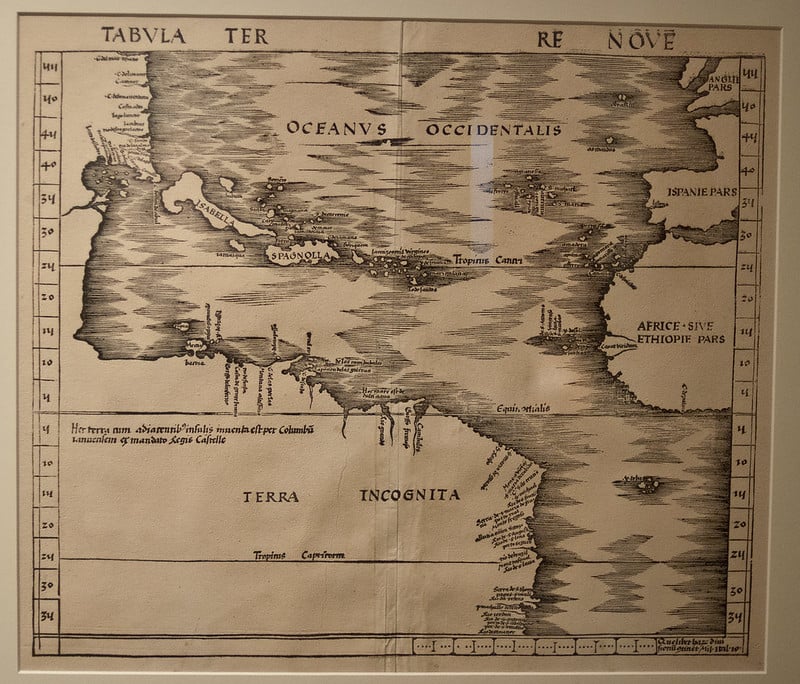
Henricus Martellus World Map
Drawn around 1490, Henricus Martellus’s map bridged medieval and modern thinking. Using fresh Portuguese data, he showed that Africa could be circumnavigated—a huge revelation.
His work influenced both Columbus and Waldseemüller, linking the old Ptolemaic worldview with the new age of discovery. It’s one of those quiet, pivotal creations that shaped the next century of exploration.
Diogo Ribeiro Map

By 1529, Diogo Ribeiro, cartographer for the Spanish crown, produced a world map that finally showed the Pacific Ocean’s true vastness. Based on Magellan’s circumnavigation, it corrected many earlier misconceptions and depicted the Philippines and other Pacific islands with unprecedented accuracy.
The map even helped Spain and Portugal negotiate colonial boundaries—proof that maps had become as political as they were practical.
The Cartographic Revolution
These maps didn’t just record discoveries—they fueled them. From Babylonian priests sketching a flat world to Renaissance scholars charting new oceans, each map expanded humanity’s understanding of what was possible.
Every stroke of ink or etching on parchment was an act of imagination. Today’s digital and satellite maps owe their existence to these visionaries who dared to draw what others could only dream of.
More from Go2Tutors!

- The Romanov Crown Jewels and Their Tragic Fate
- 13 Historical Mysteries That Science Still Can’t Solve
- Famous Hoaxes That Fooled the World for Years
- 15 Child Stars with Tragic Adult Lives
- 16 Famous Jewelry Pieces in History
Like Go2Tutors’s content? Follow us on MSN.