Largest Structures Seen From the Sky
From high up, some human works stand out across the land – not because they were meant to be seen, but because they grew too large to ignore. A handful of efforts stretch wide enough to show their form only when viewed from above.
Built for protection, moving liquids, carrying people, or growing meals, these were never made for eyes in planes. Seen from space? That happens when actions repeat, spread far, last long.
Shape appears where effort piles over years.
From high above, shapes appear that make no sense when viewed up close. Stretching through barren stretches, lines cut across like scars while flat areas get rearranged into blocks.
Boundaries follow old divisions, drawn by hands long gone. These marks show how people once moved earth, split effort, and claimed space – over centuries.
Above the clouds, certain creations stretch wide – structures shaped by hands but seen only fully from far away. Each one takes up space like a secret drawn on land, visible best where birds fly.
From high above, roads link them like threads across flat earth. Some were built long ago; others rose fast in open desert.
Size here means more than numbers – it shows how much ground people reshape just to exist. What they become depends on who looks down.
Great Wall of China
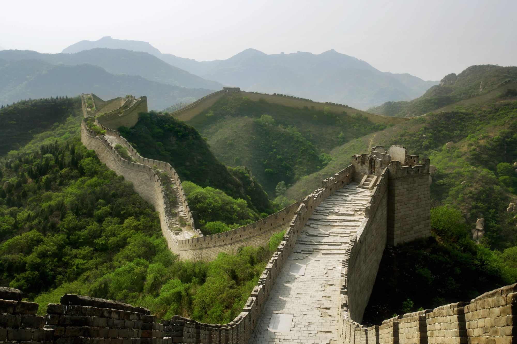
The Great Wall is often misunderstood as a single continuous barrier, but it is actually a network of walls, trenches, and natural features built over centuries. When viewed from the sky, its scale becomes clear as it snakes across mountains, deserts, and grasslands for thousands of miles.
From ground level, the wall feels local and fragmented. From above, it reads as a deliberate line drawn across geography itself.
Its visibility comes from contrast, with stone and earth cutting through varied terrain.
That said, the wall’s importance is not just visual. It reflects centuries of coordinated labor and the long-term priorities of multiple dynasties trying to manage borders rather than conquer space.
Three Gorges Dam
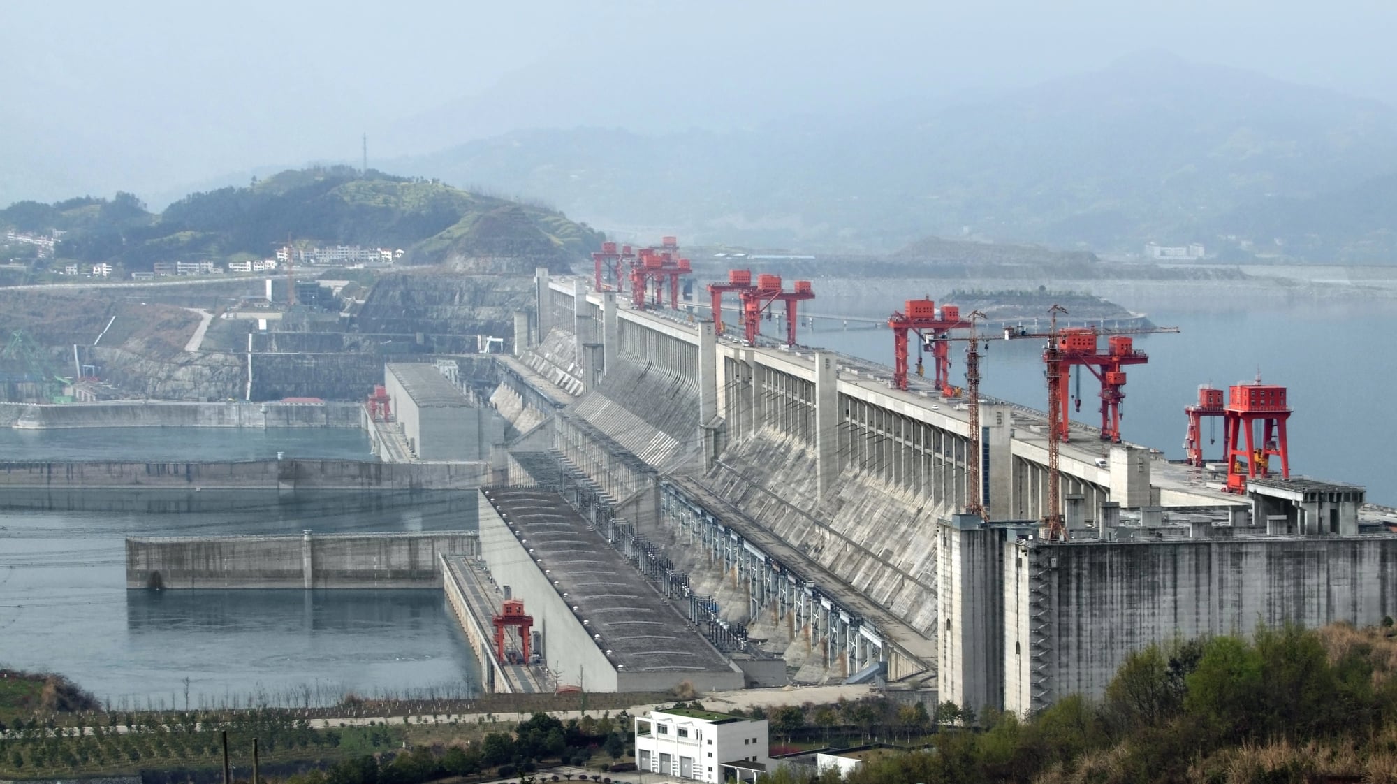
The Three Gorges Dam is one of the most dramatic modern examples of scale visible from the sky. Spanning the Yangtze River, it reshaped both the waterway and the surrounding landscape.
From above, the dam appears as a sharp interruption in the river’s natural flow, backed by a vast reservoir.
Its visibility comes from geometry. Straight concrete lines cut across a winding river, creating a visual contrast that is unmistakable in aerial imagery.
The reservoir stretches far upstream, altering the appearance of valleys and shorelines.
Beyond its size, the dam represents modern engineering ambition. It shows how contemporary societies use technology to impose structure on natural systems at unprecedented scale.
Palm Jumeirah
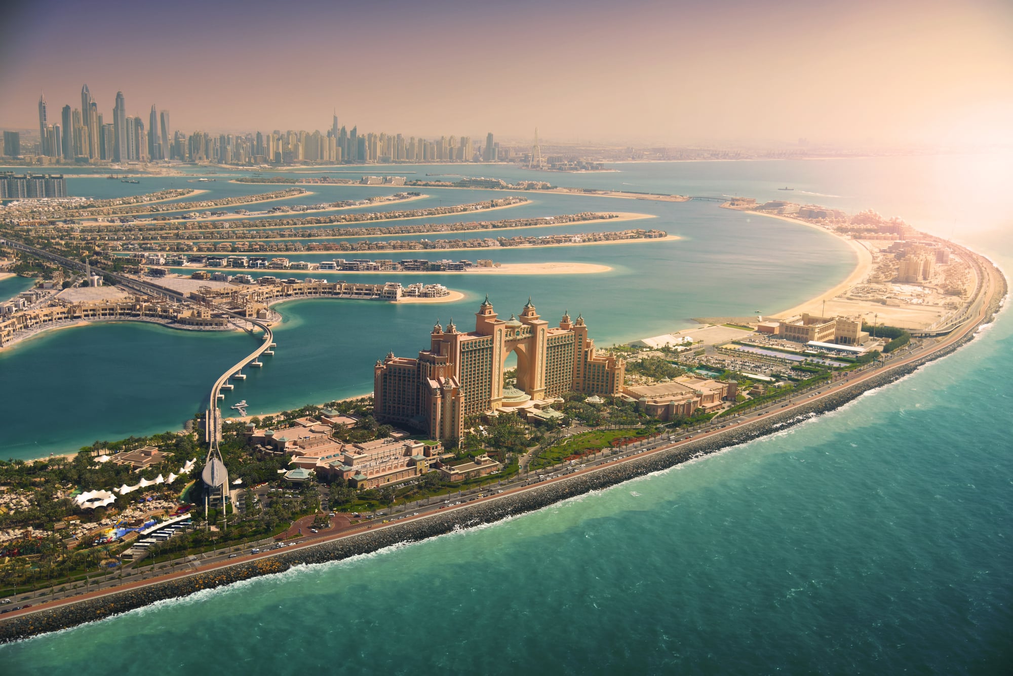
Palm Jumeirah was designed with aerial visibility in mind, unlike most structures on this list. Built off the coast of Dubai, it forms a palm tree shape that is only fully legible from the sky.
Individual buildings fade into the pattern when viewed from altitude.
From above, the island reads as a symbol rather than infrastructure. The trunk, fronds, and surrounding crescent create a deliberate image carved into the sea.
That image required enormous land reclamation and constant maintenance.
Still, its scale tells a deeper story. Palm Jumeirah reflects how modern development sometimes prioritizes visual identity and global recognition as much as function.
Nazca Lines
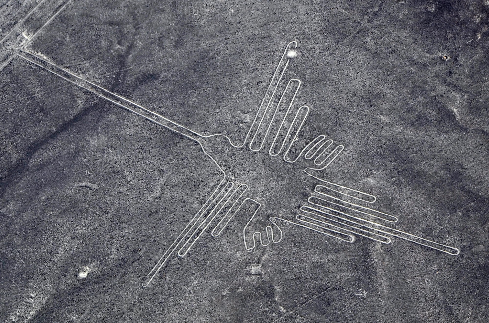
The Nazca Lines are among the oldest large-scale human markings visible from the sky. Etched into the desert of southern Peru, they include geometric shapes, long straight lines, and animal figures that stretch hundreds of feet.
From the ground, the lines are difficult to interpret. From above, they resolve into deliberate designs.
Their visibility depends on the flatness and dryness of the landscape, which preserved them for centuries.
What makes the Nazca Lines remarkable is intention. They were created without aerial technology, yet their full form only emerges when viewed from above.
That disconnect continues to fascinate researchers and observers alike.
Interstate Highway System
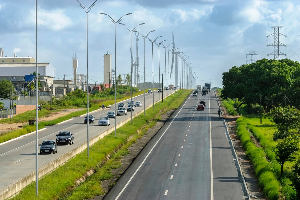
The U.S. Interstate Highway System is not a single structure, but from the sky it reads as one connected network. Highways cut through cities, farmland, deserts, and mountains, forming a web that links the entire country.
Aerial views reveal patterns that drivers never see. Interchanges form symmetrical shapes, long straight segments stretch across open land, and urban grids tighten around major routes.
The system’s scale becomes clear only when distance collapses under altitude.
Its visibility reflects coordination rather than monumentality. The interstates show how infrastructure can reshape a continent quietly, one mile at a time.
Suez Canal
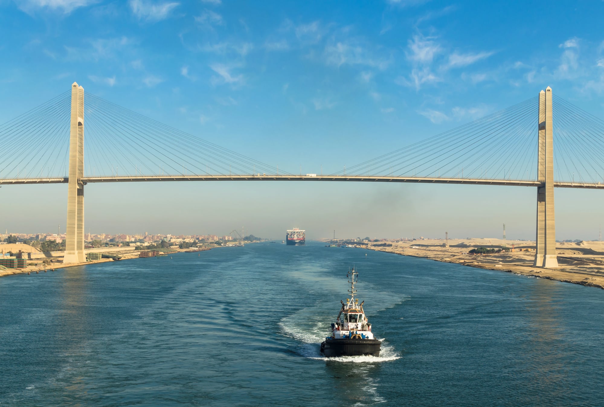
The Suez Canal appears from the sky as a precise line cutting through desert, linking the Mediterranean and Red Seas. Unlike rivers, it does not wander.
Its straightness makes it instantly recognizable in aerial images.
From above, the canal highlights the contrast between natural landscape and human intervention. Water moves where none existed before, and ships appear small against the scale of the corridor.
Its importance lies in function rather than form. Yet its visibility from the sky underscores how a single project can alter global trade routes and redraw economic geography.
Greenhouses of Almería
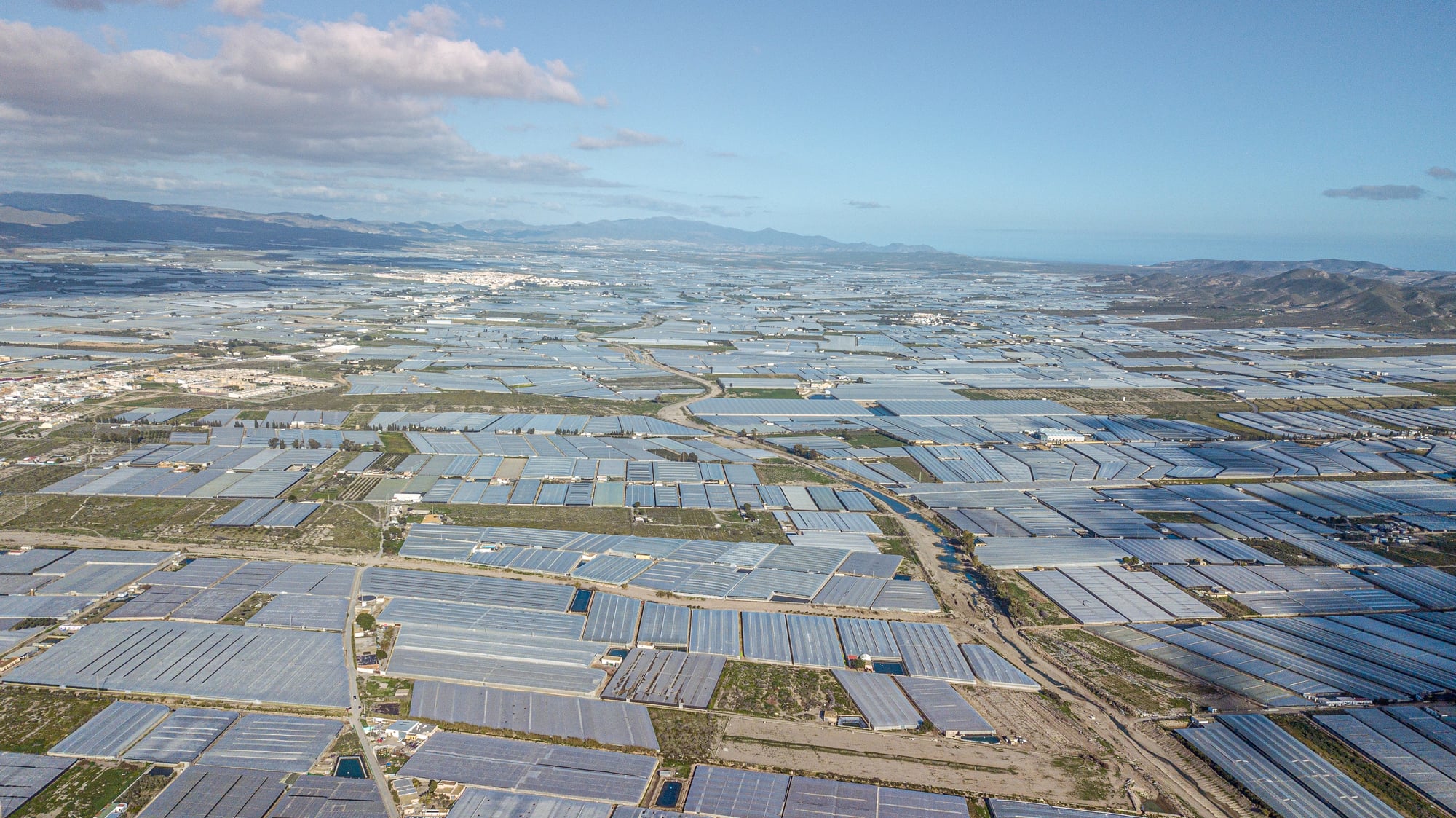
In southern Spain, the Greenhouses of Almería cover vast areas with reflective plastic roofs. From the sky, they appear as a continuous white expanse stretching across the landscape, often described as a sea of glass.
This structure is not tall or monumental, but repetition gives it scale. Thousands of individual greenhouses combine into a single visual mass that reshapes how the land looks from above.
The view tells a story about modern food systems. Intensive agriculture leaves marks that rival ancient monuments in size, even if their purpose is purely practical.
Great Pyramid of Giza
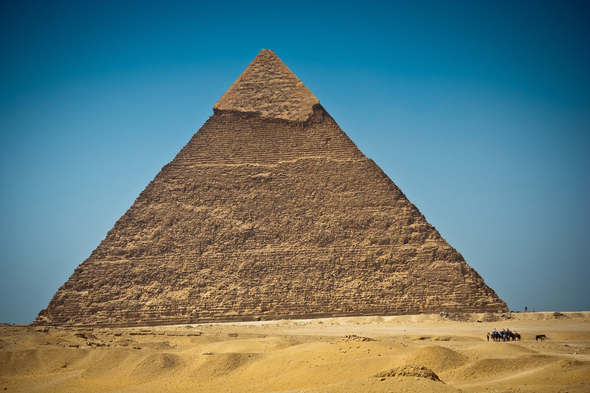
Individually, the Great Pyramid of Giza is not the largest structure visible from the sky. Its significance comes from precision and longevity rather than sheer footprint.
Still, from above, its geometry stands out sharply against the surrounding desert.
The pyramid’s straight edges and orientation make it easy to identify in aerial imagery. Its survival over thousands of years amplifies its impact, especially when seen alongside modern development nearby.
From the sky, the pyramid feels less like a relic and more like a constant. It remains legible across time, technology, and perspective.
Netherlands Polder System
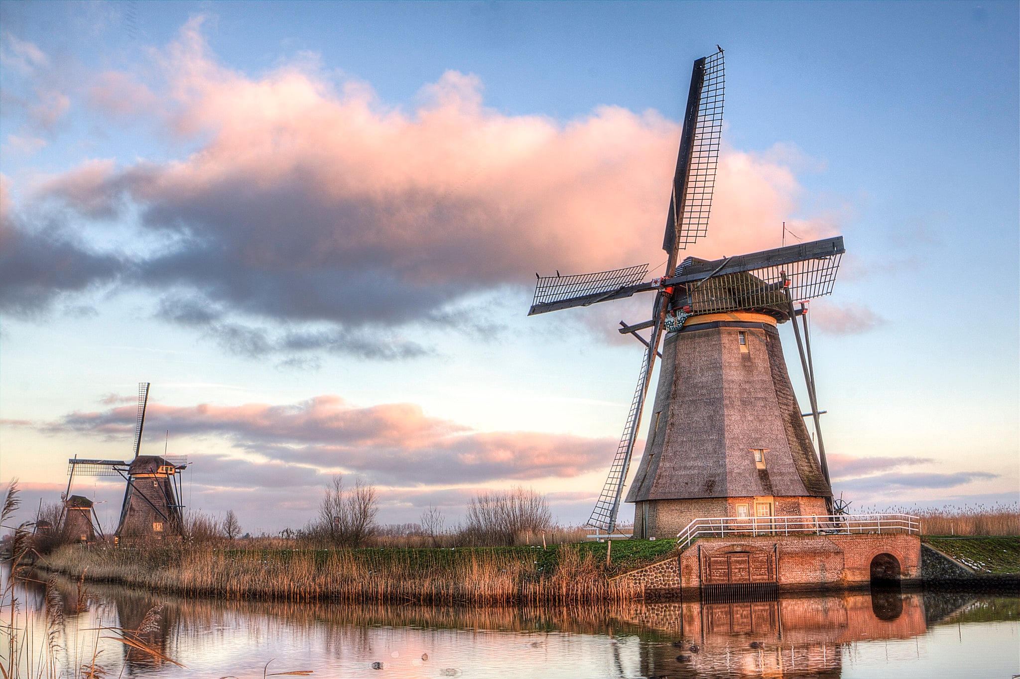
Large portions of the Netherlands exist below sea level, made livable through an extensive system of dikes, canals, and reclaimed land known as polders. From above, these areas appear as carefully ordered grids bordered by water.
The scale becomes apparent in aerial views that show entire regions shaped by human planning. Straight canals divide land into precise rectangles, creating patterns that contrast with natural coastlines.
This system’s visibility reflects collective effort. It represents centuries of coordinated management rather than a single construction project.
Rice Terraces of Banaue
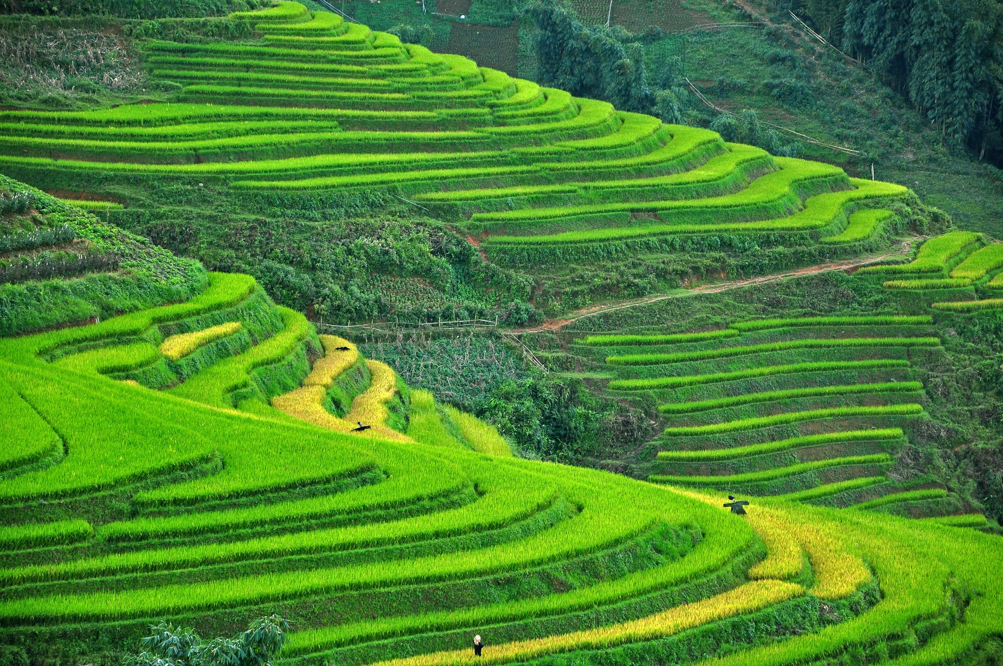
Carved into the mountains of the Philippines, the Rice Terraces of Banaue follow the contours of steep terrain. From the sky, they resemble layered steps wrapping around hillsides.
Their scale emerges through repetition and continuity. Individual terraces are modest, but together they transform entire mountain faces into cultivated landscapes.
These terraces demonstrate how agriculture can become architecture at large scale. From above, they show how human survival strategies can reshape nature without flattening it.
Why Seeing Them From the Sky Changes Everything
Floating high changes everything about what you see down below. Up close, things seem practical, tied to daily use.
But seen from far up, shapes link together like a quiet plan unfolding. Distance shows purpose, hidden order, even patience across time.
Looking at it differently questions what we think growth means. Structures from long ago – say, the Nazca Lines or the Great Wall – stand out just as much as today’s roads and reservoirs.
Just because something is big doesn’t mean only now can build it.
From above, the biggest things built by people show more than skill. What stands where tells what mattered most back then.
Seen far off, shapes on the ground uncover choices made long ago. Distance turns decisions into visible traces across terrain.
More from Go2Tutors!

- The Romanov Crown Jewels and Their Tragic Fate
- 13 Historical Mysteries That Science Still Can’t Solve
- Famous Hoaxes That Fooled the World for Years
- 15 Child Stars with Tragic Adult Lives
- 16 Famous Jewelry Pieces in History
Like Go2Tutors’s content? Follow us on MSN.