Photos Of the Largest Mountain Ranges in the World
High peaks aren’t just scenery. Rivers begin where they rise, winds shift around their slopes, nations draw lines along their ridges, while people build lives shaped by their presence.
Across continents, some chains run so far that deserts give way to forests without leaving the same range. Talk of the biggest ones usually focuses on distance from end to end, even if elevation and earth forces play roles too.
Mountains did not rise suddenly. Built by crashing continents, erupting volcanoes, instead of quiet shifts over ages.
A glimpse into major ranges reveals how they steer weather, carve rivers, yet redefine landscapes across Earth.
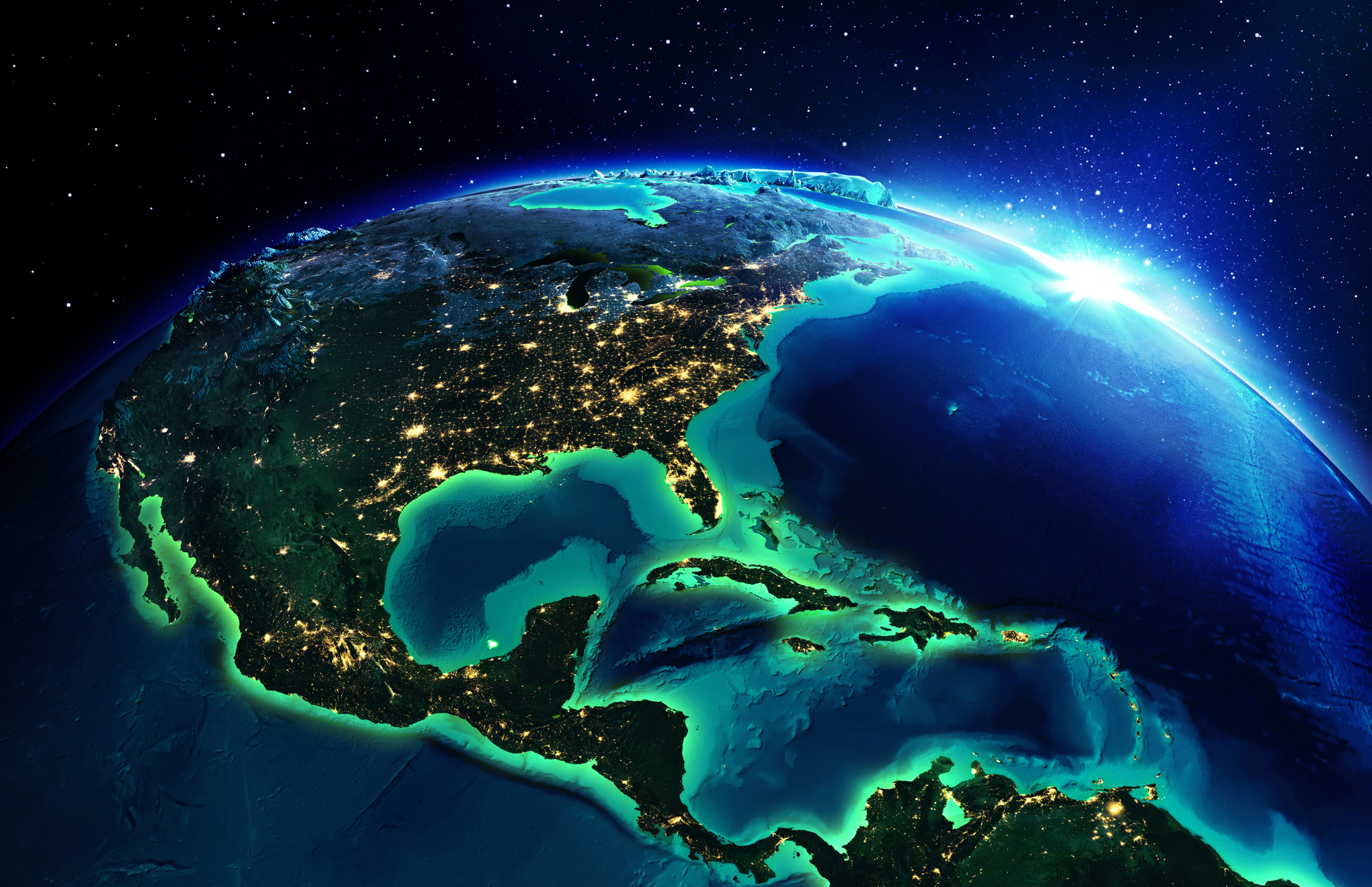
Andes Mountains (South America)
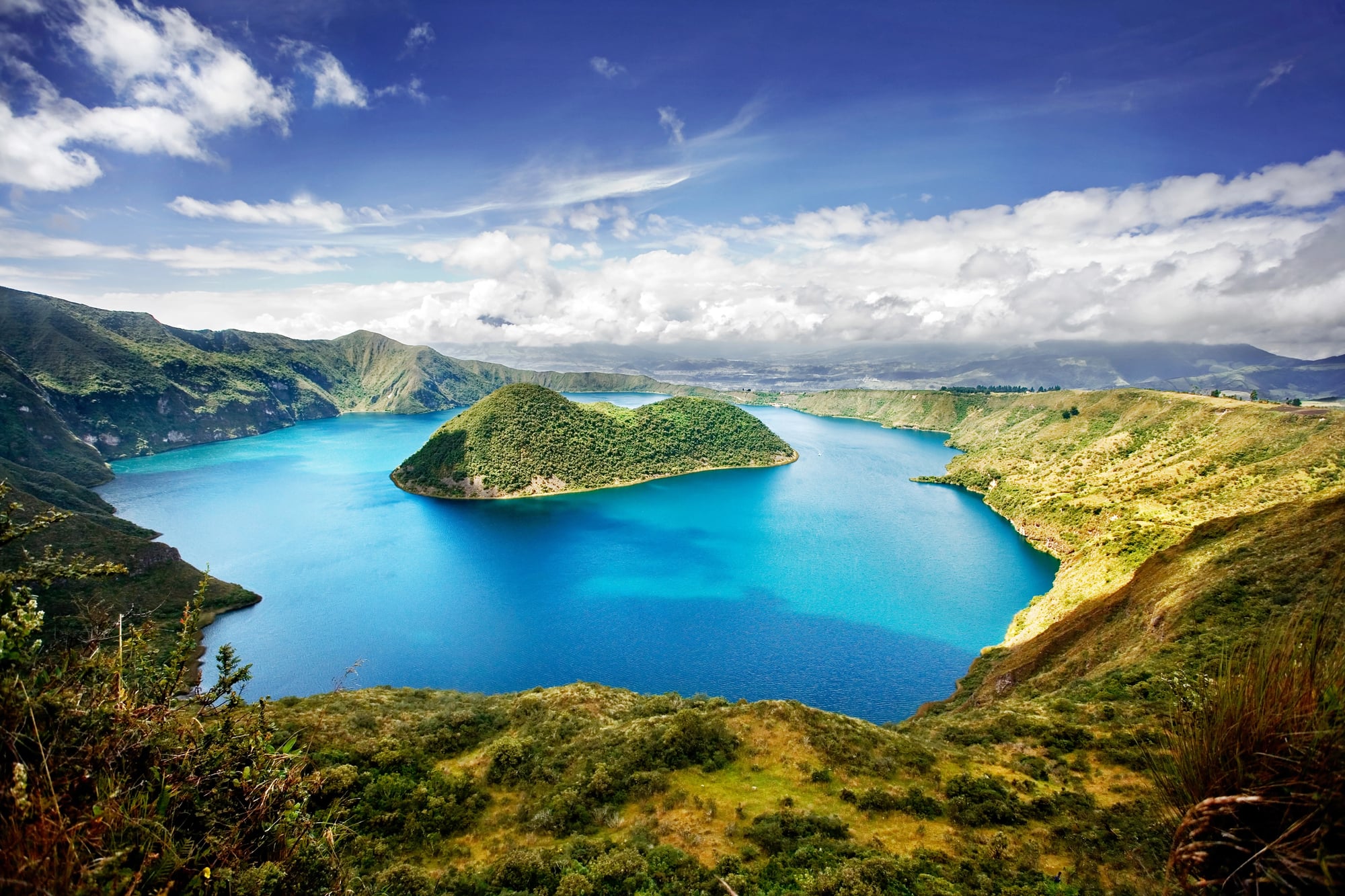
The Andes Mountains hold the title as the longest continental mountain range in the world, stretching roughly 4,300 miles along South America’s western edge. They pass through seven countries, including Venezuela, Colombia, Ecuador, Peru, Bolivia, Chile, and Argentina.
The Andes are remarkably diverse. In Peru and Bolivia, high-altitude plateaus such as the Altiplano support cities perched more than 12,000 feet above sea level.
Farther south, Patagonia features jagged peaks and glacial lakes carved by ancient ice flows. The range also contains Aconcagua, which rises nearly 23,000 feet and is the highest peak outside Asia.
Beyond scenery, the Andes shape weather patterns across the continent. They create rain shadows that contribute to the formation of the Atacama Desert, one of the driest places on Earth.
At the same time, they trap moisture in other regions, sustaining agriculture and dense populations.
Rocky Mountains (North America)

The Rocky Mountains extend approximately 3,000 miles from northern Canada to New Mexico in the United States. They form a dramatic backbone through western North America and influence both climate and water systems.
Unlike a single continuous wall, the Rockies consist of multiple subranges, valleys, and high plains. Glaciers once carved deep U-shaped valleys that now host alpine lakes and forests.
Major rivers, including the Colorado, Columbia, and Missouri, originate in these mountains, making them essential to millions of people downstream.
The Rockies also play a significant role in North America’s weather patterns. They act as a barrier to Pacific moisture, contributing to wetter coastal climates and drier inland regions.
Economically, they support tourism, mining, and energy industries, reinforcing their importance beyond natural beauty.
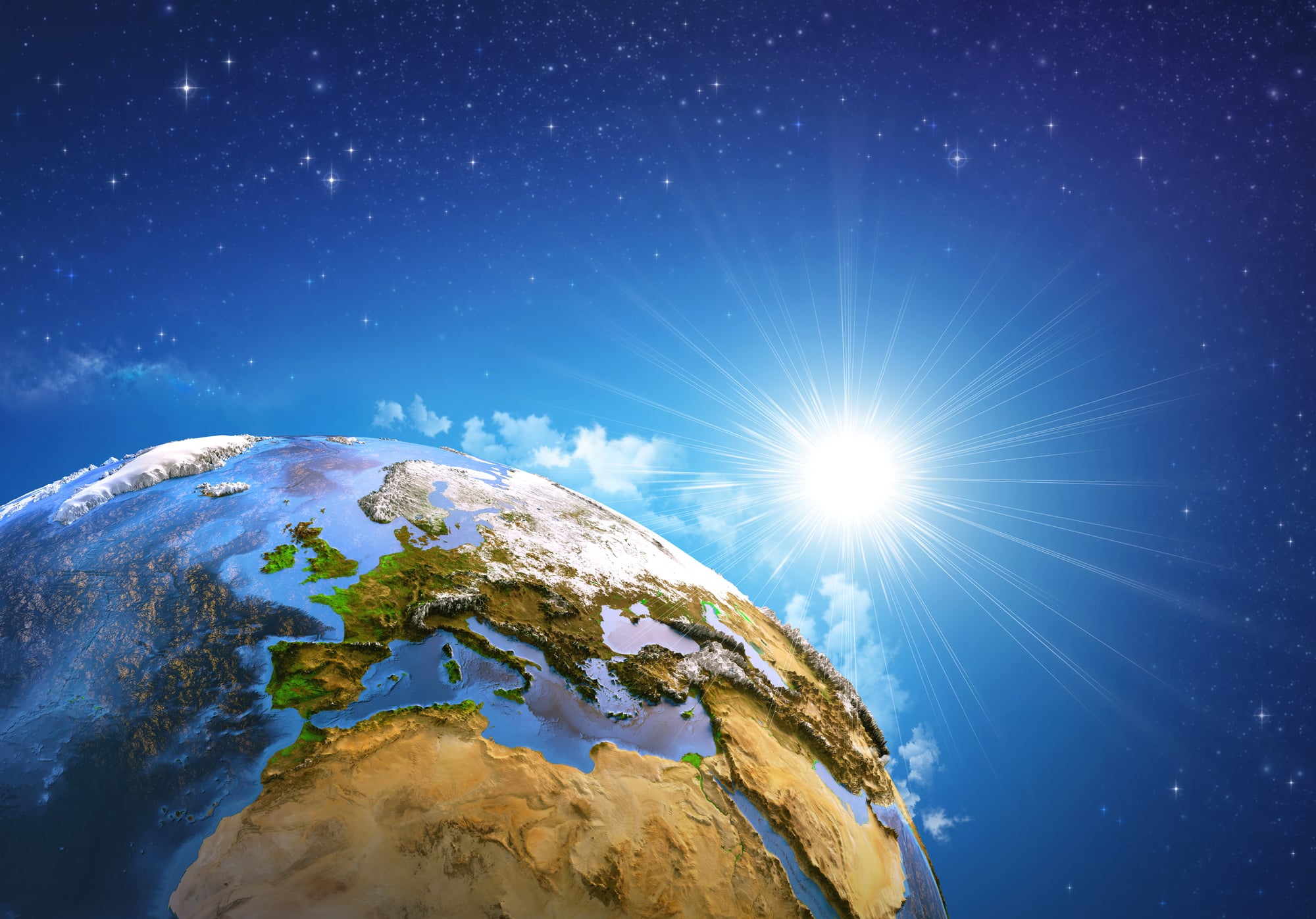
Himalayas (Asia)

The Himalayas stretch roughly 1,550 miles across Nepal, India, Bhutan, China, and Pakistan. Though shorter than the Andes and Rockies, they are the tallest mountain range in the world.
Mount Everest, standing at 29,032 feet, sits within this colossal system, alongside dozens of other peaks above 26,000 feet. The Himalayas were formed by the collision of the Indian and Eurasian tectonic plates, a process that continues today.
In fact, the mountains are still rising incrementally each year. Their height dramatically influences regional climate.
The Himalayas block cold winds from Central Asia, helping shape the monsoon systems that support agriculture across South Asia. Major rivers such as the Ganges, Indus, and Brahmaputra originate from Himalayan glaciers, earning the region the nickname ‘the water tower of Asia.’
Transantarctic Mountains (Antarctica)
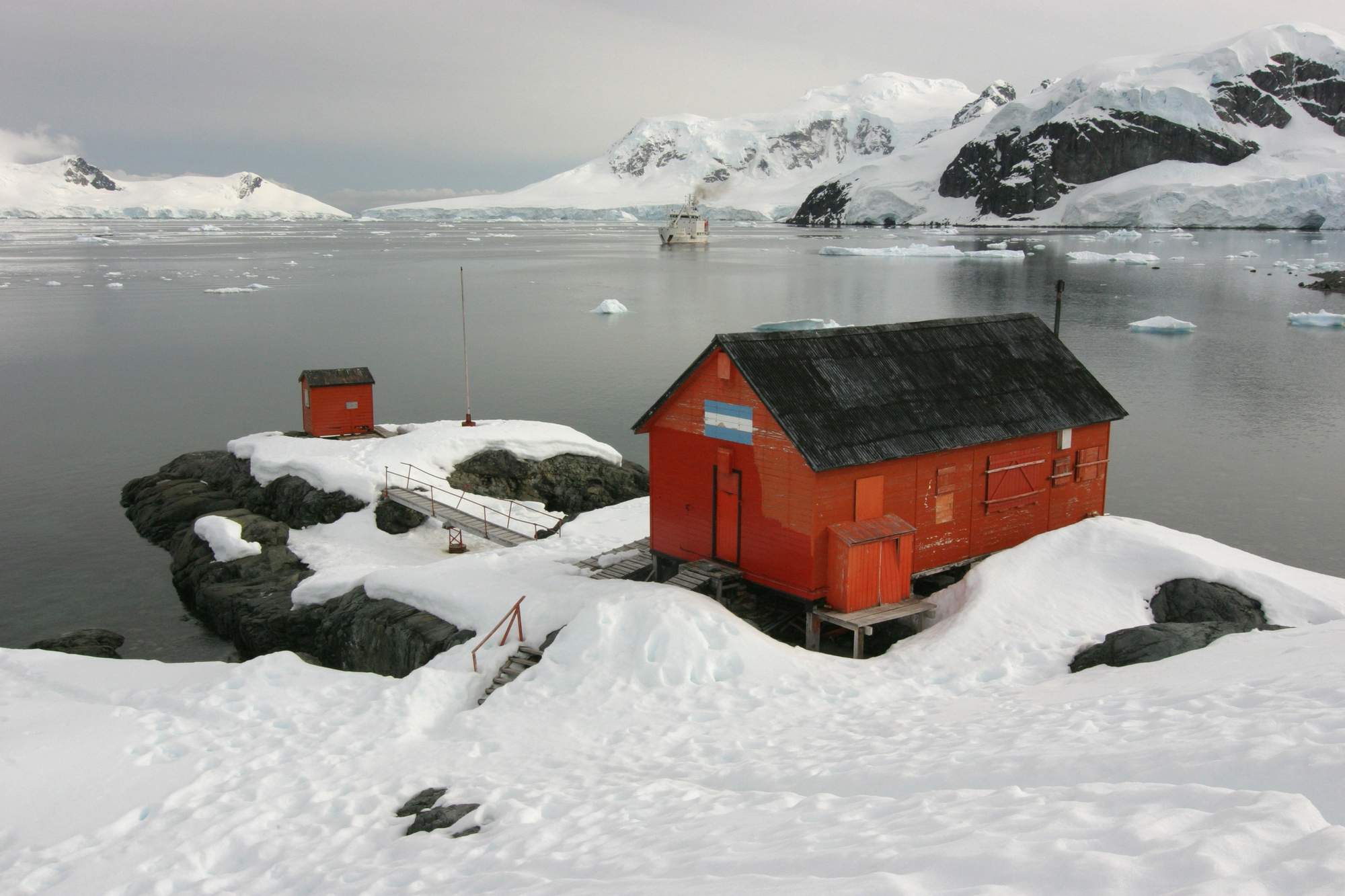
The Transantarctic Mountains run about 2,200 miles across Antarctica, effectively dividing the continent into eastern and western regions. Much of this range lies buried beneath thick ice sheets, making it less visible than other mountain systems.
Despite its remoteness, the Transantarctic range is crucial to scientific research. Exposed rock formations provide insight into ancient supercontinents and Earth’s geological evolution.
The range also influences ice flow patterns across Antarctica, shaping glacial movement and stability. Conditions here are extreme.
Temperatures plunge far below freezing, and human presence is limited primarily to research stations. Even so, the scale of this mountain system rivals more familiar ranges in other parts of the world.
Great Dividing Range (Australia)
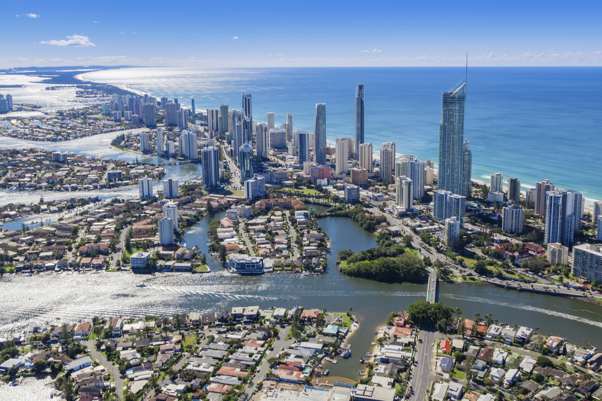
The Great Dividing Range stretches over 2,300 miles along Australia’s eastern coastline. It is the third-longest land-based mountain range globally, though its peaks are generally lower than those in Asia or the Americas.
The range plays a vital role in separating Australia’s wetter coastal areas from its drier interior. Rainfall patterns shift dramatically on either side of the mountains, influencing farming and settlement.
Rivers that originate in the Great Dividing Range supply major cities and agricultural regions. While not towering in height, the range’s length and environmental influence make it central to Australia’s geography.
Snowfall in certain sections contrasts sharply with the country’s desert reputation, highlighting its ecological diversity.
East African Rift Mountains (Africa)
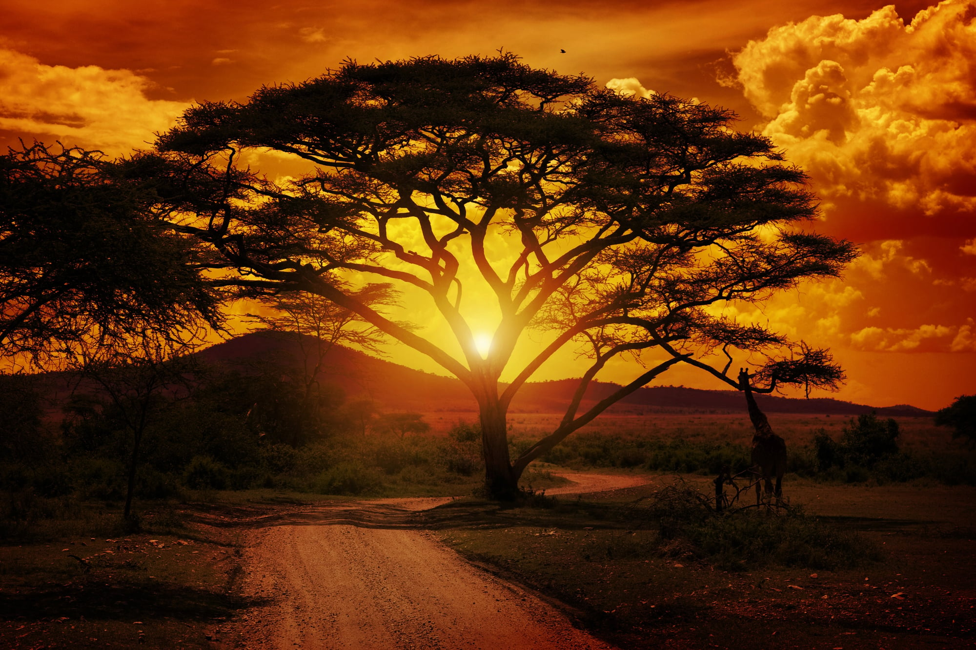
The East African Rift system spans thousands of miles from the Red Sea down through Mozambique. Within this tectonic zone lie mountain systems such as the Ethiopian Highlands and the Rwenzori Mountains.
This region is geologically active. The African continent is slowly splitting along the rift, forming volcanic peaks and deep valleys.
Mount Kilimanjaro, Africa’s tallest mountain at 19,341 feet, is part of this broader system. The rift’s elevation changes create varied climates, from alpine conditions near summits to tropical ecosystems at lower elevations.
Its geological activity provides scientists with valuable insight into how continents evolve over millions of years.
Ural Mountains (Russia)

The Ural Mountains extend about 1,600 miles from the Arctic Ocean to Kazakhstan. They are traditionally considered the boundary between Europe and Asia.
The Urals are far older than the Himalayas or Rockies, having formed roughly 250 to 300 million years ago. Over time, erosion softened their peaks, giving them a more rounded profile.
Though not especially tall, they are rich in natural resources, including iron ore and precious metals. Their mineral wealth fueled industrial growth in Russia for centuries.
In this way, the Urals demonstrate that size is not solely about elevation. Length and economic impact also shape a mountain range’s significance.
Appalachian Mountains (North America)
The Appalachian Mountains stretch approximately 1,500 miles from Canada to Alabama. They are among the oldest mountain ranges on Earth, dating back over 480 million years.
Time has worn them down considerably. Unlike the sharp peaks of the Rockies, the Appalachians feature rolling ridges and forested slopes.
Yet their ecological importance remains immense. They host some of the most biodiverse temperate forests in the world.
Historically, the Appalachians influenced settlement patterns in early American history, acting as both barrier and resource. Their coal deposits fueled industrial expansion, shaping economic development across eastern North America.
Atlas Mountains (North Africa)
The Atlas Mountains stretch roughly 1,600 miles across Morocco, Algeria, and Tunisia. They form a natural divide between the Mediterranean coast and the Sahara Desert.
The Atlas range moderates climate in North Africa. Snowfall in higher elevations contrasts sharply with the arid desert plains nearby.
This environmental variation supports agriculture and distinct ecosystems within a relatively compact geographic area. The mountains have also played a cultural role, shaping trade routes and settlement patterns for centuries.
Their scale influences both weather and human movement across the region.
Altai Mountains (Central Asia)

The Altai Mountains span about 1,200 miles across Russia, Mongolia, China, and Kazakhstan. Though shorter than some ranges on this list, their geographic reach across multiple countries makes them significant.
The Altai region is known for glaciers, alpine meadows, and archaeological sites that reveal ancient nomadic cultures. Its rugged terrain has preserved landscapes that feel largely untouched by modern development.
Positioned at the crossroads of Asia, the Altai Mountains serve as both ecological corridor and cultural boundary. Their scale reflects not only physical length but also historical depth.
Where Scale Meets Story

Highest peaks on Earth mean more than just height marked in numbers. Because of them, rivers begin – flowing water to vast populations far away.
Across lands, storms shift direction when meeting these giants. Life forms survive high up where few places allow – cut off, shaped by thin air and steep walls.
Under pressure deep below, land masses slowly bend and break apart. One edge grinds against another, lifting rock into sharp ridges over millions of years.
Rising through storms or buried under ice sheets, these massive formations reveal how alive the ground really is. Movement never stops, even when nothing seems to change.
More from Go2Tutors!

- The Romanov Crown Jewels and Their Tragic Fate
- 13 Historical Mysteries That Science Still Can’t Solve
- Famous Hoaxes That Fooled the World for Years
- 15 Child Stars with Tragic Adult Lives
- 16 Famous Jewelry Pieces in History
Like Go2Tutors’s content? Follow us on MSN.