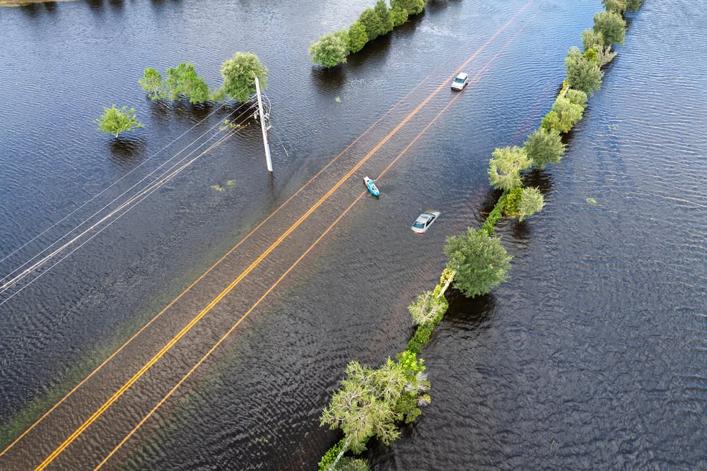
Roads That Disappear Under High Tides
Driving a road that vanishes into the ocean sounds like something from a fairy tale. But these routes exist in real places around the world, and locals use them every day.
Twice daily, the tide rolls in and makes these roads impassable. Then it retreats, and traffic resumes as if nothing happened.
The experience of crossing one stays with you. You watch the water creeping closer to your tires.
You calculate whether you have enough time. You wonder what happens if you get it wrong.
Passage du Gois Demands Perfect Timing
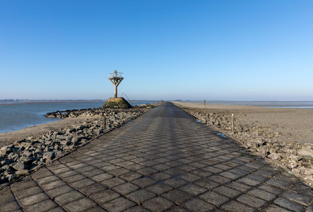
This causeway in France stretches 2.6 miles between the mainland and Noirmoutier Island. The Atlantic covers it twice a day, leaving just a few hours for crossing.
Signs post the safe crossing times, and locals know to check them religiously. The road surface gets slick with seaweed and mud between tides.
Cars slide if drivers go too fast. Rescue towers dot the route at regular intervals for anyone who misjudges the timing.
People climb these towers and wait, watching their vehicles disappear beneath the waves. The Tour de France used this passage in 1999, creating one of the race’s most memorable stages.
Riders had to navigate wet, slippery pavement while racing against each other and the incoming tide.
Holy Island Causeway Tests Patience

Twice daily, the North Sea cuts off Lindisfarne from mainland England. The causeway becomes an underwater feature, and the island returns to its original state—completely isolated.
Tourists misjudge the tides constantly. The refuge box on the causeway fills with stranded drivers who abandoned their cars as water rose past the doors.
Locals shake their heads at the rental cars submerged past their windows, owners safe but vehicles ruined. The island has published tide tables for centuries.
Pilgrims used them in medieval times, and modern visitors need them just as much. The tide waits for no one, and insurance companies won’t cover stupidity.
Jindo Sea Road Appears A Few Times Each Year
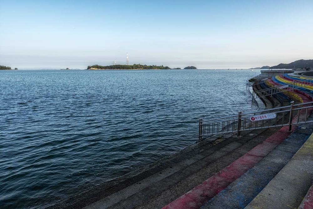
South Korea’s “Moses Miracle” happens a few times a year when the tide recedes far enough to expose a land bridge between Jindo and Modo islands. The road emerges for about an hour, and thousands of people walk across during the annual festival held in spring.
The phenomenon occurs due to specific tidal conditions between March and June, though festivals celebrate it only once annually. The rest of the year, the islands remain separated by water.
Local legend says a tiger god created the path to save villagers fleeing from invaders. Science credits tidal harmonics.
Festivals now celebrate the event annually in spring, turning a natural occurrence that happens multiple times into a focused cultural moment. People carry offerings, others just walk for the experience of crossing the sea on foot.
Brouage Road Vanishes in the Charente

This French causeway disappears so regularly that locals barely notice anymore. The road connects a historic fortified town to the mainland, but the Seudre River has other plans twice daily.
The crossing takes minutes when the tide cooperates. But wait too long, and you’re stuck for hours.
No rescue towers here. Just water, and the knowledge that you should have checked the schedule.
The surrounding marshes make the experience eerie. The road doesn’t just get covered—it becomes part of a flat, featureless seascape that looks the same in every direction.
Omey Island Strand Gets Traffic During Low Tide
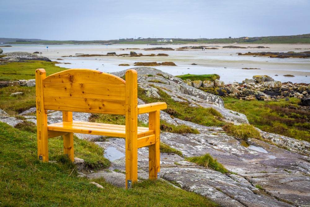
Ireland’s tidal causeway crosses a beach. During low tide, cars drive across packed sand to reach the island.
The route looks absurd—tire tracks through what should be swimming territory. The sand stays firm enough for vehicles, but only for a few hours.
Miss your window, and you’re either stuck on the island overnight or abandoning your car to the tide. Island residents time everything around the crossings.
Doctor’s appointments, grocery runs, social visits all depend on tidal charts. About 30 people live on Omey year-round.
They’ve mastered the rhythm. Visitors panic more often.
Cobblestone Path to Mont-Saint-Michel Now Retired

For centuries, pilgrims timed their approach to this French abbey based on tides. The bay has some of the strongest tidal movements in Europe, and the causeway regularly flooded.
A permanent bridge replaced the tidal causeway in 2014, ending a tradition that dated back to medieval times. The decision sparked debate.
Some celebrated improved safety and accessibility. Others mourned the loss of the island’s natural isolation.
The old causeway still exists, now reserved for pedestrians who want the traditional experience. The tide still rolls in fast enough to catch slow walkers.
Shell Road to Ceduna Becomes Seafloor Regularly

Australia’s Eyre Peninsula has a beach route that doubles as a legitimate road during low tide. The packed shell surface handles cars well when dry.
When wet, it becomes treacherous. Local councils maintain it as an official route, posting tide warnings and closure signs.
Tourists ignore these signs with impressive consistency. Recovery services stay busy pulling cars from the water.
The road cuts significant time off the inland route, making it tempting for people in a hurry. But there’s no hurrying once the tide turns.
The ocean doesn’t care about your schedule.
Cartmel Sands Once Guided Coaches Across

Before bridges and railways, coaches crossed Morecambe Bay’s tidal flats in northwest England. Local guides led travelers across channels that shifted with every tide.
Miss the safe path, and quicksand waited. The practice ended over a century ago, but organized walks still cross the bay at low tide.
Guides who know the current channels lead groups across. The same dangers exist, just with fewer horses and carriages involved.
The bay claims vehicles occasionally when drivers attempt crossings without guides. The sand looks solid until it isn’t.
Then you sink, and the tide comes in anyway.
Crater Lake Access Floods with Rainy Season

Indonesia’s Mount Bromo area includes a road that seasonal flooding makes unusable for months. The route technically stays above water during dry season, but monsoon rains turn it into a river crossing.
Locals drive through when they must, water splashing over hoods. Motorbikes get pushed through by hand, riders walking alongside.
The alternative means a multi-hour detour around the caldera. The flooding is predictable, but fixing the drainage isn’t.
The road exists in a volcanic depression where water naturally collects. Engineering solutions run expensive, and the local government has other priorities.
Norfolk’s Roman Road Shows at Spring Tides

England’s coast hides a Roman road that emerges only during the lowest tides of the year. The rest of the time, it sits under sand and water, known to exist but invisible.
Archaeologists mapped it using historical records and occasional sightings. The road once connected mainland settlements but now serves as a curiosity for beachcombers during extreme low tides.
When exposed, the ancient paving stones still hold together after nearly two thousand years. Then the tide returns, and they disappear for months.
Rakiura Track Crossing Demands Tide Knowledge

Stewart Island’s walking track in New Zealand includes a beach section that becomes impassable at high tide. Hikers must time this segment carefully or face dangerous wading through rough water.
DOC posts tide times at the track entrance, but visitors still get caught regularly. The section involves about 90 minutes of beach walking.
Get the timing wrong by even half an hour, and waves hit your knees. Search and rescue teams respond to stranded hikers several times each season.
The advice stays simple—check the tides, start early, don’t dawdle.
Lindisfarne Castle Road Adds Drama
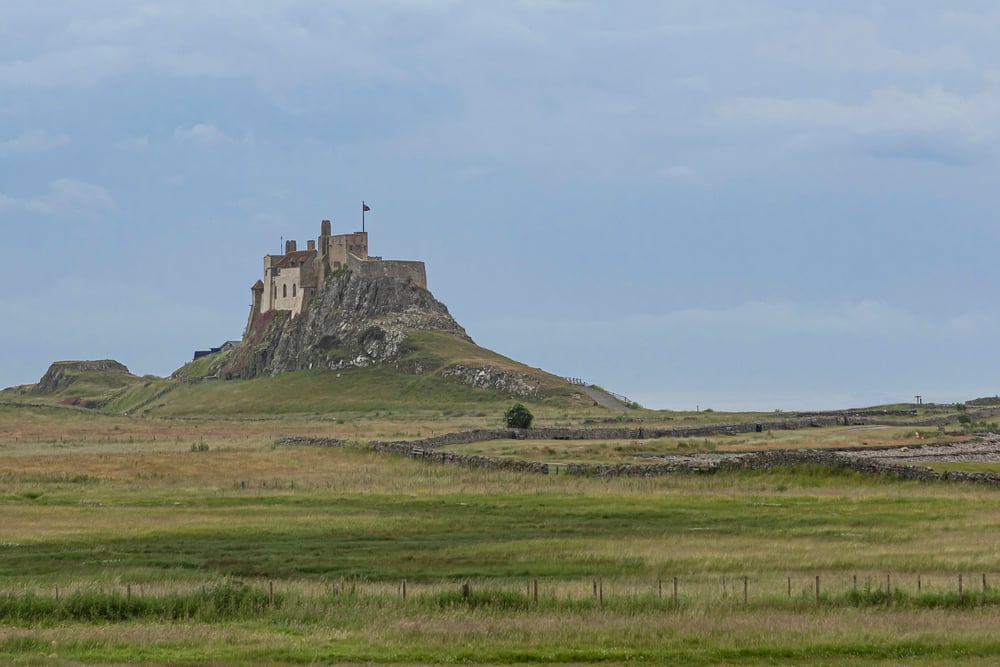
The road to the castle on Holy Island becomes completely submerged at high tide, cutting off the historic fortress. Visitors who linger too long in the castle find themselves trapped until the next low tide.
The castle’s position made strategic sense centuries ago. An island fortress that enemies couldn’t reach during high tide offered real defensive advantages.
Now it just inconveniences tourists with poor time management. Castle staff used to rescue stranded visitors regularly.
Now they just announce closing times clearly and let people learn their own lessons about tide tables.
The Rhythm of the Tides
These roads teach patience the hard way. You can’t force the ocean to retreat faster.
You can’t negotiate with the tides. You either respect the water’s schedule or deal with the consequences.
The locals who use these routes daily develop an intuitive sense of timing. They feel the tides the way other people feel weather.
Visitors lack this sense and suffer for it. But that’s part of the experience—learning that nature’s timetable matters more than yours ever will.
More from Go2Tutors!

- The Romanov Crown Jewels and Their Tragic Fate
- 13 Historical Mysteries That Science Still Can’t Solve
- Famous Hoaxes That Fooled the World for Years
- 15 Child Stars with Tragic Adult Lives
- 16 Famous Jewelry Pieces in History
Like Go2Tutors’s content? Follow us on MSN.