The Science Behind Tornadoes: What Causes Them?
Tornadoes are among nature’s most unpredictable and destructive forces—capable of reducing entire neighborhoods to rubble in a matter of minutes. Even after decades of study, these violent whirlwinds still hold mysteries scientists are eager to solve.
To truly understand how a tornado forms, we need to look at the delicate blend of atmospheric ingredients that must align almost perfectly. Below are 15 scientific factors and processes that help explain how tornadoes come to life and why they behave the way they do.
Supercell Thunderstorms
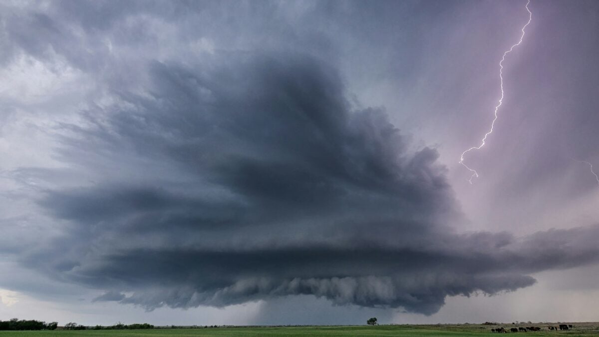
Most of the world’s most powerful tornadoes are born from supercell thunderstorms—massive, rotating storm systems defined by a long-lasting spinning updraft known as a mesocyclone. Picture them as the heavyweights of the storm world: tall, anvil-topped clouds that can stretch a mile wide and persist for hours.
Not every supercell will spawn a tornado, but when the balance of ingredients is just right, these storms create some of the most catastrophic twisters on record.
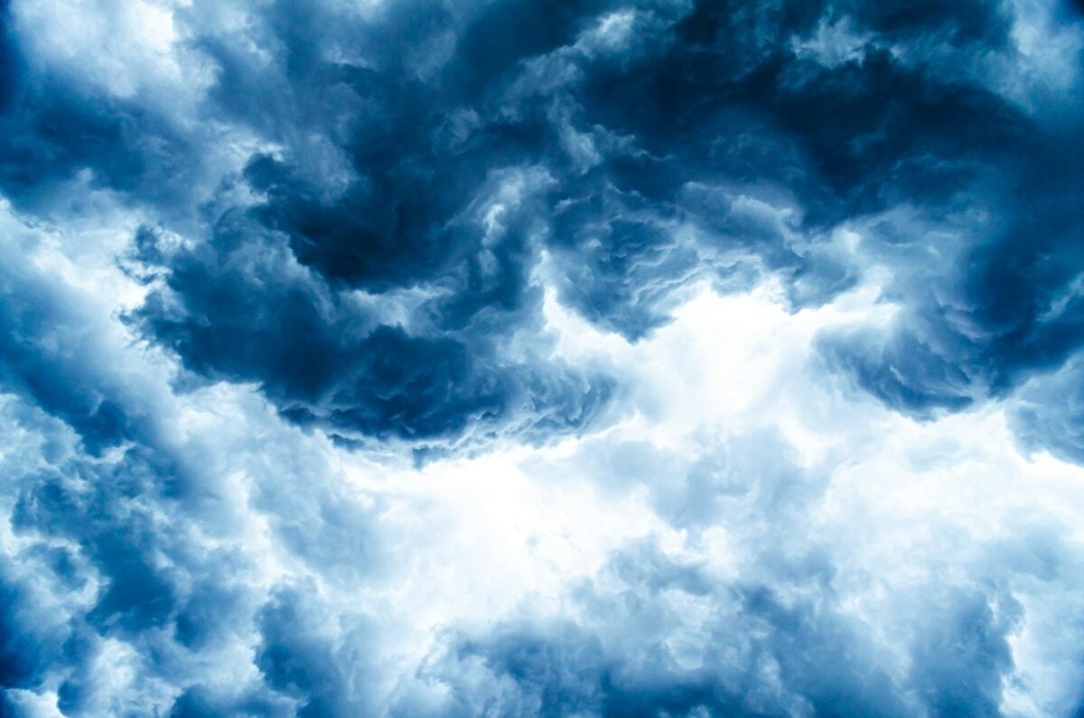
Atmospheric Instability
Tornadoes thrive in unstable atmospheres—when warm, moist air hugs the ground while colder, drier air sits above it. It’s a bit like stacking a tower of heavy books on top of lighter ones—eventually, something has to collapse.
On outbreak days, the temperature can drop by nearly 30°F per mile with height, setting the stage for explosive updrafts. This instability acts as the raw energy that fuels the storms capable of producing tornadoes.
Like Go2Tutors’s content? Follow us on MSN.
Wind Shear
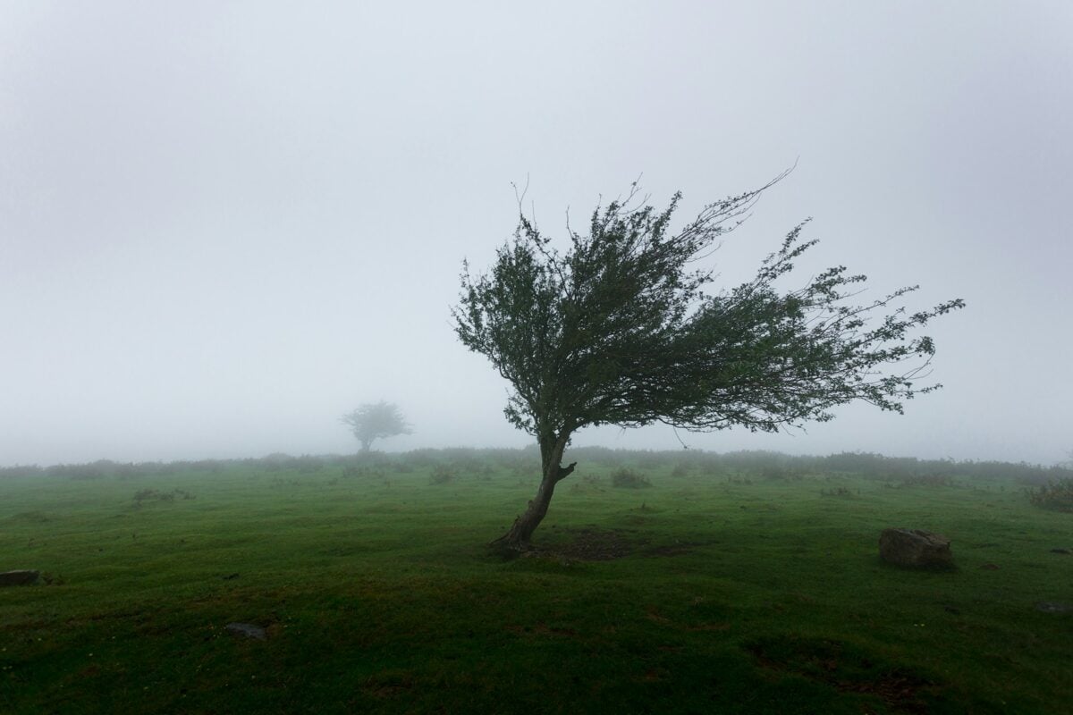
Wind shear refers to changes in wind speed or direction at different altitudes, and it’s a crucial ingredient for creating rotation. Imagine rolling a pencil between your palms as your hands move in opposite directions—that’s what’s happening to air layers inside a sheared atmosphere.
Both speed shear (wind increasing with height) and directional shear (wind shifting direction) help organize the storm’s rotation. Without wind shear, thunderstorms might still form—but they won’t spin.
Mesocyclone Development
A mesocyclone is the rotating updraft at the heart of a supercell—the “engine room” of tornado-producing storms. When horizontal spinning air caused by wind shear is tilted vertically by strong rising air, a mesocyclone develops.
Doppler radar can detect this rotation, which is why forecasters can sometimes issue tornado warnings before a funnel cloud even appears.
Low-Level Rotation

A mesocyclone high in the atmosphere isn’t enough to create a tornado on its own. Tornadoes need rotation near the ground, too. This low-level spin develops when air currents at the surface interact—warm air rises while cooler air sinks and spreads outward.
When these opposing flows balance just right, the air near the surface starts rotating, forming the base for a potential tornado.
Like Go2Tutors’s content? Follow us on MSN.
Temperature Differences

Some studies suggest that temperature contrasts around the edges of the mesocyclone may play a role in triggering tornadoes. These temperature boundaries act like invisible barriers that shape how air behaves inside the storm. Curiously, some of the most violent tornadoes ever recorded showed very little temperature contrast, suggesting scientists still have more to uncover about this mysterious ingredient.
Moisture Content
No moisture, no tornado. High humidity provides the fuel thunderstorms need to grow. Typically, dew points of at least 60°F near the surface are required for severe weather to develop.
This moisture—often drawn from the Gulf of Mexico—feeds storm updrafts, intensifies energy, and sets the stage for rotating systems that can generate tornadoes.
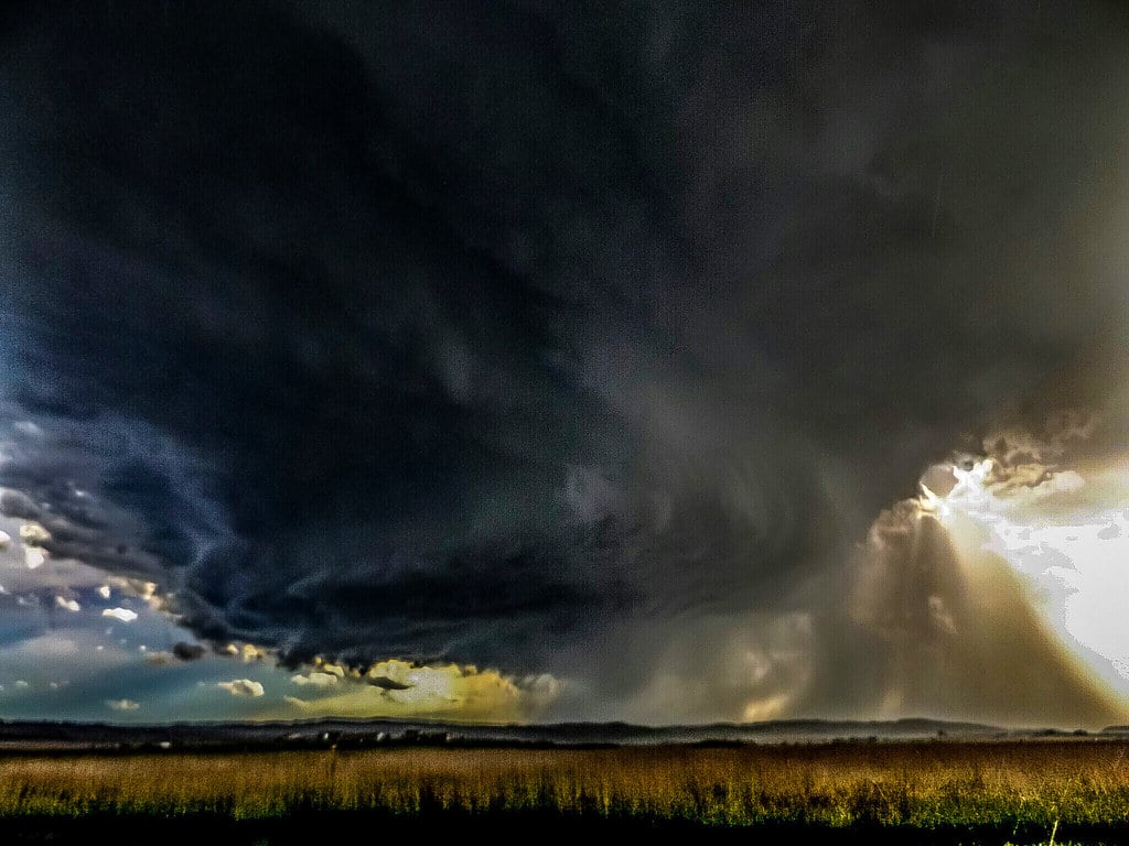
Rear Flank Downdraft

The rear flank downdraft is a burst of descending air that wraps around the backside of a storm, sometimes visible as a bright or clear slot just behind the wall cloud. It’s a crucial but not fully understood piece of the puzzle.
This downdraft brings gusty surface winds and helps funnel air toward the ground, which can enhance the tornado’s rotation and strength.
Like Go2Tutors’s content? Follow us on MSN.
Updraft Tilting

Wind shear not only spins storms—it also tilts their updrafts. This tilt prevents rain from falling back through the rising air, allowing the storm to sustain itself longer.
Without this separation, the cool downdrafts and rainfall would smother the warm updrafts, cutting the storm’s life short. By keeping rain displaced, the storm remains organized and capable of producing tornadoes for extended periods.
Horizontal Vorticity
Changes in wind speed with height can create invisible, horizontally spinning tubes of air in the atmosphere—a phenomenon known as horizontal vorticity. When these tubes meet strong rising air, they tilt vertically and help build the rotating updrafts that define supercells.
This shift from horizontal to vertical rotation is one of the key transitions that set tornadoes in motion.
Lifting Mechanisms

Every storm needs a trigger. Cold fronts, low-pressure systems, and jet streams act as lifting mechanisms that push warm, moist air upward into the atmosphere. As this air rises and cools, it condenses into clouds, often sparking thunderstorms.
When those storms form in environments rich in instability and wind shear, the stage is set for tornado development.
Like Go2Tutors’s content? Follow us on MSN.
Wall Cloud Formation

As a storm matures, its powerful updraft pulls in air from miles around. Some of this air cools and condenses beneath the rain-free base, forming a wall cloud—a dark, lowered section of the storm that can start rotating.
A persistent, spinning wall cloud often signals that a tornado could form soon. That’s why storm spotters and meteorologists keep their eyes glued to it.
Condensation Funnel
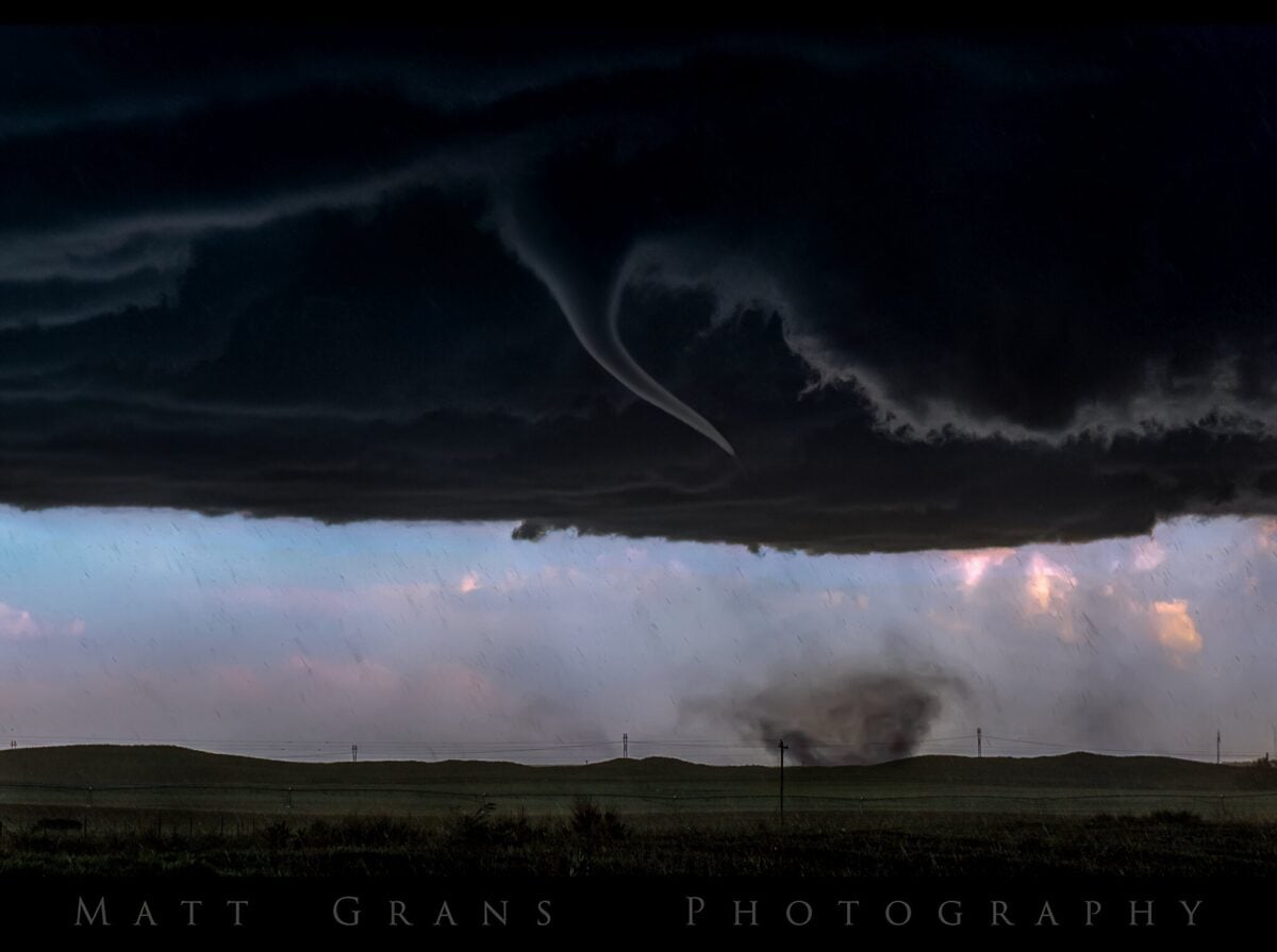
When air inside a tornado spins rapidly, pressure drops and temperatures fall. This cooling causes water vapor to condense into visible droplets, forming the condensation funnel we recognize as a tornado.
Sometimes, the funnel doesn’t fully reach the ground—but debris and dust being lifted into the air confirm that a tornado is, in fact, on the ground.
Non-Supercell Tornadoes

Not all tornadoes come from supercells. Around 20% form from other systems, such as quasi-linear convective systems (QLCS)—lines of storms that often appear overnight or early in the morning.
These tornadoes tend to be weaker and shorter-lived. Landspouts are another type, forming while the thunderstorm is still developing, with their spin starting near the ground rather than in the clouds.
The Remaining Mysteries
Here’s the kicker: only about one in five supercell thunderstorms ever produces a tornado, and scientists still don’t fully understand why. Despite over six decades of research—including projects like VORTEX, which used mobile radar to study storms in detail—many questions remain about that critical “tipping point” when a rotating storm becomes a tornadic one.
Each tornado season brings new data, inching science closer to the answers.
Where Science Meets Reality
Tornado formation might look like a simple recipe on paper, but nature rarely sticks to the script. Every outbreak reminds scientists how complex the atmosphere truly is.
Still, advances in radar technology and computer modeling have dramatically improved early warnings and saved countless lives. As research continues, the gap between what we know and what nature decides to do keeps narrowing—even if it never disappears completely.
from Go2Tutors!

- 16 Historical Figures Who Were Nothing Like You Think
- 12 Things Sold in the 80s That Are Now Illegal
- 15 VHS Tapes That Could Be Worth Thousands
- 17 Historical “What Ifs” That Would Have Changed Everything
- 18 TV Shows That Vanished Without a Finale
Like Go2Tutors’s content? Follow us on MSN.