Tiny Nations You Can Walk Across in a Day
Most countries take hours to cross by car, days by train, or weeks on foot. But scattered across the globe are nations so small that you could walk from one border to another before lunch.
These places pack entire cultures, governments, and histories into spaces smaller than many city neighborhoods. Some of these countries fit inside a single city block.
Others stretch across a few square miles but remain walkable if you have decent shoes and a full water bottle. Each one offers something different—medieval fortresses, Formula 1 tracks, tropical beaches, or centuries-old religious sites.
Vatican City: The World’s Smallest Country

The Vatican covers just 109 acres. You can walk its perimeter in roughly 40 minutes at a leisurely pace. The entire nation sits within Rome, surrounded by Italian territory on all sides.
Despite its size, the Vatican operates as a full country with its own postal system, radio station, and railway line. The Swiss Guard still protects the Pope, wearing uniforms supposedly designed by Michelangelo.
The gardens take up more than half the total land area, though you need special permission to enter them. St. Peter’s Basilica dominates the skyline. The Sistine Chapel draws millions of visitors each year.
But step away from the tourist areas and you’ll find quiet courtyards where Vatican employees go about regular office work—just in one of history’s most unusual office parks.
Monaco: Where Millionaires Park Their Yachts

Monaco stretches along the French Riviera for about 2.5 miles. Walking from one end to the other takes roughly 90 minutes.
The country is less than one square mile total, making it the second-smallest nation on Earth. The principality packs in casinos, yacht clubs, and the famous Monte Carlo district.
The Formula 1 Grand Prix winds through city streets each May. Real estate prices here rank among the highest anywhere—some apartments sell for over $10,000 per square foot.
You’ll encounter wealth at every turn. Ferraris idle at traffic lights. Helicopters shuttle between Monaco and Nice airport.
But the old town still has narrow medieval streets where locals shop for groceries and walk their dogs like anywhere else.
San Marino: The Mountain Republic
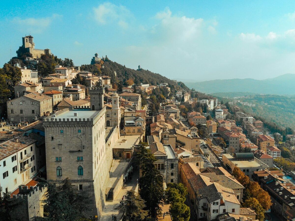
San Marino perches on Mount Titano in northern Italy. The entire republic covers 24 square miles, but the historic center clusters around three medieval towers on the mountain peak.
You can walk between all the major sites in a few hours. This republic claims to be the world’s oldest surviving sovereign state, founded in 301 AD.
Three towers crown the mountain’s three peaks, connected by walls and paths. The views stretch across the Italian countryside to the Adriatic Sea on clear days.
The capital, also called San Marino, feels like stepping into a different century. Stone buildings line steep cobblestone streets.
Shops sell crossbows alongside postcards. But San Marino also has modern highways, shopping centers, and a functioning government that predates most European nations by centuries.
Nauru: The Pacific Island Nation

Nauru sits alone in the Pacific Ocean, about 2,500 miles northeast of Australia. The entire island measures 8.1 square miles.
Walking the coastal road that circles the island takes roughly three hours. This tiny nation once had the highest per capita income in the world, thanks to phosphate mining.
But the deposits ran out, leaving behind a cratered interior landscape. Today, Nauru faces economic challenges and relies heavily on aid.
The population barely exceeds 10,000 people. Everyone lives along the coast since the interior remains largely uninhabitable due to decades of mining.
There’s one small airport, one main road, and almost no tourism infrastructure. Nauru exists in relative isolation, known mainly to people who study Pacific island nations.
Tuvalu: Nine Islands Fighting Rising Seas

Tuvalu consists of nine coral atolls scattered across the Pacific. The total land area adds up to just 10 square miles. Each individual island can be walked in under an hour.
The capital, Funafuti, occupies the largest atoll. Rising sea levels threaten Tuvalu’s existence.
The highest point across all nine islands reaches only 15 feet above sea level. King tides regularly flood low-lying areas.
The government has explored relocating the entire population if the ocean continues to rise.
Life here moves slowly. There are no traffic lights anywhere in the country.
The airport runway doubles as a community gathering space when planes aren’t landing. Residents farm coconuts, catch fish, and watch the horizon, knowing their nation faces an uncertain future.
Liechtenstein: The Alpine Principality

Liechtenstein sits between Switzerland and Austria in the Alps. The country covers 62 square miles, larger than some on this list, but you can still walk from the southern to northern border in a day if you’re in decent shape.
The hike takes about 8 to 10 hours. The capital, Vaduz, holds fewer than 6,000 people.
The prince lives in a castle overlooking the town. You can see it from almost anywhere in the valley, though tours aren’t offered since the royal family still lives there.
Liechtenstein has no army. No airport either. But it has more registered companies than citizens—over 37,000 businesses call this principality home, attracted by favorable tax laws.
The country also produces dental equipment and precision instruments that ship worldwide.
Malta: The Mediterranean Fortress
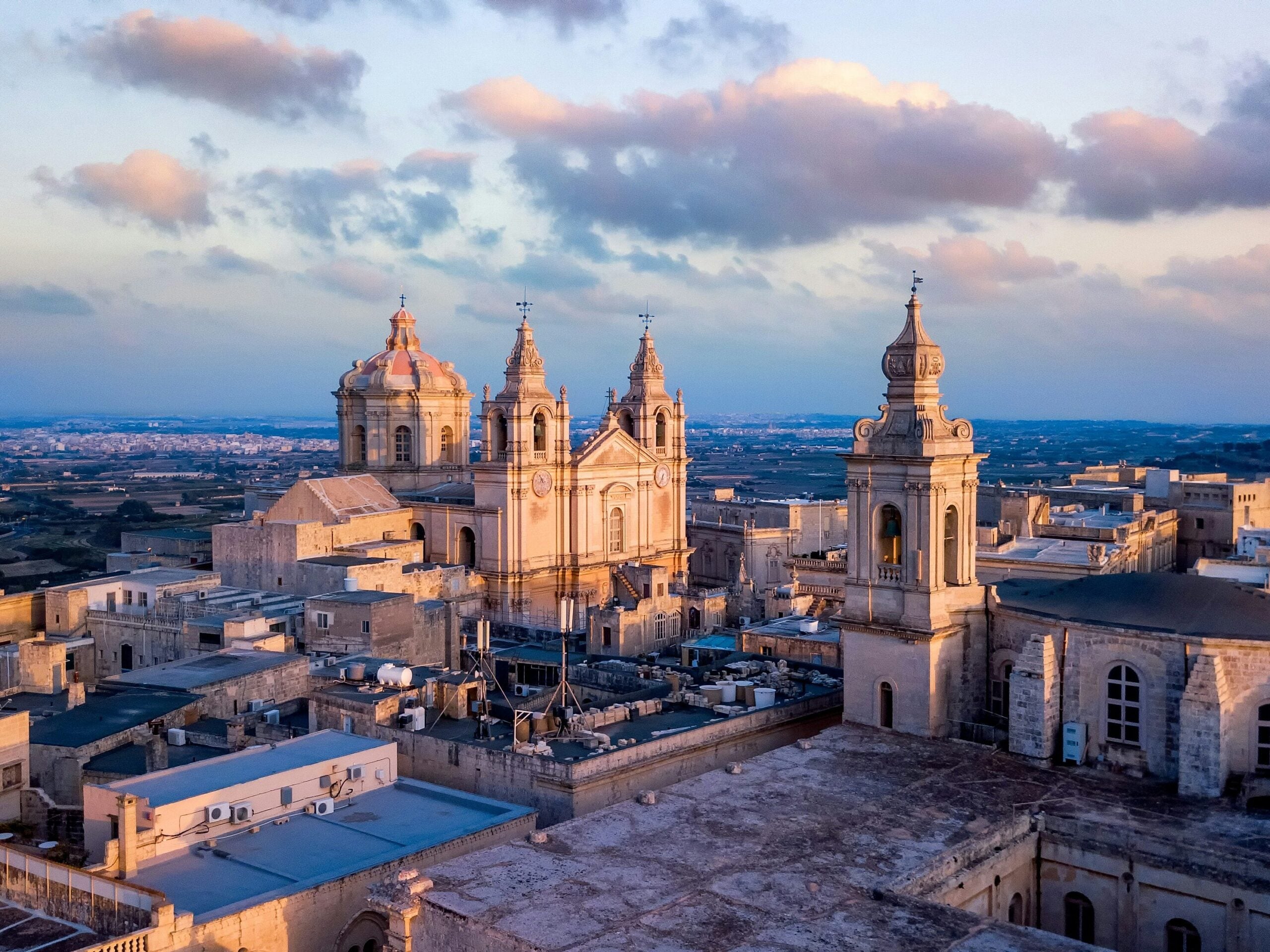
Malta covers 122 square miles across three inhabited islands. The main island can be crossed by foot in a long day’s walk, though most people break it up into shorter sections.
Ancient temples, baroque churches, and World War II fortifications dot the landscape. Valletta, the capital, was built by the Knights of St. John in the 16th century.
The entire city is a UNESCO World Heritage site. Massive stone walls surround the old town. Inside, narrow streets climb steep hills, offering views of the harbor where centuries of naval battles played out.
Malta speaks both Maltese and English, a legacy of British colonial rule. The beaches attract European tourists in summer.
But the island also has a thriving film industry—the azure waters and ancient architecture have stood in for everything from Troy to King’s Landing.
Andorra: The Pyrenees Tax Haven
Andorra hides in the Pyrenees mountains between France and Spain. The country covers 181 square miles of steep valleys and high peaks.
Walking the length would take more than a day, but hiking trails crisscross the nation, letting you experience different regions in single-day treks. Skiers flock here in winter. The mountains offer excellent slopes at lower prices than French or Swiss resorts.
In summer, hikers take over. Over 60 lakes dot the high country. The capital, Andorra la Vella, sits at 3,356 feet elevation—the highest capital city in Europe.
Andorra has no military and no income tax. Shopping districts fill with electronics stores and perfume shops, attracting bargain hunters from neighboring countries. The entire economy depends on tourism and banking, with agriculture playing only a minor role despite the rural setting.
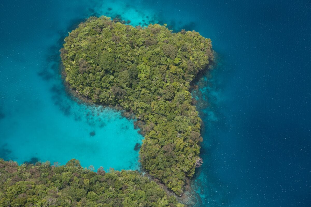
Seychelles: 115 Islands of Granite and Coral
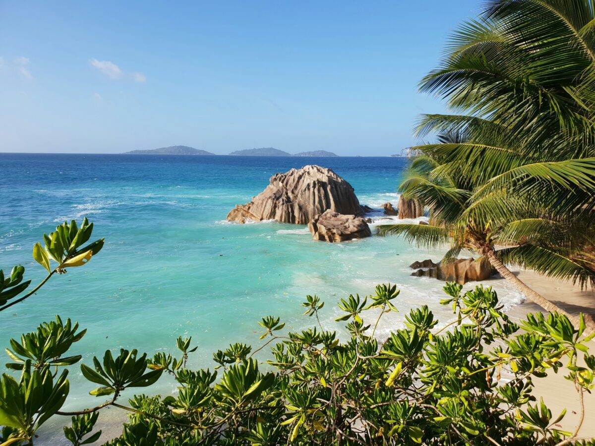
Seychelles spreads across 115 islands in the Indian Ocean. The total land area equals 176 square miles, but split among dozens of islands.
Individual islands like La Digue can be circled on foot in a few hours. Bicycles are the main transport there.
Granite boulders the size of houses rise from white sand beaches. Giant tortoises, some over 100 years old, roam freely on certain islands.
The waters hold some of the world’s richest marine biodiversity. About 90% of the population lives on the main island of Mahé.
The capital, Victoria, is one of the world’s smallest capital cities. You can walk across it in 15 minutes.
The rest of Mahé offers mountains, beaches, and forests, all accessible via hiking trails that showcase the island’s natural beauty.
Palau: Western Pacific Paradise
Palau consists of over 500 islands, but only nine have permanent residents. The total land area measures 177 square miles.
Each inhabited island can be explored on foot in a day. The main island, Koror, holds most of the population and can be walked in several hours.
The Rock Islands create an otherworldly landscape—hundreds of mushroom-shaped limestone formations covered in jungle, rising from turquoise water. Jellyfish Lake holds millions of golden jellyfish that have lost their sting over generations of isolation.
Divers consider Palau one of the best destinations on Earth. Palau became independent in 1994, one of the world’s youngest nations.
The economy depends almost entirely on tourism and fishing. The government created one of the world’s first shark sanctuaries and banned bottom trawling to protect marine ecosystems.
Conservation shapes national policy here more than in most countries.
Barbados: The Caribbean’s Eastern Outpost
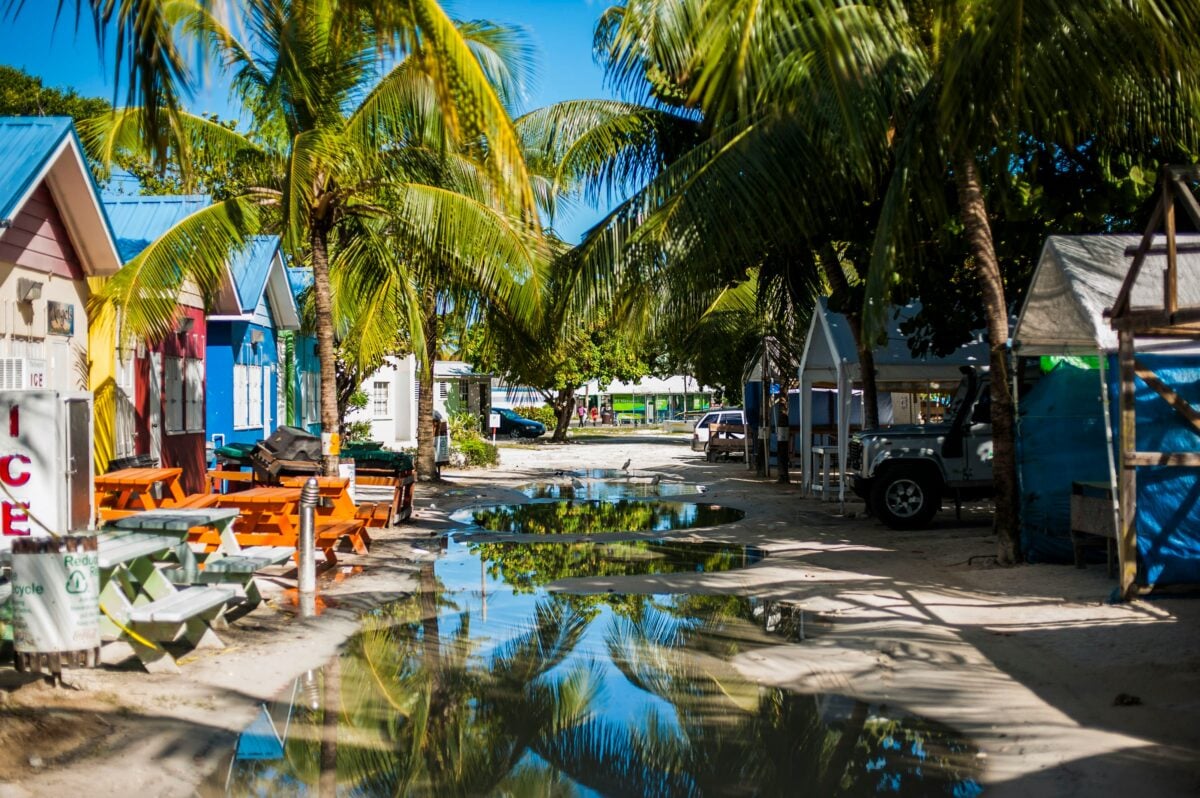
Barbados lies on the far side of the Caribbean Sea. It’s roughly 166 square miles big. If you keep moving without slowing down, crossing it top to bottom lasts around eight hours.
Folks usually split this trek into chunks – hitting sandy shores, old landmarks, or roadside eateries one by one. Bridgetown’s old buildings stand next to new ones, showing how time changed things.
While the city grew, its historic garrison stayed protected by UNESCO. Back then, sugar fields ran the island’s money flow. These days, visitors and financial services keep people working.
The east side meets the Atlantic – steep cliffs, heavy surf crashing down. On the flip side, the west touches the quiet Caribbean, dotted with resorts along pale sandy shores.
It’s busier here compared to nearby islands, thanks to solid infrastructure, steady utilities, plus a working political system.
Grenada: The Spice Island

Grenada spans 133 square miles down in the southern Caribbean. You could walk from one side to the other in a single day, but the hilly middle terrain slows you down.
Spices like nutmeg and cinnamon pop up all over the place, which is how it earned that famous name. St. George’s, the main town, curves along a cove shaped like a U.
Bright houses go up the nearby slopes. Inside the island, you’ll find thick woods, falls, and also a lake sitting in an old volcanic bowl. Sand stretches across both the windy side and the calm shore.
Hurricane Ivan smashed Grenada back in 2004, wiping out nearly every building you’d see. Rebuilding happened slowly, yet some damage still shows up today.
Tourism’s a big deal now, alongside selling spices, while schools like St. George’s pull in loads of med students from overseas.
A World in Miniature

Small countries show that big isn’t always better. Yet each one stands out by keeping traditions alive while making the most of tight land and few supplies.
Although you could cross some in just hours, it gives a real feel for daily life – seeing how folks get by when nothing’s far away. Location might shape a nation, yet tiny states prove outcomes differ wildly.
While some struggle, others thrive despite size – proof that circumstances aren’t everything.
More from Go2Tutors!

- The Romanov Crown Jewels and Their Tragic Fate
- 13 Historical Mysteries That Science Still Can’t Solve
- Famous Hoaxes That Fooled the World for Years
- 15 Child Stars with Tragic Adult Lives
- 16 Famous Jewelry Pieces in History
Like Go2Tutors’s content? Follow us on MSN.