18 Largest Manmade Reservoirs in the United States
There’s something quietly remarkable about standing at the edge of a reservoir and forgetting, for a moment, that none of it was ever supposed to be there. The water stretches out like it always belonged, birds work the shoreline, and bass hold in the shaded coves — but beneath the surface lie the bones of old towns, flooded farmland, and in some cases, entire communities that were moved so the water could rise.
The United States has built more than 50,000 artificial lakes over the past century. A handful of them are so vast they shift regional climates, power entire states, and supply drinking water to tens of millions of people.
These are the 18 largest, ranked by maximum storage capacity in acre-feet — a measure that captures how much water each reservoir can hold at its peak, including flood storage.
1. Lake Mead — Nevada and Arizona

Lake Mead holds more water than any other reservoir in the country. Created by the Hoover Dam in 1936 on the Colorado River, it sits roughly 30 miles southeast of Las Vegas and supplies water to more than 20 million people across Arizona, Nevada, California, and parts of northern Mexico.
At full capacity, the lake holds about 28.9 million acre-feet, though it rarely comes close to that figure anymore. Persistent drought and surging regional demand have kept it well below full for decades — the last time it reached capacity was in 1983.
The Hoover Dam itself is worth understanding on its own terms. At 726 feet tall, it was the tallest dam in the world when it was completed and remains one of the most recognizable feats of American engineering.
Construction ran from 1931 to 1936, employing thousands of workers during the height of the Great Depression. The dam generates 2,080 megawatts of hydroelectric power and serves a dual purpose as both a water storage facility and an energy producer.
Lake Mead’s water problems are well documented. In recent years, the reservoir has dropped to around 30–40% of its capacity, exposing previously submerged structures and prompting serious conversations about long-term water security in the American Southwest.
2. Lake Powell — Utah and Arizona

Lake Powell is the second-largest reservoir in the country, sharing that Colorado River system with Lake Mead. Formed by Glen Canyon Dam in 1963, it sits at the Utah-Arizona border and took 17 years to fill to its normal water level.
At maximum capacity it holds roughly 26.2 million acre-feet and stretches 186 miles with more than 2,000 miles of shoreline. The Glen Canyon Dam stands 710 feet tall — a concrete arch-gravity structure that curves into the canyon walls and uses the surrounding rock as part of its support system.
The dam’s power plant generates around 1,320 megawatts and serves seven western states. For a reservoir built in one of the most remote canyon landscapes in North America, Lake Powell draws a surprising amount of traffic.
Nearly 3 million people visit each year, drawn by the surreal red rock formations, hidden coves, and places like Rainbow Bridge National Monument — one of the tallest natural arches in the world, now accessible by boat. Like Lake Mead, Powell has experienced dramatic water level declines in recent decades, touching historically low levels as drought and upstream demand have mounted.
3. Lake Sakakawea — North Dakota

Lake Sakakawea is the largest reservoir in the north-central United States and the third-largest in the country overall, with a maximum capacity of about 23.8 million acre-feet. It stretches 178 miles across western North Dakota, created by the Garrison Dam completed in 1956 on the Missouri River.
Its 1,500 miles of shoreline give way to the Badlands landscape that surrounds it — rolling plains, bluffs, and grasslands that run to the water’s edge. The lake’s name honors Sacagawea, the Shoshone-Hidatsa woman who guided Lewis and Clark through the Louisiana Territory.
The reservoir’s creation came at a significant human cost: the rising water flooded thousands of acres of the Fort Berthold Indian Reservation, forcing hundreds of Native American families from their homes and villages. That displacement remains a painful chapter in the project’s history.
Today the lake is both a major source of hydroelectric power and one of the most popular fishing destinations in the upper Midwest, with walleye, northern pike, and smallmouth bass drawing anglers from across the region.
4. Lake Oahe — South Dakota and North Dakota

Lake Oahe stretches 230 miles from Pierre, South Dakota, up into North Dakota — one of the longest reservoirs on the continent. It holds about 23.5 million acre-feet at maximum capacity and was created by the Oahe Dam, an enormous earth-filled structure on the Missouri River completed in 1962.
The Oahe Dam is one of the largest earthen dams in the world, built from compacted layers of rock and fill rather than concrete. It provides hydroelectric power to several Midwestern states and anchors more than 50 recreational areas along the shoreline.
Kayakers, paddleboarders, and anglers work the lake regularly, and bald eagle sightings are common. Walleye fishing in particular draws a devoted following.
Like Sakakawea to the north, Lake Oahe’s construction displaced Native American communities from the Standing Rock and Cheyenne River Sioux reservations — a consequence that fundamentally shaped the region’s relationship with the dam system.
5. Fort Peck Lake — Montana
Fort Peck Lake stretches 134 miles through central Montana and is the state’s largest body of water by a significant margin. At maximum capacity it holds about 19.1 million acre-feet, making it the fifth-largest reservoir in the country.
Its shoreline runs for 1,520 miles — longer than the entire coastline of California. The Fort Peck Dam was a New Deal project, built between 1933 and 1940 during the Great Depression to control flooding along the Missouri River.
At nearly four miles long, it is one of the largest hydraulic earth-filled dams in the world. Its construction brought in roughly 10,500 workers, spawning 18 boomtowns almost overnight in what had been an empty Montana prairie.
The land surrounding the lake is protected as part of the Charles M. Russell National Wildlife Refuge, the second-largest refuge in the contiguous United States.
Pronghorn, mule deer, elk, and bighorn sheep roam the area, and the shoreline has become known for its dinosaur fossil excavations. The Fort Peck Interpretive Center displays some of what’s been found nearby.
6. Lake Roosevelt — Washington

Lake Roosevelt runs 150 miles through northeastern Washington along the Columbia River, formed by Grand Coulee Dam in 1942. It holds about 9.5 million acre-feet at maximum capacity and covers 125 square miles, making it the largest reservoir in the state.
Grand Coulee Dam is the largest hydroelectric power facility in the United States, generating 6,809 megawatts across three power plants. The dam was championed by President Franklin D. Roosevelt, whose name the lake now carries.
Originally built with two power plants, a third was added in 1974. Annual energy output exceeds 21 billion kilowatt-hours — enough to power millions of Pacific Northwest homes. The lake passes through the Colville and Spokane Indian reservations, and the surrounding landscape offers dramatic canyon scenery that draws boaters, campers, and anglers throughout the warm months.
7. Kentucky Lake — Kentucky and Tennessee

Kentucky Lake is the largest man-made lake east of the Mississippi River. It was created in 1944 when the Kentucky Dam impounded the Tennessee River along the Kentucky-Tennessee border.
The lake covers more than 160,000 acres and offers over 2,000 miles of shoreline, running southward from western Kentucky into the state of Tennessee. What makes Kentucky Lake unusual in these rankings is the gap between its typical conservation pool and its maximum flood storage capacity — the latter is nearly three times the former.
This means that during major flood events, the reservoir can hold an extraordinary volume of water well above its normal level. The lake sits at the southern end of the Land Between the Lakes National Recreation Area, a 170,000-acre peninsula of forest, wildlife, and trails wedged between Kentucky Lake and Lake Barkley.
The region draws hikers, hunters, bird watchers, and water sports enthusiasts year-round.
8. Lake Cumberland — Kentucky

Lake Cumberland lies in south-central Kentucky, formed by the Wolf Creek Dam on the Cumberland River. Completed in 1952, the reservoir holds about 6.09 million acre-feet at maximum capacity and has 1,225 miles of shoreline threading through six Kentucky counties.
At 101 feet on average, it’s a relatively deep lake by regional standards. The Wolf Creek Dam was built by the Army Corps of Engineers to provide hydroelectric power and flood control.
Over the decades, the reservoir attracted a substantial tourism economy built around houseboats — Lake Cumberland became one of the country’s premier houseboat destinations, with dozens of marinas and rental operations lining the coves. Annual visitor spending pumps well over $100 million into the surrounding economy.
9. Lake Koocanusa — Montana and Canada

Lake Koocanusa is one of the more unusual reservoirs on this list, partly because it crosses an international border. It stretches 90 miles through northwestern Montana and into British Columbia, Canada, formed by the Libby Dam on the Kootenai River.
It holds about 5.8 million acre-feet at maximum capacity and reaches depths of 370 feet. The dam was a joint American-Canadian project, built between 1966 and 1972 by the Army Corps of Engineers.
The Libby Dam generates up to 600 megawatts of power and holds about 13% of the total water volume in the entire Columbia River system. The lake’s name was coined by locals using the first syllables of Kootenai, Canada, and U.S.A. — KooCanUSA.
It’s become something of a badge of regional identity for a reservoir that genuinely spans two nations. Rainbow trout, burbot, and sockeye salmon are common in the lake’s cold, clear water.
10. Bull Shoals Lake — Arkansas and Missouri

Bull Shoals Lake sits in the Ozark Mountains, formed by the impoundment of the White River in northern Arkansas and southern Missouri. At maximum capacity it ranks 10th nationally.
The Bull Shoals Dam, a massive concrete structure built between 1947 and 1951, was the fifth-largest dam in the world when construction began. President Harry S. Truman dedicated it in 1952.
The lake covers about 45,000 acres in its conservation pool with more than 700 miles of shoreline and depths reaching 210 feet near the dam. The Corps estimates the dam has prevented well over $225 million in flood damage over its lifetime.
Below the dam, the White River transforms into one of the premier trout fisheries in the central United States. Cold water released from the depths of the reservoir creates conditions suitable for rainbow, brown, brook, and cutthroat trout — species rarely found this far south.
National and regional fishing tournaments work both the lake and the river throughout the year.
11. Lake Francis Case — South Dakota

Lake Francis Case is the fourth in a chain of large Missouri River reservoirs in the Dakotas. It stretches over 100 miles through south-central South Dakota, held back by the Fort Randall Dam — built adjacent to Old Fort Randall, a military installation dating to 1856. The reservoir holds about 3.8 million acre-feet at maximum capacity and has a shoreline of 540 miles.
The lake earned its name from South Dakota Senator Francis Higbee Case, who championed the project in Congress. Among its less-expected claims to fame, Lake Francis Case hosts one of the largest wintering populations of bald and golden eagles in the country, with hundreds congregating near the open water below the dam each winter.
12. Amistad Reservoir — Texas and Mexico

Amistad Reservoir is unlike any other on this list: it’s an international lake, jointly owned and managed by the United States and Mexico through the International Boundary and Water Commission. The name means “friendship” in Spanish, chosen to reflect the binational cooperation that produced it.
The dam sits on the Rio Grande about 12 miles northwest of Del Rio, Texas, at the confluence of the river with the Devils River. Construction ran from 1964 to 1969, and the reservoir holds about 5.5 million acre-feet at full capacity.
The U.S. portion of the shoreline is managed as the Amistad National Recreation Area by the National Park Service. The reservoir’s creation came with an environmental loss that can’t be undone: the filling of Goodenough Spring, the only known natural habitat of the Amistad gambusia, a small fish found nowhere else in the world.
When the spring was submerged under about 70 feet of water in 1969, the species was immediately eliminated from the wild.
13. Harry S. Truman Reservoir — Missouri

Harry S. Truman Reservoir sits in west-central Missouri on the Osage River, the largest reservoir in the state. It was formed by the Truman Dam, completed in 1979 — one of the last large Army Corps of Engineers dam projects of its era.
The lake covers roughly 55,000 acres at normal pool and has more than 900 miles of shoreline. The reservoir manages flooding for the Osage River basin and generates hydroelectric power.
The surrounding watershed contains some of the most intact Ozark forest in the state, and the lake draws fishing and camping traffic throughout the warmer months. White-tailed deer and wild turkey are abundant in the surrounding public lands.
14. Lake Shasta — California

Lake Shasta is California’s largest reservoir, formed by the Shasta Dam on the Sacramento River in the northern part of the state. At maximum capacity it holds about 4.55 million acre-feet, and the dam — at 602 feet — is among the tallest in the country.
Construction ran from 1935 to 1945, providing Depression-era employment before shifting into wartime infrastructure work. The Shasta Dam combines the flows of three rivers: the Sacramento, the McCloud, and the Pit.
The reservoir provides water storage, flood control, hydroelectricity at 710 megawatts, and protection against saltwater intrusion into the Sacramento-San Joaquin Delta. It’s also one of the most popular recreational lakes in the western United States, with houseboating, fishing, and water sports driving a substantial tourism economy.
15. Toledo Bend Reservoir — Texas and Louisiana

Toledo Bend Reservoir spans roughly 205,000 acres along the Texas-Louisiana border on the Sabine River, making it the largest body of water in the South. It holds about 4.48 million acre-feet at maximum capacity, stretches 65 miles from north to south, and has 1,264 miles of shoreline.
What sets Toledo Bend apart financially is that it was built entirely without federal funding — the only public water conservation and hydroelectric project of its size to make that claim. Two state-level Sabine River authorities from Texas and Louisiana worked with private utility companies to finance and build the project, completed in 1969 at a total cost of $70 million.
Bass fishing is the lake’s defining recreation. Toledo Bend consistently ranks among the top largemouth bass fisheries in the country, and the lake hosts major professional fishing tournaments throughout the year.
16. Sam Rayburn Reservoir — Texas

Sam Rayburn Reservoir is the largest lake contained entirely within the borders of Texas. It sits in the Pineywoods of Deep East Texas, formed by a dam on the Angelina River completed in 1965.
The reservoir holds nearly 4 million acre-feet at maximum capacity and covers around 114,000 acres. The dam was originally named McGee Bend before Congress renamed it in 1963 to honor Speaker of the House Sam Rayburn, a longtime advocate for soil and water conservation, who had recently died.
Rayburn represented the district where the lake was built and had pushed for decades to see East Texas water projects realized. Sam Rayburn is widely regarded as one of the finest largemouth bass lakes in the nation — Bassmaster magazine ranked it first in the country in 2018.
More than 300 fishing tournaments take place on the reservoir each year.
17. Strom Thurmond Lake — Georgia and South Carolina

Strom Thurmond Lake — also known as Clarks Hill Lake — sits on the Savannah River along the Georgia-South Carolina border. Completed in 1954, it was formed by the J. Strom Thurmond Dam, the largest earth-filled dam east of the Mississippi River.
The reservoir holds about 2.5 million acre-feet and covers roughly 71,000 acres with over 1,200 miles of shoreline. The lake serves multiple purposes: flood control, hydroelectric power, water supply, and recreation.
It attracts millions of visitors annually and has developed a substantial residential and vacation property base along its forested shoreline. Striped bass and largemouth bass draw tournament anglers, while the surrounding Army Corps of Engineers land provides some of the best public recreation opportunities in the region.
18. Lake Eufaula — Alabama and Georgia

Lake Eufaula fills out the lineup, resting where Georgia meets Alabama along the Chattahoochee River. Called Walter F. George Reservoir too, its waters came together behind a dam finished in 1963.
That structure holds back roughly 45,000 acres of water. Winding across 85 miles, it slips through soft hills and quiet countryside. Water stored behind the dam keeps the Chattahoochee deep enough for barges heading from Columbus, Georgia, all the way to the Gulf.
Power comes out of it too – spinning turbines when water flows through. Over time, fishermen started showing up more, drawn by how often they’d pull big ones out.
A ten-pound largemouth? Around here, that kind of catch doesn’t raise eyebrows.
The lake just grows them like that.
More Than Water

Not just their scale links these 18 reservoirs together. With time came lasting marks – entire valleys drowned, towns moved block by block, ancient river paths wiped clean.
Along the Missouri River, five massive lakes took shape, born from dams raised close together after the war, each going up while the world adjusted to peace. Though far apart, they echo one fate: water held back where it once flowed without pause.
Flooded lands and lost heritage weigh heavily on Native nations, where voices went unheard during massive construction projects long ago. Yet those same waters bring safety from floods, power without smoke, fresh supplies to tap, fun on lakes that keep quiet towns alive today.
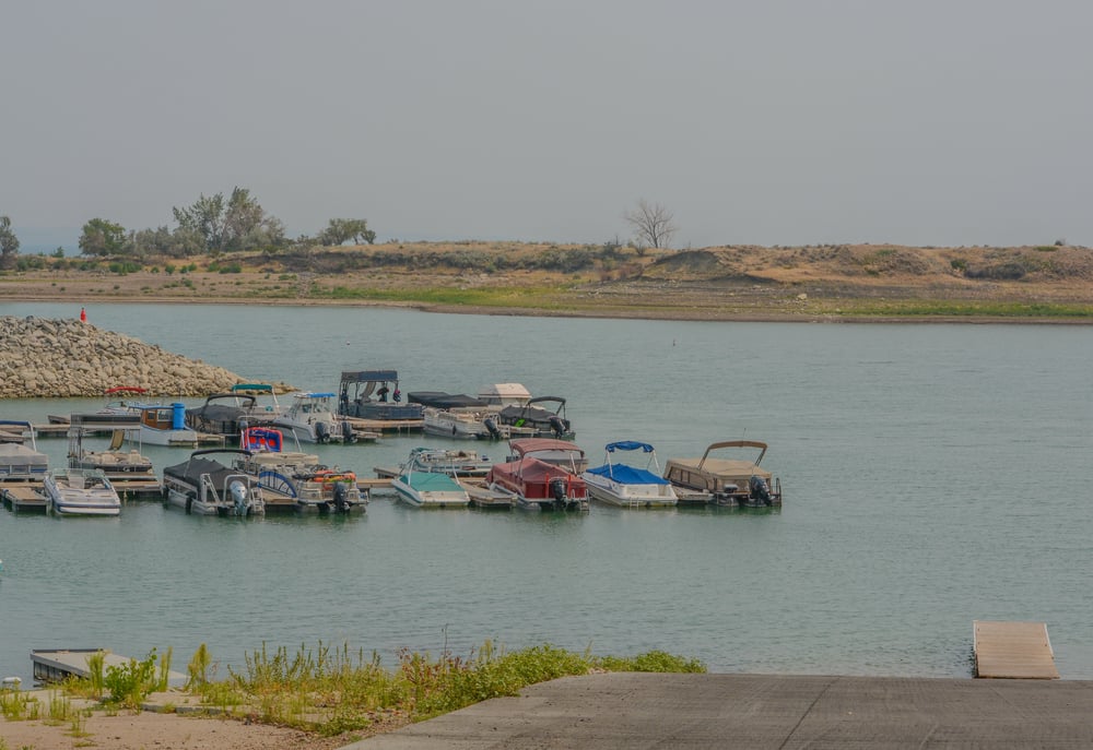
Floating on the surface today, the liquid stays put for years ahead. Peering across from shorelines like this one reveals what might be our most tangled creation yet.
More from Go2Tutors!

- The Romanov Crown Jewels and Their Tragic Fate
- 13 Historical Mysteries That Science Still Can’t Solve
- Famous Hoaxes That Fooled the World for Years
- 15 Child Stars with Tragic Adult Lives
- 16 Famous Jewelry Pieces in History
Like Go2Tutors’s content? Follow us on MSN.