Ancient Travel Routes That Connected Civilizations
Long before planes carried passengers across oceans and highways linked cities together, people still found ways to cross great distances. They walked through deserts, sailed across seas, and climbed over mountains to trade goods, share ideas, and connect with other cultures.
These ancient paths shaped the world in ways that still matter today. Let’s look at some of the most important routes that brought different civilizations together.
The Silk Road

This wasn’t just one road but a network of paths stretching over 4,000 miles from China to the Mediterranean Sea. Merchants carried silk, spices, and precious stones along these routes, but they also transported something even more valuable: knowledge.
The journey could take years to complete, and travelers faced bandits, harsh weather, and difficult terrain. Cities along the way grew wealthy by providing food, shelter, and fresh supplies to passing caravans.
Mathematical concepts, religious beliefs, and artistic styles spread from one end of Asia to the other because of these connections.
The Incense Route

Arabian traders controlled a network of paths through the desert that carried frankincense and myrrh from southern Arabia to the Mediterranean world. These fragrant resins were worth more than gold in ancient times because people used them in religious ceremonies and burials.
The route ran through some of the harshest desert landscapes on Earth, where finding water meant the difference between life and death. Camels made this trade possible since they could travel for days without drinking.
Cities like Petra grew into magnificent centers of wealth by controlling key points along this route.
The Amber Road
Northern Europe’s connection to the Mediterranean world depended on this path that brought golden amber from the Baltic Sea to Roman markets. The glowing resin, formed from ancient tree sap, fascinated wealthy Romans who paid enormous sums for it.
Traders moved the precious material southward through Central Europe, crossing rivers and forests that most people never left their entire lives. This route helped spread Celtic and Germanic culture into southern regions.
The path also worked in reverse, bringing Roman goods and ideas northward into lands that had never seen marble statues or written languages.
The Trans-Saharan Trade Routes

Crossing the Sahara Desert required knowledge that took generations to develop, but African traders mastered paths through the sand that connected West Africa to North Africa and the Mediterranean. Gold and salt moved in opposite directions along these routes, with each being extremely valuable to the people who lacked it.
Camel caravans of hundreds of animals traveled together for safety and support. Cities like Timbuktu became legendary centers of learning because they sat at important crossroads.
Islamic scholars, merchants, and ideas flowed southward while African goods and culture moved north.
The Royal Road of Persia

The Persian Empire built a maintained highway that ran over 1,500 miles from Sardis in modern Turkey to Susa in Iran. Mounted messengers could travel the entire distance in just seven days, which was remarkably fast for ancient times.
Rest stations stood every 15 miles or so, providing fresh horses and food for official travelers. This efficient system let Persian kings control a massive empire by getting information and orders to distant provinces quickly.
The road also boosted trade since merchants knew they could travel safely under Persian protection.
The Spice Route by sea

While land routes got most of the attention, sailors were connecting distant shores long before recorded history. Ships sailed from India and Southeast Asia to the Arabian Peninsula and East Africa, carrying pepper, cinnamon, and other spices that transformed food in distant lands.
Monsoon winds made this trade possible, blowing ships eastward for part of the year and westward during other months. Sailors had to understand weather patterns, star navigation, and ocean currents to survive these journeys.
Coastal cities grew wealthy by serving as transfer points where goods switched from one ship to another.
The Appian Way
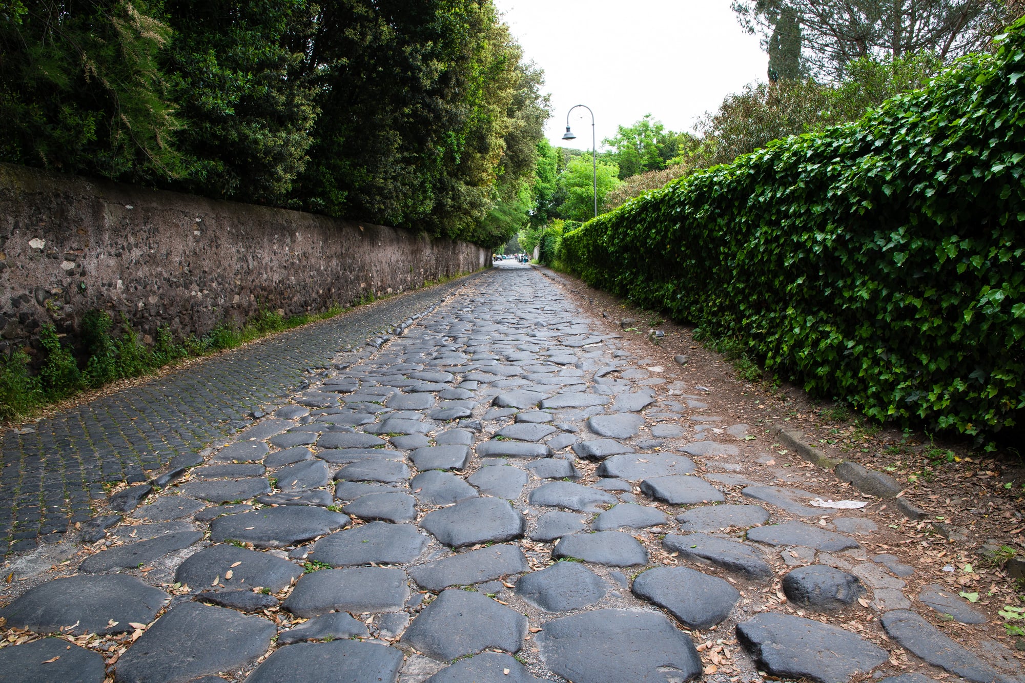
Rome’s most famous road started as a military highway but became the main connection between Rome and southern Italy. Built starting in 312 BCE, it featured carefully fitted stones that created such a smooth surface that parts of it still exist today.
The Romans understood that good roads meant military power, quick communication, and economic growth. Travelers could cover about 40 miles per day on this road, which was exceptional speed for the ancient world.
The engineering techniques used here spread throughout the Roman Empire, creating a road network that totaled over 250,000 miles.
The Tea Horse Road
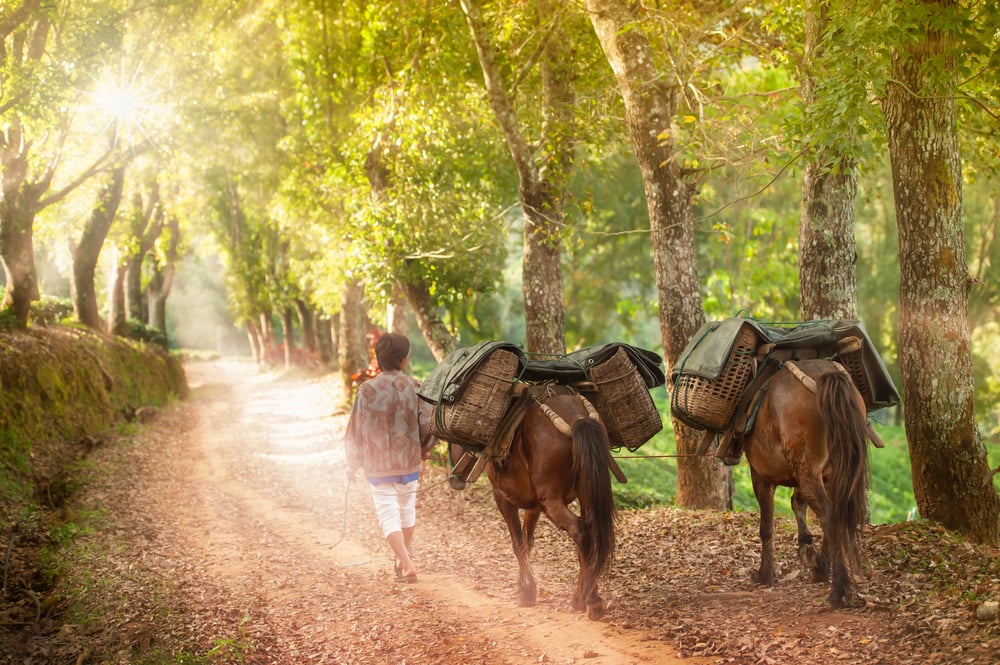
High in the mountains between China and Tibet, traders developed paths that exchanged Chinese tea for Tibetan horses. The routes climbed to elevations over 16,000 feet, where thin air made every step difficult.
Horses from the Tibetan plateau were essential for Chinese military campaigns, while tea became a vital part of Tibetan culture and diet. This trade created cultural connections between very different societies that might otherwise have remained isolated.
The paths also extended into Southeast Asia, spreading Chinese influence into mountain regions that were nearly impossible to reach by other means.
The Via Egnatia

This Roman road connected the Adriatic Sea to Constantinople, making it the main east-west route across the Balkans. Built in the 2nd century BCE, it helped Rome control Greece and eventually facilitated the spread of Christianity throughout Europe.
The road remained important long after Rome fell, serving Byzantine, Ottoman, and modern empires. Armies, merchants, and pilgrims all used this route to cross between Europe and Asia.
Some sections featured tunnels carved through solid rock, showing the determination Romans had to create direct paths.
The Hanseatic Trade Routes

Northern European merchants created a network of sea routes connecting cities around the Baltic and North Seas during the medieval period. Ships carried timber, furs, fish, and grain between ports from Russia to England.
The Hanseatic League formed when these trading cities banded together for mutual protection and benefit. This network operated more like a business alliance than a traditional trade route, with shared laws and practices.
The wealth generated helped cities like Hamburg and Lubeck become independent powers that challenged kings and emperors.
The Grand Trunk Road

Stretching across the Indian subcontinent, this route connected Bengal to Afghanistan for over 1,500 miles. Various empires maintained and improved the road over thousands of years, from ancient Indian kingdoms to the Mughal Empire.
Travelers found rest houses, wells, and shade trees planted at regular intervals. The road helped unify the diverse cultures of South Asia by making travel and communication easier.
British colonizers later paved much of it, and modern highways still follow the same basic path.
El Camino Real
Spanish colonizers in the Americas created roads connecting their settlements from Mexico City to Santa Fe, and along the California coast. These routes helped Spain control vast territories with relatively few soldiers and administrators.
Missions, presidios, and pueblos grew up along the road at intervals that reflected a day’s travel by horse. Native American guides and laborers built much of the actual road, though they received little credit or benefit.
The path became the spine of Spanish colonial culture in North America.
The Viking Trade Routes

Scandinavian seafarers developed routes that connected northern Europe to the Byzantine Empire and the Middle East via Russian rivers. Vikings carried furs, amber, and enslaved people southward, returning with silver, silk, and spices.
Their shallow-draft boats could navigate both open seas and narrow rivers, giving them access to places other Europeans couldn’t reach. This network helped fund the Viking age of exploration and conquest.
Cities like Kiev and Novgorod began as Viking trading posts before becoming centers of Slavic civilization.
The Imperial Highway of Japan

The Tokaido Road connected Edo (modern Tokyo) to Kyoto, serving as the main route through Japan for centuries. Travelers passed through 53 stations offering food, lodging, and entertainment along the 320-mile journey.
Strict regulations controlled who could use the road and how they traveled, reflecting Japan’s rigid social hierarchy. The famous artist Hiroshige created woodblock prints showing scenes from each station, making the road part of Japanese cultural identity.
Daimyo lords had to travel this route regularly to attend the shogun’s court, which kept them loyal and drained their finances.
The Old Salt Route
Central Europe’s economy depended on paths that carried salt from mines and coastal areas to regions that lacked this essential mineral. Cities charged tolls and taxes on salt shipments, generating massive wealth for whoever controlled the routes.
Bad Reichenhall and Hallstatt became important centers because of nearby salt deposits. The routes helped standardize prices and measures across different regions.
Wars were fought over control of these paths since salt preserved food, making it crucial for survival.
The Natchez Trace

Long before Europeans arrived, Indigenous people carved out a 440-mile trail across today’s Mississippi, Alabama, and Tennessee. This path linked the Mississippi River with the Cumberland, sticking to high ground so it wouldn’t get soaked by floods or bogs.
Eventually, U.S. pioneers and merchants started using the same track, sometimes running into those who had lived there first. Workers who sent cargo south by river would trek back up north along this road, turning it into one of early America’s most traveled routes.
Along the way, small shelters and stalls popped up to serve travelers – yet thieves made parts of the journey risky.
The Great North Road

England’s key path linking London to Edinburgh slowly formed over hundreds of years, starting from old Roman tracks and ancient trails. Along it, roadside stops for coaches popped up every so often, building a network that made longer trips possible.
As builders got better and bandits became less common, the journey turned quicker and safer. Over time, mail carriages began sticking to tight timetables, changing how fast news moved across the country.
Towns sprang up along this corridor, shaped by the flow of people passing through.
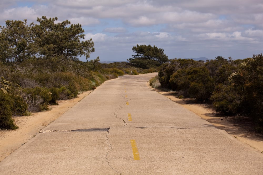
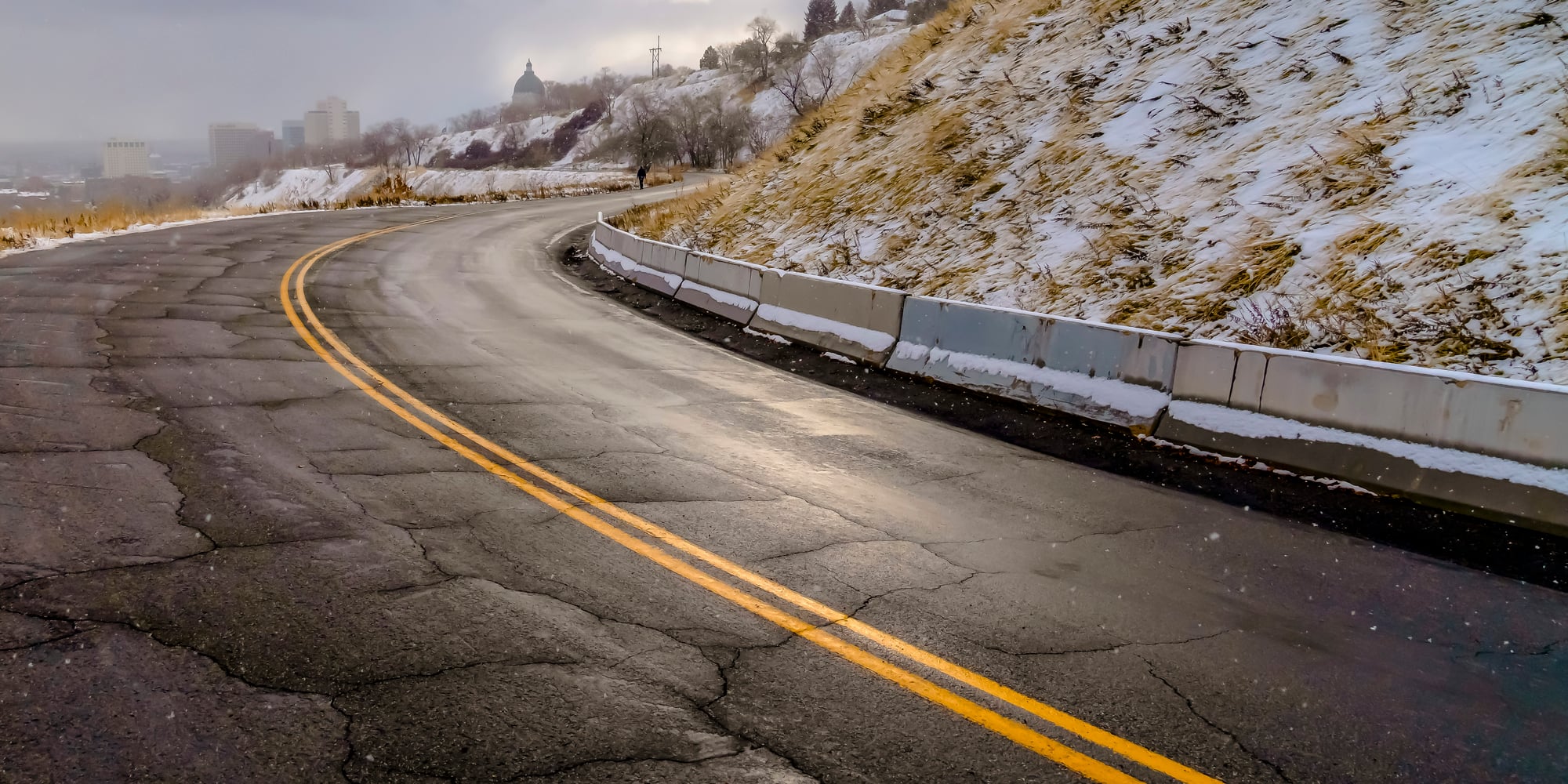
Where trails keep going

Those old trails stuck around – even after fancy new tech showed up. Today’s roads frequently trace the exact lines merchants used ages back, since early wanderers picked smart ways over hills or past barriers.
Towns that sprang up near historic exchange lanes tend to stay busy hubs now, proving links from centuries ago still guide daily life spots. Tracing these tracks reveals why far-off societies sometimes think alike or use matching tools despite being worlds apart.
More from Go2Tutors!

- The Romanov Crown Jewels and Their Tragic Fate
- 13 Historical Mysteries That Science Still Can’t Solve
- Famous Hoaxes That Fooled the World for Years
- 15 Child Stars with Tragic Adult Lives
- 16 Famous Jewelry Pieces in History
Like Go2Tutors’s content? Follow us on MSN.